Past Outings/Events:
| 2015 February 22, Sunday. O: Backbone Trail-Newton Canyon. Kyla Hjertstedt, Karen Lovett. Kyla’s Provisional. Come enjoy an easy day hike along Newton Canyon in the Santa Monica Mountains. Approx. 4.5 miles round trip with a 520’ gain/loss. This segment of the Backbone Trail parallels Newton Canyon transitioning from densely wooded canyon into chaparral-blanketed slopes. On clear days, possible ocean views and views of vineyards in upper Newton Canyon. Dogs (on leash) welcome. Bring lug soles, snacks, water, 10 essentials, and layers. Meet at 9am in the trailhead parking lot. From the Ventura Freeway (101) in Agoura Hills, take Kanan Road towards the beach for about 8 miles. The parking lot is on your right between the second and third tunnels. Rain Cancels. Questions? Contact Kyla at 626-419-4193 or khjertstedt@gmail.com. |
|
| 2015 February 13-16 Fri-Mon. Presidents’ Day Wknd Joshua Tree National Park. Barbara Edwards, Grace Hengst. Join us President’s Day weekend at the Black Rock Canyon campground (elev. 4000), located in the northwest corner of the park, just 5 miles from Yucca Valley. Campsites are dispersed on the hillside at the mouth of the canyon, and surrounded by Joshua trees, junipers, cholla cacti, and desert shrubs. Trailheads to scenic hiking trails in the hills are easily accessible from the campground. They take hikers to ridgelines overlooking the snowy peaks of San Jacinto and San Gorgonio via Eureka Peak, Panorama Loop, and Warren Peak trails. If you get tired of scenic hikes, you can head into town…. Yucca Valley offers restaurants, and shopping . Flush toilets and water are available at the campground. Showers nearby. Expect daytime temperatures in the mid 60s and nighttime temps to dip into the 30s. Dogs permitted in campground, but not on most trails. Cost is $32 per person for 3 nights camping. A few RV sites (no hook-ups) are available. Please send check (made out to GLS) and email address to: Barbara Edwards, 1739 S. Sherbourne Dr., L.A. 90035. Questions? Contact Barb, greyhund@sbcglobal.net. |
|
| 2015 February 8, Sunday. O: Valley Forge Trail (5090’), Kenyon Devore Trail (5630’). Dora Olea, Gail Wise. On this 7 mile, moderate hike, we start at a high point and it is all downhill from there. Just kidding, not exactly. We do start at the highest point of our journey near Mt. Wilson at 5,630’. Then we slowly descend to the campground at Valley Forge at 3,490’, and then ascend back up again to Mt. Wilson Road to a different trailhead at 5,090’. The total elevation gain is about 1,600 feet. By doing this one in the winter we avoid bugs. Since our hike does not end where we started, there is a short car shuttle involved. Dogs must carry their own water. Bring 10 essentials, a National Forest Adventure Pass, layers, 3 qtrs. Water (more if it’s hot out), lug soles, hiking poles (optional), sunscreen, sunglasses, hat, snacks and lunch. Meet 8:20 am because we will take off at 8:30am sharp. Directions: 210 W. exit on Los Angeles Hwy, La Canada – rideshare for carpooling. Rain/snow cancels. Questions to Dora at chamacasister@gmail.com or Gail at cell: 310-433-2298 , email: gailwise2@gmail.com) with questions. We expect the hike to take between 3 1/2 to 4 1/2 hours, so with the drive and car shuttle, expect to be gone until about 2:30 or so -- with an emphasis on the ‘or so’. |
|
| 2015 February 1, Sunday. O: Temescal Canyon. Carol Jeffcoate, Jeff Johnson. Carol’s Provisional. A moderate paced hike in the ever popular Temescal Canyon in Pacific Palisades. We will follow the canyon trail past the waterfall up to Skull Rock on the Ridge Trail and nice views of the ocean. This out and back hike is about 5 miles and a little over 1000 ft elevation gain. Parking in the Temescal Canyon Park lots is $7, parking on Sunset Blvd is free. The canyon will be cool in the morning so wear layers, bring at least 2 liters of water. Lug soles are recommended. Due to the popularity of the trail we will start at 8 a.m. Meeting in the lower parking lot (closest to Sunset Blvd). Questions? Contact Carol, 562-985-1007. |
|
| 2015 January 24, Saturday. O: Moro Canyon at Crystal Cove Park. Jeff Johnson, Anna Baum. Come see the gorgeous coastal hills of Laguna Beach, plus get a great workout. A loop trail about 10 miles long, with 1850’ of gain/loss takes us around the perimeter of Crystal Cove State Park. We’ll pass through back-country campsites as well as many steep up and downs, all the while taking in stunning panoramas that span from Catalina to snow-capped Mt. Baldy. The precious park (saved from developers) spans 2,400 acres of native wilderness, mostly the coastal sage scrub plant community. We’ll traverse trails of many names; see if you can find the fake name among the following: No Name Ridge; No Dogs; No Dice Trail; Ticketron; Poles. There is little shade; bring a hat, sunscreen, lugsole shoes, lunch, and at least 2-3 liters of water, as well as the other 10 essentials. Meet at 8:30 a.m. at the Long Beach rideshare spot. (North side of E. Atherton St., south of 405, between Palo Verde and Bellflower, more specifically between Fanwood Ave and N. Britton Dr., next to the Gant Elementary playground.) We’ll aim to meet at the Park at 9:15 to begin hiking at 9:30 a.m. Parking at Crystal Cove State Park is $15 unless you have a State Park Pass. Sorry, no dogs allowed on State Park trails. Questions? Contact Jeff at 562-434-8473. |
|
| 2015 January 17, Saturday. O: Mishe Mokwa Trail to Tri-Peak (3010 ft) to Backbone Trail to Sandstone Peak (3111 ft). Gina’s Provisional. Gina Masequesmay, Nancy Beverly. Want a panoramic view of the ocean, nearby islands, mountains, canyons, and areas in Ventura and Los Angeles? Want to see some cool rock formations and have a shaded rest stop with a picnic table? Want a restroom at the trailhead? Want creek crossing (if weather permits) and a challenging hike to two summits? Come to this 7.5 mile loop with a 2524 ft. of elevation gain in the Santa Monica Mountains near Malibu. The trail begins at Sandstone Peak Trailhead and warms you up with a 298 feet elevation gain workout in 0.4 mile. Then, it’s a series of ups and downs on the beautiful Mishe Mokwa trail. Along the way, we will get a view of the Balanced Rock perching on another rock. After nearly 2 miles, the trail descends and crosses a creek to the Split Rock, an oak grove that provides you with a picnic table. We will have a 15-minute stop for nature’s call and snacking. After everyone has replenished him/herself, we will continue about another 2 miles to Tri-Peak. Tri-Peak is 0.5 mile from Mishe Mokwa Trail. This part of the hike is semi-strenuous with 332 ft. of elevation gain in 0.5 miles; however, the summit rewards you with a fantastic view of Ventura and Los Angeles at 3010 feet. We will have lunch here for about 30 minutes. From Tri-Peak, we will descend onto the Backbone Trail and go another 1.9 miles to Sandstone Peak, the highest point in the Santa Monica Mountains at 3111 feet. This last part of the trail is the steepest and is semi-strenuous. The elevation gain is 247 ft. in 0.3 mile. This last summit will be a 15-minute stop for you to register your name in a notebook under the W. Herbert Allen placard. Please bring the ten essentials for hiking, lunch, snacks, and at least 2 liters of water. Lug soles are a must for this hike. Orientation and introduction begin promptly at 10 am at the Sandstone Peak trailhead. The hike will begin at 10:10 am and will end by 3:30 pm. Plan to arrive between 9:40 and 9:55 am so you will have time to use the restroom and prepare for the hike. Note there is only one pit-hole restroom at the parking lot, so bring what you need if you need to go off trail to answer nature’s call. Note that the drive to the trailhead from PCH or Westlake can take from 50 minutes to an hour because it’s a small windy road. This is a moderate to semi-strenuous hike and not for beginners. Rain cancels. The Sandstone Peak trailhead is 14041 Yerba Buena Road, Malibu, CA 90265, 1 mile east of Circle X Ranch Office and 0.5 mile west of the Mishe Mokwa Trailhead. There is limited parking and carpooling is highly recommended. Questions? Contact masequesmay.gina@yahoo.com or call my gvoice: (818) 835-1059. |
|
| 2015 January 4, Sunday. O: Hancock Park/Larchmont/Windsor Square Urban Walk. Barbara Edwards, S.K. Chiou. Come enjoy the history and architecture of this fascinating area. Hancock Park was once home to such notables as Howard Hughes, Ellen Degeneres, Nat King Cole and others. We start by strolling through Larchmont Village, a small café-laden shopping area where the locals hang out. Then we will explore a historic preservation overlay zone where the grand old mansions of Windsor Square are still standing. Next we will return to the village for a quick lunch and then meet again to continue on the second part of the walk where we will stroll by Mae West’s home and other mansions in a shady tree-lined neighborhood. Meet at 8:30 AM in front of Noah’s Bagels at 250 N. Larchmont Blvd. About a mile east of Highland. Walk starts promptly at 9 AM. Free all-day parking in the neighborhood south of the village. Bring water and lunch, or money if you want to eat out. Approx 5 miles, 200 ft elevation gains. Dogs welcome. Rain cancels hike. Please RSVP to leader if possible in case of last minute changes. greyhund@sbcglobal.net. |
|
| 2014 Dec 20, Saturday. O: Red Box (4640') to Strawberry Peak (6160'). Gail Wise, Grace Hengst. 9.6 miles, rolling, with 1600’ gain/loss. Join us for a figure-8 loop starting and ending at the Trippet Ranch trailhead in Topanga Canyon (farther point of the Nov. 29 hike). Rolling hills provide alternating canyon greenery and expansive views of the Pacific. We’ll start out on the Musch Trail, winding through a verdant hillside punctuated with openings that allow views of the Santa Monicas. Gaining Eagle Rock (1957’), we’ll admire the sandstone and look in every direction. Next, we’ll dive into Garapito Canyon, surfacing at Hub Junction and then head back on fire roads with constant vistas for the rest of the hike. Rain Cancels. Bring: At least 2 liters of water, lugsoles, 10 essentials. Pace: moderate. Time: meet 8: 45 AM, depart 9 AM sharp. Getting there: 20829 Entrada Road, Topanga Canyon, CA 90290. From 101, drive ~7.7 miles south on Topanga Canyon Road and take a left on Entrada Road. Drive on Entrada Road for one mile, following signs for Topanga State Park. There is a $10 day-use fee to park at Trippet Ranch. Free parking is available along the road outside the park - but make sure that your wheels do not cross the white line on the road. Questions? Contact Teresa 612-384-0421. |
|
| 2014 Dec 13, Saturday. O: Topanga Area. Dawn Wilson, Teresa Nick. 9.6 miles, rolling, with 1600’ gain/loss. Join us for a figure-8 loop starting and ending at the Trippet Ranch trailhead in Topanga Canyon (farther point of the Nov. 29 hike). Rolling hills provide alternating canyon greenery and expansive views of the Pacific. We’ll start out on the Musch Trail, winding through a verdant hillside punctuated with openings that allow views of the Santa Monicas. Gaining Eagle Rock (1957’), we’ll admire the sandstone and look in every direction. Next, we’ll dive into Garapito Canyon, surfacing at Hub Junction and then head back on fire roads with constant vistas for the rest of the hike. Rain Cancels. Bring: At least 2 liters of water, lugsoles, 10 essentials. Pace: moderate. Time: meet 8: 45 AM, depart 9 AM sharp. Getting there: 20829 Entrada Road, Topanga Canyon, CA 90290. From 101, drive ~7.7 miles south on Topanga Canyon Road and take a left on Entrada Road. Drive on Entrada Road for one mile, following signs for Topanga State Park. There is a $10 day-use fee to park at Trippet Ranch. Free parking is available along the road outside the park - but make sure that your wheels do not cross the white line on the road. Questions? Contact Teresa 612-384-0421. |
|
| 2014 Dec 6, Saturday. O: Holiday Party. Grace Hengst, Mary Adair. This year the GLS Holiday Party is again at Grace and Mary’s Mount Washington home. This is a time to talk with other GLS members and just have fun sharing the holiday spirit! The festivities start at 2 pm and finish at 6 pm. Please bring a potluck item to share, and let Grace know what item you plan on bringing. GLS provides beverages, plates, silverware, and lasagna (vegetarian and meat). There will be 2 door prizes, a “Half & Half” raffle in which there will be 30% to first winner, 20% to second winner, and half goes to the GLS treasury. There will also be a silent auction, so please bring a new or used hiking/camping/other item, in good condition, to the party. The proceeds go to GLS. Please reclaim any unsold items at the end of the auction. Also, view and vote on photos submitted for the GLS photo contest. We will count the ballots for election to the GLS Management Committee and announce the new board members at the party. Send a check to “GLS” for the admission charge of $5.00. Send to: Grace Hengst, 1717 Burnell Drive, Los Angeles, CA 90065. Enclose SASE if you need directions to the house. Note: Mapquest can get you lost in this area, so call Grace at 323-697-6886 in the days before the party if you need clarification. Parking: plan to park on the surrounding streets, as there is no legal parking on Burnell Drive. |
|
| 2014 November 29, Saturday. O: Topanga Canyon: Los LionesTrippet Ranch. Anna Baum, Jeff Johnson. Come work off that pumpkin pie! 13 miles roundtrip, strenuous in parts,1,300 feet elevation gain. After a steep, 1.5mile climb up lovely shaded switchbacks through chaparral, we’ll follow a steep winding fire road that affords stunning coastline vistas and beautiful views of Santa Ynez and Topanga Canyons on either side. We’ll pass the turnoff to the Parker Mesa Overlook, then continue on East Topanga Fire Road another 2.6 miles, mostly level, to Trippet Ranch Visitor Center (where the December 13 hike will begin). We will eat lunch there and return the way we came. Wear sturdy shoes, bring at least two quarts water, 10 essentials, lunch, snacks, sunscreen. Heavy rain cancels. From Highway 1/Pacific Coast Highway in Pacific Palisades: turn north on Sunset Boulevard. Drive 0.3 mile and turn left on Los Liones Drive. Follow Los Liones Drive to its end in about a half-mile and park in the lot across from a church or on the street. From the 405 and Sunset: Travel west out Sunset Blvd., past Temescal Cyn, and a block past Palisades Drive, turn right up Los Liones. Hike begins at 9 a.m. sharp. Heavy rain cancels. Questions? Contact Anna at 310-990-0610. |
|
| 2014 Nov 22 - Nov 23, Sat - Sun. O: Sugarloaf Mt. + Pine Knot Trail. Nancy Beverly, Mike Brostoff. We had such a good time up at Big Bear last year, we’re going to do it again – on different trails, though. On Saturday, we plan to hike Sugarloaf Mountain if the weather holds (i.e. no rain / snow). It’s roughly 10 miles roundtrip with 2000’ elevation gain, going up to 9952’. If you’re planning on coming on that hike, get some rigorous hikes in so you can give it a good shot! On Sunday morning, we’ll do an easier hike – Pineknot Trail up to Grand View Point, six miles roundtrip, 1200, up to 7688’. If the weather is dicey on Sugarloaf, then Pineknot (+ some extra miles) may become the Saturday hike. Or we may go snowshoeing both days! If you’d like to spend the night Saturday at Tammie & Kyla’s (our gracious hostesses!) in Big Bear, RSVP to nancybeverly at sbcglobal.net by November 15. If you’re just doing the Saturday hike, RSVP by November 20th (by then we should know the weather forecast). Directions to the appropriate trailhead & the gals’ home will be sent out. Sorry, no showing up at the last minute – we may have to change plans and who knows what the cell phone service will be. For the hikes, bring the ten essentials and for staying overnight, bring money for dinner at a restaurant, whatever you’d like for breakfast, and a sleeping bag. Overnight indoor guest limit is eight; there is a little room on the outdoor porch for sleeping under the (chilly) stars and driveway space for camper type things (no tents in the yard, sorry!). |
|
| 2014 Nov 7-10, Fri - Mon. O: Joshua Tree Carcamp. Dora Olea, Grace Hengst. Circumstances of life have prevented us from putting a foot on the ground at J-T. Well, now we are going to put both feet: for one day, two or three (you choose). We will have hikes from 8 miles rt. to a 5 miles rt. or if you choose just to read or catch up with your needlework, this is the trip for you. The campsite has a limited space for participants and parking; therefore, carpooling is recommended. Cost not exceed $20.00 dollars. To reserve your spot, you MUST mail your check before Saturday, November 1st. RSVP and more details, contact Dora at (213) 200-0239 or chamacasister@gmail.com. |
|
| 2014 Nov 1, Saturday. O: Vasquez Rocks. Dora Olea, Grace Hengst. Amazing what 25 million years of earthquake activity can do! A beautiful outcropping landscape of rocks’ history that began in prehistoric times when the sandstone rocks were uplifted at a picturesque angle, showing their jagged red features. In 1874 Tiburcio Vasquez, one of California’s most notorious bandits, used these rocks to elude capture by law enforcement. It has been a popular filming location for movies, television shows and commercials. We’ll hike up to the Sanctuary Cave, over the Bandito Trail and the Geological Trail. About four miles with elevation gain/loss of less than 1000 ft. Great opportunities for taking pictures as well as identify many species of flora and perhaps fauna. K-9s welcome. Bring lug soles, lunch, sunscreen, hat and sunglasses as well as plenty of water. Contact leaders Grace (323) 697-6886, or Dora (213) 200-0239 or chamacasister@gmail.com with any questions about the hike. Meet 9 am. From the Antelope Freeway (14) near Canyon Country, exit on Agua Dulce Road. Head north 1.5 miles. Agua Dulce swings west and you join Escondido Canyon Road, proceeding 0.25 miles to the signed Vasquez Rocks County Park entrance on your right. Rain cancels. |
|
| 2014 Oct 25, Sat. O: Orchard Camp, via Sierra Madre. Dora Olea, Diane Zaepfel. Que calor! Let’s beat the heat with a moderate paced hike, 9 miles rt with 2000’ elevation gain/loss on a trail that the Gabrielino Indians forged as a footpath on their way to the majestic Mt. Wilson. Later on, around 1800s, two colorful mountaineers, George Aiken and George Islip, planted a small grove of apple, cherry, plum and chestnut trees. With the maturity of these trees, the place became known as Orchard Camp. On our way back, Diane will take us for a delicious lunch in a funky place which is her specialty. Bring 2 liters of water, lug soles, sunscreen, and snacks. Dogs welcome. Bathrooms at the trailhead Meet at Miramonte Ave. near the junction of Mt. Wilson Trail Rd. at 8am. Driving Directions: From the Foothill Freeway (210) in Arcadia, exit on Baldwin Ave. and head north. Turn right on Miramonte Ave. near the junction of Mt. Wilson Trail Road, which is on your left. Rain cancels. Questions? Contact Dora, (213) 200-0239 or chamacasister@gmail.com. |
|
| 2014 Oct 25, Sat, 8:00 AM to 5:00 PM (time tentative). Angeles Chapter Leadership Training. Become a qualified Sierra Club leader. The Leadership Training Program can prepare you to lead Angeles Chapter outings. Whatever your passion -- biking, climbing, hiking, photography, rafting, sailing, skiing, and much, much more - the LTP is your gateway to leading groups of folks who share your passion. Seminar at the Costa Mesa Community Center, 1845 Park Avenue, Costa Mesa, CA 92627. For information, see the LTC website (http://angeles.sierraclub.org/ltc/). Deadline for receipt of application is October 11. No registration after this date or at the door. |
|
| 2014 Oct 18. O: Evening Meditation Hike on Westridge. Nancy Beverly, Anna Baum. Join us for a silent, walking meditation hike in the Santa Monica Mountains as the sun goes down. We’ll meet at 5:45 p.m. at the top of paved Westridge where the fire road of the same name begins. After some brief instructions and a little centering exercise, we’ll head off. This is a moderate 7.4 mile out ‘n’ back hike with some modest hills along the way (the first two miles are uphill, but it’s gradual). Bring lugsole boots, water, snacks, and layers in case it gets chilly. No dogs please. There is a little park at the turnaround spot – which has picnic tables, a restroom and a water fountain (none of those are at the trail head). We may or may not break the silence to check in and see what insights people have had along the way. The sun sets at 6:15, so we’ll have twilight at the start but it’ll be dark on the return. As with Griffith Park, which we hike in darkness much of the year, we’re on a wide fire road and the bounce from the city lights should be enough to illuminate the way back. Bring a light for emergency purposes if you like but we won’t turn them on otherwise. Directions: go west on Sunset Blvd. from the 405. At the light at Mandeville Canyon Rd., turn right. At the first stop sign (Mandeville Lane is on the right), roll forward a few feet to Westridge and turn left. Stay on Westridge all the way to the top – ignore the many turn offs along the very steep way including the one to Banyon (the hike isn’t nearly as steep as the drive up!). Park on the paved street, the little dirt lot at the top is a bit tight on space. Questions? Contact Nancy, nancy at sbcglobal.net. |
|
| 2014 Oct 12, Sunday. O: Mt. Disappointment (5994’), San Gabriel Pk (6161’) and Mueller Tunnel. Dora Olea, Gail Wise. Let’s start with the name: Why is this mountain called “Disappointment”? Why such a weird odd name for a mountain - disappointment? Indeed, it was a disappointment for the government surveyors who lugged their equipment to the top of the mountain in 1875, but the mountain was not high enough, so they had to continue to the higher summit of San Gabriel Peak to do their surveying. The reward was and still is that the views from both summits are panoramic. A moderate-paced 7 miles rt. loop with 1400’ elevation gain and 1019’ loss. Last but not least, we will hike the famous Cliff Trail between Eaton Saddle and Markham Saddle, now bypassed by the Mueller Tunnel. This trip requires a shuttle and a National Forest Adventure Pass for parking. Dogs carry their own water. Bring 10 essentials, 3 qtrs. water (more if it’s hot out), lug soles, hiking poles (optional), sunscreen, sunglasses, hat, snacks and lunch. Meet 8:20 am because we will taking off at 8:30am sharp. Directions: 210 W. exit on Angeles Crest Highway, La Canada rideshare point for carpooling. Questions? Dora at chamacasister@gmail.com. |
|
| 2014 Oct 4, Saturday. O: Cajon Pass. Mike Brostoff, Grace Hengst. Cajon Pass is the mountain pass between the San Bernardinos and the San Gabriels where interstate 15 heads north from LA. We will meet at the intersection of the 15 and the 138 and hike 5.5 miles west on the Pacific Crest Trail, and then return We will walk underneath the 15, through the Southern Pacific Railroad tracks, over the San Andreas Fault and passing by many outcroppings of the Mormon Rocks. Bring water, sun protection, layers especially if it is cold, lunch, 10 essentials. Hike starts at 9:00 AM. If conditions are bad at the pass but good elsewhere, we will find an alternate hike. For more information and to RSVP, contact Mike Brostoff. mbros4162@yahoo.com. |
|
| 2014 Sep 27, Sat. O: Zuma Loop Trail. Alan Schimpff, Tom Molloy. This a great strenuous workout rewarded by beautiful scenery. The trail includes two major ascents, a descent into Zuma Canyon, crossing a stream and a traverse along a ridge with beautiful ocean views. Round-trip: 11 miles, 2800 elevation gain and loss Bring at least 2 quarts of water and the 10 essentials. Meet at 9:30 AM at the trailhead. If taking the 101 west, turn left on Kanan Road and head over the mountains to PCH. On PCH, head northwest for about ½ mile (or two stoplights) until you reach Busch Road. Turn right on Busch and follow it to the end of the road which is the trailhead, park there. If taking PCH west, pass Kanan Road until you come to Busch Road about ½ mile (or two stoplights) later. Turn right on Busch and follow it to the end of the road which is the trailhead. Questions? Contact leaders at 310-589-9125. |
|
| 2014 Aug 29 - Aug 31, Fri - Sun. O: White Mountain Hiking. Susan Campo, TBA. This is a classic hike on trail to a 14,252 foot peak, near Big Pine, CA. On Sunday there will be an Open House at the USC Research Station which means we can drive up a bit more to the higher trailhead making this hike 10 mi RT and 2000 ft gain/ loss. Do not under estimate this hike as the elevation can make it extremely difficult. NO BEGINNERS! Please do not attempt this hike if you are inexperienced with altitude and its effect on your body!
Aug. 29 Drive up from LA and meet at a primitive site for camping. Aug. 30. We will acclimatize with a moderate hike in the interesting Bristlecone forest and re-group at a remote primitive location. Aug. 31. At dawn drive up the 13 mi gravel road to the gate of the Research facility and start at the highest possible trailhead to climb the White Mountain. After the hike you are free to depart for home or continue on next adventure with Susan (see Mt. Tom below). No fee is charged for this trip, but you will be expected to “chip in” for carpooling to the trailhead if needed or for some group supplies, happy hour, or snacks. |
|
| 2014 Jul 19 - Jul 20, Sat - Sun. O: Mt. San Jacinto Backpack. Kirk Olsen, Dora Olea. This moderately strenuous trip is a great introduction to backpacking for beginners while still being fun for those with more experience. On Saturday we’ll ride the Palm Springs Aerial Tramway to the Mountain Station (8,516 ft. elev., bring $$ for tram) followed by a leisurely 2-3 mile backpack (600 ft. gain) to our campsite. After preparing camp we’ll have plenty of time to explore, play games or just relax. Sunday we’ll do a 6 mile RT day hike to the peak (10,804 ft. elev., 1,700 ft. gain/loss) where we’ll enjoy a spectacular view encompassing much of Southern California. After breaking camp we’ll backpack down to the Mountain Station (600 ft. loss) where we’ll board a tram and ride to the desert below. To reserve your spot mail a $12 check payable to GLS to the attention of Kirk Olsen, 3350 E 7th St Ste 301, Long Beach , CA 90804. Include your contact information (incl. e-mail, telephones) and a summary of your hiking experience (including elevation) and fitness level. Registered participants will receive gear list and time/location specifics. Permit is limited to 12 participants. Questions? Contact Kirk Olsen. |
|
| 2014 June 29, Sunday. O: Make-Your-Own First Aid Kit. Marie Ammerman, Tim Vo. A First Aid Kit is a must for every hiker or camper, even when on a Sierra Club outing. Leaders can only carry so much! Be able to help yourself if an emergency arises by making your own kit for $12.00 for GLS members; $15.00 for non-members. The leaders will pool the money to take advantage of bulk discounts, selecting items with hikers in mind, and then we'll all get together to divvy up the supplies, and talk a little about specific circumstances in which you might need some of these items. This is NOT a First Aid certification course; instead, it's a chance to have a little fun with friends and share the expenses of creating a personal first aid kit to keep in your backpack. Space will be limited, so sign up right away with Marie by mailing a check, payable to GLS, to Marie Ammerman, 5744 Ensign Ave., North Hollywood CA 91601. Please include an email address and phone number. For questions, contact Marie at ammermanm@ yahoo.com, 818-406-3529. Location and meeting time will be given to all participants upon sign-up. Deadline for signup: May 22 to give us time to order supplies. |
|
| 2014 June 14, Saturday. O: Mount San Antonio Mt. Baldy (10,064’) and West Baldy (9,988’). Dora Olea, Sharon Kirk. TJoin us for a steep and strenuous but moderately paced hike to one of our favorite local peaks. We’ll start at Manker Flats with a brief stop at the SC San Antonio Ski Hut, arriving at the top of Mt. Baldy, 9 mi rt, 4000’ gain/loss. If time and energy permit we’ll walk over to West Baldy (9,988’, not an official HPS peak) before returning the way we came to the TH. Meet at 7:00 am at the Manker Flats TH (at locked gate to the Baldy fire road) or 5:30 am at the Tustin rideshare (R side of Stater Bros). Bring 10 essentials including 3 liters water, lunch/snacks, lug-soled boots, hat, sunscreen, layers, rain gear. Rain cancels. Leaders: Dora Olea, and Sharon Kirk. |
|
| 2014 June 7, Saturday. O: East Fork, San Gabriel River – Bridge to Nowhere. Dora Olea, Jim Angus. Born of snow-fed rivulets, the many tributaries of the East Fork of the San Gabriel River gather together to form one the liveliest mountains streams in the San Gabriel Mountains. Along a section called “The Narrows,” the East Fork squeezes through the deepest gorge in South California. At the lower portal of this gorge, miles from any existing roadway, stands the curious “Bridge to Nowhere,” a relic of an attempt in the 1930s to establish a highway link between the San Gabriel Valley and Wrightwood. A catastrophic flood in 1938 demolished most of the road-to-be, leaving the bridge stranded upstream. Even though, it is a moderate-kind of- strenuous hike with 1000ft gain and loss, we will pace our trekking for about 9.7 miles. Limited shade, mostly gradual with some rugged terrain and rock scrambling. Wading through ankle to thigh high water is unavoidable so bring an extra pair of sacks. There are a minimum of four river crossings on the hike up the canyon. Special features to find: Swam Rock, Sheep Mountain Wilderness, Bridge to Nowhere, wildflowers, deer, bighorn sheep, and “dreamers” along the river digging for gold. National Forest Adventure Pass. Dogs welcome. Bring plenty water, lug soles, hiking pool, sunscreen, sunglasses, hat, and your lunch. Meet 8 am ready to hike at the parking lot. Driving Direction: Carpooling is recommended from Target at Colorado and Sierra Vista in Eagle Rock. (MUST RSVP if you are carpooling from Target .)Take 210 East, exit Azusa / 39 hwy. Turn left on N. Azusa/39 Hwy., it changes to N. San Gabriel Canyon Rd. drive up for over 10 miles turn right onto E. East Fork Rd. up to the parking lot (Camp Bonita Rd.), before a sharp right onto Glendora Mountain Road. Questions? Dora. |
|
| 2014 Jun 5 - Jun 8, Thu - Sun. O: Pismo Beach. Barbara Edwards, Grace Hengst, Judith Demarrah. Join us for a weekend of fun, just 3 hours, 175 miles, northwest of L.A. on the central coast. This area is home to the endangered Pismo clam and our campground lies adjacent to a freshwater lagoon that attracts both indigenous and non-native migratory birds. A wooded nature trail will take you around the lagoon and a short hike will lead you through the dunes to the beach. The Oceano sand dune area is recognized by scientists and conservationists as the finest, most extensive coastal dunes remaining in California. Activities could include hiking, bird watching, beach and dune walks. The charming town of Pismo Beach is a mile away and the Monarch Butterfly Grove, home to a large colony of monarchs every winter, is also nearby. Cost is $58 per person for 3 nights camping. Or $45 per person for 2 nights camping (Fri and Sat) This price includes all parking fees. Hot showers available. LEASHED dogs permitted in campground but not on state park trails. Send check made out to GLS to: Barbara Edwards. |
|
| 2014 May 24, Saturday. O: Dawson's Saddle (7900') - Mt. Throop Junction (8790') - Mt. Baden-Powell (9,400’). Gail Wise, Nancy Beverly. Glider sightings, ancient trees and beautiful vistas in every direction -- what's not to like? As we hike a narrow ridge up the Dawson's Saddle trail, we'll have expansive views both east and west. We'll then connect with the PCT near Mt. Throop on our approach to Baden-Powell. There will be a good chance of seeing gliders along the way. Near the summit, we'll say hi to the Wally Waldron tree, which, at 1,500 years old is one of the oldest living trees in the San Gabriels. We'll enjoy lunch on the summit where we will have the entire Angeles National Forest to gaze upon in 360 degree panoramic splendor before returning the way we came. This 8.8 mile hike with 1,500' elevation gain will be challenging for the weekend day-hiker as almost all of it is above 8,000 feet. Sun screen is a must and a hat is highly recommended due to the strength of the sun at that elevation. Also bring layers and at least two liters of water (three liters are even better). Lug soles are mandatory. We'll start in the morning to avoid afternoon thunderstorms, but bring a waterproof shell/poncho/garbage bag just in case. Meet at 8:00 am at the La Canada rideshare point. The drive to the trailhead will be about an hour and 15 minutes. For questions contact Gail. |
|
| 2014 May 24 - May 26, Sat - Mon. O: Telescope Peak (TRIP IS FULL). Susan Campo, TBA. THERE IS STILL ROOM ON THIS TRIP BUT ONLY FOR SOMEONE WITH A 4X4 WHO IS WILLING TO HELP GET OTHERS TO THE CAMPSITE.
This wonderful hike in DEATH VALLEY NATIONAL PARK will not be hot like the rest of the park at this time. Hopefully all snow has just melted off the peaks and nights will be cold. Only experienced hikers should apply. Trip is limited to 10 and mostly determined by your means of transportation. Mahogany Flats (8,100 feet elev.) campground is 1.5 miles up a very steep gravel road past the Charcoal Kilns and is accessible ONLY by 4x4, high clearance vehicles (strong trucks). Mahogany Flats has no water so you must be prepared for wilderness camping. Thursday, we will drive up and save campsites in case you need to come on Friday night. Friday we will stretch our legs on Wildrose Peak about 10 miles, 2,200 ft gain. Saturday will be a rest and acclimatization day. Bring some fun games. Sunday we climb Telescope Peak, 14 miles RT, 3000 ft gain. NOTE: The Leader Susan reserves the right to change the day of the hike to Sat. due to weather. Monday morning we depart for home. This hike was first led by Susan in the early years of GLS; then led yearly by Steve Green for several years, making it a historic GLS hike. This is the leader’s favorite hike in Southern California because from the top you can see the highest peak in the USA, Whitney, AND the lowest point in the USA, Badwater! If you wish to reserve, you MUST send leader your info. AND hiking experience AND the type of vehicle you will be driving AND if you are willing to take any passengers. Even parking space is limited up there. |
|
| 2014 May 15, Thursday. O: Mount Wilson. Susan Campo, Jim Angus. YES, we are trying something different. Let’s do a conditioning hike during the week, daytime. Maybe someone has the day off, is retired or just is tempted to play hookey! This Mt. Wilson hike will be shaped like a lollipop from Chantry Flats. 4800 foot gain in 14 mi RT….not for beginners! BUT it will be slowish and gentle as possible on the bones…a social and conditioning hike! Contact leader if you are coming or for more info! Meet at Chantry Flats by 8 am. (Take Santa Anita Ave. north off the 210 and drive all the way up the mountain to parking lot.) Rain cancels. Well behaved dogs on leashes okay. |
|
| 2014 May 10, Saturday. O: The Getty Museum. Nancy Beverly, Jeff Johnson.How’s this for an art mash up: Ansel Adams, Jackson Pollack and Queen Victoria. Crazy, right? So join GLS on an art extravaganza trip to the Getty where you can see Ansel's landscapes, a restored Jackson mural, and portraits of the Queen + photos she collected when photography was in its infancy. The Getty opens at 10; we’ll meet at the Bad News Bears (I’m not kidding) Little League baseball parking lot at Sepulveda & Ohio no later than 9:30 a.m. Or you can meet us at the start of the Getty tram ride a little after 10. Museum address is 1200 N. Sepulveda, and parking there is $15 (hence the concept of carpooling from the baseball lot). After taking in all of the new aforementioned exhibits (plus catching Van Gogh’s Irises from the permanent collection because you should), we’ll gather for lunch and discuss our impressions. Bring money for parking plus your sack lunch (there is a restaurant but it’s pretty pricey and busy). Questions? Contact Nancy. |
|
| 2014 May 3, Saturday. O: Channel Island Day. Hike Mike Brostoff, Amanda Smith. NOTE: The starting time is an hour later than in previous years. The Channel Island day hike has now become an annual GLS tradition, attracting over two dozen participants each time. We will be taking a ferry to Santa Cruz Island where we will be offering a variety of hikes for different levels. There is no drinking water or food on the island, so pack your pack like a normal outing. After returning to the mainland, we will head over to a nearby restaurant (optional.) We will meet at Island Packers 1691 Spinnaker Drive Ventura Harbor 93001 at 8:15 AM. 805- 642-1393. The boat leaves at 9:00 AM. The ride is an hour and we should return to Ventura Harbor by 6:30 PM. The cost for the trip is $65.00. Most of the fee pays for the ferry, the extra will be sent to Sierra Club conservation. Send a check made payable to GLS by April 17th to: Mike Brostoff, 11220 Moorpark #110, Studio City CA 91602. After April 17th, please contact Mike to check for availability. Please include a note indicating whether you are interested in dinner afterwards, your e-mail address and the best phone number to reach you at. If you do not have e-mail then please include a SASE. Bring minimum 2 quart water, lugsole hiking boots, snacks, & 10 Essentials. Note: in the rare case that weather may be poor, call 805-642-1393 after 5:30AM on the day of the trip. A recording will indicate whether the boat is canceled. |
|
| 2014 April 26, Saturday. O: Puerco Canyon. Anna Baum, Jeff Johnson. Puerco Canyon Road is a tiny residential street of Malibu mansions that deadends into a fire road. The fire road weaves up the mountain providing amazing ocean views. The road eventually connects with the Backbone Trail, which leads to a well-known rock outcropping. We will have lunch at the rock outcropping and return the same way we came and revel in the beauty. On a clear day, you can see the ocean between Long Beach and the Orange County coastline. Round-trip: 10 miles, 2500' elevation gain. Bring at least 2 quarts of water, lunch, and the 10 essentials. Meet at 9:00 AM at the parking area for Malibu Seafood which is located on PCH, 1.8 miles north of Malibu Canyon Road. Malibu Seafood is the sign that has the sun bathing and sun burned lobster. Rain cancels. Questions? Contact Anna at ambaum@dslextreme.com. |
|
| 2014 April 19, Saturday. O: Mount Waterman. Gail Wise, Nancy Beverly. Come hike under the pines and cedars and enjoy gorgeous views along a ridge as we hike up to Mt. Waterman and back. At five miles roundtrip, with 1300’ gain/loss, this is a moderate hike (but can seem taxing if you’re out of shape – Mt. Waterman is over 8000’). Bring layers, snacks and water. Well-mannered dogs are welcome but MUST be on leash at all times. Meet at the La Canada rideshare point at 9 a.m. Questions? Contact Gail at 310-433-2298 or gailwise2@gmail.com. |
|
| 2014 April 11 - 14, Friday – Monday. O: "Big O" Birthdays Celebration at Joshua Tree - carcamp. Dora Olea, Grace Hengst. Join us on this 4-day adventure about hiking and celebrating all the birthdays that fall in a "Big O" number such as 20's, 30's, 40's, 50's, 60's, 70's 80's etc. Do not tell Grace but we will celebrate her “Big 70” with carne asada and her favorite glass of wine. Each day we will hike around the park or if you chose just to read or catch up with your needlework this is the trip for you. The campsite has a limited space for participants and parking; therefore, carpooling is recommended. Cost and more details will be provided at the RSVP. Contact Ltd: Dora ASAP at chamacasister@gmail.com. The campsites are first come, first served. Please let Grace know if you are willing and able to drive to Joshua Tree and camp a couple days early, say on Thurs or even Wed to help hold sites at Ryan Campground. If so, call Grace at 323-697-6886. |
|
| 2014 March 30 Sunday. Los Angeles Arboretum and Botanical Garden. Barbara Edwards, S.K Chiou. Please join us in a very special birthday celebration for our own Grace Hengst. Occupying the heart of the historic Rancho Santa Anita, the Los Angeles County Arboretum & Botanic Garden is a unique 127 acre botanical garden and historical site. Home to plant collections from all over the world, including many rare and endangered species, the Arboretum also houses outdoor historical landmarks that include Native American, Rancho Period, and late 19th century treasures. The Arboretum is also an animal sanctuary. In addition to the Arboretum’s famous peacocks, visitors will see species of resident and migratory birds, aquatic creatures, as well as numerous species of small reptiles and mammals. Plan on a 3 mile stroll with 200 ft. gain. We will return to our cars for an early picnic, birthday cake, and then continue on our walk. If we are lucky, we will see the Pink trumpet tree, a South American native that produces its brilliant display of color in early spring through early summer. Meet at 9:30 am at the entrance. Bring lunch or money for the cafe. Rain or excessive heat cancels outing. Admission $9 adults, $6 seniors. Free parking. From the 210 heading east, Exit Baldwin, turn right (south); go for 1/4 mile. The Arboretum will be on the right, across from the Santa Anita Race Track, 301 North Baldwin Avenue, Arcadia, CA, 91007. http://www.arboretum.org/. Please RSVP to leader if possible, in case of last minute changes greyhund@sbcglobal.net. |
|
| 2014 March 22, Saturday, 10 a.m. La Jolla Canyon Loop: Rebirth. Teresa Nick, Amanda Smith. 7.5 miles, 1200' gain, moderate pace. La Jolla Canyon burned in the Springs Fire last year. It's still somewhat surreal with blackened-stick bushes all around and a few patches that didn't burn. It's starting to come back. My favorites are the yucca bombs - they're still black but have green shoots coming out of the top. It's really neat. There are all kinds of little plants that may not do well with the heavier plant cover. This is your chance to see ecological succession in progress. We'll start up La Jolla Canyon with its dry waterfall and returning wildlife, including lizards. Then there's a fire road with views for miles. You are on the roof of Malibu. Lastly, we head down the gorgeous Ray Miller Trail, with views of the Pacific with every step. If you're up for it, we'll all rendezvous at Neptune's Net biker restaurant after. Bring at least 2 liters of water, lug soles, sun glasses, and sun screen. There is a pay parking lot at the trailhead or you can try to park on PCH and walk in (allow extra time). RSVP to leader at teresa.nick@me.com, 612-384-0421 or amandajillsmith@gmail.com, 323-646-0771. Rain cancels. |
|
| 2014 March 15, Saturday. O: O’Melveny Park. Dora Olea, Jeff Johnson. The second-largest park in L.A. County, second only to the expanses of Griffith Park on the opposite site of the Valley, offers the best view of the San Fernando Valley. We will take a stroll along citrus groves, grassy fields, and a riparian canyon in this tranquil park situated in Granada Hills. The first 0.9 mile explores the initial section of the well-maintained lawns shaded by oaks and eucalyptus trees extended over a quarter-mile into Bee Canyon Trail. For a better view of the Valley and a good workout we will hike up the challenging Mission Point Trail that climbs over 1,000 ft in 1.5 miles. A moderate pace hike with approx. 4 miles round trip. 1,400 ft. elev. gain/loss. Short car shuttle. Bathrooms and water at the trailhead. K-9 welcome. Bring water, lug soles, sunscreen, and your lunch. Meet 9 am. From CA 118, exit at Balboa Blvd. and head north 2.3 miles to Sesnon Blvd. Make a left on Sesnon, following it for just over 0.5 miles to the entrance of O’Melveny Park on the right. Free parking, carpooling is recommended. Questions leader Dora at (213) 200-0239 or chamaca1954@att.net. |
|
| 2014 March 8 - 9, Sat – Sun. O: Backpack: CHRT, Joshua Tree National Park. Dora Olea, Jeff Johnson; and Susan Campo supporting. Backpacking at Joshua Tree on the California Riding and Hiking Trail is our next adventure. This time we will hike about 16.5 miles in two days. It is a beautiful experience that you cannot miss. On Saturday, we will pack in about 6.5 miles and set up the camp in the middle of nowhere. On Sunday, we will hike out around 10 miles. This trip requires backpacking experience and involves a car shuttle. Optional Mexican Feast on Sunday. Space is limited. Cost is only $20 per person. This includes camping fees on Friday and other group expenses. For more info and RSVP contact leader Dora at chamaca1954@att.net, or phone 213-200-0239. |
|
| 2014 March 1, Saturday. O: Los Angeles Arboretum and Botanical Garden. Barbara Edwards, S.K. Chiou. Occupying the heart of the historic Rancho Santa Anita, the Los Angeles County Arboretum & Botanic Garden is a unique 127 acre botanical garden and historical site. Home to plant collections from all over the world, including many rare and endangered species, The Arboretum also houses outdoor historical landmarks that include Native American, Rancho Period, and late 19th century treasures. The Arboretum is also an animal sanctuary. In addition to The Arboretum’s famous peafowl, visitors will see species of resident and migratory birds, aquatic creatures, as well as numerous species of small reptiles and mammals. Plan on a 3 mile stroll with 200 ft. gain. We will return to our cars for an early picnic, and then continue on our walk. If we are lucky, we will see the pink trumpet tree, a South American native that produces its brilliant display of color in early spring through early summer. Meet at 9:30 am at the entrance. Bring lunch. Rain or excessive heat cancels outing. Admission $9 adults, $6 seniors. Free parking. Please RSVP to leader if possible, in case of last minute changes: greyhund@sbcglobal.net. From the 210 heading east, exit Baldwin, turn right (south); go for 1/4 mile. The Arboretum will be on the right, 301 North Baldwin Avenue, Arcadia, CA, 91007. http: //www.arboretum.org/. |
|
| 2014 Feb 22, Sat. O: Henninger Flats From Eaton Canyon Nature Center. Teresa Nick, Dawn Wilson. 7 miles, 1640' gain/loss. Join us at 8 AM at the Eaton Canyon Trailhead by the port-o-lets on the north end of the parking lot. We'll hike at a moderate pace, ascending to the fire road via the Eaton Canyon Trail. We'll stop for breaks and to look at the woodpeckers. No promises, but California quail are often seen on this trail. If it's clear, we'll see the ocean on the way up and from the Flats. Eaton Canyon Nature Center address: 1750 N. Altadena Dr, Pasadena, CA 91107. There is an overflow lot south of the main lot, if you have trouble finding parking. Nature Center has a history of automobile break-ins, so make sure you don't leave anything valuable visible through the windows. Questions? Call Teresa at 612-384-0421. |
|
| 2014 Feb 14 - Feb 17, Fri - Mon. O: Presidents Day weekend Anza Borrego State Park. Barbara Edwards, Grace Hengst, Jude Demarrah. Come celebrate Presidents Day with 3 nights of camping in the beautiful desert. Anza-Borrego Desert State Park is the largest State Park in California. The park features washes, wildflowers, palm groves, cacti and sweeping vistas. We may have the chance to see roadrunners, golden eagles, kit foxes, mule deer and bighorn sheep as well as iguanas, chuckwallas and the red diamond rattlesnake. Average temps are low 70s daytime and night mid 40s. Activities will include plenty of nature walks and hiking. Hot showers available. Well-behaved dogs permitted in campground but not on trails. Cost is $45 per person for 3 nights of camping and all parking fees. We have 2 group sites. Some RV sites available. Please send check (made out to GLS) and email address to: Barbara Edwards, 1739 S. Sherbourne Drive, Los Angeles CA 90035. |
|
| 2014 February 9, Sunday. O: Griffith Park in Shortcuts and Ridges. Dora Olea, Nancy Beverly. Come and hike the Griffith Park lomas and veredas as the banditos did. As the banditos, we will hike and hide ourselves by hiking mostly on the shortcuts, sometimes not too short, and the ridges, sometimes not to rigid. As the banditos, we will sweat and stink but will not complain. As the banditos, we will share food if we have something left. As some banditos, we will carry our dogs, which carried their own water. As the banditos, if there is a bonita doncella in disgrace (give her my ph. #), we will rescue her. As the banditos, we will be captured and brought back to reality for a hot shower and warm bed. Between 5/6 miles, 1145’ gain/loss. Bring lugsole shoes, plenty water, something to eat, trekking poles, sun, dress in layers, screen and hat. Dogs are welcome. Rain cancels. Inquires to Dora at chamaca1954@att.net. Meet at 9 am at the flagpole near the vending machines at the Crystal Springs Griffith Park HQ/Visitors Center, 4730 Crystal Springs Drive, LA. (Note: Mapquest, Google Maps, etc. may be misleading.), Directions: (1) From I-5 going north, exit at Griffith Park exit, 0.25 mi. beyond Los Feliz Bl. Make a right turn at the 3-way stop sign. Proceed 0.6 mi. and turn in the driveway just before the Ranger Station. If you miss the driveway, proceed 0.1 mi, turn right at the stop sign, drive 0.15 mi. to the parking lot. (2) From Los Feliz Bl., turn north on Riverside Drive, which becomes Crystal Springs Dr. Proceed 0.5 mi. to the 3-way stop sign, go straight, and then follow (1) above directions to the Ranger Station. (3) From 134 going west, exit at I-5 south toward Los Angeles. Exit I-5 at Los Feliz Blvd West toward Hollywood. Proceed to Signal light and turn right at Riverside Drive. Proceed as in (2) and (1) above to Ranger Station parking lot. (4) From Fwy. 134 going east, exit Victory, turn right at bottom of ramp. Make immediate left onto Zoo Drive. Drive through the park, passing the zoo on your right and the Gene Autry Museum on your left. Curve around and pass the golf course. You’ll come to a stop sign at Griffith Park Drive & Crystal Springs Road (which is the road you're on now, it changes names). Proceed one more block to the next stop sign at the Ranger Station and turn left. Drive all the way around behind the Ranger Station to park. |
|
| 2014 February 2, Sunday. O: Heritage Square Museum, Lummis Home Historic Walking Tour. Laura R., Karen L. Join us for an easy walking tour of this living history museum as we explore the settlement and development of Southern California during its first 100 years of statehood. Over the past 40 years, the Heritage Square Museum has acquired eight historic structures from locations around LA, all of which exhibit the rich cultural and architectural history of Los Angeles. The Museum is located at 3800 Homer Street in Los Angeles off the 110 Fwy, 10 minutes northeast of downtown. Admission is $10 (adults). Meet at 11:30 am at the Palms Depot, which is where the guided tours start hourly. For more information and directions, please see: http: //heritagesquare.org/visit. The Heritage Square/Arroyo Gold Line Station is nearby, but please check for walking directions on getting to the Heritage Square from the station: http: //www.yelp.com/biz/heritage-square-arroyo-gold-line-station-los-angeles. Time permitting, we will then go to the nearby historic Lummis Home for a brief free tour: http: //www.socalhistory.org/historical-sites/lummis-home.html. Questions? Please email the leaders at geowmn@verizon.net. |
|
| 2014 January 25, Saturday. O: Devils Canyon. Dora Olea, Susan Campo. On the corner of San Fernando Valley, Devils Canyon sports abundant growths of live oaks and willow and a small, intermittent stream. We will admire the wind-and-water-carved sandstone bedrock along both sides of the canyon. This sandstone, a part of the same formation exposed at Stony Point and Santa Susana Pass, originated from marine sediments laid down roughly 80 million years ago. Shallow caves can be found in Devils Canyon's tributaries-especially Falls Creek- if you don't mind a little bushwhacking. Moderate hike. Dogs welcome. Bring water, lug soles, sunscreen, and your lunch. Meet 9 am. For driving directions and more details about the trip, please email the leader Dora at chamaca1954@att.net. |
|
| 2014 January 19, Sunday. O: Cheseboro, Palo Comado and Upper Las Virgenes Canyon Loop. Jim Angus, Dora Olea. Ever wonder what it would have been like to hike the San Fernando Valley and the foothills of the Santa Monica Mountains before it was built up and paved over? This is your chance! Just west of the Valley lies a large open space preserve consisting of the Upper Las Virgenes, Cheseboro and Palo Comado Canyons. Stroll through intact oak woodland along shady streams on roads that have never seen pavement. Explore the upper canyon where the oaks give way to chaparral and shepherds once pastured their flocks. This is a moderate but long hike, a little over 10 miles for the full loop, with an elevation gain/loss of about 1,200 feet. The pace will be slow but steady. Well behaved dogs are welcome. Bring lunch, at least 2 liters of water (extra water for dogs), lug soles, layered clothes, rain and sun protection. Meet at 9 am at the second and final parking area near the start of the Modelo Trail. From Highway 101/Ventura Freeway in Agoura Hills, exit on Chesebro Road. Continue one block straight ahead, past the stop sign, to Palo Comado Canyon Road and turn left. Drive 0.3 miles to Chesebro Road and turn right. Continue 0.7 miles to Cheeseboro Canyon Road and turn right. The trailhead parking lot is 0.2 miles ahead. (Lat: 34.156073 Lon: -118.731257) Heavy rain Cancels. Questions? Call or text Jim at 323-895-0001 or email him at jim@jimangus.com. Trail Map: http: //www.nps.gov/samo/planyourvisit/upload/Cheeseboro07.pdf. |
|
| 2014 January 4, Saturday. O: Topanga Canyon: Trippet Ranch (1200’) – Hub Junction (1980’) – Eagle Rock (1860’). Gail Wise, Susan Campo. Gail Wise's Provisional Hike. Start the New Year off right with a pleasantly invigorating 5 mile hike in Topanga State Park. We will take the fire road to Hub Junction, then loop around to Eagle Rock, where we’ll enjoy a snack and spectacular ocean views (weather permitting) before heading back to the ranch. Approx. 800’ elevation gain. Bring water, snacks, sunscreen, hat, sneakers or lug soles and an extra layer or two in case it’s chilly. Meet at the picnic tables / restroom at the Trippet Ranch parking lot at 9:00 a.m. If you want to avoid the parking fee ($10), park on Entrada for free and walk into the park. Rain cancels. No dogs allowed (sadly). Directions: from PCH, turn inland on Topanga Cyn Bl at the Malibu Feed Bin, go approximately 4.6 miles through town and then turn right onto Entrada Road. Follow Entrada as it winds up the hill about a mile to Trippet Ranch Parking lot. From the 101, exit on Topanga Cyn Bl, take Topanga Cyn south approx. 7.8 miles and turn left onto Entrada (about 1 mile after you see the Topanga Fish Market), then follow Entrada to Trippet Ranch per above. Questions? Call Gail at 310-433-2298. |
|
| 2013 December 14, Saturday. O: Zuma Canyon Susan Campo, Tom Molloy.Come to Malibu to enjoy an 8 mile loop around Zuma Canyon with only 800 ft. gain/loss. 2.5 miles of the loop is on a “use trail” which means you should be comfortable walking on un-even surfaces and rocks. The rest of the hike is on fire roads with a moderately steep incline. We hope to get nice views of the ocean as well as the shaded valley with varied coastal vegetation. Because of the chance of accidentally touching poison oak, we ask that you carry or wear long sleeves and pants. Also bring clothing suitable for the weather that day, hiking poles if you use them, lunch, 2 liters water . Lug sole boots are a requirement. RAIN CANCELS. Meet at 9 sharp in the parking lot at the end of Busch Drive off of Hwy 1 in Malibu (just north of Point Dume and across the Hwy from Zuma Beach). |
|
| 2013 December 7, Saturday. O: Holiday Party. Grace Hengst, Mary Adair. This year the GLS Holiday Party is again at Grace and Mary’s Mount Washington home. This is a time to talk with other GLS members and just have fun sharing the holiday spirit! The festivities start at 2pm and finish at 6pm. Please bring a potluck item to share, and let Grace know what item you plan on bringing. GLS provides beverages, plates, silverware, and lasagna (vegetarian and meat). There will be 2 door prizes, a “Half & Half” raffle in which there will be 30% to first winner, 20% to second winner, and half goes to the GLS treasury. There will also be a silent auction, so please bring a new or used hiking/camping/other item, in good condition, to the party. The proceeds go to GLS. Please reclaim any unsold items at the end of the auction. Also, view and vote on photos submitted for the GLS photo contest. We will count the ballots for election to the GLS Management Committee and announce the new board members at the party. Send a check to ‘GLS” for the admission charge of $5.00. Send to: Grace Hengst, 1717 Burnell Drive, Los Angeles, CA 90065. Enclose SASE if you need directions to the house. Caution: Mapquest can get you lost in this area, so call Grace at 323-697-6886 in the days before the party if you need clarification. Parking: you may need to park on the surrounding streets, as there is quite restricted on Grace's street. |
|
| 2013 November 30, Saturday. O: Angeles Crest Hwy Via Shortcut Cyn to West Fork Campground. Dora Olea, Susan Lucille Campo. An easy short hike. 6 miles rt. and 1800’ feet elevation loss and gain. Years ago, before the Los Angeles Crest Highway was a reality, Shortcut Canyon felt trod of many boots and hooves. The busy trail, built in 1893 by Louie Newcomb, Arthur Carter and John Hartwell, was the major route into the Charlton Flat-Chilao-Buckhorn backcountry. The canyon and trail were so named because it greatly cut the distance into the mountain interior. Shortcut Canyon is a woodsy delight, and the West Fork retains its charm of yesterday. You will get the feel of the old San Gabriels when bandits, hunters, anglers and prospectors rambled into the then-wild heart of the range. Bring lug soles and extra socks, your sandwich, sunscreen, hat and sunglasses as well as plenty of water. Dogs must bring their own water. Bathrooms during the hike. MUST display an Adventure Pass at the trail-head. Meet at the la Canada-ride-share at 9:00 am sharp. Driving directions: Ride-Share is La Canada Angeles Crest Hwy (Hwy 2), Just N of Foothill Fwy (I-210). Park on Angeles Crest Hwy only. See more at: http://angeles2.sierraclub.org/get_outdoors/know_you_go/rideshare_meeting_places. Rain cancels. Questions? Contact Dora at (213) 200-0239 or chamaca1954@att.net. |
|
| 2013 November 23, Saturday. O: Mount Washington Urban Hike. Grace Hengst, Barbara Edwards. Nestled in the hills near downtown LA, Mt Washington is populated by artists, free spirits and Bohemian types (and our own GLS leader!). It is also home to the world’s headquarters of the Self Realization Fellowship. Join us as we roam the hills on which this idyllic neighborhood filled with eclectic and historical architecture resides. As a bonus, we will encounter stunning views of the San Fernando Valley and downtown L.A., and we will fill our spirits with peace and epiphany as we stroll through the venerable grounds of the SRF headquarters. Leashed dogs permitted. 5 miles r/t, 1000 ft gain, many hills. Bring lunch. Rain cancels. Meet at 9 AM for coffee and bagels, at Grace’s, 1717 Burnell L.A., 90065. Hike starts at 9:30. |
|
| 2013 November 16-17, Sat-Sun. O: Pacific Crest Trail from Onyx Saddle to Coon Creek Jump Off. Mike Brostoff, Nancy Beverly. We will hike a 5.5 mile section (11 miles total) of the Pacific Crest trail in the San Bernardino Mountains. Starting at the Onyx saddle which is South of Big Bear, we will head south on the PCT. After 2 miles, we will pass a wild animal refuge of rescued animals including tigers, bears and lions. The trail passes within a few yards of their cages. We will break for lunch at the Coon Creek Jump Off, a spectacular, steep granitic defile, then retrace our steps to the trailhead. This is a moderately paced hike with steady gain and loss in both directions, approximately 1500’ gain total. Bring lunch, at least 2 liters water, lug soles and sun protection. We will meet at 8 a.m. in Angelus Oaks (about 1 hour and 45 minutes from LA), then caravan another 30 minutes to the trailhead. For those of you who don’t want to make the drive back the same day, GLS members Tammie and Kyla have graciously offered to host 8 of us total (including Mike & Nancy) in their Big Bear home Saturday night. We will be having a group dinner for those sleeping over, which is $5.00. The hike is free. To make a sleepover/dinner reservation, send a check by November 9th made out to GLS to Nancy Beverly @ 13449 Riverside Dr., Apt. C, Sherman Oaks, CA 91423. For more information or to simply RSVP for the hike portion and get directions, contact Nancy Beverly at 818-681-5192 or nancybeverly@sbcglobal.net. |
|
| 2013 November 16, Saturday. O: Sunset Ridge Trail from Millard Canyon to Echo Mountain - Jim Angus Provisional. Jim Angus, Susan Lucille Campo.Same old, same old, NOT! Approach Echo Mountain and the remains of the historic railway and the White City from a new direction. We'll leave from the Millard Canyon Campground trailhead and hike up through a wooded canyon above the falls, then up a steep incline to the bed of the old railway. From there, it's a gentle hike to Echo Mountain and the historic ruins. We'll take some time to have lunch and explore the ruins of the White City then return the way we came. Be prepared for some great views. This is a moderate but long hike, approximately 9 miles/2000 foot gain/loss. The pace will be slow but steady. Well behaved dogs are welcome. Bring lunch, at least 2 liters water (extra water for dogs), lug soles and sun protection. Meet at 8 am at the Millard Canyon parking lot. Note that an Adventure Pass or National Park/Federal Lands pass is needed to park at the campground. From the 210 exit Lincoln Ave head north 1.9 miles. Turn right on W Loma Alta Dr., make a left on Chaney Trail (flashing red light) 1.5 miles to the parking lot. Rain Cancels. Questions? Call or text Jim at 323-895-0001 or Susan at susanlucillecampo@yahoo.com. |
|
| 2013 November 10, Sunday. The Laramie Project: Ten Years Later. Nancy Beverly. In 2008, on the eve of the tenth anniversary of Matthew Shepard's murder approaching, Moisés Kaufman [Tectonic Theater Project] started thinking about legacy, transformation and about what had come out of Matthew's murder. How had Laramie ultimately been affected by the crime and the media frenzy that followed? Several members of the Tectonic Project returned to Laramie to ask many of their original interviewees how the town had changed, and also interviewed people they hadn't talked to the first time, including the perpetrators of the murder as well as Matthew's mother, Judy Shepard. The Laramie Project: Ten Years Later is the powerfully dramatic result of those interviews. This has gotten fabulous reviews, hope you can join me. Tickets are $25: http://laglcculturalarts.eventbrite.com/ |
|
| 2013 November 9, Saturday. Leaders’ First Aid Refresher Class. We are again planning for leaders to be able to take the every-four-years first aid refresher class all together, with GLS covering half the cost of the class for active GLS leaders. Details still being worked out. If interested, please email Jeff Johnson at jgj@cheerful.com. |
|
| 2013 October 31 - November 3, Thu - Sun. O: Morro Bay. Barbara Edwards, Judith Demarah, Grace Hengst. Join us for Halloween! Morro Bay is considered to be the largest, least disturbed saltwater marsh on the California coastline. This magnificent natural area provides a haven for an extraordinary range of bird life. It is a major stop on the pacific flyway for migratory birds, and around 70,000 birds may be seen on the bay on a given day. It is both a State and National Estuary. Morro Bay State Park is within minutes of a heron rookery, Montaña de Oro State Park, the El Moro Elfin Forest and Audubon's Sweet Springs Nature Preserve. The park is located 200 miles northwest of L.A. Some activities may include: hiking at nearby Montana de Oro, kayaking or walking in estuary, bird watching, or strolling into town for fresh seafood. We have two group campsites and hot showers are available. Dogs are permitted but are not allowed on any state park trails and must be on leash at all times. Per person, $55 for 3 nights camping and all parking fees. Or $40, per person, for 2 nights (Fri-Sat). Send check (made out to GLS) and email address to: Barbara Edwards 1739 S. Sherbourne Dr. L.A. 90035. |
|
| 2013 October 26, Saturday. O: Cucamonga Peak (8859’) via Icehouse Canyon. Dora Olea, Kirk Olsen. Cucamonga Peak is the only wilderness in Southern California that encompasses parts of two national forests – Angeles and San Bernardino. Even tough, this hike is usually rated strenuous, we will make our best to transform it into a strenuous-moderate version. First of all, we will start the hike from the Icehouse Canyon trailhead. Secondly, we will hike up in a moderate-easy pace. Thirdly, we will have a relaxing-snack-break at the Icehouse Saddle. And finally, we will bring plenty of water and lunch to eat at the top. It is a long hike, but the view from the summit, taking in the eastern end of the range, the San Bernardino Valley and the mountains beyond, is well worth the effort. 12 mi RT; 3800’ gain/loss. Bring at least 2 liters of water, lug soles, your lunch, sunscreen, hat, sunglasses and dress in layers. Dogs must bring their own water. Adventure Pass is required on your parked vehicle. Meet at 9: 00 a.m. at Icehouse Canyon parking lot off the Mt. Baldy Road in the Mt. Baldy Village. Rain cancels. Questions? Contact Ldr: Dora at (213) 200-0239. |
|
| 2013 October 20, Sunday. O: La Brea Tar Pits/ Fairfax District/Farmer’s Market. Barbara Edwards, S.K. Chiou. Ever have an urge to meet mastodons, camels and saber-toothed cats from prehistoric LA? Then join us for a natural history tour of the “tar pits” at Rancho La Brea, and a walk around the historic Fairfax district. We will end our walk at The Original Farmer’s Market. Meet at 9: 00 a.m. in front of the Page Museum for bagels and coffee, 5801 Wilshire Blvd., Los Angeles, CA 90036 (next to LACMA). Tar pits tour led by SK starts at 9: 30 a.m. Fairfax district walk led by Barbara starts at 10 a.m. Plenty of free street parking is available in the neighborhood, south of Wilshire. Be prepared for 4-5 miles of walking. Heavy rain cancels. |
|
| 2013 October 5, Saturday. O: Oak Glen Apple Outing. Marie Ammerman, Amanda Smith. Join us for a full day of exploring the apple orchards, restaurants, and nature trails of Oak Glen. Located approximately 1.5 hours away from L.A., off the 10, several farms in this little town offer pick-your-own apples, musical entertainment, antique shopping, and more. The Wildlands Conservancy maintains a reserve here of over 2,000 acres, which includes easy trails to wetlands and a grove of ancient trees. There are restaurants for lunch, or you may bring your own and take advantage of the picnic areas in the reserve. Please RSVP no later than September 25 to Marie at ammermanm@yahoo.com (818-842-6401); or Amanda at amandajillsmith@gmail.com (323-646-0771) to attend and get more information. |
|
| 2013 September 28 & 29. WTC, GLS. I: Mt. Silliman (11,188’) 11 miles rt, 4300’ gain. Anne Mullins, Beth Epstein. Come see the fall colors in Sequoia National Park. Strenuous but moderately paced backpack from Lodgepole to Silliman Lake, 3200’ gain (first 3.5 miles are on trail with some use trail; last mile is a cross country climb up to the lake). Sat. evening happy hour. Climb Mt. Silliman Sunday morning (2 miles cross country rt, 1000’ gain) and then pack out. Return to cars late Sun. afternoon. Must be comfortable with cross country and Class 2 terrain and travel on steep friction slabs. Group size limited due to permit. Permit fee. Send recent conditioning and hiking experience, contact numbers, and carpool info to leader. Questions? Contact Anne, hike2thepeak@gmail.com), or assistant Beth, b.epstein@verizon.net. |
|
| 2013 September 21, Saturday. O: Throop and Hawkins from Dawson Saddle. Jeff Johnson, Nancy Beverly. 6.5 miles, 1800’ gain and loss, from Dawson Saddle, 7900’, to Throop Peak, 9138’, to Mt. Hawkins, 8850’ on the Dawson Saddle Trail and the PCT, then back again. This hike starts at elevation and includes a considerable climb so, if you are not familiar with the territory, consider it strenuous. Big views all around from the high ridges. Meet 8 am at La Canada rideshare point, or 9 am at Dawson Saddle. Bring lunch, plenty of water, layers for changes in the weather. Adventure Pass required for trailhead parking. Questions? Call Jeff Johnson 562-434-8473. |
|
| 2013 September 15, Sunday. O: Mt. Timber (8303’). Dora Olea, Jeff Bates. With a moderate pace, we will trek Mt. Timber trail up Icehouse Saddle via Icehouse Canyon trailhead. 9mi. rt., 3303ft. gain/loss with some steep up and down sections. We will pass through a forest of Incense Cedar, Ponderosa and Sugar Pines. From the saddle, we will look into the inviting Cucamonga Wilderness country and down over the Lytle Creek drainage. The boulder strewn floodplain of Icehouse Canyon bears testimony to nature’s torrential fury. Bring lug soles, dress in layers, sunscreen, sunglasses, hat, and three liters of water. Dogs must bring their own water. Bathrooms at the trailhead. Driving Directions: Drive to Icehouse Canyon parking area, 1.5 miles above Mt. Baldy Village just off Mt. Baldy Road. Meet at the parking lot at 9am. Display Adventure Pass on your parked vehicle. Rain cancels. Questions? Contact Dora chamaca1954@att.net. |
|
| 2013 September 7, Saturday. O: Zuma Loop Trail. Alan Schimpff, Tom Molloy.This a great strenuous work out rewarded by beautiful scenery. The trail includes two major ascents, a descent into Zuma Canyon crossing a stream and a transverse along a ridge with beautiful ocean views. Round-trip 11 miles, 2800 elevation gain and loss. Bring at least 2 quarts of water and the 10 essentials. Meet at 9: 30 AM at the trailhead. If taking the 101 west, turn left on Kanan Road and head over the mountain until PCH. On PCH, head northwest for about ½ mile (or two stoplights) until you reach Busch road. Turn right on Busch and follow it to the end of the road, which is the trailhead, park there. If taking PCH West, pass Kanan Road until you come to Busch Road about ½ mile (or two stoplights) later. Turn right on Busch and follow it to the end of the road, which is the trailhead. |
|
| 2013 Aug 29 - Sep 1, Thu - Mon. O: Rock Creek. Barbara Edwards, Grace Hengst, Jude Demarrah. Palisades Group Campground lies along Rock Creek in Inyo National Forest, 15 miles south of Mammoth Lakes. The campground sits at an elevation of 8.800 feet, at the bottom of a steep canyon adjacent to Rock Creek and amidst the shaded aspen and lodgepole pine trees. The area is home to abundant wildlife, including black bear, mountain lions, mule deer, pine martin, pika and many species of fish and birds. Hiking, scenic driving, photography, wildlife viewing and fishing opportunities abound, with local lakes and streams within walking and driving distance. A catch from the creek may including brook, brown, rainbow and stocked Alpers trout. There are numerous hiking trails in and around Rock Creek Canyon, some of which meander around high-elevation alpine lakes. Flush toilets and potable water at site. Showers nearby. THIS IS BEAR COUNTRY. All food and toiletries must be stored in bear lockers. $35 per person for 5 nights of camping. RV’s extra. Space is limited. Well behaved dogs permitted. Send check made out to GLS to: Barbara Edwards, 1739 S. Sherbourne Dr., L.A. 90035! |
|
| 2013 August 25-28, Sun 7am - Wed by 5 pm. O: Mule Pack II, basecamp Horton Lake (optional hike up Mt. Tom). Susan Campo, TBA. This trip is open to beginners and does not involve as much elevation gain or distance as the previous mule pack. We will walk in approximately 5 miles, 1000 foot gain. However, for those well-conditioned and prepared, (leader’s approval necessary), we will use one of our layover days to hike up Mt. Tom, 13652’ elev., 3652’ gain, partly on “use trails” and scree (6 miles RT depending on route from base camp, “strenuous” hike). Others can relax in the meadows and lakes below and will enjoy their experience as well. Other days we will explore the upper Horton Basin together and sit by a beautiful waterfall. You will see Four Gables Peak looming above us. Gorgeous! (This trip is slightly more than the first one because of a fuel surcharge to bring the mules over and back to the Pack Station by trailer.) Less than last year’s dunnage drop, this trip is $290 per person. You must reserve ASAP. Email the leader soon to indicate interest and ask questions. NOTE: If you want to attend the GLS campout at Rock Creek, you can do your laundry in Bishop and be right on time for your next outing! |
|
| 2013 August 20-23, Tues 6:45am -Fri 5pm. O: Mule Pack I, Basecamp Upper Pine Creek. Susan Campo, Diane Zaepfel. What a fabulous opportunity to explore the wilderness above Bishop, CA! The mules save your back by carrying in our camping supplies and dropping them at our base camp. You hike with only your day pack. The hike to the base camp is “moderate”, 2000 feet gain and 6 miles to camp at 10000’ elevation. You are free to relax, fish , enjoy nature around the many lakes of the area. One day some will want to explore west toward Italy Pass. Another day we can go south on a trail over Pine Creek Pass to the lake area (Moon Lake) at the top of French Canyon. (We will be north of where we hiked one day last summer on the Mt. Humphrey Mule pack trip.) Optional hikes range up from 6 to 12 miles RT (visit up to 12000’ elev.), but you can also spend the days doing less strenuous nature walks at 10000’. You will need to drive up to our pack station on Aug 19 and camp overnight for free or drive up from Bishop very early on Aug 20. We are finished by 5 pm on Aug. 23.... You must reserve ASAP. The good news is that this packer is more reasonable than last year; we get the dunnage drop for $275 each (a bargain!). Email leader soon with personal questions and to show your interest. Also see the outing below. NOTE: Some of those people on the above Mule Pack trip will be staying over in Bishop for the nights of Aug. 23 and 24 so as to position ourselves again for the SECOND mule pack adventure. We will use that time to do laundry, buy more food, eat , drink and REST! You are welcome to sign up for just one of the 2 consecutive mule pack trips or both. |
|
| 2013 Aug 17 - Aug 18, Sat - Sun. I: Muah Mtn. Backpack (WTC Experience Trip). Marie Ammerman, Jim Fleming. Muah Mountain in the Sierras offers breathtaking views of the Owens Valley and the Golden Trout Wilderness. This trip will take us through meadows and pine forests to the top of the 11,016' peak. We'll start early on Sat. morning, hike to our camp, go cross country to the top of the peak, and finish the day with a group happy hour. Sunday we'll have the choice to pack out at a leisurely pace, or possibly bag another nearby peak, depending on weather, group preference, and other safety factors. While the trip is designed to fulfill requirements for a WTC experience trip, giving WTC students first dibs on the available spots, anyone interested is welcome to apply. Keep in mind that water sources are seasonal in this area, and you must be capable of packing in all the water you will need, as there is no guarantee we will find any. Basic trip stats: Approx. 12.5 miles RT, 2715' gain; with a second peak added it's approx. 16.5 miles RT, 4515' gain. Information about camping near the trailhead will be supplied. Feel free to contact Marie with questions; to apply, please email your recent backpacking experience and information on your level of condition-ing to Marie Ammerman at ammermanm@yahoo.com no later than July 31st. |
|
| 2013 August 11, Sunday. O: GLS Splash Bash Potluck! Nancy Beverly, Mike Brostoff. GLS member Sherry Thomas is hosting a pool party at her Thousand Oaks home. Please bring bathing suits, towel, flip flops and a dish to pass. There may be an easy-to moderate 3-mile loop hike in Sherry's neighborhood. Two miles on pavement, one on dirt, sneakers with tread are fine or hiking boots if you need them. Dogs welcome at party, must be on leash for hike (coyotes are in the 'hood). 2:00PM - 8:00PM. Mark your calendar. Contact Sherry Thomas for more info, 818-674-2288, DRSherryThomas@yahoo.com. |
|
| 2013 August 3, Saturday. O: Solstice Canyon hike and afternoon boogie boarding. Anna Baum, Tom Molloy. 7.1 miles RT, 2,000-ft altitude gain/loss, moderate to strenuous. This invigorating hike is steep in parts, and pays off with a stunning view of Pt. Dume and the Malibu coastline. We will be doing the Rising Sun-Sostomo Loop, with its climbs up and down canyon walls, alternating shade and exposed road. Along the way we rest at the romantic ruins of Tropical Terrace, once the most idyllic home in Malibu. Afterward, we'll cross PCH and eat lunch and swim at the state beach. Meet at the Solstice Canyon trailhead lot at 8:30 am sharp. From PCH, turn on to Corral Canyon Road, drive 0.2 mile to Solstice Canyon Park gateway. There's overflow parking at the entrance, and a more spacious lot 0.3 mile farther inside at the main trailhead where we'll meet. Bring 10 essentials, 2-3 qts water, lunch, snacks, lugsoles, hiking poles, bathing suit and towel; boogie board if you have one. |
|
| 2013 July 27, Saturday. O: Marathon Beach Bike Ride & Activities. Mike Brostoff, Nancy Beverly. A 45 mile round-trip bike ride along the coast from the Palisades to Palos Verdes. This trip is a series of beach activities strung together by biking. We will meet at 8:00 AM in the Palisades. We will bike for one mile and eat a leisurely breakfast at Back to the Beach, a restaurant with tables outside on the sand. We will then bike 20 miles through many beach communities until we reach Torrance where we will relax, lay out in the sun, swim, or whatever. Afterwards we will turn back and head to El Segundo where we will catch a 2:30 matinee at the Old Town Music Hall. The Old Town Music Hall is like walking into a movie theater from the 1930's. They have a Wurlitzer Organ complete with a wall full of neon pipes and other instruments. The movie is usually preceded by a sing-a-long and a Laurel and Hardy short. After the film, we will head to Venice for dinner at the C&O Trattoria. Following dinner, we will ride the Ferris Wheel on the Santa Monica pier in memory of Kathy Brizzard who suggested adding this event to the journey. We will complete our final leg of the journey returning to the Palisades with a magnificent view of the sunset over the Pacific. Bring: a bike; bike lock; spare tire and/or patch kit; bike pump; helmet; headlight; bathing suit and change of clothes if you plan to swim; beach towel; water (we can refill along the way); money for breakfast (about $12.00), movie ($8.00), dinner (about $15.00) and extra for snacks along the way; library books you want to return (we pass the Marina Del Rey Public Library). For more information and to reserve a spot, contact Mike Brostoff. |
|
| 2013 July 20, Saturday. O: Grammy Museum. Nancy Beverly, Amanda Smith. If you haven’t been to the Grammy Museum downtown, you’re in for a real treat. The museum is chock full of interesting pop music exhibits, from documentaries to costumes to interactive music displays. Right now there’s a Ringo Starr exhibit – featuring his Sgt. Pepper suit! If we get at least ten people to RSVP to the leaders by July 18th, we can get a group rate of $10 a ticket (tix are regularly $12.95). The official address is 800 W. Olympic Blvd. (corner of Olympic Boulevard and Figueroa Street), in the L.A. LIVE district. Meet at 12:30 p.m. at the museum entrance on Figueroa Street. Fearless leader Nancy will be taking the Metro Red Line to the 7th St./Metro Center Station, which is a 7 min. walk from the museum. There are many privately owned parking lots in the vicinity and many offer flat rate parking, but bear in mind the museum does NOT offer validated/discounted parking at those lots or the ones in the L.A. LIVE complex. Here’s the link to the parking page so you can plan ahead: http://www.grammymuseum.org/visit/planning-your-visit/parking. After we roam the museum for a couple of hours, we’ll stroll up the street to a photo exhibit near Figueroa and 7th Street. Wear comfy shoes, and bring cash for entrance fee, parking/Metro, souvenirs, and perhaps a soda afterwards. |
|
| 2013 Jun 30 - Jul 6, Sun - Sat. O: Northern New Mexico. Mike Brostoff, Grace Hengst. Spend a week in Northern New Mexico at Takoja Retreats. Nestled on 40 acres, 28 miles north of Taos, the Takoja Retreat Center is surrounded by tall mountains and wide expanses of sage and cedar. There are many activities to suit everyone from exploring unlimited hiking trails and mountains, (including Wheeler Peak, the highest mountain in New Mexico standing at over 13,000 feet) to Taos with its pueblo and diverse artist scene. The mountains offer much more wildlife viewing than we are accustomed to in California. Bighorn sheep, black bears, and marmots are common, with an occasional mountain lion or porcupine sighting for the off trail adventurer, and don’t forget, the coyotes will sing you to sleep every star-filled night. There will be a few group activities, but most of the week is left free to spend the time as you wish. You have your option of camping on the property or staying in the two Adobe domes complete with kitchen, bathrooms and showers. They have added authentic New Mexico cuisine to complement the full buffet breakfasts served every day. In addition, there are three complete evening dinners and one supper of gourmet leftovers. Price for the trip varies depending on the accommodations you choose: Dome: Private 2 person loft with bathroom: $400 (per person) Dome: Communal sleeping area: $365 Camping: $315 Since the acoustics of the domes can generate a lot of noise, we are encouraging people to camp. Campers will have access to the bathrooms and showers. Please send check payable to GLS, phone number, address and email address to Mike Brostoff 11220 Moorpark #110 North Hollywood, 91602. If interested in the loft, please contact Mike first to check for availability. |
|
| 2013 Jun 22 - Jun 23, Sat - Sun. O: Backpacking to San Gorgonio Mt., via Vivian Creek. Dora Olea, Kirk Olsen. This impressive but majestic mountain is the highest peak in the South California, with an altitude of 11,502’ ft. Our backpacking trip is classified as a strenuous, but we will travel at easy pace over two days. Saturday we’ll backpack 5.5 miles with 3360’ gain from Vivian Creek Trailhead to High Creek Trail Camp, set up camp, explore the area and enjoy Happy Hour as we prepare for an early start the next day. Sunday morning we’ll travel 3.8 miles to the peak with a light load before we return to camp, pack up and hike down to the trailhead. Experienced backpackers only. Contact Ltd: Dora at chamaca1954@att.net with recent backpacking experience and conditioning for trip status and details. |
|
| 2013 Jun 15, Saturday, O: Navigation Practice Hike. Marie Ammerman, Eva Eilenberg. For anyone with some navigation experience and the desire to build on it, this hike will take us into some of the most beautiful high country of the Angeles National Forest. We'll hike along a ridge trail with spectacular views; eat lunch beneath soaring Jeffrey pines, and get some fresh air as we spend the day comparing the terrain with our maps and taking bearings on the peaks in the distance. Expect a hike of 8-10 miles, depending on how long we take practicing at each stop. Gain of approximately 2200', taking us up over 8,000'. Sorry, but this is not a hike for people with no navigation experience; if you have taken a Very Basic Nav Workshop, WTC, or another navigation course, please indicate that when signing up. You need to know basic map and compass vocabulary and have a rough idea how to take a bearing, but you do not have to remember everything or even be super good at it! This hike will help you remember what you learned and improve your skills in a no-pressure setting. Please contact Marie Ammerman to sign up and get meeting times, locations, and map information. RSVP is a must to attend. You will need a compass, and you WILL be required to provide your own topo map—instructions will be provided when you sign up. Plan to begin hiking early and to spend most of the day in the mountains. No dogs, please, you will be busy, they’ll be bored. Questions? Contact Marie at ammermanm@yahoo.com. |
|
| 2013 June 8, Saturday. O: Altadena to Idlehour Trail Camp. Dora Olea, Kirk Olsen. Bring your bathing suit and potluck item to share for this local hike. In a moderate easy pace we will reach a secluded spot of unusual natural charm, the canyon bottom at Idlehour Trail Camp. Here the creek experiences one of its few serene moods, and fine forest of oaks, bay and big-cone spruce provides cover. In this woodsy haunt once stood Camp Idle Hour, a small trail resort of the Great Hiking Era. The name signified the quiet, restful mood of the place, and throughout its existence (1915 – 1929) the camp was a favorite of lovers of sylvan seclusion. The trailhead starts at 1006 ft., we will hike up to Henninger Flats (2550 ft.) toward our destination at 2680 ft. 5.4 miles each way with 1674 ft. loss and gain. Bring lug soles, bathing suit, sunscreen, sunglasses, hat, three liters of water, and potluck item. Dogs must bring their own water. Bathrooms at Henninger Flats. Meet at the corner of Pinecrest Dr. 2300 E. and Crescent Dr. 2100 E. at 8 am. Driving directions: From the 210 E., exit on 28/Altadena / Sierra Madre Blvd. Turn left onto N. Altadena Dr., then turn right onto Crescent Dr., last, turn right on the first right that becomes Pinecrest Dr. Rain cancels. Must RSVP to leader Dora chamaca1954@att.net. |
|
| 2013 June 2, Sunday. O: Marina Del Rey Urban Walk. Barbara Edwards, S.K. Chiou. We start by wandering through the peaceful marina and experience its serenity. Then we’ll enter the southern end of Venice’s Grand Canal and follow the popular path along the canal. Here we will find remnants of old Venice, Abbot Kinney’s turn of the century vision of an American city resembling Venice, Italy. Now, most of the canals are buried beneath an upscale neighborhood. The path ends at Ballona Lagoon Marine Preserve, a small natural saltwater estuary that was once part of a vast wetlands stretching for thousands of acres. We will then walk out toward the ocean on the jetty, returning to our cars after sauntering and viewing wildlife along the beach. No elevation gain. 5 miles r/t. Meet in front of Noah’s Bagels, 546 Washington Blvd, (near Ocean Ave) at 10 am. Plenty of free parking on residential streets of Venice. Questions? Contact Barb at greyhund@sbcglobal.net. |
|
| 2013 May 25, Saturday. Mt. Lewis, Mt. Sally, Vetter Mountain Photo Shoot. Nancy Beverly, Jeff Johnson. Three peaks in one (trip)! Well, actually, the trips to the peaks are fairly short – the emphasis will be on taking pictures. So if you’re wanting to rack up mileage, this isn’t the outing for you. If you don’t like to take photos, also pass this one by. Mt. Lewis is two miles roundtrip but with 485’ of gain (topping out at 8396’– not easy, you’ll feel the altitude). Mt. Sally (5408’) is also two-miles rt with 600’ of gain. Vetter (5908’) is four miles roundtrip, 520’ of gain – and who knows what other interesting scenic things we might stop and snap shots of along the way. Bring your camera, lugsole boots, water, snacks, hiking poles if you use them, sunscreen, hat, and money to stop at Newcomb’s Ranch for refreshing drinks. Leave doggies at home – they might get bored as we line up our perfect shots. Meet at 9 a.m. at the La Canada Rideshare Point off Highway 2. Questions? nancybeverly@sbcglobal.net. |
|
| 2013 May 18 - May 19, Sat - Sun. O: Long Beach Pride. Jeff Johnson, S.K. Chiou. We will be at Long Beach Pride again this year, with our booth again staffed by GLS volunteers. Stop by if you are there. |
|
| 2013 May 11, Saturday. O: Channel Island Day Hike. Mike Brostoff, Tom Molloy.The Channel Island day hike has now become an annual GLS tradition, attracting over two dozen participants each time. We will be taking a ferry to Santa Cruz Island where we will be offering a variety of hikes for different levels. There is no drinking water or food on the island, so pack your pack as for a normal outing. After returning to the mainland, we will head over to a nearby restaurant (optional.) We will meet at Island Packers 1691 Spinnaker Drive Ventura Harbor 93001 at 715 AM (805) 642-1393. The boat leaves at 8:00 AM. The ride is an hour and we should return to Ventura Harbor by 6:30 PM. The cost for the trip is $65.00. Most of the fee pays for the ferry, the extra will be sent to Sierra Club conservation. Send a check made payable to GLS to: Mike Brostoff, 11220 Moorpark #110, Studio City CA 91602. Please include a note indicating whether you are interested in dinner afterwards, your e-mail address and the best phone number to reach you. If you don’t have e-mail then please include a SASE. Bring minimum 2 quart water, lugsole hiking boots, snacks, & 10 Essentials. Note: in the rare case that weather may be poor, call 805-642-1393 after 5:30AM on the day of the trip. A recording will indicate if the boat is canceled. |
|
| 2013 May 4, Saturday. O: Laguna Coast Wilderness Park. Karen Lovett, Laura Rainey. Join us on this easy walk to Orange County's only natural lake. This will be a perfect opportunity for those new to hiking to see what it's all about and why we love it. We will take the Lake Trail out and back for a total of about 2 miles and then take Barbara's Lake Trail which takes us right along the lake and adds another half mile. This is a flat walk with negligible gain and loss. For those that are up for it, once we finish the lake walk, there are other easy trails we may choose to explore. Park at the Nix Nature Center ($3 fee) and meet at the entrance to the Center at 10am. Bring snacks and water. Dogs not allowed. The nature center is at 18571 Laguna Canyon Rd. (Route 133) in Irvine, 3.5 miles south of I-405, and 5.3 miles north of PCH (Rte. 1), Laguna Beach. Questions? Contact leader at 562-438-3418. |
|
| 2013 April 27, Saturday. O: Sandstone Peak Loop, Tri Peaks side trip. Anna Baum, Tom Molloy. 7.5 miles RT, 1400-ft altitude gain/loss, approximately 4.5 hours hiking. Moderate to strenuous. Stunning panoramic ocean/mountain views. This moderately paced hike takes us on a lovely loop through a shady canyon and past unique formations of volcanic rock masquerading as sandstone formations, then on to the highest peak in the Santa Monicas, Mt. Allen (3,111 feet). We're adding a short side-trip to Tri Peaks for extra credit. We'll have great views of the ocean, the Channel Islands, and perhaps see wildflowers. Meet at Sandstone Peak trailhead parking lot at 9 AM. There is another lot a bit farther up the road, so make sure you're at the one marked Sandstone Peak Trailhead. This parking lot can fill up early; please carpool if possible. From Malibu: Take Pacific Coast Highway (1) north past the Ventura County line. Turn east on Yerba Buena Road. The Sandstone Peak Trailhead parking lot is approximately 5.5 miles from PCH, on the left side, about 1 mile after Circle X Ranch. An alternate route from Westlake Village and the 101: exit on Westlake Blvd from the 101 Freeway, and follow it south for several miles as it merges with Mulholland highway. Turn right onto Little Sycamore Canyon and it will become Yerba Buena Road as you cross the county line. Proceed on Yerba Buena Road for about 4+ miles to trailhead to the 2ND parking lot on the right side. If you see the Circle X Ranch, you've gone too far. Bring 10 essentials, 2-3 qts water, lunch, snacks, lugsoles, hiking poles. Questions? Contact Anna at 310-990-0610. |
|
| 2013 April 21, Sun. O: RUSTIC CANYON HIKE AND ADVENTURE. Barbara Edwards, S.K. Chiou . Next to Will Rogers State Historic Park, there is a shady canyon with a shady past. Murphy Ranch, a compound built by Nazi sympathizers in the 1930s was abruptly abandoned and left to decay in Rustic Canyon. Now the grounds of Murphy Ranch are uninhabited, dilapidated, and possibly haunted, but beautifully cloaked with live oaks and sycamores. This makes it fabulous for a cool morning hike through woodland trails dotted with Nazi ruins (and ghosts?). We will do a 4 mile hike r/t, with 600 ft gain total. Well behaved dogs on leash allowed. There are no restrooms at the trailhead. Meet at 9am on the corner of Capri and Amalfi Dr. in Pacific Palisades. There’s plenty of free parking in the neighborhood. Bring lunch or a snack, plenty of water, hat, sunglasses, lugsoles. We will return to the cars before 1 pm. Directions: Take 405 Fwy and exit on Sunset Blvd. Drive southwest on Sunset (towards the ocean) for approx. 3.2 miles and turn right (north) on Capri Dr. Proceed for another ½ mile to Amalfi. |
|
| 2013 April 20 – April 21, Sat - Sun. O: Los Padres National Forest, carcamp with two peaks. Dora Olea, Jeff Johnson. Away from modernism but in touch with nature, where nature will be your blanket if you forget your sleeping bag. We will stay in a primitive campsite, bring your own water. First hike planned for Saturday, followed by potluck in camp. On Sunday, feeling all fresh and energetic, we will hike about 10 miles R.T. to climb Thorn Point with its lookout tower and views over the Sespe Wilderness, 2000’ gain/loss. Bring camping gear, lug soles, dress in layers, sunscreen, sunglasses, hat, water for two days and a potluck item to share. Adventure Pass required to park. Space is limited. RSVP and details contact Dora at: chamaca1954@att.net. |
|
| 2013 April 13, Saturday. O: Seven Peaks Plus. Susan Lucille Campo, Dora Olea.This fabulous hike was first offered in Jan 2011. Now Susan is back with more! Dora suggested that this outing should be re-named: 10 Peaks and Points. Something new has been added to this loop hike….the rarely visited Turtle is back! It is a total 12 miles, 2500 feet gain/loss, and is more strenuous than it sounds. But it will prove to be a “blast” for those in good shape and with a spirit of fun and adventure. Getting to the trail head may mean an early rise, but if you want an amazing hike, this is it! Bring: at least 3 liters of water, lunch, snacks and appropriate clothing for weather changes. Also bring long sleeve shirt and long pants for passage through some short bushy areas. Meet at 8:30 am at the trailhead. Please RSVP the leader so we will be expecting you! Specific directions from SF. Valley: Exit the 101 FWY in Agoura Hills at Kanan Dune road, go left over freeway. In about 6 miles turn right on Mulholland . In 1.8 miles continue left-ish onto Encinal Road. In 4 miles make a right on Lechusa and go a short distance. Turn right on Decker Cyn. Rd. In .7 mile make a sharp left on Mulholland. In only .3 turn right on Little Sycamore Cyn. Rd. (the name of the road changes to Yerba Buena…no problem…and 3.6 miles after you took Little Sycamore you will see trailhead parking on both sides of the road. The one on your left is a larger dirt lot. Park and meet here. It will take you 20 to 30 min. to drive from the exit of the 101 in Agoura Hills to get to the parking lot at our trailhead. If you are coming from the PCH, ocean side, consult your map and note that our meeting point is 2 parking lots past Circle X Ranch ranger station. |
|
| 2013 April 7, Sunday. O: Arroyo Seco. Dora Olea, Jeff Johnson. The trail alternates between following the old road and stream-hopping where roadbed and bridges have washed out. The canyon closes in and the scenery becomes more woodsy – giant canyon oaks, alders, willows, sycamores, and even eucalyptus. It is a short and easy hike, 6 miles round trip, about 4:30 hrs. 500 ft. gain/lost. Nearly obliterated by floods and fires, its nature’s stillness reigns supreme in the canyon, broken only by the sound of the arroyo (stream) and hikers’ laughs. Our potluck will have near the Brown Canyon Debris Dam. Bring lug soles and extra socks, a potluck item to share, sunscreen, hat and sunglasses as well as plenty of water. Dogs must bring their own water. Bathrooms during the hike. Meet at the parking lot at 9:30 am sharp. From the 210 Freeway, take the Arroyo Blvd. off-ramp and drive N. on Arroyo which promptly becomes Windsor Ave. Continue N. 0.70 miles a parking lot on left hand-side between W. Mountain View St. and Ventura St. Rain cancels. Questions? Contact Dora at chamaca1954@att.net or 213 200-0239. |
|
| 2013 March 30, Saturday. O: Descanso Gardens. Barbara Edwards, S.K. Chiou.Descanso Gardens is a 160 acre preserve of woodlands, chaparral and fabulous gardens, located at 1418 Descanso Drive, La Cañada Flintridge, 91011, near the intersection of the 210 and 2 freeways. Entrance fees are: Adults 8$, Seniors/Students $6. Parking is free. Meet at the entrance at 9 am. We will enter as a group, stroll gingerly through the lilac garden, rosarium and Japanese gardens. Then, break for lunch around 11 am at the picnic area near the parking lot. Bring your own or purchase a gourmet sandwich at the café. After lunch we will visit the Boddy Mansion, California gardens and camellia forests. Blooming in March will be camellias, irises, fragrant lilacs, cherry trees ,daffodils and possibly tulips. Our entire stroll will be approx 3 miles, 200 ft gain. If a gingerly stroll is not for you, there are miniature choo-choo train rides and guided tramcar tours available for a nominal fee. Children welcome. RSVP to leader if possible, in case of any last minute changes, at greyhund@sbcglobal.net. Major rain cancels. http://www.descansogardens.org/. |
|
| 2013 March 24, Sunday. O: Franklin Canyon. Barbara Edwards, S.K. Chiou. This is a reschedule of the hike that was cancelled in January. Franklin Canyon is an undeveloped 600+ acre canyon behind the Beverly Hills Hotel. It features a lake, historic ranch and hillside hiking trails that boast a rich history as movie and TV show locations. Memorable Hollywood moments filmed here can be seen in such films as It Happened One Night, and on TV in The Andy Griffith Show. We will hike approximately 4.5 miles, 800 feet elevation gain, easy to intermediate. Meet at the Sooky Goldman Nature Center parking lot at 9:30am for coffee and bagels before hiking. Hike starts at 10am. Well behaved dogs on leashes welcome. Don’t forget water, lunch and hiking boots. Directions: From the 101 Freeway, take Coldwater Canyon Boulevard south to the intersection of Coldwater Canyon and Mulholland Drive. Make a 90 degree right turn onto Franklin Canyon Drive. There is no street sign "Franklin Canyon." Road signs read "Road Closed 800 Feet" and "Sunset to Sunrise"; this is the park entrance. Do not make a U-turn for this will bring you onto Mulholland Drive instead of Franklin Canyon. Stay on paved surface to reach the Sooky Goldman Nature Center, 2600 Franklin Canyon Drive, Beverly Hills, CA 90210 (310-858-7272). Rain cancels. |
|
| 2013 March 16, Saturday. O: O’Melveny Park. Dora Olea, Jeff Johnson. The second-largest park in L.A. County, smaller only than Griffith Park on the opposite site of the Valley, offers the best view of the San Fernando Valley. We will take a stroll along citrus groves, grassy fields, and a riparian canyon in this tranquil park situated in Granada Hills. The first 0.9 mile explores the initial section of the well-maintained lawns shaded by oaks and eucalyptus trees extended over a quarter-mile into Bee Canyon Trail. For a better view of the Valley and a good workout we will hike up the challenging Mission Point Trail that climbs over 1,000 ft in 1.5 miles. A moderate pace hike with approx. 4 miles round trip. 1,400 ft. elev. gain/loss. Short car shuttle. Bathrooms and water at the trailhead. Dogs welcome on leash. Bring water, lug soles, sunscreen, and a potluck lunch item to share. Meet 9 am. From CA 118, exit at Balboa Blvd. and head north 2.3 miles to Sesnon Blvd. Make a left on Sesnon, following it for just over 0.5 miles to the entrance of O’Melveny Park on the right. Free parking, carpooling is recommended. Questions? Dora at chamaca1954@att.net or 213 200-0239. |
|
| 2013 March 9, Saturday. O: Mt. Lowe (5603'). Dora Olea, Diane Zaepfel. Join us for a hike up Mt. Lowe once known as "Railway to the Sky," Los Angeles' first funicular. Only a few foundations exist today! A moderate paced hike. We will pass a beautiful waterfall in the distance, nice trees and views of the city. The gain/loss is 3,798 ft. in 13 miles RT. From the summit we will see Mt. Markham, Brown Mountain, Mt. Disappointment and San Gabriel Peak. Dogs welcome on leash. Must bring Adventure Pass, 2 liters of water, lug soles, sunscreen, and your lunch. Meet at 8am in the Millard campground parking lot. From the 210 exit Lincoln Ave head north 1.9 miles. Turn right on W Loma Alta Dr., make a left on Chaney Trail (flashing red light) 1.5 miles to the parking lot. Contact Dora at chamaca1954@att.net or 213 200-0239 if you have questions. CONTACT LEADER BY EMAIL BY MARCH 8th. Rain cancels. |
|
| 2013 February 24, Sunday. O: Snowshoe Hike - Mt. San Jacinto. Dora Olea, Kirk Olsen. Join us for a leisurely snowshoe hike on groomed trails near the Palm Springs Aerial Tramway Mountain Station (elevation 8,516 ft.). Meet at the Valley Station at 10:30 am. Please allow time to park and ride bus. We will purchase our tickets and ride up together. Limited number of snowshoes/poles available for rent at the top - bring your own or rent them locally to guarantee availability. Once situated we will hike for approximately 3 hours and then eat a warm meal at the Mountain Station cafeteria. Distance and elevation gain will depend on our speed - approx. 3miles and 500 ft. Ticket, rental, weather and cafeteria information available at www.pstramway.com. Dress appropriately and bring water, snacks, etc. carpooling (213) 200-0239. |
|
| 2013 Feb 15 - Feb 18, Fri - Mon. O: Joshua Tree National Park. Barbara Edwards, Judith Demarah. Join us President’s Day weekend at the Black Rock Canyon campground (elev 4000),located in the northwest corner of the park,just 5 miles from Yucca Valley. Campsites are dispersed on the hillside at the mouth of the canyon, and surrounded by Joshua trees, junipers, cholla cacti, and desert shrubs. Trailheads to scenic hiking trails in the hills are easily accessible from the campground. They take hikers to ridgelines overlooking the snowy peaks of San Jacinto and San Gorgonio via Eureka Peak, Panorama Loop, and Warren Peak trails. If you get tired of scenic hikes, you can head into town…Yucca Valley offers restaurants, and shopping. Flush toilets and water are available at the campground. Showers nearby. Expect daytime temperatures in the mid 60’s and nighttime temps to dip into the 30’s. Dogs permitted in campground, but not on most trails. Cost is $32 per person for 3 nights camping. A few RV sites (no hook-ups) are available. Please send check and email address to: Barbara Edwards, 1739 S. Sherbourne Dr., L.A. 90035. |
Trip is full. Contact Barbara to get on the waiting list!
|
| 2013 February 9, Saturday. O: Bedford Peak. Jeff Johnson, Laura Rainey.Bedford Peak is in the central Santa Ana Mountains, 3800 ft. elevation. Our very moderately-paced hike will be 7 mi. RT, 2000 foot gain and loss, on old fire road now closed to traffic. From the ridges, views north to the San Gabriel, San Bernardino, and San Jacinto mountain ranges, often under winter snow in February. Our route is low enough that it is rarely snowy. Geological information about this historic mining district from Laura Rainey. Possible stream crossing (on road) to reach the trailhead. Meet 9 AM at the end of Silverado Canyon Road, at the locked gate. If the gate is open, you can drive 200 yards further, cross the stream, trailhead parking just beyond on the left, Adventure Pass required. Bring water, lunch, layers for weather possibilities, trail footwear. You must contact Jeff before the outing – weather conditions may lead to last minute diversion to an alternate trailhead, though that has not actually happened for several years. Carpooling possible from Long Beach rideshare. Questions? Call Jeff, 562-434-8473. |
|
| 2013 February 3, Sunday. O: Very Basic Navigation Workshop. Marie Ammerman, Eva Eilenberg. In these days of smart phones and GPS units, why bother with map and compass? Because those things break, their batteries die, or they don't get reception (even GPS units!) in the exact sticky situations in which you'll really need them. This workshop, held in Burbank and the Verdugo Hills, is designed for beginners, but all are welcome. We'll go over the parts of a compass and how to use one; how to read and use a variety of maps, including topographic maps; and how to put the two together in the field. Unlike past workshops, this one will run longer in order to give us a better chance to practice skills taught. Plan on bringing a lunch and spending 4-5 hours, and come prepared for both "classroom" discussion and a hike up to 4 miles round-trip, up to 1000' of gain. You will need a compass and a map. RSVP to Marie Ammerman (818-842-6401; ammermanm@yahoo.com) for specific information on maps, compasses, directions, schedule, and items to bring. Feel free to call with questions. No dogs- you'll be busy and they'll be bored. Rain cancels. |
|
| 2013 February 2, Saturday. I: Quail Mountain (5813’) and Mount Minerva Hoyt (5405’) (Anne Mullin's I-provisional). Anne Mullins, Robert Myers. Quail Mountain (5813’) and Mount Minerva Hoyt (5405’): Two peaks in one day in Joshua Tree National Park. Join us for a strenuous xc route over desert terrain to the top of Quail Mountain and to the newly named Mount Minerva Hoyt. 11miles rt, 2500’ gain. Must be comfortable with xc travel. Send hiking resume to Ldr: Anne Mullins (hike2thepeak@gmail.com). Anne’s evaluator is Robert Myers. |
|
| 2013 January 26, Saturday. O: Cajon Pass. Mike Brostoff, Grace Hengst. Cajon Pass is the mountain pass between the San Bernardinos and the San Gabriels where interstate 15 heads north from LA. We will meet at the intersection of the 15 and the 138 and hike 5.5 miles east on the Pacific Crest Trail and then return. We will walk underneath the 15, through the Southern Pacific Railroad tracks, over the San Andreas Fault and pass by many outcroppings of Mormon Rocks. Bring water, sun protection, layers especially if it is cold, lunch, 10 essentials. Hike starts at 9:00 AM. If conditions are bad at the pass but good elsewhere, we will find an alternate hike. For more information and to RSVP, contact Mike Brostoff, mbros4162@yahoo.com. |
|
| 2013 January 19, Saturday. O: Topanga Canyon: Los Liones – Verda de la Montura. Anna Baum, Alan Schimpff. 9 miles one-way car shuttle hike, strenuous in parts, 1,300 feet elevation gain. After a short, steep, 1.5-mile climb up lovely shaded switchbacks through chaparral, we'll follow a steep winding fire road for 2.5 miles that affords stunning coastline vistas and beautiful views of Santa Ynez and Topanga Canyons on either side. We'll pass the turnoff to the Parker Mesa Overlook, then continue on East Topanga Fire Road another 2.6 miles, mostly level, to Trippet Ranch Visitor Center. We will eat lunch there and then continue along the Eagle Springs Fire Road to descend along the Sta. Ynez Trail. This trail includes an optional side trip to a waterfall, 1-mile round-trip. We'll wind up near Palisades Drive, and shuttle ourselves back to Los Liones. Meet at 9:30 a.m. near the corner of Sunset and Los Liones. Directions: From Pacific Coast Highway in Pacific Palisades, turn north on Sunset Boulevard. Drive 0.3 mile and turn left on Los Liones Drive. Park near the first stop sign you see, a short ways up, so that we can meet to sort out how many cars needed to shuttle to Palisades Drive. Wear sturdy shoes, bring at least two quarts water, 10 essentials, lunch, snacks, sunscreen. Heavy rain cancels. |
|
| CANCELLED!!!
2013 January 13, Sunday. O: Franklin Canyon. Barbara Edwards, S.K. Chiou.Franklin Canyon is an undeveloped 600+ acre canyon behind the Beverly Hills Hotel. It features a lake, historic ranch and hillside hiking trails that boast a rich history as movie and TV show locations. Memorable Hollywood moments filmed here can be seen in such films as “It Happened One Night,” and on TV in “The Andy Griffith Show.” We will hike approximately 4.5 miles, 800 feet elevation gain, easy to intermediate. Meet at the Sooky Goldman Nature Center parking lot at 9:30am for coffee and bagels before hiking. Hike starts at 10am. Well-behaved dogs on leashes welcome. Don’t forget water, lunch and hiking boots. Directions: From the 101 Freeway, take Coldwater Canyon Boulevard south to the intersection of Coldwater Canyon and Mulholland Drive. Make a 90 degree right turn onto Franklin Canyon Drive. There is no street sign "Franklin Canyon." Road signs read "Road Closed 800 Feet" and "Sunset to Sunrise"; this is the park entrance. Do not make a U-turn for this will bring you onto Mulholland Drive instead of Franklin Canyon. Stay on paved surface to reach the Sooky Goldman Nature Center, 2600 Franklin Canyon Drive, Beverly Hills, CA 90210, 310 858-7272. Rain cancels. |
CANCELLED!!!
|
| 2013 January 5, Saturday. O: Jones Peak. Susan Campo, Diane Zaepfel. Do a moderate calorie burner to a local peak. Moderate 6.6 miles RT with 2275 feet elevation gain/loss. Won’t take all day, maybe 4 hours! Meet at Bailey Canyon Park parking lot at 9 AM, 451 W. Carter Ave, Sierra Madre, CA 91024. Location north of the 210 freeway, exit Baldwin Blvd and go North. Turn left at end on Cater Street. Parking lot on right before dead end. Bring lunch, water, appropriate weather clothing, boots, poles if you use them. Well behaved dogs on leash OK. Please email leader with phone number the day prior if you intend to be there. |
|
| 2012 Dec 22, Saturday. O: Gold Canyon. Susan Campo, Diane Zaepfel. Meet at 9 am sharp and let’s burn off a few more Holiday calories. Plus if it has rained earlier, the views can be spectacular! Will do a moderate 10 mile loop hike with 2,500 gain/loss. From the 210 freeway in Pacoima, exit on Osborne Street. Head north and it becomes Little Tujunga Cyn. Road. Go 4 miles to Gold Creek Rd. Turn rt. And wind down the paved road for about a mile to the Oak Springs trailhead and Parking on your right. You need an Adventure Pass to park here. Bring lunch, water, appropriate weather clothing, lug boots, hiking poles if you use them. Please email the leader with your phone number the day prior to hike if you expect to be there. Well behaved dogs OK with leash. Rain cancels or may shorten the route! |
|
| 2012 Dec 16, Sunday. O: DeVore Trail to West Fork Campground. Nancy Beverly, Mike Brostoff. A new hike for GLS! But a trail that’s been around for years – you’ll learn all about the man for which the trail is named, Kenyon DeVore. This hike starts near Mt. Wilson, heading down the DeVore Trail through a forest of Jeffrey and sugar pines, incense cedar, big-cone spruce and many oaks. The Station Fire wiped out a bit of it, but there is still plenty of shade before and after that section. There are also some stream crossings and sandy, narrow cliffs, so bring your hiking poles. Also bring a big lunch, snacks and 3+ liters of water, it’s a long, strenuous hike – between 10 and 12 miles, depending on whether we stop at West Fork Campground or continue on down Strayns Creek to the old DeVore Trail camp. Please note: the hike is all downhill at the start and all uphill on the way back and takes six+ hours round-trip. Meet at the La Canada rideshare point at 8 a.m. Adventure Pass needed to park at trailhead. Bring layers to accommodate the weather. Sorry, no dogs on this one – poison oak is growing on the edges of the trail – which humans can avoid but the dogs could easily get into, and then brush up against their two-footed friends. Rain, snow, or forest fires cancel. Questions? Contact Nancy @ 818-681-5192.<greyhund@sbcglobal.net> |
|
| 2012 Dec 8, Saturday. O: Holiday Party. Grace Hengst, Mary Adair. This year the GLS Holiday Party is again at Grace and Mary’s Mount Washington home. This is a time to talk with other GLS members and just have fun sharing the holiday spirit! The festivities start at 2pm and finish at 6pm. Please bring a potluck item to share, and let Grace know what item you plan on bringing. GLS provides beverages, plates, silverware, and lasagna (vegetarian and meat). There will be 2 door prizes, a “Half & Half” raffle in which there will be 30% to first winner, 20% to second winner, and half goes to the GLS treasury. There will also be a silent auction, so please bring a new or used hiking/camping/other item, in good condition, to the party. The proceeds go to GLS. Please reclaim any unsold items at the end of the auction. Also, view and vote on photos submitted for the GLS photo contest. We will count the ballots for the election to the GLS Mgmt Committee and announce the new board members at the party. Send a check to “GLS” for the admission charge of $5.00. Send to: Grace Hengst, 1717 Burnell Drive, Los Angeles, CA 90065. Enclose SASE if you need directions to the house. Caution: Mapquest can get you lost in this area, so call Grace at 323-697-6886 in the days before the party if you need clarification. Parking: you may need to park on the surrounding streets, as parking is quite restricted on Burnell by Grace’s house.<greyhund@sbcglobal.net> |
|
| 2012 Dec 2, Sunday. O: Glendale, Verdugo Mountains - Beaudry Loop. Eva Eilenberg, Amanda Smith. This nearby hike offers a short but sweet work out, topped with spectacular views just before sunset (we hope). We’ll be on fire roads for most of the time, as we steadily climb and then descend approximately 1500 ft in a loop that is just under 6 miles long. Water, good hiking shoes, a jacket and the usual day-hiking essentials are recommended. Note that a part of our descent will be around dusk. Well-behaved and leashed dogs okay. Meet at 3 pm at the fire gate near 3110 Beaudry Terrace, Glendale. Street parking is available in this residential neighborhood. Severe storms cancel<ammermanm@yahoo.com>.<greyhund@sbcglobal.net> |
|
| 2012 Nov 24, Saturday. O: Zuma Loop Trail. Alan Schimpff, Tom Molloy. This a great strenuous work out rewarded by beautiful scenery. The trail includes two major ascents, a descent into Zuma Canyon, crossing a stream, and a transverse along a ridge with beautiful ocean views. Round-trip: 11 miles, 2800 elevation gain and loss. Bring at least 2 quarts of water and the 10 essentials. Meet at 9:30 AM at the trailhead. If taking the 101 west, turn left on Kanan Road and head over the mountain until PCH. On PCH, head NW for about ½ mile (or two stoplights) until you reach Busch road. Turn right on Busch and follow it to the end of the road which is the trailhead, park there. If taking PCH West, pass Kanan Road until you come to Busch Road about ½ mile (or two stoplights) later. Turn right on Busch and follow it to the end of the road, which is the trailhead<ammermanm@yahoo.com>.<greyhund@sbcglobal.net> |
|
| 2012 Nov 18, Sunday. O: Mt. Wilson. Dora Olea, Robin Ridinger. In a moderate pace we will trek Mt. Wilson trail up Little Santa Anita Canyon via Orchard Camp. 15mi. rt., 4500 ft. gain/loss with some steep up and down sections. Enjoy its historical trails and crystalline streams where you can lean against an old oak, cool your heels in the rushing water, relax and watch the river flow. At the peak, if time permits, we will visit the Observatory, Communication Towers and Solar Camera Tower. Bring money for food and soft drinks at the Cosmic Café at the top where we will have our lunch. Bring lug soles, dress in layers, extra pair of socks, sunscreen, sunglasses, hat, and three liters of water. Dogs must bring their own water. Bathrooms at the trailhead and at the top. Meet at Miramonte Ave. near the junction of Mt. Wilson Trail Rd. at 9am. Driving Directions: From the Foothill Freeway (210) in Arcadia, exit on Baldwin Ave. and head north. Turn right on Miramonte Ave. near the junction of Mt. Wilson Trail Road, which is on your left. The trail begins 150 yards up this road and is marked by a large wooden sign. After passing some homes, the trail shortly intersects the main trail. Rain cancels. Questions? Contact Dora at 213-200-0239<ammermanm@yahoo.com>.<greyhund@sbcglobal.net> |
|
| 2012 Nov 11, Sunday. O: Malibu Creek State Park. Grace Hengst, Alan Schimpff.In honor of this Veteran’s Day, us 2 real veterans will lead an easy 4 ½ mi 500’ elevation gain/loss hike to the site of the filming of the M*A*S*H Movie and TV Series showing the staff of an army hospital during the Korean War. This spectacular landscape of rock outcroppings, jagged mountains, and deep gorges developed 2-15 million years ago during a period of dramatic geologic changes. Those forces continue today. Optional 1 mi hike to the Rock Pool, site of many films including “South Pacific”, and the Visitor Center. The park is located 4mi south of Highway 101 on Las Virgenes/Malibu Canyon Road. Latitude/Longitude:34.1033/-118.7331. Meet at 9:30 am at the day parking lot near the bathrooms. Bring 2 quarts of water, lunch, $ for parking. No dogs allowed on the trails. Rain cancels. Call Grace at 323-697-6886 with questions<ammermanm@yahoo.com>.<greyhund@sbcglobal.net> |
|
| 2012 Nov 4, Sunday. O: Long Beach Museum of Art and Historic District Walking Tour. Karen Lovett, Laura Rainey. Come join us at the beautiful Long Beach Museum of Art, located in historic Bluff Park. The Museum campus includes the historic Elizabeth Milbank Anderson house and carriage house, now called the Miller Education Center (built in 1912), oceanfront gardens, and a new pavilion with two floors of expansive gallery space for changing exhibitions. The museum’s particular strength lies in 300 years of ceramics, early 20th century European art, California Modernism and contemporary art of California. In addition to the prized permanent collection, we will also have the opportunity to see “Twelve Miles to the Horizon: Sunrise and Sunsets” by the amazingly talented photographer Catherine Opie. Through her work, she has investigated aspects of community, making portraits of many groups including LGBT community; surfers; and most recently high school football players. We will meet in front of the museum at 11:00am and after we are finished (12:30), we’ll proceed on a brief walking tour of some of Long Beach’s historical neighborhoods, including Bluff Park, Carroll Park, and Rose Park (3-4 miles, less than 100 feet gain). The Museum is located at 2300 East Ocean Boulevard, Long Beach. Free parking is available in the Museum parking lot on Ocean Blvd., one block west of the main entrance. For more info about the museum, please see: http://www.lbma.org/visit.html. Questions? Call leaders at 562-438-3418<ammermanm@yahoo.com>.<greyhund@sbcglobal.net> |
|
| 2012 Oct 28, Sun. O: Thorn Point. Dora Olea, Jeff Johnson. Join us for a slow to moderate-paced hike to Thorn Point, 6935’, in the Sespe Wilderness, Los Padres N.F., near Frazier Park. 8 miles round trip, 2000’ gain/loss on trail. Trail through woodland, up switchbacks, along ridges, great views in all directions. The fire tower at the summit, now abandoned but still climbable, was also once used as a condor lookout. Bring lug soles, dress in layers, sunscreen, sunglasses, hat, three liters of water and a potluck lunch item to share. Dogs must bring their own water. Meet Sylmar rideshare point, leave at 8:00am sharp. (Encinitas Av, S of Roxford St; Roxford exit from I-5). Can also stop to meet hikers at Frazier Park on the way in. High clearance vehicles best for the road in. Rain cancels. Adventure Pass required for trailhead parking. Please contact Dora ahead of time, doraolea@yahoo.com<ammermanm@yahoo.com>.<greyhund@sbcglobal.net> |
|
| 2012 Oct 20, Sat. O: Mugu Peak -- La Jolla Valley. Tom Molloy, Alan Schimpff. A comprehensive trek through the western quadrant of Pt. Mugu State Park. The hike begins in La Jolla Canyon, then crosses a field to ascend Mugu Peak. The trail then descends into La Jolla Valley, a large grassy meadow, and then joins up with a well-graded and scenic trek along the ridge dividing La Jolla Cyn and Big Sycamore Cyn. Curving down the rounded slopes east of La Jolla Canyon, the trail takes in sweeping views of the Pt. Mugu coastline and the distant Channel Islands. Round-trip: 10 miles, 1950' elevation gain. Bring at least 2 quarts of water, lunch, and the 10 essentials. Meet at 9:30 AM at the parking area for the Ray Miller Trailhead. Drive north on PCH about 35 miles past Santa Monica. Take the first turn off to the right after passing the Big Sycamore Campground and "the great sand dune." Parking fee. Usually free parking can be found on PCH. Call leaders to RSVP, 310-589-9125. Rain cancels<ammermanm@yahoo.com>.<greyhund@sbcglobal.net> |
|
| 2012 Oct 14, Sun. O: Mt Lukens. Dora Olea, Grace Hengst. Mt. Lukens, aka Sister Elsie, offering spectacular views, is a challenging peak in the front range of the San Gabriel Mountains. At the top, you stand at the highest point in the city of Los Angeles, and peer over the vast urban plain. The view to the north and east is across the various ridges and peaks of the San Gabriels. We plan on moderately placed hike on a route that takes us 6 ½ miles round trip, 3000’ gain and loss. The “Station Fire” of a couple years ago left the trails in bad condition, so, after we scout this area again, we may change the route, so please pay attention to possible changes listed in the weekly updates from Laura Rainey! Dogs welcome. Please bring at least 2 liters water (more if it is a hot day), a potluck lunch item to share, sunscreen, clothing to match the weather. Lug soles recommended. Meet promptly at 8am. Directions to trailhead: From 210 freeway in La Crescenta, take the Pennsylvania Ave exit N. to Foothill Blvd. Turn left (west) on Foothill Blvd. To New York Ave. Turn right (north) on New York Ave., then left on Markridge, then turn right into the George Deukmejian Wilderness Park (city of Glendale), 3429 Markridge Rd., between New York and Frederic. Plenty of parking in a large parking area. Heavy rain cancels<ammermanm@yahoo.com>.<greyhund@sbcglobal.net> |
|
| 2012 Oct 5-7, Fri-Sun. O: GLS 25th Anniversary Bash! Marie Ammerman, Grace Hengst, with Sharon Hartley co-host, and GLS volunteers. SIGN-UP DEADLINE EXTENDED TO SEPT. 15! GLS turns a quarter-century old this year, and we’re having a big ol’ party to celebrate. All GLS members are welcome to join us at the Sierra Club’s Harwood Lodge for a weekend of fun and friendship. Long-time members can reminisce; new members can learn about GLS history and get in on the plans and dreams for the next 25 years. The Lodge is located on the slopes of Mt. Baldy, only a 1.5 hour drive from the L.A. area. It has dormitory sleeping arrangements with showers, a fireplace, and a gorgeous mountain setting. Bring sleeping bag or bed linens, towel, a chair for sitting on the front deck, any other personal items and hiking equipment if you plan to hike. All meals will be provided; please bring your own snacks and beverages (Lodge has potable tap water). We will do our best, within reason, to accommodate special dietary requirements, so please be sure to mention those when you sign up. Driving directions and other details will go out to attendees in Sept. Check in: Friday evening at 7 pm. Check out: Sunday afternoon at 2 pm. In between, you can choose from hikes, games, reading or lounging on the front deck or in the Lodge living room. If it's cold, we'll have a fire in the huge fireplace. The Lodge committee provides overseers who will be in the Lodge the entire time, so you can leave your luggage and go off hiking without worrying. Saturday evening we'll have our Anniversary Dinner, the main event of the weekend. If you'd like to volunteer to help make this event as special and fabulous as possible, please contact Marie. We need help with prepping food, setting up, decorating, leading hikes or other activities, minor housekeeping, signing in guests, creating displays, final cleanup, and more. It will be a fun way to give back to GLS for all it's given you over the years. Thanks in advance! Sign up runs until September 15th. Cost is $60.00 per person, which includes two continental breakfasts, lunch fixings for Saturday, dinner Saturday evening, and a pick-up lunch on Sunday; also includes Lodge fees. Information about local restaurants for Friday night dinner for anyone interested will be provided. To sign up, send name, phone & email, Sierra Club member number if you have one, and a check payable to GLS to Marie Ammerman, 423 E. Elmwood Ave., Apt. F Burbank CA 91501. Questions or volunteer offers: email Marie at ammermanm@yahoo.com or call 818-842-6401. No pets at the Lodge at any time. Cell service is limited and there is only one landline, for emergencies, which connects only to the local police station—please make plans accordingly<ammermanm@yahoo.com>.<greyhund@sbcglobal.net> |
|
| 2012 Sep 30, Sun. O: Stair Hike in the Swish Alps (Silver Lake). Eva Eilenberg, Amanda Smith. Many people don’t know where A Different Light bookstore used to be or why the former Black Cat made a mark in the LGBT history books. And many of us weren’t even crawling back when Silver Lake was called, either with derision or with pride, the Swish Alps. On this rigorous stair walk, we’ll note some addresses that have earned Silver Lake a place in history, and we’ll celebrate the newly designated Mattachine Steps near the reservoir. Please wear good walking shoes, bring water and be prepared to sweat. On this urban hike, we’ll be climbing up and down many of the public staircases in the neighborhood, as well as traipsing up and down a number of steep hills. You’ll feel it. Well-behaved, fit dogs are okay. Between 7-8 miles. Approximately 1200 gain. Meet promptly at 8 am at Intelligentsia Coffee, 3922 West Sunset Boulevard, just east of Sanborn Ave. Note: this is another Carmageddon weekend, so plan your weekend accordingly)<ammermanm@yahoo.com>.<greyhund@sbcglobal.net> |
|
| 2012 Sep 23, Sun. O: Echo Mountain via Sam Merrill Trail. Grace Hengst, Dora Olea. Moderately paced historic hike to the ruins of two old hotels (Echo Mountain House and The Chalet), and the old Echo Mountain Railway. To beat the heat, this 5mi rt, 1400’gain/loss hike starts at 8am sharp. Dogs OK. Meet in front of the iron gate of the Cobb Estate at the top of Lake Ave. Allow enough time for parking along Lake Ave. Directions: From the Foothill Freeway (210) in Pasadena, exit on Lake Ave. and travel north 3 ½ miles to its end at Loma Alta Drive. Bring 2 liters of water, snacks, sunscreen. Lugsoles recommended. Rain may cancel. Questions? Contact leaders; Grace, 323-697-6886<ammermanm@yahoo.com>.<greyhund@sbcglobal.net> |
|
| 2012 Sep 16, Sun. O: Santa Monica and Rustic Canyons Urban Walk. Barbara Edwards, S.K. Chiou. Beat the heat and join us for a 4-5 mile walk through shady Rustic and Santa Monica Canyons. We will encounter ocean views, historic mansions, architectural masterpieces, secret stairways and numerous former homes of “Golden Era” celebrities. Elev. gain 500 ft. We will end with a stroll on the beach and lunch at the Annenberg Beach Club (http://www.annenbergbeachhouse.com),which is the former home of Marion Davies and William Randolph Hearst. We will plan for a free docent-led tour of Marion’s private guest house. Meet in Santa Monica, at the northern end of Palisades Park on the bluff (corner of San Vicente Blvd and Ocean Ave), at 9:30 am for bagels and coffee. Ample free parking is available in the neighborhood. Walk starts at 10:00 am. and will be finished before 3pm. Plan on bringing lunch or $ for the pricey café at the Annenberg. Please be advised that dogs are NOT permitted on the beach portion of the walk. Don’t forget water, hat, sunscreen, and good walking shoes. Heavy rain and/or excessive heat cancels<ammermanm@yahoo.com>.<greyhund@sbcglobal.net> |
|
| 2012 Sep 9, Sun. O: Sunday at Silverwood Lake. Mike Brostoff, Grace Hengst.Silverwood Lake is in the San Bernadino Mountains about 10 miles east of the Cajon Pass and interstate 15. The lake was formed by the 249-foot Cedar Springs Dam, which holds back the waters of the west fork of the Mojave River as it passes through the San Bernardino Mountains. Being at the lake feels like what what a Summer Sunday should. The Pacific Crest Trail passes around the west side perimeter of the lake. We will hike a total of 5 miles (2.5 each way) on the trail with approximately 300' gain or loss. We could do more or less depending on the mood of the group. Afterwards, there will be an optional scenic drive on the 138 towards Lake Arrowhead through a beautiful pine forest. Be aware the temperatures might be warm this time of year but we will be near the water. Bring water, sun protection, layers, lunch, 10 essentials. Hike starts at 11:30 AM. For more information and to RSVP, contact Mike Brostoff. mbros4162@yahoo.com or (818) 399-4035<ammermanm@yahoo.com>.<greyhund@sbcglobal.net> |
|
| 2012 Aug 30-Sep 3, Thu-Mon. O: Rock Creek Carcamp. Barbara Edwards, Jude Demarrah. Palisades Group Campground lies along Rock Creek in Inyo National Forest, 15 miles south of Mammoth Lakes. The campground sits at an elevation of 8.800 feet, at the bottom of a steep canyon adjacent to Rock Creek and amidst the shaded aspen and lodgepole pine trees. The area is home to abundant wildlife, including black bear, mountain lions, mule deer, pine martin, pika and many species of fish and birds. Hiking, scenic driving, photography, wildlife viewing and fishing opportunities abound, with local lakes and streams within walking and driving distance. Catches from the creek may include brook, brown, rainbow and stocked Alpers trout. There are numerous hiking trails in and around Rock Creek Canyon, some of which meander around high-elevation alpine lakes. Flush toilets and potable water at site. Showers nearby. THIS IS BEAR COUNTRY. All food and toiletries must be stored in bear lockers. $28 per person for 4 nights of camping. Space is limited. Send check made out to GLS tO: Barbara Edwards, 1739 S. Sherbourne Dr., L.A. 90035. Questions? Email greyhund@sbcglobal.net.<greyhund@sbcglobal.net> |
|
| 2012 Aug 29, Wednesday O: Signal Hill Walk. Jeff Johnson, Laura Rainey. 3-4 miles, 500-750 feet gain/loss. Meet on Industry at Redondo, in Signal Hill, 7pm, we aim to be back at the cars by 8:30. Walking on pavement and gravel. Sensible walking shoes, water, layers for cool evening breezes. Rain cancels, drizzle goes. Questions? Call Jeff 562- 434-8473.<greyhund@sbcglobal.net> |
|
| 2012 Aug 25-26, Sat-Sun. O: Tyee Lakes Backpacking Trip. Dora Olea, Kirk Olsen. Tyee Lakes is a beautiful four-lake chain � an experience that you cannot miss! Friday night we will car camp near the trailhead on Bishop Creek Road. Saturday morning we will pack in about 3 miles and set up camp alongside the lakes. That afternoon we will sightsee, swim and dine. If time permits on Sunday we will do a short hike before we pack out to Sabrina Lake trail-head. 7 miles total with 2,300 ft. gain/loss. Space is limited and nominal fees apply for the campground and wilderness permit. Contact Dora at doraolea@yahoo.com <doraolea@yahoo.com>for more info and RSVP.<greyhund@sbcglobal.net> |
|
| 2012 Aug 18-19, Sat-Sun. O: Ice House Cyn. loop and Mt. Baldy hikes (with optional Harwood Lodge). Dora Olea, Susan Campo. Stop thinking that it is too hard! Yes, you can hike up Mt. Baldy!! On Sunday we will hike Baldy at a moderate pace. 8.5 mi. rt., 3900’ gain/lost. You can attend either hike or both that week-end and stay in the area at Sierra Club’s economical Harwood Lodge on Saturday night for standard overnight fee ($12/$15), payable at the lodge. Hot shower, kitchen, and bunk beds are available. You MUST bring your own food to cook and a sleeping bag for the dorm. Weekend Hikes: (1) Sat. at 10 am meet at Ice House Canyon Trailhead, just off the Mt. Baldy road. USFS parking pass required. We will do a moderate hike, only 6.5 miles loop on the Icehouse/ Chapman trails, 2500 ft. gain. Then depart or follow us to the Lodge. (2) Sun. meet 8 am at Manker Flats to hike Mt. Baldy. USFS parking pass required. Bathrooms are at the trailhead. We will go from Manker Flat trailhead to summit via the Sierra Club Ski Hut and return via the Backbone Trail to Baldy Notch and the road under the ski lift. Optional descent from Baldy Notch uses the ski lift ($10). Bring 10 essentials, 3 qts water (more if it's hot out), lunch, snacks, lugsoles, sunscreen, hiking poles. Directions: 210 E. exit on Baseline Rd. Turn left, Next light turn right on Padua Ave., Right onto Mt. Baldy Rd. Go past Mt. Baldy Village 2 mi. turning left at Icehouse Cyn.( or right if you are meeting us on Sat.) If you are meeting us at Harwood Lodge, it shares a driveway with Zen Center across from Snow Crest. Or for Sunday’s Baldy hike, keep driving 2mi. to Manker Flat trailhead on your left- hand-side. Questions? Dora, doraolea@yahoo.com.<greyhund@sbcglobal.net> |
|
| 2012 Aug 11, Saturday O: Vincent Gap to Prairie Fork. Jeff Johnson, Kirk Olsen.From Vincent Gap (6600’) below Baden- Powell we descend Vincent Gulch, through Sheep Mountain Wilderness, to the Prairie Fork (4500’), at the heart of the upper East Fork of the San Gabriel River. After a break at the water, we return the same way. About 8 miles round trip, 2100’ descent/ ascent. Much of the way in shade, partly down the middle of the drainage, usually dry most of the way. Parts of this trail may be rough. We may see lilies, we could see sheep. Expect the ascent to be warm, bring plenty of water, sun protection, layers, lunch, 10 essentials. No dogs, please. Meet at La Canada rideshare point at 7:30 am for the 50 mile drive to Vincent Gap. Adventure Pass required to park at Vincent Gap. Questions? Call Jeff at 562-434-8473. |
` |
| 2012 Aug 9-15, Thu - Wed. O: Piute Pass, Sierra Mule Pack trip. Susan Lucille Campo, Diane Zaepfel. Experience the alpine mountain wilderness while not needing a �backpack�. We will have our camping gear dropped by mules over Piute Pass, in the Sierra Nevada near Bishop, CA (about 5 hours from LA). You hike in and out with only your day pack. The hike on trail to our base camp is 6 miles , 2078 ft. gain, �moderately hard� since the elevation at Piute Pass is 11423 ft. We will do a slow, steady pace to enjoy our first full day of hiking and arrive ready to make camp. From our base camp, the opportunity for other interesting hikes is almost unlimited. You can explore Humphrey Basin, Desolation Lake , Golden Trout Lakes and others. Take in the �world class� scenery while you hike, fish, identify alpine flowers or just relax. The Pack Station will allow us to sleep in our cars or camp on their grounds on August 9, Thursday night. This will help you acclimatize a bit, but also they require that our packed gear be ready on their docks by 7 AM on Aug 10. Since each packer outfitter has his own method and prices, the total cost for this trip is $325. The number of participants is limited so you need to contact the leader immediately with any questions. Your check paid in full is your reservation for the trip of a lifetime! Questions? Email susanlucillecampo@yahoo.com. |
|
| 2012 Jul 29 - Aug 3, Sun-Fri. O: McGee Creek Back Mule Pack. Susan Campo. If you want to be kind to your back, but would like to have a �backpacking type� experience in the Sierra Wilderness, this trip is perfect. It begins Sunday afternoon July 29 at 4:30 pm when we drop off our camping gear at the Pack Station for McGee Creek about 5 hours north of LA. We then proceed to McGee Creek Lodge to get our comfortable overnight accommodations at 7000 feet elevation. We enjoy each others company at a local eatery and have a restful night adjusting to altitude. Monday (not too early) we hike in to a site chosen for our group. You carry only your day pack. The mules take in the rest. We go about 5 miles , 1425 feet gain (easy pace). Our gear will be waiting so that we can make a cozy camp. During the week our camp stays put and you have the next few days to explore marvelous sights, short, easy or long, hard hikes are available. Also enjoy the mountain wildflowers, possible fishing or just relax by one of several near-by lakes. On Friday by noon we pack up our gear which will be carried out by the packer while we stroll back to the cars. Total cost of $285 includes the first night in a hotel and mule drop both in and back. What a deal! Limited number of participants preserves the wilderness experience. Therefore, E-mail leader SOON with questions and then send your check immediately to reserve. Questions? Email susanlucillecampo@yahoo.com. |
|
| 2012 Jul 28, Saturday O: Beachwood & Bronson Stair Walk Nancy Beverly, Nina Burokas. Two!... Two!... Two mints in one! Okay, it’s two walks in one. Part One is the Beachwood Canyon Stair Walk, at 2.6 miles, with 861 stair steps, which will take us about 90 minutes give or take. Then if you’d like still more climbing action and interesting architecture, stay for Part Two, the Bronson Canyon Stairs, 2.5 miles, 272 stair steps, and another 60 - 90 minutes. Meet at 8 a.m. off of Franklin in the Hollywood Hills at 2695 N. Beachwood Drive, the Beachwood Café (formerly the Village Coffee Shop). Give yourself some time to find parking and then join us at the café, which sits in the cluster of commercial buildings in this otherwise residential neighborhood. Bring a snack, walking shoes, a hat, sunscreen and two liters of water (it could be hot out). If you’d like coffee from the café or lunch afterwards, bring money for that as well. Dogs welcome but must be on a leash at all times (the stairs are steep and narrow, so make sure this is a good fit for your dog). For a preview of Part One (.pdf download) check out: . Those who are interested in art and craft beer, join us at District 13 for a post-walk beer & bite: District 13, 1556 N. Cahuenga Blvd (Hollywood) . Questions? Nancy at 818-379-9940. |
|
| 2012 Jul 25, Wednesday O: Signal Hill Walk. Jeff Johnson, Kirk Olsen. 3-4 miles, 500-750 feet gain/loss. Meet on Industry at Redondo, in Signal Hill, 7pm, we aim to be back at the cars by 8:30. Walking on pavement and gravel. Sensible walking shoes, water, layers for cool evening breezes. Rain cancels, drizzle goes. Questions? Call Jeff 562-434-8473. |
|
| 2012 Jul 15, Sunday O: GLS Splash Bash Potluck! Host: Sherry Thomas. (hike leaders: Mike Brostoff, Jeff Johnson). GLS member Sherry Thomas is hosting a pool party at her Thousand Oaks home. Please bring bathing suits, towel, flip flops and a dish to pass. There may be an easy-to moderate 3-mile loop hike in Sherry's neighborhood. Two miles on pavement, one on dirt, sneakers with tread are fine or hiking boots if you need them. Dogs welcome at party, must be on leash for hike (coyotes are in the 'hood). 2:00PM - 8:00PM. Mark your calendar. Contact Sherry Thomas for more info. <drsherrythomas@yahoo.com>, 818- 766-9881. |
|
| 2012 Jul 7, Sat. O: Marathon Beach Bike Ride & Activities. Mike Brostoff, Anna Baum. A 45 mile round-trip bike ride along the coast from the Palisades to Palos Verdes. This trip is a series of beach activities strung together by biking. We will meet at 8:00 AM in the Palisades. We will bike for one mile and eat a leisurely breakfast at Back to the Beach, a restaurant with tables outside on the sand. We will then bike 20 miles through many beach communities until we reach Torrance where we will relax, lay out in the sun, swim, or whatever. Afterwards we will turn back and head to El Segundo where we will catch a 2:30 matinee at the Old Town Music Hall. The Old Town Music Hall is like walking into a movie theater from the 1930s. They have a Wurlitzer Organ complete with a wall full of neon pipes and other instruments. The movie is usually preceded by a sing-a-long and a Laurel and Hardy short. After the film, we will head to Venice for dinner at the C&O Trattoria. Following dinner, we will ride the Ferris Wheel on the Santa Monica pier in memory of Kathy Brizzard who suggested adding this event to the journey. We will complete our final leg of the journey returning to the Palisades with a magnificent view of the sunset over the Pacific. Bring: a bike; bike lock; spare tire and/or patch kit; bike pump; helmet; headlight; bathing suit and change of clothes if you plan to swim; beach towel; water (we can refill along the way); money for breakfast (about $12.00), movie ($8.00), dinner (about $15.00) and extra for snacks along the way; library books you want to return (we pass the Marina Del Rey Public Library). For more information and to reserve a spot, contact Mike Brostoff, 818 399-4035. |
|
| 2012 Jun 30, Saturday. O: Mystic Canyon Hike. Susan Lucille Campo, Dora Olea.<greyhund@sbcglobal.net>This hike is in Glendora, north of the 210 Freeway. It all begins with a long, steep hill, but do not let that scare you! We will go a steady, moderate pace and focus on having a very scenic lunch. Dogs welcomed with leashes. The hike is 8.6 miles RT with 2,217� elev. gain. Bring at least 2 liters of water, lug sole boots, lunch, appropriate clothing. Starting time is 8:45 am. Email the leader at susanlucillecampo@yahoo.com <susanlucillecampo@yahoo.com>that you plan to attend by noon on the Friday prior to the hike. Directions will be sent to those responding. Indicate whether you would like to carpool from California St. and Morengo in Pasadena or drive on your own to Glendora<doraolea@yahoo.com>. |
|
| 2012 Jun 27, Wednesday. O: Signal Hill Walk. Jeff Johnson, Beth Epstein. <greyhund@sbcglobal.net>3-4 miles, 500-750 feet gain/loss. Meet on Industry at Redondo, in Signal Hill, 7pm, we aim to be back at the cars by 8:30. Walking uphill and down, on pavement and gravel. Sensible walking shoes, water, layers for cool evening breezes. Rain cancels, drizzle goes. Questions? Jeff at 562-434-8473<doraolea@yahoo.com>. |
|
| 2012 June 23, Saturday. O: Mt. Baden-Powell from Dawson Saddle. Marie Ammerman, Jeff Cuevas. <greyhund@sbcglobal.net>Hike among the pines in the Angeles National Forest high country to the top of Mt. Baden-Powell without all those switchbacks on that crowded, popular trail. We�ll meet at the La Canada rideshare point at 7 a .m. to make the approx. 1.5hr drive to the trailhead to get a good start before the day heats up. Bring lunch, snacks, at least 2 liters of water, lugsoles, trekking poles if you use them. Summit is very exposed; be ready for sun, wind. Moderate pace, 9.5 miles RT, approx. 2800� gain. Rain cancels. Well-behaved dogs welcome if kept on 6-foot leash at all times as required by forest regulations. Adventure Pass required to park at trailhead. We may stop after for a snack at Newcomb�s Ranch Inn. Questions: Marie at ammermanm@yahoo.com<ammermanm@yahoo.com>, 818-842-6401 or Jeff C. at 626-644-9879, cuevas777999@yahoo.com<doraolea@yahoo.com>. |
|
| 2012 June 16, Saturday. O: Inspiration Point. Dora Olea, Kirk Olsen. <greyhund@sbcglobal.net>A trail that honors its name! Come and be inspired by the fabulous views whenever the marine inversion layer lies low across the LA basin, or on clear, dry days the ocean horizon can be seen behind the gap at Two Harbors on Santa Catalina Island. Inspiration Point is the never-finished last part of the rail extension to Mt. Lowe. We will hike to the open-air Ramada/Panorama Point with its 15 sighting tubes that are still in place pointing to various iconic landmarks in the LA basin. Moderate-pace hike, 9 mi RT via the Castle Canyon Trail, approx. 2000 ft. gain/loss. Bring at least 2 liters of water, lug soles, a potluck lunch item to share, sunscreen, hat and sunglasses. Dogs must bring their own water. Meet at 8:15 a.m. at the north end of Lake Ave. in Pasadena. From the 210 in Pasadena, Exit 26 on N. Lake Ave. going north drive about 2 miles, park on the street close to the gate where we will meet. Rain cancels. Questions? Contact Dora at 213-200-0239 or doraolea@yahoo.com<doraolea@yahoo.com>. |
|
| 2012 Jun 7-10, Thu-Sun. O: Pismo Beach St. Pk., Oceano Carcamp. Barbara Edwards, Judith Demarah, Grace Hengst. Join us for a weekend of fun, just 3 hours,175 miles, northwest of L.A. on the central coast. This area is home to the endangered Pismo clam, and our campground lies adjacent to a freshwater lagoon that attracts both indigenous and non-native migratory birds. A wooded nature trail will take you around the lagoon and a short hike will lead you through the dunes to the beach. The Oceano sand dune area is recognized by scientists and conservationists as the finest, most extensive coastal dunes remaining in California. Activities could include hiking, bird watching, beach and dune walks. The charming town of Pismo Beach is a mile away and the Monarch Butterfly Grove, home to a large colony of monarchs every winter, is also nearby. Cost is $55 per person for 3 nights camping. Or $45 per person for 2 nights camping (Fri and Sat) This price includes all parking fees. Hot showers available. LEASHED dogs permitted in campground but not on State Park trails. Send check made out to GLS to: Barbara Edwards, 1739 S. Sherbourne Dr., L.A. 90035.<greyhund@sbcglobal.net> |
|
| 2012 June 2, Saturday. O: Mt. Zion and Sturtevant Falls Loop. Dora Olea, Jeff Johnson. <greyhund@sbcglobal.net>This is a perfect hike for early summer. The trail is well shaded and cool most of the way. It is an easy 12 miles rt. with 2100 ft. gain/lost that is barely noticeable, especially since we will return via Upper Winter Creek Trail. At 1.4 miles the Sturtevant Falls will be our first encounter with beauty. Our trip goes through a veritable fairyland of miniature cascades and crystalline pools bedecked with giant chain ferns before we could claim Mt. Zion pinnacle. Bring lug soles, extra pair of sacks, a potluck item to share, sunscreen, hat and sunglasses as well as plenty of water. Dogs must bring their own water. Bathrooms at the trailhead and along the way. Meet 7:45am Azusa rideshare pt or 7:15 am at Long Beach rideshare pt. or at the Chantry Flat parking lot at 8:30 am. From the highway 134, drive east on I-210 for 6.4 miles. Exit on Santa Anita Ave. and turn left onto Santa Anita Ave. Drive north for about 5 miles to the parking area for Chantry Flat. Rain cancels. Questions? Contact Dora at 213-200-0239 or doraolea@yahoo.com<doraolea@yahoo.com>. |
|
| 2012 May 30, Wednesday. O: Signal Hill Walk. Jeff Johnson, Beth Epstein. <greyhund@sbcglobal.net>3-4 miles, 500-750 feet gain/loss. Meet on Industry at Redondo, in Signal Hill, 7pm, we aim to be back at the cars by 8:30. Walking uphill and down, on pavement and gravel. Sensible walking shoes, water, layers for cool evening breezes. Rain cancels, drizzle goes. Questions? Jeff at 562-434-8473<doraolea@yahoo.com>. |
|
| 2012 May 27, Sunday. O: Topanga Canyon: Los Liones-Trippet Ranch. Anna Baum, Jeff Johnson. <greyhund@sbcglobal.net>13 miles round-trip, strenuous in parts,1,300 feet elevation gain. After a short, steep, 1.5-mile climb up lovely shaded switchbacks through chaparral (including ceanothus), we'll follow a steep winding fire road that affords stunning coastline vistas and beautiful views of Santa Ynez and Topanga Canyons on either side. We'll pass the turnoff to the Parker Mesa Overlook (hikers may walk out to the Overlook, another half-mile), then continue on East Topanga Fire Road another 2.6 miles, mostly level, to Trippet Ranch Visitor Center. We will eat lunch there and return the way we came. Directions: From Highway 1/Pacific Coast Highway in Pacific Palisades, turn north on Sunset Boulevard. Drive 0.3 mile and turn left on Los Liones Drive. Follow Los Liones Drive to its end in about a half-mile and park in the lot across from a church or on the street. Hike begins at 9 a.m. sharp. Wear sturdy shoes, bring at least two quarts water, 10 essentials, lunch, snacks, sunscreen. Heavy rain cancels. Questions, call Anna, 310-990-0610<doraolea@yahoo.com>. |
|
| 2012 May 19-20, Saturday-Sunday. Long Beach Pride Jeff Johnson, S.K. Chiou.<greyhund@sbcglobal.net>We will be at Long Beach Pride again this year, with our booth again staffed by GLS volunteers to greet people and tell them about what we do. If you would like to volunteer, contact Jeff Johnson, <jgj@cheerful.com>. GLS will reimburse for volunteers� admission to the festival.<doraolea@yahoo.com> |
|
| 2012 May 12, Saturday. O: Bronson Caves. Dora Olea, Nancy Beverly. <greyhund@sbcglobal.net>An easy moderate paced 6 mile hike - round trip. We visit the famous Bronson Caves, a milestone in the movies since 1919 to the present. We then leave for the Dante�s View to have our potluck in a shady fresh place. About 700� ft. elev. gain/loss. K-9 welcome. Wear layers, bring water, lug soles, sunscreen, and a potluck-lunch item to share. Meet at 8:30 am. Directions: Turn north onto Canyon Dr. off Franklin Av. (between N. Van Ness Av. and N. Bronson Av.) in the southwest section of Griffith Park or Google the address: 3200 Canyon Drive, LA, CA. After driving on Canyon Dr. for about 1 mile you will enter the park. Two FREE but small parking lots, or park along the curve. Heavy rain cancels. Questions, Dora at doraolea@yahoo.com<doraolea@yahoo.com>. |
|
| 2012 May 5, Saturday. O: Channel Island Day Hike. Mike Brostoff, Tom Molloy.The Channel Island day hike has now become an annual GLS tradition, attacticting over two dozen participants each time. We will be taking a ferry to Santa Cruz Island where we will be offering a variety of hikes for different levels. There is no drinking water or food on the Island. So pack you pack like a normal outing. After returning to the mainland, we will head over to a nearby restaurant (optional.) We will meet at Island Packers 1691 Spinnaker Drive Ventura Harbor 93001 at 715 AM (805) 642-1393. The boat leaves at 8:00 AM. The ride is an hour and we should return to Ventura Harbor by 6:30 PM. The cost for the trip is $60.00. Most of the fee pays for the ferry, the extra will be sent to Sierra Club conservation. Send a check made Outings and Events Sierra Club, Angeles Chapter, Gay and Lesbian Sierrans 9 payable to GLS to: Mike Brostoff, 11220 Moorpark #110, Studio City CA 91602. Please include a note indicating whether you are interested in dinner afterwards, your e-mail address and the best phone number to reach you at. If you do not have e-mail then please include a SASE. Bring minimum 2 quart water, lugsole hiking boots, snacks, & 10 Essentials. Note: in the rare case that weather may be poor, call 805-642-1393 after 5:30AM on the day of the trip. A recording will indicate if the boat is canceled. Questions? Mike at 818 399-4035. |
|
| 2012 April 28, Saturday. O: China Flat and Simi Peak. Dora Olea, Jeff Johnson.China Flat is a high, oak-dotted grassland meadow with sedimentary rock outcroppings. The Flat is perched on the west side of Palo Comado Cyn. beneath shadows of Simi Peak, the highest peak in the Simi Hills. The China Flat trail is a moderate-steep hike with awesome, panoramas views of Simi Valley, Oak Park, Agoura Hills, and Westlake Village. We begin our hike at a large duck pond, and cross streams before making our ascent. Looking for a huge stock pond, we will get to the impressive rock “pointing to the peak”. We will then hike up Simi Peak (2,403 ft.) the highest point of our hike. Moderate-pace hike, some steep up and down sections, steep descent near the end, 8 miles round trip, about 5 hours, 2600 ft. gain/lost. Bring lug soles, a potluck item to share, sunscreen, hat and sunglasses as well as plenty of water. Dogs must bring their own water. Bathrooms at the trailhead. Meet at the parking lot at 8:50 am sharp. From the Ventura Freeway/Highway 101 in Thousand Oaks, Exit 36 on Kanan Rd. going North drive about 2 miles, cross Hollytree Dr., then turn right into the Oak Community Center parking lot, where we will meet. Rain cancels. Questions? Contact Dora at 213-200-0239 or doraolea@yahoo.com. |
|
| 2012 April 22, Sunday. O: Los Angeles Arboretum and Botanical Garden. Barbara Edwards, S.K. Chiou. Occupying the heart of the historic Rancho Santa Anita, the Los Angeles County Arboretum & Botanic Garden is a 127 acre botanical garden and historical site. Home to plant collections from all over the world, including many rare and endangered species, The Arboretum also houses outdoor historical landmarks that include Native American, Rancho Period, and late 19th Century treasures. The Arboretum is also an animal sanctuary. In addition to The Arboretum’s famous peafowl, visitors will see species of resident and migratory birds, aquatic creatures, as well as numerous species of small reptiles and mammals. Plan on a 3 mile stroll with 200 ft. gain. We will return to our cars for an early picnic, and then continue on our walk. If we are lucky, we will see the Pink Trumpet Tree, a South American native that produces its brilliant display of color in early spring through early summer. Meet at 9 am at the entrance. Bring lunch. Rain or excessive heat cancels outing. Admission $8 adults, $6 seniors. Free parking. Please RSVP to leader if possible, in case of last minute changes, greyhund@sbcglobal.net. From the 210 heading east, exit Baldwin, turn R (south); go for 1/4 mile. The Arboretum is on the right, 301 N. Baldwin Ave, Arcadia, CA, 91007, http://www.arboretum.org/. |
|
| 2012 April 15, Sunday. O: Switzer Falls. Nancy Beverly, Dora Olea. The hike down to Switzer Falls is one of the prettiest jaunts the San Gabriel Mountains has to offer. It’s also not too difficult – 4 miles roundtrip, 600’ of loss and gain (a half mile steep climb out of the canyon). Do be aware there are numerous stream crossings (it’s a small stream), lots of rock hopping, plus shimmying over several fallen trees (the windstorms really did some damage to the area). Meet at 9 a.m. at the La Canada carpool site: exit Highway 2, a.k.a. Angeles Crest Highway, off the 210 in La Canada and turn north towards the mountains and away from the Shell gas station (which is at 4530 Angeles Crest Highway.) Drive up half a block and park on the side of the road (but not in the neighborhood). Adventure Pass needed for the Switzer parking lot. Bring a liter of water, some snacks, hiking boots, layers for the weather – and hiking poles if you like them. Dogs welcome but must be on leash, this can be a busy hiking spot with lots of hikers and canines. Rain cancels. Questions? Contact Nancy at 818-681-5192 or Dora via email, doraolea at yahoo.com. |
|
| 2012 April 8, Sunday. O: San Gabriel River Trail Bike Ride. Nancy Beverly, Mary Conte. Here’s a lovely bike ride on a dedicated bike path (no cars!) that’s relatively flat (only one hill coming back) – who could ask for anything more? Meet at 9 a.m. at the Lario San Gabriel River Trail, 15701 W. Foothill Blvd., Azusa. Exit the 210 Freeway at Irwindale Ave, go north, and turn left on Foothill Blvd (Irwindale ends at Foothill and the rock quarry). On Foothill, drive a short 1/4 mile to the entrance on the right – watch for the Lario San Gabriel River Trail decorative sign. If you go over the river, you've gone too far. Once you've turned into the park, continue up the driveway, and we'll meet at the picnic tables by the restrooms at the front of the parking lot. We'll ride approximately 20 miles and then enjoy our lunches at the Santa Fe Dam park on our way back. Bring: bike, helmet (mandatory), spare inner tube, 2 liters of water, lunch, sunscreen. Easter bunnies welcome! Questions? Call Nancy at 818-681-5192. |
|
| 2012 Mar 31, Sat. O: West Fork San Gabriel River Bike Ride. Amanda Smith, Nancy Beverly. Join us for an easy-to-moderate bike ride along the West Fork of the San Gabriel River. This 13-mile roundtrip ride takes an incredibly scenic paved service road along the bank of the West Fork river -- the road is closed to auto traffic and typically only used by cyclists, hikers & people fishing. Along the way, we’ll pass scenes of idyllic natural beauty, campgrounds and waterfalls. The road gains about 450 feet of elevation on the way out, but it’s a very gradual climb, and suitable for beginners as well as more experienced riders. We’ll stop several times along the way for rest breaks, water & snacks. There are pit toilets at the beginning & middle of the ride. Rain cancels. Meet at 9AM. Mountain bikes, hybrids and road bikes welcome. Helmets are mandatory – you will not be allowed to participate in the ride without one. Please also bring extra tire tube(s), patch kits, snacks, water. Rain cancels. DIRECTIONS: From Los Angeles: take the 210 Freeway East and exit at Azusa Ave/Highway 39 (it's about a 30 minute drive from the Valley, or Silver Lake neighborhoods). At the exit, turn left towards the mountains. The name of the road changes from Azusa Ave to San Gabriel Canyon Road as you head north. A couple of miles from the freeway, you'll pass a ranger station on the right, just before you enter Angeles National Forest. An Adventure Pass is required for each car, so carpooling with someone who has an Adventure Pass is recommended. If you don’t have one, stop at the ranger station and buy one ($5) or risk getting a ticket. After passing the ranger station, proceed another 12+ miles up the same road. You’ll reach the West Fork River after you’ve passed the East Fork River; it’s about a 30-minute drive from the 210 Freeway. Turn left into the parking lot immediately after you’ve crossed the West Fork bridge and look for our group with bicycles. |
|
| 2012 Mar 25, Sun. O: O’Melveny Park. Dora Olea, Jeff Johnson. The second-largest park in L.A. County yielding only to the expanses of Griffith Park on the opposite site of the Valley offers the best view of the San Fernando Valley. We will take a stroll along citrus groves, grassy fields, and a riparian canyon in this tranquil park situated in Granada Hills. The first 0.9 mile explores the initial section of the well-maintained lawns shaded by oaks and eucalyptus trees extended over a quarter-mile into Bee Canyon Trail. For a better view of the Valley and a good workout we will hike up the challenging Mission Point Trail that climbs over 1,000 ft in 1.5 miles. A moderate pace hike with approx. 4 miles round trip. 1,400 ft. elev. gain/loss. Short car shuttle. Bathrooms and water at the trailhead. K-9 welcome. Bring water, lug soles, sunscreen, and a potluck-lunch item to share. Meet 9 am. From CA 118, exit at Balboa Blvd. and head north 2.3 miles to Sesnon Blvd. Make a left on Sesnon, following it for just over 0.5 miles to the entrance of O’Melveny Park on the right. Free parking, carpooling is recommended. Questions? Dora at 213-200-0239.<greyhund@sbcglobal.net> |
|
| 2012 Mar 17, Sat. O: Inspiration Pt., St. Patrick’s Day Hike. Dora Olea, Marie Ammerman. Come celebrate St. Patrick's Day in the springtime green above Pasadena. We'll hike to Inspiration Point via Castle Canyon Trail and get a wonderful view of the LA area. Meet at 8:15 a.m. at the north end of Lake Ave. in Pasadena. Hike is about 9 miles RT, approx. 2000 ft. gain. Bring a little something to share for a potluck lunch break, at least 2 liters water, lugsoles, layers for weather, and something green! Prizes for the best green apparel and the best green food. Rain cancels. Questions contact Dora at doraolea@yahoo.com.<greyhund@sbcglobal.net> |
|
| 2012 Mar 10, Sat. O: Serrano Canyon Loop. Tom Molloy, Mike Brostoff. This hike starts out moving north on the pleasant Sycamore Canyon trail for about a mile and a half, where you come to the junction with Serrano Canyon Trail. The Serrano trail takes you east into a densely wooded narrow canyon, with a lovely seasonal stream crisscrossing the trail numerous times, and abundant wildlife. As the trail begins to gain elevation and move north away from the stream, a stunning vista begins to emerge.. The trail traverses gently rolling grasslands set against the steep outlines of Boney Mountain. You continue through the valley, eventually connecting up with Old Boney Trail, which drops back into Sycamore Canyon, forming a loop. 9 miles, 800' elevation gain. Meet at 9:00 A.M. in the parking lot in the Big Sycamore Canyon Campground, located about 5 miles south of Point Mugu on HWY 1 (PCH).<greyhund@sbcglobal.net> |
|
| 2012 February 25, Saturday O: Loop de Doo Hike Susan Campo, Diane Zaepfel.This is not your typical hike in Griffith Park. Everyone who attends will see something new on this hike even if you have already hiked in Griffith Park for many years! It will be a moderate paced hike , 10 miles R.T. We will walk 3 mi. of flat trail, plus 7 mi. of varied levels of up and down which will connect to three<greyhund@sbcglobal.net> historic sets of stairs in Hollywoodland . How many times will we see the Hollywood sign from different angles? We will climb the highest point in the park (Cahuenga Peak, 1820 ft.). Great views! Have you ever signed the official register at the Wonder View tree? You should bring lunch, water, lug soles and hiking poles if you use them. You should not be intimidated by steep up hill or steep downhill sections. Meet at 9 AM. Send leader e-mail by Friday prior if planning to attend. Directions:. Turn off of Barham Blvd onto Lake Hollywood Blvd. There is a light at that intersection. Drive up-hill and over to Lake Hollywood and continue along the fenced lake to meeting place at the intersection with Tahoe Blvd. Park in beginning of residential area. Questions? Call Susan at 626-688-8642. |
|
| 2012 Feb 19, Sun. O: Snowshoe Hike, Mt. San Jacinto. Kirk Olsen, Dora Olea.Join us for a leisurely snowshoe hike on groomed trails near the Palm Springs Aerial Tramway Mountain Station (elevation 8,516 ft.). Meet at the Valley Station at 10:30 am with snowshoes in hand - they can be rented at any good sports shop if you do not own them. Please allow time to park and ride the bus. We will purchase our tickets and ride up together. Once situated we will hike for approximately 3 hours and then eat a warm meal at the Mountain Station cafeteria. Distance and elevation gain will depend on our speed - approx. 3 miles and 500 ft. Ticket, weather and cafeteria information available at www.pstramway.com. Note: We have learned though experience that renting snowshoes at the top is not a viable option. Dress appropriately and bring water, snacks, snowshoes and money for the tram & cafeteria. RSVP to Dora (213) 200-0239 or doraolea @yahoo.com so we know to expect you<greyhund@sbcglobal.net>. |
CANCELLED BECAUSE OF LACK OF SNOW!!! |
| 2012 Feb 17-20, Fri - Mon. O: Anza Borrego State Park (SOLD OUT). Barbara Edwards, Grace Hengst. Come celebrate Presidents Day with 3 nights of camping in the beautiful desert. Anza-Borrego Desert State Park is the largest state park in California. The park features washes, wildflowers, palm groves, cacti and sweeping vistas. We may have the chance to see roadrunners, golden eagles, kit foxes, mule deer and bighorn sheep as well as iguanas, chuckwallas and the red diamond rattlesnake. Average temps are low 70s daytime and night mid 40s. Activities will include plenty of nature walks and hiking. Hot showers available. Well-behaved dogs permitted in campground but not on trails. Cost is $48 per person for 3 nights of camping and all parking fees. We have 2 group sites. Some RV sites available. Please send check and email address to: Barbara Edwards, 1739 S. Sherbourne Dr., L.A. 90035. Please note that this trip is sold out. If you'd like to be placed on the waiting list (or if you have any questions), please contact Barb at greyhund@sbcglobal.net. |
|
| 2012 February 11, Saturday. O: Griffith Park, Mt Lee. Grace Hengst, Dora Olea.This 10 MILE hike, 1300 ‘ gain/loss will add variety for those who usually do the Wed. night hikes. We will take trails, fire roads and paved sections to make our way across Griffith Park to the top of Mt. Lee above the Hollywood sign. We will reach Cahuenga Peak for lunch, AND proceed to several OTHER LOWER PEAKS ON THE RETURN ROUTE. The views will include surrounding cities , mountains and local wildflowers. Bring a potluck item to share for lunch. Bring 2 liters of water AND EXTRA SNACKS. Bring lug sole boots, suitable layered clothing, hat and sunscreen. THERE ARE A FEW ROUGH SPOTS ON THE TRAILS SO BRING YOUR HIKING POLES IF YOU HAVE THEM. Dogs welcome with leash. Heavy rain cancels. Meet at 9 am SHARP at Crystal Springs Park HQ/Visitors Center, 4730 Crystal Springs Drive, LA, at the picnic tables by the flag pole near the vending machines. Call Dora with questions: 213-200-0239. |
|
| 2012 February 4, Saturday O: Bedford Peak. Jeff Johnson, Kirk Olsen. Bedford Peak is in the central Santa Ana Mountains, 3800 ft. elevation. Our moderately-paced hike will be 7 mi. RT, 2000 foot gain and loss, on old fire road now closed to traffic. From the ridges, views northern to the San Gabriel, San Bernardino, and San Jacinto mountain ranges, under winter snow. Our route is low enough that it is rarely snowy. Possible stream crossing to reach the trailhead. Meet 9 AM at the end of Silverado Canyon Road, at the locked gate. If the gate is open, you can drive 200 yards further, cross the stream, to the trailhead on the left. Bring water, lunch, layers for weather possibilities, trail footwear, water shoes might be good if we do ford the stream on foot. You must contact Jeff before the outing -- weather conditions may lead to last minute road closures and diverting the hike to an alternate trailhead. Carpooling possible from Long Beach rideshare. Questions? Call Jeff, 562-434-8473. |
|
| 2012 January 29, Sunday O: Zuma Loop Trail. Alan Schimpff, Tom Molloy. This a great strenuous work out rewarded by beautiful scenery. The trail includes two major ascents, a descent into Zuma Canyon crossing a stream and a transverse along a ridge with beautiful ocean views. Roundtrip: 11 miles, 2800 elevation gain and loss Bring at least 2 quarts of water and the 10 essentials. Meet at 9:30 AM at the trailhead. If taking the 101 west, turn left on Kanan Road and head over the mountain until PCH. On PCH, head North West for about ½ mile (or two stoplights) until you reach Busch road. Turn right on Busch and follow it to the end of the road which is the trailhead, park there. If taking PCH West, pass Kanan Road until you come to Busch Road about ½ mile (or two stoplights) later. Turn right on Busch and follow it to the end of the road which is the trailhead, park there. Questions? Call leaders at 310-589-9125. |
|
| 2012 January 22, Sunday O: Las Virgenes Cyn Figure-8 Loops Hike. Dora Olea, Grace Hengst. The canyon is an Open Space Preserve area as an unspoiled landscape in the Simi Hills that straddles the Los Angeles-Ventura county line. The canyon was the domain of the Native American Chumash people, later it was used as filming high-profile movies including Gone with the Wind, Duel in the Sun, They Died With Their Boots On, as well as dozen of TV shows and commercials. In 2004, the Santa Monica Mountains Conservancy made the land an open space preserve, open to the public, and protecting several endangered or sensitive species of plant and animals such as the red-legged frog. The bucolic pastoral open space contains nine miles of seasonal streams that form the headwaters of Malibu Creek. Chaparral-dotted hills encompass live oak, cottonwoods, sycamores and walnut trees. The area is an important wildlife corridor connecting the Santa Susana Mountains with the Santa Monica Mountains. We will follow a creek bed through a gorgeous oak woodland, then gently winds through rolling grasslands with distant views. En route, the trail crosses a saddle and drops into a lush, forested canyon. The trail then connects with the adjacent loop to the eastern canyon encircled by Laskey Mesa and a broad plateau. A moderate pace hike with approx. 7 miles round trip. 400 ft. elev. gain/loss. K-9 welcome. Wear layers, bring water, lug soles, sunscreen, and a potlucklunch item to share. Meet 9 am along the curb. From Ventura Freeway/highway 101 in Calabasas, exit on Las Virgenes Rd. Drive 1.5 miles north to the posted trailhead at the end of the road. Park along the curb. Heavy rain cancels. Questions at Grace Hengst (323)697-6886, or Dora doraolea@yahoo.com. |
|
| 2012 January 14, Saturday. O: Skirball Cultural Center. Nancy Beverly, Anna Baum . Join us at the Skirball for their groundbreaking exhibit Women Hold Up Half the Sky. It features photographs, visual arts, sound installations and interactive opportunities as it addresses the oppression of women worldwide. This is a joint outing between GLS and WCLA (Women’s Center of Los Angeles), and we’ll all meet at 12 noon at the Admission Desk in the main lobby, buy our tickets, tour the exhibit, then at 2:30 hear a representative from the humanitarian organization Peace Over Violence give a first-hand account of what the group is doing to improve conditions for women. Tickets are $10, which covers the lecture as well; if you have time, join us in the café afterwards to chat. Parking is free. The Skirball is located at 2701 N. Sepulveda, Los Angeles, CA 90049, located in the Sepulveda Pass, 2.5 miles south of the 101 Freeway. Traveling north or south on the 405, take the Skirball Center / Mulholland Drive exit. Turn into the main driveway (Skirball Center Drive), bear right to follow the curve, pass the Skirball’s main entrance on your left, and drive underground to the garage (North Lot). Here’s the link with a map and even more details: . Questions? Contact Nancy at 818-681-5192. |
|
| 2012 January 7, Saturday. O: Laguna Coast Wilderness Cardio Hike (Nina’s provisional hike). Nina Burokas, Jeff Johnson . Join us for a moderately-paced but strenuous (calf/quad-burning in sections) hike through the southern section of this 7,000 acre coastal canyon. Our route: Laguna Bowl Road to Boomer Ridge Road across Old Emerald Trail to the ocean end of Emerald Canyon Road and back. 8.5 mi, 1,000' gain. Meet 9 AM at the Laguna Bowl Trailhead (660 Laguna Cyn Road, next to tennis courts). Parking: free + meter, one option is in the Public Parking area off-street on the south side of Laguna Canyon Road. From 405: exit CA-133S toward Laguna Beach, 8.5 miles to trailhead. From 73: 2.9 mi S of El Toro Rd. From PCH: 1/2 mi N on Broadway/133/ Laguna Cyn Rd. Bring sturdy shoes/boots, water (2 qts+), snacks and $ for optional apres-hike lunch and/or wine-tasting at Laguna Culinary Institute. Rain cancels. Recent rains may alter route. Long Beach carpool? Contact Jeff, 562-434-8473. Questions? Email Nina at nina.burokas@ gmail.com or call Nina at 949-226-4316. |
|
| 2011 Dec 29 - 2012 Jan 1, Thu - Sun. O: Grand Canyon New Year's Celebration. Susan Lucille Campo, Diane Zaepfel, Alan Schimpff. See the 7th Wonder of the World and World Heritage Site with WORLD CLASS hiking ! We are offering an economic benefit ; the price has been slashed by more than $100 off the price of the same trip in 2009. This is a luxury trip that includes 2 nights lodging on the South Rim at the Thunderbird Lodge and 2 nights Lodging at the bottom of the Grand Cyn at Phantom Ranch. To participate you must be able to hike at least 13 miles, 5000 ft. decent and gain on different days. There will be optional hikes available on the lay-over day at Phantom Ranch. Besides all lodging, breakfasts and dinners at the Ranch are included as well as New Year’s Eve Party in the bottom of the Grand Cyn and a dinner celebration at the El Tovar after hiking out on Jan.1, 2012. Can drive home Monday, Jan. 2. The total cost this year is $535. First, you must email the Leader, Susan Campo followed by full payment to secure a spot. We were flooded with responses to the GRAND CYN. Outing; all the WOMEN's spots have already been taken. But a waiting list has been started. If you want your name on it, email Susan when you are sure you can go. There are still openings for MEN on the trip. Men can also check with Alan Schimpff for info, 310-589-9125. |
|
| 2011 Dec 17, Sun. O: Silent Night Hike. Marie Ammerman, Anna Baum. Whether you celebrate Hanukkah, Christmas, Solstice, Kwanzaa, or something entirely different, this time of year is usually a time for reflection. Or it would be, if we had a moment to ourselves in the holiday rush. Well, we hope to give you that moment. Please join us for an entirely silent night hike- a time to reconnect with nature and yourself on a short trip into the Verdugo Hills above Burbank. Starting around 6 p.m., we will hike 3 miles roundtrip, with about 645 feet of gain, over fire roads and single-track trails, listening to the night sounds around us, watching the stars come out overhead, and feeling the gentle darkness envelope us. We anticipate the hike would take about 2.5 hours, including time at the overlook for meditation or simple reflection. Bring water, warm layers, lugsoles, and a flashlight for emergency use only, please. Please phone or email Marie to sign up or ask questions, 818-842-6401 orammermanm@yahoo.com<ammermanm@yahoo.com>. No dogs, please. Rain cancels. |
|
| 2011 Dec 10, Sun. O: Natural History Museum. S.K. Chiou, Barbara Edwards.Join us for a fun afternoon at the museum! Roam the brand new Dino hall where you can (almost) snuggle up to 20 complete dinosaur and ancient sea creature fossils, and tour the magnificent 1930s dioramas of North American and African mammals. Not excited about dead animals? Then visit the insect zoo where you are welcome to get up close and personal with little live creatures, peruse rare gems and minerals under fiber-optic lighting, or explore the archeological treasures of ancient Latin America and four centuries of Southwestern artifacts depicting life in California’s past. And those are just some of the permanent exhibits… Meet at 9:30 AM in front of the main museum entrance (facing the South Lawn). We will plan to have a lunch picnic at the beautiful rose garden next door, featuring GLS Holiday party leftovers for dessert. Bring lunch or buy it there. Bring cash for parking ($10) and cash or credit for museum admissions ($12 regular adult, $9 seniors 62+). Natural History Museum of Los Angeles County, 900 Exposition Blvd., Los Angeles, CA 90007, Phone: (213) 763-DINO.http://www.nhm.org. Questions? Contact leader:skchiou@yahoo.com. |
|
| 2011 Dec 10, Sat. O: GLS Holiday Party Grace Hengst, Mary Adair. This year the GLS Holiday Party is again at Grace and Mary’s Mount Washington home. This is a time to talk with other GLS members and just have fun sharing the holiday spirit! The festivities start at 2pm and finish at 6pm. Please bring a potluck item to share, and let Grace know what item you plan to bring. GLS provides beverages, plates, silverware, and lasagna (vegetarian and meat). There will be two door prizes, a “Half & Half” raffle in which there will be 30% to first winner, 20% to second winner, and half goes to the GLS treasury. There will also be a silent auction, so please bring a new or used hiking/camping/other item, in good condition, to the party. The proceeds go to GLS. Please reclaim any unsold items at the end of the auction. Also, view and vote on photos submitted for the GLS photo contest. We will count the ballots for election to the GLS Management Committee and announce the new board members at the party. Send a check to “GLS” for the admission charge of $5.00. Send to: Grace Hengst, 1717 Burnell Drive, Los Angeles, CA 90065. Enclose SASE if you need directions to the house. Caution: Mapquest can get you lost in this area, so call Grace at 323-697-6886 in the days before the party if you need clarification. Parking: you may need to park on the surrounding streets, as there is no legal parking on Burnell. |
|
| 2011 Dec 3, Sat. O: Echo Mountain (Anne’s provisional) Anne Mullins, Kim Homan. Moderately paced historic hike on the Sam Merrill Trail to Echo Mountain. At the top, we will visit the ruins of two old hotels (Echo Mountain House and The Chalet) before retracing our steps down the mountain. 5 miles rt with 1400' elevation gain. Meet at 8:30am in front of the iron gate of the Cobb Estate at the top of Lake Ave. Directions: From the Foothill Freeway (210) in Pasadena, exit on Lake Ave. and travel north 3.5 miles to its end at Loma Alta Drive. Park along Lake Ave. Bring two liters of water, snacks, sunscreen, lugsoles recommended. Rain cancels. Questions? Contact Anne at hike2thepeak@gmail.com. |
|
| 2011 Nov 24 - Nov 27, Thu - Sun. O: Thanksgiving Desert Outing. Susan Campo, Barbara Edwards. Come join the GLS family (limited to 30 participants) for a wonderful Thanksgiving dinner at our hotel in Beatty, Nevada on Thurs. Nov 24. We will be staying where the action is! Enjoy evening entertainment and scenic exploration / hiking during the day. For easy and interesting hikes Barbara will be leading an URBAN GHOST TOWN WALK. On another day she will be walking around the Ubehebe Crater, visit the renowned and beautiful Scotty’s Castle. Susan has scouted out something NEW this trip that you won’t want to miss if you are so inclined and fit (leader’s approval required). We will climb Whaguyhe Peak (second highest in the Grapevine Mts.) and another surprise, reachable only by high clearance vehicles. This trip includes Thanksgiving dinner, some fun surprises at the hotel and 3 nights lodging, nonsmoking two per room for a total of $130 each. (If you need a single room the total is $234 with no roommate.) To reserve your spot you must first e-mail Susan Campo. Your reservation will be confirmed when you send your check made out to GLS to the address she will indicate. susanlucillecampo@yahoo.com. |
|
| 2011 Nov 19, Sat. O: Mugu Peak -- La Jolla Valley. Tom Molloy, Alan Schimpff. A comprehensive trek through the western quadrant of Pt. Mugu State Park. The hike begins in La Jolla Canyon, then climbs up past a waterfall to ascend Mugu Peak. The trail then descends into La Jolla Valley, a large grassy meadow, and then joins up with a well-graded and scenic trek along the ridge dividing La Jolla Cyn. and Big Sycamore Cyn. Curving down the rounded slopes east of La Jolla Canyon, the trail takes in sweeping views of the Pt. Mugu coastline and the distant Channel Islands. Round-trip: 10 miles, 1950' elevation gain. Bring at least 2 quarts of water, lunch, and the 10 essentials. Call leader to RSVP. Meet at 9:30 AM at the parking area for the Ray Miller Trailhead. Drive north on PCH about 35 miles past Santa Monica. Take the first turn off to the right after passing the Big Sycamore Campground and "the great sand dune." Parking fee. Usually free parking can be found on PCH. Call leaders to RSVP, 310-589-9125. Rain cancels. |
|
| 2011 Nov 13, Sun. O: Porter Ranch Trails Hike. Dora Olea, Grace Hengst. A suburban hike at its finest! This loop with its atypical trails ranging from dirt roads and broken pavement to surface streets never lets you forget where you are. It was once the locations of remote vacation homes and horses owned by L.A.’s rich and famous. Porter Ranch now consists of a master-planned community of upscale suburban housing. It was the last portion of the San Fernando Valley to be developed. We will begin with a stroll along Aliso Creek, crossing a native plant restoration area before a contrasting saunter over a graded short hillside. Most of the trails utilize old roadbeds, with the exception of the Palisades Trail. The 2-mile section of this trail between Tampa Ave and Reseda Blvd offers fantastic views of the Valley, and would make a worthwhile hike on its own. This is a moderate hike, about 7 miles RT, with about 1000’ gain/loss, in about 4 hours. Dogs welcome. Wear lug soles, bring sunscreen, 2 liters water, and a potluck lunch item to share. Meet 9am at the Aliso Canyon Park trailhead on Rinaldi St. From CA 118, exit at Reseda Blvd and head north. Turn right on Rinaldi St and look for the sign for Aliso Canyon Park on your left after 0.5 mi. There is no parking directly in front of the park, so proceed past the sign, make a U-turn, and park along the north side of Rinaldi. Questions? Dora at (213) 200-0239, Grace at (323) 697-6886. |
|
| 2011 Nov 5, Sat. O: Cheseboro and Palo Comado Canyons. Dora Olea, Amanda Smith. Two canyons in one loop in the Santa Monica Mountains. Cheseboro Canyon and Palo Comado Canyon serve as an important wildlife corridor between the interior Transverse Ranges in the north and the Santa Monica Mountains to the south. There is a good chance of seeing deer, bobcats, coyotes, rabbits, and owl, along the trail. In fact, these canyons have the largest concentration of nesting sites of birds of prey. While looking for birds of prey on the sky, we will lunch in the Sheep Corral trail near the creek bed. Starting at Cheseboro Canyon Trail, we follow an old ranch road along a streambed through a valley oak savannah and coast live oak riparian zone. At 3.3 miles we could smell the odor of rotten eggs as part of the Sulphur Spring site. The Baleen Wall opens up the canyon to chaparral slopes. From Palo Comado Cyn, the breathtaking scenery of China Flat comes into view. All along, Palo Comado Cyn offers a tapestry of canyon-bottom woods and slopes adorned with dense patches of chaparral and sandstone outcrops. A long moderate hike, 10.3 miles rt., 5 hours long with 1200 ft. gain /lost. Dog owners be aware that there may be foxtails growing along the route, as well as the presence of mountain bikers. Bring lug soles, lunch, sunscreen, hat and sunglasses as well as plenty of water. Dogs must bring their own water. Bathrooms at the trailhead. Meet at the trail head at 9:30 am. From the Valley, take 101 west to the Cheseboro Road exit. Turn right at the stop sign and head north on Palo Comado Canyon Road. At the next stop sign, turn right (north) onto Cheseboro Road. Parking at the end of the Cheseboro Canyon Rd. Rain cancels. Questions? Contact Dora at 213-200-0239 or doraolea@yahoo.com. |
|
| 2011 October 30, Sunday. O: Solstice Canyon Grand Loop Tom Molloy, Anna Baum. Moderate to strenuous 8 mi, 2,000' gain ridgeline hike on Solstice Canyon's Rising Sun, Sostomo, and Deer Valley loop trails, with ocean views! Hike through a dense canopy of alder, oak, and sycamore trees that shade the canyon's year-round stream. Directions: Heading north on PCH, turn right at Corral Cyn. Rd. About a quarter mile up, you will see and drive through the gated entrance to Solstice Cyn. Drive past the first parking lot to get to the upper parking area. Hike will start promptly at 9 AM. Bring min. 2- quarts water, lugsole hiking boots for easy stream crossings, snacks, lunch & 10 Essentials. Halloween costumes optional. Questions? Contact Tom, 310-589-9125. |
|
| 2011 October 22, Saturday. O: Mt. Waterman Hike. Nancy Beverly, Jeff Cuevas.We had such a fun time hiking Mt. Waterman in the moonlight, let’s do it in the daylight! At six miles roundtrip, with 1300’ gain/loss, this is a moderate hike (but will have your heart pounding if you’re out of shape – Mt. Waterman is over 8000’). There is a potluck lunch at the top, so bring something to share – along with your own plate, utensils and beverage. If it’s hot out, bring two liters of water, if it’s cold, bring layers. Rain/snow cancels. Adventure Pass required to park, but we had enough people with passes last time that those who didn’t have one were able to carpool. Wellmannered dogs are welcome but MUST be on leash. (Note: Nancy called the Forest Service and found out this is their policy, even though some websites say dogs can be without a leash as long as they can come on voice command; sorry, dog lovers…). Meet at the La Canada rideshare point at 9 a.m. (Exit Angeles Crest Highway from the 210, turn north towards the mountains and park on the east side of the street just over the freeway and beyond the Shell station, which is at 4530 Angeles Crest Highway.) Questions? Contact Nancy @ 818- 379-9940. |
|
| 2011 October 16, Sunday. O: Beverly Hills Urban Walk Part 2. Barbara Edwards, S.K. Chiou. Join us for a brisk walk through the shady quiet streets of Beverly Hills. On our way, we will stop briefly, to admire some former homes of celebrities (including stories of their sordid past). On our return, we will walk through the city’s very popular, outdoor “Affaire In The Gardens” fall art show, which showcases more than 200 artists. Bring snacks and water. Plan on 3-4 hours. 5 miles r/t, 300 ft gain. Wellbehaved, leashed dogs OK. Please note, that this will be a different walk than the one in 2009. Meet at 9 am at Beverly Gardens Park, on the northeast corner of Santa Monica Blvd and Beverly Dr. We will be near the “Beverly Hills” sign under the huge fig tree. Bagels ,cream cheese and coffee provided. Walk starts promptly at 9:30 am. Plenty of free parking in residential area, north of Santa Monica Blvd. Email leader, if questions. greyhund@sbcglobal.net. |
|
| 2011 October 8, Saturday. O: Verdugos in a Loop. Dora Olea, Amanda Smith.Come on out for a local hike in the Verdugos and enjoy a potluck among the trees while looking at Griffith Park from a different perspective. A moderate challenge from the south end to the north. About 6 miles with 1700’ feet elevation gain. Approx time 4 hrs. After going up on a challenging steep winding uphill we will take a break to for the potluck and enjoy the magnificent San Gabriel Mountains to the right, and the Griffith Park to the left. We then go on a moderate fire road downhill and back down to the Stough Canyon Nature Center. Wait!, we are not there yet! We need to go around and between the bottom of the canyon and the golf course before we can reach the cars. Bring lugsole shoes, water, something to eat to share, trekking poles, and a hat. Dogs must bring their own water. Meet at the trail head at 9:00 am. at the Wildwood Canyon Park on Harvard Rd. in Burbank. From the I-5, take Alameda Avenue exit east and follow to Sunset Canyon Blvd. Left on Sunset Canyon, then about a mile to a right on Harvard Rd.; park is on your right about a quarter mile up. Park in the large lot along the road. Rain cancels. Questions? Dora 213-200-0239. |
|
| 2011 October 1, Saturday. O: All GLS Trail Maintenance Day. Anne M, Mike B.Here’s a chance to give back to the environment, have fun with the rest of the GLS, and find something good to eat, too! All members are encouraged to come out and help. There will be a range of activities available, from picking up trash to hard digging; there’s something for everyone. A potluck lunch follows, with a special treat from Porto’s Bakery to be provided (please don't bring a dessert!) We hope to add an even deeper sense of purpose to the GLS section, so please take this opportunity to come out and make a difference. What to bring: work gloves (if you have them), water, lug soles, potluck item. If interested, contact Anne, hike2thepeak@gmail.com. |
|
| 2011 September 25, Sunday O: Potluck and Hike at Sycamore State Beach. Dora Olea, Grace Hengst. We originally were planning a hike and a barbeque, but that didn’t work out, so we will have a potluck lunch along the trail instead. Our hike starts out on the Sycamore Cyn fire road, a peaceful wooded canyon with magnificent sycamores, and continues on side trails for variety. We plan on hiking 6 to 10 miles, 1000’ gain and loss, making it an easy to moderate hike. In years past, the monarch butterflies would migrate here to hang around in the big sycamore trees in the fall, so we hope to see a few on this hike, though it is a bit early in the season. We should have lovely views of the ocean, as well as of the valleys and mountains. We plan on scouting the trails again in early Sept., and will ask Laura Rainey to send more specific hike info in the weekly email update. Bring 2 liters of water, wear lug soles or good hiking shoes, bring sun protection, and a potluck lunch item to share. No dogs, as they are not allowed on State Park trails. Meet at 9am, and bring $ for parking at Sycamore Cyn campground day use area. Carpooling is recommended. Directions to trailhead: Drive up PCH, Hwy 1, 32 miles from Santa Monica to Big Sycamore Cyn Campground in Point Mugu State Park. Questions? Call Grace 323-697- 6886 or Dora 213-200-0239.. |
|
| 2011 Sep 10-11, Sat-Sun. O2: Ediza Lake Backpack. Marie Ammerman, Dora Olea.Seven miles one-way, but less than 2000 feet of gain - sound good? We'll hike in from Agnew Meadows, through soaring trees, alongside rocky streams, past Shadow Lake to Ediza Lake, lying under the dramatic peaks of the Ritter Range. We'll set up camp and explore the area; spend a night by Ediza under the stars, and head back the next day. Sign up for Ediza Lake runs from now to August 22nd; fee is 8 dollars/person. Space is limited. Send recent conditioning and check made out to GLS for 8 dollars to: Marie Ammerman 423 E. Elmwood Ave. Apt. F Burbank CA 91501. Please include contact information. Stats: 14 miles RT, approx. 1500' gain, beginning above 7000'. Questions, contact Marie at ammermanm@yahoo.com or at 818-842-6401. |
|
| 2011 Sep 2 - Sep 6, Fri - Mon O: Morro Bay State Park. Barbara Edwards, Grace Hengst, Heather Sargeant.
The Morro Bay trip is SOLD OUT. Please contact leader if interested in wait list. Join us for an end of the summer Labor Day camping trip. Morro Bay is considered to be the largest, least disturbed saltwater marsh on the California coastline. This magnificent natural area provides a haven for an extraordinary range of bird life. It is a major stop on the pacific flyway for migratory birds, and around 70,000 birds may be seen on the bay on a given day. It is both a State and National Estuary. Morro Bay State Park is within minutes of a heron rookery, Montaña de Oro State Park, the El Moro Elfin Forest and Audubon's Sweet Springs Nature Preserve. The park is located 200 miles northwest of L.A. Some activities include: hiking at nearby Montana de Oro, kayaking or walking in estuary, birdwatching, or strolling into town for fresh seafood. We have a group campsite and hot showers are available. Dogs are permitted but are not allowed on any state park trails and must be on leash at all times. Per person, $55 for 3 nights camping and all parking fees. Some RV space available. Send check (made out to GLS) and email address to: Barbara Edwards 1739 S. Sherbourne Dr. L.A. 90035. Questions? |
|
| 2011 August 27, Saturday. O: Urban Stair Walk – Silver Lake. Nancy Beverly, Amanda Smith. We had a lot of fun on last summer’s urban stair walk – let’s do another one! This is a three-mile loop through “Franklin Hills East” with lots of hilly streets and steep stairs – at one point you’ll do a stretch of 167 stair steps. Whew! Bring: a liter of water, a snack, sunscreen, hat, good walking shoes or hiking boots. Meet at 9 a.m. in front of the Casita Del Campo Restaurant, 1920 Hyperion Ave. Ques-tions? Contact Nancy @ 818-379-9940. |
|
| 2011 Aug 19 - Aug 21, Fri - Sun. O: Crystal Lake Campout. Jeff Johnson, Grace Hengst. Crystal Lake is finally open again… sort of. In 2002, the Curve Fire burned over 20,000 acres around and above Crystal Lake, damaging the access road (Route 39) and closing the area to the public for nine years. The road has just reopened, the campground has just reopened and, most astonishing, the little restaurant and the store are open, after being closed for almost 20 years. The restaurant has been completely renovated, I ate there and was pleasantly surprised. A few dozen campsites are available, new vault toilets, no dependable running water yet. No fee to camp (currently) but Adventure Pass required on every parked car. Saturday, hike the scenic Islip Ridge loop through the burn area (avoiding the heavily damaged Windy Gap trail), about 9 miles, 2500’ gain/loss, and about 40 trees across the trail (currently, though the clearing work is ongoing). Then dinner on the restaurant patio (open to 7pm), campfire at the campsite. Sunday, a shorter hike, perhaps visit the Big Cienega and other wet areas above the recreation area to look for lemon lilies. $10 per person in anticipation of typical fees being imposed, returned at camp if it’s all still free by then. Send check made out to GLS to Jeff Johnson, PO Box 13073, Long Beach CA 90803. Questions? Call Jeff at 562-434-8473. |
|
| 2011 August 13, Saturday. O: Mt. Waterman Moonlight. Hike Nancy Beverly, Jeff Cuevas. Come beat the heat and do a late afternoon / evening hike that features a great sunset at the top of Mt. Waterman – and then a return trip under the full moon. At five miles roundtrip, with 1300’ gain/loss, this is a moderate hike (but can seem taxing if you’re out of shape – Mt. Waterman is over 8000’). There is a pot-luck dinner at the top, so bring something to share – and be sure to bring your own plate, utensils and beverage. Also bring layers in case it’s chilly after the sun goes down and a headlamp or flashlight for the darker sections of the trail on the return trip (for the most-part, though, the moonlight will be our source of illumination!). Well-mannered dogs are welcome but MUST be on leash at all times. Meet at the La Canada rideshare point at 4 p.m. Questions? Contact Nancy at 818-379-9940. |
|
| 2011 Aug 4 - Aug 8, Thu - Mon. I: Kearsarge Pass (11,660'), Glen Pass (11,798'), Sixty Lake Basin (10,633'), Rae Lakes (10,544'). Eva Eilenberg, Dave Scobie.Join this small group on a big outing to the stunning Kearsarge Pass/Rae Lakes/Sixty Lake Basin area. Over 5 days, we'll cover over 36 miles and gain a total of more than 10,700'. On the night of Wed, Aug. 3, we’ll car camp at Onion Valley—optional, but highly recommended for acclimatization and an early start on Thurs. After climbing over Kearsarge Pass, we'll camp at Charlotte Lake (Day 1: 7.5 mi, 2900' gain), then head over Glen Pass to explore the relatively remote Sixty Lake Basin area (Day 2: 7 mi, 2470' gain). Day 3 details are TBD, but it will be a layover day, with an optional XC trip to bag a nearby peak or meander through the Gardiner Basin west of our campsite. The following day, we'll take an XC route to connect to the PCT, past the Rae Lakes area and up to our last campsite, near the tarns at the top of Glen Pass (Day 4: 8 mi; 2000' gain) before heading back out to the trailhead (Day 5: 9 mi, 1860' gain). Send email, phone #s and recent backpacking experience, including comfort w/XC travel. Ldr: Eva Eilenberg (eeSierraClub@gmail.com), Asst: Dave Scobie. |
|
| 2011 July 31, Sunday GLS Splash Bash Potluck! Sherry Thomas. O: Neighborhood Walk. Nancy Beverly and Grace Hengst. GLS member Sherry Thomas is hosting a pool party at her Thousand Oaks home. Please bring bathing suits, towel, flip flops and a dish to pass. Easy-to moderate 3-mile loop hike in Sherry's neighborhood. Two miles on pavement, one on dirt, sneakers with tread are fine or hiking boots if you need them. Dogs welcome at party, must be on leash for hike (coyotes are in the 'hood). 2:00PM - 8:00 PM. Mark your calendar. More info later in Tracks later. |
|
| 2011 July 23, Saturday. O: Marathon Beach Bike Ride & Activities. Mike Brostoff, Mary Conte. A 45 mile round-trip bike ride along the coast from the Palisades to Palos Verdes. This trip is a series of beach activities strung together by biking. We will meet at 8:00 AM in the Palisades. We will bike for one mile and eat a leisurely breakfast at Back to the Beach, a restaurant with tables outside on the sand. We will then bike 20 miles through many beach communities until we reach Torrance where we will relax, lay out in the sun, swim, or whatever. Afterwards we will turn back and head to El Segundo where we will catch a 2:30 matinee at the Old Town Music Hall. The Old Town Music Hall is like walking into a movie theater from the 1930's. They have a Wurlitzer Organ complete with a wall full of neon pipes and other instruments. The movie is usually preceded by a sing-a -long and a Laurel and Hardy short. After the film, we will head to Venice for dinner at the C&O Trattoria. Following dinner, we will ride the Ferris Wheel on the Santa Monica pier in memory of Kathy Brizzard who suggested adding this event to the journey. We will complete our final leg of the journey returning to the Palisades with a magnificent view of the sunset over the Pacific. Bring: a bike; bike lock; spare tire and/or patch kit; bike pump; helmet; headlight; bathing suit and change of clothes if you plan to swim; beach towel; water (we can refill along the way); money for breakfast (about $12.00), movie ($8.00), dinner (about $15.00) and extra for snacks along the way; library books you want to return (we pass the Marina Del Rey Public Library). For more info and to reserve a spot, contact Mike, 818-399-4035.. |
|
| 2011 July 17, Sunday. O: Laguna Coast Ridge Walk. Jeff Johnson, Grace Hengst. Ridgetop walk in Laguna Coast Wilderness Park, 8.5 miles, 1800’ gain/loss, mostly on fire roads, some significantly steep sections. Single track climb the first mile or so toward the ridge. Ocean and mountain views from exposed ridges, bring layers for weather possibilities, sun protection, trail footwear, lunch, water. Meet 8 a.m. at the Big Bend Staging Area, approx. 6.2 miles south of 405 on 133, in Laguna Beach (opposite Jeeps R Us, 3231 Laguna Canyon Road). Parking fee $3. If rain has fallen a day or two before, call Jeff, 562-434-8473 the night before to check for possible changes of plan. |
|
| 2011 July 10, Sunday. O: Pacific Palisades Urban and Beach Walk. Barbara Edwards, S.K. Chiou. The exclusive Castellammare neighborhood is perched just West of Sunset Blvd and North of PCH on a hill overlooking the ocean. This is a good example of an architecturally diverse region, like many in the greater L.A. area, and has troves of narrow winding streets and hillside stairs. When money was no object, people have built castle-sized Mediterranean, Spanish, modern or ranch-style homes, and the Getty Villa. Many such homes from the 1920’s are still standing, and are steeped in history…that is, Hollywood history…. The leaders will take you on a guided tour that promises to transport you back to the times and places where screen legends partied and perished. For example, hidden behind one of the moss covered walls, a screen siren died a brutal death, and her case remains a mystery even now. As a bonus, you will also enjoy cool ocean breezes and sweeping panoramas of the coastline. Then you will descend the hill, cross PCH and stroll back to Sunset on the beach. Meet at 9:30 AM for bagels and coffee. Walk starts at 10 AM. 3.5 miles, 400 ft gain total, Approx 3 hours. Bring lunch, water, comfortable walking shoes, hat, sunglasses and sunscreen. From PCH, go north (inland) on Sunset Blvd (by Gladstones). Go 1/3 mile and turn left at Las Liones Dr. Park at the first parking lot by the restroom at Topanga State Park. Free street parking on Las Liones Dr is also available. Although the Getty Villa is part of this neighborhood, it is not part of this activity, but is nearby for you to visit afterwards if interested. Questions? Contact Barb at greyhund@sbcglobal.net. |
|
| 2011 July 1-5, Fri-Tue. O: July 4th Celebration - Red's Meadow. Alan Schimpff, Karen Lovett, Laura Rainey. Four nights or just a few nights at Pumice Flat Group Camp, site #002, near Mammoth Lakes on the San Joaquin River, elevation 7,700'. Pets (well-behaved) and RVs allowed. Flush toilets, potable water, and best of all, trailheads are near the Ansel Adams Wilderness, Pacific Crest and John Muir Trails. Bring your fishing pole. Red's Meadow Pack Station is 2.5 miles at the end of Red's Meadow Road with a small general store and cafe. Expect several great hikes, a delicious 3rd of July BBQ (no, this is not a typo), and other surprises – all included in the price of the trip. Bring an appetizer to share for the 3rd. Because of the terrain and altitude, the hikes will be moderate to strenuous. There will be two sets of hikes for each day -- an easy to moderate and a moderate to strenuous. Questions? Call Alan at 310-589-9125. |
|
| 2011 June 26, Sunday. O: Valley Bike Ride. Nancy Beverly, Mary Conte. Join us for an easy bike ride on the Orange Metro bike path from Valley College in Sherman Oaks to lovely Balboa Park. Both road bikes and mountain bikes are welcome. Out and back it’s 13 miles – and if participants want to do a little more, the leaders will accommodate (no more than 15 miles, we promise). Meet at 9:30 a.m. at the northwest corner of Fulton and Burbank in Sherman Oaks – lots of street parking but do NOT park at Valley College, it’s permit only. Bring: water, snack, spare inner tube, bike lock, helmet (mandatory!), and cash if you’d like to join us for lunch at Sharkey’s after the ride (yum!). Please note: restrooms are at Balboa Park but not at the start of the outing. Questions? Contact Nancy at 818-379-9940.. |
|
| 2011 June 18, Saturday. O: Docent-led Tour of Bailey Cyn, San Gabriel Mountains + Jones Peak hike. Nancy Beverly, Marie Ammerman. Learn some of the rich natural history of the San Gabriel range, hear about the Gabrieleno Indians who lived in the canyon, and straddle an earthquake fault that stretches for miles. The 1- hour tour will be led by Bailey Canyon trail docent and GLS member Wendy Thermos. For those who are interested, it will be followed by a moderate hike to the top of Jones Peak, elev. 3375, 6.6 miles round trip, 2100-foot elevation gain, with panoramic views in 3 directions. Poles recommended for final 100 feet. Dress in layers, bring lunch and 2 qts of water. Dogs welcome but must be on leash. Meet at 9:30 a.m. at the Bailey Canyon parking lot, just north of 500 Grove St. in Sierra Madre. From the 210 Fwy, exit at Baldwin, go north 1.2 miles on Baldwin to Grand View and turn left, go a half-mile to Grove, turn right, go to the end of the street. Rain cancels. Questions? Nancy, 818-379-9940. |
|
| 2011 June 11, Saturday. O: Laguna Coast Ridge Walk. Jeff Johnson, Grace Hengst. Ridgetop walk in Laguna Coast Wilderness Park, 6-7 miles, 1100’ gain/loss, mostly on fire roads, some steep sections. Single track climb the first mile or so toward the ridge. Ocean and mountain views from exposed ridges, bring layers for weather possibilities, sun protection, trail footwear, lunch, water. Meet 10 a.m. at the Big Bend Staging Area, approx. 6.2 miles south of 405 on 133, in Laguna Beach (opposite Jeeps R Us, 3231 Laguna Canyon Road). Parking fee. If rain has fallen a day or two before, call Jeff, 562- 434-8473 the night before to check for possible changes of plan. |
|
| 2011 June 4, Saturday. O: Museum Day – Getty Center. Dora Olea, Jeff Johnson.A new installation of medieval and Renaissance European sculpture and decorative arts in four galleries displays two- and three-dimensional objects, arranged by periods and themes, and features innovative technologies. “Renaissance Art in Italy and Northern Europe, 1450– 1600” evokes the atmosphere of a studio, a room in which a Renaissance collector would have reveled in the study of classical antiquity. “Collecting in Northern Europe, 1450–1600” reflects an art patron's refined taste and love of beautiful objects, which were often displayed in magnificent cabinets. Interactive screens enable viewers to virtually explore its many facets. “Sacred Art, 1150–1600” evokes a late-medieval cathedral treasury at a time when religious devotion inspired the making of sacred objects to be placed on altars for use in holy mass. Stained glass panels, on view for the first time, take advantage of the height of the gallery. “European Glass and Ceramics, 1400–1700” showcases glass and maiolica. Meet at 10 am at the top of the hill. Lunch available at a few places at the Getty Center. Museum is free but parking cost $15 per car. Carpooling is encouraged. Parking reservations not required or accepted. RSVP Dora 213-200-0239. |
|
| 2011 May 28, Saturday. O: Betty B. Dearing Loop. Nancy Beverly, Marie Ammerman. Here’s a trail smack in the middle of Studio City – and we’ve never done it as a GLS event, so let’s rectify that, shall we? The Betty B. Dearing loop is a moderate 4-mile hike that features a lot of shade and pretty Valley vistas as well as one short VERY steep uphill climb, a couple of miles of moderate climbing, and a tricky rocky stream crossing. Directions to trailhead: Turn onto Fryman Canyon off Laurel Canyon (the Fryman with the light at the intersection, southwest side of Laurel Canyon), which is .6 of a mile south of Ventura Blvd. Travel straight up Fryman 0.6 mile until Valley Crest. Look for parking and meet at the yellow gate at the end of Fryman, a few feet up from Valley Crest. Meet at 8:30 a.m. Bring one to two liters of water (depending on the heat), a snack, hiking boots or sturdy trail runners, hiking poles if you like, and sunscreen. Dogs welcome but MUST be on leash – this is a busy residential neighborhood with a lot of dogs. Questions? Contact Nancy at 818-379-9940. |
|
| 2011 May 7, Saturday. O: Channel Island Day Hike. Mike Brostoff, Tom Molloy.For five years running, this outing has attracted dozens of participants each May, so we are offering it again this year. We will be taking a ferry to Santa Cruz Island where we will be offering a variety of hikes for different levels. There is no drinking water or food on the island, so pack your pack like for a normal outing. After returning to the mainland, we will head over to a nearby restaurant (optional.) We will meet at Island Packers 1691 Spinnaker Drive Ventura Harbor 93001 at 7:15 AM (805) 642-1393. The boat leaves at 8:00 AM. The ride is an hour and we should return to Ventura Harbor by 6:30 PM. The cost for the trip is $60.00. Most of the fee pays for the ferry, the extra will be contributed to Sierra Club conservation. We need to purchase our tickets in advance, so please send a check by April 1 made payable to GLS to: Mike Brostoff, 11220 Moorpark #110, Studio City CA 91602. Please include a note indicating whether you are interested in dinner afterwards, your e-mail address and the best phone number to reach you at. If you do not have e-mail then please include a SASE. Bring minimum 2 quart water, lugsole hiking boots, snacks, & 10 Essentials. Note: in the rare case that weather may be poor, call 805-642-1393 after 5:30AM on the day of the trip. A recording will indicate if the boat is canceled. Questions? Contact Mike at 818-763-5799<greyhund@sbcglobal.net>. |
|
| 2011 April 29 - May 1, Fri - Sun. O: Red Rock Canyon Campout. Nancy Beverly, Marie Ammerman. Join us for an exploration of geological wonders amid the white, pink, red and brown cliffs of Red Rock Canyon State Park, 120 miles north of Los Angeles. The trip is Friday afternoon through Sunday afternoon and will feature a couple of easy hikes and one challenging one. Cost is $20 per person. Sign up between March 5 and April 5 by sending your check made out to GLS to Nancy Beverly at 13449 Riverside Dr. Apt. C, Sherman Oaks, CA 91423. Contact Nancy with any questions as well, nancybeverly@sbcglobal.net. Space is limited. Modest amenities at the campgrounds: pit toilets, running water, picnic tables, fire rings – but no showers and no shade. Re: dogs, from the Red Rock website: Dogs must remain on a 6-foot maximum leash and be accompanied by a person at all times. They are not allowed on established trails (which we will be hiking on). They cannot be left unattended. Questions? Contact Nancy at 818-379-9940. |
|
| 2011 April 23, Saturday. O: O’Melveny Park. Dora Olea, Jeff Johnson. The second-largest park in L.A. County yielding only to the expanses of Griffith Park on the opposite site of the Valley offers the best view of the San Fernando Valley. We will take a stroll along citrus groves, grassy fields, and a riparian canyon in this tranquil park situated in Granada Hills. The first 0.9 mile explores the initial section of the well-main¬tained lawns shaded by oaks and eucalyp¬tus trees extended over a quarter-mile into Bee Canyon Trail. For a better view of the Valley and a good workout we will hike up the challenging Mission Point Trail that climbs over 1,000 ft in 1.5 miles. A moderate pace hike with approx. 4 miles round trip. 1,300 ft. elev. gain/loss. Car shuttle. Bathrooms and water at the trailhead. K-9 welcome. Bring water, lug soles, sunscreen, and a potluck-lunch item to share. Meet 9 am. From CA 118, exit at Balboa Blvd. and head north 2.3 miles to Sesnon Blvd. Make a left on Sesnon, following it for just over 0.5 miles to the entrance of O’Melveny Park on the right. Free parking, carpooling is recommended. Questions? Dora at 213-200-0239. |
|
| 2011 April 16, Saturday. O: Poppy Preserve. Barbara Edwards, S.K. Chiou. Each spring, the Antelope Valley California Poppy Reserve comes alive with the seasonal surprises of the Mojave Desert Grassland habitat. This Reserve is located on California's most consistent poppy-bearing land. Other wildflowers: owl's clover, lupine, goldfield, cream cups, and coreopsis, to name a few, share the grassland to produce a mosaic of color and fragrance. The duration and intensity of colors and scents vary from year to year. This year, we can expect the abundant rainfall to paint the 1,760-acre reserve profusely with wildflowers. Our hike will be about 5.7 miles total and in two parts, with lunch break in between (at our cars or nearby picnic tables if available). The first part will take us through 3.7 miles of endless poppy fields, rolling hills, and vista points with 360 degree views of the poppy covered valley (approx. 400ft gentle elevation gain and loss). After lunch we will hike 2 additional miles of the reserve (approx. 150 ft gain and loss). Lug soles are recommended. Meet at 8:30 am in front of the visitor’s center. Bring lunch, water,s nacks, sunblock and a hat. There is no shade at the reserve. The Reserve is located 15 miles west of Lancaster at 15101 Lancaster Road. From Highway 14: Take the Avenue I exit and head west 15 miles. Avenue I becomes Lancaster Road. Free parking is available in small legal parking areas on Lancaster Road. Parking in the reserve’s lot is also free if you have a “State Parks Pass”, otherwise, cost of parking is $8. No dogs permitted. Rain or excessive heat cancels hike. Questions? Contact Barbara at <greyhund@sbcglobal.net>. |
|
| 2011 April 9, Saturday. O: Laguna Coast Ridge Walk. Jeff Johnson, Grace Hengst . ARidgetop walk in Laguna Coast Wilderness Park, 6-7 miles, 1100’ gain/loss, mostly on fire roads, some steep sections. Single track climb the first mile or so toward the ridge. Ocean and mountain views from exposed ridges, bring layers for weather possibilities, trail footwear, lunch, water. Meet 10 a.m. at the Big Bend Staging Area, approx. 6.2 miles south of 405 on 133, in Laguna Beach. Parking fee. Substantial rains may lead to closed trails — call Jeff the day before for possible changes in plan, 562-434-8473. |
|
| 2011 April 3, Sunday. O: Vasquez Rocks. Dora Olea, Grace Hengst. Amazing what "25 million years of earthquake activity" can do! A beautiful outcropping landscape of rocks’ history that began in prehistoric times when the sandstone rocks were uplifted at a picturesque angle, showing their jagged red features. In 1874 Tiburcio Vasquez, one of California ’s most notorious bandits, used these rocks to elude capture by law enforcement. It has been a popular filming location for movies, television shows and commercials. Less than four miles with an elevation gain/loss to 50ft to 1000ft. Great opportunities for taking pictures as well as identify many species of flora and perhaps fauna. K-9 welcome. Bring lug soles, lunch, sunscreen, hat and sunglasses as well as plenty of water. We will probably split into 2 groups, accommodating to the conditioning of the participants, but we will all meet up to have lunch together at about 11:30. Meet 9 am. From the Antelope Freeway (14) near Canyon Country, exit on Agua Dulce Road. Head north 1.5 miles. Agua Dulce swings west, and you join Escondido Canyon Road , proceeding 0.25 miles to the signed Vasquez Rocks County Park entrance on your right. Rain cancels. Call leader, Grace Hengst, on her cell: 323-697-6886, or Dora 213-200-0239 with any questions about the hike. |
|
| 2011 March 26, Saturday. O: Sandstone Peak. Robin Ridinger, and guest leader.Highest peak in the Santa Monica Mtns with stunning ocean and canyon views. 6 mi, 1400' gain, moderate to strenuous via the Mishe Mokwa Trail. Meet 9 am at Mishe Mokwa Trailhead (from PCH, turn inland at Yerba Buena Rd 5 mi to pass Circle X Park head-quarters on R, continue 1 mi to signed Mishe Mokwa Trailhead on left-lots of parking; or from Valley, take 101, exit Westlake Blvd to Mulholland Hwy to Little Sycamore Cyn Rd, which turns into Yerba Buena Rd). Bring 10 essentials, 2-3 qts water, lunch, snacks, hiking poles. Rain cancels. Ldr: Jeff Hamilton. Co-Ldr: Robin Ridinger. Questions? Contact Robin 310-293-2446. |
|
| 2011 March 19, Saturday. O: Docent-led Tour of Bailey Cyn, San Gabriel Mountains + Jones Peak hike. Nancy Beverly, Marie Ammerman . Learn some of the rich natural history of the San Gabriel range, hear about the Gabrieleno Indians who lived in the canyon, and straddle an earthquake fault that stretches for miles. The 1-hour tour will be led by Bailey Canyon trail docent and GLS member Wendy Thermos. For those who are interested, it will be followed by a moderate hike to the top of Jones Peak, elev. 3375’, 6.6 miles round trip, 2100-foot elevation gain, with panoramic views in 3 directions. Poles recommended for final 100 feet. Dress in layers, bring lunch and 2 qts of water. Dogs welcome but must be on leash. Meet at 10 a.m. at the Bailey Canyon parking lot, just north of 500 Grove St. in Sierra Madre. From the 210 Fwy, exit at Baldwin, go north 1.2 miles on Baldwin to Grand View and turn left, go a half-mile to Grove, turn right, go to the end of the street. Rain cancels. Questions? Contact Nancy at 818-379-9940. |
|
| 2011 March 13, Sunday. O: Descanso Gardens. Barbara Edwards, S.K. Chiou.Descanso Gardens is a 160 acre preserve of woodlands, chaparral and fabulous gardens, located at 1418 Descanso Drive, La Cañada Flintridge, 91011, near the intersection of the 210 and 2 freeways. Entrance fees are: adults $8, seniors/students $6. Parking is free. Meet at the entrance at 9 am. We will enter as a group, stroll gingerly through the lilac garden, rosarium and Japanese gardens. Then, break for lunch around 11 am at the picnic area near the parking lot. Bring your own or purchase a gourmet sandwich at the café. For dessert, there will be cake and a brief birthday party for the leader. After lunch we will visit the Boddy Mansion, California gardens and camellia forests. Blooming in March will be camellias, irises, fragrant lilacs, cherry trees and daffodils. Our entire stroll will be approx 3 miles, 200 ft gain. If a gingerly stroll is not for you, there are miniature choo-choo train rides and guided tramcar tours available for a nominal fee. RSVP to leader if possible, in case of any last minute changes. Major rain cancels. <http://www.descansogardens.org>. Questions? Contact Barbara at<greyhund@sbcglobal.net>. |
|
| 2011 March 12, Saturday. O: Whale Watch Fundraiser for Inner City Outings (ICO). Guest Leaders. Join the folks at Inner City Outings for a whale watch trip led by an American Cetacean Society Specialist. Besides seeing whales, we're likely to spot dolphins, sea lions, and a variety of sea birds. This is a great way for adults and children to have fun while helping ICO raise money to provide transportation for underserved urban youth to visit wilderness areas. The boat will depart from the Port of Long Beach, Berth 55, Long Beach Sport Fishing, at 555 Pico Ave at 10:00 am and return at 1:00 pm. "Early Bird" Tickets will cost $25, then after Feb 15, the cost will be $30. Please mail a check to Catherine Ronan, 3439 Wade St, Los Angeles, CA 90066-1533. Tickets will NOT be sold at the pier. Ldrs. Elizabeth Neat, Erlinda Cortez. E-mail Elizabeth for more information <ean5455@lausd.net> <tomsmolloy@yahoo.com>. |
|
| 2011 March 6, Sunday. O: Placerita Canyon. Dora Olea, Judith Demarah . Come and help us celebrate the March Birthdays at Placerita Canyon in Santa Clarita Valley. Explore the broad, expansive oak woodlands and chaparral covered hillsides making the canyon a popular hiking destination. The canyon trail follows the creek to Walker Ranch and then to Placerita Falls. Watch out for wildlife! Approx. 5.20 miles round trip. 400 ft elev. gain/loss. Bathrooms and water on trail. K-9 welcome. Bring water, lug soles, sunscreen, and a potluck-lunch item to share upon return to picnic area at trailhead. Meet 9 am. From Freeway (5) North to Antelope Freeway (14) towards Palmdale, exit onto the Placerita Canyon Rd. and turn right. About two miles the Placerita County Park is on your right hand side. Plenty free parking. Meet at the Nature Center. Call the leader Dora for RSVP or cancellations at 213-200-0239 or <doraolea @yahoo.com>. |
|
| 2011 February 26, Saturday. O: Point Dume, Whale Watch, Tidepool, Giant Coreopsis Extravaganza, Brunch. Tom Molloy, Alan Schimpff. This year, I'm doing this popular event as a conservation fundraiser which includes Brunch at the Paradise Cove Beach Café, please join us in this 4 mile hike to help our club to wage the many battles to preserve our wild lands. This years event coincides with the probable new designation of our entire route as a state marine preserve. We will meet in front of the sunset restaurant on Westward beach road in Malibu at 9:00am. We'll hike at low tide along the beach, then ascend Point Dume to take in the annual giant Coreopsis display (this time during its peak bloom season). From the viewing platform, we'll hopefully also take in the California gray whale migration back to Alaska. From there, we'll descend down the other side by staircase to the Point Dume State Beach tide pools, to experience the kaleidoscope of marine life. We'll then walk several more coves until we get to the paradise cove beach cafe where we'll have brunch from the breakfast menu. On our way back from the restaurant, we'll return the way we came, but this time, we'll linger at the tide pools and whale viewing platform, and fully take in the Coreopsis bloom. I hope you can join us for this fundraiser. Reserve your spot by sending a $45.00 (brunch included in the contribution) check payable to GLS to Tom Molloy at 29549 Harvester Rd, Malibu, CA 90265. RSVP by phone or email up to day of hike,<tomsmolloy@yahoo.com>, a check can be sent in advance, or brought on the day of the hike. Rain does not cancel as we'll be walking on sand. |
|
| 2011 February 20, Sunday. O: Snowshoe Hike, Mt. San Jacinto. Kirk Olsen, Dora Olea. Join us for a leisurely snowshoe hike on groomed trails near the Palm Springs Aerial Tramway Mountain Station (elevation 8,516 ft.). Meet at the Valley Station at 10:30 am with snowshoes in hand - they can be rented at any good sports shop if you do not own them. Please allow time to park and ride the bus. We will purchase our tickets and ride up together. Once situated we will hike for approximately 3 hours and then eat a warm meal at the Mountain Station cafeteria. Distance and elevation gain will depend on our speed - approx. 3 miles and 500 ft. Ticket, weather and cafeteria information available at www.pstramway.com. Note: We have learned though experience that renting snowshoes at the top is not a viable option. Dress appropriately and bring water, snacks, snowshoes and money for the tram & cafeteria. RSVP to Dora (213) 200-0239 or <doraolea@yahoo.com> <doraolea@yahoo.com>so we know to expect you. |
|
| 2011 Feb 18 - Feb 21, Fri - Mon. O: Afton Canyon. Jeff Johnson, Laura Rainey .Long weekend based at the BLM campground in Afton Canyon in the Mojave Desert. Eroded desert topography, river running in the desert, minerals and geology with commentary and arm waving by friendly geologist, spots of archeological interest. Also railroad running by the campground. One day, a ridge walk south from the river toward the great geological jumble, return down a large wash, conditions permitting. Another day, walk downstream along the Mojave River, partly on gravel road, passing caves, mine camp ruin, slot canyons, return the same way. Third day, visit local areas of interest by car. $20/person, any profit to the Angeles Chapter. Send phone, email address, and check made out to GLS to Jeff Johnson, PO Box 13073, Long Beach CA 90803. Questions? Contact Jeff at <jgj@cheerful.com><jgj@cheerful.com>. |
|
| 2011 February 12, Saturday O: Ventura To Ojai Bike Ride Amanda Smith, Mary Conte. Following the Ventura River Trail, this casual paced bike ride is 32 miles round-trip with a very gradual uphill climb from downtown Ventura to downtown Ojai. The paved path is about 3-5% grade, with approximately 750' gain/loss. Along the way, we'll enjoy the natural scenic beauty of the Ventura River watershed as well as some well-placed public art. Once we get to Ojai, we¹ll stop at the Ojai Café Emporium for a yummy lunch. The trail starts in Ventura at the west end of Rex Street, a couple of blocks north of Main St and just east of the 33 freeway. There is parking on Main Street nearby, or in the paved lot 100 yards west of the 33 underpass on the south side. Meet at 9:00 a.m. at the Ventura entrance to the bike path, the end of Rex Street at Dubbers Street. From Los Angeles, take the 101 North and exit in Ventura at California Street (exit 70A). Turn Right on California, then Left on Main Street. Right on N. Olive and Left on Rex, where you'll see the entrance to the bike path. From Santa Barbara, take 101 South, and exit in Ventura at Ventura Avenue (exit 70A), go straight on Ventura Avenue, Left on Main St., right on N. Olive and Left on Rex. This bike ride, with lunch, is expected to take approximately 5+ hours. Along with a multi-speed bike (mountain bikes, hybrids and road bikes are all good), helmets are mandatory. Please also bring a bike lock, water, spare inner tube, money for dining, and layered clothing. It may be cooler in Ventura than up in Ojai, so be prepared for both. Heavy rain (but not sprinkles) cancels. RSVP required!!! RSVP to Amanda (323) 646 0771 or <queenpin@earthlink.net>. |
|
| 2011 January 29, Saturday O: Topanga Canyon: Los Liones-Trippet Ranch Anna Baum, Nancy Beverly. 13 miles round-trip, strenuous in parts, 1,300 feet elevation gain. After a short, steep, 1.5-mile climb up lovely shaded switchbacks through chaparral (including ceanothus), we'll follow a steep winding fire road that affords stunning coastline vistas and beautiful views of Santa Ynez and Topanga Canyons on either side. We'll pass the turnoff to the Parker Mesa Overlook (hikers may walk out to the Overlook, another half-mile), then continue on East Topanga Fire Road another 2.6 miles, mostly level, to Trippet Ranch Visitor Center. We we'll eat lunch there and return the way we came. Directions: -From Highway 1/PCH in Pacific Palisades: turn north on Sunset Boulevard. Drive 0.3 mile and turn left on Los Liones Drive. Follow Los Liones Drive to its end in about a half-mile and park in the lot across from a church or on the street. -From the 405 and Sunset: Travel west out Sunset Blvd., past Temescal Canyon, and a block past Palisades Drive, turn right up Los Liones. Hike begins at 9 a.m. sharp. Wear sturdy shoes, bring at least two quarts water, 10 essentials, lunch, snacks, sunscreen. Heavy rain cancels. Questions? Contact Anna at 310-990-0610. |
|
| 2011 January 23, Sunday O: Mugu Peak -- La Jolla Valley Tom Molloy, Alan Schimpff. A comprehensive trek through the western quadrant of Pt. Mugu State Park. The hike begins in La Jolla Canyon, then crosses a field to ascend Mugu Peak. The trail then descends into La Jolla Valley, a large grassy meadow, and then joins up with a well-graded and scenic trek along the ridge dividing La Jolla Cyn and Big Sycamore Cyn. Curving down the rounded slopes east of La Jolla Canyon, the trail takes in sweeping views of the Pt. Mugu coastline and the distant Channel Islands. Round-trip: 10 miles, 1950' elevation gain. Bring at least 2 quarts of water, lunch, and the 10 essentials. Meet at 9:30 AM at the parking area for the Ray Miller Trailhead. Drive north on PCH about 35 miles past Santa Monica. Take the first turn off to the right after passing the Big Sycamore Campground and "the great sand dune." Parking fee $4 per car. Usually free parking can be found on PCH. Call leaders to RSVP, 310-589-9125. Rain Cancels . |
|
| 2011 January 16, Sunday. O: Santa Monica's Seven Peaks Plus. Susan Lucille Campo, Mary Conte. This loop hike is part of the Santa Monica Mountains National Recreation Area near Malibu. This is"not the same old" because we will be hiking Sandstone, Boney, Inspiration, Exchange, Tri-peaks, Pop Top, and Big Dome. We will make a loop using the Backbone Trail and the Mishe Mokwa Trail after also visiting the Balanced Rock on Echo Cliffs. This STRENUOUS hike is 9 miles RT, 2700’ elev. gain. Participants must wear long pants and a long sleeve shirt for some scrambling. Wear lug sole boots and carry plenty of lunch and water. All participants must email the leader prior to the trip with your phone number and sign-up. (Have courtesy to cancel sign-up if need be). Rain cancels. Hike starts at 9:00 am sharp. Trail head is 16 miles West of Malibu Cyn on PCH.; continue 7 miles North on Yerba Buena Rd.; parking area is on RIGHT 2miles past Circle X Ranger Station. Questions? Contact Susan at 626-584-6848. |
|
| 2011 January 8, Saturday. O: All GLS Trail Maintenance Day. Anne M, Mike B.Here’s a chance to give back to the environment, have fun with the rest of the GLS, and find something good to eat, too! All members are encouraged to come out and help. There will be a range of activities available, from picking up trash to hard digging; there’s something for everyone. A potluck lunch follows, with a special treat from Porto’s Bakery to be provided (please don't bring a dessert!) We hope to add an even deeper sense of purpose to the GLS section, so please take this opportunity to come out and make a difference. What to bring: work gloves (if you have them), water, lug soles, potluck item. We may be working on the trails near Stough Canyon or in the Angeles Forest. Clean up starts at 9:00 and continues for 2 -3 hours, followed by the potluck, and then a leaders meeting. RSVP to Anne Mullins at <hike2thepeak@gmail.com>, so she can tell the ranger how many are attending and give you directions to the meeting spot. |
|
| 2011 January 2, Sunday. POSTPONED O: Laguna Coast Wilderness Park. Jeff Johnson, Grace Hengst. Trail closures, muddy unstable trails. |  |
| 2010 Dec 12, Sunday. O: Wilacre and Coldwater Canyons. Barbara E, S.K.Nestled between Beverly Hills and Studio City is a network of hiking trails through lush canyons and ridges. We will hike a 3.5 mile loop, 500 ft gain/loss, on wide trails,with sweeping views of the San Fernando valley, the Verdugos and the San Gabriel Mountains, and finally a yurt village. Yes, yurts!! As an added bonus, the leader will even point out a few celebrity homes! Bring lunch, water, hat and hiking boots. Dogs on leash welcome. Meet at 9:30 a.m. for bagels, coffee and leftovers from the holiday party at the “TreePeople” headquarters in Coldwater Canyon Park (not the little park on Beverly Dr), located on the ridgeline between Beverly Hills and Studio City. The entrance is at the intersection of Coldwater Cyn Ave, Franklin Canyon Dr and Mulholland Dr (West). 12601 Mulholland Drive, Beverly Hills, CA 90210, (818) 753-4600. Our hike will start promptly at 10 AM. Rain cancels. Questions ? Barb at greyhund@sbcglobal.net. |
|
| 2010 December 11, Saturday. O: GLS Holiday Party. Grace H, Mary A. This year the GLS Holiday Party is again at Grace and Mary’s Mount Washington home. This is a time to talk with other GLS members and just have fun sharing the holiday spirit! The festivities start at 2pm and finish at 6pm. Please bring a potluck item to share, and let Grace know what item you plan on bringing. GLS provides plates, silverware, some beverages, and lasagna (vegetarian and meat). There will be 2 door prizes, a “Half & Half” raffle in which there will be 30% to first winner, 20% to second winner, and half goes to the GLS treasury. There will also be a silent auction, so please bring a new or used hiking/camping/other item, in good condition, to the party. The proceeds go to GLS. Please reclaim any unsold items at the end of the auction. Also, view and vote on photos submitted for the GLS photo contest. We will count the ballots for election to the GLS Mgmt. Committee and announce the new board members at the party.
Send a check to ‘GLS” for the admission charge of $5.00. Send to: Grace Hengst, 1717 Burnell Drive, Los Angeles, CA 90065. Enclose SASE if you need directions to the house. Caution: Mapquest can get you lost in this area, so call Grace at 323-697-6886 in the days before the party if you need clarification. Parking: you may need to park on the surrounding streets, as there is no legal parking on Burnell. |
|
| 2010 Dec 4, Saturday. O: Sycamore Canyon to Overlook trail mountain bike loop. Tom Molloy., Alan S. This is an intermediate mountainbike loop, approx 12 miles with 1500 feet elevation gain. We'll ascend sycamore canyon, then wood canyon cutting up to the overlook trail via the Guadalasca trail. We'll have spectacular views of the Canyons, Boney ridge, the La Jolla valley, ocean and if clear, the channel islands. A helmet is required, you will not be able to ride without a helmet. Bring a sand chair and lunch for a meal on the beach after the ride. Bring 10 essentials a liter of water and lunch. Rain cancels. RSVP tomsmolloy@yahoo.com. |
|
| 2010 Nov 25-28, Thu – Sun. O: Thanksgiving Outing 2010. Susan C., Alan S.This trip is now fully reserved, but space may become available as the time approaches. If you are interested in participating, email Susan right away, at susanlucillecampo@yahoo.com. Enjoy Thanksgiving week-end, 3 nights at Panamint Springs, a private resort located near Death Valley National Park . We will begin our outing with a traditional buffet at noon on Thursday, Turkey , all the trimmings and homemade pumpkin or apple pie. The first organized walk will be short but help our tummies. Susan has scouted and planned all NEW hikes for GLS for every day, including Sunday. All hikes are rated I (off trail), but only REQUIRE the ability to walk 6 miles with less than 1000’ gain /loss. The group will be doing similar hikes with 2 levels offered…a total of an easy 6 miles per day or the 7- 9 mile moderate option. Most participants will be leaving on Sunday morning, but there will be a final strenuous level hike on Sunday….16 miles, 2200’ gain/loss offered to those capable and willing to drive home to LA later that day. Unlike Susan’s past trips, this time we will try TWO cost options. If you go under the “hotel option”, you will be in a room with private bath for two through Sunday morning. There is a restaurant on the premises. For those wanting the “camping option” you will sleep in your van or tent. You can economize by bringing all your own food EXCEPT for the Thanksgiving buffet which is for everyone. There is a gas station and store on the premises, but the supplies of healthy food are not dependable. It is 50 miles to Olancha and farther to a good grocery store. While daytime temps can be very enjoyable, if you chose to camp, you MUST have the EQUIPMENT needed to stay warm and dry on cold nights. Remember daylight hours are short in Nov., but on a happy note, the campground has heated showers with indoor restrooms. In the evenings Susan has planned for both GLS campers and hotel guests to socialize together. PRICES (check made out to GLS and sent to Leader) are : Hotel option $190 each or Camping option $42 each. Both include your lodging fees and Thanksgiving dinner. Questions? Contact Susan at susanlucillecampo@yahoo.com. |
|
| 2010 Nov 21, Sunday. O: Little Tokyo Walk. Barbara E, S.K. Meet at 10 am at the Little Tokyo Galleria Shopping Center (333 S. Alameda) at the corner of Alameda and 3rd St. All day free street parking available in the neighborhood. We will eat our way through Little Tokyo sampling traditional desserts, such as a wide variety of mochi (both the ice cream and non-ice cream versions), and admiring historical sights. Then we will break for an optional authentic Japanese lunch (around 11:30am), or you can bring your own. After lunch, we will stroll through Olvera Street and historic Union Station before returning to our cars. Entire walk is 4.5 miles, 200 ft gain, approximately 4-5 hours including lunch. Bring cash for food. Heavy rain cancels. Questions? Contact Barb at greyhund@sbcglobal.net. |
|
| 2010 Nov 13, Saturday. O: Mt. Pinos to Mt. Abel (aka Cerro Noroeste) and Back. Tom M, Alan S. Hike is above 8000 ft. elevation the whole time. Dress for all weather conditions. 13.5 miles roundtrip. 3800 Ft elevation gain. Bring 10 essentials, lunch, and at least 2 liters of water. We'll meet at the Sylmar carpool point at 8:00am. Rain and snow cancels. Moderate to strenuous hike. Temperature in the 40's. RSVP tomsmolloy@yahoo.com. |
|
| 2010 Nov 6, Saturday. O: Mt. La Tuna. Marie A, Nancy B. It’s not on any lists, but it does exist: Mt. La Tuna here we come! Join us for an up-and-down hike that rolls along the Verdugo hills and enjoy good company and great views of the San Fernando Valley, Griffith Park, and even the ocean if we’re lucky. We’ll start at 9 a.m. Bring lugsoles or good trail runners, snacks, 2 liters water, lunch, and clothes for any weather. Approx. 6.5 miles RT, 1800’ gain/loss. Well-behaved dogs are welcome; local regulations require leashes at all times. Rain cancels. Please RSVP to leader Marie Ammerman to sign up and get meeting point, other information: ammermanm@yahoo.com. |
|
| 2010 Oct 30, Saturday. O: Vasquez Rocks. Grace H, Dora O. Amazing what "25 million years of earthquake activity" can do! A beautiful out cropping landscape of rocks’ history that began in prehistoric times when the sandstone rocks were uplifted at a picturesque angle, showing their jagged red features. In 1874 Tiburcio Vasquez, one of California ’s most notorious bandits, used these rocks to elude capture by law enforcement. It has been a popular filming location for movies, television shows and commercials. Less than four miles with 100ft elevation gain. Lovely stream lined with sycamores along the rocky banks where we will stop for lunch break. Great opportunities for taking pictures as well as identify many species of flora and perhaps fauna. K-9 welcome. Bring lug soles, lunch, sunscreen, hat and sunglasses as well as plenty of water. Meet 9 am. From the Antelope Freeway (14) near Canyon Country, exit on Agua Dulce Road . Head north 1.5 miles. Agua Dulce swings west and you join Escondido Canyon Road , proceeding 0.25 miles to the signed Vasquez Rocks County Park entrance on your right. Rain cancels. |
|
| 2010 Oct 23, Saturday. O: Eaton Canyon. Marie A, Nancy B. Darn that Station Fire – Millard Canyon is still closed due to it, so the Sat. Oct. 23rd hike there has been move down the road a few miles to Eaton Canyon. The replacement hike is similar to Millard but shorter. It’s three miles roundtrip, very little elevation gain, a lot of stream crossings on rocks and boulders, and a lot of poison oak that’s easily avoidable (dogs must be on leashes). Directions: There are many suitable exits off the 210 freeway in Pasadena but here’s a convenient one – Hill Ave. From the 210, go north on Hill up to Orange Grove and go right (east). Take Orange Grove to Altadena Dr. and go left (north). On Altadena just past New York Dr. is the entrance to the Eaton Canyon Nature Center on the right. Turn in, park, and meet us all the way at the back of the lot at 9 a.m. Bring water, lugsole boots, hiking poles if you use them, and a snack. Questions? Contact Nancy B. |
|
| 2010 Oct 17, Sunday. O: Leo Carillo State Part to Nicholas Flats. Tom M, Alan Schimpff. This panoramic hike starts at PCH heads up to Nicolas Flats, and Nicholas pond, and then descends part way into the valley on the other side. On the return, the hike descends a different hillside overlooking the ocean offering one of the best sweeping views of the ocean. The descent is steep and can be slippery. Be prepared to fall on your butt a couple of times. 10 miles, 1800'. We'll go through chaparral plus a beautiful oak forest at the top. This trip requires a car shuttle. Meet at 10 AM at the Sycamore grove along PCH, right past the Decker Canyon Road intersection with PCH, directly across the street from the house at 33148 Pacific coast highway. From there we'll carpool shuttle one mile down the road to our starting point at Leo Carillo. Bring two or more quarts water, lunch, good lug sole hiking boots, plenty of endurance. Trekking poles recommended but optional. RSVP to leaders. |
|
| 2010 Oct 9-10, Sat–Sun. O: Mt. Islip/Little Jimmy campground easy backpack. Robin R., Marie A. Easy overnight backpack. Robin’s O-2 backpacking provisional. Meet 8AM Saturday, October 9th at trailhead in the San Gabriel mountains off the Angeles Crest Highway . RSVP to Robin at rridinger@gmail.com for sign-up, driving directions, and rideshare information. ADVENTURE PASS REQUIRED for those who drive up. Stunning views of the San Gabriel ’s, Mojave Desert , LA (all the way to the ocean) and Crystal Lake . We’ll offer a 1950’gain peak climb from Little Jimmy camp to Mt. Islip (summit is 8250’). Other hikes as the group decides. Little Jimmy campground is only 2 miles from the trailhead, but it is steep and we will hike it in 2 hours. A bear can is a MUST for participation. Marie Ammerman saw a bear cub here last year. There is a spring ¼ mile from camp and the water should be treated. Pit toilets in camp. |
|
| 2010 Oct 2. Everyone is invited to attend. Several activities have been planned and participation is welcome for any part of the day. 8:40 a.m., meet at the Griffith Park Ranger Station flag pole (regular Wed. night meeting place; plenty of parking in the back of the Ranger Station or OLD zoo parking). We will walk less than a mile to the site of the bench dedication with Councilman Tom LaBonge. 9:00 a.m at the bench 9 30 a.m. approximately, after the dedication, Grace Hengst will lead the traditional “Wed. night conditioning hike” to the top of Mt. Hollywood in honor of Kathy starting at the bench site (less than 5 mi. RT, 1145’ gain/loss). 11:00 a.m. to 1:00 p.m., potluck brunch, at the picnic tables by the old zoo. Bring a camp chair as benches are limited. |
|
| 2010 Sep 25, Saturday. O: All GLS Trail Maintenance Day. Anne M, Mike B. Join us for trail maintenance on Saturday, September 25th from 9am-noon. We will be teaming up with other groups for National Trails Day to help clean up the Tujunga Wash. Our meeting place will be at All Nations Church 10000 Foothill Blvd. Lakeview Terrace 91342. We will be picking up garbage so please bring a pair of work gloves. Garbage bags will be provided. Please bring a dish to share if you would like to stay for lunch with GLS afterwards. Dessert will be provided. R.S.V.P. to Anne Mullins by Wednesday, September 22. For more information and directions, please contact Anne. |
|
| 2010 September 18 - 19, Sat–Sun. O: Backpacking to Bishop Pass. Dora O, Robin R. Twenty miles west of Bishop sits South Lake, the starting point for this adventure. Our overnight backpacking will begin there. The trailhead starts at 9800 ft., hiking and winding through beautiful alpine scenery. In about three miles and 1000 ft. elevation gain, Long Lake will come into view. That is where we will be camping on Saturday, an absolutely gorgeous spot surrounded by magnificent mountain peaks. From there, it is another three miles to the summit, on Sunday, at 12,000 ft. with Kings Canyon on the other side. Total elevation gain 2,200 ft. and 12 miles round trip back to the trailhead. Meet at 9 AM at the trailhead. More details at the reservation time -RSVP to Dora. |
|
| 2010 Sep 3-6, Fri – Mon O: Morro Bay State Park. Barbara E, Grace H. Join us for an end of the summer, Labor Day camping trip. Morro Bay is considered to be the largest, least disturbed saltwater marsh on the California coastline. This magnificent natural area provides a haven for an extraordinary range of bird life. It is a major stop on the pacific flyway for migratory birds, and around 70,000 birds may be seen on the bay on a given day. It is both a State and National Estuary. Morro Bay State Park is within minutes of a heron rookery, Montaña de Oro State Park, the El Moro Elfin Forest and Audubon's Sweet Springs Nature Preserve. The park is located 200 miles northwest of L.A. Some activities include: hiking at nearby Montana de Oro, kayaking or walking in estuary, birdwatching, or strolling into town for fresh seafood. We have a group campsite and hot showers are available. Per person, $60 for 3 nights camping and all parking fees. Some RV space available. Send check (made out to GLS) and email address to: Barbara E. |
|
| 2010 August 28, Saturday. O: Mt. Waterman. Nancy B, Marie A. We usually hike to Mt. Waterman at dusk and make it a moonlight-coming-back hike – but here’s the hike in daylight in case you’re wondering what the place looks like in fully-lit glory – massive rocks and tall trees abound! It’s six miles roundtrip, 1300’ gain/loss – a moderate hike but you’ll feel the elevation as Mt. Waterman is over 8000’. Bring a snack or light lunch to dine on at the peak. Well-behaved dogs on leashes welcome – don’t forget water and snacks for them, too. We’ll be meeting at 8 a.m. to beat the heat and going up Big Tujunga to avoid the road closure on Angeles Crest Highway in La Canada. Bring money if you’d like to have a cold drink or lunch at Newcomb’s afterwards, which is open as of this writing. RSVP via email to the leaders for the rideshare point in Tujunga:ammermanm@yahoo.com. |
|
| 2010 August 22, Sunday. O: A Day At the Beach. Tom M, Alan S. Come join us at Zuma Beach for the day. Optional activities will include volleyball, a walk to Point Dume, a walk to view tide pools at low tide at Little Dume Beach, a hike in Zuma Canyon, playing cards, boogie boarding, body surfing, ocean swimming. Optional lunch at Spruzzo’s restaurant about a five minute walk away, or bring your own. Bring all of your beach toys, umbrellas, chair, drinks, cooler, games etc. Low tide is around 5:00 PM. So we'll probably do the optional tide pools towards late afternoon. We'll play most things "by ear", a largely unstructured day, so you can arrive late. Meet 10 am at Westward Beach, Malibu. Westward Beach is a road past the intersection of PCH and Kanan Dune, after Heathercliff, but before Busch and Zuma Beach, Turn L on Westward if you are traveling on PCH in a NW direction. Park on Westward Beach Road in front of the volleyball nets. If you get there late, you may have to park at end of road to the parking lot where you pay, or park on PCH. RSVP to <tomsmolloy@yahoo.com>. |
|
| 2010 August 14, Saturday. O: West Fork San Gabriel River Bike - Mary C's Provisional. Mary C, Amanda S. alternative: O: Gentle San Gabriel River Walk. Susan C, Eric S. Join us for a beginner bike ride on The West Fork of the San Gabriel River. The total bike loop is 12-18 miles. The trail is a service road that starts from the Highway 39 West Fork bridge and heads 6.5 miles west to a small campground, gaining 450 feet elevation in the process. For an extra challenge, for those adventurous climbers with lower gearing, just past the campground, the trail rapidly becomes quite steep and eventually reaches the top of the Cogswell Dam. Many waterfalls, swimming holes, and catch and release fishing. No one will be left behind. Take Highway 210E exit Azusa Avenue/39 which becomes San Gabriel Canyon Road. Adventure Pass can be bought at the Ranger Station. Meet at the turnstile to the paved path at the far end of the parking lot. Bring snacks, water, helmet, patch kit, extra tube(s). Mountain bikes, hybrids and road bikes welcome. Meet at 9AM. The entire group is welcome to participate in an optional lunch following the outing...Mexican food in Azusa! Anyone who doesn't have a bike for the ride can also participate in a simultaneous gentle walk for about an hour along the level service road by the creek, led by Susan Campo and Eric Sas. |
|
| 2010 Aug 12-16, Thu – Mon. O: Kings Canyon National Park. Christy V, Mike B.Many consider Kings to be a second place finish to Yosemite but King Canyon followers consider it be number one. Kings is a picturesque gateway to some of the High Sierra’s finest scenery. There are numerous hikes and nature trails in Kings, one being Zumwalt Meadow Nature Trail which is not to be missed. Roads End is just down the street which is a starting point for many backpacking trails as well as day trails. We may spend a day up in Sequoia National Park for those wanting to take a daytrip into that park. We have group site “D” at Canyon View group campground. There are flush toilets, water, a store and coin showers near the group site. Bring a potluck dish for Friday night and a bundle of firewood. Cost is $40 per person and checks can be made out to “GLS” and mailed to Christy's address (see Tracks). Questions, email <cvarni2001@yahoo.com><cvarni2001@yahoo.com>. |
|
| 2010 August 7, Saturday. O: Marathon Beach Bike Ride & Activities. Mike B, Amanda S. A 45 mile round-trip bike ride along the coast from the Palisades to Palos Verdes. This trip is a series of beach activities strung together by biking. We will meet at 8:00 AM in the Palisades. We will bike for one mile and eat a leisurely breakfast at Back to the Beach, a restaurant with tables outside on the sand. We will then bike 20 miles through many beach communities until we reach Torrance where we will relax, lay out in the sun, swim, or whatever. Afterwards we will turn back and head to El Segundo where we will catch a 2:30 matinee at the Old Town Music Hall. The Old Town Music Hall is like walking into a movie theater from the 1930s. They have a Wurlitzer Organ complete with a wall full of neon pipes and other instruments. The movie is usually preceded by a sing-a-long and a Laurel and Hardy short. After the film, we will head to Venice for dinner at the C&O Trattoria. Following dinner, we will ride the Ferris Wheel on the Santa Monica Pier in memory of Kathy Brizzard who suggested adding this event to the journey. We will complete our final leg of the journey returning to the Palisades with a magnificent view of the sunset over the Pacific. Bring: a bike; bike lock; spare tire and/or patch kit; bike pump; helmet; headlight; bathing suit and change of clothes if you plan to swim; beach towel; water (we can refill along the way); money for breakfast (about $12.00), movie ($8.00), dinner (about $15.00) and extra for snacks along the way; library books you want to return (we pass the Marina Del Rey Public Library). For more information and to reserve a spot, contact Mike Brostoff, 818-763-5799. |
|
| 2010 August 1, Sunday GLS Splash Bash Potluck! Sherry T. O: Neighborhood Walk. Nancy B and Grace H. GLS member Sherry Thomas is hosting a pool party at her Thousand Oaks home. Please bring bathing suits, towel, flip flops and a dish to pass. Late afternoon easy-to-moderate 3-mile loop hike in Sherry's neighborhood led by Nancy B and Grace H. Two miles on pavement, one on dirt, sneakers with tread are fine or hiking boots if you need them. Dogs welcome at party, must be on leash for hike (coyotes are in the 'hood). 2:00PM - 8:00PM. RSVP by July 29th, 2010, to Monica or Shirley. |
|
| 2010 Jul 23-25, Fri – Sun. O: Mt. Islip/Little Jimmy Campground Easy Backpack.Robin R, Marie A. Easy 2-night backpack. Robin’s O-2 backpacking provisional. Meet 9AM Friday, July 23rd at rideshare point. RSVP to Robin at rridinger@gmail.com sign-up and rideshare information. Adventure Pass required for those who drive up. We’ll drive about 65 miles to Islip Saddle on Friday. Return Sunday afternoon. Stunning views of the San Gabriels, Mojave Desert, LA all the way to the ocean and Crystal Lake. Happy hour Friday night – please bring something to share. We’ll offer a 1950’gain peak climb from Little Jimmy Camp to Mt. Islip (summit is 8250’). Other hikes as the group decides. Little Jimmy campground is only 2 miles from the parking lot at Islip Saddle, but it is steep and we will hike it in 2 hours. Bear cans and water are a MUST for participation. Marie Ammerman saw a bear cub here last year. Please one gallon of water – it could be dry and hot. And one piece of firewood. There is a spring ¼ mile from camp but it might be dried up and the water should be treated. Pit toilets in camp. |
|
| 2010 July 17, Saturday. O: San Jacinto Peak Hike. Alan S, Eva E. Moderate to strenuous, 11 miles roundtrip, 2300' gain. Meet at 8:45 a.m. to catch the tram at the Palm Springs Aerial Tramway (http://www.pstramway.com/tickets-gifts.asp) that, in 12 minutes, takes us 8,500' up the mountain. The first 2 miles of trail traverses a lovely pine forest, passing through Round Valley. The 3rd mile is an ascent to Wellman Divide. At this point the trail heads north towards the peak. Near the summit we will pass a small stone cabin, and after an easy rock scramble up 100 yards or so, we reach San Jacinto peak (10,834') and the great view. Directions: From Interstate 10, take the Palm Springs exit (Hwy 111) and drive 9 miles to Tram Way road. Turn right and follow the road 3.5 miles to its end at the tramway parking lot. Tram ticket price is $22.95. RSVP to Alan at 310-589-9125. |
|
| 2010 July 11, Sunday O: Sandstone Pk. via Mishe Mokwa Loop. Tom Molloy, Alan Schimpff. 6 miles RT, 1400 ft altitude gain/loss, approximately 4 hours hiking. This moderately paced hike takes us on a lovely loop through a shady canyon and past stunning igneous rock formations then on to the highest peak in the Santa Monicas. Great views of the ocean, and a breezy cool location for the late summer. The middle part of this hike is shaded, but the rest of it is exposed so please bring plenty of water (3 liters at least), sunscreen, hat, snacks/lunch. Dogs on leash are welcome; remember to bring extra water for them too! Rain cancels. Meet at Sandstone Peak trailhead parking lot at 9 AM. From Malibu: take Pacific Coast Highway north past the Ventura County line. East on Yerba Buena. The Sandstone Peak trailhead parking lot is approximately 5.5 miles from PCH, on the left side, about 1/2 mile after Circle X Ranch. An alternate route from Westlake Village and the 101: exit on Westlake Blvd from the 101 Freeway, and follow it south for several miles as it merges with Mulholland Highway. Turn right onto Little Sycamore Canyon and it will become Yerba Buena Road as you cross the county line. Proceed on Yerba Buena Road for about 4+ miles to trailhead to the 2ND (!!!) parking lot on the right side. If you see the Circle X Ranch, you've gone too far. A note to those who suffer from motion sickness: the Malibu route is slightly less curvy than the Westlake Village route. Also, please be aware that there are 2 parking lots (!!!) for this loop trail. We will meet at the Sandstone Peak lot, which is the first parking lot on the left, (1/2 mile past Circle X Ranch) as you are coming up Yerba Buena from Malibu/PCH. RSVP to <tomsmolloy@yahoo.com><tomsmolloy@yahoo.com>. |
|
| 2010 Jul 1 - Jul 5, Thu – Mon. O: Bishop Car Camp. Laura R, Karen L. Come celebrate Independence Day weekend with us in the eastern Sierra! Bishop Park Group is located 15 miles west of the town of Bishop, California. This campground is adjacent to Bishop Creek. Facilities provided include flush toilets, picnic tables, and fire rings. Popular activities include horseback riding, wildlife viewing, hiking, and fishing in a stocked trout stream. The campground is located near John Muir Wilderness trailheads and is on the road to Lake Sabrina, just before North Lake Campground. Variety of activities, depending on people's interests. Tent camping only. Sorry, no RV camping in parking lot. Maximum of 25 people on this group site. Room for only 8 vehicles on this group site. This site is not suitable for RVs or trailers. If you have an RV and still want to hang with us during the day, maybe we can work something out. Caution: Bears are frequent in this area. All food must be kept in approved containers. Two bear proof storage lockers are located on site. There will be a potluck Friday night, and we'll provide food for lunches and Saturday night dinner. We'll also provide firewood. Cost for trip $50. Please make check payable to “GLS” and mail to Laura R (see TRACKS for address). Forest Service info: <http://www.fs.fed.us/r5/inyo/recreation/camping/bishop-park-group.shtml>. |
|
| 2010 May 28-31, Fri-Mon. O: Big Bear Lake. Barbara E, Heather S. Serrano Campground is located in Big Bear Valley in the San Bernardino Mountains at elevation 6800 ft. It is situated in a pine forest on the north shore of beautiful Big Bear Lake. In late Spring, we can expect wildflowers. The National Forest surrounding the valley offers hundreds of miles of some of the most beautiful and serene hiking trails in all of Southern California. The Cougar Crest trailhead leading to the PCT is within walking distance, and there is a paved 3 mile biking/hiking lakeside trail right out of our campground. If hiking and biking aren’t your thing, there are lots of other activities to fill your Holiday weekend. Boat rentals are available for fishing, or just a tour on the lake. Or you can stroll a mile down to the Big Bear Discovery Center, a visitor center that can serve as a portal to your weekend adventures. Also, the resort town of Big Bear Lake is just a few miles away on the south side of the lake, offering cute shops and numerous restaurants. Free hot showers and flush toilets are available at our campground. Cost for 3 nights camping is $55 per person. A few RV sites (no hook-ups) are available. Please send email address and check (payable to GLS) to: Barbara Edwards, 1739 S. Sherbourne Dr., LA 90035. |
|
| 2010 May 16 - 17, Saturday and Sunday. Long Beach Pride. GLS Volunteers.Come staff the GLS table at Long Beach Pride, and spread the word. GLS pays parking and admission for volunteers. Contact Jeff Johnson for info and to sign up for a time slot. |
|
| 2010 May 1, Sat. O: Channel Island Day Hike. Mike B., Tom M. For the past four years, over 25 people attended this outing. So we are offering it again this year. We will be taking a ferry to Santa Cruz Island where we will be offering a variety of hikes for different levels. There is no drinking water or food on the Island. So pack you pack like a normal outing. After returning to the mainland, we will head over to a nearby restaurant (optional.) This event is being co-hosted with Perfect Pace. We will meet at Island Packers 1691 Spinnaker Drive Ventura Harbor 93001 at 715 AM (805) 642-1393. The boat leaves at 8:00 AM. The ride is an hour and we should return to Ventura Harbor by 6:30 PM. The cost for the trip is $55.00. Most of the fee pays for the ferry, the extra will be sent to Sierra Club conservation. We need to purchase our tickets in advance. So please send a check by April 1 made payable to GLS to: Mike Brostoff, 11220 Moorpark #110 Studio City CA 91602. Please include a note indicating whether you are interested in dinner afterwards, your e-mail address and the best phone number to reach you at. If you do not have e-mail then please include a SASE. Bring minimum 2 quart water, lugsole hiking boots, snacks, & 10 Essentials. Note: in the rare case that weather may be poor, call 805-642-1393 after 5:30AM on the day of the trip. A recording will indicate if the boat is canceled. |
|
| 2010 April 24, Saturday. O: Verdugo Traverse. Jeff J, Nancy B. Cross the Verdugos from north to south, with detour along the ridge toward the radio towers. Approx. 6 miles, 1650’ gain, 1500’ loss, on trail and dirt road, with car shuttle. Shady canyons on the north, open views on the ridges and on the descent to the south. Appropriate trail footwear, layers to shed as the day warms, water, snack/lunch. Meet 9 a.m., park curbside (not in the parking lot) outside the entrance to the Stough Canyon Nature Center at 2300 Walnut Ave., Burbank, we will drive approx. 10 mi. from there to the trailhead. Rain cancels. |
|
| 2010 April 18, Sunday. O: Mugu Peak -- La Jolla Valley. Tom M, Alan S. A comprehensive trek through the western quadrant of Pt. Mugu State Park. The hike begins in La Jolla Canyon, then crosses a field to ascend Mugu Peak. The trail then descends into La Jolla Valley, a large grassy meadow, and then joins up with a well-graded and scenic trek along the ridge dividing La Jolla Cyn and Big Sycamore Cyn. Curving down the rounded slopes east of La Jolla Canyon, the trail takes in sweeping views of the Pt. Mugu coastline and the distant Channel Islands. Round-trip: 10 miles, 1950' elevation gain. Bring at least 2 quarts of water, lunch, and the 10 essentials. Meet at 9:30 a.m. at the parking area for the Ray Miller Trailhead. Drive north on PCH about 35 miles past Santa Monica. Take the first turn off to the right after passing the Big Sycamore Campground and "the great sand dune." Parking fee $4 per car. Usually free parking on PCH. Call leaders to RSVP. Rain Cancels. |
|
| 2010 April 17, Saturday. O: Antelope Valley Poppy Reserve. Barbara E, S.K. Each spring, the Antelope Valley California Poppy Reserve comes alive with the seasonal surprises of the Mojave Desert Grassland habitat. This Reserve is located on California's most consistent poppy-bearing land. Other wildflowers: owl's clover, lupine, goldfield, cream cups, and coreopsis, to name a few, share the grassland to produce a mosaic of color and fragrance. The duration and intensity of colors and scents vary from year to year. This year, we can expect the abundant rainfall to paint the 1,760-acre reserve profusely with wildflowers. We will meander through some of the seven miles of easy trails crisscrossing the entire reserve. Meet at 8:30 a.m. in front of the visitor center. Bring lunch, water, snacks, sunblock and a hat. There is no shade at the reserve. The Reserve is located 15 miles west of Lancaster at 15101 Lancaster Road. From Highway 14: Take the Avenue I exit and head west 15 miles. Avenue I becomes Lancaster Road. Free parking is available in small legal parking areas on Lancaster Road. Parking in the reserve’s lot is also free if you have a “State Parks Pass”, otherwise, cost of parking is $8. No dogs permitted. Rain or excessive heat cancels hike. | |
| 2010 April 11, Sunday. O: Zuma Cyn Traverse. Tom M, Alan S. Downhill ocean view extravaganza, with car shuttle. We'll do this hike going all downhill, except for the first part which goes up through a cool riparian oak forest. 8.5 mi., approx 600' gain, 2400’ loss, 4.5 hrs. We'll go through beautiful oak and riparian terrain at the head of the canyon, and then again when we finish the hike at the mouth of Zuma Canyon. Most of time we'll wind our way down Zuma Ridge viewing panorama after panorama of ocean, island and mountain views, weather permitting. We'll meet at 10 a.m. at the end of Bonsall Road in Zuma Canyon, and then car shuttle 10 minutes uphill to our starting point. Bonsal Rd is a sharp right hand turn off of PCH, just before you get to the Zuma Beach parking lot (if you're coming from the south), and just before you get to the stop light at Busch Drive. Make a right on Bonsal and drive to the very end where you'll see a dirt parking lot. Bring water, lunch, and lug sole hiking shoes, and of course your 10 essentials! Call Leaders to RSVP. |
|
| 2010 April 4, Sunday. O: Ojai Bike Trip Alan S, Tom M. This is a moderate 20 mile round-trip via the Ojai Valley bike path (there's a little bit of street riding once we get to town). We will enjoy a very gradual uphill climb to Ojai (750' loss/gain), where we will have brunch (at Bocali's: http://www.boccalis.com/Menu.html) before returning to Ventura. Meet at 10:30 a.m. at Foster Park (the 101 to 33 north towards Ojai, exit at Foster Park). Call Tom and Alan to RSVP. Bring appropriate clothing, helmet, bike lock, water, spare inner tube, money for brunch and parking. Note: Helmets are mandatory, you won’t be allowed to participate without one. Rain cancels. This is a great time of year to do this ride, hope to see you there!! |
|
| 2010 April 3, Saturday. O: Backbone and Wildflower Hike Gourmet Finale. Grace H, Diane Ru. Come celebrate our spring wildflowers and do this moderate hike, 8 miles with shuttle, 1000 foot gain and loss. Come to the “I Can’t Believe I Hiked The Whole Thing Celebration” even if you didn’t! The gourmet potluck lunch will be worth it! Bring something delicious (like a special cheese) or other interesting items you can carry on this hike to share for lunch. Everyone bring their own plate and silverware. We will meet at the Ray Miller Trail Head at 9:00 a.m. and shuttle over to the hike’s start at Big Sycamore Cyn. Bring water, lug soles and appropriate clothing plus yummy gourmet items. (The Ray Miller T.H. is located up a short road off the Pacific Coast Hwy. and is on the right about 1.5 miles north of Big Sycamore Campground) | |
| 2010 April 2, Friday. O: 6th Backbone and Wildflower Hike. Grace H. Hey, we are just warming up for the weekend! Make your weekend a bit longer by joining the diehards for this Friday’s day hike. We will do 10 miles (with shuttle), 884 feet elev. gain, 3000 feet loss. Meet at 9:00 a.m. at the entry kiosk for Sycamore Cyn. on PCH. We will then drive over to the trailhead at the first parking area on your left after you pass Circle X Ranch at the top of Yerba Buena Rd in Malibu. We can have a “look-see” from Sandstone Peak and follow the Backbone Trail to where it leaves us in Sycamore Cyn. Then we finish hiking on down Sycamore Cyn. to the cars which isn’t pure Backbone Trail. But hey, you got to go home sometime and sleep! | |
| 2010 March 28, Sunday. O: Point Dume, Whale Watch, Tide Pool Walk, Giant Coreopsis Extravaganza, Brunch. Tom M, Alan S. This year, I'm doing this popular event as a conservation fundraiser which includes Brunch at the Paradise Cove Beach Café, please join us in this 4 mile hike to help our club to wage the many battles to preserve our wildlands. This years event coincides with the probable new designation of our entire route as a state marine preserve. We will meet in front of the Sunset Restaurant on Westward Beach Road in Malibu at 9:00 a.m. We'll hike at low tide along the beach, then ascend Point Dume to take in the annual Giant Coreopsis display (this time during its peak bloom season). From the viewing platform, we'll hopefully also take in the California gray whale migration back to Alaska. From there, we'll descend down the other side by staircase to the Point Dume St. Beach tidepools, to experience the kaleidoscope of marine life. We'll then walk several more coves until we get to the Paradise Cove Beach Cafe where we'll have brunch from the breakfast menu. On our way back from the restaurant, we'll return the way we came, but this time, we'll linger at the tidepools and whale viewing platform, and fully take in the Coreopsis bloom. I hope you can join us for this fundraiser. Reserve your spot by sending a $45.00 (brunch included in the contribution) check payable to “GLS” to Tom Molloy at P.O. Box 2210 Port Hueneme CA 93044. Checks need to be received by March 25th so restaurant reservations can be made. Rain does not cancel since we will be walking on sand.. |
|
| 2010 March 27, Saturday. O: 1st Backbone and Wildflower Hike. Alan S., Grace H. The Backbone Trail begins with a hike from Will Rogers State Historic Park to Topanga State Park, 10.5 miles, 1600 ft. gain and 800 ft. loss. A car shuttle will begin at Trippet Ranch in Topanga State Park. Meet in front of the entry kiosk at 8:30 a.m. You can park outside the park along the road, especially if you are going to be part of the voluntary shuttle. Bring some cash for parking fees, water, lunch, lug soles, appropriate clothing. Remember to please call or e-mail Susan with your contact info prior to this hike. Directions: Go south on Topanga Cyn. Blvd. from the 101 Fwy (or go north from Pacific Coast Hwy). Then go EAST up Entrada Rd. to Topanga State Park. |
|
| 2010 March 13, Saturday. O: Liberty Canyon Photo Op. Nancy B, TBA. We had such a good time doing this last year, let’s do it again. This is a 7-mile loop that starts at the end of Liberty Cyn. and takes us through California Valley Oaks and up some sizable climbs (on a par with Griffith Park’s Wed. night hikes). The emphasis this time will be on capturing wildflowers and fabulous views of the rugged mountains of Malibu Creek State Park with our cameras. We’ll go at a moderate pace, slow enough for shutterbugs. Bring: two liters of water, lunch, hiking boots, sunscreen and layers for unpredictable March weather. Rain cancels. Directions: From the 101, exit Liberty Cyn. Road in Calabasas and head south, going less than a mile. Park near the end of Liberty Cyn. Road – do not park in the housing development. Meet at 9 a.m. |
|
| 2010 March 5-7, 2010. O: Wind Wolves Preserve Car Camp. Marie A, Jeff C.Another chance to enjoy the magic of Wind Wolves Preserve. We’re going earlier than ever, in hopes of seeing more wildflowers and catching the sea of grass at its lush greenest. Our focus will be on seeing as much of the diverse wildlife, including tule elk, coyotes, owls, eagles, and more, as possible. We’ll have a potluck dinner, hikes, and biking opportunities. Lounging and snoozing are encouraged, too. Please note that as in past years, we must all drive into the campsite at the same time and depart from the campsite at the same time- this is the Preserve’s rule, and we cannot be flexible. If you cannot follow this schedule, please do not sign up. Arrival time: 2 p.m. Friday. Departure: 2 p.m. Sunday. To sign up, please contact Marie by e-mail to get a waiver emailed to you. Then, send your signed waiver and your $20.00 check, made out to GLS, to Mary C by January 20, 2010. A waiver (required by the Preserve) is a must in order to go. Mary has agreed to collect these and to maintain the list of participants in order to keep Marie and Jeff from drowning in paperwork. Thanks, Mary! Most of your fee goes to the Preserve as a donation; the rest goes to GLS for any expenses. Please, no dogs, though we do love them. |
|
| 2010 Feb 28, Sunday. O: Escondido Falls. Tom M, Alan S. Escondido Canyon holds one of the natural treasures of the Santa Monica Mountains: a shimmering waterfall leaping more than 200 feet over a broken cliff. Streams, oaks, sycamores, willows and monkey flower adorn the trail. This is a highly rated hike. Going North on PCH, at a point 1.7 miles west of Latigo Canyon Road and 1.2 miles east of Kanan Dume Road, turn north on Winding Way East and look for a trailhead parking lot on the left. Park here since Winding Way is a private road with no parking. 3.4 miles round trip. 500’/500’. Meet at 10:30am at the trailhead. Bring water and lunch. |
|
| 2010 Feb 20, Saturday. O: Navigation Practice Hike. Marie A., Nancy B. Well, Marie “Naverman” and Nancy “Naverly” are at it again! Here’s another opportunity to find out what those squiggly lines on the topo map really mean. Learn how to work a map and compass together. This one is for beginners or anyone wanting to brush up on navigation skills in a relaxed and friendly atmosphere. Meet at 9:00 AM at Stough Canyon Nature Center in Burbank. You’ll need to purchase a topo map and bring a compass. Please contact Marie via phone or email for information, sign-up, and for advice if you’re going to purchase a compass for the class. Bring snacks, water, lunch. Plan on about 4 hours; early sign-out can be accommodated. There will be a sit-down talk first and a practice hike of no more than 4 miles, approx. 1000 feet of gain. Rain cancels; you may phone Marie before 9 AM on the day if the weather is “iffy.” |
|
| 2010 February 14, Sunday, 9 am. O: Panorama Dome, Joshua Tree. Teresa N, Dawn W. 6 miles roundtrip, 1300 ft. gain. Meet at the GLS group camp area. | |
| 2010 Feb 12 - Feb 15, Fri - Mon. O: Joshua Tree National Park. Barbara E, Grace H. Join us Presidents’ Day weekend at the Black Rock Canyon campground (elev. 4000), located in the northwest corner of the park, just 5 miles from Yucca Valley. Campsites are dispersed on the hillside at the mouth of the canyon, and surrounded by Joshua trees, junipers, cholla cacti, and desert shrubs. Trailheads to scenic hiking trails in the hills are easily accessible from the campground. They take hikers to ridge-lines overlooking the snowy peaks of San Jacinto and San Gorgonio via Eureka Peak, Panorama Loop, and Warren Peak trails. If you get tired of scenic hikes, you can head into town. Yucca Valley offers restaurants, shopping and the Hi-Desert Nature Museum. Flush toilets and water are available at the campground. Expect daytime temperatures in the mid 60s and nighttime temps to dip into the 30s. Dogs permitted in campground, but not on most trails. Cost is $30 per person for 3 nights camping. A few RV sites (no hook-ups) are available. Please send check and email address to: Barbara E. See Tracks for address. |
|
| 2010 February 7, Sunday. O: San Jacinto Snowshoe Hike. Kirk O, Dora O. Join us for a leisurely snowshoe hike on groomed trails near the Palm Springs Aerial Tramway Mountain Station (elevation 8,516 ft.). Meet at the Valley Station at 10:30 am. Please allow time to park and ride bus. We will purchase our tickets and ride up together. Limited number of snowshoes/poles available for rent at the top - bring your own or rent them locally to guarantee availability. Once situated we will hike for approximately 3 hours and then eat a warm meal at the Mountain Station cafeteria. Distance and elevation gain will depend on our speed - approx. 3 miles and 500 ft. Ticket, rental, weather and cafeteria information available at www.pstramway.com. Dress appropriately and bring water, snacks, etc. | |
| 2010 Feb 6, Saturday. O: Wildacre/Fryman & Coldwater Cyns. Barbara E, S.K.Nestled between Beverly Hills and Studio City is a network of hiking trails through lush canyons and ridges. We will hike 5 miles, 500 ft gain/loss, through shaded forests, stream crossings, sweeping views of the San Fernando Valley, the Verdugos and the San Gabriel Mtns, and finally a yurt village. Yes, yurts!! Bring lunch, water, hat and hiking boots. Dogs on leash welcome. Meet at 9 a.m. for bagels and coffee at the TreePeople headquarters in Coldwater Cyn. Park (not the little park on Beverly Dr.), located on the ridgeline between Beverly Hills and Studio City. The entrance is at the intersection of Coldwater Cyn. Ave., Franklin Cyn. Dr. and Mulholland Dr. (West). 12601 Mulholland Drive, Beverly Hills, CA 90210, (818) 753-4600. Our hike will start promptly at 9:30 AM. Rain cancels. |
CANCELLED |
| 2010 Jan 31, Sun. O: Bedford Peak. Susan Lucille, Jeff J. Bedford Peak is located in the Santa Ana Mountains, 3800 ft. elevation. Our hike will be 7 mi. RT with 2100 foot gain. It is often hiked in January because this peak is low enough so that the trail is clear while offering a view of 3 major mountain ranges which may be snow covered at this time of year. However, if we have had recent rain there may be a small creek crossing near the start of the hike or it may be dry. Meet at 8:30 am at the end of Silverado Cyn. Road at the gate. If the gate is open, drive 200 yards more to the parking area, need Adventure Pass. Bedford TH is on the left. Please bring water, lunch, lug sole boots and some spare water shoes for possible steam crossing. You MUST call or e-mail Susan with your contact info. prior to this outing so she can keep you abreast of any weather concerns or changes. If you wish to carpool from Pasadena, contact Susan. If you prefer carpooling from Long Beach, contact Jeff. | |
| 2010 Jan 30, Sat. O: Disc Golf (Frisbee Golf) Christy V, Nancy B. Come out and challenge yourself to a game of disc golf. It doesn’t matter if you have never played before or have never heard of it. Meet 9 am at the disc course at El Dorado Park in Long Beach. It is located next to the library. Address: 2800 N Studebaker Rd, Long Beach 90815.You can bring you own disc (you can buy a pack for around $30) or rent them at the tennis center for around $2 (the tennis center also sells them for $12-$18 a piece). If you buy the disc you will need a driver and a putter disc. There is no course fee and parking is free by the tennis center, other parking lots will cost between $6-$8 a day. Please let Christy know if you will be joining us so we will not start without you. |
|
| 2010 Jan 24, Sun. O: Topanga Canyon: Los Liones-Trippet Ranch. Anna B Alan S. 13 miles round-trip, strenuous in parts,1,300 feet elevation gain After a short, steep, 1.5-mile climb up lovely shaded switchbacks through chaparral (including ceanothus), we'll follow a steep winding fire road that affords stunning coastline vistas and beautiful views of Santa Ynez and Topanga Canyons on either side. We'll pass the turnoff to the Parker Mesa Overlook (hikers may walk out to the Overlook, another half-mile), then continue on East Topanga Fire Road another 2.6 miles, mostly level, to Trippet Ranch Visitor Center. We we'll eat lunch there and return the way we came. Directions: From Highway 1/Pacific Coast Highway in Pacific Palisades, turn north on Sunset Boulevard. Drive 0.3 mile and turn left on Los Liones Drive. Follow Los Liones Drive to its end in about a half-mile and park in the lot across from a church or on the street. Hike begins at 9 a.m. sharp. Wear sturdy shoes, bring at least two quarts water, 10 essentials, lunch, snacks, sunscreen. Heavy rain cancels. |
|
| 2010 Jan 23, Sat. O: Pool (as in Billards) night. Nancy B, Ginger B. Eight ball in the side pocket! Join us on our first GLS pool hall outing as co-leader and aspiring pool shark Ginger B. offers insider tips (leader Nancy B. has no tips but can offer witty commentary…). RSVP to Nancy at nancybeverly@sbcglobal.net or 818-379-9940 before Jan. 22. Cost is $7.50 per hour, two people per table, $1 for each additional player. We plan on staying a couple of hours, so bring enough cash to cover your bets, er, time on the table. Meet at 4:30 PM at Charles Billiards, 244 N. Brand, Glendale, 91203, just south of California St. Street. Parking is available although can be tough to find, so give yourself time to find a spot and bring money for the meters (plus extra $ if you’d like to join the gang for dinner afterwards). |
|
| 2010 Jan 17, Sunday. O: Backbone Trail from Malibu Canyon Road to Kanan Dume Road. Tom M, Alan S. Join us for hiking 13 miles and 3200' gain of the Santa Monica Mountains Backbone Trail. Weather permitting, we'll have wonderful ocean and mountain views. This hike is quite strenuous in places. Call leader to RSVP. Meet at the backbone trailhead parking lot on Malibu Canyon Rd (Las Virgenes) at 7:45 AM. We'll leave promptly at 8:00 AM. There is a pay parking area at the trailhead. Directions: Exit 101 in the San Fernando Valley at Las Virgenes Road and drive south OR drive north from Pacific Coast Hwy. into Malibu Canyon . The trailhead is South of Tapia Park which is approx. halfway thru Malibu Cyn on the west side of the road. What to bring: Lunch, 2 liters of water minimum, 10 essentials, sun screen. See you there! |
|
| 2010 Jan 16, Saturday. O: Bolsa Chica. Christy V, Jeff J. The Bolsa Chica is one of the Sierra Club's success stories in helping to protect Southern California's vanishing coastal wetlands from pressures of real estate development. The Reserve is a rare ecosystem where salt water from the ocean and freshwater from the land meet and mix, forming an unusually rich diversity of habitats, including freshwater wetlands, costal bluff scrub, grasslands, and a eucalyptus stand that provides critical nesting habitat for raptors and herons. Expect to see any of the 321 species of migratory and permanent resident birds that have been sighted here in the past decade. We will walk approximately 5 miles, zero elevation gain/loss. Bring 2 quarts of water, lunch, binoculars, comfortable walking shoes, sunscreen, hat and windbreaker/light jacket. Dogs are not allowed. Rain cancels. Meet at 9 AM in front of the Interpretive Center, 3842 Warner Ave., Huntington Beach. From the 405 or 22 freeways, take the Bolsa Chica Rd exit south to Warner Ave. Turn right on Warner Ave., and then left into parking lot before PCH. |
|
| 2010 Jan 9, Saturday. O: All GLS Trail Maintenance Day. Anne M, Mike B. Here’s a chance to give back to the environment, have fun with the rest of the GLS, and find something good to eat, too! All members are encouraged to come out and help. There will be a range of activities available, from picking up trash to hard digging- there’s something for everyone. A potluck lunch will follow, with a special treat from Portos Bakery to be provided (please don't bring a desert!) We hope to add an even deeper sense of purpose to the GLS section, so please take this opportunity to come out and make a difference. What to bring: work gloves (if you have them), water, lug soles, potluck item. We will be working at the Stough Canyon Nature Center. Clean up starts at 9:00 and will continue for 2 -3 hours. After which we will then have a potluck and then a leaders meeting. Please RSVP to Anne Mullins, so she can tell the Ranger how man are attending. The Nature Center is located about the Golf course, Use the address of the Golf Course below to get directions and then follow Walnut beyond the golf course and park below the gate. 1500 Walnut Ave Burbank, 91501l. |
|
| 2009 Dec 31 - Jan 3, Thu – Sun O: Death Valley Camping. Christy V, Grace H.Come celebrate the new year in Death Valley. We will be camping in the group site at Furnace Creek at an elevation of -190 ft. There is drinking water and flush toilets. Bring firewood, potluck for Friday night and if you wish a bottle of bubbly. The fee is $35 and this does not include entrance fee of $20. Send check to: 2449 E. 5th St. #10, Long Beach CA 90814. Questions? Contact the leaders. |
|
| 2009 December 27 Sun O: Zuma Ridge. Downhill. Diane Ru, Susan C. Downhill Ocean view extravaganza… (car shuttle) We'll do this hike going all downhill other then for the first part which goes through a cool riparian oak forest. This is a unique mostly downhill , mostly ocean view hike, 8.5 mi., approx 600' gain, 2400’ loss, 4.5 hrs. We'll go through beautiful oak and riparian terrain at the head of the canyon, and then again when we finish the hike at the mouth of Zuma Canyon. Most of time we'll wind our way down Zuma Ridge viewing panorama after panorama of ocean, island and mountain views, weather permitting. We'll meet at the end of Bonsall Road in Zuma Canyon, and then car shuttle 10 minutes up hill to our starting point. Bonsal Rd is a sharp right hand turn off of PCH, just before you get to the Zuma Beach parking lot (if you're coming from south), and just before you get to the stop light at Busch Drive. Make a right on Bonsal and drive to the very end where you'll see a dirt parking lot. Call leader to RSVP. Meet there at 10:00am. Bring water, lunch, and lug sole hiking shoes, and of course your 10 essentials! |
|
| 2009 December 20, Sunday. O: Ojai Bike Trip. Alan S, Tom M. This is an easy to moderate 22 mile round-trip via the Ojai Valley bike path (there's a little bit of street riding once we get to town). We will enjoy a very gradual uphill climb to Ojai (750' loss/gain), where we will have brunch before returning to Ventura. Meet at 9:30 AM at Foster Park (the 101 to 33 north towards Ojai, exit at Foster Park). Park outside Foster Park directly underneath HWY 33. Call Tom and Alan for more info. Bring appropriate clothing, helmet, bike lock, water, spare inner tube, money for brunch and parking. Note: Helmets are required. You can’t participate without one. Rain cancels. It’s a great time of year to do this ride, hope to see you there! |
|
| 2009 December 16, Wednesday. O: Long Beach Shore Walk. Jeff J, Kirk O. Last regularly scheduled 3rd Wednesday Long Beach beach walk. Meet at the foot of Belmont Pier at 7 PM. Park in the parking lot at the southern end of Termino, free after 6 PM. We will tear down the beach to Naples, make a quick circuit to see the holiday lights, then head back around, stopping on 2nd Street for a bite to eat, back to the parking lot by 9:30. 5 mi., 50’ gain/loss. Beachable shoes, layers for wind or cold, water, $$ for dinner! | |
| 2009 December 13, Sunday. O: Franklin Canyon. Barbara E, S.K. Franklin Canyon is an undeveloped 600+ acre canyon behind the Beverly Hills Hotel. It features a lake, historic ranch and hillside hiking trails that boast a rich history as movie and TV show locations. Memorable Hollywood moments filmed here can be seen in such films as “It Happened One Night,” and on TV in “The Andy Griffith Show”. We will hike approximately 6 miles, 800 feet elevation gain, on several trails from easy to intermediate levels. Meet at the Sooky Goldman Nature Center parking lot at 9:30 AM, 2600 Franklin Canyon Drive, Beverly Hills, CA 90210. 310 8587272. Coffee, bagels and GLS Holiday Party leftovers will be provided before hiking. Well behaved dogs on leashes permitted. Don’t forget water, lunch and hiking boots. Directions: From the 101 Freeway, take Coldwater Canyon Boulevard south to the intersection of Coldwater Canyon and Mulholland Drive. Make a 90 degree right turn onto Franklin Canyon Drive. There is no street sign "Franklin Canyon." Road signs read "Road Closed 800 Feet" and "Sunset to Sunrise"; this is the park entrance. Do not make a U-turn for this will bring you onto Mulholland Drive instead of Franklin Canyon. Stay on paved surface to reach the Sooky Goldman Nature Center. Rain cancels! |
|
| 2009 December 12, Saturday. O: GLS Holiday Party. Grace H, Mary A. This year the GLS Holiday Party is again at Grace and Mary’s Mount Washington home. This is a time to talk with other GLS members and just have fun sharing the holiday spirit! The festivities start at 2 PM and finish at 6 PM. Please bring a favorite pot luck item to share. GLS provides beverages, plates, and silverware, and a few basic food items. Food is served at the beginning of the party, so please arrive around 2 PM if possible. Let Grace know what food item you think you plan to bring and whether you have special dietary concerns. There will be two door prizes of $25 gift certificates to REI, a “Half and Half” raffle in which there will be 30% to the first winner and 20% to the second winner, and half goes to the GLS treasury. There will also be a silent auction, so please bring a new or used hiking/camping/other item, in good condition, to the party. The proceeds go to GLS. Please reclaim any unsold items at the end of the auction. Also, view and vote on photos submitted for the GLS photo contest. We will count the ballots for election to the GLS Management Committee and announce the new board members at the holiday party. Send a check for the admission charge of $5.00 to ‘GLS’. Send to: Grace Hengst, 1717 Burnell Drive, Los Angeles, CA 90065. Also send SASE if you need directions to the house. Caution: Mapquest can get you really lost in this area. Call Grace at 323-227-6444 if you need clarification. See you at the PARTY! |
|
| 2009 December 6, Sunday. O: Loop Over Mt. Baldy. Susan C, Robin R. Due to fire closures, the previous trip on this date was changed to: A moderately strenuous loop hike with short car shuttle, total hike 9.4 miles, elev. gain 3904’ and loss 2264’. Meet at Mt. Baldy Ski lift parking lot at 7:30 AM. Hikers will shuttle to Manker Flats to begin the hike. We will hike 5.2 miles via San Antonio ski hut and the “bowl” trail to Mt. Baldy. To return we will go 4.2 miles via the backbone trail to the top of the ski lift at Baldy Notch. After “a bit of tea and happy hour” inside the hut, we can descend on the chair one-way (costs $10) back to the cars. Bring lunch, lug soles, water, appropriate extra clothing, $10 plus. Note that we must pace ourselves to reach and descend the lift by closing, but we should be there long before 5 PM! Heavy rain or snow cancels. You must call or email the leader by the Friday before the hike if you are planning to attend. |
|
| 2009 December 5, Saturday. I: Gulch Point & Onyx Peak, Cross-Country Hike. Eva E, Adrienne B (Eva’s Provisional). Enjoy amazing views of the western Mojave, Big Bear Lake peaks, and the San Bernardino high country from Lightning Gulch Point (9465 feet), which is on the Hundred Peaks Section list. This all-day loop hike will be a fun but challenging excursion, with lots of (okay, almost all) cross-country travel — approx. 8 miles roundtrip, with 3000’ gain/loss. We won’t be racing through the area, but you’ll want to be in good condition and comfortable hiking off trail. Rain cancels. Snow means snowshoes — and a shorter loop. Group size will be limited. Please RSVP with email and phone #. |
|
| 2009 November 28, Saturday. O: Mugu Peak - La Jolla Valley. Tom M, Alan S. A comprehensive trek through the western quadrant of Pt Mugu State Park. The hike begins in La Jolla Canyon, then ascends Mugu Peak. The trail then descends into La Jolla Valley, a large grassy meadow, where it joins up with a well-graded and scenic trek along the ridge dividing La Jolla Cyn and Big Sycamore Cyn. Curving down the rounded slopes east of La Jolla Canyon, the trail takes in sweeping views of the Pt Mugu coastline and the distant Channel Islands. Round-trip: 10 miles, 1950' elevation gain. Bring at least 2 quarts of water, lunch, and the 10 essentials. Call leader to RSVP. Meet 9:30 AM at the parking area for the Ray Miller Trail, about 35 miles north on PCH from Santa Monica. You can park right outside the park to save on the parking fee. Take the first turn off to the right after passing the Big Sycamore Campground and the "great sand dune". Parking $8 per car. Rain cancels. |
|
| 2009 November 21, Saturday. GLS First Aid Refresher At 1501 South Brand, Glendale, 9 AM, approximately 3-1/2 hours. GLS covers half the $35 for active leaders who need to refresh their first aid to stay certified as Sierra Club hike leaders. Contact Jeff Johnson ahead of time to reserve a spot. Details will be sent out before the day to people who have signed up. It was fun last time doing it as a group, almost 20 people were there! |
|
| 2009 November 18, Wednesday. O: Signal Hill Walk Jeff J., Kirk. Last regular 3rd Wednesday walk at Signal Hill. Meet NW corner of Redondo and Hill, in Signal Hill/Long Beach, at 7 PM. We will tear over the hill, over to the graveyard, around some oil fields, and tear back, stopping for a bite to eat before we get back to the parking lot by 9:30. 5 miles, 500’ gain/loss. Good walking shoes, layers for cold or wind, water, $$ for dinner. | |
| 2009 November 15, Sunday. O: Ontario Peak. Susan Lucille, Marie A. Due to fire closures, the previous trip on this date was changed. We will now hike 13 miles, 3600’ elevation gain up Icehouse Cyn. and over to Ontario Peak for the views! Carpooling from leader’s home in Pasadena at 6:30 AM or meet at the Icehouse Cyn. Trail Head at 7:30 AM. (Exit from the 210 at Mountain, go north and continue 1.5 mi north of Baldy Village. Turn right – east off of San Antonio Cyn. Road to the Icehouse Cyn. T.H.). Bring lunch, water, snacks, appropriate extra clothing, lug soles. The pace will be slow but steady. Heavy rain or snow cancels. To participate, you must call or email the leader by Friday before the hike. |
|
| 2009 Nov 8, Sunday. O: Memorial Hike for Kathy Brizzard -- Cherry Cyn. Park Hike in La Canada. Susan Lucille, Diane Ru. Kathy was scheduled originally to assist with this hike. Instead , in her honor, we will do the hike as a memorial to her. She would have loved it if everyone attended. At the viewpoint mentioned, we will invite everyone to share a memory of their time with Kathy. Only 5 miles RT total means we will be finished by early afternoon. Cherry Cyn.Park was made by the S.M. Mts. Conservancy from part of the Frank Lanterman Natural Reserve in 1985. We will have lunch at a view point which they named "The Ultimate Destination". With 1000 foot gain/loss, we will experience parts of the La Canada horse corridor, Owl's Trail, Cerro Negro trail, Descanso overlook, Liz's Loop and Cherry Cyn. Fire Road. Views are fabulous in clear weather or just come for the exercise. Meet at 10 AM. Take the Angeles Crest Hwy exit off the 210 Freeway and turn south - AWAY from the mountains. Turn left (go east) on Foothill and proceed .9 mi to the light at Gregorian Rd. (do not cross under freeway). Turn Right on Gregorian Rd.; make a left on Chula Senda Park on the street when you see the horse crossing near Woodfield Rd. The leader has scouted out this hike to show you the best views from this hidden and almost secret open space. Bring lunch, water, lug-sole boots. Dogs on leash welcome. |
|
| 2009 Oct 31, Saturday. O: Solstice Canyon Grand Loop. Jeff C, Amanda S. Jeff's provisional hike. Moderate 6 mi, 1200' gain ridgeline hike on Solstice Canyon's Rising Sun, Sostomo, and Deer Valley loop trails, with ocean views! Hike through a dense canopy of alder, oak, and sycamore trees that shade the canyon's year-round stream. The trail we will take is relatively easy except for a moderately-strenuous climb up a short, single-track trail with an elevation gain/loss of 800' on the Sostomo trail. Directions: Heading north on PCH, turn right at Corral Cyn. Rd. About a quarter mile up, you will see and drive through the gated entrance to Solstice Cyn. Pay the parking fee and drive past the first parking lot to get to the upper parking area. Hike will start promptly at 9 AM. Bring min. 2-quarts water, lugsole hiking boots for easy stream crossings, snacks, lunch & 10 Essentials. (Editor: O-rated costumes not discouraged.) |
|
| 2009 Oct 24, Saturday (Note change in location!). O: Hay Canyon to Bee Flat. Jeff J, SK. Since getting to Vincent Gap today would involve a long detour, now that the Angeles Crest Highway is closed at La Canada, we are instead going to walk into the heart of the Station Fire burn area above La Canada close to the eponymous ranger station where we will see the aftermath of the fire at this moment before the winter rains. Steep and slippery gravel road and trail, about 4 miles, 1500 feet gain/loss, shorter and steeper than the Griffith Park Wed night hike. Wear appropriate trail footwear, be prepared for slips and falls. South-facing slopes, may be hot. Though plants are already resprouting from the ground, the burned hillsides look especially rugged and fragile now and will likely look very different in a few months. Meet 8 AM at the La Canada rideshare point, short drive to the trailhead. Rain cancels. | |
| 2009 Oct 18, Sunday. O: Beverly Hills Urban Walk Barbara E, S.K. Join us for a brisk walk through the shady quiet streets of Beverly Hills, as we make our way to the beautiful grounds of the 18 acre Doheny estate and mansion ,built in 1928 for the oil baron. Admission is free. On our way there, we will stop briefly, to admire a few former homes of celebrities (including stories of their sordid past). On our return, we will walk through the city's very popular, outdoor "Affaire In the Gardens" fall art show, which showcases more than 200 artists. Bring lunch and water. Plan on 4 hours. 6 miles r/t, 400 ft gain. Dogs welcome on the walk, but not allowed on estate grounds. Meet at 8:30 am at Beverly Gardens park, on the northeast corner of Santa Monica Blvd and Beverly Dr. We will be near the "Beverly Hills" sign under the huge fig tree. Bagels, cream cheese and coffee provided. Walk starts promptly at 9am. Plenty of free parking in residential area, north of Santa Monica Blvd. | |
| 2009 Oct 9-12 (Fri- Mon). O: El Capitan State Beach Car Camp. Barbara E, Grace H. Join us for a long weekend of fun at the beach, 17 miles west of Santa Barbara. El Capitan State Beach offers visitors a sandy beach, rocky tidepools, and stands of sycamore and oaks along El Capitan Creek. Autumn is monarch butterfly time. A bike trail connects the park with Refugio State Beach, 2.5 miles away. Other activities could include, kayaking, wine-tasting, swimming and hiking .Hot showers available. Dogs permitted in campground, but not on beach. Cost is $40 per person for 3 nights camping and all parking fees. Please send check and email address to : Barbara E. |
|
| 2009 Oct 3, Saturday. O: Big Sycamore Trail & Wood Canyon Bike Loop Tom M, Alan S. Mountain bike ride, a 14 mile loop on some easy flats, some steep climbing (on pavement), some technical dips in the dirt, some speedy downhill. Meet at 9 AM at the Big Sycamore Canyon parking lot. Take Pacific Coast Hwy 32 miles northwest of Santa Monica, cross the Ventura Co. line, then look for the "Big Sycamore Canyon Campground 800 feet" sign, and finally the "Pt. Mugu State Park" sign. Park here (there is a parking fee; some free parking available on PCH; additional paid parking on the beach side). Bring mountain bike, helmet (you will not be able to ride with the group without one), water, and a spare inner tube. This is an intermediate ride - not for complete novices. The ride should take about 2.5 hours (1200' of gain). Feel free to join us for a picnic lunch and optional boogie boarding, or relaxing at the beach afterwards. RSVP to leaders. |
|
| 2009 Sep 27, Sunday O: Zuma Cyn Traverse, mostly downhill Tom M, Alan S.Downhill Ocean view extravaganza. (car shuttle) Because it may be hot this time of year, we'll do this hike going all downhill other then for the first part which goes through a cool riparian oak forest. This is a unique mostly downhill , mostly ocean view hike, 8.5 mi., approx 600' gain, 2400' loss, 4.5 hrs. We'll go through beautiful oak and riparian terrain at the head of the canyon, and then again when we finish the hike at the mouth of Zuma Cyn. Most of time we'll wind our way down Zuma Ridge viewing panorama after panorama of ocean, island and mountain views, weather permitting. We'll meet at the end of Bonsall Road in Zuma Cyn., and then car shuttle 10 minutes up hill to our starting point. Bonsal Rd is a sharp right hand turn off of PCH, just before you get to the Zuma Beach parking lot (if you're coming from south), and just before you get to the stop light at Busch Drive. Make a right on Bonsal and drive to the very end where you'll see a dirt parking lot. Meet there at 10:00 AM. Bring water, lunch, and lug sole hiking shoes, and of course your 10 essentials! RSVP to leaders. |
|
| 2009 Sep 26, Saturday. O: All GLS Trail Maintenance Day. Anne M, Mike B. Due to the Station Fire and road closures, trail maintenance for Saturday, September 26 has been moved to the Wildwood Picnic Area in Big Tujunga Canyon. Plan on meeting at the rideshare point in La Canada by 8:15am so we can meet up with the ranger by 9:00am. We will be picking up trash and working on graffiti removal. Please bring work gloves if you have them. The Forest Service will be providing lunch. For desert GLS will be providing a Porto's cake. Afterwards, there will be a leader's meeting. R.S.V.P. to Anne M by Thursday, September 24. |
|
| 2009 Sep 13, Sunday O: PCH to Nicholas Flats to PCH. Tom M, Anna B. This panoramic hike starts at PCH heads up to Nicolas Flats, and Nicholas pond, and then descends part way into the valley on the other side. On the return, the hike descends a different hillside overlooking the ocean offering one of the best sweeping views of the ocean. The descent is steep and can be slippery. Be prepared to fall on your butt a couple of times. 10 miles, 1800'. We'll go through chaparral plus a beautiful oak forest at the top. This trip requires a car shuttle. Meet at 10 AM at the Sycamore grove along PCH, right past the Decker Canyon Road intersection with PCH, directly across the street from the house at 33148 Pacific coast highway. From there we'll carpool shuttle one mile down the road to our starting point at Leo Carillo. Bring two or more quarts water, lunch, good lug sole hiking boots, plenty of endurance. Trekking poles recommended but optional. RSVP to leaders. |
|
| 2009 Sep 12, Saturday. O: Marathon Beach Bike Ride, Activities Mike B, Amanda S. A 45 mile round-trip bike ride along the coast from the Palisades to Palos Verdes. This trip is a series of beach activities strung together by biking. We will meet at 8:00 AM in the Palisades. We will bike for one mile and eat a leisurely breakfast at Back to the Beach, a restaurant with tables outside on the sand. We will then bike 20 miles through many beach communities until we reach Torrance where we will relax, lay out in the sun, swim, or whatever. Afterwards we will turn back and head to El Segundo where we will catch a 2:30 matinee at the Old Town Music Hall. The Old Town Music Hall is like walking into a movie theater from the 1930's. They have a Wurlitzer Organ complete with a wall full of neon pipes and other instruments. The movie is usually preceded by a sing-a-long and a Laurel and Hardy short. After the film, we will head to Venice for dinner at the C&O Trattoria. Following dinner we will complete our final leg of the journey returning to the Palisades with a magnificent view of the sunset over the Pacific. Bring: a bike; bike lock; spare tire and/or patch kit; bike pump; helmet; headlight; bathing suit and change of clothes if you plan to swim; beach towel; water (we can refill along the way); money for breakfast (about $12.00), movie ($7.00), dinner (about $15.00) and extra for snacks along the way; library books you want to return (we pass the Marina Del Rey Public Library). For more information and to reserve a spot, contact Mike B. | |
| 2009 Sep 3-7 (Thu- Mon). O: White Mountain Car Camp. Eric S, Grace H. Climb one of the California Fourteeners! (14,246) Third highest peak in California. The easiest fourteener you'll ever do. Get a spectacular view of the Sierra and the Desert Ranges. When you reserve your spot, Eric will send you the trip notes. Bring, wood, water and tarps (in case of rain). This is a somewhat remote group camp on a jeep road. There is no water but we will have tables, fire pit, a shade structure and a very nice new pit toilet. On Saturday, Grace and others will lead an easy 4 to 6 mi. round trip hike at 10k feet, from Schulman Grove. You will experience the ancient Bristlecone pines. Some of these trees are over four thousand years old. Be prepared for weather changes. On Sunday, Grace and others will be leading a big all day hike up White Mountain Peak (14,246) or you can do it on your own. You will need a high clearance vehicle or arrange for a ride to the trailhead. Other nearby hikes are easier. After the hike there will be a delicious chili dinner (meat and vegetarian). Please send a check for $25 made out to GLS, to Eric S. Please feel free to call with any questions regarding this trip. I will send all info via email. Space is limited. Send checks in early so you won't be wait listed! |
|
| 2009 Aug 29, Saturday. O: Throop Peak. Marie A., Nancy B. As requested, we’ll head for Throop Peak again this year along a beautiful high country trail under Jeffrey pines, with great views along the way. Strenuous 10 mile RT, approx 2600’ gain to reach the top at 9,138’. Meet at La Canada rideshare point at 6:45 AM for a 7 AM, 1 hour drive to the trailhead. Bring plenty of water, lugsoles, snacks and lunch. Plan on an all-day event. Please call Marie with questions. |
|
| 2009 Aug 22, Saturday. O: Solstice Canyon Grand Loop Hike. Jeff C. (Provisional), Amanda S. Cancelled. |
|
| 2009 Aug 14-16, Fri - Sun. O: Santa Cruz Island Campout. Christy V, Alan S.Santa Cruz Island is the largest of California’s eight Channel Islands. Boat leaves Island Packers, Ventura Harbor, Fri. at 8 A.M. for Scorpion Cove, returns Sun. at 6 P.M. Half mile walk from the pier to the group campsite. Recommend you pack as if you're on a backpack. Expect short hikes on Friday and Sunday and a longer hike on Saturday. Bring a dish to share for potluck on Saturday. Potable water available, pit toilets. Cost of $90 covers roundtrip boat fare and 2 nights on island. No trash containers are provided; campers must pack out their own trash. Write check to “GLS” mailed to Christy. Your check reserves your spot. Space for 15 campers. Other questions? Contact Christy. |
|
| 2009 Aug 8, Saturday. O: Navigation Practice Hike. Marie A.., Nancy B. A follow-up to our popular Very Basic Nav Workshop, this hike is designed to allow participants to put their new skills into practice. We’ll hike up into the Verdugos in Burbank and work on taking bearings, transferring them to the map, and on terrain recognition as well. The hike is open to anyone with at least some prior navigation training. Please bring a USGS 7.5’ topo, Burbank Quad; a compass, pencil, eraser, snacks, lugsoles, and 2 liters of water. We’ll have an early start- the Verdugos are lovely but quite hot in summer. Meet at 7:30 a.m. at Stough Canyon Nature Center . Hike is approximately 4 miles, 1500’ gain with plenty of stops for nav practice. Should be over by noon for sure, and probably sooner depending on heat. Please e-mail or call Marie to RSVP and get directions. |
|
| 2009 Aug 1-5, Sat - Wed. O: Dinky Lakes Base-camp Backpack (with Possible I-rated day hikes). Susan C, Diane R. We will explore the fabulous Dinky Lakes Wilderness Area of the Sierra National Forest above Fresno, CA. Elevations of 8000 to 9000 feet. The Willow Meadow Trail Head requires high clearance or 4 wheel drive. (Carpooling possible. Drive up on Friday July 31 and get home on Thurs. Aug 6). We will base camp at two different spots and do on-trail hikes to explore other sites. We may possibly hike on trail to the top of Red Mt. and Dogtooth Peak. Cost of trip is $5 for the Wilderness Permit. Permits are limited; so please contact Susan by e-mail BEFORE June 1 if you want to be included. Sooner would be better! Send experience and conditioning levels to leader before approval. This would be a wonderful opportunity for someone in our club seeking an I-RATED hike to lead for their qualification or experience rating. If you would like to work out leading an I-rated hike as part of this week, please e-mail Susan as soon as possible. Some interesting off-trail hikes are available, possibly near the Three Sisters in Dinky Lake area. |
|
| 2009 Jul 18, Saturday O: Moro Canyon/Boogie Boarding at Crystal Cove. Christy V, S.K. Join us on a hike thru Moro Canyon across from Crystal Cove 3.5 mile, 700ft.. Then join us for either laying on the beach or boogie boarding across the street at Crystal Cove. Bring water, lunch, lug soles, and boogie board and beach attire. It gets very warm in the canyon so dress accordingly. Meet at 9 am the parking lot of The park. There is a $10 parking fee, but you can park below in the elementary school parking lot for free and walk up the road to the parking area. Crystal Cove 8471 Pacific Coast Highway, Laguna Beach 92651 (949) 494-3539, website www.parks.ca.gov. |
|
| 2009 Jul 14-24. Climb Mount Fuji in Japan with Susan and Diane. Climb Mount Fuji in Japan with GLS members Susan and Diane and others. Twelve of Susan's friends have already signed up for this trip sponsored by the Angeles Chapter of Sierra Club. Very few openings lef. If you are interested in going or getting on the wait list, e-mail Roxana Lewis: roxtlewis@aol.com. The trip will be based in Kyoto, will visit the Gion, one of the oldest festivals in Japan, and also visit Hiroshima, Nara, Miyajima, Chikubishima, Hikone, and climb Mt. Fuji to see the sunrise. |
|
| 2009 Jul 11, Saturday O: Cooper Canyon, maybe with lilies. Jeff J, Nancy B.Moderate 6 mi loop hike with 1100' loss down Little Rock Creek to Cooper Cyn Falls on N side of San Gabriel Mtns, 900' gain up Buckhorn Creek. Swim at Cooper Falls, possible lemon lilies along the trail. Short car shuttle. Meet 7:30 am at the La Cañada rideshare point. Bring water, lunch, appropriate hiking footwear, Adventure Pass if parking at the trailhead. |
|
| 2009 Jul 2-5, Thu - Sun. O: Bishop Park Car Camp. Laura R, Karen L. Come celebrate Independence Day weekend with us in the eastern Sierra! Bishop Park Group is located 15 miles west of the town of Bishop, California. This campground is adjacent to Bishop Creek. Facilities provided include flush toilets, picnic tables, and fire rings. Popular activities include horseback riding, wildlife viewing, hiking, and fishing in a stocked trout stream. The Campground is located near John Muir Wilderness trailheads and is on the road to Lake Sabrina, just before North Lake Campground. We'll offer a variety of activities, depending on people's interest. Tent camping only. Sorry, no RV camping in parking lot. Maximum of 25 people on this group site. There is room for only 8 vehicles on this group site. This site is not suitable for RVs or trailers. If you have an RV and still want to hang with us during the day, maybe we can work something out. CAUTION: Bears are frequent in this area. All food must be kept in approved containers. 2 bear proof storage lockers are located on site. There will be a Potluck for Friday night, and we'll provide food for lunches and Saturday night dinner. We'll also provide firewood. Cost for trip - $50. Please make check payable to GLS and mail to Laura R. Getting There: Bishop Park Group (CA) 70519 Bishop Park Group Inyo CA From Highway 395 in the center of Bishop, turn west on Line Street (Highway 168) west for 15 miles to the campground on the left. Forest Service info:http://www.fs.fed.us/r5/inyo/recreation/camping/bishop-park-groups.html |
|
| 2009 June 27, Saturday O: Matilija Canyon. Tom M., Alan S. Highlights views of mountains, wonderful cascades and pools along stream. Distance: 6 miles round trip with only 600 feet elevation gain. Approx time 3 hours. Difficulty: Moderate. Some tricky stream crossings. A few areas with overgrown brush. The destination of this hike is a spectacular section of Matilija Creek that flows over unusual rock slabs. The last 1/2 mile of the trail follows beautiful cascades and pools of clear water. Trailhead: Because Adventure passes are needed, we'll car pool to the trailhead from near Ojai at Foster Park. Meet at 10 a.m. underneath the freeway right before you enter Foster Park. Foster Park is at 438 Casitas Vista Road, Ventura County right off of Hwy 33 as you exit at Casitas Vista Rd. Bring good hiking boots, lunch and at least 2 quarts of water and the 10 essentials. Bring Adventure Passes if you have them. If we don't have enough passes, we'll buy them on way to trailhead. Bring swimsuits for if we find the right swimming hole. RSVP to leaders required!!!. |
|
| 2009 June 20, Saturday O: Icehouse Cyn. to Timber Mtn. (8303’) Lisa L, Nancy B. Lisa’s provisional! Get out of the heat and up to the cool San Gabriel Mountain high country. This moderately paced strenuous 10 mile RT hike starts at 4770’ and climbs 3400’, taking us through the Cucamonga Wilderness along a trail canopied by oak, cedar and fir, to the top of Timber Mountain and stunning views of the Antelope Valley. Leashed, well-mannered K9s welcome. Bring plenty of water for you and your furry friend, lugsole boots, hat, sunscreen and lunch. Adventure Pass if parking at trailhead. RSVP to leader for rideshare point information and for possible change of route if weather requires. |
|
| 2009 Jun 12-15, Fri - Mon. O: Sequoia National Park. Christy V, Barbara E. Camp and hike in our second oldest National Park and experience the serenity of hiking among the world's largest and oldest trees. This trip has something for everyone. From easy tourist walks to moderate or strenuous hikes. Wake up early and watch the bears, chipmunks and mule deer eating their breakfast at Crescent Meadow. Some hikes may even have snow depending on the winter snowfall. Those interested in caverns can visit the beautiful Crystal Cave (additional charge). Four nights of camping at Lodgepole Campground (elevation 6700ft) is $48.00. This does not include the park entrance fee which is $20. If you carpool the entrance fee can be divide up to four people per vehicle. Or those who have the National Park Pass can use it. Lodgepole has flush toilets, coin showers, drinking water, store and deli. Please send check to: Christy V. |
|
| 2009 June 6, Saturday. Mount Waterman Moonrise. Nancy B, Robin R. Beat the heat and join us on an evening hike! This has become a GLS tradition you don’t want to miss. We gather at 4 p.m. at the La Canada rideshare point and hike up to Mt. Waterman in the early evening (5 miles roundtrip, 1300’ gain/loss – a moderate hike but you’ll feel the elevation as Mt. Waterman is over 8000’). Bring a potluck item to share and something to drink as we enjoy the sunset and moonrise (it’ll be a nearly full moon). The moonlight will be our magical illumination as we make our way back down the trail – but feel free to bring a flashlight and/or headlamp plus layers, a hat and gloves – it’s often chilly in the mountains at night. Well-behaved dogs on leashes welcome – don’t forget water and snacks for them, too. |
|
| 2009 May 23-25, Sat – Mon. I: Backpacking in the Angeles Forest. Marie A, Susan L. CANCELLED. |
|
| 2009 May 23, Saturday. O: Mt. Hillyer via Silver Moccasin Trail. Marie A, Susan L.The easy backpack scheduled for this weekend has been postponed, and we’re leading this moderate dayhike instead. A pleasant hike through forested country that once was home to horse thieves, the trail tops out at the rocky summit of Mt. Hillyer, 6162’. Bring lunch, lugsoles, at least 2 liters of water, and layers in case it’s windy or overcast. Approx. 6 miles, 1000’ gain. Meet at 7:30 a.m. at La Canada rideshare point for the 27-mile drive to the trailhead. Adventure Pass required to park. Rain or forest fire cancels. |
|
| 2009 May 16 - 17, Saturday and Sunday. Long Beach Pride. GLS Volunteers.Volunteer to staff our table, tell visitors about GLS. GLS pays your entrance fee. Contact Karen L for more information. |
|
| 2009 May 16, Saturday. O: Shuttle hike around Mount Waterman. Susan C, Dianne Z. This moderate hike starts at the parking area for Mt. Waterman . We hike up a little more than half way to Mt. Waterman . Then we descend on the Twin Peaks trail until we get to Three Points Trail Head on Angeles Crest Hwy. (On June 6th, join GLS for the moonrise hike that goes all the way to Waterman.) Drivers shuttle back to the other cars. The entire hike is a bit under 8 miles, more down hill than up. Meet at 7:45 am at the La Canada carpool point with 2 liters of water, lug-sole boots, lunch. Adventure pass required per vehicle. Please e-mail leader at least 24 hrs in advance if you plan to attend. | |
| 2009 May 10, Sunday. O: All GLS Trail Maintenance Day. Anne M, Mike B. Here’s a chance to give back to the environment, have fun with the rest of the GLS, and find something good to eat, too! All members are encouraged to come out and help. There will be a range of activities available, from picking up trash to hard digging; there’s something for everyone. A potluck lunch follows, with a special treat from Porto’s Bakery to be provided (please don't bring a desert!) We hope to add an even deeper sense of purpose to the GLS section, so please take this opportunity to come out and make a difference. What to bring: work gloves (if you have them), water, lug soles, potluck item. We will be doing trail maintenance at the Pines Area off the Angeles Crest Highway. We will be meeting at the La Canada ride share point at 8:30 am, then carpool to our spot. Adventure Passes not needed to park at Pines Day Use Area. Clean up starts at 9:00 and continues for 2 -3 hours, followed by the potluck, and then a leaders meeting. Please RSVP to Anne M, so she can tell the Ranger how many are attending. From the 210 intersection with Hwy 2, Angeles Crest Highway, go 9 miles north to intersection of Angeles Crest Highway and Angeles Forest Highway. Left onto Angeles Forest Highway, 1/4 mile to Pines Day Use Area, on the left. |
|
| 2009 May 2, Sat. O: Channel Island Day Hike. Mike B., Tom M. For the past two years, over 25 people attended this outing. So we are offering it again this year. We will be taking a ferry to Santa Cruz Island where we will be offering two day hikes: an easy 4 mile hike or a challenging 10 -15 mile+ hike. Both hikes will offer spectacular views (depending on the June Gloom.) . There is no drinking water or food on the Island. So pack like a normal outing. After returning to the mainland, we will head over to a nearby Mexican restaurant (optional.) We will meet at Island Packers 1691 Spinnaker Drive Ventura Harbor 93001 at 715 AM (805) 642-1393. The boat leaves at 8:00 AM. The ride is an hour and we should return to Ventura Harbor by 6:30 PM. The cost for the trip is $55.00. Most of the fee pays for the ferry, the extra will be sent to Sierra Club conservation. We need to purchase our tickets in advance. So please send a check by April 1 made payable to GLS to: Mike B. Please include a note indicating whether you are interested in dinner afterwards, your e-mail address and the best phone number to reach you at. If you do not have e-mail then please include a SASE. Bring minimum2 quart water, lugsole hiking boots, snacks, & 10 Essentials. Note: in the rare case that weather may be poor, call 805-642-1393 after 5:30AM on May 3. A recording will indicate if the boat is canceled. |
|
| 2009 Apr 24-26, Fri – Sun. O: Wind Wolves Preserve. Marie A, Nancy B. After falling in love with the Wind Wolves Preserve last year, we’re going back. This car camp will have something for everyone hiking at various difficulty levels, animal watching, bird watching, and biking for those who want to bring their bikes. We’ll have a grand fire each night, conditions permitting, and a potluck on Saturday evening. PLEASE NOTE: The Preserve asks that we all arrive at the same time and leave at the same time. This is due to the camp's location and the fact that we may be driving amongst hikers. We anticipate a Friday afternoon arrival, and a Sunday afternoon departure. Times will be more specific as we coordinate with the Preserve. If you are not able to follow this schedule, please do not sign up for this trip. The preserve also requires that each participant sign a waiver, and that all paperwork be in their office a month in advance. Therefore, deadline for signup will be March 10, 2009, no exceptions. This Preserve is a very special place, and we know that it’s more than worth the trouble it takes to camp there. There will be a $15.00 per person fee for the trip, which will be donated to the Preserve, less any expenses for the group. Make checks to GLS and mail to Marie. Please bring firewood if you have any, water, and a potluck item. Only truly catastrophic weather cancels this trip. If you have any questions, please e-mail Marie.
Directions? Click here. |
|
| 2009 April 18, Saturday. O: Fall Canyon. Jeff J, Jeff C. It rained on Dave's January hike here, and I missed it, so I am trying. Moderately strenuous canyon hike near Hidden Springs off of the Angeles Forest Highway to sometimes swimmable creek. Will return via an old dirt road and a short car shuttle. 5-1/2 mi rt, 1600 foot gain. Expect a New Zealand style wet-footed stream crossing. Meet 9 a.m. La Canada Rideshare. Bring lunch, 3-4 qts water, appropriate footwear and layers, Adventure Pass to park. Rain cancels. |
|
| 2009 April 11, Saturday. O: Verdugos in a Loop Dora. O, Kathy B. Come on out for a local hike in the Verdugos and enjoy a potluck among the trees while looking at Griffith Park from a different perspective. A moderate challenge - 6-mile rt. From the South end to the North. About 6 miles with 1700’ elevation gain. Approximately 4 hrs. After going up on a strenuous steep winding uphill we will take a break for a potluck and enjoy the magnificent San Gabriel Mountains to the North, and Griffith Park to the South. We then take a fire road downhill to the Stough Canyon Nature Center. Wait!, we are not there yet! We need to return to our cars from the bottom of the canyon via the golf course. Bring lugsoles, water, something to share, trekking poles, and a hat. Dogs welcome, but bring water for them. Meet at the trail head at 9:30 a.m. At the Wildwood Canyon Park on Harvard Rd. in Burbank. From the I-5, take Alameda Avenue exit east and follow to Sunset Canyon Blvd. Left on Sunset Canyon, then about a mile to a right on Harvard Rd.; park is on your right about a quarter mile up. Park in the large lot along the road. Rain cancels. |
|
| 2009 April 4, Saturday. O: Liberty Canyon. Nancy B, Amanda S. A new-to-GLS hike in the Santa Monicas, this is a 7-mile loop that starts at the end of Liberty Canyon and takes us through a stand of California Valley Oak, up some moderate climbs over into Malibu Creek State Park, offering great views of the mountains. The climbs are on a par with the Griffith Park Wed. night hike in terms of aerobic workout. Bring: 2 liters of water, a substantial snack, lugsoles, sunscreen and other layers for whatever Mother Nature offers up this day. Rain cancels, sprinkles do not. Directions: From the 101, exit Liberty Canyon Road in Calabasas and head south less than a mile. Park near the end of Liberty Canyon Road itself – do NOT park in the housing development. Meet at 9 a.m. |
|
| 2009 March 29, Sunday. O: Bolsa Chica. Christy V, Jeff J. The Bolsa Chica is one of the Sierra Club's success stories in helping to protect Southern California's vanishing coastal wetlands from pressures of real estate development. The Reserve is a rare ecosystem where salt water from the ocean and freshwater from the land meet and mix, forming an unusually rich diversity of habitats, including freshwater wetlands, costal bluff scrub, grasslands, and a eucalyptus stand that provides critical nesting habitat for raptors and herons. Expect to see any of the 321 species of migratory and permanent resident birds that have been sighted here in the past decade. We will walk approximately 5 miles, 0 elevation gain/loss. Bring 2 quarts of water, lunch, binoculars, comfortable walking shoes, sunscreen, hat and windbreaker/light jacket. Dogs are not allowed. Rain cancels. Meet at 9 a.m. in front of the Interpretive Center, 3842 Warner Avenue, Huntington Beach, CA 92469. From the 405 or 22 Freeways, take the Bolsa Chica Rd exit south to Warner Avenue. Turn right on Warner Avenue, and then left into parking lot before PCH. |
|
| 2009 March 28, Saturday. O: Cozy Dell Loop. Tom M, Alan S. Meet at 9 a.m. at the end of Signal Street heading north out of downtown Ojai for an 8 mi shuttle hike, 800' gain, but trail continually gains and loses elevation through the whole hike. Half of the cars will drive and park at the Cozy Dell Trail parking lot on Hwy 33. Hike through oaks on the Cozy Dell Trail (1.9 mi), which connects to the Foothill Trail (3.5 mi) until we hit Gridley Rd. Walk down Gridley Rd (0.4 mi) and hike the Shelf Rd Trail (1.8 mi) — which affords panoramic views of the Ojai valley citrus orchards — and return to cars parked on Signal Street. Shuttle back to Cozy Dell parking lot. Hike should last 4-5 hours depending on breaks and lunch and shuttle time. Bring 10 essentials, hiking shoes, water. Call or email for additional directions. Rain cancels. |
|
| 2009 March 22, Sunday. O: Elyria Canyon. Grace H, Barbara E. Take advantage of this easy to moderately easy 1-1/2 to 2 mile, 300'gain/loss hike in hilly Elyria Canyon Park, a visually enticing 35 acre natural area in the heart of Mt Washington, home to one of the largest remaining stands of native California Black Walnut trees as well as many other native plants. After the hike we will tour our yard of native drought tolerant plants, many of which should be in full bloom. Then we'll have lunch on our deck overlooking the garden. Bring a potluck item to share. Grace will make a delicious (hopefully) salad using miner's lettuce and other native plant parts. Meet at 10 a.m. at Grace & Mary's house, as the trail starts just up the street. There's no parking on Burnell, so park on the surrounding streets. Mapquest can get you lost, so call, early, for directions. Well behaved dogs on leash are welcome. Bring water. Wear lug soles or trusty sneakers. Rain probably will not cancel. |
|
| 2009 March 21, Saturday. O: Wild Costa Mesa Walk. Jeff J, Christy V. Wild? Costa Mesa? Yes, parkland in Costa Mesa. We will walk across open bluffs, through green canyons, and by wetlands, and even an archeological site. About 6 miles, about 300 ft gain/loss, walking on dirt, gravel, pavement and, if it’s rained recently, mud. Meet 10 a.m. in the parking lot at Estancia Park in Costa Mesa. From 405 in Costa Mesa, exit on Harbor, south about 1 mile to Adams, go right, about 0.9 miles to Mesa Verde Drive, go right, go a few hundred feet to Boa Vista Drive, go left, parking lot is on the left. Car shuttle from there to the starting point. Bring snack/lunch, water, appropriate footwear and layers. Possible bonus visit afterward: Noguchi’s famous sculpture garden nearby. |
|
| 2009 March 14, Saturday. Los Feliz Urban Walk. Barbara E, SK. Come celebrate Barbara’s 29th birthday and enjoy the history and architecture of Los Feliz. First we will explore “The Oaks “area , where we can admire the former homes of stars such as Cary Grant, Randolph Scott and Ramon Navarro from the street. Also we’ll see several architectural gems built by Lloyd Wright. This part is 3 miles, 600 ft gain. We will return to our cars for lunch and birthday cake. Then we will do a short hike up to the historic Griffith Park observatory to admire its architecture and the view. This part is 2 miles, 600 ft gain. Meet in front of the “Trails Café” on Fern Dell Dr. in Griffith Park at 9AM. Nearest cross streets are Western Ave and Los Feliz Blvd. Bring lunch and water. Well behaved dogs on leash welcome. |
|
| 2009 March 7, Saturday. O: Devil's Punchbowl to Devil's Chair. Amanda S, Marie A. The Devil¹s Punchbowl is the point where the San Andreas and Punchbowl Faults have collided to create upwards jutting rock formations. We'll get great views of the high desert, pine forests, amazing rock formations and hopefully some wildflowers too. This moderate hike is approximately 7.4 miles, out & back on the Burkhart trail, with 1200’ gain/ loss. Meet at the Nature Center at 10 a.m.. We'll check out the displays on the local flora & fauna then start our hike to the Devil's Chair. Hike should take approximately 4+ hours. Directions from Los Angeles: Take Hwy 14 to the Pearblossom Hwy. exit, go east into the town of Pearblossom. Turn right onto Longview Road (County N6) and follow signs. for Devil¹s Punchbowl Natural Area, 7 miles away. Free parking at the visitor center. Please call the visitor center at (661) 944- 2743 for trail conditions (possible mud, possible snow). Drive from L.A. could take between 90 min to 2 hours. Bring minimum 2 quarts water, lugsole hiking boots, snacks, layered clothing for altitude & weather, sun protection & 10 essentials. Dogs on leash OK. Rain cancels. RSVP required!!! Please RSVP to Amanda to confirm your attendance. |
|
| 2009 March 1, Sunday. O: Santa Rosa Plateau. SK, Barbara E. Plenty of rain this year brings lots of wildflowers and bigger vernal pools at the Santa Rosa Plateau. This Ecological Reserve protects unique ecosystems like some of the few remaining bunchgrass prairies and vernal pools in S. California. We will do a moderate 10 mile loop hike. Elevation gain is a gently sloping 700 ft. Highlights of the hike are rolling green hills and meadows studded with California poppies, blue-eyed grass, lilies, lupines, etc., streams with shady oak-lined banks, a historic adobe built in the 1840's where we will stop for a lunch break, and vernal pools atop mesas that are home to the rare fairy shrimp. There is a $2 day use fee per person. No dogs permitted in the Reserve. Meet at the Santa Rosa Plateau Visitor Center at 39400 Clinton Keith Rd., Murrieta, at 9:30 A.M. Take I-15 to the Clinton Keith exit in Murrieta, head S. 4 mi. on Clinton Keith Rd. Bring lunch, lots of water, hat, sunscreen, and layers for warm or cold. Extreme heat (above 95° F) or heavy rain cancels. Contact the leader with questions — on the night before if you are not sure about cancellation. |
|
| 2009 February 22, Sunday. O: La Jolla Valley by the Road Less Travelled. Tom M, Alan S. We'll meet at the Ray Miller trailhead in the La Jolla Valley parking lot at 9:30 a.m., We'll ascend the valley via the Mugu Peak bypass so we can enjoy the unparalleled island and ocean vistas without having to ascend the peak. We'll bisect the La Jolla Valley via an oak shaded riparian trail. We'll picnic at a nice ocean/island overlook, and have a snack at the La Jolla Valley spring-fed pond picnic tables before beginning our descent completing the loop. 10 essentials, lug shoes, 2 liters water at least. Drive north on PCH about 35 miles past Santa Monica. Take the first turn off to the right after passing the Big Sycamore Campground and "the great sand dune". Parking fee $4 per car. Rain cancels. 8 miles, 5 hours. |
|
| 2009 February 21, Saturday. O: Another Very Basic Nav Workshop. Marie A.., Nancy B. Back by popular demand! For every beginner, and for those leader candidates in quest of an “I” rating, this workshop will focus on the very basics of using topo maps and compasses in hopes of taking the mystery out of both. We will also discuss what to expect at a nav noodle and checkoff. All are welcome. We’ll meet at the Stough Canyon Nature Center in Burbank at 8 a.m.. An introduction to the nav tools will be followed by an easy-paced hike (4-6 miles, approx. 1400’ gain — will adapt to fit schedule) to put skills to use. You will need to purchase a Burbank quadrangle USGS topo map and bring a compass. Please call/e-mail Marie to sign up, get instructions, and directions to the Center. Rain cancels. |
|
| 2009 February 13-16, Friday - Monday. O: Anza-Borrego State Part Car Camp. Barbara E., Heather S. Come celebrate Presidents Day with 3 nights of camping in the beautiful desert. Anza-Borrego Desert State Park is the largest state park in California. The park features washes, wildflowers, palm groves, cacti and sweeping vistas. We may have the chance to see roadrunner, golden eagles, kit foxes, mule deer and bighorn sheep as well as iguanas, chuckwallas and the red diamond rattlesnake. Activities will include plenty of nature walks and hiking. Hot showers available. Well behaved dogs permitted in campground but not on trails. Cost is $35 per person for 3 nights of camping and all parking fees. Please send check and email address to Barbara E. |
|
| 2009 February 7, Saturday. O: Fall Canyon. Dave B.., Mike B. Moderately strenuous hike near Hidden Springs off of the Angeles Forest Highway to sometimes swimmable creek. Will return via an old dirt road and a short car shuttle. 5-1/2 mi rt, 1600 foot gain. Meet 10 a.m. La Canada Rideshare. Bring lunch, 3-4 qts water, lugsoles, Adventure Pass to park. Rain cancels. |
|
| 2009 January 31, Saturday. O: Escondido Falls. Tom M, Alan S. Escondido Canyon holds one of the natural treasures of the Santa Monica Mountains: a shimmering waterfall leaping more than 200 feet over a broken cliff. Streams, oaks, sycamores, willows and monkey flower adorn the trail. This is a highly rated hike. Going North on PCH, at a point 1.7 miles west of Latigo Canyon Road and 1.2 miles east of Kanan Dume Road, turn north on Winding Way East and look for a trailhead parking lot on the left. Park here since Winding Way is a private road with no parking. 3.4 miles round trip. 500’/500’. Meet at 10:30am at the trailhead. Bring water and lunch. |
|
| 2009 January 24, Saturday. O: Silverado to Bedford Peak. Jeff J, Kathy B. Call Jeff Friday night before to check for change of route. USFS closes the area on short notice when conditions require. The fastest hiking route from an Orange County trailhead to a peak on the Santa Ana ridgeline between Orange and Riverside Counties. Great view N to the snowcapped San Gabriel, San Bernardino, and San Jacinto ranges. 1800’ gain, 6 mi. RT. One stream crossing at the beginning. Meet 10 A.M. at the USFS parking lot at the end of the pavement on Silverado Canyon Road. Exit 55 in Orange at Chapman. Go E on Chapman which turns into Santiago Canyon Rd for 10.6 miles. L onto Silverado Canyon Rd, also called Maple Springs Rd, for 5.6 mi to the gate at the end of the pavement in the USFS parking lot. You can park farther down the road and walk up. Adventure Pass for the USFS parking lot. Or meet in town at the Silverado Café at 9 a.m. for breakfast (28272 Silverado Canyon Rd, Silverado, CA 92676). Decent trail shoes, lunch, water, layers for hot or cold. Rain cancels. |
|
| 2009 January 18, Sunday. O: Giant Coreopsis Bloom & Late Breakfast at Paradise Cove Cafe. Tom M, Alan S. Must RSVP by January 5, so restaurant reservation can be made. Come join us for a 3 mile round trip hike from Westward Beach to Paradise Cove and back at low tide. We will admire the rare Giant Coreopsis in its brief bloom at Point Dume, the southernmost point of its range. From the top of Point Dume, we'll also search the horizon for Gray Whales on their annual migration. We'll descend the point on the staircase and explore the tide pools at low tide. We'll have a wonderful late breakfast at the Paradise Cove Cafe. Meet for the hike at 8:30am in front of the Sunset Restaurant on Westward Beach Rd in Malibu. Park on Westward Beach Rd. We’ll target getting back to the restaurant for breakfast by 10:00am. After breakfast, back to our cars the way we came. About 3 miles round trip. Bring shoes appropriate for beach and walking on beach rocks, slabs, etc. Bring cash for breakfast, water and ten essentials. There are water fountains at the start of the walk. Rain will not cancel as we're walking on sand. |
|
| 2009 January 17, Saturday. O: Ventura To Ojai Bike Ride. Amanda S, Nancy B.Following the Ventura River Trail, this leisurely paced bike ride is 32 miles round-trip with a very gradual uphill climb from downtown Ventura to downtown Ojai. The paved path is about 3-5% grade, with approximately 750' gain/loss. Multi-speed mountain bikes, hybrids and road bikes will all do, but cruisers definitely not recommended. Along the way, we'll enjoy the natural scenic beauty of the Ventura River watershed as well as some well-placed public art. Once we get to Ojai, we¹ll stop at the Ojai Café Emporium for a yummy lunch. The trail starts in Ventura at the west end of Rex Street, a couple of blocks north of Main St and just east of the 33 freeway. There is parking on Main Street nearby, or in the paved lot 100 yards west of the 33 underpass on the south side. Meet at 9:00am at the Ventura entrance to the bike path, the end of Rex Street at Dubbers Street. From Los Angeles, take the 101 North and exit in Ventura at California Street (exit 70A). Turn right on California, then left on Main Street. Right on N. Olive and left on Rex, where you'll see the entrance to the bike path. From Santa Barbara, take 101 South, and exit in Ventura at Ventura Avenue (exit 70A), go straight on Ventura Avenue, left on Main St., right on N. Olive and left on Rex. This bike ride, with lunch, is expected to take approximately 5+ hours. Bring helmet (mandatory), bike lock, water, spare inner tube, money for dining, and layered clothing. It may be cooler in Ventura than up in Ojai, so be prepared for both. Heavy rain (but not sprinkles) cancels. RSVP required!!! RSVP to Amanda. |
|
| 2009 Jan 10, Saturday. O: All GLS Trail Maintenance Day. Anne M, Mike B. Here’s a chance to give back to the environment, have fun with the rest of the GLS, and find something good to eat, too! All members are encouraged to come out and help. There will be a range of activities available, from picking up trash to hard digging; there’s something for everyone. A potluck lunch follows, with a special treat from Porto’s Bakery to be provided (please don't bring a desert!) We hope to add an even deeper sense of purpose to the GLS section, so please take this opportunity to come out and make a difference. What to bring: work gloves (if you have them), water, lug soles, potluck item. We will be doing trail maintenance at the Pines Area off the Angeles Crest Highway. We will be meeting at the La Canada ride share point at 8:30 am, then carpool to our spot. Adventure Passes not needed to park at Pines Day Use Area. Clean up starts at 9:00 and continues for 2 -3 hours, followed by the potluck, and then a leaders meeting. Please RSVP to Anne Mullins, so she can tell the Ranger how many are attending. From the 210 intersection with Hwy 2, Angeles Crest Highway, go 9 miles north to intersection of Angeles Crest Highway and Angeles Forest Highway. Left onto Angeles Forest Highway, 1/4 mile to Pines Day Use Area, on the left. |
|
| 2008 Dec 29 - 2009 Jan 1 (Mon-Thu). O: GRAND CANYON NEW YEAR'S CELEBRATION. Susan C., Diane Ru, & Alan S. Here is the trip you have been asking about. This is Susan’s 8th trip to Phantom Ranch, Grand Cyn. National Park, Arizona. There will be NO CAMPING on this trip. To attend you must be able to hike at least 13 miles with a 5000ft. descent, and similar gain on the return hike. We are staying in a hotel on the South Rim at the start and end of the trip. On Dec. 30th, we hike down to Phantom Ranch, located at the bottom of this fabulous canyon (beds, showers and hot breakfasts and dinners). For those preferring NOT to rest on Dec 31st, we have several options. There will be a tiger hike led by Alan over to the first snow on the NORTH rim and back to Phantom Ranch for a max. day hike of 18 miles RT. If you have to know the gain, you may want to pass on that option! Or go with the moderate group to have a relaxing lunch at Ribbon Falls, 8 mi RT, 1000 ft. gain. Or join the stroll that goes to the “beach” on the Colorado River that loops across two beautiful bridges, 5 mi. RT. Whatever you choose to do, beauty will surround you! That evening, we celebrate New Year’s eve (based on New York time). On Jan 1st, we hike out and up to the hotel on the South Rim using a different trail than the hike down. That night we will have a dinner celebration at the El Tovar. Good-byes are on Jan. 2. The cost of this trip includes 2 nights lodging on the South Rim, PLUS 2 nights with breakfasts and dinners at Phantom Ranch, a New Year’s Eve party, dinner at El Tovar, and more. This trip is not repeated every year and often has a waiting list, so you will want to act fast on reserving this world class outing. To RESERVE and guarantee your spot, the trip must be paid in full. COST is $645 per person. E-mail Susan for questions and how to make payment. |
|
| 2008 December 27, Saturday. O: Malibu: PCH - Nicholas Flat - PCH. Tom M, Jeff C. This panoramic hike starts at PCH heads up to Nicolas Flats with ponds and then descends part way into the valley on the other side. On the return, the hike descends a different hillside overlooking the ocean offering one of the best sweeping views of the ocean. The descent is steep and slippery and very exposed. Be prepared to fall on your butt a couple of times. 10 miles, 1800’ We'll go through chaparral plus beautiful oak forest at the top. This trip requires a car shuttle. Meet at 9am at the entrance of the Leo Carillo Beach and camping parking lot in Malibu. You can pay to park or find parking for free on PCH. Bring two or more quarts water, lunch, good lugsole hiking boots, plenty of endurance. Trekking poles recommended. No dogs. Rain cancels. |
|
| 2008 December 20, Saturday. O: Naples Holiday Lights Walk. Jeff J., Kathy B. 2 hr, 2 mi, 50' gain. Leisurely evening walk through extravagant holiday lights by the Naples canals. Meet 5:30 PM at the public parking lot on Marina Drive, south of Second Street (take 22 W into Long Beach, exit at Studebaker, L on Studebaker, R on Westminster, which turns into 2nd Street, L at Marina Dr – first light past PCH – R at 2nd driveway, into the big public parking lot). Will get back to the cars by 7:30 PM. Bring snack, warm clothing. |
|
| 2008 December 13, Saturday. O: Iron Mountain and Mt. McKinley. Susan C, Kathy B. Let’s burn off a few holiday calories on this strenuous loop hike in the San Gabriel Mountains near Sunland. Hike up the Tom Lucas Trail to the ridge and summit Iron Mt., 3000 ft gain. Then descend the Mendenhall Ridge to the turn off to Mount McKinley, a great “lower peak”. Sign the register there and you can honestly say that you have climbed Mount McKinley! Continue down to finish a 16 mile loop day. Bring lug soles, long pants, big lunch, plenty of water and a pleasant attitude. Meet at the northeast corner of Foothill Blvd and Mt. Gleason Ave in Sunland at 7:30 AM, Adventure Pass required for parking. Rain cancels. |
|
| 2008 December 7, Sunday. O: Pasadena City Walk. Barbara E., Diane R. Enjoy architecture and history on this leisurely 7 mile walk. Starts at 9:30 AM. Heavy rain cancels. Well-behaved leashed dogs OK. Email Barbara for meeting information. |
|
| 2008 December 6, Saturday. O: Holiday Party Grace H. and GLS volunteers. This year we will have a combined Holiday Party and GLS Leader Awards Celebration at Grace and Mary’s Mount Washington home. This is a time to talk with other GLS members and just have fun sharing the holiday spirit! The festivities start at 2pm and finish at 6pm. Please bring a favorite pot luck item to share. GLS provides the beverages, plates, and silverware, and some food for back-up. Food is served at the beginning of the party, so please arrive around 2pm if possible. Let Grace know what food item you think you will be bringing and whether you need vegan food. There will be 2 door prizes of $25 gift certificates to REI, a “Half and Half” raffle in which there will be 30% to the first winner and 20% to the second winner, and half goes to the GLS treasury. There will also be a silent auction, so please bring a new or used hiking/camping/other item, in good condition, to the party. The proceeds go to GLS. Any items left after the auction will again be donated to needy children through an inner city youth program. We have not had an Awards Celebration yet this year, and have decided to include it at our holiday party. If any of you has an idea for a serious or funny award category, please send it to the GLS Management Committee. We would greatly appreciate any and all comments/categories. We will decide on the 2008 awards, including Sierran of the Year, at our Mgmt. Comm. meeting. Finally, we will count the ballots for the election to the GLS Management Committee and announce the new board members at the party. To send the admission charge by mail, write check for $5.00 to ‘GLS’, and send to Grace. Send SASE if you need directions. Caution: Mapquest can get you really lost in this area. Call Grace if you need clarification. See you at the PARTY!! |
|
| 2008 November 29, Saturday. O: Zuma Cyn Traverse, Mostly Downhill. Tom M, Alan S. This is a unique mostly downhill , mostly ocean view hike, 8.5 mi., approx 600' gain, 2400’ loss, 4.5 hrs. We'll go through beautiful oak and riparian terrain at the head of the canyon, and then again when we finish the hike at the mouth of Zuma Canyon. Most of time we'll wind our way down Zuma Ridge viewing panorama after panorama of ocean, island and mountain views, weather permitting. We'll meet at the end of Bonsall Road in Zuma Canyon, and then car shuttle 10 minutes up hill to our starting point. Bonsal Rd is a sharp right hand turn off of PCH, just before you get to the Zuma Beach parking lot (if you're coming from south), and just before you get to the stop light at Busch Drive. Make a right on Bonsal and drive to the very end where you'll see a dirt parking lot. meet there at 10:00am. Bring water, lunch, and lug sole hiking shoes, and of course your 10 essentials! Rain cancels. |
|
| 2008 November 22, Saturday. O: Condor Peak. Dave B., Mike B. Strenuous hike at a somewhat quick pace. Ascend beautiful but sometimes overgrown and poison oak-infested Trail Canyon Tr and descend sunny Condor Peak Tr by employing a short car shuttle. 15 mt rt, 3800' gain (4000' loss). Bring lunch, 3-5 qts water, lugsoles, wind breaker, Adventure Pass. Rain/snow cancels. Meet at La Canada rideshare point at 8:00 AM. |
|
| 2008 Nov 14-16 (Fri-Sun). O: Palomar Mountain State Park - San Diego County. Christy V., Marie A. This 1,897-acre park has spectacular views of the Pacific Ocean from its forested vantage point. This is one of the few sites in the Southern California region that has a Sierra Nevada feel to it. Camp in Cedar Grove at 4,700 elevation and has several hiking trails (Boucher Trail- 4 miles and Lower Doane Valley Trail-3 miles). We are a short distance from Doane Pond which is stocked with trout and also has bluegill, bullhead and channel fish. You can fish in Doane Pond but you need to have a fishing license which can be purchased at most sporting good stores or Wal-Mart for the seasonal licenses or you can purchase one day or two day licenses. Fishing hours are from 6:00am to sunset. This park is about 8 miles from the Palomar Observatory which houses America 's largest telescope. The Observatory is open to the public for free from 9:00am to 4:00pm daily, tours are also available. Dogs are allowed in the campground but must be on a leash at all times and at night in tents or vehicles. Dogs are not allowed on trails. Water, coin showers, flush toilets are available. Please bring a dish to share for potluck on Saturday night and firewood. This trip will be limited to 15 campers. Cost for the trip will be $18. Contact Christy V for details. Deadline to sign up is September 30, 2008. Also located at the summit of Palomar Mountain are Mother's Kitchen (restaurant) and Palomar General Store which offers sundries, firewood, snacks, groceries as well as being considered one of the finest gift shops in San Diego. |
|
| 2008 November 8, Saturday. O: Newcomb Loop Conditioning Hike. Susan C., SK. The first half of this strenuous hike will go from the Moccasin Trail. Head down Shortcut Canyon to the beautifully wooded picnic areas of the West Fork and Devore. There will be many stream crossings and a few severe drop offs from narrow spots along the trail. We will leave the ascending Gabrielino Trail at the Red Box dirt road and circle Newcomb Peak. Then we will descend and ascend on the Edison fire road with easier walking conditions back to finish our loop. Bring water, lunch, snacks and lug soles for this total hike of 17 miles. A roller coaster gain and loss of 4300 feet total for the day. Meet at 7:30 AM at the La Canada carpool point. Rain cancels. | |
| 2008 November 2, Sunday O: Conservation Soiree! Tom M., Alan S. CANCELED. | |
| 2008 November 1-2, Sat-Sun. I: Backpack, Mount San Jacinto State Wilderness, Jean Peak(10670’), Marion Mountain(10362’), Drury Peak(10160’). Ann P, Griffith Park Section, Susan C, GLS. This strenuous overnight backpack is being coordinated by Grace H and Dora O. We will carpool, leaving Pasadena area at 5:30am on Sat, then drive about 1 1/2 hours to the trailhead past Black Mountain Campground off highway 243. Hike starts at 7:45am at the Fuller Ridge Trailhead(7680’). We will start our backpack on the Fuller Ridge Trail (Pacific Crest Trail) for 5 miles, then continue on the Deer Springs Trail for about 1 ½ miles, and set up camp at Little Round Valley Campground(9800’). Then optional hike to Mount San Jacinto(10834’), 1 ½ miles each way, return to camp for happy hour, dinner, and a good night’s sleep. Up early Sun morning for 4 mile, 1200’ gain loop cross country to Jean, Marion, and Drury, then return to camp and pack out early Sun afternoon. Trip total of 17 miles r/t, 3300 to 4300’ gain/loss. Limited group size. Good chance at practicing navigation skills. 10 essentials required. Bring a day pack for the hikes cross country. Filterable water near camp. Contact Grace for more trip info, to secure your spot, and coordinate sharing of campstoves, tents, etci |
|
| 2008 October 26, Sunday. O: Church Walk. Susan C., Barbara E. This is called a church walk because we are doing it on Sunday morning and the sun-light filtering down through the leaves and branches reminds some hikers of stained glass windows. Make a loop of the Upper and Lower Winter Creek Trail. For a leisurely walk in nature, please join us for this 6 mi RT hike. There won't be any sermon! Angelic dogs on leash OK. Meet 8 AM at the Chantry Flats ranger station (Adventure Pass required). Fire, smoke or rain cancels. |
|
| 2008 October 25, Saturday. O: Progressive Lunch Hike. Susan C., Dora O. This outing can also be called “One Hike Fits All”, even doggies! Well-behaved dogs with leash OK. Meet at 9:30 AM at the La Canada carpool point. We will carpool 16 miles to trail head. Bring lunch, water, boots. If you only want to hike to Point A bring a folding chair and something to enjoy (knitting, bird book, novel). Point A is only 1 mi RT, 200 ft. gain. Here everyone will enjoy an appetizer. Most of us will continue to bag San Gabriel Peak and have our salad course (or veggie sticks) there before returning to Point A. Total if you stop now is 3.5 mi RT, 1000 foot gain. If you “can’t do just one peak”, we continue over to Mt. Lowe to eat our entrée (sandwich), making the day’s total 5.5 mi RT, 1300 ft. gain. For a very sweet view and dessert, take the Markham Peak side trip on the way back, only 444 feet more in less than 4 mi, making your total hike 6.3 mi RT and 1744 ft. gain. Note that the hikers with dogs and anyone uncomfortable with drop-offs and unsure footing will not do Markham Peak. All reunite at Point A to return to cars together. Fire, smoke or rain cancels. |
|
| 2008 October 18, Saturday. O: Mt. Lukens Dog Hike 5,074’ Robin R., Nancy B.From Deukmejian Park in La Crescenta. Strenuous 9 mi rt, 2900' gain hike. Spectacular views on the way up to highest point in the city of L.A. Meet 9 AM at Deukmejian Park (exit 210 Fwy at either Lowell or Pennsylvania Ave, N to park entrance on 3429 Markridge Rd. La Crescenta, CA 91214, via either Dunsmore or New York Ave. Bring 10 essentials, 3 qts water, lunch, snacks, lugsoles, hiking poles. Small, well-conditioned dogs on leash OK, bring a dog bowl. Rain cancels. |
|
| 2008 Oct 10-12. O: Pismo Beach State Park car camp. Barbara E., Laura R. Pismo Beach State Park car camp at Oceano. Join us for a weekend of fun, just 3 hours northwest of L.A. on the central coast. This area is home to the endangered Pismo clam and our campground lies adjacent to a fresh-water lagoon that attracts both indigenous and non-native migratory birds. A wooded nature trail will take you around the lagoon and a short hike will lead you through the dunes to the beach. The Oceano sand dune area is recognized by scientists and conservationists as the finest, most extensive coastal dunes remaining in California. Activities could include hiking, bird watching, beach and dune walks. The town of Pismo Beach is a mile away and the Monarch Butterfly Grove, home to a large colony of monarchs every winter, is also nearby. Cost is $30 per person for 3 nights camping. Send check to: Barbara E. Hot showers available. Dogs OK. |
|
| 2008 September 27, Saturday. O: All GLS Trail Maintenance Day. Anne M, Mike B. Here’s a chance to give back to the environment, have fun with the rest of the GLS, and find something good to eat, too! All members are encouraged to come out and help. There will be a range of activities available, from picking up trash to hard digging; there’s something for everyone. A potluck lunch follows, with a special treat from Porto’s Bakery to be provided (please don't bring a desert!) We hope to add an even deeper sense of purpose to the GLS section, so please take this opportunity to come out and make a difference. What to bring: work gloves (if you have them), water, lug soles, potluck item. We will be doing trail maintenance at the Pines Area off the Angeles Crest Highway. We will be meeting at the La Canada ride share point at 8:30 am, then carpool to our spot. Adventure Passes not needed to park at Pines Day Use Area. Clean up starts at 9:00 and continues for 2 -3 hours, followed by the potluck, and then a leaders meeting. Please RSVP to Anne Mullins, so she can tell the Ranger how many are attending. From the 210 intersection with Hwy 2, Angeles Crest Highway, go 9 miles north to intersection of Angeles Crest Highway and Angeles Forest Highway. Left onto Angeles Forest Highway, 1/4 mile to Pines Day Use Area, on the left. |
|
| 2008 September 21, Sunday. O: Malibu: PCH to Nicholas Flats to PCH. Tom M, Alan S. This panoramic hike starts at PCH heads up to Nicolas Flats with ponds and then descends part way into the valley on the other side. On the return, the hike descends a different hillside overlooking the ocean offering one of the best sweeping views of the ocean. The descent is steep and slippery and very exposed. Be prepared to fall on your butt a couple of times. 10 miles, 1800’ We'll go through chaparral plus beautiful oak forest at the top. This trip requires a car shuttle. Meet at 9 AM at the entrance of the Leo Carillo Beach and camping parking lot in Malibu. You can pay to park or find parking for free on PCH. Bring two or more quarts water, lunch, good lug sole hiking boots, plenty of endurance. Trekking poles recommended. No dogs. Rain cancels. |
|
| 2008 September 13, Saturday. O: Bolsa Chica. S.K., Christy V. The Bolsa Chica is one of the Sierra Club's success stories in helping to protect Southern California's vanishing coastal wetlands from pressures of real estate development. The reserve is a rare ecosystem where salt water from the ocean and freshwater from the land meet and mix, forming an unusually rich diversity of habitats, including freshwater wetlands, costal bluff scrub, grasslands, and a eucalyptus stand that provides critical nesting habitat for raptors and herons. Expect to see any of the 321 species of migratory and permanent resident birds that have been sighted here in the past decade. We will walk approximately 5 miles, 0 elevation gain/loss. Bring 2 quarts of water, lunch, binoculars, comfortable walking shoes, sunscreen, hat and windbreaker/light jacket. Dogs are not allowed. Rain cancels. Meet at 9 am in front of the Interpretive Center, 3842 Warner Avenue, Huntington Beach, CA 92469. From the 405 or 22 Freeways, take the Bolsa Chica Rd exit south to Warner Avenue. Turn right on Warner Avenue, and then left into parking lot before PCH. |
|
| 2008 September 6, Saturday. O: Marathon Beach Bike Ride & Activities. Mike B, Susan C. A 45 mile round-trip bike ride along the coast from the Palisades to Palos Verdes. This trip is a series of beach activities strung together by biking. We will meet at 8:00 am in the Palisades. We will bike for one mile and eat a leisurely breakfast at Back to the Beach, a restaurant with tables outside on the sand. We will then bike 20 miles through many beach communities until we reach Torrance where we will relax, lay out in the sun, swim, or whatever. Afterwards we will turn back and head to El Segundo where we will catch a 2:30 matinee at the Old Town Music Hall. The Old Town Music Hall is like walking into a movie theater from the 1930's, with a Wurlitzer Organ complete with a wall full of neon pipes and other instruments. The movie is usually preceded by a sing-a-long and a Laurel and Hardy short. After the film, we will head to Venice for dinner at the C&O Trattoria. Following dinner we will complete our final leg of the journey returning to the Palisades with a magnificent view of the sunset over the Pacific. Bring: a bike; bike lock; spare tire and/or patch kit; bike pump; helmet; headlight; bathing suit and change of clothes if you plan to swim; beach towel; water (we can refill along the way); money for breakfast (about $12.00), movie ($7.00), dinner (about $15.00) and extra for snacks long the way; library books you want to return (we pass the Marina Del Rey Public Library). For more info and to reserve a spot, contact Mike. |
|
| 2008 August 31, Sunday. O: Beach City Walk. Barbara E, S.K. Escape the heat!!! Join us for a moderately paced walk through the marina, Fisherman’s Village and on to the beach. The first part of the walk will be 5 miles, through Marina Del Rey, to Burton Chase Park, then returning to our cars for a short break by the lagoon. Wear good walking shoes. Well behaved dogs on leashes permitted for this portion. The second part will be a walk on the sand at Playa Del Rey for 2 miles. Dogs are not permitted on the beach for this portion. Join us for both or either parts of the walk. Beginners welcome. No elevation gain. Bring water and snacks. Meet at 9 am at the Del Rey Lagoon in front of restrooms. Coffee, bagels and cream cheese provided by leader. From the 405 in Culver City, southwest on Culver Blvd to Esplanade (approx 4 miles), 1 block right to park at 6660 Esplanade, 90293. Free parking. |
|
| 2008 August 23, Saturday. O: Big Sycamore Trail & Wood Canyon Mountain Bike Ride Nancy B, S.K. Join us for Nancy’s favorite mountain bike ride – a 14 mile loop of fun, fun, fun; some easy flats, some steep climbing (on pavement), some technical whoopdie-do dips in the dirt, some speedy downhill. Meet at 9 am at the Big Sycamore Canyon parking lot. Take Pacific Coast Highway 32 miles northwest of Santa Monica, cross the Ventura Co. line, then look for the “Big Sycamore Canyon Campground 800 feet” sign, and finally the “Pt. Mugu State Park” sign. Park here (there is a parking fee; some free parking available on PCH; additional paid parking available on the beach side). Bring mountain bike, helmet (you will not be able to ride with the group without one), water, and a spare inner tube. This is an intermediate ride – not for complete novices and not for hammerhead tigers. The ride should take about 2.5 hours (1200’ of gain). Feel free to join us for a picnic lunch and optional boogie boarding at the beach afterwards. |
|
| 2008 August 17, Sunday. O: Mount Williamson (8244') - Dave's Provisional.Dave B, Nancy B. Join us for this short but somewhat steep hike through beautiful, forested Angeles High Country to a summit overlooking Antelope Valley. 4 mi RT, 1600' gain. Meet 10 am at the La Canada Rideshare. Bring 2 quarts water, sunscreen, lunch, fsp. |
|
| 2008 August 10, Sunday. O: Very Basic Navigational Workshop. Marie A, Jeff C.For every beginner, and for those leader candidates in quest of an “I” rating, this workshop will focus on the very basics of using topo map and compass in hopes of taking the mystery out of both. We will also discuss what to expect at a nav noodle and checkoff. All are welcome. We’ll meet at the Stough Canyon Nature Center in Burbank at 8 am to avoid the heat. A brief (1 hour) introduction to the nav tools will be followed by an easy-paced hike (4-6 miles, approx. 1400’ gain — will adapt to fit weather) to put skills to use. You will need to purchase a Burbank quadrangle USGS topo map and bring a compass. Please call/email Marie to sign up, get instructions, and directions to the Center. |
|
| 2008 August 10, Sunday. O: Serrano Canyon Loop Tom M, Alan S. This hike starts out moving north on the pleasant Sycamore Canyon Trail for about a mile and a half, where it comes to a junction with Serrano Canyon Trail, which takes you east into a densely wooded narrow canyon, with a lovely seasonal stream crisscrossing the trail numerous times, and abundant wildlife. As the trail begins to gain elevation and move north away from the stream, a stunning vista begins to emerge. The trail traverses gently rolling grasslands set against the steep outlines of Boney Mountain. You continue through the valley, eventually connecting up with Old Boney Trail, which drops back into Sycamore Cyn, forming a loop. 9 miles, 800' elevation gain. Meet at 9:00 am in the parking lot in the Big Sycamore Cyn Campground, located about 5 miles south of Point Mugu on Hwy 1 (PCH). |
|
| 2008 August 2, Saturday. O: Mount San Jacinto. Mike B, Jerry K. Hike to San Jacinto Peak 10,804' via Marion Mountain trial, the second tallest peak in Southern California. Strenuous hike. 11 miles. 4350' gain. Be in good condition. Hike starts at 8:30 am. For more information, contact Mike. |
|
| 2008 August 2, Saturday. O: Pt. Mugu State Park Loop Trail/ Beach Adventure Alan S, Tom M. 7 mi. 1100 foot elevation gain. We'll hike the Sycamore Canyon Trail to the Overlook Trail where we'll ascend the ridge and then loop back to our starting point via the scenic trail (may be very steep descent in spots) We'll have a late lunch on the beach. Meet at 9:00 am at Sycamore Canyon daytime parking lot. Take PCH to the Big Sycamore Canyon Campground in Pt. Mugu State Park (about 15 minutes north of Kanan Dume Road). $8.00 parking fee so try to park on PCH. Bring a sand chair and any other beach paraphernalia you'd like to keep in your car till after the hike. Bring water, hiking shoes, 10 essentials, a snack for the hike and then lunch, which you can leave in your car for our beach picnic following. Spectacular ocean, Boney Ridge and Channel Island views that time of year, weather permitting. Rain cancels. |
|
| 2008 July 26, Saturday. O: El Morro Canyon (Crystal Cove State Park) - Christy's Provisional. Christy V, Barbara E. We will hike approx 6 miles taking the El Morro Canyon Trail and turning onto the East Cut Across Trail (also known as "I Think I Can"). Then turn onto El Moro Ridge to El Moro Canyon Trail that goes through a grove on our way back to the starting point. For those who want, after the hike, you can walk across to Crystal Cove beach. Bring water, lunch, and lugsoles. It does get warm even though we are near the beach so dress accordingly. Meet at 9:00 am in the parking lot of the park. There is a parking fee of $10 but you can park below in the elementary parking lot for free and walk up the road to the parking area. Crystal Cove State Park, 8471 Pacific Coast Hwy, Laguna Beach 92651 (949) 494-3539 website: www.parks.ca.gov. |
|
| 2008 July 20, Sunday. O: Kayaking in Long Beach. Karen L, Laura R. Join us for a few hours of summer fun as we explore the waters of Alamitos Bay. Meet at 9:00 AM at Kayak on the Water, 5411 E. Ocean Blvd. From the 405, take the 7th Street exit to Studebaker, turn left and take Studebaker until it dead ends at Westminster, then turn right. When Westminster crosses P.C.H., it turns into 2nd St. Go over 2 bridges, turn on Bay Shore Ave immediately after the second bridge. It's 1/4 mile on the left side, next to the basketball courts. Park on street or at metered lot. Be prepared to rent a kayak for 2 hours. Lunch nearby after. |
|
| 2008 July 19, Saturday. O: Sandstone Peak Dog Hike 3,111’. Robin R, Dora O.Highest peak in the Santa Monica Mountains with ocean view of the Channel Islands and a descent through beckoning canyons. 6 mi, 1400' gain, 4 hours, moderate to strenuous via the Mishe Mokwa Trail. Meet 9 AM at Sandstone Peak Trailhead (from PCH, turn inland at Yerba Buena Rd 5 mi to pass Circle X Park headquarters on R, continue 1 mi to signed Sandstone Peak Trailhead on left — lots of parking; or from Valley, take 101, exit Westlake Blvd to Mulholland Hwy to Little Sycamore Cyn Rd, which turns into Yerba Buena Rd). Bring 10 essentials, 2-3 qts water, lunch, snacks, lugsoles, hiking poles. Small, well-conditioned dogs on 6’ leash OK, bring a dog bowl. Rain cancels. |
|
| 2008 July 13, Sunday. O: Orange County Beach Walk. Jeff J., S.K. A long beach walk north from the tip of the Balboa Peninsula in Newport Beach to the bluffs above Bolsa Chica in Huntington Beach, 11 miles, maybe 100' elevation gain, with car shuttle. Last time, we went north to south, some with bare feet the whole way. Rest stop and beach-towel-potluck-lunch break approx. 1 mi after we cross the Santa Ana River (on a bridge). Possible snack/dinner stop in Huntington Beach. The last couple miles are on the bluff path above the surfing beach in Hunt-ington Beach. Bring beachable footwear, layers for warm or cold (it may be cold and windy), portable shareable lunch item, water, sun protection. If you want to walk just part of the way, call the leader to make arrangements. Low tide noon, high tide 6:30 AM. Meet 10:30 AM West Jetty View Park, at East Ocean Front and Channel Road in Newport Beach. From 405, take 55 S until it turns into Newport Blvd. Continue on Newport, down the hill, across PCH onto the Balboa Peninsula. Continue until Newport merges with Balboa Blvd, continue on Balboa until it turns into Channel Rd, which ends at E Ocean Front. Park on nearby residential streets. |
|
| 2008 July 12, Sunday. O: Palos Verdes Hike - Swim - Potluck. Dora O, Grace H.After a sweaty mountain hike, we will deserve a refreshing splash in the ocean. We will be hiking in the spectacular Palos Verdes peninsula. A 5 mile hike RT, 1100' altitude loss/gain. Approximate 5 hrs.: hiking, sunning, and lunching. Bring a potluck to share, a bathing suit for a refreshing swim in a pebble bay, your hiking gear, and plenty of water. K9s are very welcome, with extra water for the doggies. We will meet at Del Cerro Park in Palos Verdes at 8:40 am. Directions: 405 to Crenshaw Blvd exit. Drive on Crenshaw South (through Torrance and Palos Verde) until its dead ends. Turn left and the Del Cerro Park is down on the street on your right. Park in the parking lot or on the street. |
|
| 2008 July 2-6, 2008 (Wed-Sun). O: Table Mountain Car Camp/Bishop Creek. Alan S., Karen L., Laura R., & Tom M. Join us for the whole four nights or just a few nights. This secluded walk-in (100 yards) group campground is at 8500’ elevation and sits on the banks of the north fork of Bishop Creek. Expect several great hikes, a delicious 4th of July barbeque, and other surprises – all included in the price of the trip. Cost includes lunch fixings (except for the last day) and BBQ on the 4th. Bring an appetizer to share for the 4th. Because of the terrain and altitude, the hikes will be moderate to strenuous. There will be two sets of hikes for each day -- an easy to moderate and a moderate to strenuous. Cost for the extra long weekend is $75 (written out to GLS & mailed to Alan S). Space will be limited to 25 campers.
** Click here for the trip notes **. |
|
| 2008 June 29, Sunday O: Sandstone Pk. via Mishe Mokwa Loop. Amanda S., Anna B. 6 miles RT, 1400 ft altitude gain/loss, approximately 4 hours hiking. This moderately paced hike takes us on a lovely loop through a shady canyon and past stunning sandstone rock formations then on to the highest peak Mt Allen/Sandstone Peak (3,111) in the Santa Monica's. Great views of the ocean, and a breezy cool location for the late summer. The middle part of this hike is shaded, but the rest of it is exposed so please bring plenty of water (3 liters at least), sunscreen, hat, snacks/lunch. Dogs on leash are welcome; remember to bring extra water for them too! Rain cancels. Meet at Sandstone Peak trailhead parking lot at 9 AM. From Malibu: Take Pacific Coast Highway (1) north past the Ventura County line. Turn east on Yerba Buena. The Sandstone Peak trailhead parking lot is approximately 5.5 miles from PCH, on the left side, about 1/2 mile after Circle X Ranch. An alternate route from Westlake Village and the 101: exit on Westlake Blvd from the 101 Freeway, and follow it south for several miles as it merges with Mulholland highway. Turn right onto Little Sycamore Canyon, which becomes Yerba Buena Road as you cross the county line. Proceed on Yerba Buena Road for about 4+ miles to trailhead to the 2ND (!!!) parking lot on the right side. If you see the Circle X Ranch, you've gone too far. A note to those who suffer from motion sickness: the Malibu route is slightly less curvy than the Westlake Village route. Also, please be aware that there are 2 parking lots (!!!) for this loop trail. We will meet at the Sandstone Peak lot, which is the first parking lot on the left, (1/2 mile past Circle X Ranch) as you are coming up Yerba Buena from Malibu/Pacific Coast Highway. |
|
| 2008 June 28, Saturday O: Matilija Canyon. Tom M., Alan S. Join us for an easy/moderate 6 mile round trip hike with only 600 feet elevation gain. Expect some tricky stream crossings, a few areas with overgrown brush. Highlights include views of mountains, wonderful cascades and pools along Matilija Creek. The destination of this hike is a spectacular section of Matilija Creek that flows over unusual rock slabs. The last 1/2 mile of the trail follows beautiful cascades and pools of clear water. Trailhead: because Adventure Passes are needed, we'll car pool to the trailhead. Meet right outside the entrance of Foster Park at 9:30 AM. Foster Park is at 438 Casitas Vista Road, Ventura County, right off of Hwy 33 as you exit Casitas Vista Rd. Bring good hiking boots, lunch and at least 2 quarts of water, and the 10 essentials. Bring Adventure Passes if you have them. If we don't have enough passes, we'll buy them on the way to trailhead. Bring swimsuits for when we find the right swimming hole. |
|
| 2008 June 21, Saturday O: Lily and Orchid Hike Jeff J., Ginny H. (Nat. Sci.) Join lily enthusiast Jeff Johnson on this hike from Three Points around the southwest side of Waterman to a lovely meadow of Incense Cedar and, if we’re lucky, lemon lilies, rein orchids, and stream orchids. Moderately paced, 8 mi rt, 1500 ft gain. Meet at 8 AM at the La Canada carpool point with water, lunch, hat, camera. |
|
| 2008 June 14, Saturday O: Mt. Baldy 10,064’ Robin R., Jeff H. You can touch the sky. Strenuous, 8.4 mi rt, 3900' gain. From Manker Flats to the summit via the Sierra Club Ski Hut. Moderately paced. Ski lift option on descent available ($10). Meet 8 AM at Manker Flats. Bring 10 essentials, 3 qts water, lunch, snacks, lugsoles, hiking poles. Rain cancels. |
|
| 2008 June 7, Saturday O: Hancock Park/Larchmont/Windsor Square Urban Walk Barbara E., Nancy B. Come enjoy the history and architecture of this fascinating area. Hancock Park was once home to such notables as Howard Hughes, Mary Pickford, Muhammad Ali and others. We start by strolling through Larchmont Village, a small cafe-laden shopping area where the locals hang out. Then we will explore a historic preservation overlay zone where the grand old mansions of Windsor Square are still standing. Next we will return to the village for a quick lunch and then meet again to continue on the second part of the walk where we will stroll by Mae West's home and other mansions in a shady tree-lined neighborhood. Meet at 8:30 AM in front of Noah’s Bagels at 250 N. Larchmont Blvd. about a mile east of Highland. Walk starts promptly at 9 AM. Free all-day parking in the neighborhood south of the village. Bring water and lunch, or money if you want to eat out. Approx 5 miles, 200 ft elevation gain. Dogs welcome. | |
| 2008 May 31, Sunday. O: All GLS Trail Maintenance Day. Anne M, Mike B. Here’s a chance to give back to the environment, have fun with the rest of the GLS, and find something good to eat, too! All members are encouraged to come out and help. There will be a range of activities available, from picking up trash to hard digging- there’s something for everyone. A potluck lunch will follow, with a special treat from Porto Bakery to be provided. We hope to add an even deeper sense of purpose to the GLS section, so please take this opportunity to come out and make a difference. What to bring: work gloves (if you have them), water, lug soles, potluck item. We will be doing trail maintenance at the Pines Area off the Angeles Crest Highway. We will be meeting at the La Canada ride share point at 8:30AM, then carpool to our spot. (From the 210 intersection with Hwy 2, Angeles Crest Highway. 9 miles north to intersection of Angeles Crest Highway and Angeles Forest Highway. Turn left onto Angeles Forest Highway. Drive 1/4 miles - Pines Day Use Area is located on the left side. Adventure Passes not needed at this parking spot). Clean up starts at 9:00, continues for 2 -3 hours, we will then have a potluck, and then a leaders’ meeting. Please RSVP to Anne M so she can tell the Ranger how many are attending. | |
| 2008 May 23-25 (Fri-Sun). I: Wind Wolves Preserve, Eagle Rest Peak (6,005'). Marie A., Susan C. A whole new world to explore, and only about 90 miles from home. Marie’s second required 'I' provisional, this car camp will take us to a preserve with great scenery, varied environments, and a chance to see Tule Elk. The main event will be the 8-12 mile RT hike to conquer Eagle Rest Peak, counted on the HPS list. Not a tall peak, but a challenging one nonetheless. Participants who attempt the hike should be in good shape. The mileage is uncertain as the exact route has yet to be determined, and changes within the Preserve have lengthened the usual route by an unknown amount. PLEASE NOTE: The Preserve asks that we all arrive at the same time and leave at the same time. This is due to the camp’s location and the fact that we’ll be driving amongst hikers. We anticipate a Friday afternoon arrival, and a Sunday afternoon departure. Times will be more specific as we coordinate with the Preserve. If you are not able to follow this schedule, please do not sign up for this trip. The preserve also requires that each participant sign a waiver, and that all paperwork be in their office a month in advance. Therefore, deadline for sign-up will be April 10, 2008, no exceptions. This Preserve is a very special place, and we believe that it will be worth the trouble it takes to camp there. At this point, there is no fee for this trip; this may change as we learn more from the Preserve. If you have any questions, please contact Marie. |
|
| 2008 May 17-18 (Sat-Sun). O: Long Beach Pride. Jeff J. GLS will have a table at Long Beach Pride again this year. Come volunteer for a few hours to meet and greet and spread the word about GLS. Everyone is there to have a good time, so it’s not difficult. GLS pays the all day admission for volunteers, so you can come early or stay late, listen to the music and see some shows. Questions? Call Jeff J. |
|
| 2008 May 3, Sat. O: Channel Island Day Hike. Mike B., Tom M. For the past two years, over 25 people attended this outing. So we are offering it again this year. We will take a ferry to Santa Cruz Island where there will be two day hikes: an easy 4 mile hike or a challenging 10 -15 mile+ hike. Both hikes will offer spectacular views (depending on the "June gloom"). There is no drinking water or food on the Island. So pack like a normal outing. After returning to the mainland, we will head over to a nearby Mexican restaurant (optional). We will meet at Island Packers 1691 Spinnaker Drive Ventura Harbor 93001 at 715 AM (805) 642-1393. The boat leaves at 8:00 AM. The boat ride is an hour and we should return to Ventura Harbor by 6:30 PM. The cost for the ferry is $55. We need to purchase our tickets in advance. Please send a check by April 7 made payable to GLS to: Mike B. Include a note indicating whether you are interested in dinner afterwards, your e-mail address and the best phone number to reach you at. If you do not have e-mail then please include a SASE. Bring minimum 1.5 quart water, lugsole hiking boots, snacks, & 10 Essentials. Note: in the rare case that weather may be poor, call 805-642-1393 after 5:30AM on May 3. A recording will indicate if the boat trip is canceled. |
|
| 2008 Apr 27. Sun. O: Thorn Point (6935’). Ingeborg P., Nancy B. The trail (8 miles rt, 2000’ gain) to the summit of Thorn Point leads past unusual sandstone formations to an ancient lookout where condors have been spotted during past hikes. The drive requires high-clearance vehicles, depending on previous rainfalls. Bring lunch, 2 liters of water, weather-appropriate layers, and sunscreen. Heavy rain cancels. Contact leaders for meeting time and place. Ingeborg e-mail:ingebike@yahoo.com. This trip is co-sponsored by the HPS section. |
|
| 2008 Apr 19. Sat. O: Santa Rosa Plateau. S.K., Kirk O. Plenty of rain this year brings lots of wildflowers and bigger vernal pools at the Santa Rosa Plateau. This Ecological Reserve protects unique ecosystems like some of the few remaining bunchgrass prairies and vernal pools in S. California. We will do either an easy 6 mile hike with a car shuttle if the temperature is above 80ºF, or a moderate10 mile loop hike if below 80ºF. Elevation gain is a gently sloping 700ft. Highlights of the hike are rolling green hills and meadows studded with California poppies, blue-eyed grass, lilies, lupines, etc., streams with shady oak-lined banks, a historic adobe built in the 1840's where we will stop for a potluck lunch break, and vernal pools atop mesas that are home to the rare fairy shrimp. There is a $2 Day Use Fee/person. No dogs permitted in the Reserve. Meet at the Santa Rosa Plateau Visitor Center at 39400 Clinton Keith Rd., Murrieta, at 9:30 AM. Take I-15 to the Clinton Keith exit in Murrieta, head S 4 m on Clinton Keith Rd. Or to carpool, meet 8:30 AM at the North Orange County rideshare point (park-n-ride, E side of Tustin Av just S of Lincoln Av, Orange). Bring lots of water, hat, sunscreen, layers for warm or cold, and something portable to share at the potluck lunch. Extreme heat (above 95ºF) or heavy rain cancels. Contact leader SK with questions, or the night before if you are not sure about cancellation. |
|
| 2008 Apr 13. Sun. O: Big Sycamore Trail & Wood Canyon Mountain Bike Ride. Tom M., Alan S. From the parking lot, we ride up Big Sycamore Trail. We turn and ride our bikes up the paved Ranch Center Road, then connect to Wood Canyon Trail, which will be a downhill ride back to Big Sycamore trail and the parking lot. Distance is 14 miles with 1200' of gain; should take about 2.5 hours. Meet at 9:30 a.m. at Sycamore Cyn parking lot. Take PCH to the Big Sycamore Canyon Campground in Pt. Mugu State Park (about 15 minutes north of Kanan Dume Road). $8.00 parking fee so try to park on PCH. Rain cancels. Mountain bike is needed, helmet is mandatory (you will not be able to ride with the group if you show up without one) and a spare tube. After the ride, join us for a picnic lunch at the beach. |
|
| 2008 Apr 5. Sat. O: Devil's Punchbowl. Karen L., Laura R. The Devil’s Punchbowl is geologically spectacular, due to its location above the San Andreas and Punchbowl Faults. We will start out at the Nature Center where we will have a presentation on the animals in the area, complete with some live snakes and owls. Then we will go to the viewpoint and have a presentation on the geology of the area. These will take approximately 1 hour. We will then begin our moderate 7.4 mile, 1200’ gain out and back hike at an easy pace. Meet at 11 a.m., we should be finished around 4:00 p.m. Take Hwy. 14 to the Pearblossom Hwy. exit, go east into the town of Pearblossom. Turn right onto Longview Road (County N6) and follow signs for Devil’s Punchbowl Natural Area, 7 miles away. Free parking at the visitor’s center. Please call the visitor’s center at (661) 944-2743 for trail conditions (possible mud, possible snow). Bring minimum 1.5 quart water, lugsole hiking boots, snacks, & 10 Essentials. Rain cancels. |
|
| 2008 Mar 30, Sun. O: Matilija Canyon. Tom M., Diane R. The destination of this hike is a spectacular section of Matilija Creek that flows over unusual rock slabs. The last 1/2 mile of the trail follows beautiful cascades and pools of clear water. This time of year, the ceanothus should be blooming against snow-capped peaks. Distance: 6 miles round trip with only 600 feet elevation gain. Approx time 3 hours. Difficulty: Moderate. Some tricky stream crossings, A few areas with overgrown brush. Trailhead: Because Adventure passes are needed, we'll car pool to the trailhead from near Ojai at Foster Park. Meet at Foster Park at 10:00 a.m. Foster Park is at 438 Casitas Vista Road, Ventura County, right off of Hwy. 33 as you exit at Casitas Vista Rd. Bring good hiking boots, lunch and at least 2 quarts of water and the 10 essentials. Bring Adventure Passes if you have them. If we don't have enough passes, we'll buy them on the way to the trailhead. Bring swimsuits in case we find the right swimming hole. Call Tom or Alan to let them know you are coming. |
|
| 2008 Mar 23, Sun. O: Los Feliz Architecture & History Walk. Barbara E., Nancy B. Work off those Easter dinner calories in advance by joining us for a moderate 6 mile walk in the Los Feliz hills. Approx 1000' elev gain. The highlight of this historic Hollywood suburb is Frank Lloyd Wright’s Ennis-Brown House, a massive fortress-like structure on top of a hill. Other attractions include hillside residences previously owned by celebrities such as Brad Pitt, Madonna, Walt Disney, Bela Legosi and Elvira. Be prepared for stunning views of downtown LA, Hollywood, and the Pacific Ocean. Meet at the restrooms on the corner of Commonwealth and North Vermont, next to the Greek theater in Griffith Park at 9 AM. Plenty of free parking. Bagels and coffee provided by leader. Bring water and a light lunch. Walk will be in 2 parts, returning to our cars and restrooms at the halfway point. |
|
| 2008 Mar 22, Sat. O: Mount Lukens. Amanda S., Marie A. A challenging peak in the front range of the San Gabriels. At the top, you stand at the highest point in the City of LA, and peer over a vast urban plain. The view to the north and east is across the various ridges and peaks of the San Gabriels. Moderate but challenging route, 8.5 miles RT, 3000' gain and loss. Expect hike to take about 5 hours. Bring lunch/snacks, water, extra layers, gloves & hat in case of cold windy weather at the summit. Dogs are welcome. Meet at 8:30 AM at George Deukmejian Wilderness Park (City of Glendale). Directions: From 210 in La Crescenta, take the Pennsylvania Ave. exit N. to Foothill Blvd. Turn left (west) on Foothill Blvd. to New York Av. Turn right (north) on New York, left on Markridge, then between New York and Frederic, turn right into the George Deukmejian Wilderness Park (City of Glendale) and park in lot. Rain cancels! |
|
| 2008 Mar 15, Sat. O: Round Top, Granite Mt. Nancy B., S.K. Pine trees, clear mountain air and a stunning 360 degree view at the top await you on this Peak Baggers’ Special. This is a moderately strenuous 13 mile (roundtrip) hike that will take most of the day. Elevation gain is approximately 1600’. Much of the hike is on a gradually climbing fire road – that’s the moderate part – but you will feel the elevation as we get to Round Top Peak at 6,316’. The strenuous part is heading up Granite Mountain – 20 minutes on a steep, barely-there trail that tops out at over 6600’. Meet at 8 a.m. sharp at the La Canada rideshare point. Bring a big lunch, 3 liters of water, sunscreen and lots of layers for unpredictable March weather. Adventure Pass required to park at trail head. Heavy rain or snow cancels. |
|
| 2008 Mar 7-9 O: Afton Canyon Car Camp. Jeff J., Laura R. Car camp at BLM campground by a riparian area in Afton Canyon on the Mojave River, between Baker and Barstow. Saturday, visit interesting local desert locations, some driving involved. Potluck Saturday night. Sunday, explore areas near camp including Cave Mountain and nearby canyons, possibly visit a ghost town on the way home. Good road in from highway to the campground. Dry campground, bring plenty of water. Bad weather could require change of plans. Cost $10, check to "GLS" to Jeff J., include email address or SASE. Questions? Contact the leader.
Click here for the Trip Notes. |
|
| 2008 Mar 2, Sun. O: Whale Watching, Tide Pool Hike. Tom M., Alan S. It will be low tide. We'll have lunch first followed by walk to Little Dume Beach to explore tide pools, climb up to Point Dume to whale watch, then down to Westward/ Zuma Beach (2m). We'll park and meet at the first volleyball net on Westward Beach Road near Zuma Beach in Malibu at 11:00 AM. Westward Beach is a few roads north of the intersection of PCH and Kanan Dume, after Heathercliff, but before Busch Drive and Zuma Beach. Turn L on Westward if you are traveling on PCH in a NW direction. We'll car shuttle over to the Paradise Cove Café. You must RSVP to Tom, so reservation can be made. Bring cash as no separate checks. Bring a quart of water, and the ten essentials and shoes appropriate for beach, tidepool, coast rock walking. |
|
| 2008 Feb 24, Sun. O: Upper Santa Ynez Canyon. Karen L., Laura R. Moderate 6 mile, 1100' gain out and back hike. This hike starts at Trippet Ranch in Topanga State Park. We take the East Topanga Fireroad a short distance before descending into the lush Santa Ynez Canyon. We will pass interesting sandstone formations as we work our way down towards the waterfall. Our turn around point will either be the old cabin site or the waterfall (if conditions allow us to get there). The way out is steep in places. Meet at 10:00 a.m. near the picnic tables in Trippet Ranch. Bring minimum 1 quart water, lugsole hiking boots, snacks, and 10 Essentials. Rain cancels. |
|
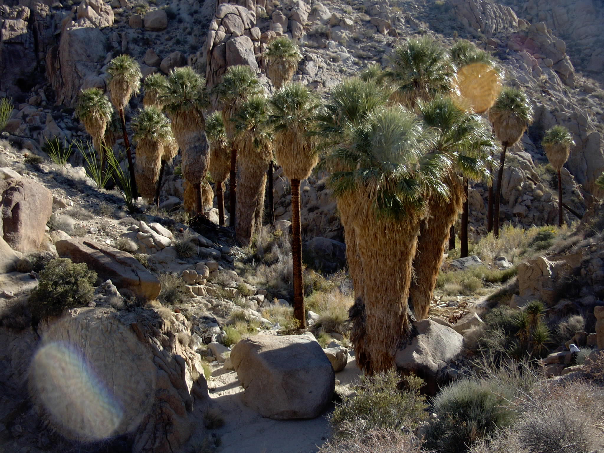
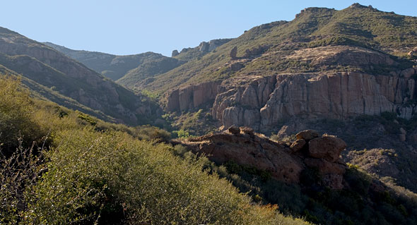

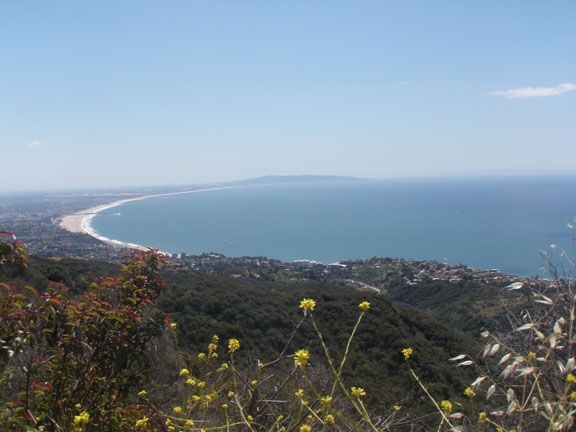
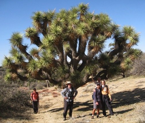
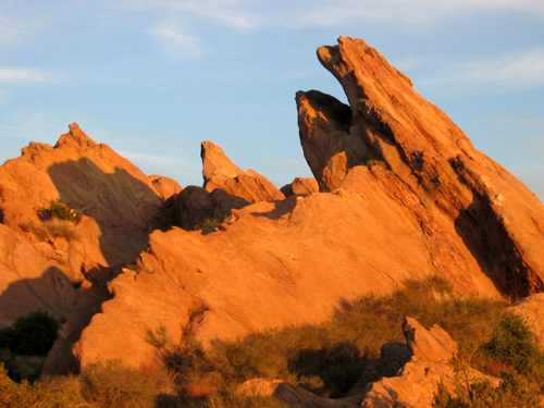
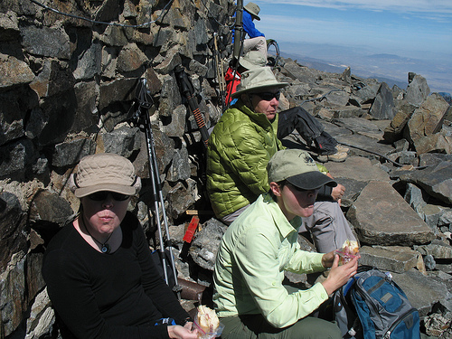

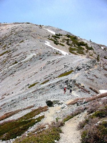
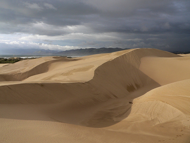
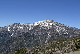
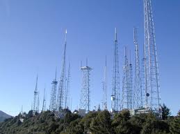
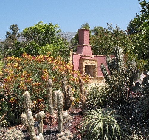
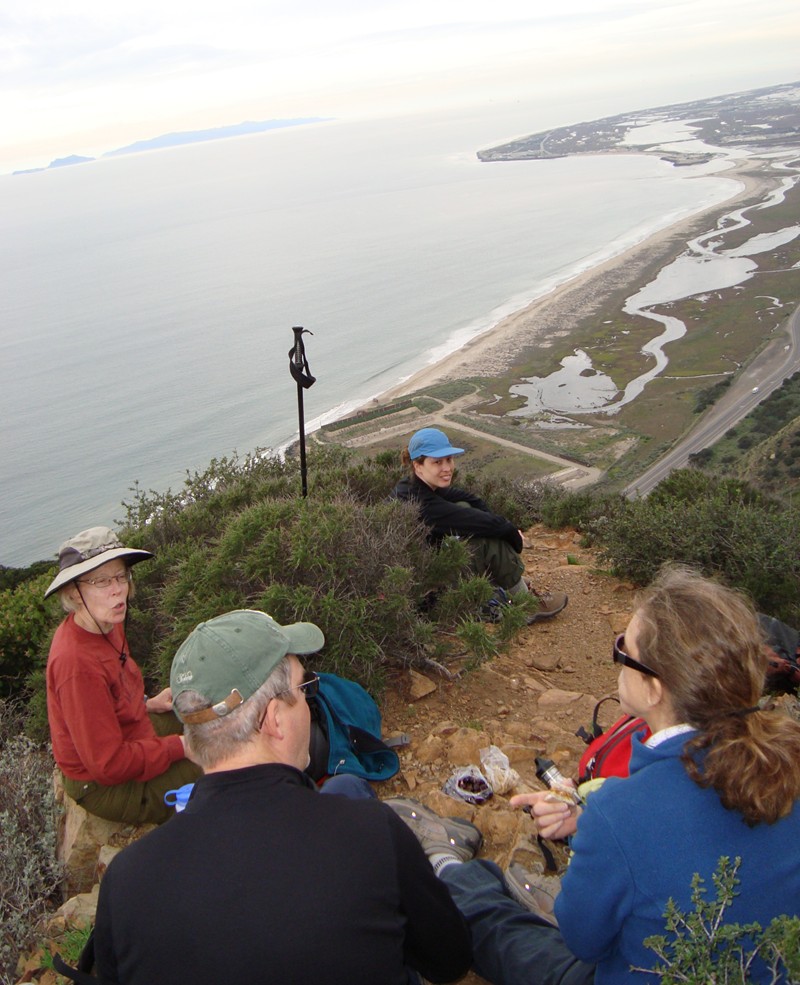
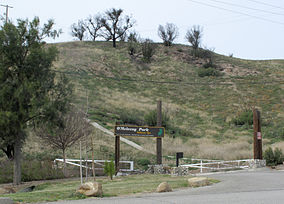
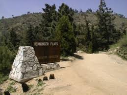
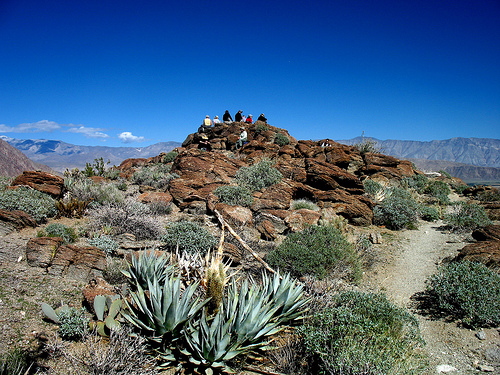
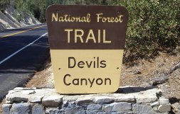
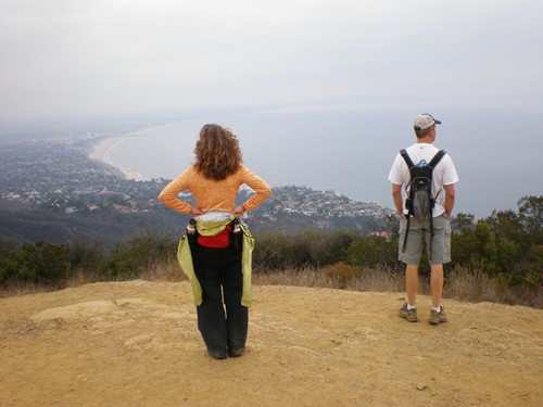
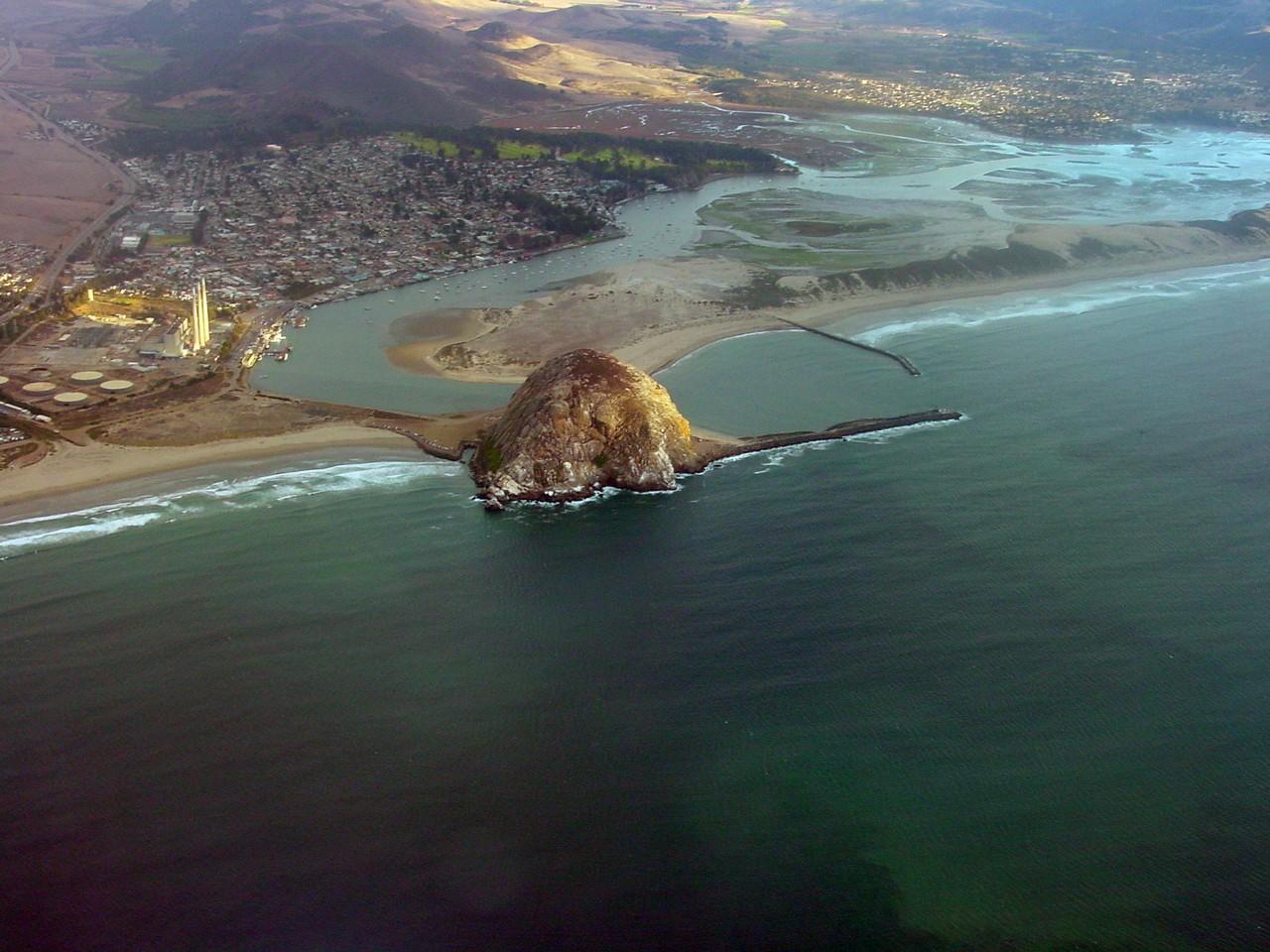
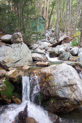
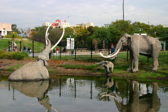
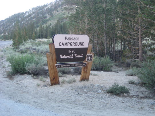
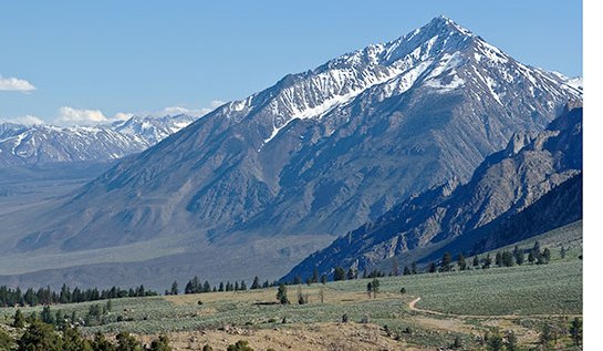
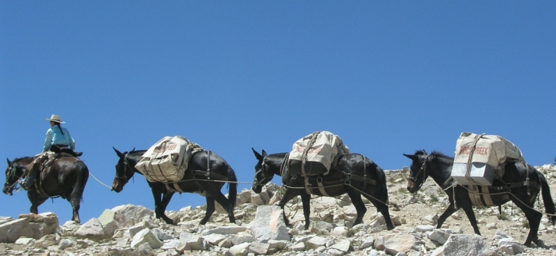
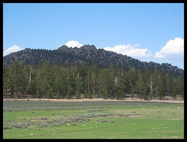

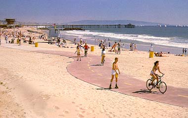
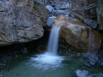

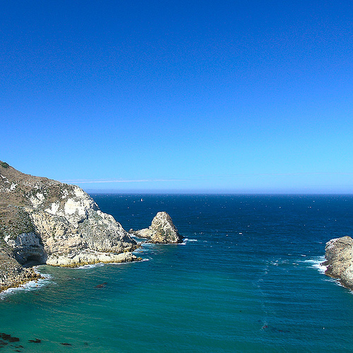
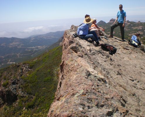
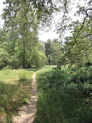
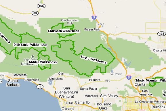
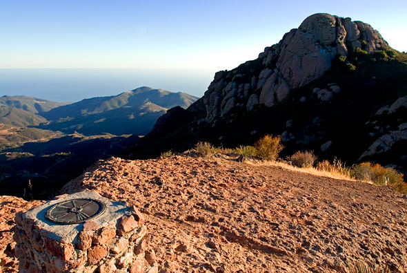

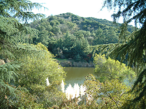
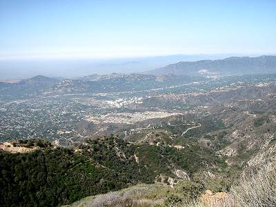
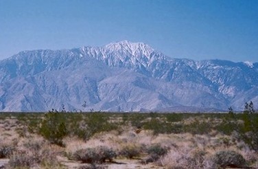
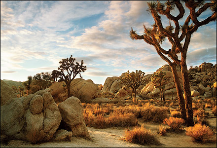


.jpg)


.JPG)


.JPG)


.JPG)


.jpeg)


