Mountains, Minefields, and the Sea of Galilee: Following the Golan Trail
This long-distance trail offers a side of Israel most visitors don’t see
Photos courtesy of Jonathan Schechter.
Mount Hermon, Israel’s tallest mountain. The Sea of Galilee, a freshwater lake 680 feet below sea level. Lush, forested hills. Pastoral meadows, orchards, and vineyards. Volcanic craters. Druze villages. A medieval fortress, and ruins from the Roman and Byzantine eras. Oh, and minefields, too.
For those willing to make the effort and take some (reasonable) risks, the 75-mile-long Golan Trail offers hikers a wilder side of Israel. While you’ll get a good dose of outdoors adventure as you trek the rugged Golan Heights along the Israel-Syria border, the Golan Trail is, above all, a passage through living history—sometimes serene, sometimes startling, and always exciting.
Two words are paramount for a successful trek: Situational Awareness. This is not a trail for trial-and-error trekking or blind reliance on GPS navigation. Wanderlust must be kept in check. An Israeli tourism site reminds visitors: “Large portions of the Golan Heights remain military zones. You must never deviate from the Golan Trail when hiking in this region. You could unwittingly stumble onto firing zones or minefields.” Duly noted.
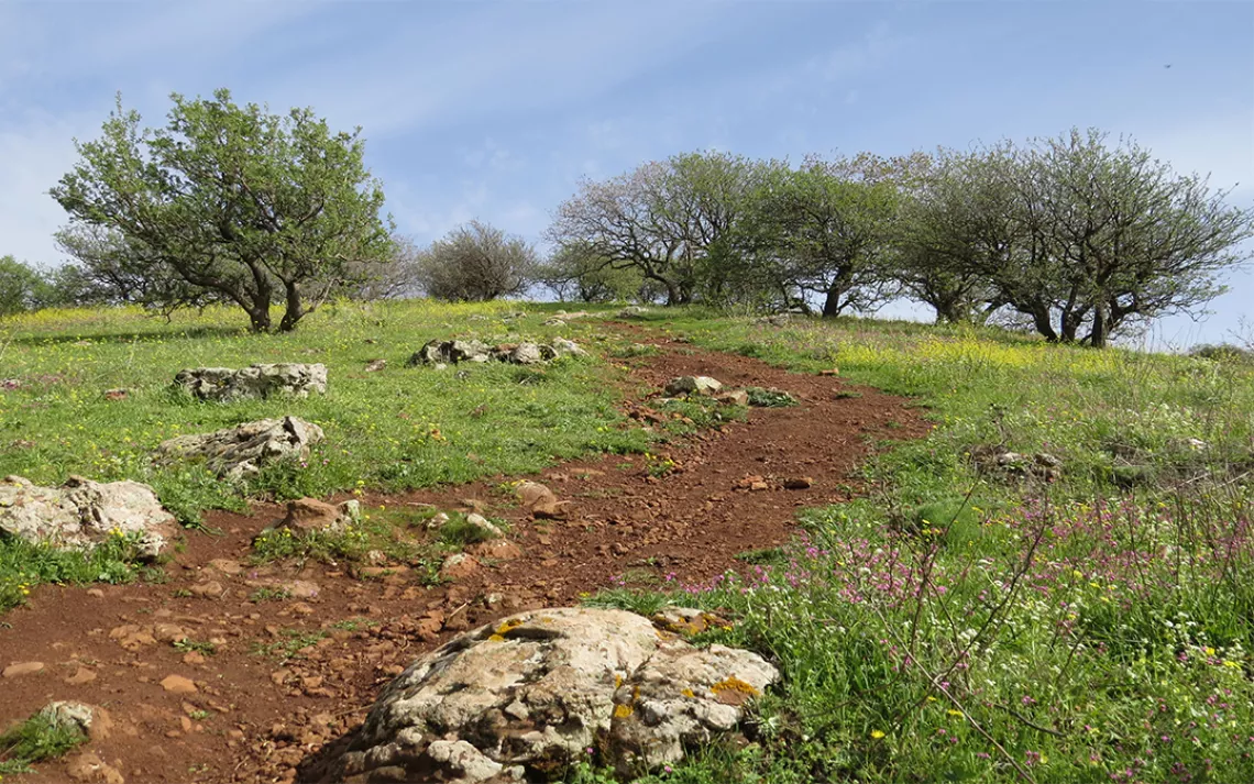
We started our trek not far from the Nimrod Fortress, a 13th century castle that once guarded the route between Damascus and the Galilee region. Today, the fortress is part of an Israeli national park, and colonies of hyrax, a groundhog-like creature, sunbathe on the fortress walls. On the Golan Trail, strange juxtapositions abound, and standing near the fortress we encountered our first scene of contrast: not far from the crumbling castle walls, snow-capped Mount Hermon bristled with Israeli radar domes and antennas.
I wondered out loud about minefields we would encounter during our hike. Avner, my Israeli guide, glanced at his topographic map and shrugged, “They are marked.” He added an Arabic phrase, “Yallah,” (Let’s go!) and we were off.
On the outskirts of Mas’ade, a Druze village on the Golan Heights, we moved to the side of the dirt road that is part of the trail to make way for a tractor. The driver, sporting the traditional curling mustache of the Druze, and a white fez, nodded. The Druze—an Arabic-speaking religious minority whose faith combines elements of Judaism, Christianity, and Gnosticism—number less than a million people, but they have a strong sense of ethnic pride, and the orchards were filled with colorful Druze flags.
Although we were well within earshot of Syria, there were no sights or sounds of the civil war during our trek. The land appeared at peace, and I was able to focus my attention on locating the next Golan Trail waymark of green, blue, and white.
Hikers usually take five to seven days to complete the 15 connected sections of the trail. Numerous road crossings and access points make section hiking easy. Thru-hikers are offered regular diversions: side trails leading to kibbutzim and villages with small convenience stores, coffee shops and cafes. Most trail junctions have signs in Hebrew and English that also note amenities such as nearby cafes, lodging and other natural areas. If one is so inclined, you can find hotels and hostels to sleep indoors, though they can be pricey. Or do it the easy way like we did: just step off the trail, and pitch camp under the nearest tree. With dawn’s arrival, breakfast is coffee, hard-boiled eggs, and fruit, then it’s back on the trail.
The proximity of human settlements makes resupply effortless. This is especially important when it comes to water. Natural water sources along the trail are few and questionable, so keep an eye out for the drinking-water stations along the way. The trail also meanders through and near protected nature reserves. Some permit camping in designated areas.
Nature lovers will be well rewarded. The landscape is home to mountain gazelles, golden jackals, wild boars, Indian crested porcupines, and the Hoopoe, Israel’s national bird. A soft trisyllable “oop-oop-oop” drew our attention to a Hoopoe perched in an orchard just hours after starting our trek. There is no mistaking this beauty. Its undulating flight pattern resembles the flutter of a butterfly, and there is no other bird along the Golan Trail with the colors of black and white, and a peculiar shade of orange that seems to be tinged with pink.
The porcupines stayed elusive, but loose quills testified that they had waddled across the trail. Darkness brought the territorial howls and yips of golden jackals (Canis aureus) and reminded me of the night music and behavior of the eastern coyote (Canis lantrans) back home in Michigan. We never spotted one of these common canids, but their tracks were common in muddy trail sections and near villages. The mostly nocturnal, and rather, hefty wild boars only came into view once, but their rooting behavior stood out in meadows where they searched for bulbs, grubs, and mushrooms.
History buffs will be rewarded, too. A rest stop at the Valley of Tears, a site commemorating an epic tank battle between Israel and Syria during the Yom Kippur War of 1973, was a sobering, yet oddly soothing experience, a testament to the healing powers of time and nature. Wildflowers, including delicate red anemones, bloomed amid lichen-encrusted rocks, while sheep and goats grazed where bloody tank battles once raged. Much of the site is now part of the Mount Bental Nature Reserves and offers a 360-degree panoramic view that includes dormant volcanoes. As a coffee addict, one of my most memorable moments occurred on the top of the short but extremely steep ascent of Mount Bental, one of the volcanic peaks. A small café and United Nations Peacekeeper lookout post hugs the windy summit. It was an unexpected place to sip coffee and gaze out at the green Syrian landscape while listening to bird song— a reminder that nature knows no borders.
As for the minefields, as long as you stay on the path, there’s not much to worry about. Minefields are marked with a red triangle warning symbol along with text in Hebrew, English, and Arabic, and they are fenced off with barbed wire. A bigger safety concern is the traffic wherever the trail intersects with roads.

Mt. Hermon.
Every bend in the trail, rough ascent, rocky slope, forested hillside, flowering meadow or stream crossing brought adventure and spectacular scenery, and some trail junctions offered gateways to other trails. Northeast of the Sea of Galilee, in Trail Section # 9, near the Daliyot Junction, a red marked diversion trail (Golan Trail is green-blue-white) leads along a cliff to the Gamla Nature Reserve, a magnificent rocky landscape where Griffon Vultures nest, and the tallest waterfall (170 feet) in Israel is found.
One of those vultures, rising on the afternoon thermals, reminded me of the words of Freya Stark, a 20th century travel writer: “There is a great moment, when you see, however distant, the goal of your wanderings.” On the Golan Trail the goal was not distant. I found it underfoot and overhead every step of the way from Mount Hermon to the Sea of Galilee.
Follow the Writer’s Footsteps
Best Time To Hike: March is a great month for the trail. Winter storms are (usually) over, but the searing heat of summer has yet to begin. Wildflowers bloom and great flocks of storks soar the thermals as they head north toward Europe.
Pro Tip: Although in Hebrew, this online map of the entire country shows the route in relation to the rest of the country, elevation changes, and natural features. Enter “Shvil HaGolan” in the magnifying glass search engine here. The Golan Trail (in the NE corner of the country-wide hiking trails map) is indicated with a narrow blue-green dashed line.
Golan Trail Route Map in English and Hebrew.
Guides and Additional Information: It is not always easy to locate guides before arriving in the country, however many Israelis are extremely helpful. “Golan Trail Guide” on Facebook is another pre-trip source. Although the posts are in Hebrew, queries will be answered in English. The Society for the Protection of Nature in Israel is a great resources to get started before arriving. “SPNI Tourism Department provides service to groups that wish to hike and enjoy Israel's nature, including the Golan Trail and the Israel National Trail, accompanied by trained and qualified guides, including accommodation at SPNI field schools and all other arrangements such as transfers and meals. To book such a tour please contact Michal Meroz at this email: michalm@spni.org.il.” For English language information on field schools, including lodging near the trail visit here. The Hermon and Golan Field Schools are good sources for general trail information and all field schools welcome visitors.