In the 1986 book Cadillac Desert, Marc Reisner talks about the whole history of the West being about, “moving water from where it is, and presumably isn't needed, to where it isn't, and presumably is needed. “ And dams and reservoirs have been one of the main tools for this kind of work. Of dams he said “When archaeologists from some other planet sift through the bleached bones of our civilization, they may well conclude that our temples were dams" Its true that this intervention in the natural flow of our watersheds has drastically changed our landscapes and has displaced people, wildlife, and even our own awareness about local water, especially here in Los Angeles. We know the environmental harm that dams have created, but what if I shared that visiting our local dams has actually been one of the biggest influences on my naturalist’s journey to learn about water here in LA?
In 2021, when my husband told me that he wanted to learn how to fish, my first thought was “with what water?”. With our busy lives here in LA it can be easy to miss our local watersheds. From our cars we catch glimpses of concrete channels just off the freeways and think “surely those aren’t real rivers”. As a transplant from Florida, my 2008 move to Los Angeles was jarring to say the least, back then I saw the apparent lack of water and like many others thought “it’s all a desert”.
I knew that LA had (and still has) many sources of water and that despite what many think, this basin was not a desert or wasteland before the aqueduct was built. I had learned about our wild rivers of the past that peaked through the concrete in the Glendale Narrows and the more natural spots along the Arroyo Seco. I had read about our coastal wetlands and the street names that hold their memory. But I had never considered visiting a local reservoir because weren’t those the “bad places” that were the result of drastically altering our natural watersheds?
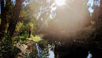
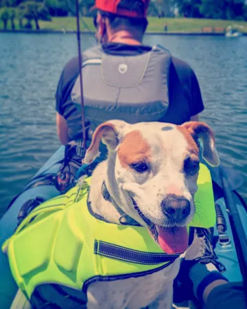
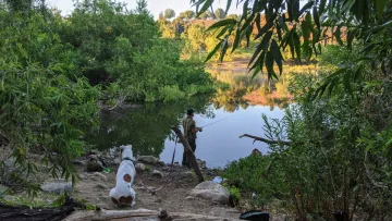
Fast forward to those early years of the pandemic and I found myself sitting “lakeside” several times a week as I accompanied my husband on his learn-to-fish journey at the handful of recreational reservoirs in LA County. I had always been a hiker but visiting these “lakes” gave me something new, a chance to slow down and just enjoy being near water. I got a hammock, a picnic blanket, some bird watching binoculars, and started to enjoy the slower pace of outdoor connection through observations with INat and my nature journal. We even got an inflatable kayak, something I had never pictured doing in LA for my first 13 years here.
On this journey I learned that while some reservoirs were built to hold water brought here from the Sierras or the Colorado River, other reservoirs were built to hold storm water runoff from our local watersheds, our own rivers, creeks, springs, and washes. These sources of water have been drastically changed through the use of concrete channels and underground tunnels and with all this intervention and movement of water by water reclamation it’s easy to see why it’s so hard to connect to our local watersheds here in LA. It all looks manmade. Or that’s what I used to think.
We might not think of these man-made lakes as places to connect to the natural world but if we can look past the constructed facade and explore the surrounding areas that feed the reservoirs then we can learn about what springs, creeks, and washes still exist here.
Sharing about these local reservoirs is not an endorsement of building more dams but instead a chance to reflect on my personal story of how these water reclamation projects greatly influenced me in my California Naturalist story. Even if they do have a bad reputation in environmentalist circles, they were an entry point for me to connect to water and ask questions about how it got there. And at the end of the day, kayaking is just a lot of fun too!
After visiting so many of them I have to ask, “while they are here, what can we learn from them?” In many cases we are learning that the dams have to eventually go but in the meantime I hope you will be encouraged to get to know these local spots, the water they contain, and the watershed beyond the dam.
Puddingstone Lake/ Frank G. Bonelli Regional Park
Watershed- San Gabriel River Basin
San Dimas, CA
250 acre lake with 14 miles of multiuse trails, motor boats, sailing, equestrian center
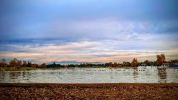
Just a few minutes away from the LA County Fairgrounds, Puddingstone Lake was one of the first reservoirs we visited when my husband first decided to learn how to fish in 2021. I was blown away by the natural shoreline and the many trails that pass through oak scrub and other native ecosystems. This lake is great for all kinds of boating and you get great views of Mt.Baldy and the San Gabriel Mountains.
History- Puddingstone Reservoir was built in 1928 to help prevent flooding and help collect water for nearby citrus growers. Just North of where the lake is today was a historical source of water known as Mud Springs by settlers and was an important water source for the area. Puddingstone collects water from the local watershed known as Oak Wash and lets out into Walnut Creek (that also goes by the nearby Raging Waters Waterpark). Since the 1950’s the lake level is also maintained by water LA County purchases and imports so that recreating activities like boating and fishing are not affected by seasonal droughts.
Environmental Issues- Urban stormwater runoff has led to higher levels of heavy metal, low oxygen, and elevated nutrients. There is an advisory for eating fish due to contaminants like Mercury while environmental groups work to mitigate pollution from storm runoff.
Get Involved- Pomona Valley Bird Alliance, Nature For All and LA County Parks Foundation
Lake Balboa/ Anthone C. Beilenson Park/ Sepulveda Wildlife Preserve
Watershed- Sepulveda Basin/ Los Angeles River
San Fernando Valley, CA
27 acre lake with trails, boat rentals, picnicking, model boats and airplanes, archery, wildlife refuge, fly fishing, bass fishing and more!
If Puddingstone Lake was our first reservoir we spent time at, Lake Balboa became the most often visited. Lake Balboa is situated in a more orderly, park-like setting although small you can launch your own kayak or paddle board and enjoy the park from the water. If you never explored the surrounding area you might think this area is just family bbq’s and swan boats but don’t stop there. Just next door you can explore the Sepulveda Wildlife Refuge! Here you can see one of only three areas where the LA River is soft bottomed and therefore filled with plants and biodiversity instead of just concrete. Another fantastic spot for birdwatching this part of the river is also great for fly fishing too! Haskell Creek and Bull Creek also run through the Sepulveda Basin.
History- Lake Balboa was created by the Army Corps of Engineers as part of a revitalization project in the Sepulveda Basin Recreation Area, a part of the LA River. Although Lake Balboa is man made and filled with highly treated reused water from the nearby Tillman Reclamation Plant (also known as Starfleet Academy to trekkies) this area is a historical floodplain for the LA River and the nearby Wildlife Refuge is one of only three parts along the LA River that is soft bottomed and not completely covered in concrete due to its high water table (groundwater). A complicated area fed by both imported water, especially in the dry season, but also one of the more natural areas to experience the LA River. The Sepulveda Basin with its manicured park and nearby more wild refuge is a perfect place to get to know our local water. Start with the Largemouth Bass fishing in Lake Balboa, go fly fishing for Carp in the free flowing LA River, and end with a birdwalk with the San Fernando Audubon in the wildlife refuge.
Environmental Issues- The Sepulveda Basin has suffered from the impacts of development, brush fires, litter and trash, and invasive plants. Despite the challenges this area supports a wide range of life and many groups and volunteers working to improve biodiversity and restore the preserve.
Get Involved- Friends of The LA River @FOLAR, San Fernando Audubon Society @sfvaudobon, California Native Plant Society @cnps.losangeles, Sepulveda Wildlife Reserve @sepulvedabasinwildlifereserve,
Santa Fe Dam Recreation Area
Watershed- San Gabriel River Basin
Irwindale, Ca (also home to the Renaissance Pleasure Faire)
70 acre lake with boat rentals, trails, biking, birdwatching and native plant restoration areas.
If you’ve been to the Renaissance Pleasure Faire you have been to Santa Fe Dam! At first I thought the shoreline was a bit stark here but what makes Santa Fe Reservoir so cool is the commanding views of the San Gabriel Mountains and these cute little islands in the middle of the lake that are actually sanctuaries for birds. The east shore also has a native plant preserve which makes for excellent plant and therefore bird viewing.
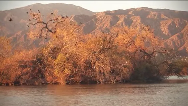
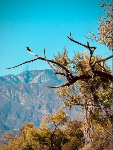
History- This reservoir was completed in 1947 and is directly fed by the San Gabriel River and runoff from the San Gabriel Mountains just three miles away. The San Gabriel River shaped the land, all the way from what we see today at Santa Fe Dam to Puente Hills and eventually Seal Beach. Historically, the San Gabriel River had the greatest natural flow out of all the rivers in LA County, but more on that in an upcoming post. The lake is relatively small but the capacity of the entire dam is much larger, reminding us of the potential for catastrophic 100 year rainfalls and flooding. All this is to say that visiting Santa Fe Dam and the San Gabriel River is an absolute must in order to understand water in LA today.
Environmental Issues- Similar to those mentioned already the ecosystem here suffers from excessive trash, pollution from urban runoff, and invasive species.
Get involved- Active SGV @activesgv, California Native Plant Society San Gabriel Chapter @cnps_sgm, Pasadena Audubon Society @pasadenaaudubon
Lake Piru
Watershed- Piru Creek Watershed and Santa Clara River Valley
Between Santa Clarita and Fillmore off the 126 (just into Ventura County)
1,240 acre lake and 20 miles of trail, camping, fishing, boating and nearby Los Padres National Forest for even more exploration
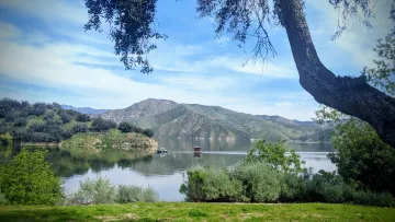
My first trip to Lake Piru was actually for production work for a TV show I was working on. This view was my office for a few days and I was not mad about it. This is the largest and most remote reservoir I am sharing in this article but I included it to bring awareness to the nearby Santa Clara River which this reservoir feeds into via Piru Creek. In addition to being one of the prettiest reservoirs in our area my husband had one of his best fishing days ever here. This lake does have a high number of swimming accidents so be careful near the water and make sure to follow all posted regulations. The Sespe Condor Sanctuary is nearby and although this refuge is off limits to the public, its proximity to Lake Piru means you might be able to spot a California Condor, North America’s largest land bird!
History- Lake Piru was created in 1955 with the completion of the Santa Felicia Dam. This dam captures runoff from Piru Creek which is the largest stream system in Southern California that is largely still natural, but more about our local creeks in my next post.
Environmental Concerns- Invasive quagga mussels, mercury advisory for fish in lake, harmful algae blooms in warmer months, and accessibility to Piru Creek for Southern Steelhead Trout.
How to get involved- TreePeople @treepeople, Channel Islands Restoration @channelislandrestoration, Conejo Valley Audubon @conejovallyaudubon
Honorable Mentions
Leg Lake at Whittier Narrows and nearby Nature Center in El Monte, CA
Peck Road Water Conservation Area in Arcadia, CA
Castaic Lagoon in Santa Clarita, CA
Lake Cuyamaca in San Diego County
Lake Cachuma near Santa Barbara, CA
Bio- Amanda Leigh Smith is a California Naturalist and artist based in Los Angeles. You can find her work on www.losangelesisnotadesert.com or on Instagram @laisnotadesert