Fire Season's Impact on Our Water
Scientists in Colorado are working to find out how, exactly, fire changes watersheds
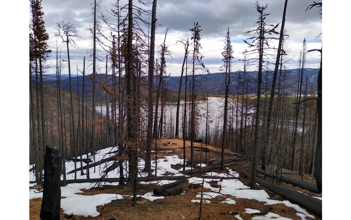
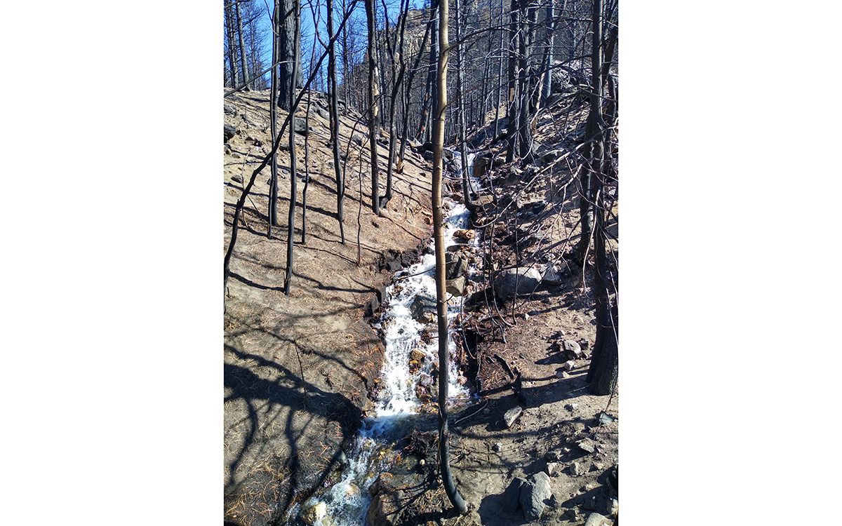
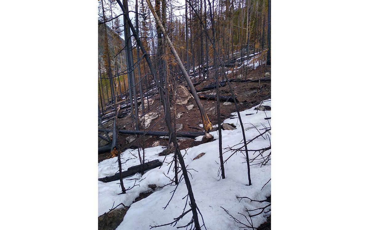
Photos courtesy of Heather Hansman
It’s spring in the fire-scorched headwaters of the Colorado River, high up in the Rocky Mountains, and a team of researchers are wading through ankle-deep ash and a pick-up-sticks-esque maze of downed trees to collect data from water monitors and weather stations.
That’s because fire damage isn’t just destructive for trees that go up in flames. More than half of America’s drinking water comes from forested areas, and when it comes to water, fire has direct and cascading impacts on a range of things, from food production to public health, because it clogs up reservoirs and contaminates water sources. That’s why these scientists are trying to understand how fire impacts water—how it changes the snowpack, as well as the runoff and the land itself. And here in the headwaters of the Colorado River, which provides water for 40 million people in the western US—and which was devastated by the East Troublesome, Grizzly Creek, Mullen and Pine Gulch Fires, which raged from August to December of 2020—they’re quantifying the impact. Because if they have ways to show direct connections between fire and flooding and contamination in the water supply, then communities and utilities downstream can develop a baseline for mitigating damage and protecting their water supplies. It’s a crucial connection point, especially as the western US gets explosively hotter and drier. Over 8 million acres burned across the US in 2020—the most on record—and 2021 is already shaping up to be just as fire-filled.
The team, led by Colorado State University hydrologist Stephanie Kampf (who, full disclosure, is my second cousin), has placed instruments all over the burn scar to monitor how things are changing. So far, they've seen wind-scoured, sun-melted snow in the burned areas, and now, as the snow starts to melt, they’re measuring stream discharge and water quality, looking for fire impacts. They’re predicting they'll see flash flooding, major channel changes, erosion, and turbidity in the water supply due to the fire, and they want to try to quantify exactly where it happens and why. “We’re trying to figure out what we can do pre-fire to protect the watershed,” Kampf says.
Later in the summer, they’ll measure how channel sediments and shape change after summer rainstorms. They'll also fly drones over any areas that experience severe erosion or debris flows to see how the topography has been altered and where the fire’s impacts have been the most significant. It’s tedious, tricky work, with tons of data points (the National Science Foundation gave them a multiyear grant to work on it), so in their study, which started with the 2020 fires, they’re trying to quantify just how much fire changes a watershed, especially as megablazes sweep across entire ecosystems.
Kampf notes that while we broadly know how fire impacts water sources—and cause erosion and sedimentation—her team, along with researchers from the US Geological Survey, are among the first to put the pieces together and to collect wide-ranging data about how and where the changes happen and how fire impacts snow, and then water, because the research takes a lot of time on foot in hard-to-reach burned areas. “More papers have come out in the past few years about snow after fire, but these are the first intensive field sites. Often in the past people have done this work opportunistically, when there happens to be a fire near them,” she says.
In a healthy forest, in contrast, trees, underbrush, and ground cover filter water and protect soil from erosion. That soil strains contaminants out of the water, and then slowly releases it into streams, acting like a gigantic sponge, cleaning the water and preventing flooding.
But after a fire, ash changes the land’s ability to self-regulate, burned forests tend to landslide, and scorched soil doesn’t hold moisture, which causes runoff and erosion. Contaminants, carcinogens, and burned material run off downstream instead of being filtered out through the soil. Nutrients’ balance in the soil gets out of whack. Downstream debris chokes up riverbeds, reservoirs, and water treatment plants. It becomes an economic and health issue, in addition to an ecological one.
For instance, in Colorado, after the Buffalo Creek in 1996 and the Hayman Fire 2002, Denver Water, the largest utility in the state, which provides water for 1.5 million people, spent more than $26 million dredging out Strontia Springs Reservoir, one of the main water storage sources. The fires showed the tangible downstream damage burns could bring.
Since then, Denver Water has been proactive in forest thinning and fire management, to prevent repeat contamination. They’ve been on the front end of that burgeoning mission, as communities across the fire-prone West—from Southern California to Northern Montana—try to protect their watersheds and their water sources from fire damage through programs that range from targeted ground-cover planting to the turbidity sensors employed by the city of Fort Collins, Colorado. (When the river gets too gummed up with sediment—as happens when snow runoff or rain flows through a burned forest—they serve to turn off the water pumps.)
That's all easier than it sounds, however—Fort Collins can do that because it has a backup water supply. And Denver Water's forestry program is theoretically helpful, but of course, the people behind it can't predict where future fires might strike, and spread.
You can’t mitigate and plan for things you don’t understand—and that’s why Kampf and her team are trying to quantify and better comprehend where fires are most destructive and how their impacts run downstream. And they’re looking at how such knowledge can be applied in a hotter, more fire-prone West, where fire and water are intrinsically linked. “We’re at this tipping point. There are all these stresses in the ecosystem, so what is it going to look like in the future?” she asks.