Walkable, Bikeable Los Angeles
Tucked behind the Los Angeles Police Department’s massive headquarters is a nameless block-long patch of grass, a modest splash of green that someone navigating downtown LA might easily overlook.
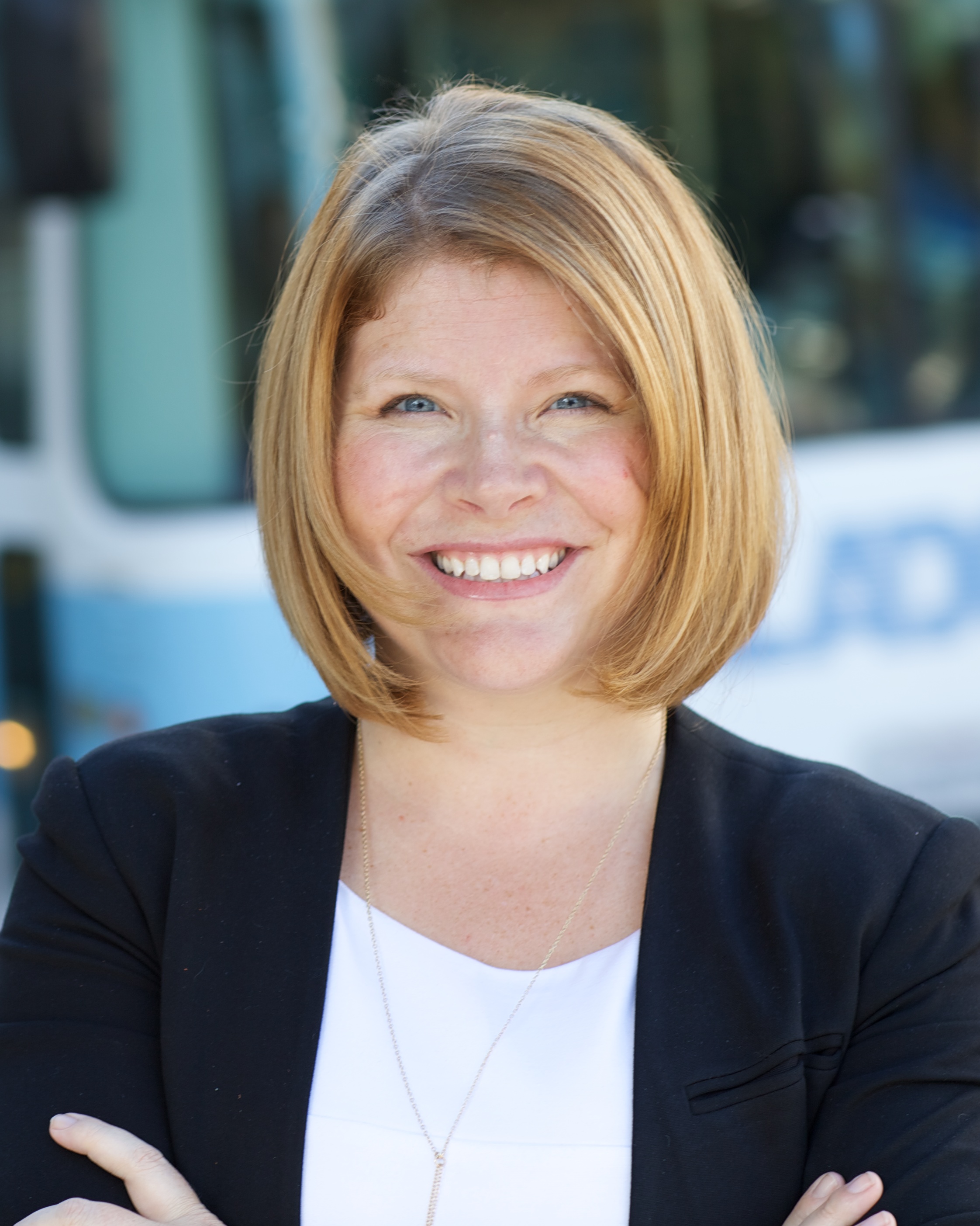
Seleta Reynolds, LA’s traffic czar—official title: General Manager of the Los Angeles Department of Transportation—does not overlook it. She sees in it the future of Los Angeles.
Pausing in our brisk walk toward Second and Broadway, Reynolds points at LAPD’s unfenced backyard and exclaims, “This is a huge victory for urbanism. I love this place!”
At first glance, the object of Reynolds’s affection is unimpressive. The little island of grass in a sea of concrete is threadbare in spots, a small platoon of palms rustling forlornly at one end, and dwarfed by the towering stone and glass wedge that serves as LAPD’s HQ. But to Reynolds, its very ordinariness is the point: In this era defined by fear of shootings and terrorism, with so many “public” buildings closed off behind layers of forbidding security, this bit of free and open space on the cops’ own turf communicates something different. The lack of security signals a lack of fear, Reynolds says, which in turn invites people to feel safe. It invites people in.
“And so this space is always used,” Reynolds enthuses with a sweeping gesture of her hands. “It’s always full of people. People on foot. People with dogs. This is now a street that’s welcoming, rather than off-putting.”
It’s immediately clear that Reynolds is right. There’s a good reason why the grass is worn to the nub in spots. This is a space people use and enjoy on foot throughout the day—in downtown LA, of all places, which has for the last half century been as welcoming to pedestrians as a minefield. In every person pausing for lunch on a bench, in every dog on a leash lifting a leg at the base of one of those palms, Reynolds sees her adopted city’s relationship to its streetscape evolving into something cleaner, healthier, and more vibrant.
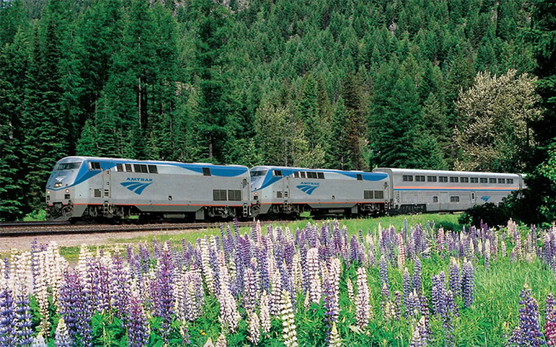
This, she says, is how the built landscape of Los Angeles ever-so-slowly morphs from car space into public space, from pedestrian deadly to pedestrian friendly. All it’ll take is softening up the other 7,500 miles of streets, as the city slips toward a future in which (with apologies to the '80s band Missing Persons) everybody walks in LA. At least a little.
When Los Angeles mayor Eric Garcetti hired Seleta Reynolds away from San Francisco’s livable streets program in late 2014, he publicly introduced her as “the ideal field marshal in the war against traffic.” The memory still makes her wince. Not that she doesn’t hope to tame LA's epic car congestion, where drivers spend an average of 80 hours a year stuck in traffic. It’s just that the mayor’s martial imagery felt uncomfortably close to the rhetoric raised against her up north, where, despite Bay Area progressivism, nearly every move to accommodate pedestrians, bicyclists, or greener transit options was spun by opponents as a “war on cars.”
“We are not waging a war on cars,” Reynolds says. “We are working to give the people of Los Angeles more choices.”
That may seem like a fine distinction, but in this capital of car culture, Reynolds and her staff want to be seen more as mobility pied pipers than anti-auto warriors. Her stated goal is not to disadvantage drivers but to offer them additional options by making it easier and safer to walk or pedal in LA.
That last bit—the “safer” part—is particularly vital, because there is real and justified fear about walking in LA, where pedestrians are involved in only 10 percent of the city’s traffic crashes yet account for more than 35 percent of the fatalities. Among Reynold’s many jobs (she’s also in charge of city buses, parking enforcement, traffic design and control, bike lanes, and preparing for the advent of driverless cars), she is also charged with carrying out the mayor’s ambitious vow to end all traffic fatalities by 2025.
Part of Reynolds’s approach is to focus on “calming” traffic, lowering speed limits on selected streets and even removing lanes of vehicle traffic, while adding bike lanes and pedestrian protections. Calmed streets also use timed traffic lights and dedicated “pockets” that keep turning cars from slowing down traffic flow. Smooth, steady flow can get drivers where they’re going as quickly or quicker than old-school streets, which impose much more hurry-up-and-wait on drivers. A calm street means less smog, less driver impatience, and fewer pedestrian deaths. That in turn encourages more walking and less driving, which reduces traffic congestion further.
This virtuous cycle is the key to the “Great Streets” approach, as LA calls it, and Reynolds says it advances not with a big, flashy, billion-dollar project like a subway or a trolley, but slow and on the cheap—one block, street, and neighborhood at a time.
Her department has an extensive list of these projects, either complete or in the works. There are the protected bike lanes near the enormous California State University’s Northridge campus in the San Fernando Valley. There is the rise of “scramble” intersections, where all the traffic signals turn red while all the “Walk” signs light up, allowing pedestrians to cross safely every which way, including diagonally. There is the partnership between the city and ride-share company Lyft to connect people to transit and bike-sharing stations, solving the “first-mile, last-mile problem” that can make driving seem so much more convenient. And then there’s the flashiest of all the projects: the remaking of Broadway.
Broadway is Exhibit A in the Great Streets effort, just a few blocks away from LAPD’s backyard, a remodeling of one of the oldest and most important streets in the city's history. A hundred years ago, Broadway was the main drag in the nation’s largest theater district, even bigger than that other Broadway. Pictures from the era show a street overflowing with shoppers, diners, and theatergoers on foot, served by the largest streetcar system in the world. All that faded after World War II, and Broadway has been dominated by four lanes of very busy, fast car traffic ever since.
The makeover has reduced a 1.3-mile downtown stretch of Broadway to three vehicle lanes, creating extra pedestrian space with planters, benches, and tables with umbrellas for outdoor dining. This is particularly popular at the downtown Grand Central Market, a newly renovated foodie destination where outside tables are in high demand, and where Reynolds likes to grab a quick breakfast to watch how the new street works. Traffic signals here don’t use the “scramble” but offer pedestrians a head start: The “Walk” signals come on four seconds before cars get the green, which eases the threat of right turners nailing people as they step off the curb.
A year and a half into this experiment, Reynolds’s department is still gathering data on how these changes have affected safety, commerce, and congestion. By all appearances, a once-moribund part of downtown is now a thriving hub of commerce drawing a broader mix of visitors—on foot and on bike.
If this sort of neighborhood-level transformation persuades Angelenos to become more omnivorous in their mobility choices, then the economic, environmental, health, and safety gains could be enormous, Reynolds says. The opportunity lies in the fact that half of all trips in the metropolitan area are under three miles—easy walking or biking distance in a city with 300-plus sunny days a year and an essentially flat geography. Yet 84 percent of those short trips—to school, to the market, to the ATM, to the coffee shop—are currently made in cars, according to city estimates.
Shifting just a portion of those short trips from cars to other options, Reynolds says, would relieve traffic congestion, ease the demand for parking, cut emissions, improve health and obesity, and reduce roadway injuries and deaths.
“The stakes are enormous,” she says. “But I think we can get there.”
In some ways, getting there is just a matter of remembering where we used to be. Reynolds grew up in the 1980s on a dead-end street in Jackson, Mississippi, with the freedom to walk, ride a bike, and wander, with a sense of streets as public places to be enjoyed as well as traveled.
She acknowledges that Los Angeles is a different animal, where people have for decades been conditioned to see the automobile as the only practical mobility option. But that’s as much about perception as infrastructure, she says. To her, transforming streets from being mere conduits for cars to something bigger and better, making them places of culture and commerce and play as well as transport, starts with attitude. The infrastructure will follow.
Why is it, she wonders, that Angelenos can name their favorite restaurant, favorite museum, or favorite park in a heartbeat, but if you ask them their favorite street, they look at you like you’re nuts? To its own people, LA streets are places of dread. Reynolds wants to alter that perception.
“It shouldn’t be that way,” she says. “Streets are spaces that belong to the people. They are public spaces, and we should be able to think about them like any of our other favorite places.”
Seleta Reynolds/Photo Courtesy of Los Angeles Department of Transportation