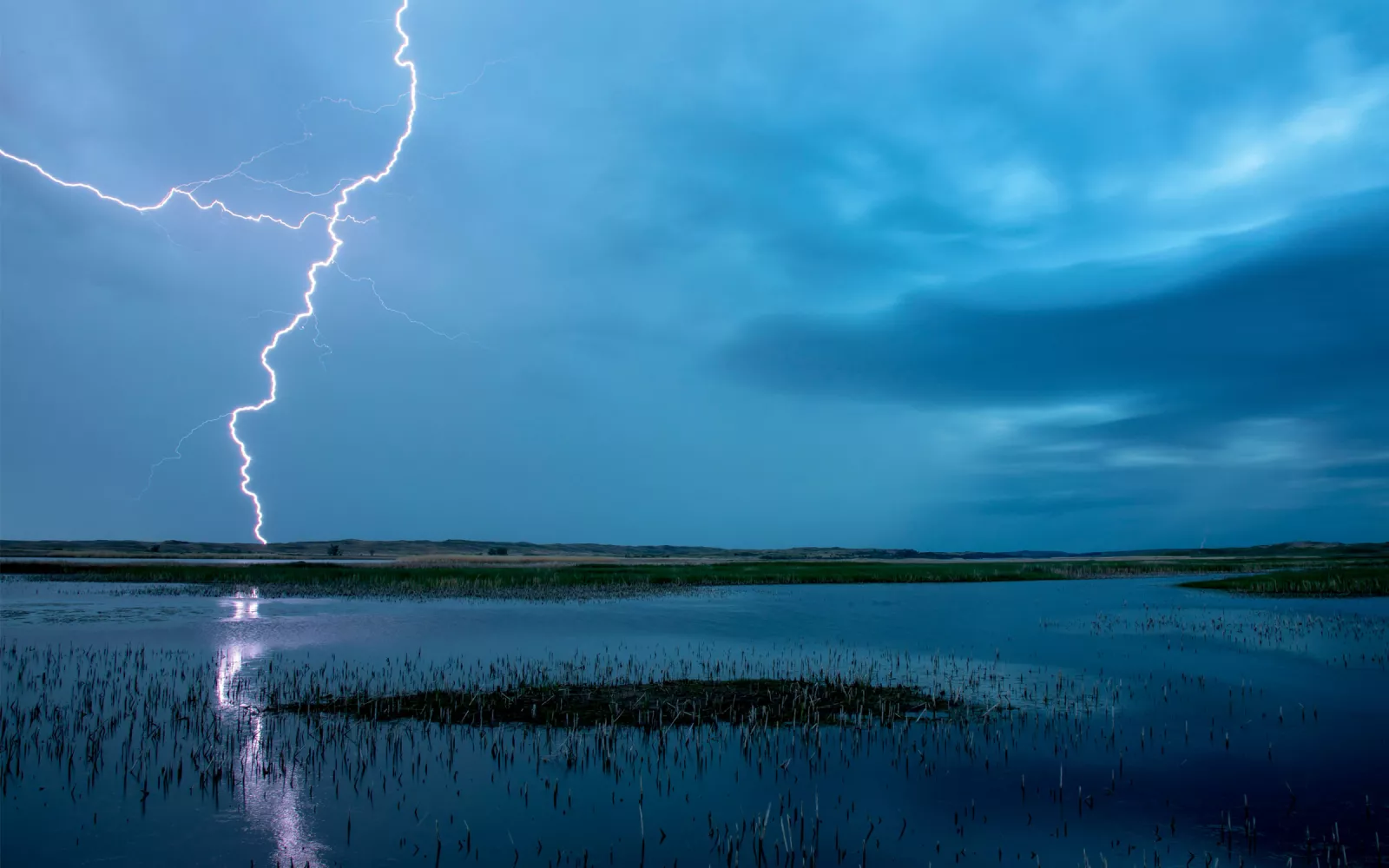
Lightning strikes over a wetland in the Nebraska Sandhills. | Photo by Ethan Freese
How to Think Like a Watershed
The Platte Basin Timelapse turns science into photographic poetry
THE IDEA FOR Platte Basin Timelapse began with a simple desire. "I knew that I wanted to keep working in the Big Backyard," says conservation photographer Michael Forsberg.
In spring 2011, Forsberg and documentary filmmaker Michael Farrell had just finished shooting Great Plains: America's Lingering Wild, soon to air nationally on PBS. They were driving back to Nebraska, and with all that "windshield time" ahead of them, Farrell eventually braved the question: "What's next?"
Somewhere in the red-dirt scrubland of Oklahoma, with Forsberg's dusty gray Suburban pushing 300K miles, the two spitballed their next big adventure: a long-term multimedia project that would use timelapse cameras to illustrate how water connects all of us, everywhere, all the time. The technology was familiar. For Great Plains, they'd incorporated timelapse cinematography to ease transitions. And for Forsberg's previous book of the same name, he'd often relied on camera traps automatically triggered by movement within the frame. With both, Forsberg says, "I was really struck by the sweep of time." The cameras captured not only "the cast of characters that move through any particular point" but also how those characters—and their physical environs—change from one season to the next. At the same time, he'd begun to see a pattern in his work. All of it was linked, in one way or another, to that most critical resource: water.
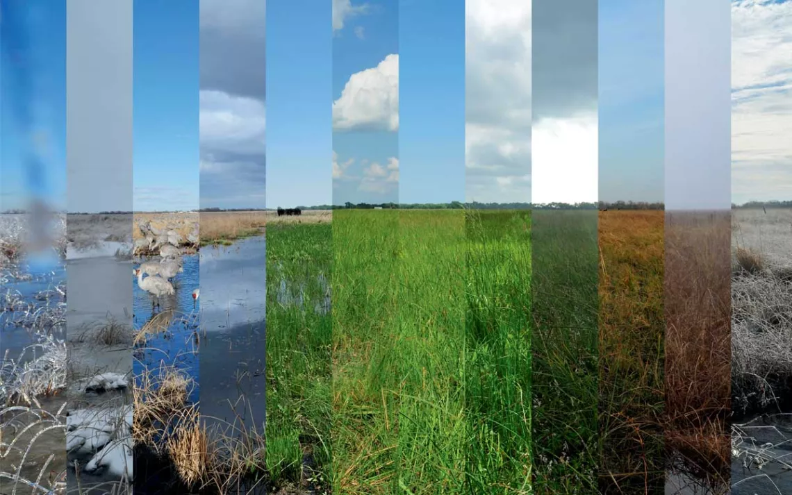
This composite image, captured by a Platte Basin Timelapse camera, represents one full year of a wet meadow landscape on Mormon Island in Nebraska. | Photo by Michael Forsberg
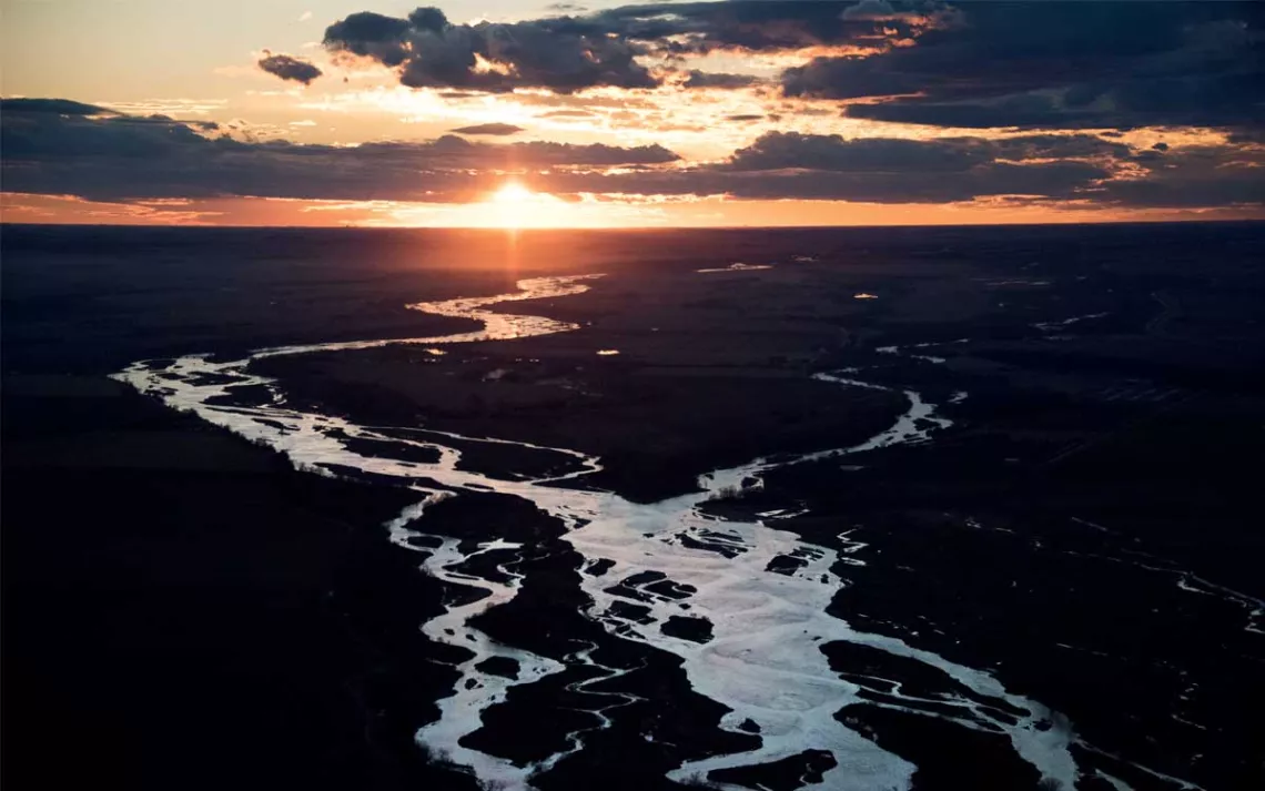
For the new project, Forsberg and Farrell settled first on a watershed—"a system unto itself," Forsberg says, a natural frame wherein every action and reaction could be easily witnessed. Then they zeroed in on the Platte River Basin, from the river's headwaters in the Colorado Rockies to the Missouri River and its gordian dance with the Ogallala Aquifer below, one of the largest groundwater sources in North America. "It's not the Tetons. We're not looking over the north rim of the Grand Canyon. We're looking at grassland. We're looking at cropland. We're looking at the land that's an anchor for the sky. But you only see that beauty if it grows on you. And that takes time," Forsberg says. "We can help compress that time a little bit."
Almost from the start, the project spilled its banks. To secure funding, Forsberg and Farrell partnered with the University of Nebraska, where they now teach a course on digital imaging and storytelling. To get the project off the ground, they hired students as interns, some of whom are now full-time employees. "So this project has become a learning laboratory," Forsberg says. "The Platte Basin is the stage waters, the muse. And it's a launchpad to try to create the next generation of conservation storytellers."
Now in its 13th year, what they eventually called Platte Basin Timelapse operates more than 60 timelapse cameras throughout the 90,000-square-mile watershed. Each camera, housed in a weatherproof shell and powered by a solar unit, takes one photo during every hour of daylight. Some are permanent—"legacy cameras," Forsberg calls them. Others are temporary. Together, he says, "they bear witness to a watershed in motion."
The cameras have captured lightning kissing the storm-roiled waters of Lake Ogallala, near the Kingsley hydroelectric plant in southwestern Nebraska—a wild convergence, a synchronicity of man and nature. They've captured a windmill after a rainstorm, its reflection glassy in the water tank below, sunflowers crowding like cattle. They've captured the Platte, this "relic of a braided river," Forsberg says, trying to braid itself again—conveyors of sand churning downstream. They've captured the same wetland in every season, then stitched the images together to form a living composite, or as former project researcher Emma Brinley Buckley wrote for the scientific journal Ecology and Society, to "facilitate novel perceptions." And here, like rivers converging, science flows into verse. In the formal language of the Platte Basin Timelapse project, one hears echoes of the late Nebraska poet Don Welch. In his poem "Advice From a Provincial," Welch admonishes the lazy outsider to go home, to "work on your eyes" and "bring back a sight which can co-create meaning."
Then notice at sunset how our river is on fire,
a long burning vowel running westward,
back to the mountains, those granite consonants
which thrust themselves at the sky.
Through composite imagery, curated galleries, a new website, and a sprawling portfolio of multimedia stories, Platte Basin Timelapse co-creates meaning in a region chronically overlooked and underappreciated. Neither Forsberg nor Farrell could have predicted that the project would still be running today, more than a decade down the line. And yet, as Forsberg reminds us, "there is no finish line in conservation."
The Platte Basin Timelapse team has been telling the story of the Platte River Basin watershed since 2011 through an innovative blend of research, art, and documentary film. Learn more at plattebasintimelapse.com.
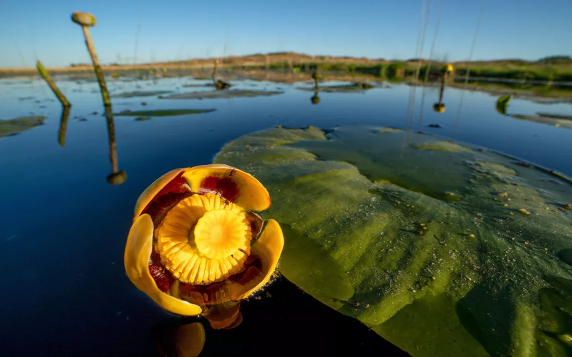
Named for the family ranch that preceded it, the Ballards Marsh State Wildlife Management Area in north-central Nebraska—the first public hunting area in the state—features an archetypal Sandhills wetland. Here the Ogallala Aquifer spills across roughly 320 acres of mixed-grass prairie, creating ideal habitat for everything from muskrat to perch and yellow pond lilies, like those shown here floating on the surface. Though common throughout North America, this aquatic species is now relegated to just a few Sandhills wetlands in Nebraska, beyond the reach of cattle and cropland conversion. | Photo by Ethan Freese
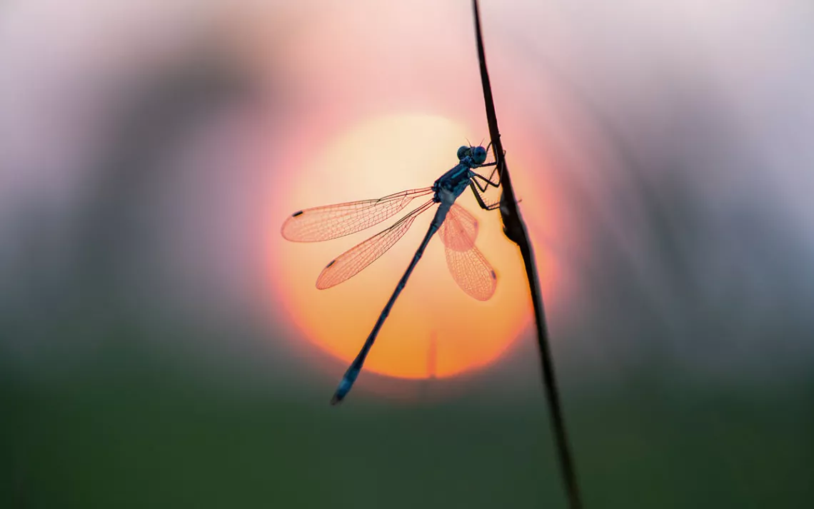
Smaller and more delicate than the dragonfly, the nymph of a damselfly, a closely related species, spends roughly a year in the water before flying away as an adult. It then dies just weeks later. Here, the sun sets on a damselfly at Little Salt Fork Marsh Preserve near Lincoln, Nebraska. | Photo by Dakota Altman
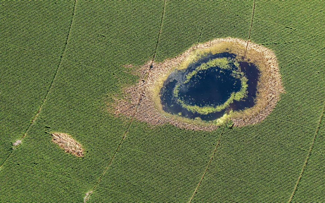
A playa wetland surrounded by a cornfield captured from a drone in southwest Nebraska. | Photo by Mariah Lundgren
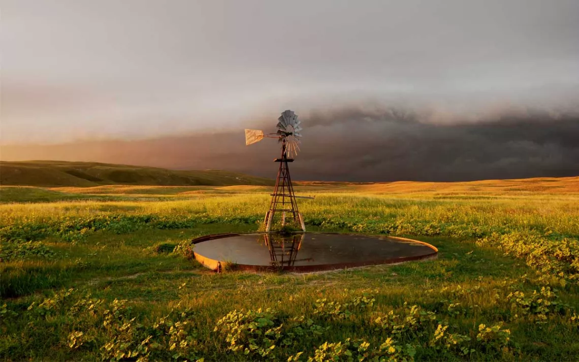
Windmills like this one, which pumps groundwater to the surface, make the Sandhills some of the finest ranch country in the world. The timelapse camera that captured this image has been taking photos every daylight hour since 2011. | Photo by Michael Forsberg
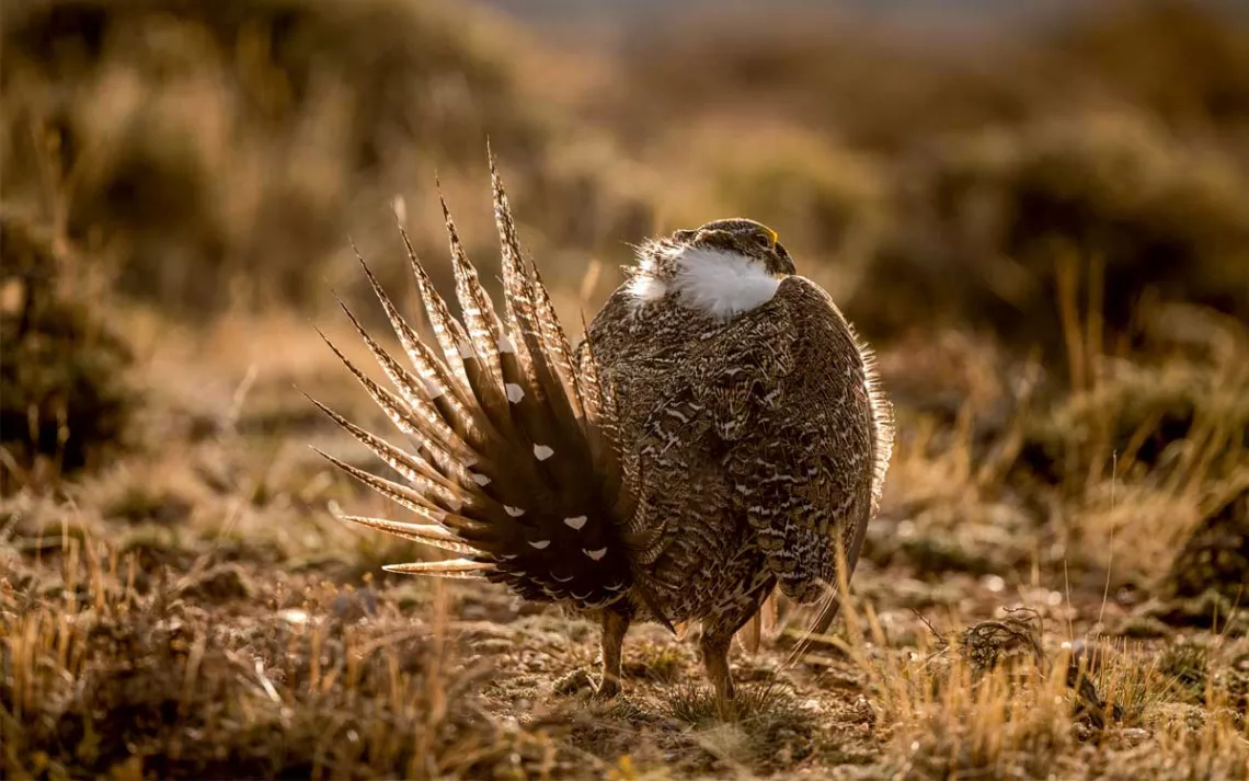
Hoping to attract a female, this sage grouse in Wyoming fans his tail feathers, then struts through the lek and emits a pattern of strange sounds—a pigeonlike cooing, a swish of rubbing feathers, a booming pop from his yellow air sac. | Photo by Mariah Lundgren
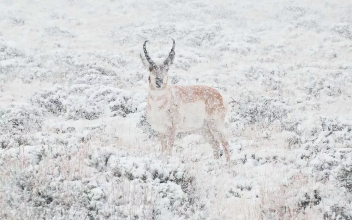
In Wyoming, a solitary pronghorn freezes in the face of the camera. Biologists worry that climate change and the increasing frequency and duration of severe winters may be stressing pronghorn populations. | Photo by Michael Forsberg
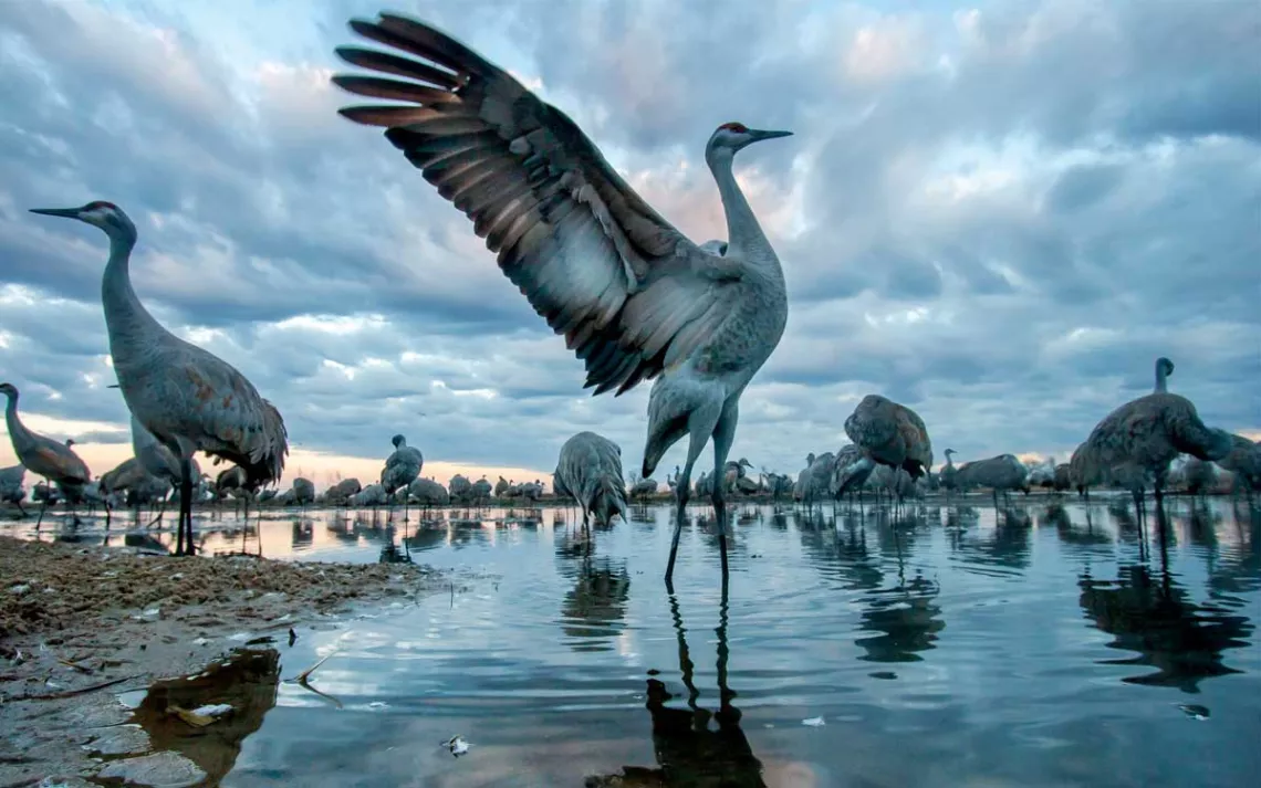
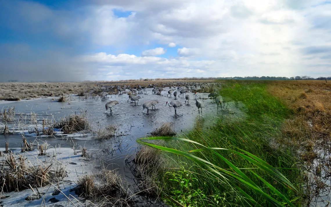
A sandhill crane on the Platte River in Nebraska, photographed by a remotely triggered camera. | Photo by Michael Forsberg
Created by splicing together and photoshopping timelapse images taken throughout the year, this composite image features a wet meadow at Mormon Island, adjacent to the Platte River in central Nebraska. | Photo by Emma Brinley-Buckley
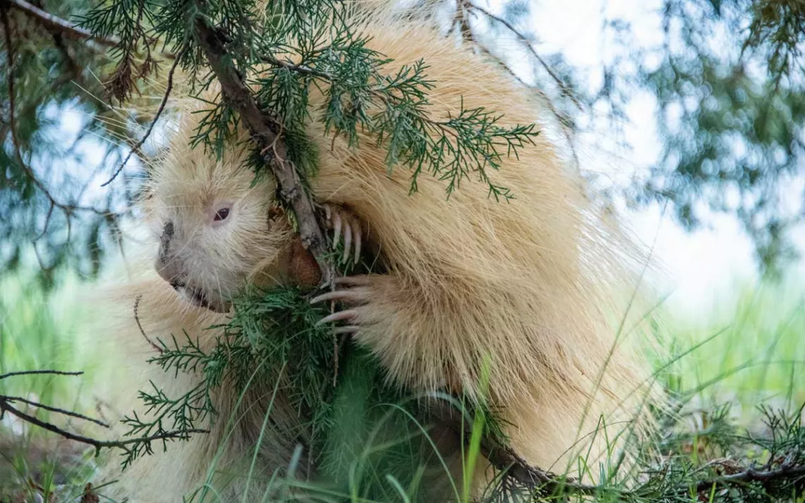
Photographer Michael Forsberg and his friend rescued this rare albino porcupine after it was struck by a vehicle. | Photo by Michael Forsberg
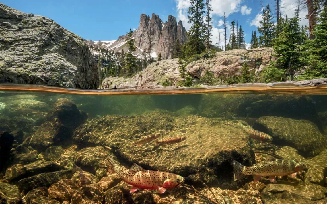
Native cutthroat trout swim in a frigid alpine lake high above the plains of Colorado. | Photo by Michael Forsberg
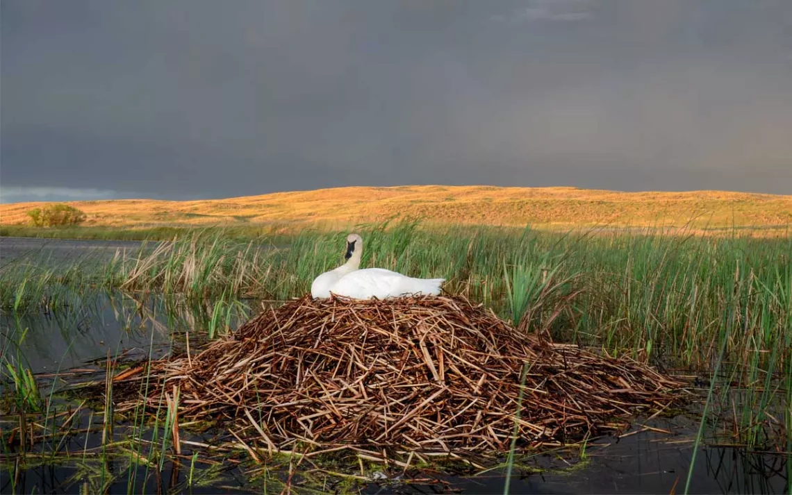
A female trumpeter swan sits atop her nest—built upon a preexisting muskrat lodge—in the Nebraska Sandhills, the southern end of the swans' breeding range. | Photo by Michael Forsberg
When Edgar W. Nye coined what became the phrase "a mile wide and an inch deep" in 1889, he was talking about the Platte River—that "queer stream" running wide and shallow through the plains of Wyoming, Colorado, and especially Nebraska. | Photo by Michael Forsberg