CA/NV Wilderness Team Report
Advocacy Outing to the Bodie Hills
October 6-9, 2023
by JoAnne Clarke
Friday evening, we all met at the Bridgeport Memorial Hall for an informal talk with Evan Standler, a BLM sage-grouse biologist. He gave us an introduction to the sage-grouse and explained their mating habits, called lekking. He explained there are several lek sites in the Bodie Hills and described the threats to these birds. The Bodie Hills are one of the last strongholds for Bi-state Sage-Grouse, a Distinct Population Segment of sage-grouse with unique characteristics which is found in only a few counties along the central California-Nevada border. The sage-grouse are considered an “umbrella species”. By conserving habitat necessary for sage-grouse to survive and thrive, more than 350 species of sagebrush associated plant and animals also benefit. We were fortunate to spot six sage grouse in the road during our driving tour.
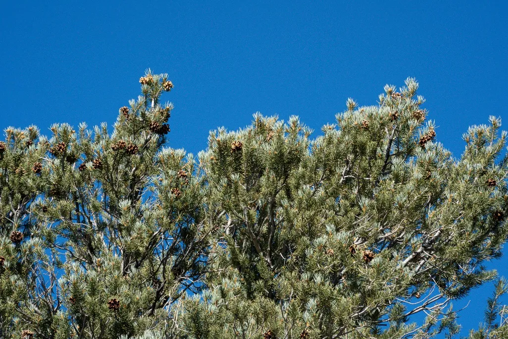
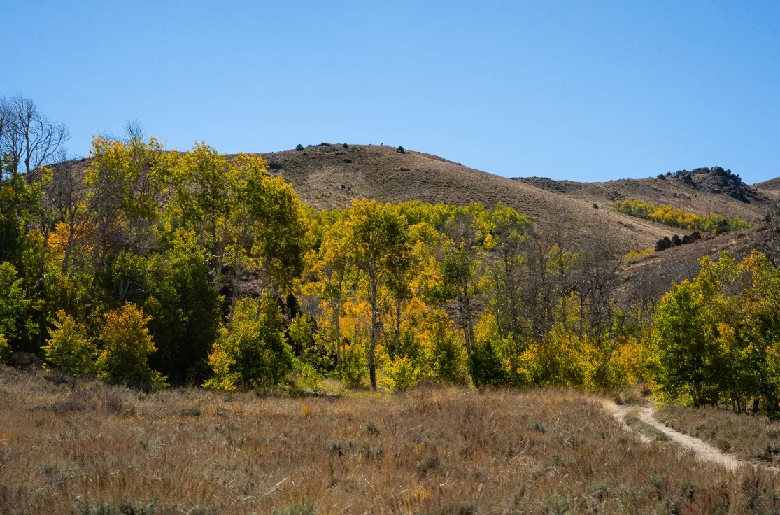
Saturday, we took a driving tour of the Bodie Hills, hosted by Lynn Boulton and 30 X 30 advocate Janet Barth of the Range of Light Group. Jora Fogg, CA Associate Program Director for Conservation Lands Foundation joined us on this tour and provided much of the information. Our first stop was at a Forest Service Road to look at the pinyon forest and to talk about the Sweetwater Forest Resilience Project which is studying how best to protect the pinyon forests. The Project is also considering the perspective of the Washoe and other Tribes who have lost significant amounts of their pine nut collecting sites.
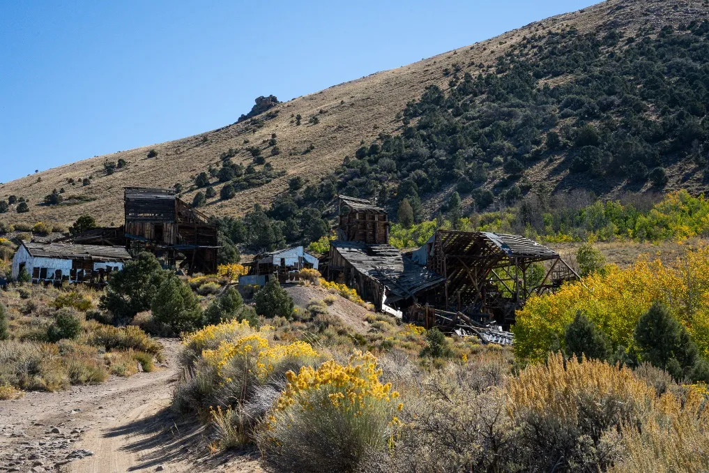
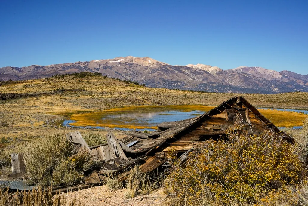
Our second stop was The Chemung Mine. This is a gold and silver mine that was started in 1909 and abandoned by the 1950s. Across the way is an ephemeral pond and the Sweetwater Mountains are in the distance to the north. Above the mine is Masonic Mountain. This area is the oldest and largest eruptive center in the Bodie Hills, started 15 million years ago.
Our third stop was the Masonic/New York Mountain mining district. Gold was first discovered in the 1860s and was kept in production until the 1920s. Claims were recently filed around Dome Hill on both the California side and the Nevada side portending to a mining revival. Various springs feed Masonic Creek. There is a riparian area along it that has a lot of biodiversity and is different than other areas in the Bodie Hills. While we were here Jora described arborglyphs, carvings of shapes and symbols into the bark of living trees, so we proceeded to look for some carved by Basque shepherds. In addition to the glyphs we also found a tree that had been scratched by a bear. Jora’s hand shows the size of the bear’s claw marks.

We had lunch in a small aspen grove supported by two springs. This road goes to the Paramount Mine. It was mined for mercury. It is the western end of a sinter that extends into Nevada to Bald Peak on the Dry Lakes Plateau. A sinter is a vein of hydrothermally altered rock. Geologists looking for gold look at sinters. If gold is present, even if it is microscopic, they then drill and extract core samples looking for the gold veins below--the source of the gold at the surface in the sinter.
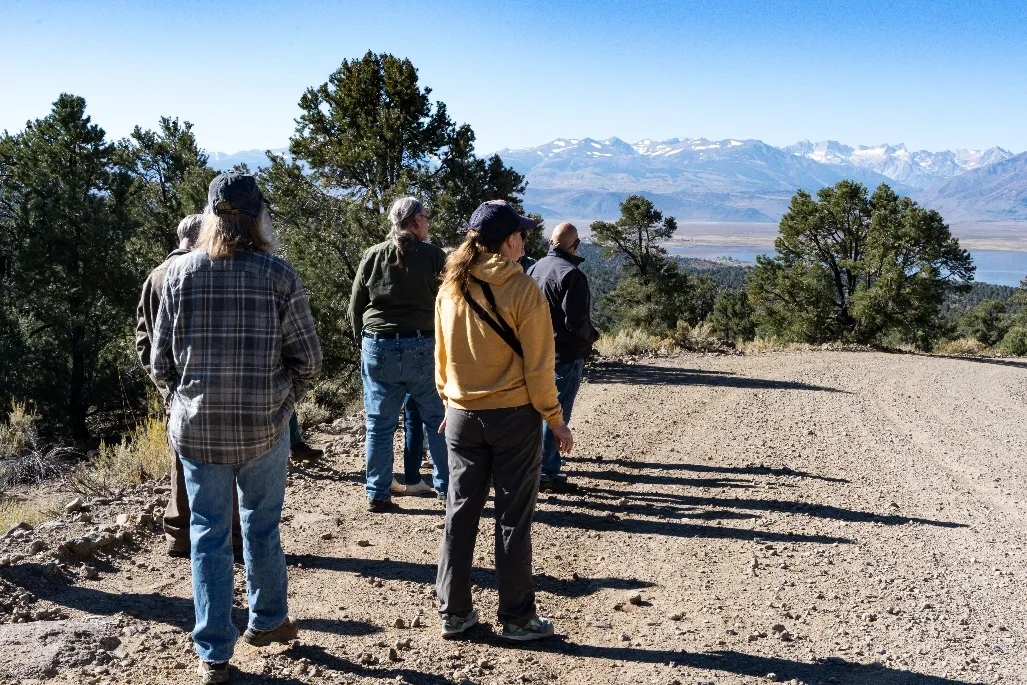
After lunch we hiked up to a view point to see the Dry Lakes Plateau, Bald Peak where the gold exploration will be, Beauty Peak and the Rough Creek and Atastra Creek drainages. The Dry Lakes Plateau is the heart of the Bodie Hills. It is in the Bodie WSA and is listed in the National Register of Historic Places.

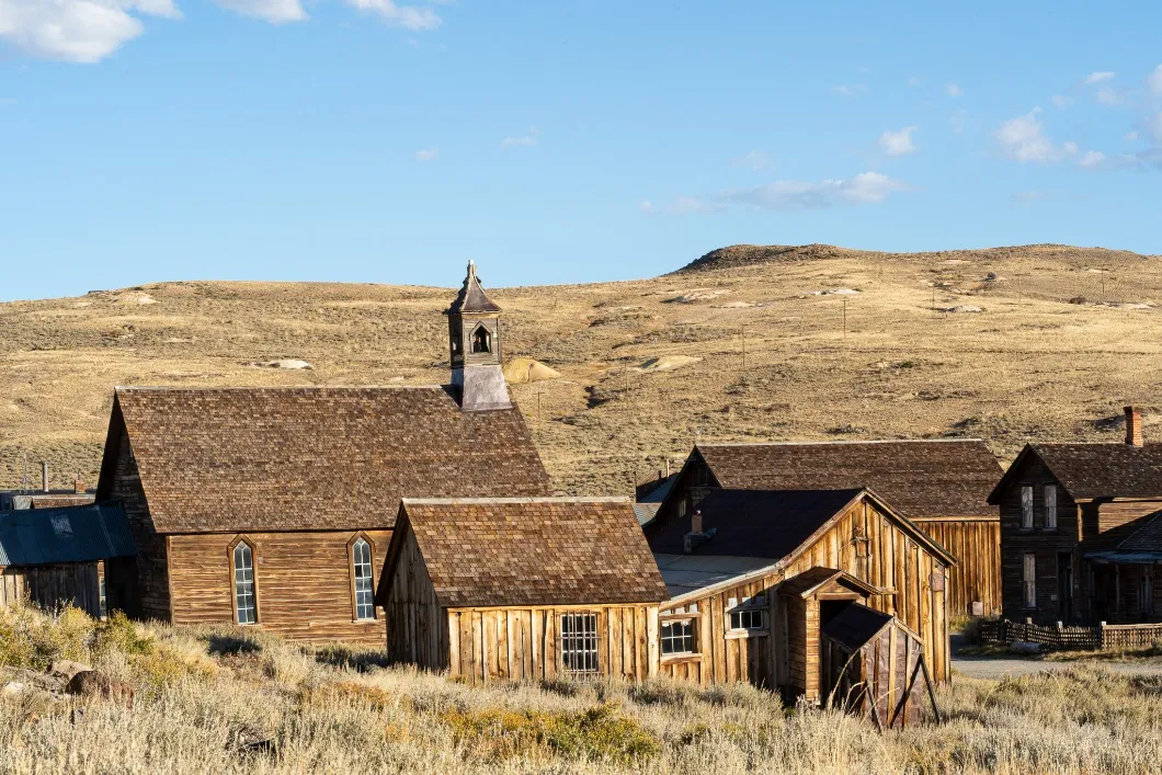
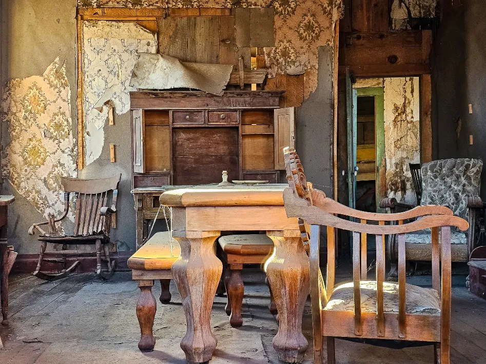
We spent some time at the Bodie State Historic Park where we walked around the town and peeked in the windows. Gold was discovered in 1859 by W. S. Bodey. The town's population of 8,000-10,000 people started to decline in 1881 and mining stopped in 1942. Most of the town burned down in the fires of 1892 and 1932.
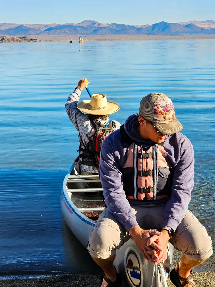
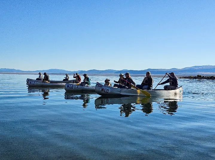
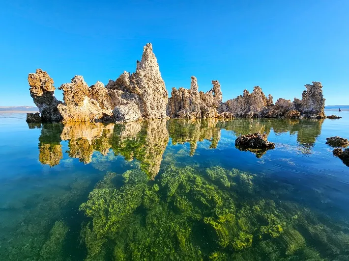
Sunday, Gary Nelson and Ryan Garrett of the Mono Lake Committee treated us to a canoe tour of Mono Lake where we witnessed bubbling springs, alkali flies, brine shrimp, underwater tufa towers, migrating birds, and crystalline waters, all from the unique vantage point of a canoe. Gary and Ryan, our experienced canoe guides, shared some of Mono Lake’s unusual natural history as well as the story about efforts to protect this million-year-old lake. Afterwards we took a walking tour and had a presentation at South Tufa about the LA Dept of Water and Power diversions from the watershed.
Ryan took us to the original diversion of Upper Lee Vining Creek and we followed the aqueduct to Grant Lake, LADWP’s water storage, and finally to the site of West Portal, the town where they built the tunnel through the Mono Craters as part of the aqueduct.
To finish off the day we hiked the beautiful Lee Vining Creek Trail from the Mono Lake Visitor Center to downtown Lee Vining.

Monday Lynn and Janet provided us with a driving tour of the North side of the Bodie Hills. We followed the East Walker River to its relatively new state park.

Monday Lynn and Janet provided us with a driving tour of the North side of the Bodie Hills. We followed the East Walker River to its relatively new state park.

We happened upon State Park Ranger, Larry Spickert, at the 9 Mile Ranch and Stage Stop who gave us an interesting history of the ranch and the area.


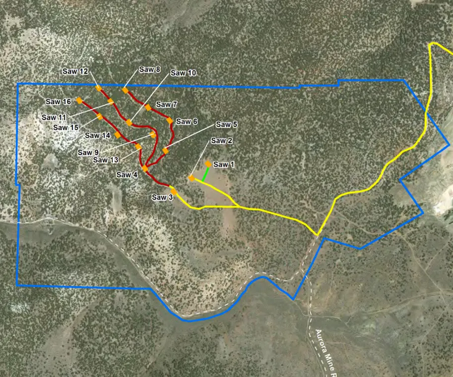
We drove by the Aurora Gold Mine, an open pit mine where we saw the tailings pile of cyanide leached ore and a pit lake, then walked through the historic Aurora Cemetery before viewing exploratory drilling sites from an overlook.

Truly, a dazzling weekend thanks to Anne, Lynn, Janet, all presenters and participants!
All photos by JoAnne Clarke.