SierraScape April - May 2006
Back to Table of Contents
text and photos by Becky Denney
 Proud as I was of the terrain of our Ozarks as I was growing
up, I could never write a paper on its geology because I couldn't
find more than a few sentences of information. In this article
I meant to give you a complete picture of the
St. Francois Mountain Area
as far as its geology, its exciting natural features, its
native plants and animals and the quality of its ecosystems.
But I'm thrilled to say I found the formation of its rocks too
interesting. Descriptions of its newer biological features will
have to be written later.
Six million tons of granite were removed to level Proffit Mountain when Taum Sauk Reservoir was built. While the St. Francois Mountains have persisted for millions of years, we have the tools to rip them apart and destroy them. Destroy enough of these outcroppings, rip them apart or cover them with concrete and we will have destroyed the pieces so that future geologists and future Missourians can learn no more than we know now.
The Precambrian granite rock that underlies the St. Francois Mountains and possibly all of Missouri can actually be seen at Elephant Rocks State Park. The granite was formed when it crystallized from molten magma below the surface of the earth more than 1.246 billion years ago. Vertical fractures formed when the stone cooled and the formation fractured more as it was uplifted. Erosion exposed the granite and the fracture joints expanded. It took eons to produce the boulders we now see. Although granite abounds at Elephant Rocks, the only known granite shut-ins is at Castor River Shut-Ins Natural Area.
 Most Precambrian rocks are overlaid with rock systems of
more recent origin which is why the St. Francois Mountains are
so unusual. These exposed rocks were formed long before dinosaurs,
primitive amphibians, trees, or trilobites. Although the Precambrian
period makes up about seven-eighths of the earth's history, we
have only learned the history of Missouri volcanic rocks in the
last four or five decades.
Our St. Francois Mountains are the result of ancient volcanic and intrusive activity which occurred in some places over 1.4 billion years ago. When the Appalachians started forming 460 million years ago, the St. Francois range was twice as old as the Appalachians are today. The Rockies with their grand 14,000 footers started forming about 70 million years ago. Taum Sauk Mountain and its neighboring knobs are among only a few areas in the U.S. that were volcanic islands in the Paleozoic Era seas and were never submerged as the area of the Ozarks was. Our mountain knobs are so old and worn they've been called roots of mountains.
Missouri has 5 different landform regions or provinces as they are called by geologists. One of these provinces is the St. Francois Mountains and another is the Ozarks. The vertical elevations or mountains in the Ozarks are eroded from a dissected plateau of sedimentary layers of limestones, sandstones, and shales that had been deposited by the seas. This is according to Unklesbay and Vineyard.
In an article for Missouri Resources in Spring, 2002 written by Mike Currier, he described a Precambrian landscape of explosive volcanoes and calderas. A caldera is formed when a huge volcano collapses into itself. Thus a large craterlike valley is created. This is the terrane which is often visible in the St. Francois Mountains.
Mike goes on to say that we can see the result of volcanic activity in formations in Johnson's Shut-Ins State Park:
"Evidence of intense volcanic activity can be seen in the pink or reddish rocks, called rhyolite that dominates the surface. Some of the rhyolite formed when molten lava exploded so forcibly that it was ejected as small droplets that hardened into ash. The lava cooled quickly, resulting in a fine-grained erosion-resistant rock visitors can see in the park. "
 After the volcanic activity stopped, weathering and erosion
changed the region into a hills and valley landscape. The difference
in elevation was greater than 2000 feet from mountain top to
valley floor. Today the difference in elevation is less than
1000 feet. During the Paleozoic Era much of the volcanic landform
was buried by the rivers and seas which deposited limestone,
dolomites, sandstones, and shales. With more uplifts and more
erosion in the St Francois Mountains area, the upper Precambrian
rocks such as rhyolite, related felsite, and tuffs underlaid
with granite again resurfaced. In
Taum Sauk Mountain State Park,
Johnson's Shut-Ins State Park, and many places in the St. Francois
Mountains we can still see remnants of an ancient topography
as it was formed millions of years ago.
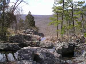
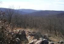
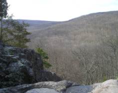
To envision the landscape as it was formed and reformed in past history takes imagination as well as training. Geologists were able to relate the entangled parts. The mountains seen from glades high on Taum Sauk Mountain are Wildcat Mountain, Weimer Hill, Proffit Mountain, Church Mountain, and Vickery Mountain. Acres of these mountains are owned by Missouri in Conservation areas or state parks. But 1200 acres adjacent to and on Church Mountain and 1340 acres including Proffit Mountain and Lower Taum Sauk Lake are owned by AmerenUE, portions of which may be used for pumped storage power plants. The present collapsed reservoir and a power line are visible from the glades on Taum Sauk. The top of Church Mountain is prominent in the view from Taum Sauk. A reservoir on Church Mountain will indeed ruin it as a natural area, ruin the view and the solitude for future epochs.
Taum Sauk Mountain, Weimer Hill, Wildcat Mountain, Proffit Mountain, Church Mountain, and Vickery Mountain are the heart of the St. Francois Mountain area. They must be protected for future generations as part of the Missouri state park system.