What can Melbourne (Australia) teach San Antonio about living with drought?
In the latter part of May of 2016, 9.4 inches of rain fell on our roof. If we’d added two more 10,000-gallon tanks (like the ones pictured below, in our yard), we could have captured nearly 20,000 gallons more water in May alone.
My husband and I get all of our water from rainwater harvesting. It’s a time-honored water source in rural Texas, but our cities have not yet discovered that rainfall – captured, right where we live, used and reused here – can be one of our best protections from the ravages of drought.
Without fully appreciating all the water we have – rain-water, storm-water, gray-water and waste-water – as valuable water supply resources, San Antonio will never be able to cope with future droughts. Our local and regional coalitions against the Vista Ridge pipeline have time-and-time-again demonstrated all the weaknesses of the entire project, only to have Council members and editorial boards say, in effect: You’re probably right about some flaws of the project, but the city is going to run out of water if we don’t acquire new resources that can produce enough water for our growing population.
We challenge their assumptions about San Antonio’s future growth. We believe that San Antonio’s political leaders, its water utility SAWS, and the business interests that dominate the Chambers of Commerce seem determined to pursue outdated water policies that are extremely expensive, inflexible, and risky. Worse, they are likely to prove completely ineffective in the face of climate change uncertainties.
We need whole new ways of thinking and deciding about water
Fortunately, San Antonio can learn a lot from the city of Melbourne, Australia, which struggled through a severe, 13-year-long severe drought from 1997 to 2009. Just before the rains came in 2009, the city’s reservoirs held only 25.6% of capacity – a historic low. The contrasts, as well as similarities, between Melbourne and San Antonio are instructive.
Melbourne is a prosperous, culturally diverse, and vibrant city of some 4.3 million people in its greater metropolitan area. It is regularly at or near the top of international lists of the “most livable” cities. Melbourne has far less suburban sprawl than San Antonio, and its city center is far larger and more densely populated (in high-rise multi-family housing). Melbourne’s average annual rainfall is about 80% of San Antonio’s. Like San Antonio, it is prone to serious flooding. The principal water source of San Antonio (underground, Edwards Aquifer) is much less at risk than Melbourne’s river-fed reservoirs that are subject to considerable evaporation, especially during summer heat waves.
Editor's note: this article continues on our website through the links below.
Part I: Reduced Demand (by both residents and businesses)
Part II: Integrated new ways of thinking about water in urban design
by Meredith McGuire, Conservation Committee Co-Chair
Dinner Party at Eco Centro
Please join us for our annual potluck dinner and party. Delight to the scrumptious food prepared by our members and friends while sharing stories with one another. All are welcome, you don't have to be a Sierra Club member.
Tuesday, July 19th
6:30 p.m.
William R. Sinkin Eco Centro, 1802 North Main Avenue
Map
Please bring a favorite dish to share. Join in the fun! Be creative! While there will be reusable plates and utensils available, you are encouraged to bring your own to cut down on waste and so someone isn't stuck washing everything after the party ends.
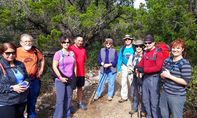
Here are the hikers getting ready for a great day of exploring.
VIA’s "Vision 2040" Public Transportation Plan
Come learn about VIA's Vision 2040 plan, and about the city's coordinated transportation planning. Vision 2040 is a community-driven process to update VIA’s Long Range Plan through the year 2040.
Thursday, July 28th
6:30 p.m.
Lions Field Adult Center, 2809 Broadway @ Mulberry
Map
San Antonio's various transportation agencies are working together on a plan that will result in a sustainable and livable city, where there are options such as biking, walking, and public transit. Imagine a city with connections to move you around quickly and reliably while you relax and read on your way there.
Vision 2040 includes innovations like bicycle connection and storage nodes and safe bike lanes. Come learn about what the research has turned up. This will be the city's first transportation plan, and one that considers many variables such as climate change, easing congestion along some major corridors, cleaning the air, and building a sense of community. This event is free and open to the public.
Seen this one? El Morro National Monument
El Morro is a small national monument south of Gallup, New Mexico and just west of the much larger El Malpais National Monument. Its reason for existence is a sandstone butte including Inscription Rock and a large tinaja (natural water catchment) that was of critical importance for pre-historic residents and later travelers. The base of the butte is called Inscription Rock as it has many petroglyphs, and signatures and statements with dates back to 1605. Some of the statements relate how desperate people were for water before getting here.
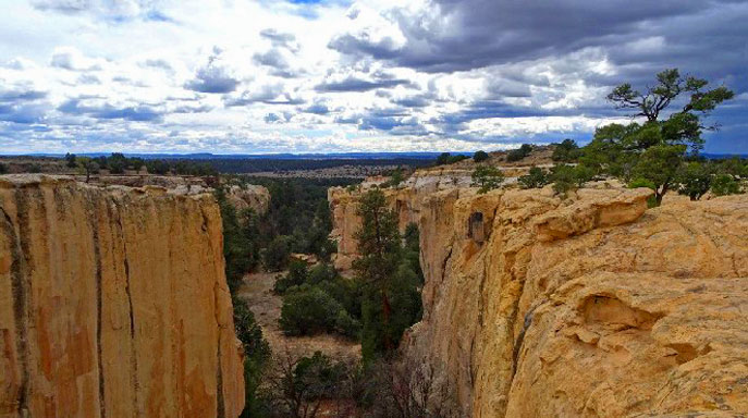
On top of the butte there are the ruins of Atsinna pueblo, occupied 1275-1350 by as many as 1500 people, with at least 875 rooms. A large kiva and several rooms remain excavated for viewing, but looking across the large site it is easy to see in the rumbled terrain traces of the other dwellings.
There is a 2 mi loop trail past the tinaja, inscriptions and across the top of the mesa, and past the pueblo ruins. And a nice campground, no reservations. For protection of the site the loop trail must be accessed through the visitor center and a read of the regulations is required. A good brochure explaining the highlights along the trail is available at the visitor center.
by Kevin Hartley, Newsletter Editor