San Antonio's Disaster Committee Discovers the Disaster Planning that Wasn't
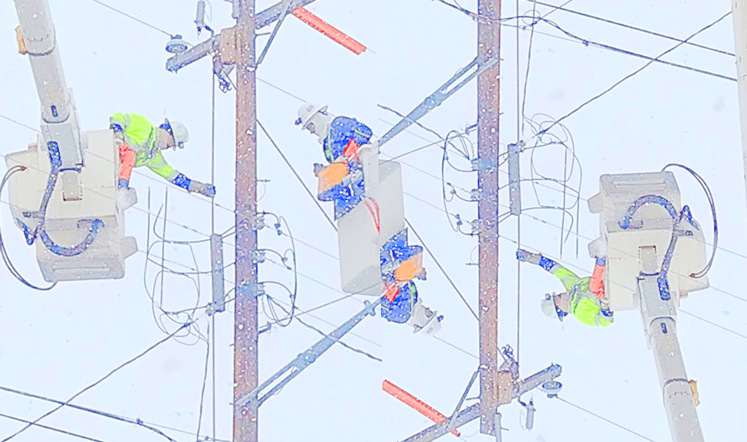
After nearly 400,000 were left freezing without power and light during Winter Storm Uri and water pump stations failed, the ire of local residents fell on San Antonio’s water and power utilities. Failures by elected and appointed leaders have largely flown under the radar. That may change.
The Committee on Emergency Preparedness has been tasked by Mayor Ron Nirenberg with discovering how San Antonio fell into a frozen dark hell during February’s Winter Storm Uri and making recommendations to prevent an encore collapse.
To say the committee could do more to engage the public would be akin to calling the punishing polar vortex a cold snap.
Meeting notices aren’t posted until a day ahead. The meetings aren’t streamed or advertised on the City of San Antonio’s Facebook page as are Council meetings and nightly COVID-19 updates. The archives are scattered and hard to locate. (Only one of three meeting recordings are hosted on the group’s webpage.*) Due to COVID-19 precautions, members of the public are only allowed to view the proceedings in an adjacent room. There are no public agendas. There is no live public comment; feedback is invited through a survey page or by leaving a message with 311.

Its members, mostly current and former City Council members, have agreed to “hang up” their Council hats and conduct their investigation as concerned residents. But should the investigation lead back to failures of the Mayor and City Council, well .. we’ll see how long those hats stay off.
So far, the meetings have involved a lot of wondering. The initial meeting was used to develop a list of categories (English; Spanish) from which to develop questions worth pursuing. The second meeting saw development of a list of questions for CPS Energy (English only). Last Friday’s hour-and-a-half meeting was dedicated to developing a list of questions for the San Antonio Water System leadership, the result of which is yet to be posted.
Editor's note: read the rest of this article at Deceleration News.
by Greg Harman, San Antonio Clean Energy Organizer for Lone Star ChapterClimate Action SA Launching New Campaign
Climate Action SA (CASA), a coalition of which Sierra Club is a key partner, is launching a new campaign with updated policy recommendations for a COVID/Winter Storm Uri recovery. Their October Open Letter to City leaders is being revised and expanded. And be sure to visit their recent webinars page where they discuss these evolving recommendations.
CASA and allied organizations are launching their campaign next week in a drive for realistic and urgent climate action for our city. Contact Greg Harman for details. Thanks!
by Greg Harman, San Antonio Clean Energy Organizer for Lone Star ChapterHiking Mistakes: Sure Taught Me a Lesson or Three
For a start: an NPS ranger friend said “always carry three sources of light”. I mistakenly thought, that was back in the day of unreliable incandescent lights, and sure he had to carry three in case someone needed rescuing.
Comanche National Grassland
I was hiking in Comanche National Grassland from Picture Canyon Campground, in southeastern Colorado, just north of the Oklahoma state line (see first and second pictures below). I had done a trail here with my wife earlier; that one was easy to follow and well used.
On the trailhead sign there were two loops, one connecting with the trail done earlier. I thought no problem, even though starting a bit late, I'll do the middle loop and connect with the easy trail, getting back before sunset.
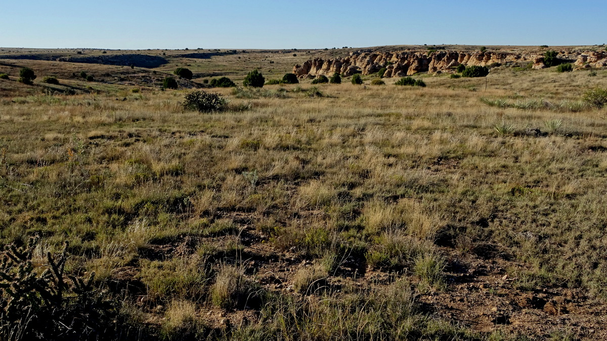
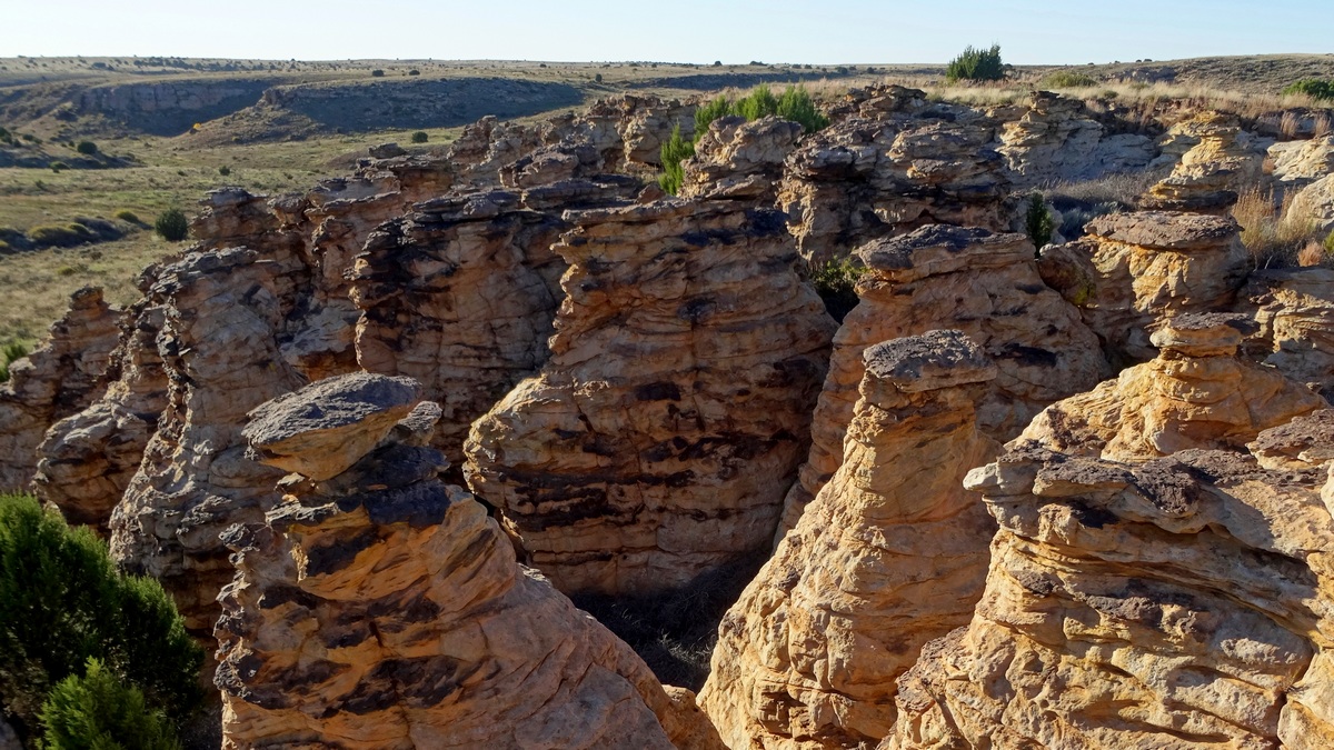
Pretty neat moseying across the prairie, occasionally seeing a route marker post and a few footprints. Encountered some marker posts that had rotted and fallen over. It was beginning to get a bit late when I realized hadn't seen a marker in a while.
I was recording my track on my phone app, but it didn't correlate with the map on the sign and the terrain was getting pretty rough. Realized I had best turn around and re-trace my steps. Soon it was dark with no moon; pulled out my headlamp. Tried a shortcut across a ridge back to the road; that was a mistake.
My headlamp was dimming; should have had a spare. My phone app allowed me to follow my track back reasonably, but this hike was 10 miles total.
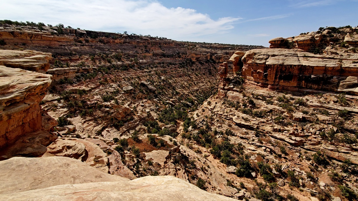
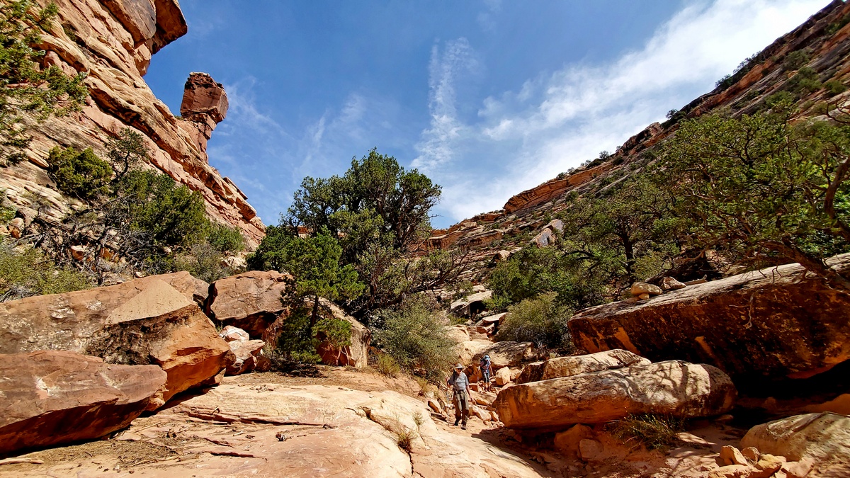
Slickhorn Canyon on Cedar Mesa, in Bears Ears National Monument
Here is a webpage about Slickhorn First Fork and another about Third and Trail Forks. I was hiking a loop with friends (see third and fourth pictures below). We thought it would be 6 hours or so, and got started mid-morning. For various reasons we were still hiking well after sunset, no trail, but thankfully a little moonlight through the overcast, trying to get across the prairie back to the cars.
We had only one headlamp and one participant had a significant issue with muscle pain and weakness. All went fine though easily could have been otherwise. Was 10 miles total, I had thought it would be around 8, as didn't have an actual route.
Bears Ears is being restored!
Bears Ears National Monument is in southeastern Utah and was designated by President Obama in 2016, and then was reduced in size 85% by President Trump in 2017. One of President Biden's first executive actions was to begin restoring Bears Ears and also Grand Staircase-Escalante National Monument, which is a little further west.
Sierra, the magazine of the national Sierra Club, has a good article about Bears Ears. High Country News, a Utah publication, has an article about the involvement of the Bears Ears Inter-Tribal Coalition in the early planning for the monument and work towards the restoration.
A Few Lessons Learned
Headlamps
Carry at least two; need a spare and someone else might need to borrow. Test them before starting and have spares in the car. Imagine doing a day hike, expecting to be out by 3 pm; then have an accident or encounter someone needing help and are delayed till after dark. Then our headlamp fails and must pull out a spare. Could use a headlamp to make us apparent to a rescue team. Our phones have lights but we want to have hands free for trekking poles and in case of a stumble. And need phones for navigation and calls, don't want to run the battery down.
Trekking poles
These help substantially going both up and downhill, as we are four-legged once again. I have descended some trails that would have been much trickier without poles. And, in the event of an injury it may be possible to do tape and/or a splint, and hobble out with aid of poles, as an alternative to waiting for help no telling when. Surely with a sprain, may be possible even with more serious injuries. Someone else might need to borrow your poles in such an event.
Keep poles well tightened; one of mine collapsed once and I fell into a cactus, with surprisingly little consequence. Collapse and securely tie poles to your pack for sections where you may need to be doing handholds with both hands; best to do this before entirely necessary to have some margin, both hands free of poles, in case a foothold slips. Can throw poles up/downhill, but they won't levitate back in case you need to turn around. Keep your hands out of the pole straps at tricky spots in case of a fall; getting tangled up with your poles could result in a serious injury. Learned this latter bit the hard way.
Navigation
I haven't taken an orienteering course so my navigation skills are a little limited. Here is a link to resources at Orienteering.org that look useful. I depend upon my offline navigation phone app more than might be best. I have a spare phone, as my carrier offered a free line, and I had an old phone. So I have the app on both phones with the route info loaded as best I can find, in case I bust or lose one.
If the sun is out, occasionally think about it's direction and how that correlates with our route. Best to carry a printed map and compass of course. Be aware of our navigation skill level, and don't do “surely that is the trail just over there, oh it isn't but surely it is over there” etc, and then have lost track of where we started this routine and can't simply backtrack. I did this once in a potentially serious situation; then using a good topo map and compass I was still confused. Was saved when I realized should trust my GPS, though there had been variances from the supposed route on it. I didn't know that this is fairly common. Sure taught me a lesson, I hope!
by Kevin Hartley, Alamo Group Outings leader
Outings: The Call of the Wild
Visit the Alamo Sierra Club Outings page on Meetup for detailed information about all of our upcoming Sierra Club Outings.
The Alamo Sierran Newsletter
Richard Alles, Editor
Published by The Alamo Group of the Sierra Club, P.O. Box 6443, San Antonio, TX 78209, AlamoSierraClub.org.
The Alamo Group is one of 13 regional groups within the Lone Star Chapter of the Sierra Club.
Changed your contact information?
If you're not sure whether the Sierra Club has your current email address, send an email to Member Services with your name and address and/or member ID (see Locating Your Member ID) so they can add your email address to your member record.
Have you moved? Let us know by sending your old address, your new address and your member ID to: address.changes@sierraclub.org.
Go online for the latest news and events
 |