Boerne Thoroughfare Plan Sacrifices Green Spaces
The City of Boerne -- esp. Mayor Handren who works in San Antonio -- is targeting the SE and NE Quadrants again. As soon as the Kendall County Boerne Fair Oaks Transportation Committee (KCBFOTC) submits its final report to the City this month, the City is going to hire a consulting engineer to start working on the Boerne Thoroughfare Plan which will be more than a loop. It will have numerous "legs and fingers" that will radiate from the loop to augment development.
This is not a mobility plan. It is an urbanization plan designed to "fast forward" the City's population growth to 50,000 by 2030. It has always been an urbanization plan (it dates back to 1974).
The question is, are we willing to sacrifice more environmentally sensitive green space for subdivisions designed to last just 25 years? Are we going to pave over recharge features and make future flooding in and around Boerne even worse? Sounds like a really bad bargain to me.
For information about the plan, please visit this website set up by one of the KCBFOTC committee members.
We've already done too much damage to the Cibolo and other geological features around here with sloppy development. Please take a look at this presentation by Dr. George Veni on June 29, 2021. Every citizen and local government official needs to watch this.
Also, please sign this petition: Petition · Boerne City Council: Stop the Boerne Thoroughfare Plan ("Gateway 2.0"): It's NOT A Mobility Plan! · Change.org
Finally, it's not certain yet how this latest road scheme will be funded. There may be a bond issue if TxDOT doesn't support it. Mayor Handren may also be looking at alternative financing schemes. All of this needs to be exposed to local and national media as well as environmental groups throughout Texas. We can't keep robbing the natural resources around here forever. Mother Nature is going to "bite back" at some point.
by Lance KyleWhite Sands National Park: Not Your Ordinary Park Experience
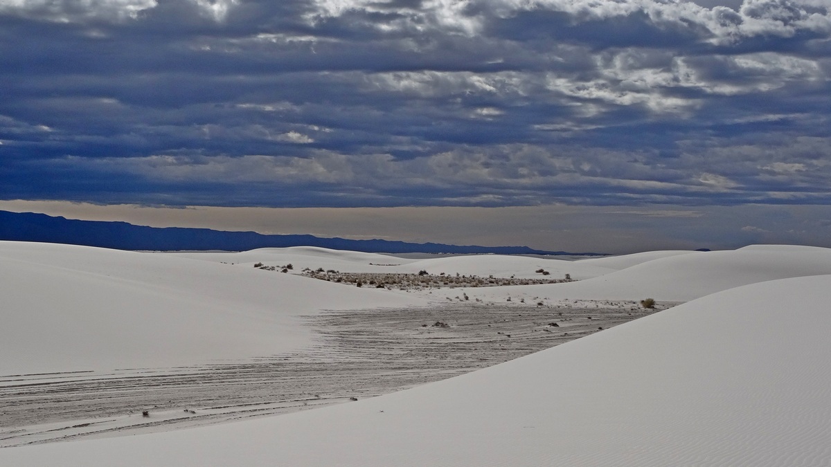
White Sands National Monument was created in 1933. In 2019 it was redesignated as White Sands National Park; at that time there was some land exchange with the surrounding White Sands Missile Range, adding 2000 acres for a total of 146,000 acres. Here are the NPS website with the maps webpage, and the excellent Wikipedia article, from which some of the info below was abstracted. This park is just southwest of Almogordo, New Mexico off US 70.
The park includes almost half of the Tularosa Basin, which now is the largest gypsum dunefield of it's type in the world. The basin during the last ice age 24 to 12 thousand years ago contained lakes, grasslands and large mammals. Rains and snowmelt from the mountain ranges west- and eastwards carried gypsum to a 1,600 square mile lake now called Lake Otero.
The longest known fossilized human trackway was found in 2018 at what was Lake Otero. From an NPS page: “These ancient footprints ... show what researchers believe to be a female or a young male walking for almost a mile, with a toddler's footprints periodically showing up alongside. The evidence reveals the person alternated from carrying the child, shifting the young one from side to side, by how the footprints broadened and slipped in the mud with the additional weight...
An international team of scientists, in collaboration with staff from the National Park Service, has produced evidence through footprints showing how these animals may have been hunted – but White Sands still has many stories to tell. In the fossilized prints, we see the traces of children playing in puddles that formed in giant sloth tracks, friends jumping between mammoth tracks and the steady stalking of humans in search of large prey."
We may be wondering "what is gypsum?". Per Wikipedia: “...a soft sulfate mineral composed of calcium sulfate dihydrate, with the chemical formula CaSO4·2H2O. It is widely mined and is used as a fertilizer and as the main constituent in many forms of plaster, blackboard/sidewalk chalk, and drywall. A massive fine-grained white or lightly tinted variety of gypsum, called alabaster, has been used for sculpture by many cultures...".
There is a smaller gypsum dunefield on the west side of Guadalupe Mountains National Park. A picture was included in the February 2016 issue of this newsletter (PDF).
Visiting
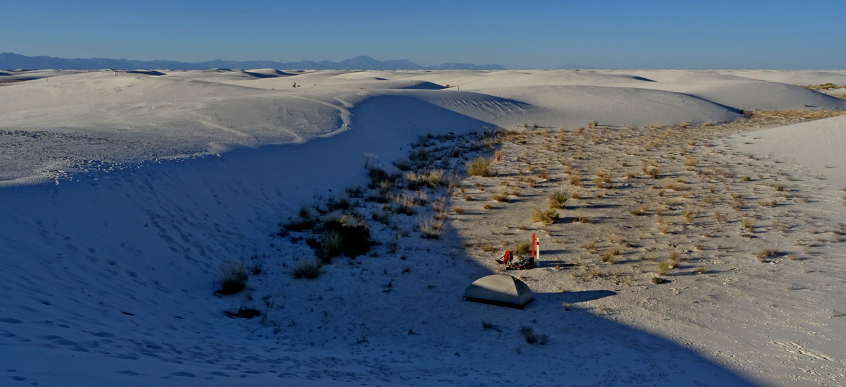
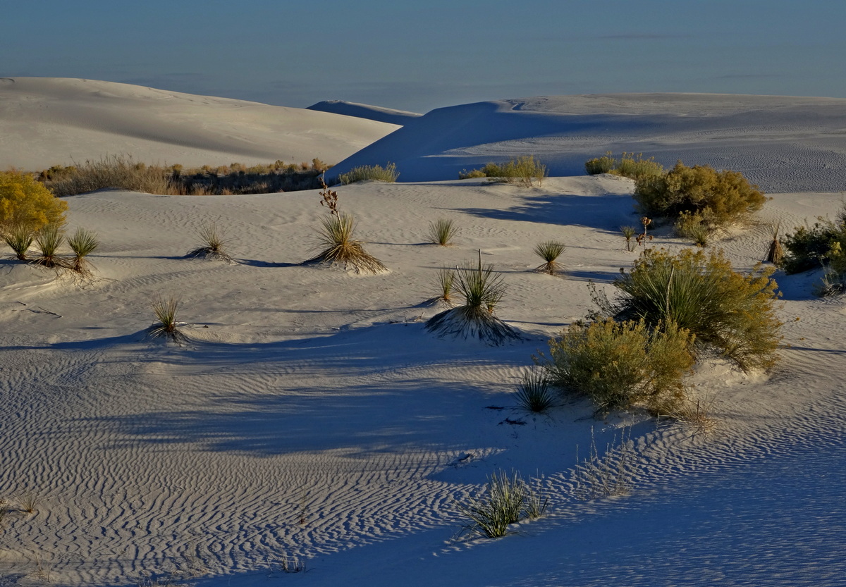
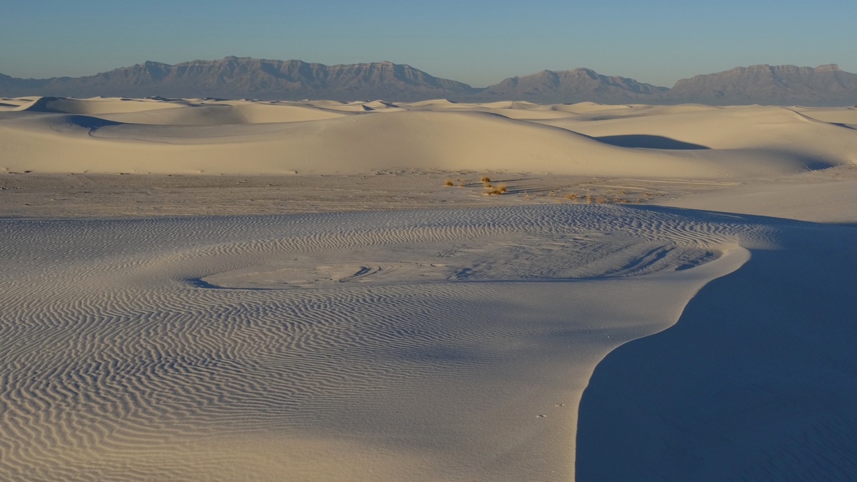
The gate is open 7 am till 7-9 pm, depending upon the season. The Dunes Drive is a lollipop loop going past the backcountry camping area and spots where children slide down the dunes on saucers which are available for rent at the visitor center. At the north end of the road is the trailhead for Alkali Flat; this is a 5 mile loop with marker posts along the route. We should watch for the posts carefully; usually a few are visible in the distance. Here's a good trip report. The trail gets very hot Summers or even Spring and Fall afternoons and there is no shade. Consider the likely temperatures, hydrate well and have sweet/salty snacks. Shoes get full of sand quickly, so boots with gaiters are good, or sandals, or just bare feet across many sections (if the sand isn't hot). A couple died on the trail in June 2015, likely due to heat stroke, though their child survived. A man died on the trail in June, 2019.
Camp spots are available along a 2 mile loop by reservation. These spots are simply numbered posts. So we carry gear to our spot, 1 mile maximum, set up and have lovely sunset/sunrise vistas from the top of whatever nearby dune; see the next two pictures.
Oliver Lee Memorial State Park is 20 miles south of Alamogordo, east of US 54. It has developed sites, some reservable, and restrooms with showers. Dog Canyon Trail runs from the state park northwest up into the Sacramento Mountains in Lincoln National Forest. From this trail there should be good views of White Sands and the San Andres Mountains to the west.
From the e-Mailbag
From time-to-time, the Alamo Group receives messages concerning local environmental issues. If you have thoughts to share on any of these issues, send me a message and I'll forward them to the writer.
The real problem with CPS
The real problem with CPS and SAWS is the pay of their CEOs. San Antonio wants first class management, but is only willing to pay for fourth class. Just like the former City Manager.
from Lee R.
by Richard Alles, Newsletter Editor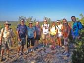
Outings: The Call of the Wild
Visit the Alamo Sierra Club Outings page on Meetup for detailed information about all of our upcoming Sierra Club Outings.
The Alamo Sierran Newsletter
Richard Alles, Editor
Published by The Alamo Group of the Sierra Club, P.O. Box 6443, San Antonio, TX 78209, AlamoSierraClub.org.
The Alamo Group is one of 13 regional groups within the Lone Star Chapter of the Sierra Club.
Changed your contact information?
If you're not sure whether the Sierra Club has your current email address, send an email to Member Services with your name and address and/or member ID (see Locating Your Member ID) so they can add your email address to your member record.
Have you moved? Let us know by sending your old address, your new address and your member ID to: address.changes@sierraclub.org.
Go online for the latest news and events
 |