Become More Involved With the Sierra Club! Run for the Alamo Group Executive Committee
Every fall, we need to elect — or reelect — three members of the Alamo Group Executive Committee, our nine-member governing body. To qualify for service on the ExCom, you need only be a Sierra Club member.
Requirements of the position include becoming familiar with local Sierra Club operations and issues and attending monthly ExCom meetings, which take place the second Thursday of each month and last about two hours. (During the COVID pandemic, the meetings are on Zoom.)
ExCom elected positions last three years. We do request that, as an ExCom member, you be willing to volunteer for other tasks as time permits. Issues currently on our front burner include closing the city’s coal-fired power plants, fighting the 1604 bypass project by Texas Department of Transportation, and convincing HEB to stop using plastic bags and wrappings.
If you’re interested in throwing your hat in the ring, please email your name, a brief biography, a one paragraph campaign statement, and a current photo to Alamo Group Chair Alan Montemayor, alan.montemayor@sbcglobal.net, or Vice Chair Wendell Fuqua, wendellefuqua@gmail.com.
We’re on a very short timeline to vet our nominations and submit them to the state office in time for the election. If you’re interested, please send your information by November 7th. Many thanks.
by Alamo Group Executive CommitteeVote Tomorrow on Election Day, November 2nd!
Get out there and vote tomorrow on Election Day, November 2nd! For residents of Texas House District 118, a seat in the state legislature hangs in the balance!
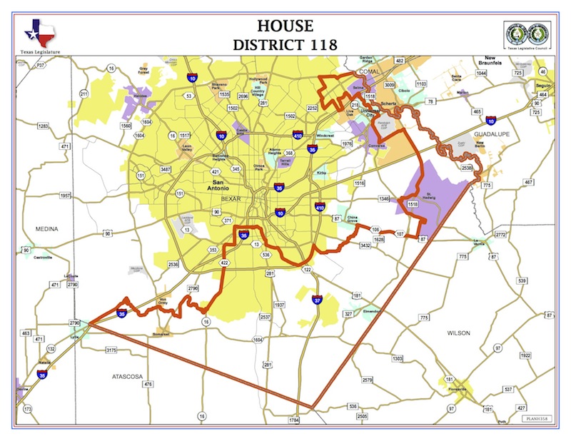
There are only 150 seats in the Texas House of Representatives, and in our highly politicized state, every seat represents a crucial vote on essential issues we face as Texans. House District 118 covers portions of South San Antonio and South Bexar County, including Somerset, Losoya, and Elmendorf, but also stretches into east and northeast Bexar County (see map). If you live in this district it is especially important for you to vote tomorrow in the runoff election for your state representative.
How we got here
HD 118 was represented by State Rep. Leo Pacheco (D) for the past two legislative sessions. However, after the last session, he announced he would resign in August (source). That initiated a special election called by Gov. Abbott, which was held on Sept. 28. No candidate achieved 50% or more of the total vote, which prompted a runoff election between the top two candidates.
Who is running?
There is one Democrat and one Republican in this special runoff election. Frank Ramirez (D) (candidate website) and John Lujan (R) (candidate website) were the top two candidates. Lujan received 41.5% of the total votes in the Sept. special election (2,938) and Ramirez earned 20% of the vote (1,416).
There were three other candidates who ran for the seat. By party, there were 3,561 votes for Republican candidates and 3,514 votes for Democratic candidates.
 |
 |
|
Frank Ramirez (D)
|
John Lujan (R)
|
|
Image sources: campaign Facebook pages
|
|
Voting information
The only remaining day to vote is Election Day, Tuesday, Nov. 2. In addition to the runoff election in HD 118, there is a Joint Constitutional Amendment, General, Special and Bond Election that all Texans can vote in.
To check if you’re registered to vote and find your polling location, visit Bexar County Elections Dept..
Unsure what form of ID you need to vote? Check out VoteTexas.gov to see a list!
by Matt Johnson, Lone Star Chapter Political and Communications DirectorIn Memory of an Alamo Group Leader
We note the recent passing of one of our early Alamo Group leaders, David Davidson. David, a PhD engineering graduate of Rice University, joined the Alamo Group (initially the South Texas Group) along with his wife Patricia soon after its founding in 1968. He was at the start of a long and distinguished career as a Material Science researcher at Southwest Research Institution.
One of Patricia's early memories of the Alamo Group was an outing to Basin area of Big Bend National Park in which there was an unexpected snowstorm during a day hike. They decided to break camp and find a hotel room in Sanderson to avoid tent camping during the miserable weather conditions.
David was an active participant in the early conservation efforts of the Alamo Group serving a term as Conservation Chair. Some of their concerns included opposition to the building of the North Expressway through the Olmos Basin, air quality issues, and water quality issues related to prevention of pollution of the Edwards Aquifer. David was also an active leader at the state level on conservation issues facing Texas including the Texas Water Plan which would have created canals to connect Texas river to the Mississippi River. He served a term as Chair of the Lone Star Chapter of the Sierra Club.
As an avid supporter of many conversations efforts, David also had leadership positions in the Nature Conservancy of Texas and the American Bird Conservancy.
In retirement David worked on the restoration of a Hill Country property in Kendalia. He reduced the amount of Ashe juniper on the property and experimented with solarization as a method to kill the invasive KR Bluestem that has often overwhelmed the native prairie grasses of Texas. His particular interest was the relationship between the microbial content of the soil in KR Bluestem areas and areas restored with native grasses after solarization. Alamo Group members had several opportunities to visit the Davidson property in the past decade to see this research and enjoy the native habitat on the property.
Jerry Morrisey has helped introduce David's research ideas for KR Bluestem removal to the Albert and Bessie Kronkosky State Natural Area (ABK) which is being developed by Texas Parks and Wildlife Department on Hwy 46 west of Boerne. Dr. Jose Rodolfo Valdez Barillas of the Biology Department of Texas A&M San Antonio is leading the research effort. Alamo Group members can volunteer to help with this research project and with other survey teams at ABK developing baseline habitat data prior to the opening of ABK which will likely occur in 3 to 4 years.
by Jerry Morrisey, Alamo Group Outings ChairThree National Monuments Restored!
On October 7th President Biden reversed the actions taken by President Trump regarding Grand Staircase/Escalante and Bears Ears national monuments in Utah, and Northeast Canyons and Seamounts National Monument southeast of Cape Cod. Here's the PBS.org page.
Conservative Utah leaders said this should have been negotiated so the status of these wouldn't be reversed again and again by successive presidents. Yes that would have been good, implying the idea of national park status. But they surely would have only agreed to that with substantial concessions regarding sizes, mining and oil/gas extraction prohibitions and OHV access.
Grand Staircase-Escalante National Monument (GSENM)
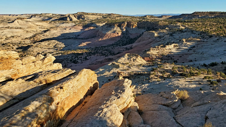
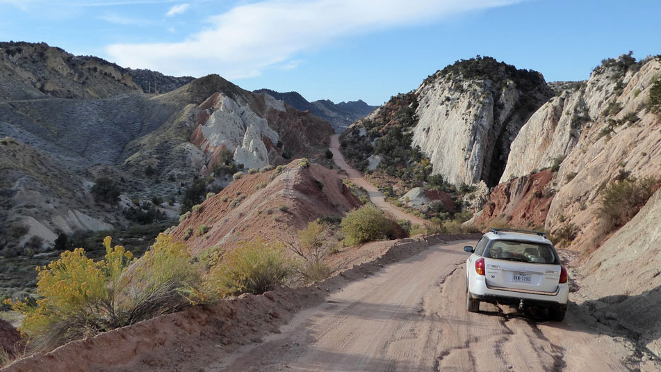
This national monument is managed by the BLM (Bureau of Land Management) and was established by President Clinton in 1997 at 1.9 million acres. It was reduced by President Trump in 2017 to 1 million acres to allow mining. For more vistas and information on visiting a little corner of this spectacular place see the July 2021 issue of this newsletter.
For more background and news see GSENM.org, the website of Grand Staircase-Escalante Partners.
In GSENM and BENM there are hundreds of ruins and thousands of other known archeological sites, and many more undiscovered. If you visit these ruins take nothing but photos and don't touch.
Bears Ears National Monument (BENM)
President Obama proclaimed Bears Ears National Monument December 28, 2017. This was 1.35 million acres and protected a big area in southeastern Utah south and east of Canyonlands National Park, and north and east of Glen Canyon National Recreation Area, and includes much of Manti-La Sal National Forest, and is jointly managed by BLM and USFS. President Trump replaced BENM with two much smaller remants of the original. President Biden re-instated the original boundaries and protections with a small addition. The BLM and USFS BENM web pages aren't quite updated yet.
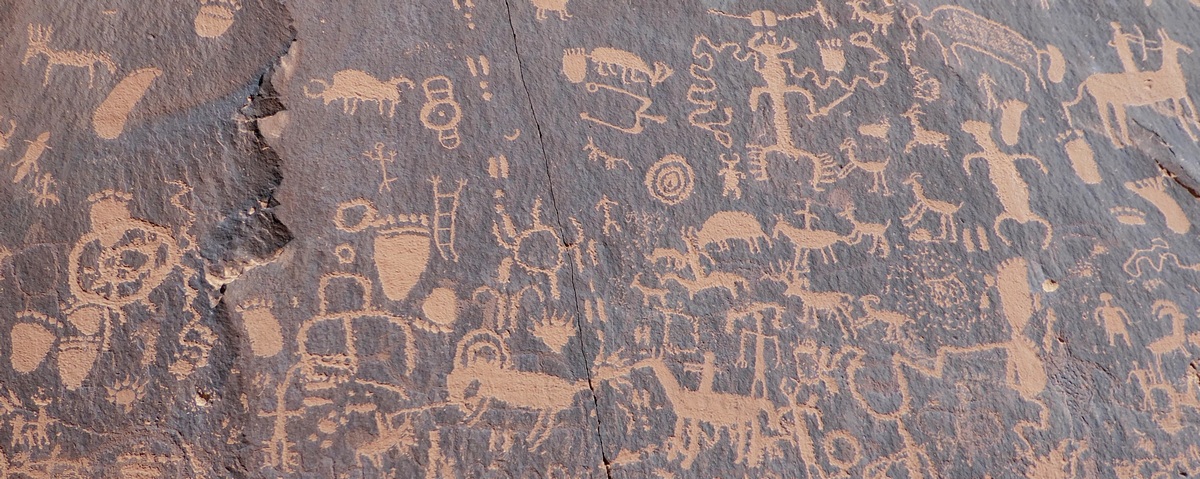
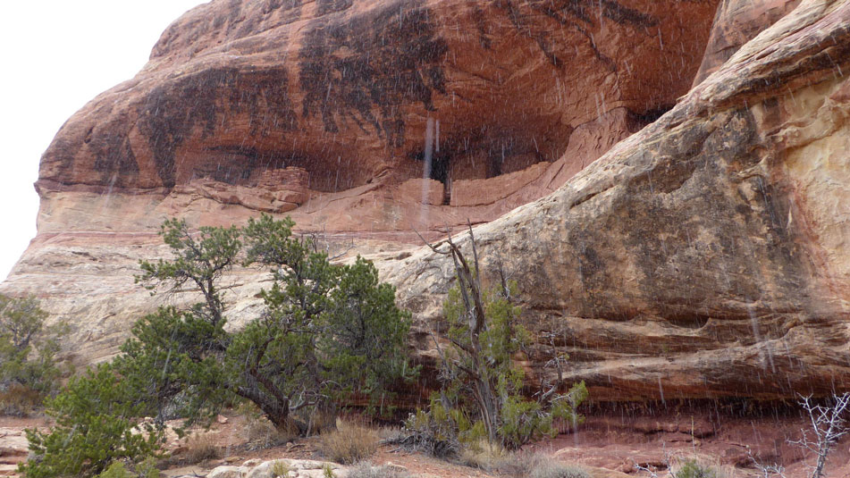
The Bears Ears are a pair of buttes near the center of the monument. For some pictures see articles in the March 2017 and April 2019 issues. The next picture below is reprinted from the latter issue. For more background go to BearsEarsCoalition.org, the website of the Bears Ears Inter-Tribal Coalition. They have a news page and map.
Northeast Canyons and Seamounts National Monument
An NOAA (National Oceanic and Atmospheric Administration) webpage says this one is about 130 miles east-southeast of Cape Code and includes 4,913 square miles. The website has a map. NOAA and US Fish and Wildlife Service jointly administer the monument. Here is the USFWS webpage.
President Obama created this national monument September 15, 2016. A Wikipedia page provides a bunch of information not on the government pages: “On June 5, 2020, President Donald Trump signed a proclamation purporting to lift the restrictions on commercial fishing at the Monument but without modifying the boundaries. ... On October 8, 2021, President Biden restored the original protections for the national monument, prohibiting commercial fishing and phasing out crab and lobster fishing by 2023."
by Kevin Hartley, Alamo Group Outings leaderExtinction is Forever
We admit it at last.
Gambusia are gone –
petite fish found only
in the San Marcos River.
Nobody has seen one
since nineteen eighty-two.
We have nice photographs –
one-inch flashes of gold.
We can cry about it.
At least we can still feel
something – sadness, regret.
Sometime soon our senses
will stop perceiving loss.
The war’s gone on too long.
Elephant, tiger, dolphin –
all our living brethren
piled into railroad cars
for extermination.
Magnificent redwoods
the oldest among us
may also not last long.
We better start praying.
written October, 2021 by Darby Riley, Alamo Group Political ChairThe Olympic Peninsula, Washington: a Couple More Spots
Further to prior articles/pictures about Olympic National Park in this newsletter, here are a couple additional spots visited early August 2019. The earlier articles were about the rain forests, August 2020; the coastal beaches, February 2021; and the mountains, August 2021.
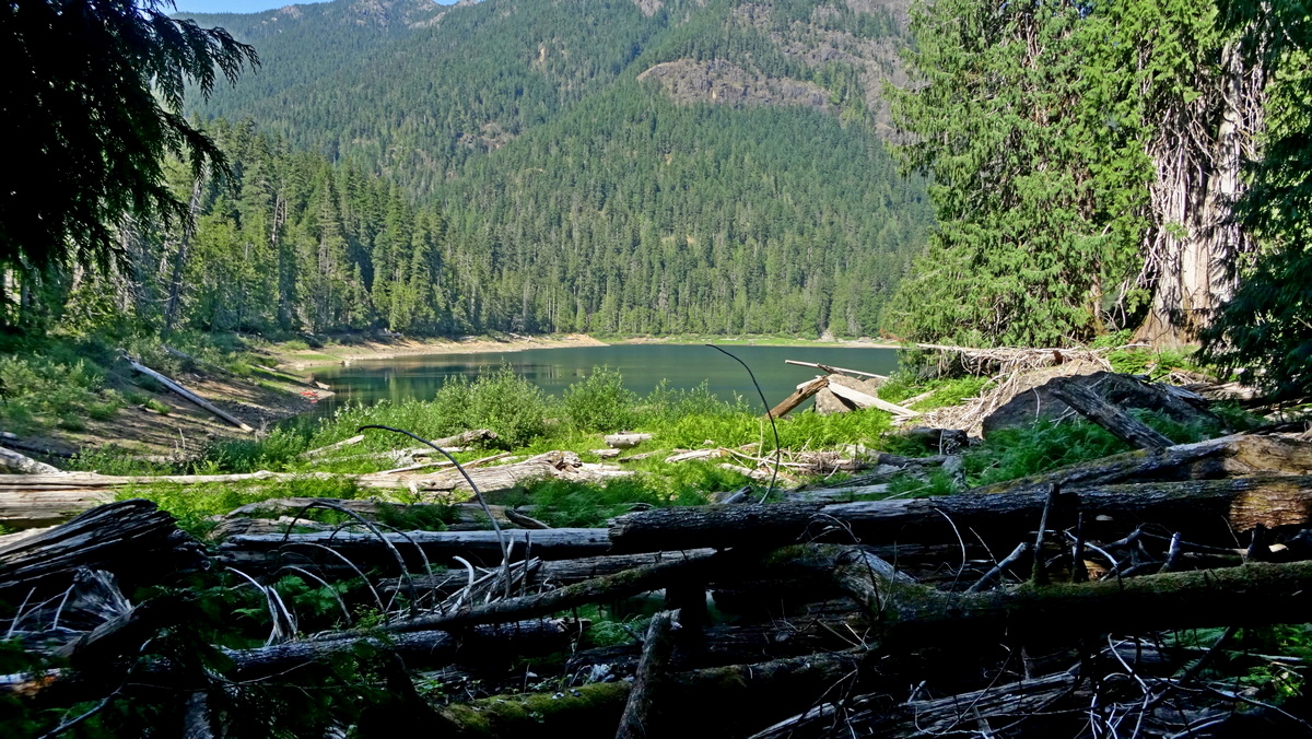
A popular destination in Olympic National Forest is Lena Lake, picture above. This is in the southeast corner of the peninsula due north of Skokomish. The hike to the lake is 6 mi roundtrip with gain 1300'. Here is the OutdoorProject.com page with map and PDF guide. Lena Creek campground with nice large sites and potable water is almost opposite the trailhead on Hamma Hamma Road.
Upper Lena Lake is a few miles west-northwest up a trail from Lena Lake along the west fork of Lena Creek. The OP map shows this is in Olympic National Park. And, another trail along the east fork to Brothers Base Camp at the end of Brothers Trail, in Brothers Wilderness. A USFS page says regards the latter, "Hike through a remote canyon area called the Valley of the Silent Men. ... Only experienced climbers should continue on from the end of The Brothers Trail." Here is a page at AllTrails.com with pictures and a map.
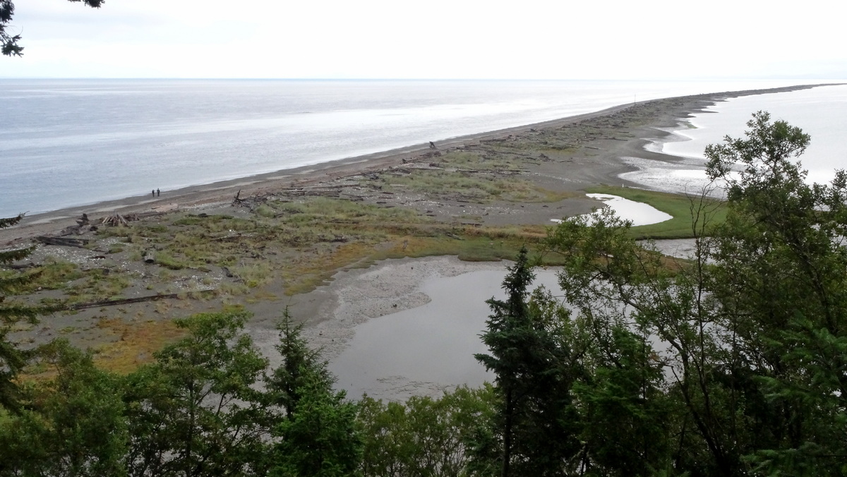
Dungeness Spit is much more interesting than my pictures on an overcast day would suggest. This is mostly Dungeness National Wildlife Refuge, in the northeast corner of the Olympic Peninsula, due north of Sequim. This area averages less than 16" rain per year due to the rain shadow of the Olympic Mountains, whereas the Hoh Rainforest 50 miles west-southwest averages 135".
Dungeness is the longest spit in the US at 5.5 miles length. At the trailhead/parking area there is a campground. The lighthouse with historical exhibits near the end of the spit is staffed by the New Dungeness Lighthouse Association. Here is the OutdoorProject.com page.
Resource Usage for Electric Vehicle Production
Here is an important in-depth look at the production of EVs and the resources necessary to carry out reduction of emission goals. Learn about these issues.
The presentation linked below was prepared by Roger Baker of Austin. Dr Charles Hall who is mentioned at the end is one of the authors of Energy and the Wealth of Nations.
Baker notes that:
The most limiting resources for EVs are likely to be oil and copper, which are themselves economically interdependent. However, both these key resources may now be peaking in global production at about the same time. This presents a problem, since it is hard to imagine easily expanding copper production when the oil needed to make the transition is in short supply. This resource limit picture is further complicated by industrial rivalry between the USA and China.
This presentation, How achievable is the large scale electrification of the U.S. car industry?, is very readable with ample graphs, and is very engaging.
by Barbara McMillin, Alamo Group Transportation Chair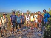
Outings: The Call of the Wild
Visit the Alamo Sierra Club Outings page on Meetup for detailed information about all of our upcoming Sierra Club Outings.
The Alamo Sierran Newsletter
Richard Alles, Editor
Published by The Alamo Group of the Sierra Club, P.O. Box 6443, San Antonio, TX 78209, AlamoSierraClub.org.
The Alamo Group is one of 13 regional groups within the Lone Star Chapter of the Sierra Club.
Changed your contact information?
If you're not sure whether the Sierra Club has your current email address, send an email to Member Services with your name and address and/or member ID (see Locating Your Member ID) so they can add your email address to your member record.
Have you moved? Let us know by sending your old address, your new address and your member ID to: address.changes@sierraclub.org.
Go online for the latest news and events
 |