From the e-Mailbag
From time-to-time, the Alamo Group receives messages concerning local environmental issues. If you have thoughts to share on any of these issues, send us a message and we'll forward it to the writer.
The views and opinions expressed here are those of the authors individually and do not necessarily reflect the views or opinions of the Alamo Group or its members.
Natural area slated for development
I read that USAA has sold the gorgeous and nature-filled golf course, La Cantera Palmer Course. It was sold to a real estate developer based in California.
I can not imagine the loss of such a property to more homes, apartments, condos and other buildings. Surprisingly, there has a been no story in the local newspaper or TV.
submitted by Mike W.Edwards Aquifer threatened
There is an interesting 1988 article in Texas Monthly about this region's sources of water, especially the Edwards Aquifer. The prognosis for the Edwards Aquifer and the rivers downstream was dire.
Over the last 7 years, we have heard SAWS and lots of developers claiming that the Vista Ridge Pipeline was the solution to make San Antonio "Waterful," a place of abundant water. The water from the pipeline has been flowing in San Antonio for over a year, but not without lots of expensive, unanticipated messes to fix, so the ratepayers had been paying huge rate hikes to pay for water that couldn't be delivered.
The worst impacts, so far, of the Vista Ridge deal are on the people in several counties east of Austin, whose wells tap the Carrizo and Simsboro formations of the Carrizo-Wilcox Aquifer - a slow-to-recharge aquifer that has been drawn down heavily in the first year of Vista Ridge pumping (see: Central Texas landowners blame SAWS’ Vista Ridge pipeline for dry wells by Erin Douglas). Just a few weeks ago, another scientific report alerted us to the fact that Texans cannot rely on pumping groundwater in the future (see: Report: Future of groundwater pumping in Texas unsustainable by Elena Bruess, San Antonio Express-News).
submitted by Meredith McGuire, Alamo Group Conservation ChairNo Holiday Gathering This Year
The Alamo Group, due to the continuing pandemic, will not be holding our usual December potluck this year. Our monthly general meetings, held on third Tuesdays, will resume on January 18, 2022 with “A Discussion on the Energy Innovation and Carbon Dividend Act“ presented by Bill Hurley and Stuart Birnbaum.
Watch your email in January for an announcement containing info for joining the Zoom meeting.
A Discussion on the Energy Innovation and Carbon Dividend Act
Tuesday, January 18, 2022
6:00 p.m.
Online via Zoom
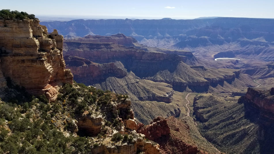
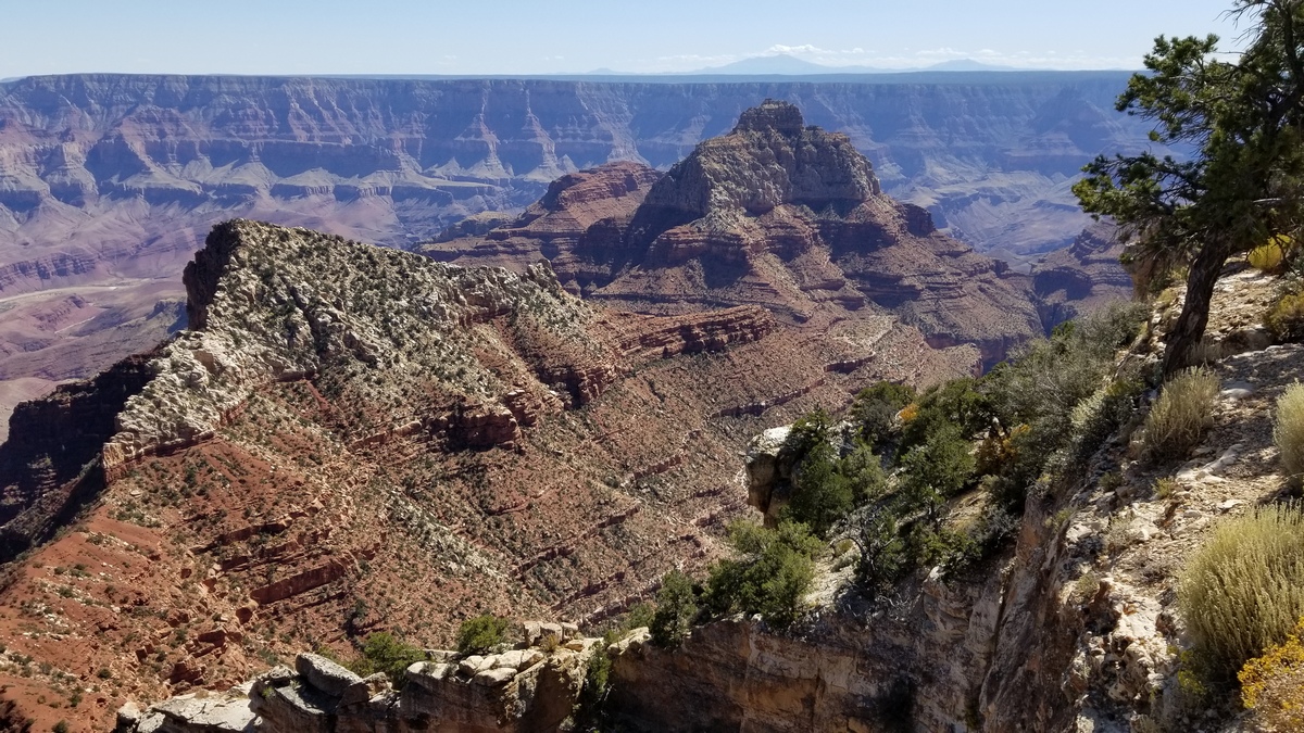
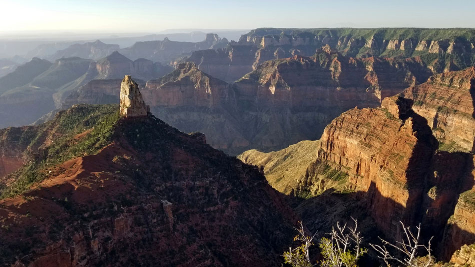
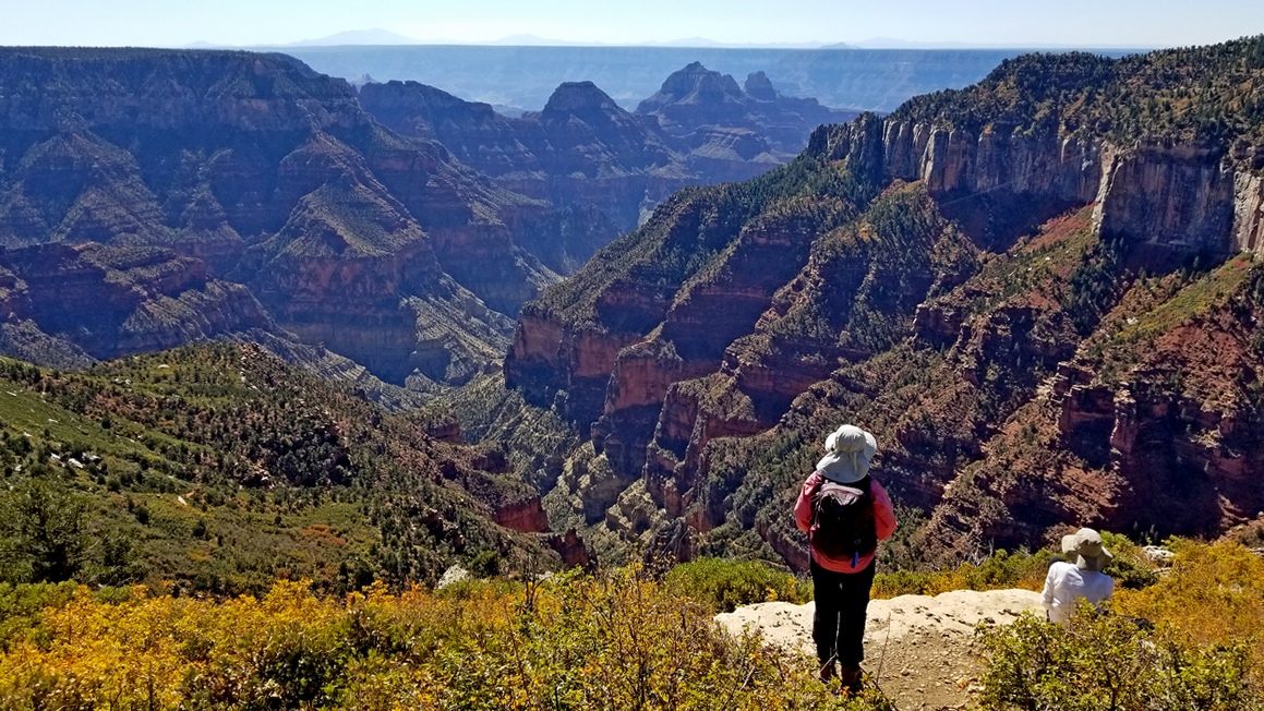
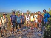
Grand Canyon National Park: North Rim Viewpoints
A group of us from the Hill Country went to the North Rim in October 2019 for day hikes shortly before the park closed for the Winter. The first four pictures are typical scenes from easily accessible viewpoints. There are a number of such viewpoints, particularly off Cape Royal and Point Imperial roads, which run east from AZ highway 67 not far north of the North Rim lodge. This is mostly along the east side of Walhalla Plateau, which is a thumb off the greater Kaibab Plateau by Bright Angel Canyon (see the 5th picture). Here is the park North Rim services and map brochure (PDF).
There are another pile of longer dayhikes to rim vistas and drives to others through Kaibab National Forest, some requiring 4WD/high clearance. We'll cover a few in a subsequent issue of this newsletter. One was discussed in the May 2021 issue, Monument Point with a hike to the Esplanade.
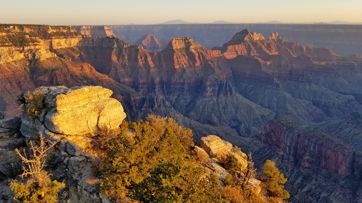
The vistas include many buttes and peaks named by Clarence Dutton, a geologist on John Wesley Powell's second Colorado River voyage, who later did much additional extensive work. What these things are named can often be figured out by taking bearing lines on a topo map (Mt. Humphreys was a great help), making a guess as to identity, and doing an internet search for photos to confirm.
In addition to the vista from Walhalla viewpoint (picture below), don't miss the Walhalla Glades Pueblo ruins which are just north of Cape Royal.
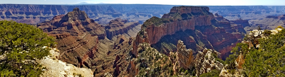
A few people at these viewpoints look at the peaks and wonder, are there routes up those? Many of them are seriously technical. There are lots of websites with details for climbers.
For example, I searched about climbing Vishnu Temple (next picture) and found an excellent page by a climber who had to turn back. It includes the serious detail one would wish. Another general trip article mentions an ascent of Vishnu, making it sound not too bad (only couple bits of class 5)!?!
A bearing line to Humphreys showed the mesa upper right to end at Atoko Point, which is a few miles north of Cape Final (see the last section below) and the flat topped butte seemingly left of that is Jupiter Temple. The latter is actually southeast of Cape Final. Atoko Point is just south of Roosevelt viewpoint, off Cape Royal road.
The obvious question was, is there a reasonable route to Atoko? Found this page; it is a few miles bushwacking to great views. And Naji Point a few miles further south, same deal. On a list for another trip.
Vistas, haze and air quality
The above picture is typical of views degraded by air pollutants. You can't see Mt Humphreys on the horizon as you can in the picture at HikingProject.com. Here is an NPS article on air quality at Grand Canyon. One culprit was the Salt River Project coal-fired power plant east of Page, Arizona, now shut down, being replaced by renewable sources.
Some of us have been on the South Rim in Big Bend National Park and seen the visibility impacted by industrial pollutants from the US and Mexico. I have been in Utah planning on a summit climb, but canceled due to poor visibility, probably from the wildfires in California and elsewhere in the southwest.
The next picture caption mentions Roaring Springs which feeds the trans-canyon pipeline. The pipeline was constructed in the 1960s but now is prone to failures; there is a replacement project in the works. Prior to the pipeline, water was brought to Grand Canyon Village in rail tank cars from Williams, 60 miles south.
The North Kaibab Trail is vaguely visible on the lower right side of the canyon. The power lines discernible upper right go down to the Roaring Springs pump station; this supplies the water for 3 canyon campgrounds and all of Grand Canyon Village on the South Rim.
Mt Humphreys again on the horizon left center. Deva and Brahma temples again center. This is a 5 mile loop from the parking area for the Ken Patrick and North Kaibab trails.
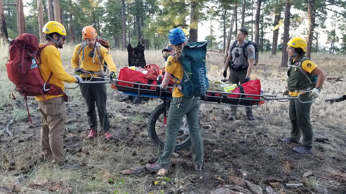
The Kneecap Maneuver
On the 2019 trip we were hiking to Cape Final, an easy 4 mile roundtrip from Cape Royal road, with a little scrambling only at the rim. A buddy tripped over a little rock a mile in, landed a knee on another, dislocating/fracturing the kneecap.
Pulling out a splint designed for lower arms we realized it wouldn't work for a knee. A buddy pulled out a folding seat pad, which worked reasonably, after relocating the kneecap. The latter is an emergency procedure that may be used with in wilderness situations with proper training and greatly reduces pain and risk of further tissue damage.
The patient was preparing to hobble out with our assistance and trekking poles, but finally one phone was able to call 911. The National Park Service evac team showed up. No place to land a chopper. There were a paramedic, ranger, and some interpretive staff to fill out the litter crew.
At the South Rim the park has a serious urgent care center and a pile of ambulances, but we heard at the North Rim they have exactly: one ambulance. Another example of additional NPS funding needed. Here is the park emergency services page with a link to the 2018 annual report, very interesting detail with pictures.
Before the litter showed up at the trailhead the evac coordinator asked for help jump-starting the ambulance; the battery had run down due to use of the space heater in preparation for the patient. She produced cables but said she was a backcountry ranger, didn't deal much with vehicles. We were happy to help; these rangers are likely trained similarly to WEMTs (Wilderness EMTs), so someone like this I would wish to have for my evac.
As our buddy went off to a hospital in Utah the paramedic invited us to say goodbye; we said “Michael, some people will do anything for attention!” The paramedic was highly amused. Michael now wishes to be hiking again, though hopes to skip the kneecap maneuver.
Perhaps
The alien space ships
which people keep seeing
moving in strange ways
at the speed of thought –
what are they after?
Flying between stars
is beyond our ken.
It takes us eight months
just to get to Mars.
Do they hope to wake us
before we kill our world,
our selves? Are they
envoys of the universe
on a rescue mission?
It’s hard to think
that they too might
be so deluded
as to take next quarter’s
profits as a stand-in
for The Great Spirit.
For our cosmic cousins
maybe greed is pointless,
power is for love,
and being – its endless beauty –
is always to be celebrated.
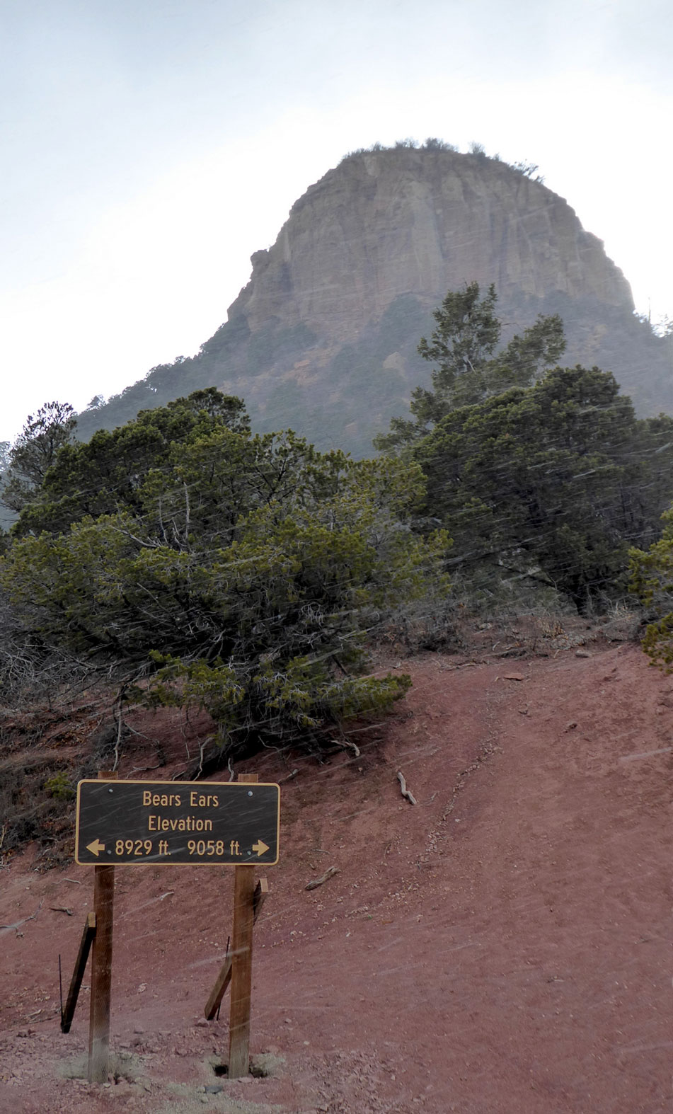
A Profound and Important Book
The Bears Ears, a Human History of America's Most Endangered Wilderness covers the ancient to current history of a vast area in southeastern Utah, including Obama's national monument designation and Trump's reversal thereof. Written by David Roberts and published February, 2021, it is extremely readable, with much detail about the key players down through history, starting with the Indigenous peoples plus archaeologists, pot hunters, San Juan County commissioners and tourists like ourselves.
It also features local Mormon history including the Hole-In-the-Rock expedition. Roberts died of cancer in August of this year.
Thankfully Biden has restored the monument (article in this newsletter November 2021) but we must not be complacent. If we understand some of the background we may be prepared and feel like we understand just a bit of what happened here. Other issues including articles with pictures in Bears Ears were March 2017 and April 2019.
The San Antonio library has copies of this book and others by Roberts about the Indigenous peoples of the western US, and his books about the history of exploration in the US and alpine climbing. Roberts mentions in particular another book in the library's collection: Voices From Bears Ears, Seeking Common Ground on Sacred Land by Rebecca Robinson.
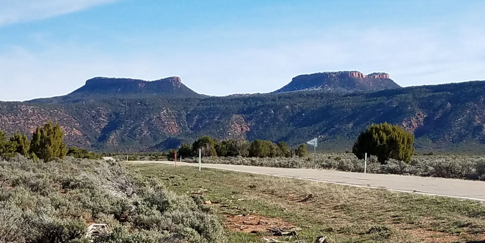
Looking at the above picture we wonder if we could climb each summit and take a picture of the other. Found this page at SummitPost.org about a route up the west one, class 3 (not bad, if we actually find the same route), gain 450', 1.7 mi round trip. Here's a way up the east one also at SummitPost.org, mostly follows an old road so class 2, 1.2 mi round trip, gain 507'.
Outings: The Call of the Wild
Visit the Alamo Sierra Club Outings page on Meetup for detailed information about all of our upcoming Sierra Club Outings.
The Alamo Sierran Newsletter
Richard Alles, Editor
Published by the Alamo Group of the Sierra Club, P.O. Box 6443, San Antonio, TX 78209, AlamoSierraClub.org.
The Alamo Group is one of 13 regional groups within the Lone Star Chapter of the Sierra Club.
Changed your contact information?
If you're not sure whether the Sierra Club has your current email address, send an email to Member Services with your name and address and/or member ID (see Locating Your Member ID) so they can add your email address to your member record.
Have you moved? Let us know by sending your old address, your new address and your member ID to: address.changes@sierraclub.org.
Go online for the latest news and events
 |