Missed a Meeting? Watch the Video
We have begun posting videos of our monthly general meeting presentations on our Facebook page and YouTube channel. Watch our April meeting, West Side Rising: How San Antonio’s 1921 Flood Devastated a City and Sparked a Latino Environmental Justice Movement, now on YouTube or Facebook.
Digital Preservation of Early Cretaceous Dinosaur Tracks and Trackways, and the Geological Heritage of Central Texas
Our May general meeting features Thomas L. Adams, PhD (Curator of Paleontology and Geology, Witte Museum, San Antonio) discussing his research into central Texas dinosaur tracks & trackways and efforts to digitally preserve those tracksites.
Tuesday, May 17th
6:00 p.m.
Online via Zoom
Meeting schedule
Zoom link opens at 5:30. Please join early to ensure you are admitted prior to the start of the featured program.
| Informal get-to-know-you | 6:00 pm to 6:15 pm |
| Announcements | 6:15 pm to 6:30 pm |
| Featured program | 6:30 pm to 8:00 pm |
RSVP
To receive an email with the information you need to join the Zoom meeting, visit our event page and submit the RSVP form.
Program topic
Dinosaur tracks and trackways represent an invaluable testimony of ancient life forms, and are considered an integral part of the cultural and scientific history of Texas. Many dinosaur tracksites in Texas are at risk of being lost from increasing urbanization and amplified weathering and flooding due to climate change. This is especially true in central Texas, where the metropolitan population grows by 1.7% yearly.
About our speaker
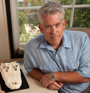
Dr. Adams, Curator of Paleontology and Geology at the Witte Museum, oversees the acquisition, curation, preparation, and conservation of the fossil, mineral, and rock collections. He also provides education and expertise in paleontological resources for students, educators, and the general public through museum exhibitions, public education, and scientific lectures. His research focuses on Cretaceous ecosystems and faunal diversity within Texas, as well as crocodyliform evolution and biodiversity and paleobiogeography of Mesozoic ecosystems.
For more about this program and our speaker, visit our event page.
The Alamo Group of the Sierra Club holds its general meetings the 3rd Tuesday of most months. They're always free and open to the public.
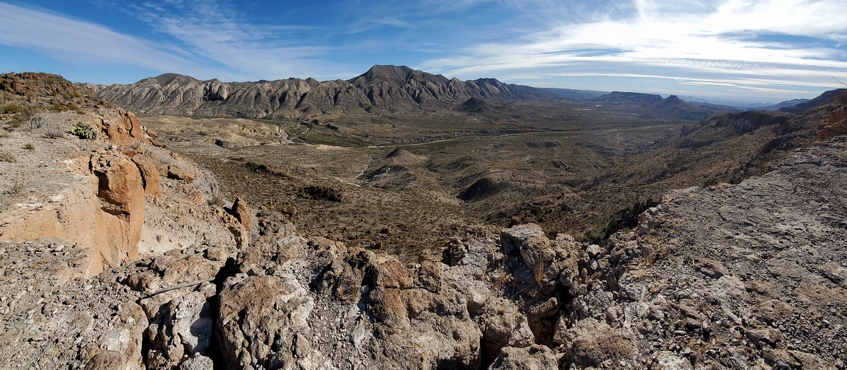
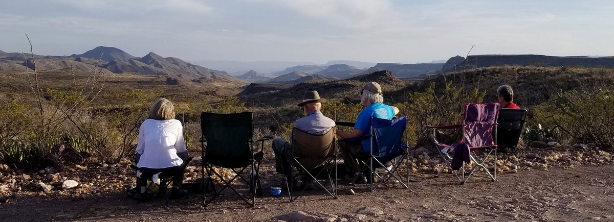
The Other Side of Nowhere: Big Bend Ranch State Park — Mostly About the Solitario
This article set in Texas' largest state park is largely about the Solitario, the remains of a massive volcanic upheaval, a laccolith, about 35 million years old. There is a good article at Marfa Public Radio. And the Wikipedia page.
This is further to intro stuff in an April 2022 issue article about this park, which also covered hikes and campgrounds along FM 170, just north of the Rio Grande. Here's the link to the park maps page; the Discovery Map is the big overview. There will be an article on other spots in the interior of the park in the June 2022 issue.
It is a 27 mile drive east from Presidio along Casa Piedra and Main Park roads to the Sauceda visitor center near the center of the park, which has showers and a bunkhouse. Just east of Sauceda is South Leyva campground; a bunch of sites with shade shelters, fire rings and a composting toilet. And there are a bunch of widely distributed primitive campsites in the interior of the park, many only accessible by 4WD roads; for these we are supposed to bring our own toilet.
It is quite excellent to stay a spell at South Leyva and do short drives west and east to trailheads. But note that traffic in the interior of the park, even along Main Park road, is very limited, in the event of a problem. Some campsites may not see visitors for months or longer. Hardly any cell phone service anywhere but there is wifi at Sauceda. Park rangers do drive Main Park road daily, at least to Sauceda.
It is important to be prepared for vehicle problems. On early trips I had no problems though was not very well prepared. On a trip December 2021 I was well prepared happily, as I had a flat tire and saw another camper did also. Highly advised for the park interior: full size spare wheel, tire inflator, tire plug kit, tools, jump starter, jumper cables, multimeter, tow strap, fire extinguisher, shovel etc. More food and most importantly more water than we imagine will be needed. Ask others if they need help with a problem; could be us next time.
Just a few hikes and vistas
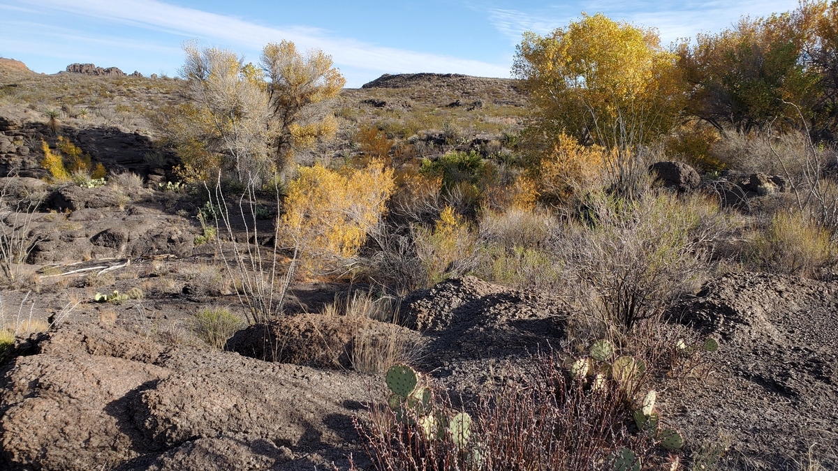
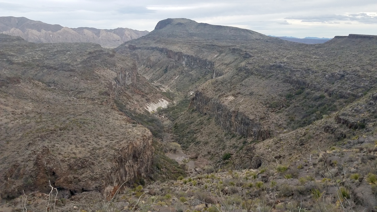
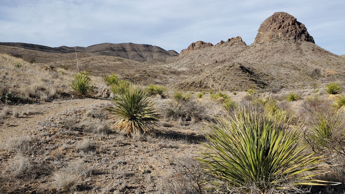
To make sense of these pictures look at the Fresno Canyon Area map (PDF). The first 4 pictures were taken on routes from the Puerto Chilicote trailhead, which is 7 miles drive southeast from Sauceda visitor center. We can get to Madrid Falls overlook in about 4 miles hiking southwest. Madrid Falls is said to be the 2nd highest in Texas. Going southeast from Puerto Chilicote 2 miles we get to a Solitario flatirons overlook, 3rd picture. 1.5 miles from the trailhead en route to Madrid Falls overlook we see the lovely oasis in the 1st picture.
Coming back from Madrid Falls, 2nd picture, there is a trail cutting off going south of Cerro Chilicote, which makes for a pleasant loop itself. That joins the trail to the Solitario flatirons viewpoints, the 4th and 5th pictures.
Prior to the December 2021 trip I had the grand idea of a dayhike loop from Puerto Chilicote to the viewpoint in the 4th picture, then down a route into Fresno Canyon, south to Arroyo Mexicano and up to near Madrid Falls. Surely there would be some class 3 route (here's a page about this rating system) up the north side of the arroyo, then back to the trailhead. Maybe 15 miles. But if I couldn't find a route would have to backtrack; then would be like 22 miles.
Couldn't find any reference to such a route out of the arroyo; even if such exists maybe hasn't been found as this area is not fractionally as popular as climbs in Yosemite. Decided this was a dumb idea solo at age 70 so made other plans.
The Solitario!
The Solitario, a few more pictures
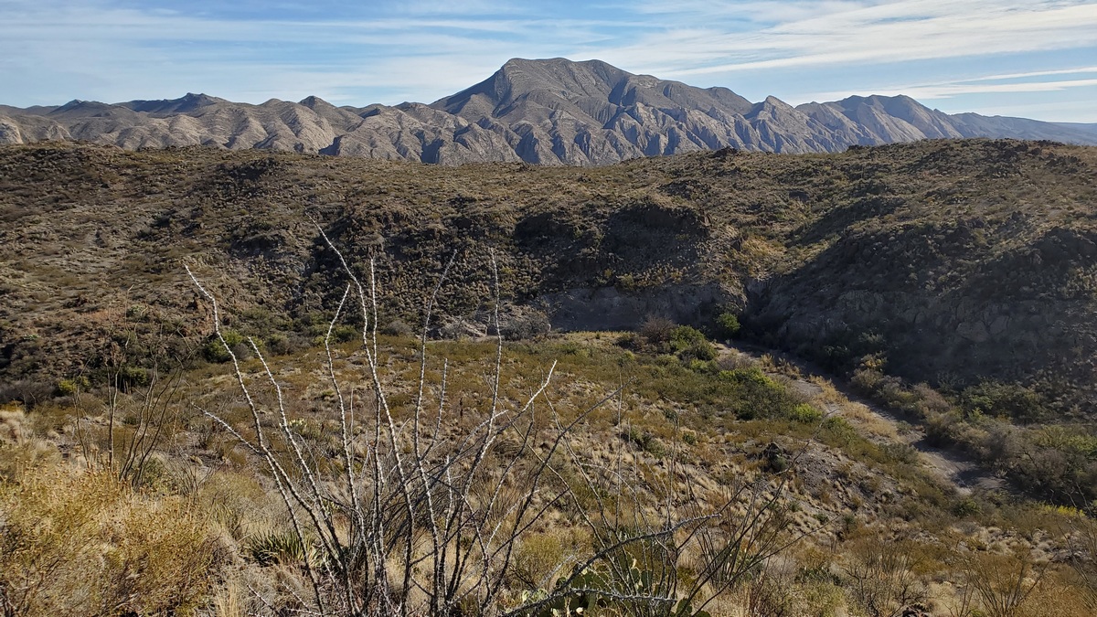
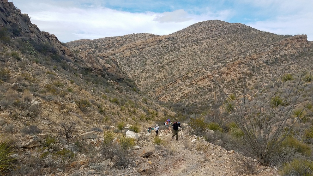
The next three pictures below are from the south end of a loop around west side of the Solitario, taken from spots east of the flatirons in the prior three pictures. Makes sense looking at the Fresno Canyon map. This is a super 9.4 mile moderate hike, gain 1100', south from Burnt Camp trailhead, which is 14 miles east and south from Sauceda.
In December 2021 I encountered nobody else on the trail and there were no other vehicles at the trailhead before or after or on the road from Sauceda. So again, best be sure we are prepared for a vehicle or medical issue. Could be days before another hiker would appear on the trail.
The route is largely obvious, but surely carry a printed map and navigation devices. I carry a spare phone with the same offline navigation app and map as my regular phone, not having trained with Lewis and Clark. Got actually a bit lost on a trip elsewhere due to being confused, even with a Garmin GPS device. Sure taught me a lesson!
The Other Side of Nowhere!
We can buy a park sticker saying this at visitor centers. A retired TPWD guy mentioned he had supervised planning/preparation work at this park before it opened in 2007. And that there is a sign with NOWHERE on one side and THE OTHER SIDE OF NOWHERE on the other. This sign is said to be 2.4 miles southwest on Solitario road from Main Park road, then south (walking highly advised) on a likely unmarked turnoff which goes .6 miles to Tanque Blanco (see the map). On the map the latter appears to be near the head of the Fresno Creek drainage. If I hike around the Solitario again surely I must see Tanque Blanco and THE OTHER SIDE OF NOWHERE.
by Kevin Hartley, Alamo Group Outings leader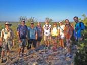
Outings: The Call of the Wild
Visit the Alamo Sierra Club Outings page on Meetup for detailed information about all of our upcoming Sierra Club Outings.
The Alamo Sierran Newsletter
Richard Alles, Editor
Published by the Alamo Group of the Sierra Club, P.O. Box 6443, San Antonio, TX 78209, AlamoSierraClub.org.
The Alamo Group is one of 13 regional groups within the Lone Star Chapter of the Sierra Club.
Changed your contact information?
If you're not sure whether the Sierra Club has your current email address, send an email to Member Services with your name and address and/or member ID (see Locating Your Member ID) so they can add your email address to your member record.
Have you moved? Let us know by sending your old address, your new address and your member ID to: address.changes@sierraclub.org.
Go online for the latest news and events
 |