Problems with Plastic Pollution — What We Can Do Now
Our November general meeting features Alan Montemayor, the Chair of the Alamo Group of the Sierra Club, discussing pollution from plastics and ways of reducing it.
Tuesday, November 15th
6:00 pm
Meeting schedule
| Informal get-to-know-you | 6:00 pm to 6:15 pm |
| Announcements | 6:15 pm to 6:30 pm |
| Featured program | 6:30 pm to 8:00 pm |
Venue
This will be a hybrid meeting.
In-person location
William R. Sinkin Eco Centro, 1802 North Main Avenue
Map
Zoom meeting access info
- Meeting ID: 966 5254 0606
- Passcode: 377093
- Link: https://sierraclub.zoom.us/j/96652540606?pwd=UUVISUw3OHluQ2xsQk5IeENxeXFZdz09
Program topic
Plastic has many desirable characteristics. Since 1909, we have been signaling the supply chain that we want more and cheaper plastic products. This has led to a disposable economy in plastics that is polluting every corner of our planet with micro and macro plastics. It is a vast, uncontrolled experiment and all of earth's creatures, including ourselves, are the test subjects.
We can only change the situation by signaling to the supply chain that we no longer want plastic products. Each of us needs to Refuse plastic products, Reduce our use of plastics, Reuse plastic products, Rot plastic products and, as a last resort, Recycle plastic products. We must spread the word to all we know and ask our local grocers to begin the process of moving away from plastics.
About our speaker
Alan is a lifelong San Antonio native and has been active with the Sierra Club since 1983. He has a Bachelor of Science in mechanical engineering from Texas A&M University and worked at Southwest Research Institute for 25 years, designing alternative fuel vehicles.
He is an environmentalist, hiker and do-it-yourselfer. Before Covid, Alan and his wife loved to travel the world. He is passionate about conservation of natural resources, clean energy, local agriculture, sustainability and improving the quality of life for not just San Antonio and Bexar County but the whole world. His efforts are directed towards local actions that will lead to sustainable energy, water, air quality and food policies for our region. Climate justice is a large part of that local work, and there’s plenty to be done.
Alan is chairman of the Alamo Group of the Sierra Club and sits on the board of the Greater Edwards Aquifer Alliance. Alan says, “I thought retirement would allow me to sleep late and enjoy life, but I’m up every morning at 6am, ready to save the world.“
The Alamo Group of the Sierra Club holds its general meetings the 3rd Tuesday of most months. They're always free and open to the public.
View videos of our past meetings on our YouTube channel or our Facebook page.
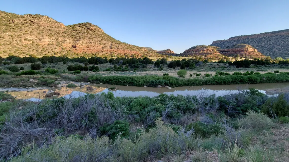
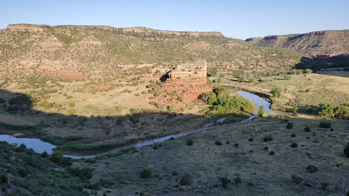
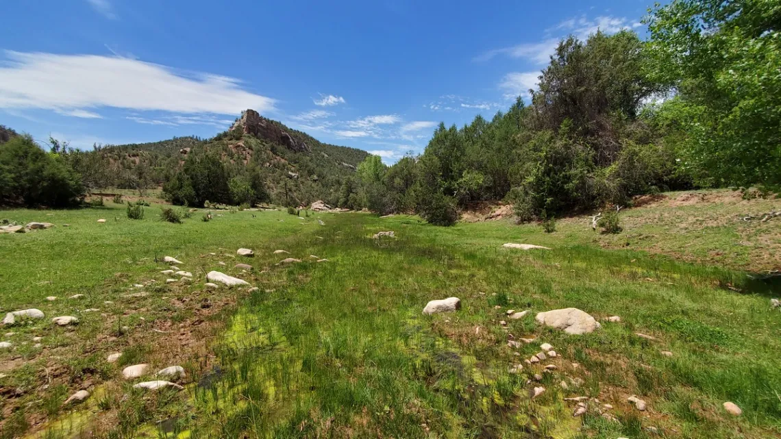
The Canadian River and Sabinoso Wilderness, New Mexico
The Canadian River in Mills Canyon
The Canadian River (Wikipedia article) is the longest tributary of the Arkansas River and rises on the east side of the Sangre de Christo mountain range in southeastern Colorado. It joins the Arkansas in eastern Oklahoma.
Of particular appeal is Mills Canyon, a protected area which the Canadian flows through. The Arkansas joins the Mississippi about 60 miles southeast of Little Rock, Arkansas.
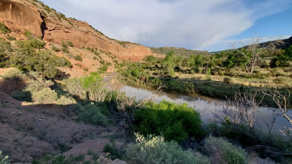
Mills Canyon is in Kiowa National Grassland. Here is a page at SummitPost.com with a topo map. This map is a little hard to read but helps make sense of the river.
To get here you drive west on road U-1 from NM hwy 39 at Mills, a wide spot in the road, which is a bit north of Roy. Six miles west on U-1 you are at Mills Rim campground, a good place to camp with an RV. At 10.4 miles you have come down the east side of the canyon 700' on a pretty well maintained road to Mills Canyon campground on the east side of the river.
The latter is very nice; neither campground has running water, and take out your trash. Further south beside the river there are a few at-large campspots. Very few visitors; the last trip in June 2021 I saw one other vehicle in the canyon.
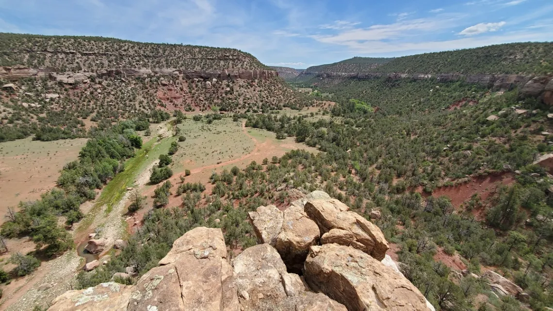
Sabinoso Wilderness
Sabinoso Wilderness (Wikipedia article) is east of Las Vegas, New Mexico, and includes mesas and canyons draining eastwards to the Canadian. Sabinoso Wilderness is 30 miles south of Mills Canyon.
An article in Santa Fe New Mexican explains that the wilderness, established in 2009, has been nearly doubled in size due to grants in 2017 and 2021, with the latter confirmed by a Department of Interior page. The 2nd expansion includes land to the north of the previous extension, including Cañon Ciruela. The BLM page says it is working on providing a 2nd access point.
Right now the only access is at the southwest corner, which is via a dirt road with a steep AWD spot a mile before the trailhead. Maybe impassible when wet. Here's the BLM page with a map that is hard to read unless you correlate with an area map and other sources. But looking closely I could find the trailhead, which is above the head of Higgins Canyon, and Cañon Ciruela.
When I visited in June 2021 the only person I saw was a guy working on the road coming down around the peninsula in the last picture below. Said he was the only one still allowed to drive into the canyon, so had to maintain the road himself; maybe he was the original landowner. He asked how far I had gotten down the canyon. He was whacking into an enormous limestone block that had fallen onto the edge of the road. I joked that hopefully he didn't have his truck in the canyon when more of the rock above fell; looked like it was ready to go any year now. He said in that case he'd have to find a sledgehammer.
When the northwest access is possible maybe I will return and have another look. That may be more interesting than the southwest access as it likely would entail a route coming down Cañon Ciruela (see a note in the caption of the picture below).
I wondered if there was a backpack trip option to the river, which is 13.5 miles straight line distance from the southwest trailhead. Though on maps a county road enters the canyon from the northwest about halfway to the river and there is a historic church a little further on. Likely the creek is usually dry not much further down the canyon than my pictures.
Outings: The Call of the Wild
Visit the Alamo Sierra Club Outings page on Meetup for detailed information about all of our upcoming Sierra Club Outings.
The Alamo Sierran Newsletter
Richard Alles, Editor
Published by the Alamo Group of the Sierra Club, P.O. Box 6443, San Antonio, TX 78209, AlamoSierraClub.org.
The Alamo Group is one of 13 regional groups within the Lone Star Chapter of the Sierra Club.
Changed your contact information?
If you're not sure whether the Sierra Club has your current email address, send an email to Member Services with your name and address and/or member ID (see Locating Your Member ID) so they can add your email address to your member record.
Have you moved? Let us know by sending your old address, your new address and your member ID to: address.changes@sierraclub.org.
Go online for the latest news and events
 |