Stop the Ashe juniper clearcutting bill
HB 2239, the Ashe juniper clearcutting bill, passed the House and has been sent to the Senate’s Local Government Committee.
- Please contact Sen. Flores’s office [(512) 463-0124 | email] and ask him to not sponsor HB 2239.
- Sen. Roland Gutierrez is our only local senator on the committee that is hearing this bill. Please contact [(512) 463-0119 | email] his office and ask him to vote NO on this bill.
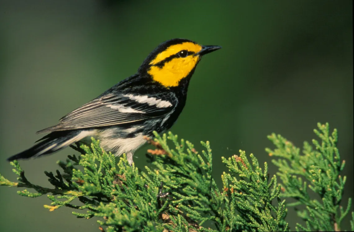
Maslowski, Steve/U.S. Fish and Wildlife Service
Oppose bill that would increase aquifer contamination
A bill that would increase contamination in your drinking water has passed in the Senate and is headed to the House Committee on Land & Resource Management. SB 2037 will nullify impervious cover limits in SA's Edwards Aquifer Recharge Zone Protection ordinance.
Once a hearing is scheduled (likely soon), we will ask Sierrans to submit comments opposing the bill on the House Witness Registration page.
Stop the "Ending Local Freedom Act"
A bill to limit the power of cities to enact environmental, consumer, and worker protections has passed the House and a Senate committee. A vote by the full Senate is the last hurdle remaining for a bill amounting to a takeover of local governments by the legislature.
Use this form to tell your state senator: Vote NO on HB 2127 — an erosion of environmental protections and local democracy.
Support this landmark energy efficiency bill
A bipartisan group of Senators passed SB 258, which would increase the energy efficiency goals for the state of Texas. The bill is headed to the House State Affairs Committee. There's not much time left in the session, so it will have to move fast.
Please use this form to contact your state Representative today and ask them to vote YES on SB 258!
Bill deregulates land development industry
SB 2038 is a bill that would enable developers to clear-cut trees and ignore protections for creeks, caves, and recharge features over the Edwards Aquifer. It was amended to exempt San Antonio. We dodged a cannon ball headed straight for our trees and aquifer.
Nonetheless, the bill is headed to Greg Abbott’s desk for his signature. No other city in Texas was spared. Land development LLCs and homebuilding corporations are soon to be substantially deregulated statewide.
Legislative updates by Richard Alles, Alamo Group newsletter editorSan Antonio's Urban Bird Rookeries
Our May general meeting features Britt Coleman, President, Bexar Audubon Society, discussing San Antonio's urban bird rookeries and strategies for managing urban-avian conflicts.
Tuesday, May 16th
6:00 pm
Meeting schedule
| Informal get-to-know-you | 6:00 pm to 6:15 pm |
| Announcements | 6:15 pm to 6:30 pm |
| Featured program | 6:30 pm to 8:00 pm |
Venue
This will be a hybrid meeting.
In-person location
William R. Sinkin Eco Centro, 1802 North Main Avenue
Map
Zoom meeting access info
- Meeting ID: 966 5254 0606
- Passcode: 377093
- Link: https://sierraclub.zoom.us/j/96652540606?pwd=UUVISUw3OHluQ2xsQk5IeENxeXFZdz09
Program topic
Urban bird rookeries have created challenges both internationally and domestically. As major urban centers expand, wild places are developed and habitat for wildlife is replaced with housing tracts, commercial properties, and other urban structures.
When considering a balance between wildlife and humans, simply deterring birds from nesting does not solve the problems of urban-avian conflict. Coleman will talk about the origins of San Antonio’s urban rookeries, the current status, and possible strategies for mitigation.
About our speaker
Since retiring from a professional career in technical software sales, Britt Coleman has devoted his time to volunteering, birding, and bird photography. He’s been a Bexar Audubon Society board member since 2019 and president since 2021.
He is also board chair for the Conservation and Advocacy committee where he leads BAS’ advocacy efforts for birds and the habitat in which they live. In that role he was instrumental in getting the Bird City Certification for San Antonio by organizing numerous local conservation groups into the steering committee, gathering data, and writing final application report.
He is on the advisory board for Mitchell Lake Audubon Center and graduated in Alamo Area Texas Master Naturalist class 43. Most recently he helped initiate the Coalition for Sustainable Urban Rookeries whose mission is to build community inclusive strategies to address urban-avian conflicts in Bexar County. .
The Alamo Group of the Sierra Club holds its general meetings the 3rd Tuesday of most months. They're always free and open to the public. View videos of our past meetings on our YouTube channel or our Facebook page.
Development Threatens Helotes Creek
Lennar Homes plans to build a 2,900 home subdivision on 1,160 acres once part of the historic Guajolote Ranch just outside of Grey Forest within the Contributing Zone of the Edwards Aquifer. San Antonio relies on the Edwards Aquifer, which makes up 63% of SAWS water supplies.
The Texas Commission on Environmental Quality (TCEQ) has scheduled a public meeting for a wastewater discharge permit application associated with the slated Lennar Homes development. The applicant, Municipal Operations LLC, has requested TCEQ approval of a permit to discharge one million gal./day of treated wastewater into Helotes Creek to serve the Guajolote Ranch subdivision Lennar intends to develop.
According to hydrologist Ron Green, co-author of a report by the SouthWest Research Institute that was commissioned by San Antonio’s Edwards Aquifer Protection Program, this application will likely set a dangerous precedent for growth in the Edwards Aquifer Contributing Zone within the Helotes Creek watershed. Plans to discharge sewage effluent into Helotes Creek upstream from the Edwards Aquifer Recharge Zone raises concerns about impacts to aquifer water quality from this volume wastewater.
The TCEQ public meeting will take place at 7:00 pm on May 9th at the DoubleTree by Hilton located at 6809 N Loop 1604 W, San Antonio, TX, 78249. All citizens and news reporters are encouraged to attend. There is additional information on the TCEQ website.
Local residents, The City of Grey Forest and surrounding communities, and environmental groups are greatly concerned about the environmental, flooding, and traffic concerns associated with the proposed Lennar development.
According to GEAA executive director, Annalisa Peace, “We recognize the need for affordable housing in the San Antonio area; however, the impacts of stormwater and waste water pollution from a high density housing project sited in this environmentally sensitive area is something that can and should be avoided.”
You can read GEAA’s comment on the wastewater permit application here.
by Annalisa Peace, Greater Edwards Aquifer AllianceValles Caldera National Preserve — North Central New Mexico
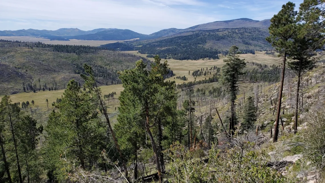
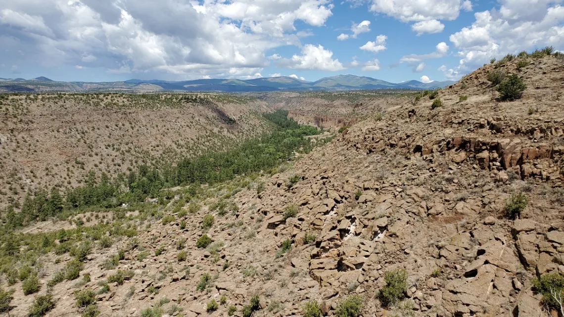
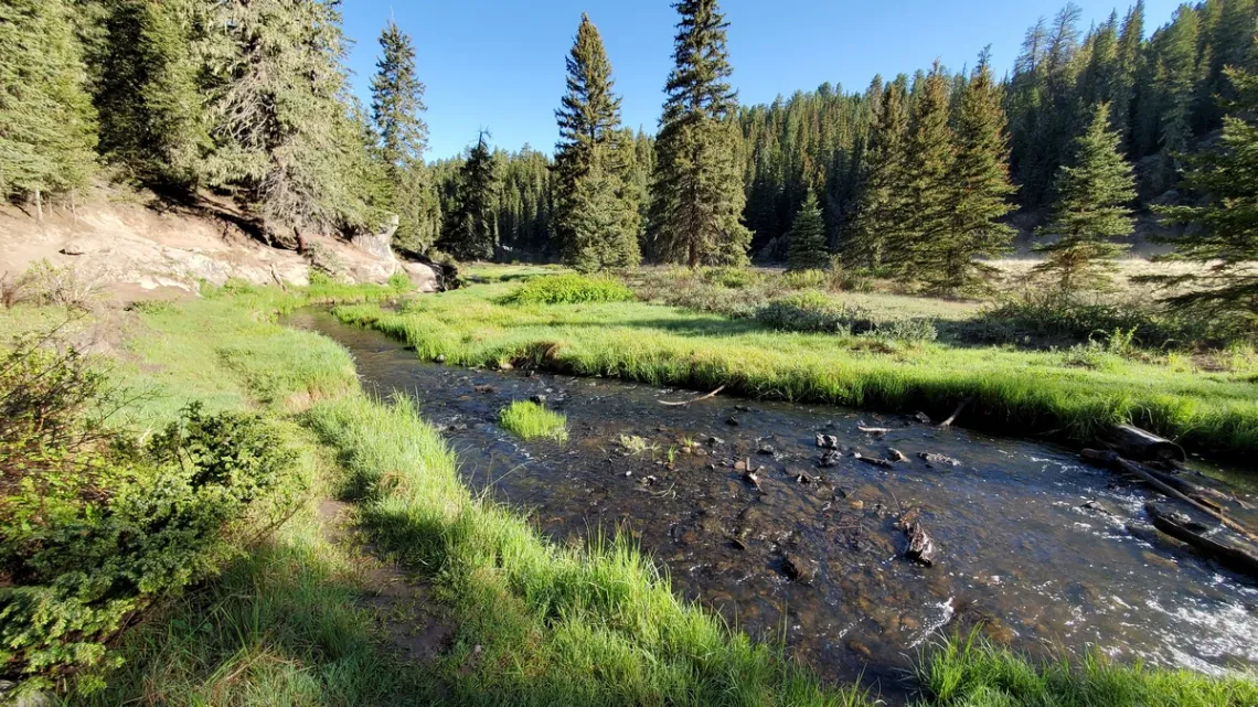
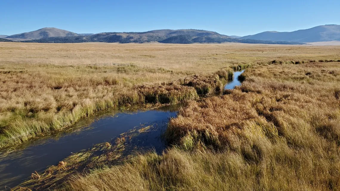
This preserve, just west of Los Alamos, is administered by the National Park Service. It was initially established in 2000 and came under NPS jurisdiction in 2015. Here's the website with the maps page, and the Wikipedia page. The 13.7 mile wide caldera resulted from an enormous eruption 1.25 million years ago. Many smaller eruptions occurred later resulting in various cinder cones, "cerros", in spots within the caldera. Here's another page about this “supervolcano”.
The first two pictures show corners of the caldera. Some of the “valles”, or grasslands, are visible. There was the enormous Los Conchas fire in 2011 and another in 2013 resulting in the barren areas on the cerros visible in the pictures. The preserve and the surrounding Santa Fe National Forest largely dodged the terrible fires that devastated large areas of Carson National Forest to the east in 2022.

Where did the original eruption ejecta go?
This went all over the area. Been to Bandelier National Monument? Much of the rock there came from Valles Caldera. The softer cliffs at Bandelier were tunneled into by Indigenous peoples for shelter, which is why the place is so interesting. The picture below is from Bandelier with a view of the caldera. Around Los Alamos some roads are cut on the edges of hills comprised of softer stuff. In general this is called welded tuff, which is partially metamorphosed volcanic ash. A Wikipedia article talks about the geology of this formation which is called the Bandelier Tuff.
Entrance and camping
The preserve entrance is on the north side of hwy 4, 16 miles west of Los Alamos. The gate is open 9 am-5 pm; no camping. Must register at the visitor center. No drinking water available, but I have collected and sanitized water from a creek. There are some backcountry access points shown on the map, some at the ends of high-clearance roads with zero visitors; we are supposed to be out by sundown. The preserve hiking page says “Currently the only camping within the preserve is by Special Use Permit, however as a newer member of the National Park Service, Valles Caldera is working hard to improve access."
Bandelier has a nice campground with potable water; hardly further east from the preserve entrance than the options to the west. To the west of the preserve entrance 7.6 miles on hwy 4 is the entrance to Jemez Falls campground, which has bunch of campsites and water, though no telling when the water is turned on/off seasonally. A sign at the entrance September 2022 said online reservation required at Recreation.gov and the phone number was not posted. There was spotty cell service here, the only place in the larger area with service at all, but it didn't like my provider and said I could only make emergency calls. So I couldn't make a reservation, but no matter. Driving on, 10.3 miles west of the entrance is an unsigned turnoff southwest with lots of nice at-large campspots. And at 10.9 miles west is Redondo campground with first-come first-serve sites but no water. These camping options are in Santa Fe National Forest.
Is that pollution or what?
Have seen floating piles of foam on creeks before. After seeing some on East Fork of the Jemez River (next picture) I did a little research. Some organic materials when composting produce oily residue which floats, foams up and collects with like bits. Could be pollution in some cases. Here's a page about this. Whew! Hardly likely could have been pollution coming from the headwaters of this river a few miles east-northeast in Valles Caldera.
Hikes
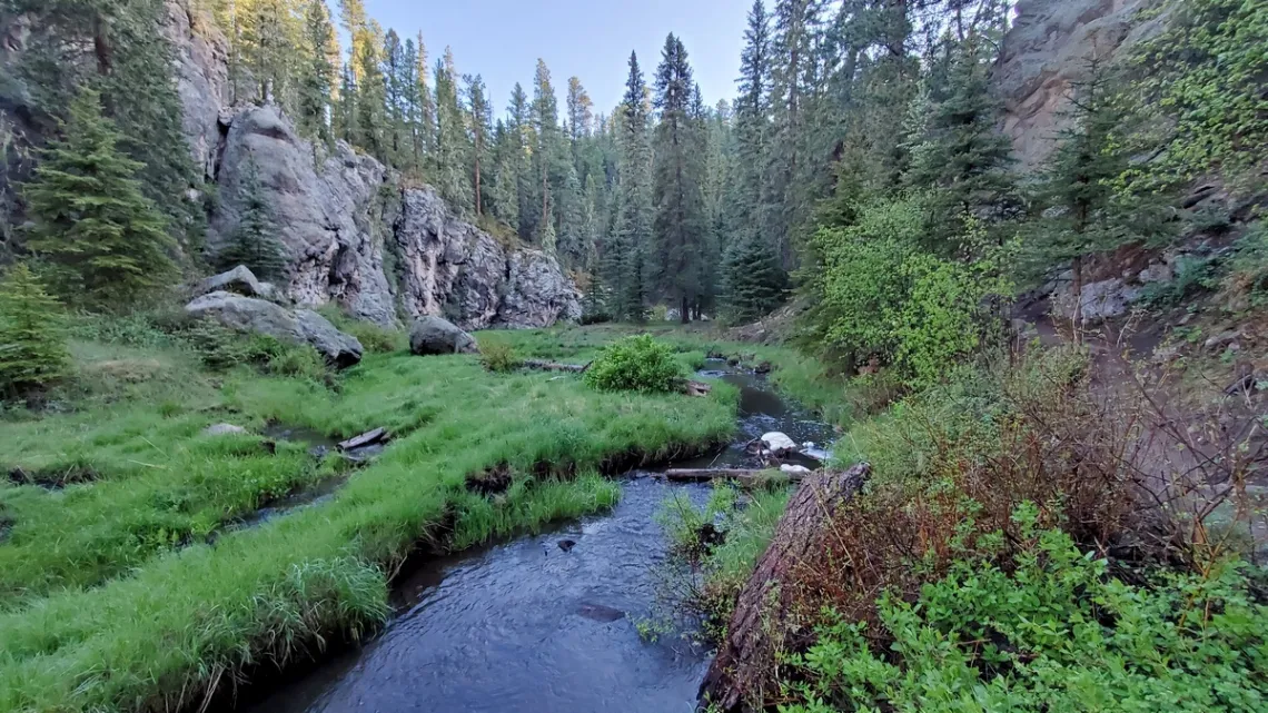
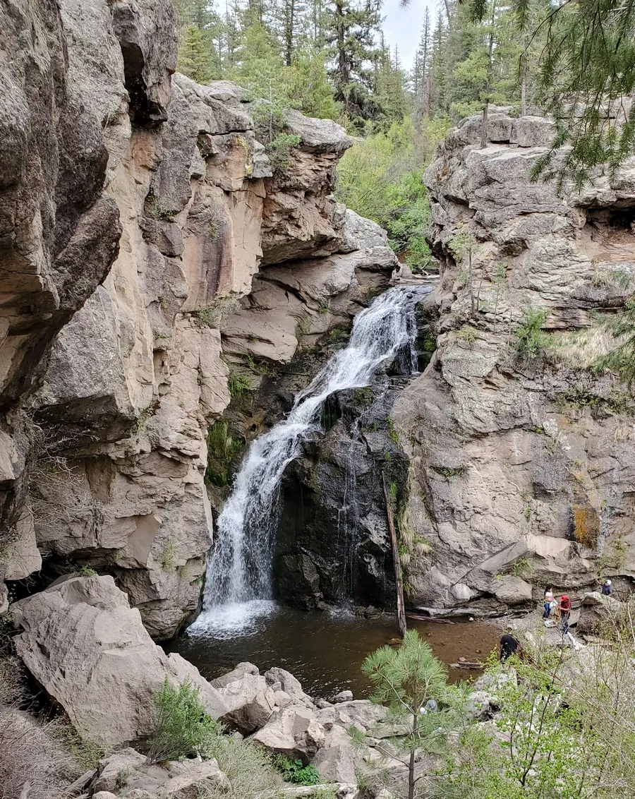
The East Fork Trail (of the Jemez River) is very picturesque. This is Santa Fe National Forest trail #137, 9 miles each way between trailheads on hwy 4: the west end at Battleship Rock 16 miles west along the road from the preserve entrance, and the east end at Los Conchas trailhead, which is 3.1 miles west of the entrance. San Antonio Creek is the "west fork" of the river, joining at Battleship Rock. The next two pictures are from the very nice section from the east end, 3 miles out and back to the spot where the trail climbs up to a mesa south of the river. 6.7 road miles west of the entrance the trail midpoint is at hwy 4, and there is an official East Fork Trail parking area, camping not allowed. At 5.7 trail miles from Los Conchas the trail passes above Jemez Falls, the last picture.
There is the nice Coyote Call loop (first picture) just south of hwy 4, trailhead 1.7 miles east of the entrance. The loop is 2.9 miles; with the extension to Rabbit Ridge it is 5.3 miles.
And the Cerro Abrigo 7.2 mile lollipop loop, with trailhead 9 miles north along the main park road. Second picture, above.
And a bunch of others detailed on the preserve hiking page. Correlate with the map of course. Some would be long drives north from the entrance, and difficult to do considering the gate time constraint.
The elk, deer, and their predators
The elk are interesting; the visitor center puts a telescope on the porch for getting a look at the herds in the central valle to the north. There are too many elk, and a smaller number of mule deer. The preserve has seasonal hunting, but as I discussed with a ranger, other than a few mountain lions we are the only predators of the elk and deer. Bring back the wolves, as at Yellowstone! A trophic cascade would result (a bit in this newsletter June 2020). Here's a good explanation of that phenomena at Nature.com.
Doing the Cerro Abrigo loop (second picture) I startled a bull elk. He tore downhill, antlers crashing through trees, then turned uphill a safe distance ahead of me. In less than a minute he covered a route that would have taken me an hour and I would have been exhausted. Could see him watching me from a good way towards the summit.
There is a road near the Cerro Abrigo trailhead going west up Valle Jaramillo. Can drive up a good ways but there is zero traffic in the event of a vehicle problem. Easy to park somewhere and walk further along Jaramillo Creek. The preserve has constructed areas fenced about 8' high along sections of the creek to exclude the elk and deer. These are separated by unfenced areas. It was quite apparent that the vegetation had been overgrazed in the unfenced areas but was doing well within the fenced. A ranger said the vegetation includes willow. A trophic cascade would include beaver, which would create some wetlands along the creek including the willow and aspen, bringing back a further sequence of other animals and plants.
Las Misiones District Creation Care Festival
Rio Texas Conference Creation Care Connection, led by First UMC-Sonora senior pastor Mark Brechin and facilitated by RTC Director of Mission, Service & Justice Ministries Abel Vega, in 2023 began observing an emphasis on Creation Care as enhancement of Native American Ministries Sunday, which is always 2 weeks after Easter.
An inaugural RTC Creation Care event brought together faith and community groups to provide information congregations need to move forward with their own projects. Alamo Group Chairman Alan Montemayor represented Sierra Club at Centro Comunitario Impacto in San Antonio during Celebración de la Tierra on Sunday, April 23, bringing information to develop a plastic-free lifestyle.
Leading up to the event Impacto Community Center Pastora Liliana Padilla spoke to the participants as she stood next to a giant depiction of Earth that community members had created with “Yo ❤ el planeta” written across it. Araceli Herrera, proprietor of Domesticas Unidas, explained how she uses vinegar, baking soda and non-toxic natural substances to clean houses; then provided demonstrations throughout the afternoon.
Children surged to the Sierra Club table where Alan Montemayor promised to teach them “magic tricks” to impress their friends. As children practiced balancing objects and catching them, they asked Alan how the trick worked, and Alan was ready to explain gravity! During the festival, children learned about trees, watersheds, plastic pollution prevention.
Missions Committee of Iglesia Metodista Unida La Trinidad provided children art opportunities to foster care for Earth and wildlife. Chapel Hill UMC provided face-painting and decals for children and adults. Spring Creek UMC shared the design of its nature trail and member-built labyrinth. Northern Hills UMC utilized the San Antonio River Basin demonstration model borrowed from San Antonio River Authority. Wesley Nurse Marta Ek and Methodist Healthcare Educator Ana Ramirez, RN, provided information. Sisters of Charity of the Incarnate Word of San Antonio shared their journey to forever protect the headwaters of the San Antonio River through acquisition and conservation easement.
Green Spaces Alliance of South Texas, Native Plant Society of Texas-San Antonio chapter, Alamo Group of the Sierra Club, Bexar Branches Alliance, Pax Christi Texas and San Antonio Water System provided consultation to support faith groups throughout the afternoon. The hope for this inaugural event was not necessarily to make the event larger, but to build confidence among faith-based groups to celebrate and lead events in their own neighborhoods in future. Thank you, Alamo Group and Chairman Alan Montemayor, for your support during the inaugural journey!
by Rachel Cywinski, Alamo Group member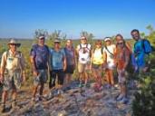
Outings: The Call of the Wild
Visit the Alamo Sierra Club Outings page on Meetup for detailed information about all of our upcoming Sierra Club Outings.
The Alamo Sierran Newsletter
Richard Alles, Editor
Published by the Alamo Group of the Sierra Club, P.O. Box 6443, San Antonio, TX 78209, AlamoSierraClub.org.
The Alamo Group is one of 13 regional groups within the Lone Star Chapter of the Sierra Club.
Changed your contact information?
If you're not sure whether the Sierra Club has your current email address, send an email to Member Services with your name and address and/or member ID (see Locating Your Member ID) so they can add your email address to your member record.
Have you moved? Let us know by sending your old address, your new address and your member ID to: address.changes@sierraclub.org.
Go online for the latest news and events
 |