Northwestern Colorado — Just a Few Spots
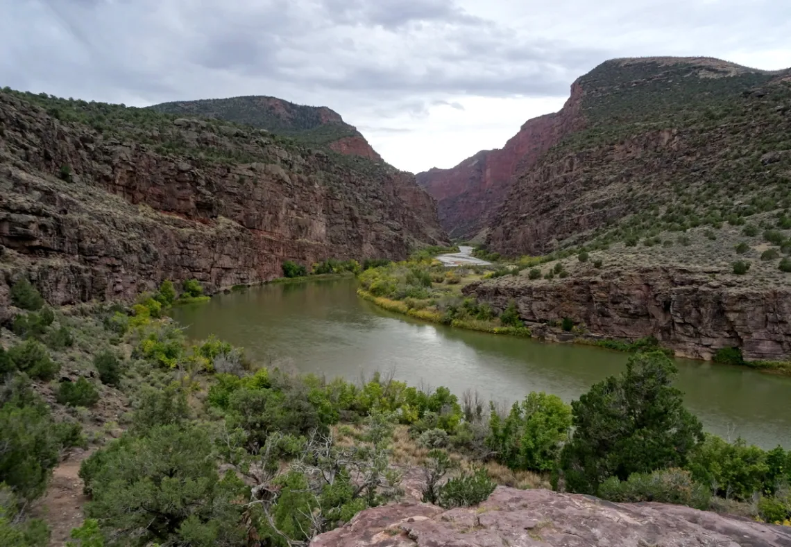
The first picture is in Dinosaur National Monument, on the Green River at the head of Lodore Canyon (pictures all taken October 2015). This was named Gates of Lodore by John Wesley Powell's 1869 expedition down the Green and Colorado rivers.
Here's the park website and maps page. And another with a perspective on the expedition. June 8, 1869 the team was camped likely at what is now the Gates of Lodore campground. The next day they were going down the Green with three heavy wooden dories and lost one at what is now named Upper Disaster Falls.
At the campground I saw a group with big rubber rafts preparing the do the Green, putting in at this historic spot. I asked “what will you do at Disaster Falls?”, they said “run 'em!” Of course, much safer and easier with rubber rafts than what Powell had. The Wikipedia article on Powell mentions that three crew members left the expedition after a few months, tried to hike out to the north, and were never seen again. Apparently Powell could be hard to get along with.
Gates of Lodore is at the far north end of the monument, reached driving south from CO hwy 318, just east of the Utah state line.
That defeated plan for damming the Green; what would have been flooded?
This bit is further to an article in this newsletter February 2019 and a further picture in May 2019. Those two include information about a plan for a dam of the Green in the monument at Echo Park, defeated by a major Sierra Club campaign. What that would have flooded depends upon height of the dam; so how high are other dams?
A Wikipedia article says the highest in the US is 770', Glen Canyon is 710' and Flaming Gorge up the Green in Utah is 502'. Suppose it would have been 500' with 400' water level height. Then looking at PC topo maps as to where 400' difference in water level would take us upstream.
The elevation at the proposed site is 5079', so where upstream would 5479' be? Upper Disaster Falls is only 5279'. 5479' is most of the way up the Green to Flaming Gorge dam, 26 straight-line miles across a large bend, so maybe 50 river miles. Yampa River joins the Green just upstream of Echo Park, with 5479' water level being nearly all the way to the eastern corner of Dinosaur, 19 straight line miles, about 32 river miles.
Therefore: everything in the first two pics of this article and others in the 2019 articles would have been drowned, covered with big lake sections as at Lake Powell behind Glen Canyon dam.
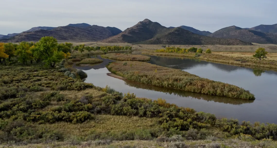
The next picture is at the Green in Browns Park National Wildlife Refuge. Another page with a map (PDF). This place is just north of Dinosaur; if we drive west on CO hwy 318 after visiting the Gates of Lodore it is a short distance.
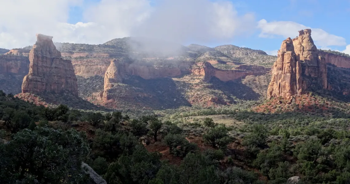
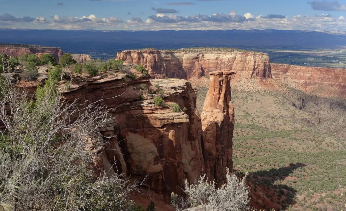
The next two pictures are in Colorado National Monument, southwest of the city of Grand Junction and just east of the Utah state line. While driving in the monument I was shadowed a bit by an inquisitive red-shouldered hawk, much appreciated.
The monument website geology webpage says about the Wingate sandstone, surely what we are looking at in the pictures, “Wind-blown (eolian) sandstone with large, sweeping crossbeds. This is the thickest layer that forms many of our steepest cliffs. ... 200 million years old, 329 feet thick."
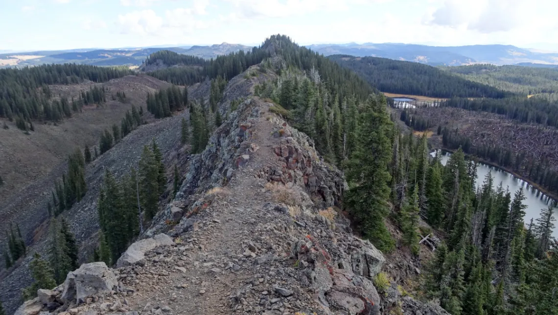
The next picture is on the Crag Crest loop route, in Grand Mesa National Forest, about 50 mi due east of Grand Junction. Not difficult as it looks though best not stumble off the crest. Here's the HikingProject.com page.
Recently remembered that the crest rock was welded volcanic tuff. Searched about this geology and found the Grand Mesa Wikipedia article which says “Grand Mesa is the largest flat-topped mountain in the world. … The mesa is topped by a hard layer of volcanic basalt. This layer formed [about 10] million years ago, by the eruption of at least 27 separate lava flows from a vent in the Crag Crest area".
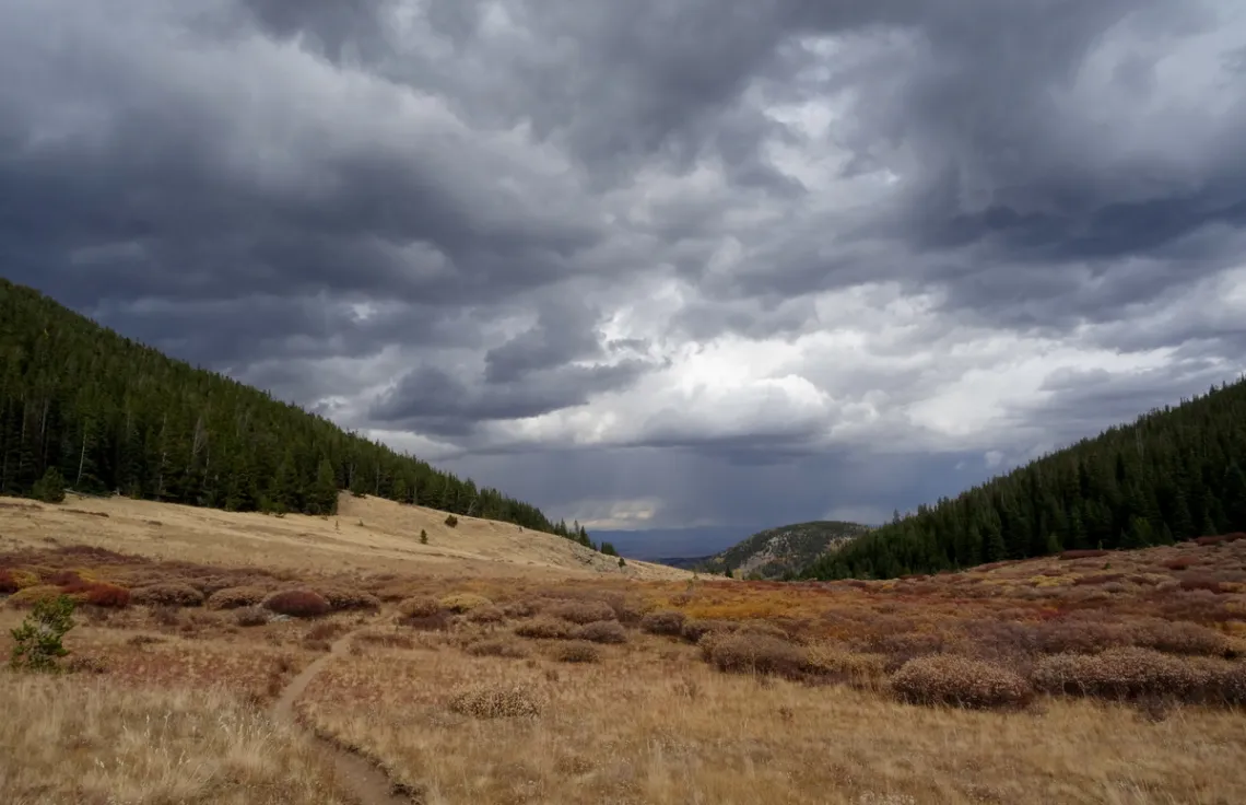
The last picture is in Buffalo Peaks Wilderness, south of Breckenridge. Felt like I was learning stuff about wilderness and water courses. Here's a good state website map of the 12 mi loop comprised of the Rich Creek and Tumble Creek trails. And one at OutdoorProject.com with other details and pictures.
How to Use Permaculture and Build a Food Forest in Your Yard
Our August general meeting features, Stephen Lucke, founder of Gardopia Gardens, discussing how to grow your own food in an urban garden.
Tuesday, August 15th
6:00 pm
Meeting schedule
| Informal get-to-know-you | 6:00 pm to 6:15 pm |
| Announcements | 6:15 pm to 6:30 pm |
| Featured program | 6:30 pm to 8:00 pm |
Venue
This meeting will not be webcast on Zoom. Attend in-person at:
William R. Sinkin Eco Centro, 1802 North Main Avenue
Map
Program topic
By growing food and learning the science behind horticulture, individuals become aware and invested in their overall health. Self-awareness coupled with basic tools for wellness empowers program participants to make their own healthy choices.
Effective interventions are needed to address the growing epidemic of obesity-related diseases and environmental issues. Gardopia Gardens aims to reduce obesity and malnutrition by increasing accessibility to fresh produce and implementing strategic intervention programming in schools, businesses, and community organizations.
Gardopia Gardens provides programs and services to educational, commercial, and residential communities, providing tools, materials, and best practices to ensure their sustainability.
About our speaker
Stephen Lucke is a food systems expert and activist focusing on health and environmental justice who educates and empowers communities on how to lead healthy and sustainable lifestyles through urban agriculture. He became aware of San Antonio’s obesity epidemic and climate crises in his college years, sparking his journey to help find a solution to declining planetary and population wellness that disproportionately impacts BIPOC communities.
In 2015, Stephen founded Gardopia Gardens to help solve the challenges facing his community by working with educational and community institutions to ensure current and future generations have the knowledge and skills to cultivate a high quality of life for themselves and society, fighting against malnutrition-related diseases and environmental degradation.
The Alamo Group of the Sierra Club holds its general meetings the 3rd Tuesday of most months. They're always free and open to the public.
View videos of our past meetings on our YouTube channel or our Facebook page.
Outings: The Call of the Wild
Visit the Alamo Sierra Club Outings page on Meetup for detailed information about all of our upcoming Sierra Club Outings.
The Alamo Sierran Newsletter
Richard Alles, Editor
Published by the Alamo Group of the Sierra Club, P.O. Box 6443, San Antonio, TX 78209, AlamoSierraClub.org.
The Alamo Group is one of 13 regional groups within the Lone Star Chapter of the Sierra Club.
Changed your contact information?
If you're not sure whether the Sierra Club has your current email address, send an email to Member Services with your name and address and/or member ID (see Locating Your Member ID) so they can add your email address to your member record.
Have you moved? Let us know by sending your old address, your new address and your member ID to: address.changes@sierraclub.org.
Go online for the latest news and events
 |