From "The Age of Resilience"
This table is adapted from the text of The Age of Resilience: Reimagining Existence on a Rewilding Earth by Jeremy Rifkin (St. Martin’s Press, 2022).
| 20th century: Efficiency/Progress | 21st century: Adaptivity/Resilience |
|---|---|
| Productivity | Regenerativity |
| Growth | Flourishing |
| Ownership | Access to commons |
| Seller-buyer markets | Provider-user networks |
| Linear processes | Cybernetic processes |
| Vertically integrated economies of scale | Laterally integrated economies of sale |
| Centralized value chains | Distributed value chains |
| Corporate conglomerates | Smaller cooperatives block-chained in fluid commons |
| Intellectual property rights | Open-source sharing of knowledge |
| Zero-sum games | Network effect |
| Globalization | Glocalization |
| Consumerism | Eco-stewardship |
| Gross domestic product (GDP) | Quality-of-life indicators (QLI) |
| Negative externalities (Pollution) | Circularity (no pollution) |
| Geopolitics (economic and military competition or cooperation) | Biosphere politics (regional and global cooperation to protect all of life) |
Preventing and Treating Heat Illness in an Outdoor Environment
Join Sierra Club members Alan Montemayor and Cheryl Hamilton to hear about their first-hand experiences as Preventative Search and Rescue Rangers (PSAR) at Big Bend National Park (BBNP) in far West Texas.
Tuesday, October 17th
6:00 pm
Meeting schedule
| Informal get-to-know-you | 6:00 pm to 6:15 pm |
| Announcements | 6:15 pm to 6:30 pm |
| Featured program | 6:30 pm to 8:00 pm |
Venue
This meeting will not be webcast on Zoom. Attend in-person at:
William R. Sinkin Eco Centro, 1802 North Main Avenue
Map
Program topic
BBNP has seen a dramatic increase in first-time visitors during the past few years, and the number of heat-related rescues and fatalities have increased as well. Because of this, the park implemented the PSAR program in May 2021 to educate visitors in the prevention and treatment of heat illness.
For the past three summers, Alan and Cheryl have lived in the Chisos Mountains for the months of May, June and July. Together with a team of other PSAR volunteers, they have assisted hundreds of visitors suffering from heat related illnesses and saved countless lives.
On a daily basis, PSAR rangers greet visitors at the Chisos Basin Trailhead to guide them towards experiences that will keep them safe and help them enjoy BBNP to the fullest. This trailhead in the Chisos Basin is the busiest destination in the park because multiple hikes begin at this location.
Hikes from the Basin Trailhead range in duration from fifteen minutes to three days, including overnight backpacking in the mountains and desert. Day hikers are the most likely visitors to experience heat illness.
The PSAR team makes sure that visitors have adequate water, food, electrolytes, experience, and knowledge of the trails they plan to hike. They suggest strategies that will keep them safe in the Chihuahuan desert and Chisos Mountains environments. They also alert visitors about what to do if they encounter wildlife such as bears, mountain lions, javelina and venomous snakes.
Using radios, the PSAR team monitors the trails to determine if anyone needs assistance. Nearly every day, one or more PSAR volunteers hikes portions of the Window Trail to assist hikers. The Window Trail has more rescues than any other trail in the park. The PSAR team also joins the park’s Search and Rescue (SAR) team when additional personnel are needed.
Join Alan and Cheryl to learn how you and your family and friends can prevent heat illness in an outdoor environment. Learn about the early signs and symptoms of heat illness and how to assist someone who may be experiencing heat exhaustion or heatstroke. The knowledge you gain from this program may save your life or the life of someone you care about!
About our speakers
Alan Montemayor is the Chair of the Alamo Group of the the Sierra Club. He is a lifelong cave explorer and active environmentalist, specializing in electric vehicles and sustainable water and energy policy.
Cheryl Hamilton is a Texas Master Naturalist specializing in eradication of invasive plants and restoration of habitats with native plants. An avid hiker and backpacker, Cheryl is certified as a Wilderness First Responder with the Wilderness Medicine Institute.
When they are not volunteering, Alan and Cheryl offer sustainable living tours of their San Antonio home, including solar panels, electric vehicle charging, rainwater catchment, native plants and raised-bed organic gardens.The Alamo Group of the Sierra Club holds its general meetings the 3rd Tuesday of most months. They're always free and open to the public.
View videos of our past meetings on our YouTube channel or our Facebook page.
The Great Basin: the Largest Area in North America Where Waters Are Stuck
This is an enormous area from which waters don't drain eventually to an ocean, demarcated by the Great Basin Divide. Included is most of Nevada, much of southeastern California, southeastern Oregon, western Utah and a bit of southeastern Idaho. Here is the Wikipedia article with maps; if we click on the relief map we can see substantial detail.
The article says this “...is the largest area of contiguous endorheic watersheds, those with no outlets, in North America." Excepting as mentioned, the Los Angeles aquaduct, which drains water from the Owens River Valley. A map in the above article shows that much of the Great Basin is the Great Basin Desert. Also included is the Mojave Desert and some of the Sonoran in southeastern California.
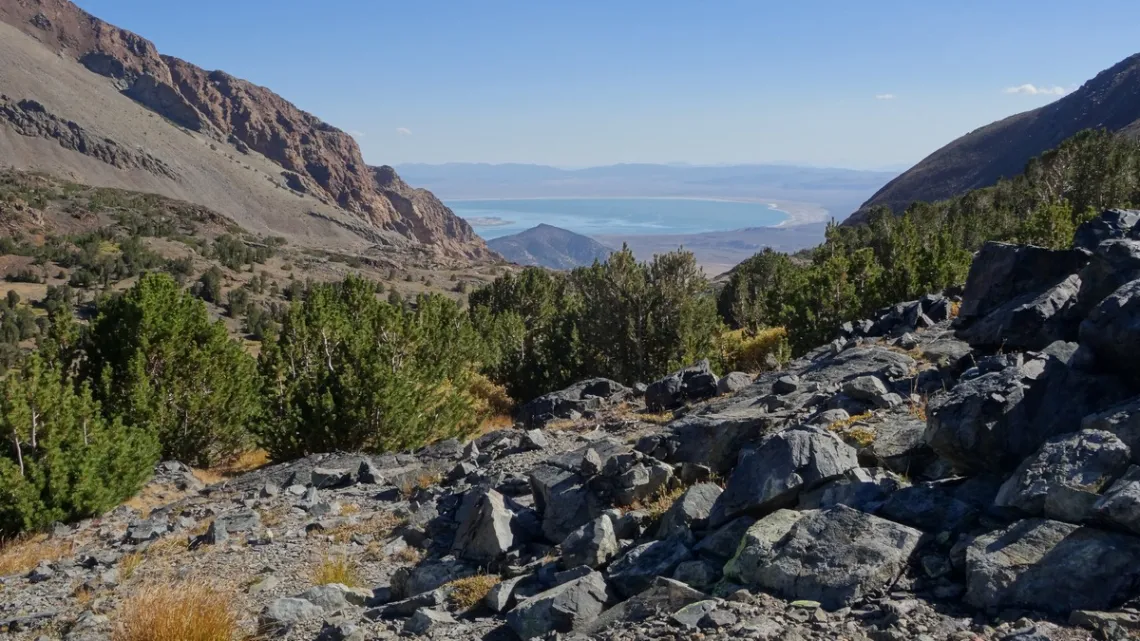
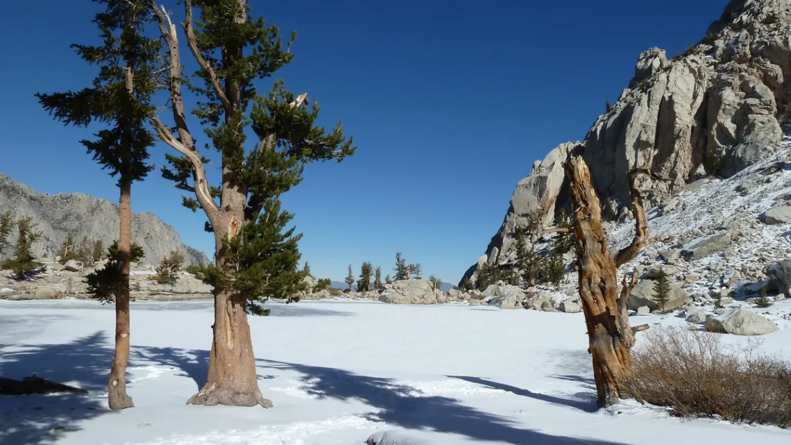
The first picture is just east of Yosemite National Park on the Great Basin Divide, looking into the Great Basin. Drainage ahead, east, is to Mono Lake, in which brine shrimp do well as the water is very alkaline. Drainage behind, west, is to the Toulumne River (article in this newsletter January 2020) and eventually to the Pacific.
Writing this article I was reviewing my pictures from trips in the west and southwest US. Trying to figure out, are those places in the Great Basin? Can I identify more spots on the Great Basin Divide?
The next picture is just east of Yosemite, about 15 miles northwest of the previous picture. Reprinted from September 2019. Looking carefully at watercourses on a PC map app I see a ridge just west is on the Divide.
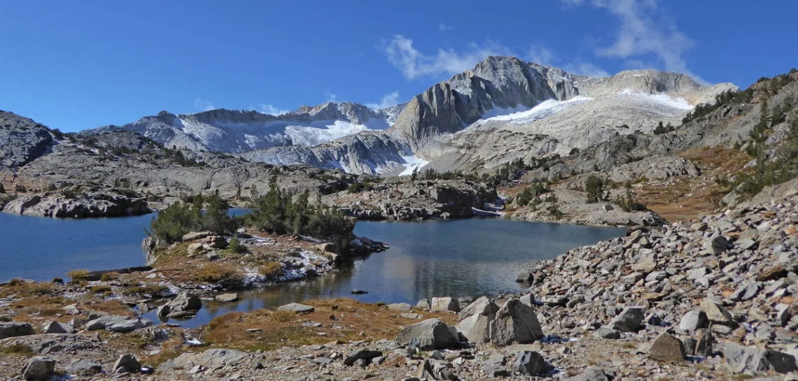
Looking at a Yosemite map (park map download page) we can see drainages southwest from the northeast park boundary to the Toulumne, and northeast from the other side into the Great Basin. Correlated with my PC map also. So: it appears that much of the northeast park boundary is right on the Great Basin Divide, which to the southeast crosses Tioga Pass and Mono Pass. Tioga is on CA hwy 120 and is the east entrance to the park.
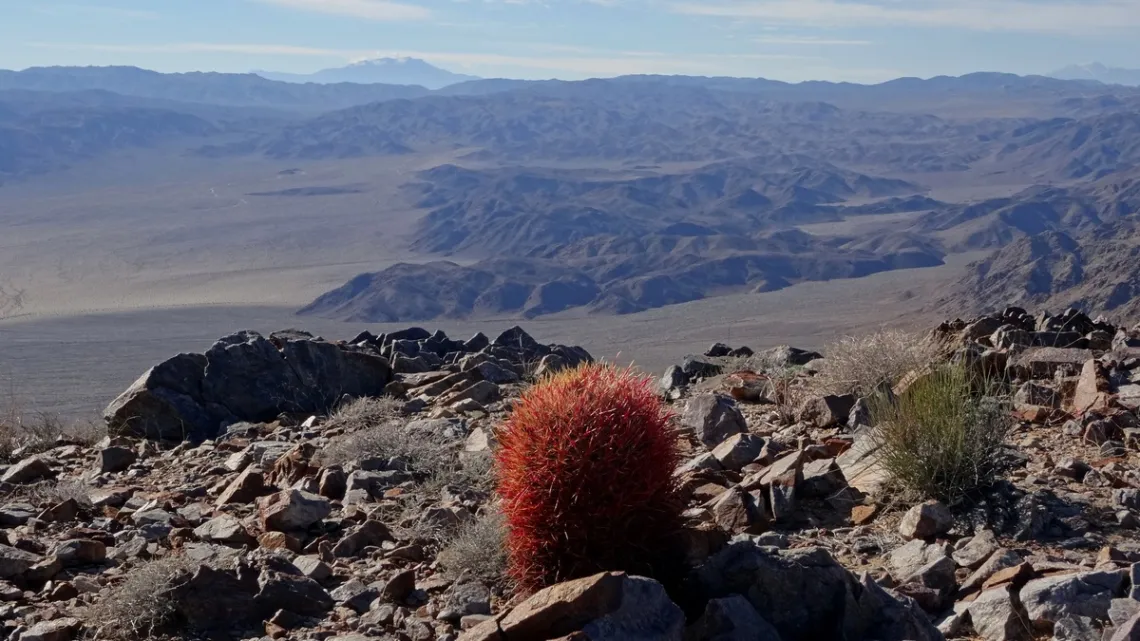
The next picture is in Joshua Tree National Park, which is in the Great Basin. See the caption about a peak in the picture. Then I wondered, the highest peak in southern California? Is it on the Great Basin Divide? Indeed it is.
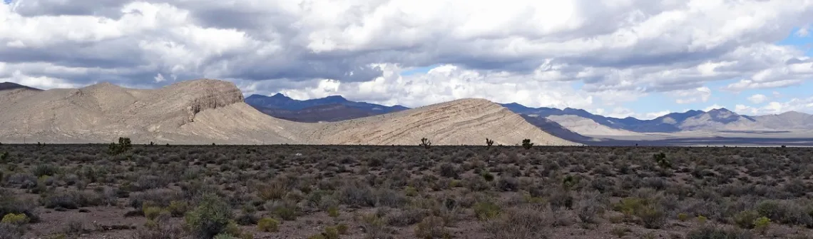
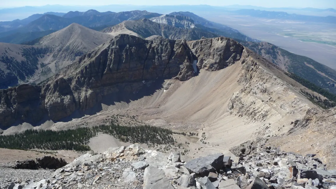
The picture above and the three below are within the Great Basin. The basin and range topography apparent in the next two surely adds to the viewing pleasure. That is about the vast Basin and Range Province, which overlaps with much of the Great Basin.
The article map linked in the initial paragraph shows a bunch of these basins and ranges. From the page link above:
... characterized by abrupt changes in elevation, alternating between narrow faulted mountain chains and flat arid valleys or basins. The physiography of the province is the result of tectonic extension that began around 17 million years ago in the early Miocene epoch.
Other Spots Within the Great Basin
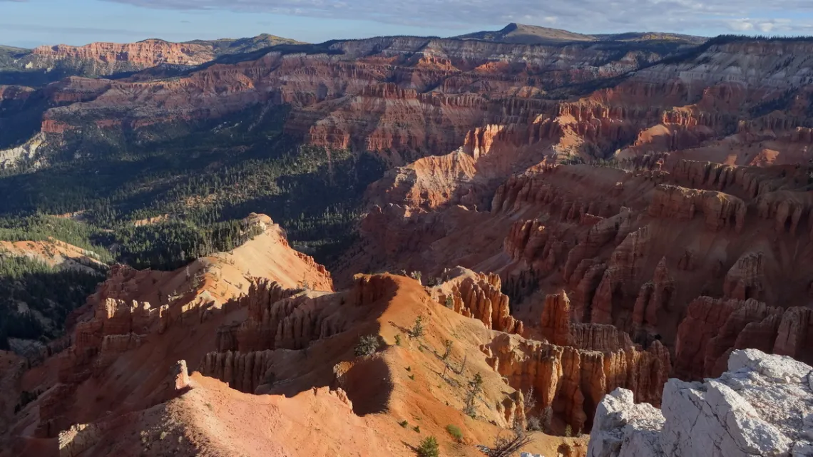
The place is so large there are a bunch, including many scenic spots I haven't visited. One more: Cedar Breaks National Monument, Utah, which is not far northeast of Zion National Park, picture below. Cedar Breaks is drained to the west (left in the picture) by a creek which peters out. But only 10 miles south-southeast are the headwaters of North Fork Virgin River. The Virgin, which runs through Zion, joins the Colorado at the north end of Lake Mead. So it appears the Divide is smack between Cedar Breaks and Zion.
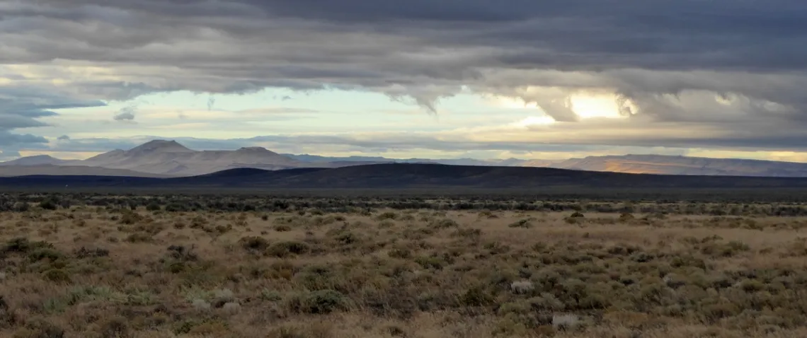
Also in the Great Basin, eastern and southeastern California: Death Valley (June 2019) and Joshua Tree (May 2020) national parks. Mojave National Preserve (May 2016, PDF), Mojave Trails National Monument (March 2019) and Ancient Bristlecone Pine Forest Preserve (December 2017). In northwestern Nevada: Black Rock Desert, and just north of that Sheldon National Wildlife Refuge.
by Kevin Hartley, Sierra Club Life MemberImproving Soil Health in Your Own Backyard to Mitigate Climate Change Impacts
An unsung hero in the effort to respond to and mitigate the impacts of climate change can quite literally be found in your own yard right under your feet. Your soil, when healthy, can be an instrumental tool in helping us face the impacts of climate change while creating greater resilience.
Despite what many think, soil can be so much more than dirt. A healthy soil is alive and full of organisms that help plants access vital minerals and nutrients and is an ecosystem within itself. Improving soil health means managing plants and soils in such a way as to promote soil organisms, especially the microbes that capture carbon dioxide from the atmosphere and turn it into soil organic matter (SOM). It’s this soil organic matter that increases soil’s ability to maximize the benefits of its ecosystem services, which include removing greenhouse gases from the atmosphere; reducing stormwater runoff; recharging aquifers and creeks; biofiltrating drinking water; improving plant health; and allowing us to reduce irrigation.
Compared to the mineral component of soil, SOM “can hold 10 to 1,000 times more water and nutrients.” Soils with high organic matter provide water to plants and soil organisms for longer periods of time during droughts, a crucial role in a region constantly in the midst of droughts and heat waves.
Basically, soil acts as a water savings account. In this matter, it packs no small punch – just a one percent increase in soil organic matter allows soil to hold up to 20,000 more gallons of water per acre per precipitation event when not saturated. And it doesn’t stop there. A one percent increase in SOM could also allow for the storage of up to around an additional 5 tons of carbon per acre, the equivalent of removing up to 29 tons of carbon dioxide from the atmosphere.
In your typical San Antonio residential lot, this one percent increase in SOM could potentially translate to 1,600 more gallons of water stored per rain event and 0.4 more tons of carbon stored, removing 2.32 tons of carbon dioxide from the atmosphere. That all sounds great, you may say, but what can I do? The answer is to make the soil in your yard the healthiest version of itself.
Soil health is degraded by human activity, but it can also be restored through human activity. The top layer of soil contains the majority of SOM and organisms, so protecting it from erosion and high temperature is a priority. Protection can be provided by either vegetation or mulch, but vegetation has the benefit of additional cooling through evapotranspiration. No matter which way your soil is covered, the cooler temperature will reduce the loss of SOM due to microbial action and reduce moisture loss due to evaporation.
To help increase and protect the soil organic matter in this top layer of soil, you can:
- Keep the soil covered,
- Minimize disturbance and compaction,
- Maximize the types of plants and root systems, and
- Maximize root growth.
There are many ways to achieve these four goals, most of which don’t require breaking a sweat or your budget.
Refrain from using chemical fertilizers, pesticides, and herbicides. Herbicides and pesticides don’t stop at killing the unwanted guests in your yard, they also damage the beneficial microorganisms in the soil. Chemical fertilizers can have similar undesired consequences. Instead of chemical fertilizers, add organic material such as leaves, compost, and mulch to your lawn annually.
Reduce how often you mow your lawn and increase the height of your grass. Let grass grow to 4 to 6 inches before mowing and then not less than 3.5 inches (mowing no more than 30 percent of the leaf blade is recommended). Generally speaking, the higher your grass grows, the deeper and more robust are its roots, which translates into less maintenance and less irrigation. Plants and their roots can capture the carbon from carbon dioxide to produce energy and feed microorganisms in the soil, which in turn increases SOM and improves soil health.
In times of drought, minimize mowing your lawn. Higher vegetation and more robust roots are better able to tolerate drought, and mowing during a drought causes additional stress to already highly stressed plants.
Grow diverse native plant species. Minimize mowing year-round by covering portions of your landscape in mulch, with areas of native grasses and wildflowers. These diverse “pocket prairie” areas provide a variety of plant and root systems to support soil health while also offering food and shelter to pollinators and song birds.
To learn more, you can review this explainer and presentation from the Greater Edwards Aquifer Alliance.
by Deborah Reid, Technical Director, and Rachel Hanes, Policy Director, Greater Edwards Aquifer Alliance
Outings: The Call of the Wild
Visit the Alamo Sierra Club Outings page on Meetup for detailed information about all of our upcoming Sierra Club Outings.
The Alamo Sierran Newsletter
Richard Alles, Editor
Published by the Alamo Group of the Sierra Club, P.O. Box 6443, San Antonio, TX 78209, AlamoSierraClub.org.
The Alamo Group is one of 13 regional groups within the Lone Star Chapter of the Sierra Club.
Changed your contact information?
If you're not sure whether the Sierra Club has your current email address, send an email to Member Services with your name and address and/or member ID (see Locating Your Member ID) so they can add your email address to your member record.
Have you moved? Let us know by sending your old address, your new address and your member ID to: address.changes@sierraclub.org.
Go online for the latest news and events
 |