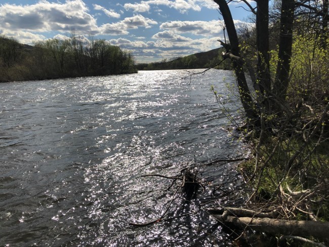
We are constantly monitoring the water quality in the Lehigh River. Probe 1 went in on Thursday March 25, 2021 on the Lehigh River in Palmerton.
Here is a video of the deployment.
The links for our two probes go to a prepared trend of data. Each shows one week of data for four chosen parameters (you can click properties and modify the trend but that takes a little more effort).

Reading the Data:
- Depth = depth of water at the probe site, recorded in feet (ft.)
- pH = acidity of the water at the probe site (less than 7.0 = acidic; above 7.0 = basic)
- Dissolved oxygen (DO) = percent of oxygen dissolved in the water at the probe site (higher percentage = more DO)
- Specific conductance = a measure of dissolved solids in the water at the probe site, recorded in microsiemens (μS) (higher specific conductance = more dissolved solids/possible pollutants)
- Temperature = temperature of the water at the probe site, recorded in degrees Fahrenheit (F)
Probe 1 - is located in Palmerton on the Lehigh River’s east bank just opposite the huge project called North Face. This project is adding about 10 ft or more of fill to cover the old north zinc plant brownfield. My understanding is that when it is done warehouses will be put in there. The fill comes in from NJ and other places so we are monitoring the runoff into the Lehigh which we know is causing pollution. The probe can pick up some aspects of this.
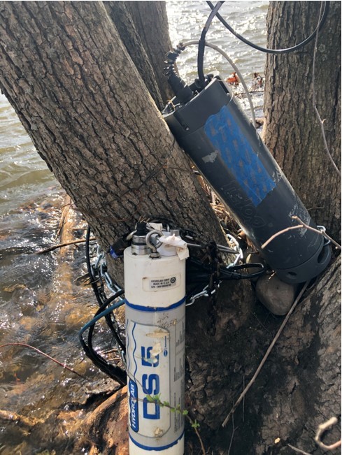
The monitor is a Hach DS5 that measures temperature, pH, depth, specific conductance, dissolved oxygen and nitrates. This connects to a Telog Ru33 cellular modem and data presented at the Telog enterprise web site. Data obtained reveals riverine conditions 24/7 between March and October for myriad Sierra Club conservation and educational objectives.

Probe 2 was deployed at Laurzs Station on April 2, 2021. Here is a video of the deployment of Probe 2.
Lehigh River Water Quality Event
The LV SC conservation program maintains a water quality monitor in the Lehigh for 24/7 monitoring. This year it is located in Palmerton adjacent to the giant clean fill location (project called "North Face" and I believe is intended to create a location for more shipping warehouses). We have worried that if this fill contains toxics they could wash into the river during storms. To monitor for this our group conservation program installed the monitor in this location (see image red circled area).
On April 14, 2020 we had a strong rain event and the red trace below shows the depth climbed from 2ft to 5 ft probe depth, which is significant given the river is about 200 ft wide at this point. It is very interesting to see the specific conductance spike from 150 to 240 during the time water level was climbing. We also see the pH increased during this period from 7.1 to 7.7.
This may indicate solutes (dissolved solids) running off the Palmerton fill site. Normally rain events cause the specific conductance to decrease because water is pure and brown turbid water is suspended solids, not dissolved solids. We see that after the spike the value does drop to a lower level than it was before the storm surge. So my guess is that some material did wash into the river for about 6 hours. It is anyone 's guess what washed in but the data indicates it was a soluble and caustic substance as it caused the pH and conductivity to climb when it washed in.
August 2018 Lehigh River pollution event
The Lehigh Valley Sierra Club collaborates with the Lehigh River Stocking Association (LRSA) in the monitoring of the water quality in the Lehigh River. Each year a water quality monitor is deployed in the Lehigh and data recorded on the probe and also transmitted to a web page. In August 2018 the probe was deployed in the Lehigh at Triechlers (about 3 miles north of Allentown) when a pollution event was recorded.
A report was developed to describe what was observed. In short, it appears that someone spilled or dumped a substantial amount of material with high dissolved solids in the river for 11 days starting on August 20th. It is suspected that due to the substantial rainfall in weeks preceding this event that possibly a company that had accumulated large volumes of waste water may have released this over the course of 11 days.
The report was shared with the PA Fish and Boat Commission and the PA DEP. Their was acknowledgement that there did appear to be an event that occurred. Comments received were that given there were no fish kills reported their was little that they could do.

