June 17, 2018

by Tom Douglas
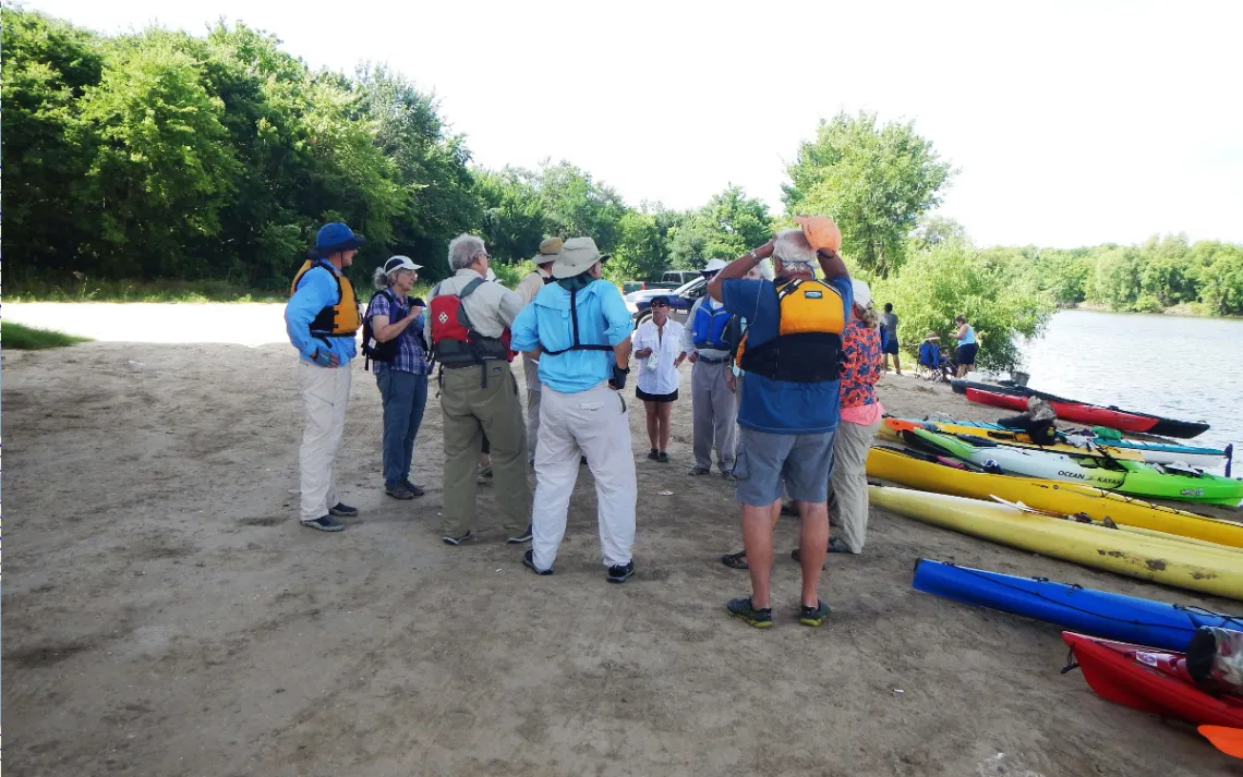
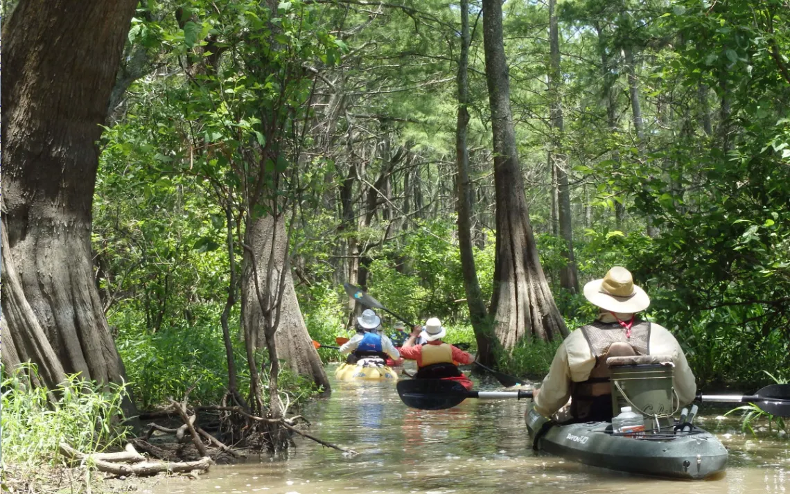
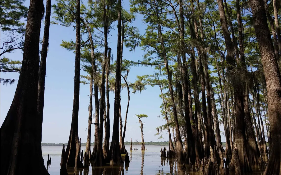
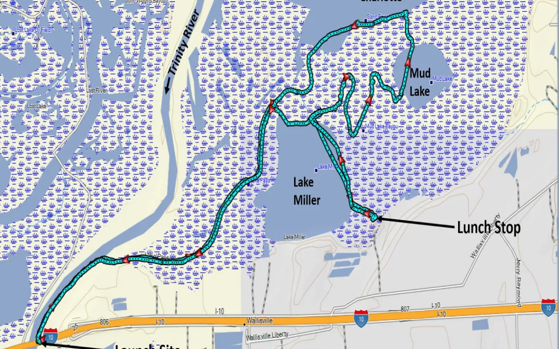
On Saturday morning, June 2, we launched our boats from the east bank of the Trinity River (referred to during the 1600s as the “River of Canoes”) at the Interstate 10 bridge. This choice of launch site was fortunate, since the 10-15 mph winds from the SSW to SSE would have made for disturbed conditions on Lake Charlotte, especially at the alternative Cedar Hill Park launch site. After about 15 minutes of paddling upstream against a gentle current, and with the wind at our backs, we turned east into Lake Pass. Around 1.6 miles farther along, we turned to the south, through a short channel, into Lake Miller, and then yet farther south along the eastern side of the lake. Near the southeast corner of Lake Miller, we paddled into a beautiful, narrow passage that led to our lunch stop. (See the map at the end of the article.) Here, the forest canopy sheltered us from wind and sun, while we rested up and enjoyed getting acquainted during our leisurely lunch.
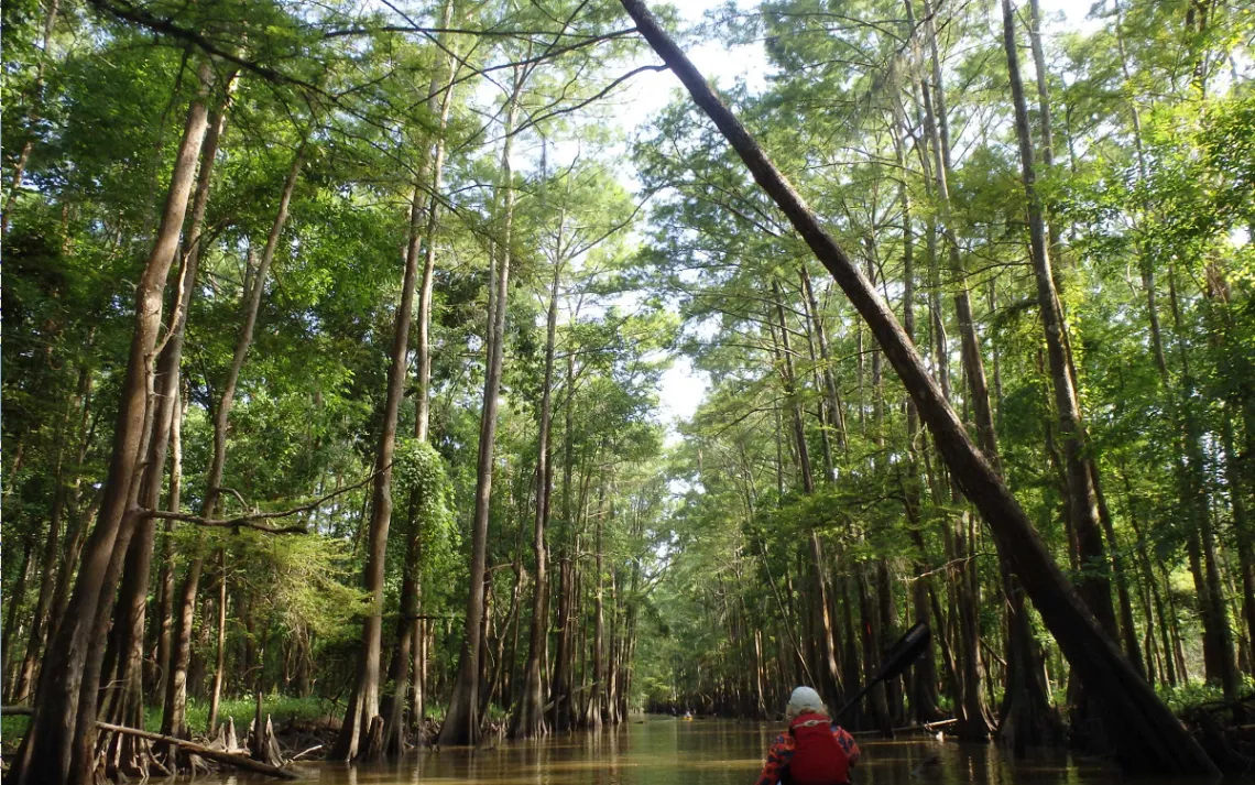
Next came the most challenging part of the trip: Mud Lake Bayou. (If this were a PBS nature show, ominous music would come up in the background at this point.) Our advance scouting party, which had explored possible routes on May 24, found that the water level was a little too low to permit paddling this bayou. But, in the time between the scouting trip and our group outing on June 2, the water level in the swamp had risen by about 3 inches. (At times during each of the three days before our outing, readings from the river gauge at Wallisville, which is only 3.5 miles downstream from Interstate 10, showed that the amount of water coming up into the river from the Bay was even more than the amount of water that was coming down the river from Lake Livingston. You may recall seeing news stories at that time about how the prevailing southerly winds were blowing clear, blue water up to Galveston’s beaches. The effect of the higher-than-normal tides could be seen on the gauge at Lake Charlotte, which was showing a daily tidal swing of about 2 inches.) Bearing all this in mind, we decided to give Mud Lake Bayou a try.
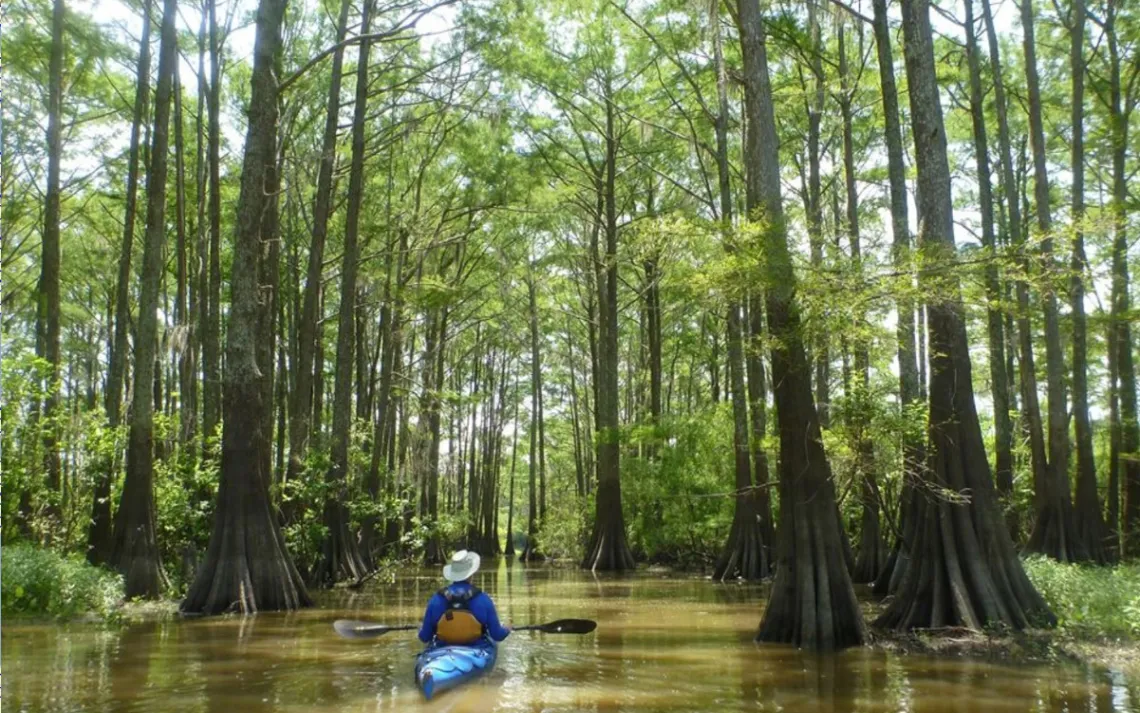
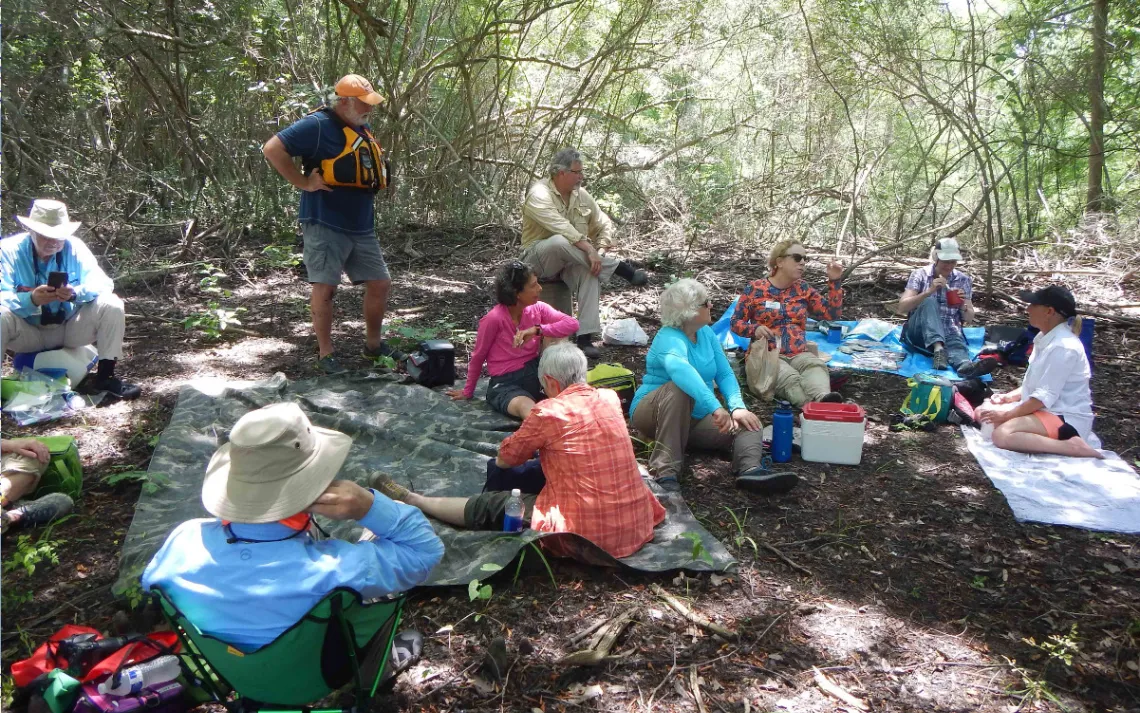
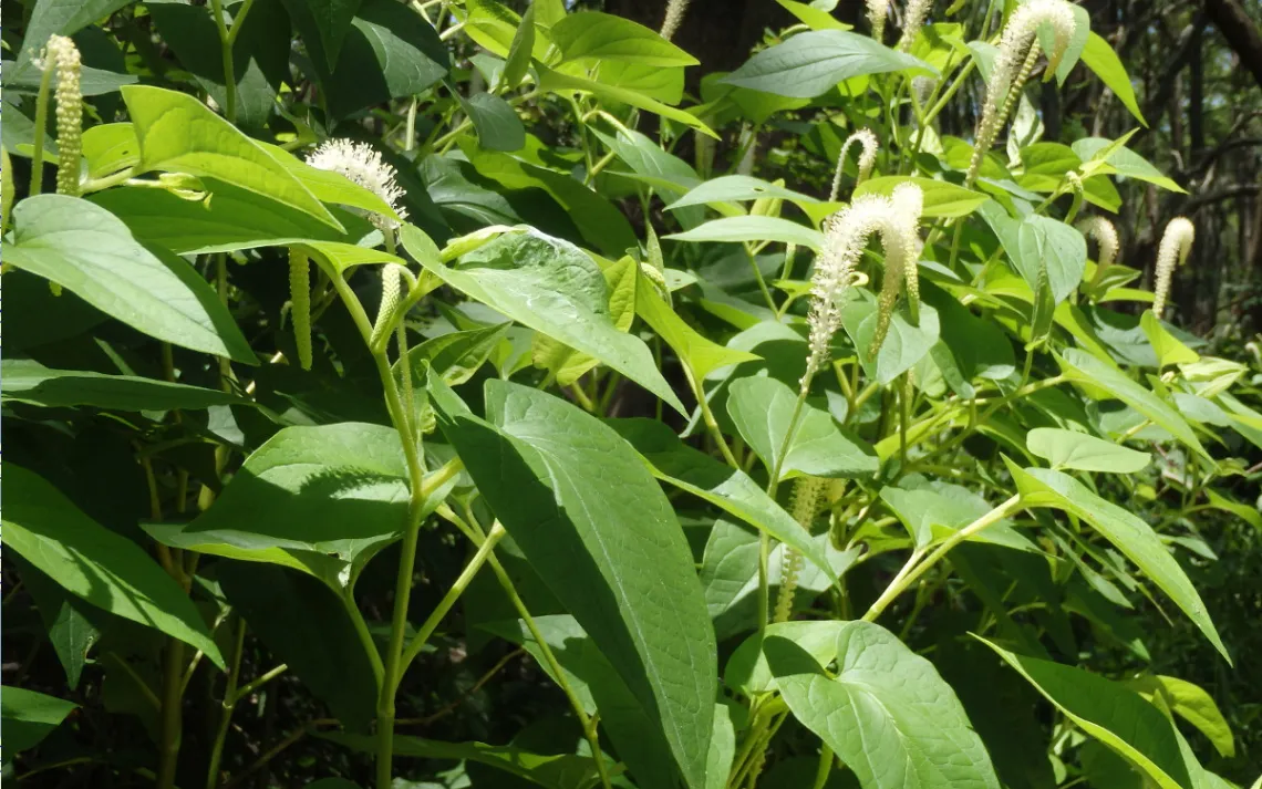
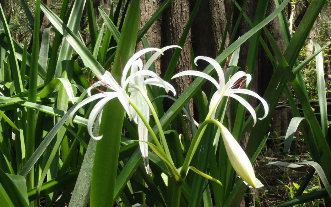
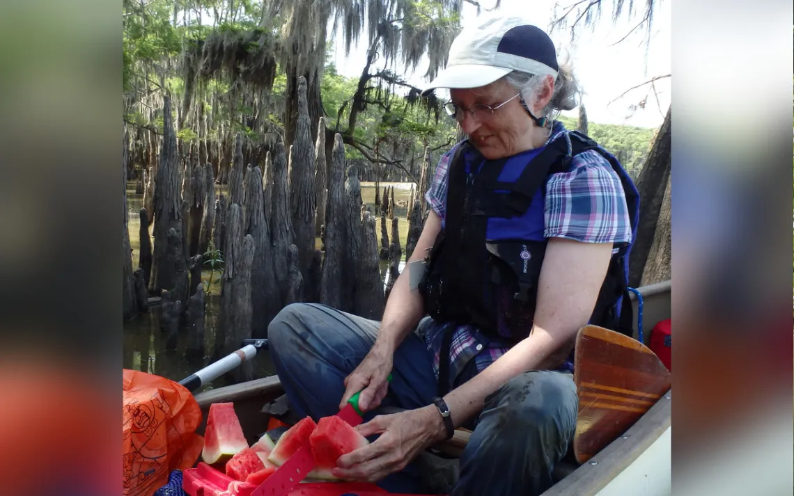
The scenery along Mud Lake Bayou featured many gorgeous flowering plants such as lizard’s tail and swamp lily, although we did find ourselves pushing over and around quite a few tree branches and shallow spots. At one point, Linda Shead helped things along by wading in to pull boats through a particularly tricky spot. After about a mile and a half of this, we came to the final challenge: a barrier of invasive alligatorweed that was truly difficult to push through. Thanks to information provided by our advance scouting party, we knew that this barrier would only extend for a few boat lengths. Then, feeling somewhat triumphant, although tired, we were rewarded with a view of Mud Lake from a shady spot where we enjoyed an ice-cold watermelon, expertly carved by Linda. It was generally agreed that this was one of the best watermelons anyone had ever tasted.
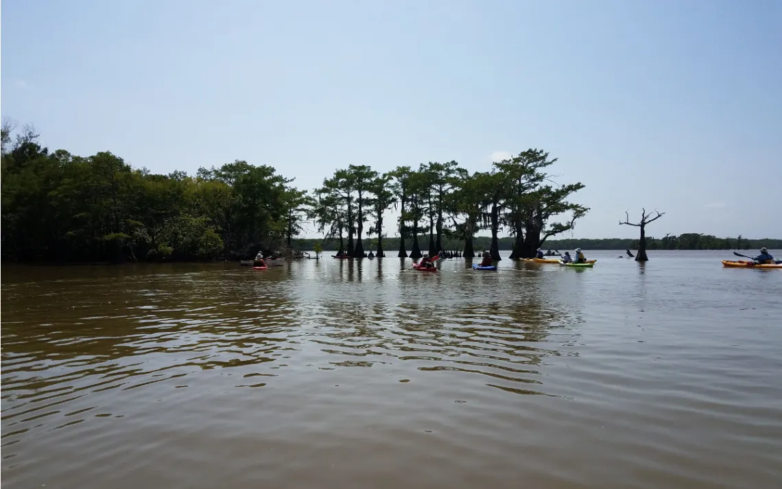
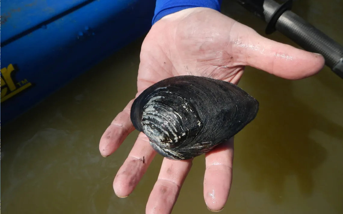
Everything after this seemed magically easy. We cut across Mud Lake, through the woods to Lake Charlotte, and west to Sand Point, where we stopped long enough to observe a specimen of the “round pearlshell” mussel, Glebula rotundata, to supplement an ongoing study of fresh water mussels. Following along the lake’s south shore, we soon reached the entrance of Lake Pass, which we followed back to the Trinity River, and then, to the take-out point at Interstate 10. Given the slow going that we had encountered at Mud Lake Bayou, combined with our 9.8 mile route, the outing finished up later than planned, for which I offer my apology.
More photos of our outing can be seen in the albums posted online by Joe Coker, Bruce Bodson, and Kent Walters. You might also enjoy having a look at the photos and videos of our advance scouting party’s adventure, as chronicled in an article by Natalie Wiest and in additional photo albums by Joe Coker and Bruce Bodson.
Online Resources:
- Trinity River History (Texas State Historical Association) tshaonline.org/handbook/online/articles/rnt02
- USGS Gauge at Wallisville waterdata.usgs.gov/tx/nwis/uv/?site_no=08067252&PARAmeter_cd=00065,00060
- USGS Gauge at Lake Charlotte waterdata.usgs.gov/tx/nwis/uv?cb_00065=on&format=gif&site_no=08067118
- Trinity River Mileage Measurements (Trinity River Authority) www.trinityra.org/default.asp?contentID=97
- Alligatorweed www.texasinvasives.org/plant_database/detail.php?symbol=ALPH
- Photo Albums www.houstoncanoeclub.org/content.aspx?page_id=187&club_id=496051
- Article by Natalie Wiest www.houstoncanoeclub.org/content.aspx?page_id=22&club_id=496051&module_id=301028