The history of a roadless area and the history of a road
By: Jim Vaaler
In 1984 Tonto National Forest had designated a large number of new Wilderness areas: Salt Wilderness, Salome Wilderness, Hells Gate Wilderness, Four Peaks Wilderness, as well as large additions to the Mazatzal and Superstition Wilderness Areas. The Verde River received Wild and Scenic status also. But many excellent areas got left behind either because of the lack of an adopter or because of the remoteness of the location. One such area is the Ash Creek Roadless Area. This area contains the permanently flowing Ash Creek as well as the Salt River's south watershed from the reservation boundary to Gleason Flats. The remote location plus the location of private property inholdings on the Tonto are the reasons why Ash Creek was not looked at. The inholdings at the Canadian Mine and at “Chrysotile” blocked access were it would have been the easiest.

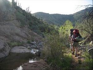
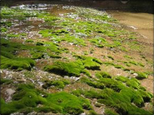
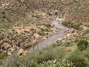
In the spring of 2004, Dan Rupert and Blair McLaughlin and me made the first Sierra Club trip that covered the full length of Ash Creek From the Salt River and up through and past Chrysotile. This was a 2 day backpack that earned the rating of A+. We walked into an almost totally unknown situation and came back having seen one of the most beautiful riparian corridors I have ever seen. Pools, Falls, and Narrows are found here in abundance. Alternating rock layer of Basalt and Limestone make up most of this canyon with the beautiful “Ruin” Granite at the very beginning down at the Salt River. The canyon bottom is filled with Cottonwood, Sycamore, Alder and Walnut trees. The Lower end is in Sonoran Desert and this gradually transitions into a Pinyon - Juniper woodland as you proceed upstream toward the abandoned Asbestos mine called “Chrysotile.” The stream flows year round and would surely be a good candidate for native fish reintroduction.Arizona Game and Fish has apparently been considering Ash Creek for just such a project.
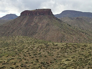
Other parts of this roadless area have abundant archeological values. The “Salt Bench” in the eastern part of the area has an excellent hilltop ruin that overlooks the Salt River. We found many walls, pottery and debitage, as well as two bedrock grinding sites.
The “Salt River Watershed” portion of this roadless area has numerous small and scenic canyons, the best of which is probably Walnut canyon. This ends in a beautiful cascade of about fifty feet, right at the Salt River. This rugged south watershed of the Salt River is home to numerous Black Bears. We had sighted one on a recent Salt River raft trip. The animal was simply wondering around down near the rivers edge.

The Ash Creek Roadless Area remains what it was 20 years ago: A beautiful place, wild in character; an excellent candidate for future Wilderness consideration. There has been one interesting change: The “road.”
1990 the permittee for the Chrysotile allotment - one “Pinky” Norris - decided it was high time to build a road Northeast from his corral at the upstream end of Gleason Flats into the Ash Creek roadless area. Trouble was he didn’t bother to go through the proper channels, do the paperwork, and get the necessary permits. I knew about the existence of this road from previous raft trips on the Salt River and had heard that it was unauthorized. After asking the Globe Ranger District for information on this “road” in mid March of this year and getting no response, I filed a Freedom of Information Act (F.O.I.A.) request with the Phoenix office of Tonto National Forest in May of this year. I got back 85 pages of documents relating to this “road,” plus lots of information on Mr. Norris’ ranching practices (or lack thereof). If you have what you think is an illegal road into a potential Wilderness Area it is important to be able to prove that this “unauthorized road” cannot legally jeopardize the area's suitability for Wilderness. Statements such as the following will be of great help:
Nov. 2, 1990
Subject: Chrysotile Allotment, unauthorized work at Gleason Flats.
In the course of the ride, we noticed a new road northeast of Ash Creek and rode to inspect the area. We found that the following work had been in the area. Among other things it was stated that; The old cattle trail proceeding northeast from Ash Creek had been worked with a bulldozer and was the road we had seen from a distance.”
-Larry Widner, District Ranger
Dec. 13, 1990
Subject: Letter to Mr Norris from the Phoenix office of TNF.
I have delayed until this time to respond to your letter of October 29th, 1990, pending a full report from District Ranger Larry Widner on the unauthorized construction and/or reconstruction of range improvements, by yourself, on the Chrysotile Allotment. This work has caused considerable disturbance to vegetative, soil, and archeological resources without the authorization of the appropriate Forest Officer. The work and resulting disturbance includes cleared lines for fence reconstruction and construction, lines cleared for cattle trails, road construction and reconstruction, areas cleared for corral construction, and a stock tank with wing ditches. A total of approximately 3 miles of fence line, 1.5 miles of roadway and an approximately 2 acre area for a new corral were cleared without authorization.
-James. L. Kimball, Forest Supervisor
Jan. 24, 1991
Subject: Letter to Mr. Howard “Pinky” Norris from Globe Ranger District
As you have been told repeatedly over the years, you needed to get our approval before beginning this work; especially before using a bulldozer on public land.” and “I suggest that it would be a good idea if you refrained from any more threats to shoot me or any of my staff.”
-Larry P. Widner, District Ranger
Oct. 7, 1991
Subject: Letter to Mr. Norris from Phoenix Office of TNF.
As you are aware our agency conducted an investigation into the allegations that you had (1) threatened and interfered with some of our employees while they were performing their official duties and (2) that you constructed roads and bulldozed clearings for other projects on National Forest lands without the proper permits.
-James L. Kimball, Forest Supervisor
Violations
Here are the specific regulations that Mr. Norris violated as referenced in a letter to Mr. Norris from James L. Kimball (Forest Supervisor) dated Dec. 13th, 1990.
1) 36 CFR 26.10(a) prohibits the construction of trails, roads, fences or other improvements on National Forest land without proper authorization.
2) 36 CFR 222.9 (b)(1) having to do with the installation and maintenance of structural and non-structural range improvements and proper authorization for such work.

And in a letter dated Feb. 16th, 1996 it is apparent that Mr. Norris has no wish to maintain the Walnut Canyon riparian grazing exclosure after he himself overgrazed the area In a letter dated Aug. 11th, 1997 to Mr. Howard and Lee Norris: “On July 21, and 22, 1997, an inspection was made of the Gleason (boundary) and Ash Creek pastures. This inspection revealed that you have placed salt in the Ash Creek Riparian Pasture, opened the gates, and are willfully allowing your cattle access to the Ash Creek Riparian area even though there was no standing water in Ash Creek for your cattle. In this situation, salt was used to purposefully attract cattle into the riparian area. This in turn has resulted in grazing utilization in excess of 80% use on herbaceous and woody riparian dependent species.”
The lengthy and detailed correspondence record reveals clearly you have been notified and are well aware of the reasons the Ash Creek riparian pasture was created. Now you are clearly and purposefully using salt to attract livestock into this area. This is particularly disturbing since your livestock have easy access to water in the Salt River.” Both of these correspondences were from Larry Widner, District Ranger for the Globe Ranger District of TNF.
Pinky” strikes again, and again, and……….Needless to say the list of Mr. Norris’s awful grazing practices could go on and on. I have just listed a couple.
Picacho IRA
General Description

This small but diverse IRA lies tucked away in the extreme east central part of Tonto National forest on the Globe Ranger District. The unit contains just under 5,000 acres and lies wholly within Gila County. The area is bounded on the east by the San Carlos tribal lands, on the north and west by the Salt River. The southern boundary roughly follows the Ash Creek/Salt River rims back to the tribal boundary. There are two cherry stemmed roads along the Salt River rim boundary, F.R. 473A and F.R. 382. Much of this IRA’s boundary has excellent topographic protection. The private property at theMine is still a functioning mine and has a locked gate.
Recreation
There are no system trails within this IRA. There is an illegal and unused dozer track that roughly parallels the Salt River and begins at the corral at the north end of Gleason Flats. This dozer track has been documented as illegal. Please refer to F.O.I.A. control number TON-2004-022 for further information. At some point in time it would be possible to convert this dozer track to a hiking trail as it provides excellent views of the Salt River. Backpacking the length of Ash Creek from the Salt River to Chrysotile is a cross-country journey that takes one into areas that are of national park caliber. Much of this area may also be accessed by rafting the Salt River. There area has a number of beautiful side canyons the feed into the Salt River: Regal and Walnut Canyons, as well as an unnamed tributary entering the Salt River just upstream of Exhibition Rapid. All three of these make excellent dayhikes while rafting the Salt River.
Wildlife
Ash Creek has been proposed as a reintroduction site for threatened and endangered Arizona native fish. There are also small native Frogs is Ash Creek, indicating that Crayfish have not been introduced into this spectacular drainage. Black Bears frequently come down to the banks of the Salt River in there search for food. Mountain Lions, Javelina, Bobcat, Deer, and Coyote also inhabit the rugged extremes of this area. Hawks and Eagles soar above this area as they conduct there daily search for prey.
This IRA has an elevation of about 2,900 ft. along the Salt River at Gleason Flats. Saguaro Cacti occur in abundance here, as well as many other indicator species for the Sonoran Desert. The area then goes through an abrupt floral transition, achieving as elevation of nearly 5,000 ft. in the Pinon/Juniper woodlands near Crysotile. The riparian corridor of Ash Creek contains numerous water loving trees: Cottonwood, Sycamore, Ash, Alder, and Walnut would be a partial listing.
Geology

As one rafts the course of the Salt River through this area, the dominant geologic feature are the dark grey basalt cliffs that rise up near the river’s edge. Further downstream, the river cuts through the Ruin Granite Formation and forms a small inner gorge upstream of Gleason Flats. Ash Creek canyon is cut through Basalt and Limestone layers. Shortly before Ash Creek enters the private property at Chrysotile, small layers of Asbestos may be seen. Asbestos is a product of thermal “contact metamorphism” between Limestone and Basalt. At the mouth of Walnut Canyon much “beach rock” can be seen in the layered Siltstone at river level.
Cultural/Archeological Values
The rim of the Salt River Canyon contain a number of prehistoric hilltop compounds. These served as year round habitation sites, but were also defensive in character as is evidenced by there construction. The private property at Chrysotile at one time was one of the largest Asbestos mines in Arizona. It produced nearly all of the Asbestos that was used in the construction of Hoover Dam. The mines at Chrysotile have been abandoned for many decades now, and the old town has been subdivided into 2 or 3 different private properties. Most of the structures dating from the mining era are still standing, many in remarkably good condition.
Watershed
Ash Creek is a spring fed, perennial creek that has it’s headwaters in the Timber Camp and Carol Springs Mountains south of Chrysotile. Ash Creek is one of the larger tributaries to the Salt River. It is comparable in size to other better known Salt River tributaries such as Cebique, Canyon, Cherry, and Pinal Creeks. Walnut Canyon forms a beautiful cascade where it enters the Salt River just downstream of “Boat Eater” Rapid. The Salt River itself is part of a much greater watershed that originates in the White Mountains of eastern Arizona. Managing this IRA in an environmentally sensitive manner will be doing a small part in keeping the waters of the Salt River in a pristine condition.
Other Resource Values
- Grazing
- Mining