For the past 50 years, the Boise River Greenbelt has been one of the Treasure Valley’s most beloved parks. The 25-mile pathway serves as one of the more popular alternative transportation routes for commuters. Now, we, along with the Idaho Conservation League, Boise Bicycle Project, Conservation Voters for Idaho and the Treasure Valley Cycling Alliance, believe it is time to develop a similarly ambitious vision for the next 50 years of pathway development to truly connect our entire community.
Investments in off-road travel corridors can increase alternative transportation adoption and reduce vehicle miles traveled. As development proliferates around the Treasure Valley, cities and counties are producing and executing master plans for pathways without a focus on cross-municipal connectivity as a guiding principle. We need a collective plan that connects the Treasure Valley, creates priority areas for public transportation investments to increase commuters that mode shift (walk/move/bike to public transit), and influences the smart development of our communities while capitalizing on a uniquely valuable recreation resource. Now is the time for city, county and state leaders to plan a valley wide, multi-use pathway system utilizing our existing canals.
Join us in asking our city, county and state leaders to collaborate on the development of a Treasure Valley multi-use pathway plan that utilizes canals to connect our communities, provide transportation options for all, build an investment strategy for public transit routes and bring open space to every neighborhood.
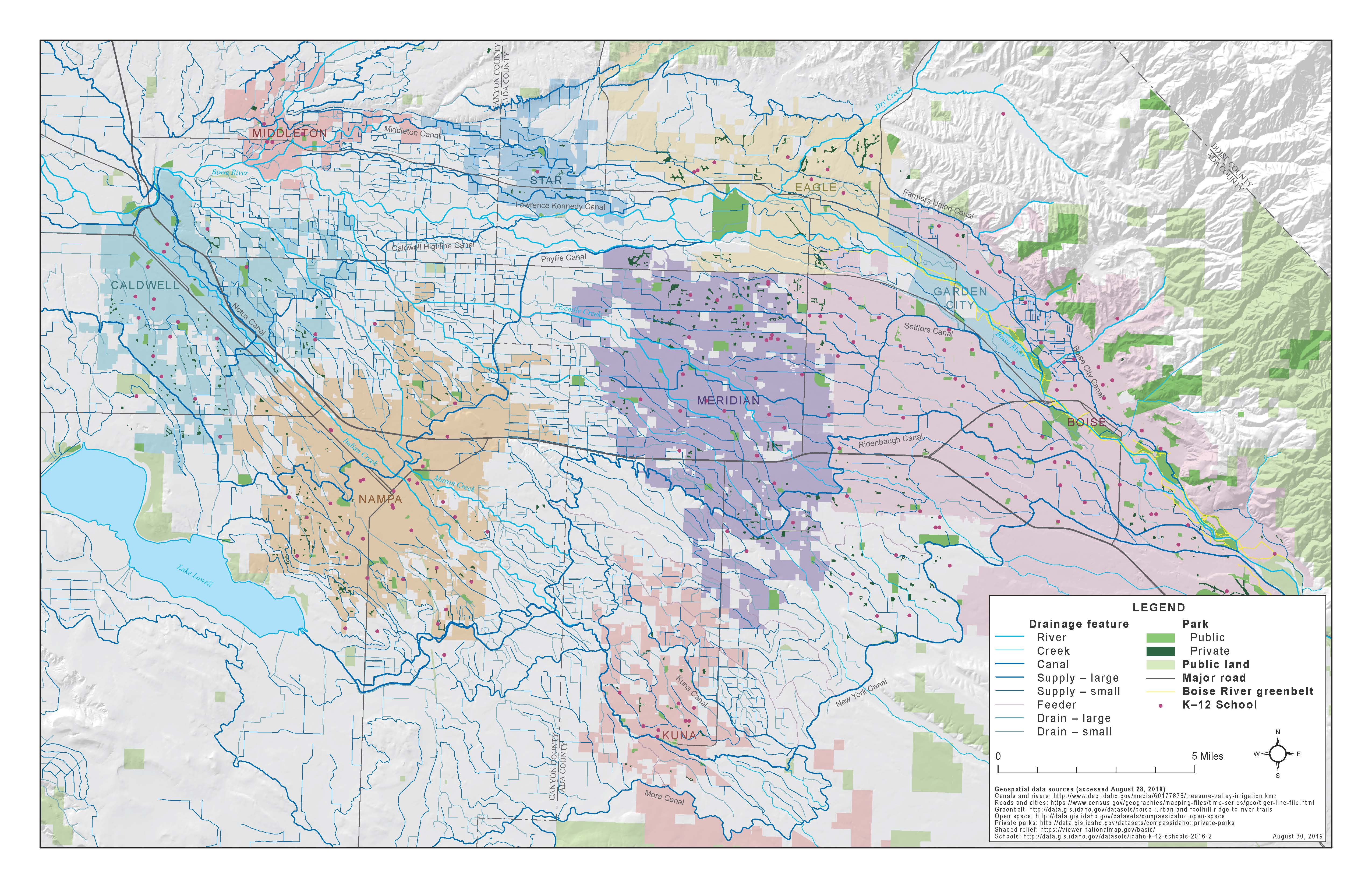
Every day, hundreds of thousands of Treasure Valley community members drive over canals that cut through the city, many likely not realizing they are crossing flowing water. There are a total of 66 irrigation districts serving Ada and Canyon counties. Together they distribute water through 1,500 miles of canals, laterals, and drains in southwestern Idaho and eastern Oregon. That's more miles of waterways than Venice and Amsterdam combined: Venice has about 26 miles and Amsterdam has 60 miles.
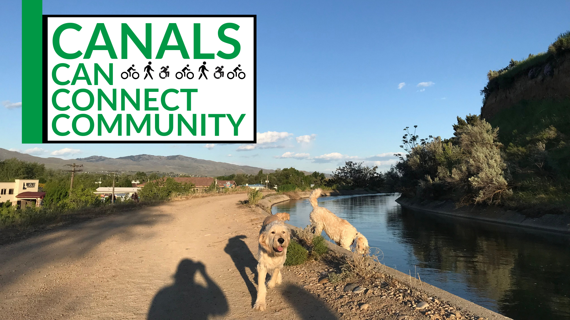
Because canals and laterals provide the water necessary for hundreds of thousands of residents to water their lawns and grow their crops, they are a natural network winding through and connecting our community. They are also open spaces, preserved from the pressures of development through easements. Today in many neighborhoods canals are de facto pedestrian pathways, bike ways, and dog parks.
Canals have maintenance road and easement setbacks that don’t interface with major roads so they present a unique opportunity to build new multi-use pathways in neighborhoods throughout the valley. This is critical because 73% of respondents in a local survey said that a lack of safe bike routes is their primary obstacle for using cycling as a transportation option. Canals, an option for off-road pathway development, can be part of the answer!
 We would like to see irrigation districts, cities, counties, and state leaders in the Treasure Valley come together to open our extensive canal system as a transportation corridor for pedestrians and bicyclists. We would like a plan that focuses on connectivity, linking neighborhoods across the valley to community centers, schools, parks and public transportation facilities. It is time to revive these canals as iconic landmarks and community-gathering spaces. As safe routes to schools, commuter pathways and open space for neighborhoods.
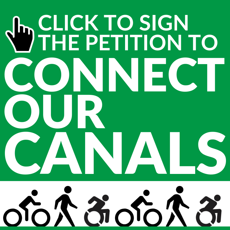
We see this canal network as a critical way to develop interconnected communities throughout the Treasure Valley.Do you want to see our canal connectivity vision come to life in the Treasure Valley? Sign our petition and join the conversation today!
We have seen this be successful in other metropolises like Denver and Phoenix. In addition, we have seen several awesome examples from several cities in the Treasure Valley!
In Meridian, canals are a critical part of their Pathways Master Plan and their Downtown Meridian Neighborhood Pedestrian and Bicycle Plan. The plan specifically lays out the vision for developing an “extensive pathway network stemming from the existing canal system within and around the City”. They note in the document that “There are numerous irrigation canals and ditches that cross through the City of Meridian that provide excellent pathway opportunities. A number of these canals are already utilized as pathway corridors, and working with the irrigation districts to provide pathways along the many of the remaining canals and ditches will be critical”. One of those pathways that currently exists runs along the immense and beautiful Ridenbaugh Canal.
In Nampa, the city cites canals’ potential in their Bicycle and Pedestrian Master Plan, saying “There are numerous irrigation canals and ditches that cross through the City of Nampa that provide excellent pathway opportunities and in some cases, regional pathway connections”. A variety of pathways already along canals. The Phyllis Canal pathway is a critical connector for a major transportation corridor shared by Nampa and Caldwell. The Deer Flat Canal Pathway is a critical connection between several bicycle boulevards.
In Caldwell, they have pathways along the Phyllis Canal and Deer Flat Canal, with plans to develop along many other major canals sited in their Pathways and Bike Routes Master Plan. In Eagle, their brand new Pathways & Trails Plan it is identified that there are about 45 miles of canals and ditches that could potentially support pathways.
In Boise, Horizon Elementary School has a walking path from a community neighborhood along the Ridenbaugh Canal that includes a crossing bridge and fencing, a perfect safe route to school! The brand new Whitewater Park and development along the Boise River Greenbelt includes access for walking & biking along canal easements. A new project is slated for Settlers Canal in West Boise that revamp open space along the canal bank to provide neighborhood park in front of Capital High School with the potential to extend to connect to Hyatt Hidden Lakes Reserve. The Penitentiary Canal is actually a segment of the Boise Greenbelt along the Boise River and the same pathway has a pedestrian bridge over Settlers Canal.