Paddling the Lower Mississippi Ain't a Huck Finn Journey Anymore
Levees, dams, and industry give the river a brutal allure, but the pelicans don't care
PHOTOS BY RORY DOYLE
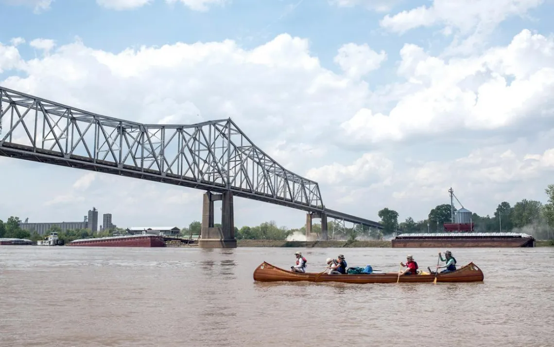
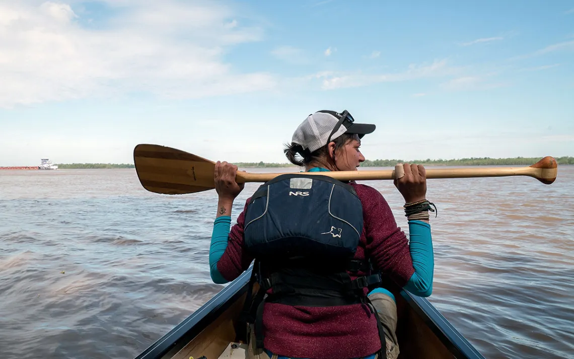
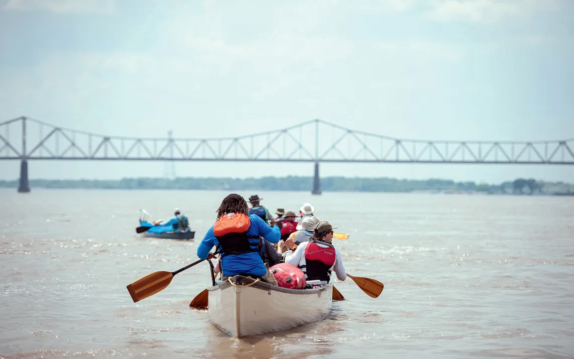
Paddling a handmade canoe under a bridge in Helena, Arkansas, en route from St. Louis to the mouth of the Mississippi.
JUST BEFORE SUNSET ON MARCH 20, 2017, at a boat ramp on the Missouri River three miles above its confluence with the Mississippi, John Ruskey took his daily dip. Then he tied back his graying hair, donned his trademark battered hat, and walked the first canoe into the water. There were 13 of us at the launch of the expedition, in two 29-foot cypress-strip canoes that Ruskey had built himself.
You could smell my inexperience—quite literally, as I had managed to shatter a bottle of whiskey on the boat ramp (I’d thought it would make a nice treat after long days on the water). For the next week, until other scents prevailed, my clothes would give off a sweet and heady aroma.
Then, on the very first night, I left my rain jacket lying on the beach. I didn’t realize it was missing until the next morning, when a guide conducting a “dummy check” of the camp lifted it up and asked to whom it belonged.
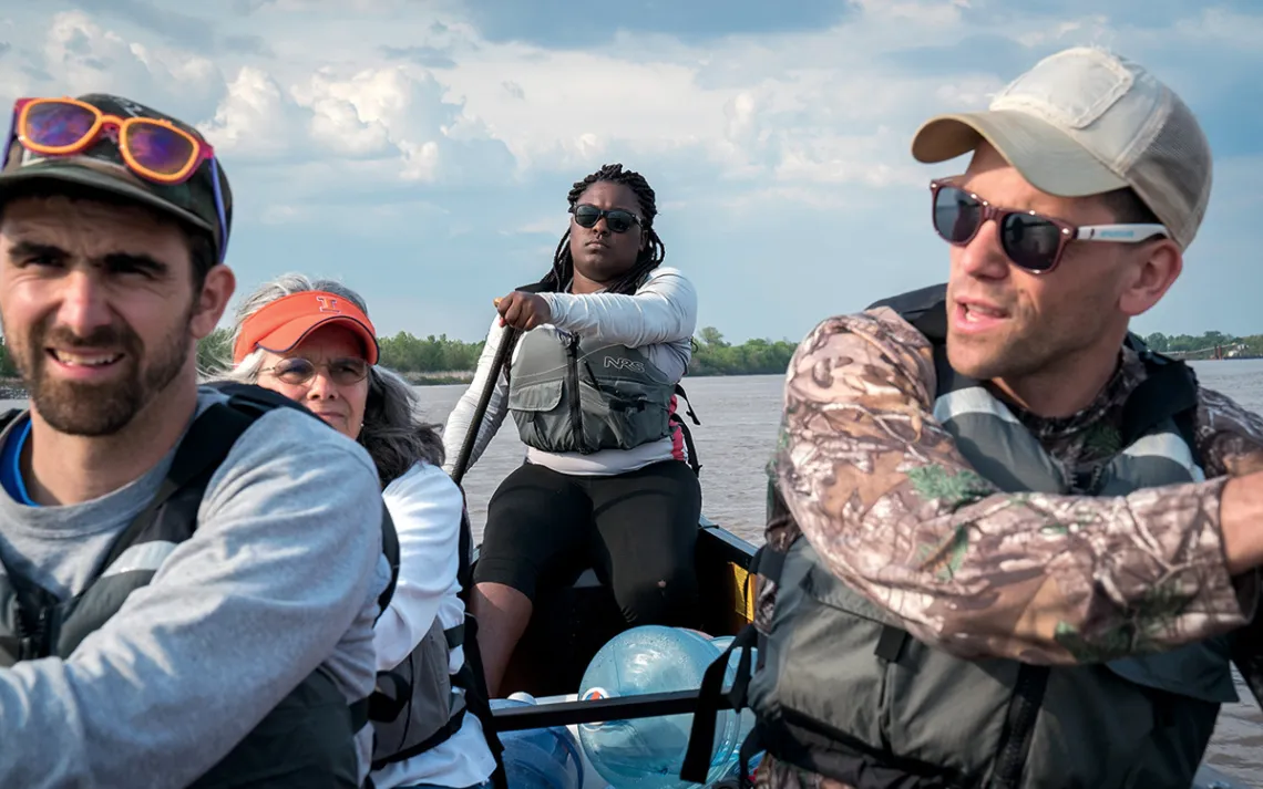
Guide Lena von Machui waits for barge traffic to pass on the Mississippi River.
The next night, I spotted a great clearing for my tent atop an eight-foot cutbank overlooking the river. As I climbed the hill to get there, I stumbled through a thick patch of cockleburs. I left the vestibule open so I could hear the river as I drifted off to sleep but forgot to account for wind direction. When I woke in the morning, a layer of sand skittered atop my sleeping bag, and the temperature was a chill 35 degrees.
When my friend John had told me he was planning this trip from St. Louis to the mouth of the Mississippi River, I was mourning the death of my father and watching a six-year relationship fall apart. I was in need of what Thoreau once called the “tonic of wildness,” and a six-week Huck Finn adventure had seemed the perfect cure.
But as prominently as the Mississippi figures in the American imagination, it is today a far different waterway than in Mark Twain’s day. In many places, the river has been entirely remade, hemmed in by levees three stories tall, bristling with wing dams, its bends paved in concrete. I wondered whether a river so tamed could provide the tonic I needed.
That sandy, prickly campsite gave me an answer. As darkness settled, a flock of red-winged blackbirds curled away like wind-carried smoke. The artificial constellation of downtown St. Louis winked to life downstream as coyotes yipped. When I woke that cold morning and saw those lights still trailing across the water, I decided it was the best campsite of my life.
WHEN RUSKEY FOUNDED the Quapaw Canoe Company in 1998, it was the first-ever guiding service on the Lower Mississippi. In 2011, he launched a series of one-to-two-week expeditions; over six years, he has covered every stretch below St. Louis at least four times. Ruskey paid attention to the islands in different seasons and noted at what water level the best sandbars disappeared. He compiled his observations online into what he calls The Rivergator, a mile-by-mile guide to help paddlers decide where to launch, where to camp, and how to pick up food and supplies. (The name is a riff on Zadok Cramer’s The Navigator, a popular manual for river-bound pioneers in the early 19th century.)
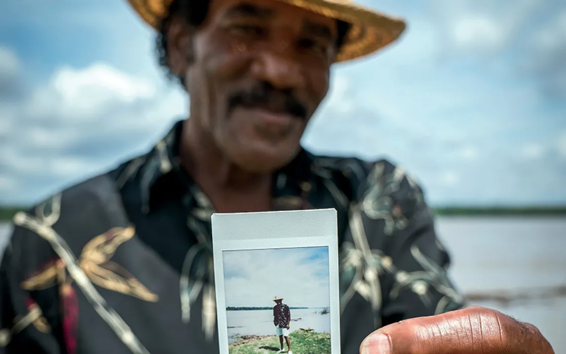
Veteran Quapaw Canoe Company driver Ellis Coleman holds up a Polaroid of himself at Terrene Landing in Bolivar County, Mississippi.
In 2017, with the project finally finished, Ruskey assembled a ragtag group of friends and followers for a final, celebratory downriver journey. He wanted to include as many people as possible, so our membership was ever shifting: Some paddled for an afternoon, some for weeks at a time. By trip’s end, 54 people had participated, with three—myself, filmmaker Chris Battaglia, and Kiwi adventurer Andy McLean—completing the entire trip.
We spent our first night on Duck Island, a mile-long strip of sand and willows at the confluence of the Missouri and Mississippi Rivers. Upstream, the second-largest oil refinery in North America grunted through the night, flickering with floodlights. In the trees above us, bald eagles peered down from their nests.
There was a dam in the river four miles downstream, so our next morning required a long portage. Bag by bag, we lugged our gear up a hill of riprap, then waddled across a gravel parking lot. A few thousand yards downstream, we piled the gear on a sand beach. Then we returned to the canoes and, their draft lessened, climbed back in.
The dam is known as the “Chain of Rocks,” for the underwater ledge it is built atop. The ledge creates a short waterfall, its height dependent on the ever-changing level of the river. That day we made a five-foot plunge—a sudden, gut-flipping drop into a turmoil of whitewater. We paddled hard to hold our line through the waves. When we reached calmer water, we turned back to the beach and reloaded our gear.
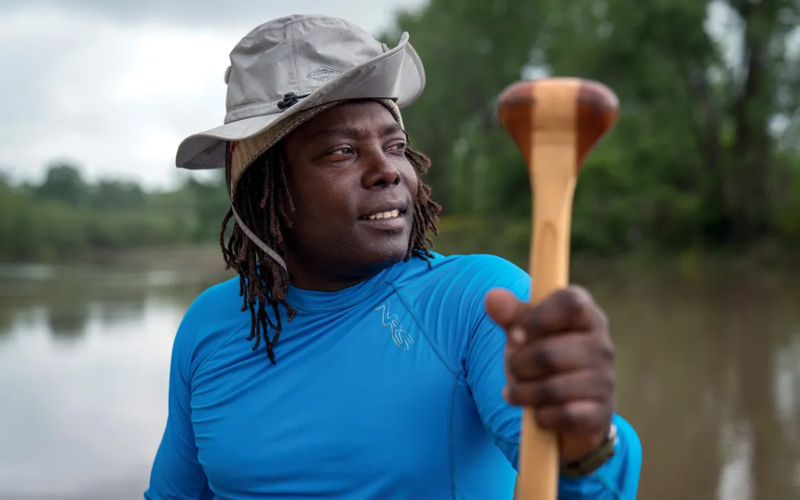
Lead guide Mark “River” Peoples holds up his paddle.
Our reward was a quiet river. In the 1940s, the U.S. Army Corps of Engineers dredged a canal to bypass the Chain of Rocks. Now, for nine miles above St. Louis, commercial traffic is “
not recommended” on the river’s main channel. That night we camped on Mosenthein Island, where I climbed through the cockleburs to my windswept cutbank. The island is little different from when Lewis and Clark paddled past in 1803: just three miles of cottonwoods, sliced through with swampy sloughs. Some want this stretch to be made part of the Wild and Scenic Rivers System, which would be the first such designation on the Mississippi. The presence of wing dams, meant to maintain a consistent channel, might prove a disqualifier, but in my experience both “wild” and “scenic” are apt.
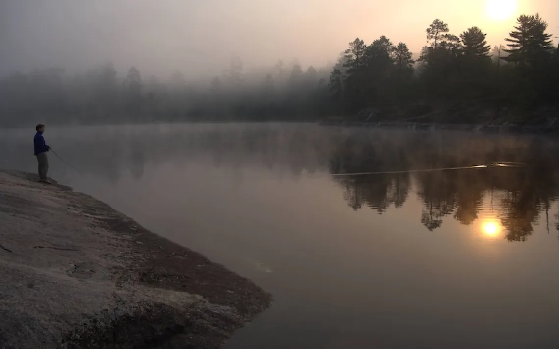
Almost every night that week was lit by some industrial presence—a power plant, a river lock, a cement factory. Viewed from across the river, these structures had a certain brutal allure, offering a glimpse at the world’s unseen engines. Their bustle did not bother the birds: Pelicans wheeled above us in an always-shifting vortex. Atop the ocher bluffs, herons guarded rookeries. When I woke on the third morning, on Beaver Island, a soft rain was falling. I slept late, lulled by the patter atop my tent and the soft gobble of turkeys in the woods.
THE RAIN GREW STRONGER in the following days. Nighttime downpours inspired the most vivid dreams of my life. I would startle awake, sure that a rising river had seized my tent or that a coyote had torn the nylon and was scavenging through my trail mix. I would breathe for a few minutes, dry and secure, then settle back to sleep.
When we reached Chester, Illinois, Ruskey caught a ride home to tend to a family illness. Relations in our group began to mirror the dismal weather. Without a leader, deciding where to camp often required an argument. The river ran in long, relentless straight lines, and I was unaccustomed to being stuck in a seat for so long—nowhere to go, nothing to do but drag the paddle.
So it was something of a relief when, on March 29, we decided that strong winds meant we’d stay in camp for two days. I took a long walk. From the top of a levee, I was startled by the ordered world beyond, of farm fields stretching to the horizon, pocked with purple flowers. To return to camp, I had to walk for a quarter mile atop a thick tangle of driftwood that sagged into the mud with my weight. The riverside willows were barren—killed, I assumed, by the latest flood. By the next morning, though, I could see that they were budding out.
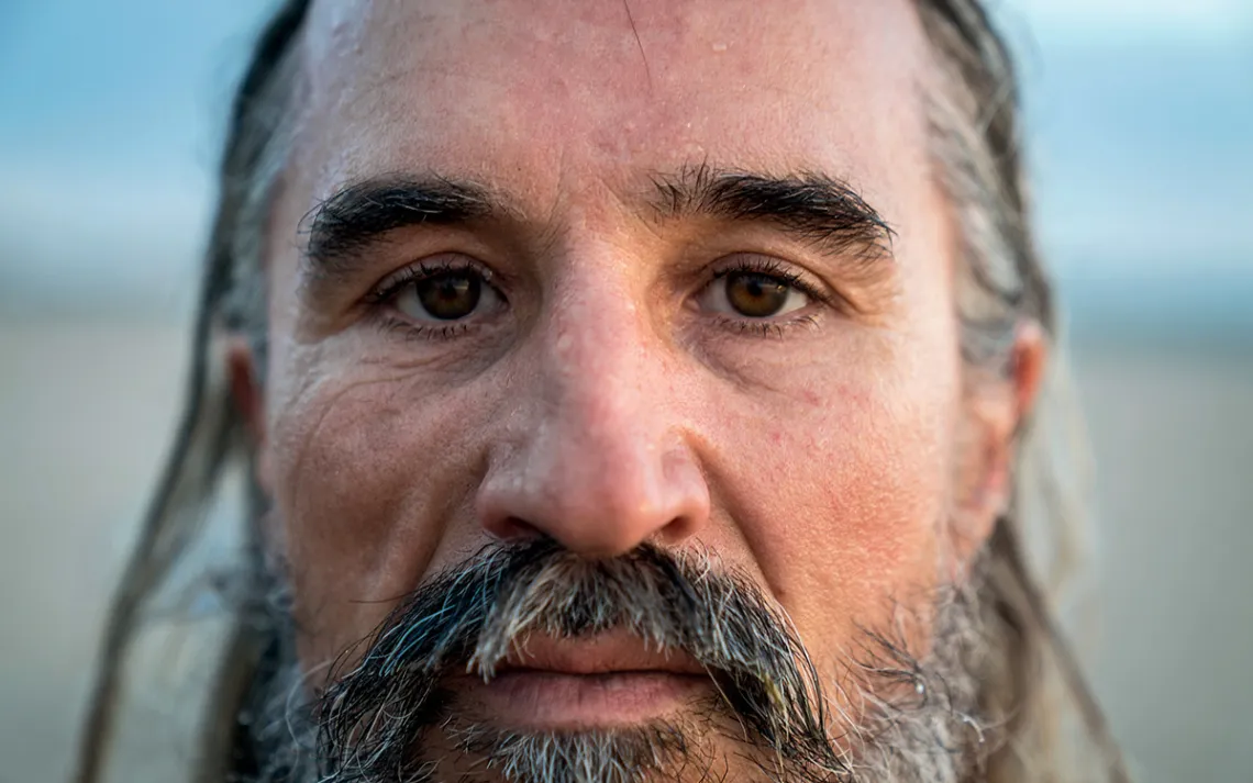
John Ruskey, founder of the Quapaw Canoe Company
We were camped across from the mouth of the Ohio River. This is where, according to geologists, the Lower Mississippi River begins. Thanks to the addition of the Ohio, it’s more than twice as powerful as the river upstream. Its massive flow has blasted away the terrain: There are no bluffs here, just flat lowlands, a floodplain that stretches as much as 120 miles across. From a canoe in the middle of the channel, I was overwhelmed by the breadth of the water and the relentless cordon of riverside trees. But when we slipped closer to the banks, the forest resolved back into individual trees. Creeks trickled in, and game trails wound away from the water’s edge, making me wish we had time to explore.
As spring took hold, my journal began to brim with notes. Because of strong winds, every few days we got stuck in camp, but that just meant more time to observe—for example, the darting lines of terns in flight. The river, I noticed, was not flat but had a complex topography all its own, crests and valleys that shifted as the current rolled. Each sandbar and island on the river, though constructed from the same few elements—willows and sycamores, sand and mud and water—was wholly different, endlessly rearranged. I sketched the shape of a favorite island in my notebook. It was so young that it didn’t appear on our 10-year-old maps. River-carried sand and mud had gotten caught in a wing dam, piling up until grass took hold—an island was born. Eventually, some flood will rip it away, or attach it to the mainland—an island will die.
We rose early on April 3 and pushed through raucous winds to Caruthersville, Missouri. We spread out gear to dry inside a concrete gazebo and walked into town. I found a riverside casino where I could buy a platter of passable barbecue, sit in a lounge seat, and overdose on free wi-fi. For the hours I sat there, I was the only customer in the place.
We were waiting for Ruskey, who arrived that afternoon with a van full of fresh paddlers. They were all eager, so despite the wind, we launched again—two canoes and Dennis, a kayaker, who soon struggled to follow our path in the choppy water. When he fell out of shouting distance, caught in the channel with the tows, we knew we had to stop. Threading a narrow gap between the pylons of an interstate bridge, we paddled furiously against an eddy. I lurched out into the mud and dragged the canoe to shore. The other boats followed, paddlers hollering with the thrill of the fight. We camped like hobos there, on a sand beach beneath the hum of I-155.
The traffic offered a fine lullaby, and I slept well. When I woke the next morning, I poured a cup of black coffee—made from twice-boiled river water—and watched as Ruskey touched up a watercolor. He’d found beauty in that steel-truss bridge, which he painted as faint lines above the twilight blue of the river. Ruskey did this each morning: Rose first, set the coffee, and looked carefully at the world. I took note and began to do the same.
Guide Valencia Metcalf leads three other paddlers downstream on the Mississippi.
Four days later we hit Memphis and paused to swap out paddlers. The clamor of the city faded quickly, replaced by wide, empty sandbars and sycamore meadows that smelled of drying wheat. This Mississippi Delta was Ruskey’s home turf, and mine. When we reached Helena, Arkansas, we intended to rest for four days. The night before that break, I realized I didn’t even have to think about my routine. Inside my dry bag, my gear was stacked in perfect order: tent on top (which I now knew to pitch upwind from the fire), then my sleeping bag and pad, and finally a duffel filled with clothes and books.
I’d be sleeping in my own bed the next night, I knew, just an hour’s drive away. But I also had my home right here.
WE RELAUNCHED ON EASTER WEEKEND with our largest group thus far: 21 people spread across four canoes. By now I was an old hand, slicing peppers for lunch, pointing out a pile of goose eggs to the new arrivals. I had become a strong-enough paddler that, when a canoe was underperforming, I was relocated to sit in its bow.
On Sunday morning, before we launched, Ruskey wafted a bundle of smoldering sage around our bodies and shared a prayer about life and death. I thought of my father and blinked back tears—not because of the loss but from a sense of connection.
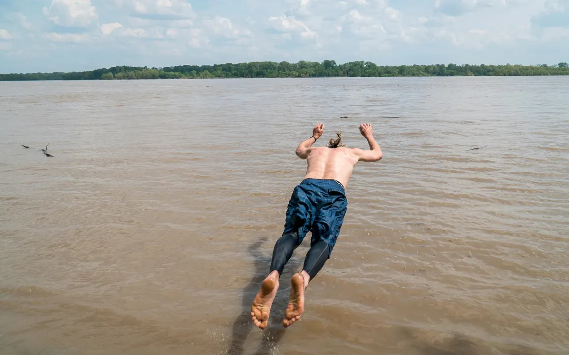
Quapaw Canoe Company founder John Ruskey is about to land in the Mississippi River face down after jumping.
After the last of the weekenders left, we returned to being a lean crew. From Natchez south, there were only six of us in one canoe: me, the other two through-paddlers, and Ruskey and his Quapaw crew—Lena von Machui, a guide and the company’s secretary, and Mark “River” Peoples, its lead guide.
Because of the many storms, we were behind schedule, and our small team pressed hard. On a 62-mile day, tied for the longest of our trip, we muscled past the Atchafalaya River—its mouth regulated by a series of metal control structures that looked like Star Wars battleships plugged into the earth—and then into Louisiana. The border was guarded by tall bluffs, which glowed crimson in the sunset. Our first alligator basked at their foot.
The next day, I decided to tackle a new skill: steering. Solemnly, I climbed into the stern. Ruskey had said that to find the fastest water, you can’t think. You try to feel the water.
That day, like so many, was wind-battered. Had I been sitting up front, I would have focused only on the misery of paddling straight into a gale. But in the stern, I lost myself, trying to feel the current. An hour passed in a blink. As the river curved west, I tucked along the southern bank, using its trees as shelter. Then the river curled south again—forming a tunnel that gathered and amplified the furious wind.
I must have been doing my job right, because my mind went blank. There was nothing but Ruskey’s command, shouted over the crash of wind and water, to head for the riprap. I shouted, too, to tell the crew that we were about to make the crossing, though I doubt anyone could hear. Then there was just paddling—the strain of muscles, the force of wood against water, the knowledge of where we were and where we needed to be and the distance between. I have a vague memory of waves crashing in from the left and the right at once, of water pooling at our ankles, weighing us down. My sole desire: Let it not be on my watch that this boat goes down.
Canoers are about to paddle under the bridge in Helena, Arkansas.
WE MADE IT, I'M HAPPY TO REPORT—pulling hard to beat a towboat, we arrived on a small patch of sand. We bailed out the canoe and settled in to another two-night storm camp. When the rain came, we clustered beneath the kitchen canopy, laughing at our circumstances. When it stopped and there was just the wind—trees bending and creaking relentlessly—we read our books and napped in our tents. That reverie was shattered the second afternoon when a tree was ripped from the ground by the wind and landed atop an empty tent, shattering two poles. Another tree fell that night; we spilled from our tents, groggily counting until we got to six. I barely slept afterward, sure the next tree would fall on me.
Four days later, as we paddled into New Orleans’s upriver suburbs, the sky turned a wide, bruised purple. On the horizon, as we rushed to shore, we saw the electric white crackles of the storm. We took shelter in an office of the U.S. Army Corps of Engineers, where hail battered the windows for hours.
The storm paused, and we walked down the levee to set up camp. It was a cramped place—the rising brown river on one side, the concrete of the levee just a few dozen feet beyond. A copse of stunted willows rose from the muddy banks. Further back, a massive old hackberry tree stood forlornly above a cross, the mark of a suicide.
That’s the tree that fell on Machui’s tent that night. She woke to find herself pinned by wood and polyester, squeezed to the side of her tent. Machui called out to Peoples for help; he couldn’t hear her, so she called him on her cellphone. He and others started to saw her free, but in the storm and darkness, she opted to stay in the tent until morning. When she rose, she saw that it was not a branch that had landed on her but the mighty trunk itself. A difference of inches would have meant her death.
Ruskey said he’d never been so close to disaster so many times. “To stand on that edge and look on the other side,” he said, “to wake up the next morning and continue life as you know it—that’s really one of the greatest journeys that’s possible.” So, 140 miles short of the Gulf of Mexico, we pulled our canoes from the water and went back to our homes. We would return, we knew. The river would still be here.
THE FIRST LEVEES WERE BUILT along the Mississippi River in 1720, to protect the young city of New Orleans, but things didn’t get really serious until after the devastating flood of 1927. The U.S. Army Corps of Engineers went to work: Dredge boats shortened the river by straightening its curves; concrete mats were added to stop erosion; new levees were built. They now stretch in a nearly unbroken line from the Gulf of Mexico to the mouth of the Ohio River—3,700 miles of levees in total. Dikes and wing dams jut from nearly every mile of riverbank, and piles of riprap stretch for miles.
The infrastructure seems to work, at least as flood protection. Record rainfall in 2011 pressed the system to its limit, but the levees held. But floods are increasing in frequency, and a recent analysis of mud cores and tree rings suggests that modern engineering may be to blame. Many geologists point to a new round of levee-building upstream, which has taken away much of the river’s capacity to store excess water.
There are other consequences as well. In Louisiana, once upon a time, the Mississippi split into many forking channels, where the muddy water would slow and settle, leaving dirt behind. Now, because of the levees, the process that built Louisiana has ended; without replenishment, the state’s marshy coast is sinking into the sea.
Here’s something else the levees do: They hide America’s greatest river. As we drove home, we paralleled the Mississippi but never saw it—just the levees’ endless green slope, often topped with fences and signs forbidding trespassing. (Our camps were sometimes only semilegal.) The state wildlife department in Louisiana maintains only three public boat ramps on the Mississippi River; none are in New Orleans.
Out of sight, out of mind: Few adventurers enjoy this river now. We saw only four other paddlers throughout our trip. Perhaps it’s not so surprising. Wilderness is supposed to offer escape from civilization and its discontents, and you can’t pretend that this river is what it once was. We saw oil sheens on the water; we paddled through ports where plumes of coal smoke darkened the sky. Pipes crossed over our heads and hid in the mud below; refineries droned all night while we tried to sleep.
Still, I felt empty after we abandoned our voyage. Instead of reaching the Gulf of Mexico—where I halfway imagined some message might be delivered to me, solving my problems—I was home days earlier than expected, sleeping inside a rectangular box of a bedroom with painted-shut windows that wouldn’t even allow a breeze. In our last days together, I told my girlfriend that I found it difficult to sleep amid such still air. She called me a river snob.
Perhaps I was. On the Mississippi River, despite the pipes and concrete, we’d followed an unbroken line of water through the heart of America. It links the cedar-topped bluffs of central Missouri to the slow cypress sloughs that wind through the southern swamps. It is dense with life—the Lower Mississippi remains one of the richest eco-regions in the country. As far as we know, none of its aquatic species have gone extinct.
Once off the river, though, I saw wildness in places I’d missed before—in the many species of birds that chirped in my suburban backyard, and the way that branches there grew in strange, jagged crooks. Too often we think of nature as something that must be untouched, pristine—and far distant from our lives. But when Thoreau wrote of wildness and its tonic, he noted that “all things” contained this mysterious force. His wildness was often found just a short amble from town. Mine was now found in any trickle of water I saw, from a roaring river to a muddy ditch. In other words, I was always surrounded by wildness, and I knew where I stood in the world.
SIX MONTHS AFTER we pulled the canoes from the river, I am with another group of paddlers gathered at that same boat ramp. The tree that nearly killed Machui still lies there, now covered in weeds.
For the next seven days, we paddle downriver in near-endless sunshine; the November afternoons are hot enough to require frequent stops so we can leap into the water. Eventually, the solid earth along the riverbank gives way to stands of marsh grass and finally the crash of ocean waves.
As we arrive on a muddy island on the edge of the Gulf of Mexico, the sky darkens and the wind returns in a bittersweet reminder of the first trip. The Mississippi rolls on—its muddy plume is visible for miles offshore before it dissolves into the sea—but our journey reaches its end. I sit on that beach for two days, listening to the wind hiss through the canes, watching the waves break beneath a gray sky, waiting. No message arrives. By now, no message is needed.
This article appeared in the July/August 2018 edition with the headline "America's River."
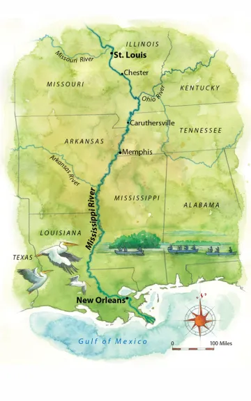
Map by Steve Stankiewicz
MORE
Get John Ruskey’s river-adventure food-prep tips: sc.org/ruskey.
Take a canoe trip with Sierra Club Outings: sc.org/adventure-travel.