The Long Journey of Mt. Mitchell’s Ancient Forests
Hiking through a forest of climate migrants in the Black Mountains

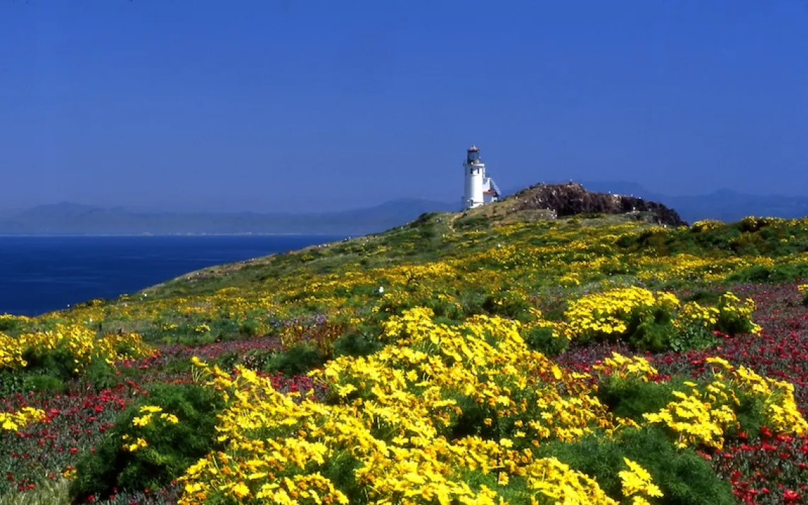
Spruce and fir forests seen from the road to Mt. Mitchell's summit. | Photos by Mike Belleme
During the late Pleistocene, 18,000 years ago, the northern part of this continent was locked in ice. Spruce and fir trees, climate refugees of their era, shifted their range southward from Canada to what are now called the Black Mountains in North Carolina. When the glaciers retreated in the Holocene, the trees moved to Southern Appalachia's highest peaks. In Mount Mitchell and the Black Mountains: An Environmental History of the Highest Peaks in Eastern America, Timothy Silver, a historian at Appalachian State University, calls this "the great tree migration."

A spider makes its way along a mossy branch.
On a clear spring day at high noon, I met Silver on Mt. Mitchell—at 6,684 feet, the tallest peak east of the Mississippi. To get there, I drove along a winding road that climbed higher and higher as the temperature gauge on my car fell from 75 to 61 degrees and my ears popped. From the parking lot, Silver and I walked a short path straight up to the summit and took in a view of the mountains that unrolled in all directions. Fir and spruce trees pointed up to a cloudless sky and filled the air with the heady smell of balsam. I imagined them in exodus, walking forests. "These trees are a souvenir from the distant past," Silver said.
Breathing in the cool conifer air, I called the forest "boreal," like those in Canada. Silver gently corrected me. In the thousands of years since the migration, the firs had become a unique species, Fraser firs. The life around them had changed, too, in coevolution. Many of the species that evolved during that time are now found only here in the high mountains of the South.
There are mosses that spread across only the warty bark of living Fraser firs and others that thrive only on downed, dead firs. More than 280 species of moss have been identified here. There is a spider the size of a lentil that crawls only in these mosses and a plant in the sunflower family with tiny flowers that bloom from tall stalks and smell like skunk. There is a salamander called the pygmy that grows no longer than a toothpick and climbs the trees at night, hunting for winged insects, and a flying squirrel that eats the mycorrhizal fungi that pop up from the spruces' spreading root systems.
"These forests are like little islands, stuck up here," Silver said. At this elevation, the fog gathers and swirls among the trees, with light rains misting the air or snow drifting down in fat, moist flakes. The temperature is, on average, 20 degrees colder here than in the valleys below, and more than 100 inches of precipitation fall each year. The weekend previous, in early April, it had been 18 degrees, with a heavy snow on the ground. Silver pointed toward a ridge. "I spent a windy night or two there," he told me. He gestured to another spot, called Point Misery. "I spent a stormy night there." He went on like that, pointing out other places.
Silver has walked the Black Mountains religiously for the past 30 years. That day, he couldn't walk far—since a knee replacement a few years ago, he doesn't hike as rigorously. I had the thought that perhaps he had sacrificed his knees, his own bones, to those rocky ridges. I had the thought that mountains shape us, that as we walk on them, they walk with us.

Mushrooms along the Old Mitchell Trail
The forests that survived the Pleistocene are tough but fragile too. Since the 1950s, an exotic insect called the balsam woolly adelgid has been killing the Fraser firs. Looking out over the mountains, we could see the snags standing in large swaths, like armies of click-clacking skeletons.
During the past hundred years, nitrogen oxides from engine exhaust and sulfur dioxides from coal-fired power plants have accumulated in the atmosphere above the peaks, then fallen as acid rain and become concentrated in fog and ice. At times, the fog that drifts across Mt. Mitchell's summit has a pH of 2.1, "an acidity level somewhere between battery acid and lemon juice." Silver wrote that in his book nearly 20 years ago, and the situation has not dramatically improved. As the trees die, all of life around them changes. The spruce-fir forests of Southern Appalachia have been classified as the second-most-endangered habitat in the country, after the East's old-growth deciduous forests.
Silver and I walked across slabs of gneiss, schist, quartzite, and granite that had folded and uplifted into this fishhook-shaped mountain range 65 million years ago. These types of rocks are highly resistant to erosion, which is why the peaks remain elevated.
So many factors led to this particular forest growing in this particular place. Rocks were compressed in the earth's layers, then lifted up toward the sky, resistant to incessant rains. The Laurentide Ice Sheet expanded, and trees walked away. Seeds scattered on the winds, roots picked up and moved inches a year, ice melted and receded, cloud-touching rocks stayed in place, more seeds flew into the breezes, the trees walked again, farther upward.
Everything is a souvenir from the distant past. We don't know how the forest will keep changing. The only time that time stopped on Mt. Mitchell was when Elisha Mitchell—the man who proved the mountain's height was superior to all others in the East and for whom it's named—broke his pocket watch. Its hands are forever stuck at the hour, minute, and second that Mitchell died in June 1857, when he took a wrong step over a waterfall: 8:19:56 P.M.
Silver departed for the Toe River; he wanted to do some fly-fishing before the drive home. I stayed and walked into the dim understory on a path soft with duff and freshly fallen needles. I thought of a passage written by the Zen thinker Dōgen in the 13th century: "Mountains . . . always walk. Do not doubt mountains walking even though it does not look the same as human walking."
A red squirrel chittered. Carpets of moss covered the forest floor and turned the light vivid green. The bark of the trees was covered in ruffly lichen. I climbed a spruce and sat on a massive low limb. Below, the tree's trunk split in two, both parts sprawling over a boulder like strange legs propped up, taking a rest.
This article appeared in the Winter quarterly edition with the headline "Mountains Walking."

Visiting North America's Sky Islands
The Appalachian Trail passes through most of the sky islands in Tennessee, North Carolina, and Virginia; research which sections will take you above 5,500 feet. Southeastern Arizona and northwestern Mexico are home to a group of sky islands known as the Madrean Archipelago—55 forested mountains separated by vast grassland and desert "seas." Other sky islands include the crest of the Sierra Nevada range in California and the Crazies and the Castle Mountains in Montana's Rocky Mountains.
The Story of a Name
The term sky islands was first used by nature writer Weldon Heald to describe a portion of the Madrean Archipelago known as the Chiricahua Mountains, where peaks rise to 5,600 feet above the hot desert grasslands and contain a unique spruce-fir-aspen forest biome.
Up Close and Personal
On North Carolina's sky islands, Fraser fir cones grow upward and have blunt needles; spruce cones point downward and have pointy needles. In the understory, you can admire hundreds of species of mosses with a simple hand lens. After or during rain is best, when they are most green and vibrant. To go deeper, pack a book like Common Mosses of the Northeast and Appalachians.