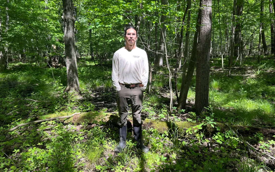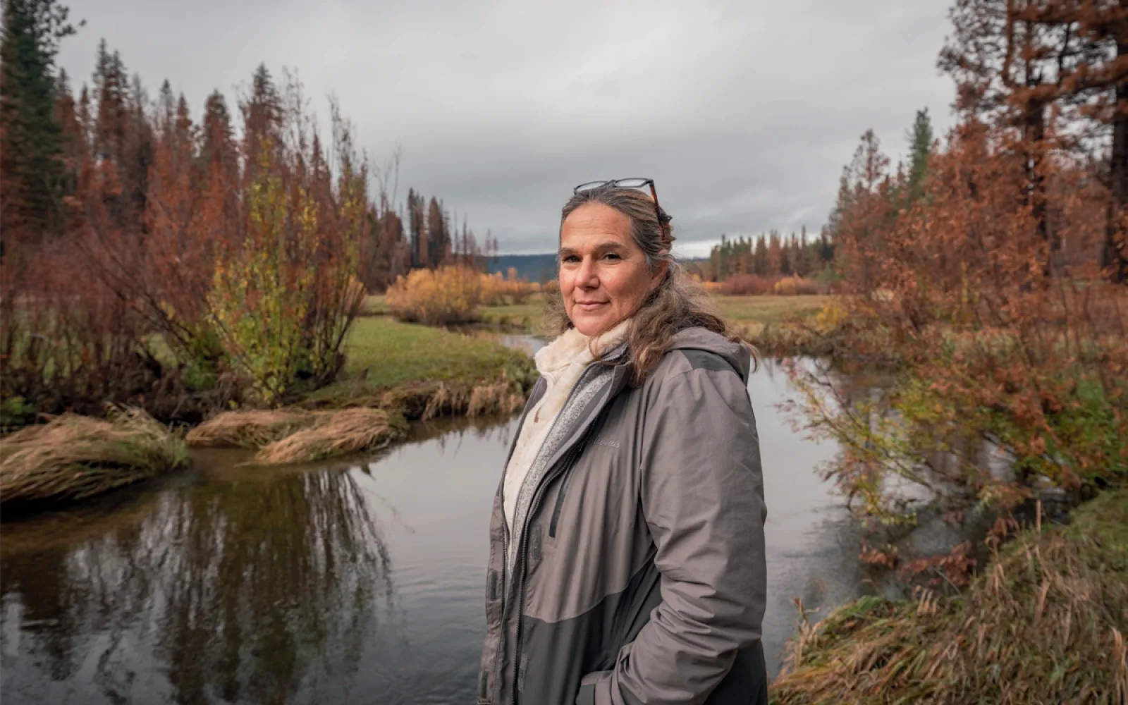
Trina Cunningham, the executive director of the Maidu Summit Consortium
PG&E, the Mountain Maidu, and a Very Powerful River
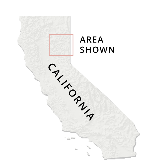
A group of Mountain Maidu has reclaimed its former lands, but not the water
Produced by Geoff McGhee
In the spring of 2021, a crew of nine workers arrived at Tásmam Koyóm, at the headwaters of Northern California's Feather River. They began to cut down saplings, dragging them over a fast-moving creek that ran through a meadow, then bending them into a tangled weave of trunks and branches that held strong in the current.
The landscape around them was an artifact of decades of cattle grazing—the utility that once owned this land, Pacific Gas and Electric Company (PG&E), had leased it to ranchers. The cattle had compacted the soil and dried out the meadow's outer reaches, transforming what had been a wetland into a field of dry grass. As the work progressed, and the sapling dams blocked the current, areas of the parched meadow began to fill with slow-moving channels of water.
The crew—made up of Mountain Maidu youths and employees of a local habitatrestoration outfit called Swift Water Design—called themselves "beavers." Actual beavers haven't been seen in this region for years, and it is forbidden by state law to introduce them. Some researchers claim that beavers have never been here at all, although there are dozens of words for the species and its handiwork in languages native to this region. The beaver dam analogs would, hopefully, create an inviting habitat for any beavers who happened to make it this far upstream, encouraging them to keep the dams up and running in perpetuity.
Before the end of the 19th century, the Mountain Maidu made their home in the Sierra, including the headwaters of the Feather River.
Before the end of the 19th century, the Mountain Maidu made their home in the Sierra, including the headwaters of the Feather River.
A century and a half ago, those lands were taken away—first by speculators looking for gold and timber and later by groups racing to control the area’s water and hydropower resources.
A century and a half ago, those lands were taken away—first by speculators looking for gold and timber and later by groups racing to control the area’s water and hydropower resources.
The Great Western Power Company flooded valleys to create dams and reservoirs, and the Feather River headwaters provided a lucrative source of water storage and hydropower.
The Great Western Power Company flooded valleys to create dams and reservoirs, and the Feather River headwaters provided a lucrative source of water storage and hydropower.
In the past two decades, a series of bankruptcies at Pacific Gas and Electric (which owns Great Western's old network) have inspired a group of Mountain Maidu to reclaim its former homelands.
An effort to take over and repair the defunct Hamilton Branch hydropower plant is one part of that plan, yet to be accomplished.
Another, already underway, is restoring meadows that weren't flooded for hydropower.
Another, already underway, is restoring meadows that weren't flooded for hydropower.
Bringing back a long-lost wetland
In spring 2021, the Mountain Maidu Summit Consortium began refashioning the landscape surrounding Tasmám Koyóm, a Maidu homeland near the meeting of Yellow Creek and the Feather River.
Bringing back a long-lost wetland
In spring 2021, the Mountain Maidu Summit Consortium began refashioning the landscape surrounding Tasmám Koyóm, a Maidu homeland near the meeting of Yellow Creek and the Feather River.
The consortium began thinning forests along the banks of Yellow and Butt Creeks and built dozens of small dams to slow the flow of Yellow Creek and restore a historical wetland that had been dried out by channelization and cattle grazing.
It took a lot of work to get to this point. Like many California Indigenous peoples, the Maidu have struggled for recognition from federal and state agencies. They’ve also had to become experts in how to work with them.
PG&E still retains the water rights. Many land-management decisions have to be cleared with California’s Department of Fish and Wildlife and a local conservation NGO called the Feather River Land Trust, which holds a conservation easement on the area.
"We're trying to build this meadow to be like something the Maidu, precontact, would have recognized," Kevin Swift, the owner of Swift Water Design, told me one afternoon in May. He estimated that the water table near the dams had already risen by a few inches in the past few days. The crew was in the process of building 40 dams along Yellow Creek, a tributary of the Feather River. "Channelization isn't a natural state," said Trina Cunningham, executive director of the Maidu Summit Consortium, as we splashed around ankle-deep in the revived shallows. "Water wants to meander and roam."
The consortium had recently taken over the ownership of this land, and the dams were only the beginning of its plans for Tásmam Koyóm. As the restoration progressed, the meadow's waters would be near stagnant in some places, move slowly in others, and rush swiftly downstream elsewhere. These micro-ecosystems would become habitats for a variety of plants, fish, and amphibians. The changes would keep valuable sediment in the meadow and out of reservoirs downstream, and they would increase the landscape's ability to store carbon and filter water.
The meadow would also, Cunningham told me, serve as a potential firebreak in the increasingly likely event of a wildfire. "Why are we digging fire lines during a fire when we could have natural fire lines cut with water?" she said. Months earlier, Maidu elder Lorena Gorbet had told me that the Maidu planned to use Tásmam Koyóm as a teaching ground to show "the right and respectful way to take care of the land." Gorbet and I spoke on a day when the wildfire smoke choked the skies purple both where I live in Berkeley and where she lives in the Sierra, hundreds of miles away. Her great-grandfather, Gorbet explained, used to be in charge of keeping the forests between Indian Valley and Mountain Meadows clear of brush, ensuring that there wasn't too much new growth accumulating in the understory. When he'd visit family members on the other side of the ridge in the late 1800s, she recalled, "they always knew when he was coming back" because they'd see small plumes of smoke rising from the forest. He was tending his landscape—keeping fire away with fire.
A few hours later, as dusk fell, Cunningham and I sat at Tásmam Koyóm's campsite, which was originally built by a Boy Scout troop and now generates income for the tribe. We chatted as the sun lowered over the meadow where the water was still rising, the blue-eyed grass catching the evening light. To our north, a flock of sandhill cranes rattled their percussive calls into the sky, and a bald eagle plunged into view and snatched something from the grasses. Cunningham inhaled deeply—it was rare to see a bald eagle out here, she said, and it felt like a sign. "Makes me so happy to be on this land and feel it coming back to life," she told me. Here, Indigenous land-management practices, along with Indigenous sovereignty, had long been dismissed by federal land-management agencies. But the next day, a crew of roughly a dozen from the US Forest Service and the California Department of Fish and Wildlife would be visiting the meadow as the Maidu's guests, to see the beaver dam analogs in action.

A beaver dam analog in Tásmam Koyóm.
Like much of the upper Feather River watershed, Tásmam Koyóm had been stolen from the Maidu by settlers in pursuit of gold, timber, and power—both political and electric. During the gold rush, they expelled the Maidu and built the town of Longville, home to a hotel, shops, and a stagecoach stop where gown-clad ladies would disembark and help themselves to the burbling soda springs nearby.
Today, all that remains of Longville is the odd square nail scattered in the grasses where the buildings used to be. But the Feather River is still sought after by a range of interests, large and small. In California, water has never been more scarce or more profitable.
In 2003, the Mountain Maidu learned that PG&E, which owns a significant amount of their former homelands, was giving away land across the state to conservation groups as part of a bankruptcy agreement. The Maidu saw it as an opportunity to get some of their land back.
What followed wasn't easy. The Mountain Maidu, like many tribes in California, aren't federally recognized, because in the 1850s, the US Senate refused to ratify treaties made between their tribes and US commissioners. After the Mountain Maidu's first application to take back their former homelands was rejected, the Maidu Summit Consortium incorporated as a nonprofit—which was the closest the Maidu could come to tribal status—in order to acquire the land.
Next, they were told they were ineligible to apply for the land at all, because they lacked a verifiable history of land stewardship—a claim community members might find hilarious if it weren't so cruel in its erasure. Finally, in 2019, after much perseverance, the consortium was granted five separate parcels of land totaling 3,000 acres, including Tásmam Koyóm.
Control of the land was not total, though. Both the Department of Fish and Wildlife and a local organization called the Feather River Land Trust held an easement on Tásmam Koyóm. Even relatively simple decisions like where to build new trails had to be cleared with both parties first. Getting the beaver dam analogs approved had been a lengthy process. Riskier interventions, like the prescribed burns the consortium wanted to carry out, had yet to be approved.
The biggest catch, however, was that PG&E had agreed to surrender the land but not the water. The Maidu Summit Consortium could use the water that flowed through the meadow, but the utility retained the right to build a power plant or a dam that would divert more water downstream, without asking permission.
Separating land and water this way is, to Cunningham, a symptom of a larger problem. The distribution of water rights after settlers arrived, she explained, wasn't about the environment, and it wasn't about the needs of the community. "It was the water rush, without consequences."
 Trina Cunningham and Ben Cunningham at Tásmam Koyóm.
In the 1880s, a man named Julius M. Howells was struck by the hydroelectric possibilities in Big Meadows, a yawning, grassy basin 25,480 acres wide, just downstream from Tásmam Koyóm. As Beth Rose Middleton Manning writes in Upstream: Trust Lands and Power on the Feather River, Howells was shocked by just how fast the water moved downhill once it left the meadows. This, he felt, was the raw potential of the earth just waiting to be harnessed for power.
In 1901, Howells brought his plan to two wealthy brothers, Edwin and Guy Earl, who purchased a portion of Big Meadows. A year later, the trio launched the Western Power Company, which would eventually become the Great Western Power Company and later be acquired by PG&E.
The Western Power Company collected land along the Feather River, along what is now Route 70, with an eye to bringing more power to a rapidly growing state—and turning a handsome profit. Much of this land had been allotted in small parcels to Maidu families by the federal government after they were dispossessed of their original homelands throughout the Sierra. The Earls often purchased these parcels under false pretenses, forcing sales by telling Maidus that they had no other choice. Gorbet remembers hearing stories of people who were tricked into trading their land for parcels that were actually leases expiring in 50 years' time.
Maidu families fought in the courts to get their land back, but all the structures of state and local governments worked against them, as they were designed to do. Landless Maidus were forcibly relocated to Sacramento, San Francisco, and even out of state, Gorbet said. The diaspora severed communities, ceremonial practices, and historical memory and records. It also laid the groundwork for the US government's decision to not designate the Mountain Maidu as a federally recognized tribe.
In 1912, the Western Power Company flooded Big Meadows to create Lake Almanor. A hydroelectric plant built there in 1921 was the first hydropower facility in what PG&E later termed the Stairway of Power. Over the course of the 40 years following the creation of Lake Almanor, the Great Western Power Company succeeded in building 10 cascading dams down the Feather River, culminating in the Oroville Dam on the valley floor—at 770 feet high, the tallest dam in the United States.

Lake Almanor, at the top of PG&E's Stairway of Power.
When the Stairway of Power was being created, Middleton Manning writes, "the plans for Lake Oroville were in the making long before Concow or Mountain Maidu people that stood to be most directly impacted were informed of them." Much of this infrastructure was built on cultural sites, ceremonial sites, and burial grounds. Today, PG&E authorities regularly reach out to Cunningham—as they are required to do by law—requesting that a Maidu Summit Consortium member be present at various rebuilds and retrofits in case human remains are found.
In 1924, the Great Western Power Company flooded more Maidu ceremonial land and burial grounds just east and upstream from Lake Almanor, creating the Mountain Meadows Reservoir. Mountain Meadows flows into Lake Almanor via Hamilton Branch. At its base, the Red River Lumber Company built another hydroelectric plant, called the Hamilton Branch Powerhouse, which generated up to 4,800 kilowatts of power.
The Western Power Company, which later became PG&E, was founded in 1880 to take advantage of the Feather River’s steep drop into the Sacramento Valley.
The company built reservoirs at Lake Almanor, Mountain Meadows, and later, Butt Valley, to provide a constant water supply for hydropower.
The Western Power Company, which later became PG&E, was founded in 1880 to take advantage of the Feather River’s steep drop into the Sacramento Valley.
The company built reservoirs at Lake Almanor, Mountain Meadows, and later, Butt Valley, to provide a constant water supply for hydropower.
This system came to be known as the Stairway of Power, a series of hydroelectric dams that sent electricity south to Sacramento and Oakland.
This system came to be known as the Stairway of Power, a series of hydroelectric dams that sent electricity south to Sacramento and Oakland.
Many of the dams were built on former Maidu settlements. Members of the Mountain Meadows Summit Consortium are frequently asked by PG&E to be on site for dam repairs where human remains may be unearthed.
Many of the dams were built on former Maidu settlements. Members of the Mountain Meadows Summit Consortium are frequently asked by PG&E to be on site for dam repairs where human remains may be unearthed.
The Stairway of Power runs down the spectacular Feather River Canyon on the river’s North Fork. The river’s Middle Fork was one of the first nationally designated Wild and Scenic Rivers.
The cascade of dams and hydroelectric plants along the Stairway of Power culminates in the mammoth reservoir at Lake Oroville. At 770 feet high, Oroville Dam is the tallest in the United States.
Climate disruption is making rainfall heavier and droughts longer across the state, and the infrastructure along the river is showing its age. In heavy rains in 2017, Oroville Dam came close to bursting its banks, narrowly avoiding a catastrophic flood.
Climate disruption is making rainfall heavier and droughts longer across the state, and the infrastructure along the river is showing its age. In heavy rains in 2017, Oroville Dam came close to bursting its banks, narrowly avoiding a catastrophic flood.
But perhaps the greatest danger is posed by the electrical transmission lines in an era of ever-drier forests.
But perhaps the greatest danger is posed by the electrical transmission lines in an era of ever-drier forests.
The Stairway of Power infrastructure is now wildly outdated. In 2017, massive rains, which are becoming more common as climate change intensifies weather patterns, threatened to burst the Oroville Dam. A year later, a rusted 142-pound, 115-kilovolt wire along the Feather River was knocked to the ground by strong winds. "The energized line produced a huge bolt of electricity," writes Lizzie Johnson in Paradise, a history of the 2018 Camp Fire, "zapping the steel tower like lightning as it charred the pillar black. Droplets of molten metal sprayed into the dry grass. That's all it took."
While the Western Power Company once scrambled to snatch up as much land as it could, PG&E is now unburdening itself of land that the courts have ordered it to, or that the utility no longer deems profitable. Following another bankruptcy in 2019, PG&E began soliciting proposals to transfer ownership of some properties, including, eventually, the Hamilton Branch plant. In recent years, the Mountain Meadows Reservoir has almost completely dried up by early fall, and the plant hasn't run since 2017.
Cunningham was ready. By restoring some of the habitat upstream and downstream from the hydro plant, Cunningham thought, the Maidu Summit Consortium could get the plant up and running, generating power it could sell back to the grid. She and her team wrote up a proposal.
Within weeks, their bid was rejected on the grounds that the consortium didn't have any hydroelectric experience. Cunningham was determined to keep trying.

Oroville Dam.
After the Oroville Dam, the Feather River ceases to be a river. From there, a massive industrial system of canals and aqueducts called the California State Water Project carries water through Sacramento and then the suburbs, through fields, and on to the Sacramento River and its delta. Control of these waterways, which were completed in the 1990s, is determined by water rights—papers that were filed over a century ago under dubious circumstances but which are still honored today.
Some of those rights belonged to a sheepherder named Thomas Brady, who took interest in the Feather River at the turn of the 20th century. At the time, he boasted some 10,000 head of sheep, one of the largest flocks in the state. During the winter and early spring, he kept them in what settlers called the Sutter Buttes and the Maidu called Esto Yamani. In the summer, decades before the dam was built, Brady moved the sheep across the valley to Oroville, and he'd graze them until they were fat enough to load onto trains bound for the slaughterhouse in Chicago.
Like many white landowners of the era, Brady had filed for water rights and got them. His particular piece of paper ensured that the local water boards would flood the fields in the Butte Sink, an 11,000-acre swath of managed wetlands 60 miles northwest of Sacramento and just south of Sutter Buttes, with water from the Feather River. This guaranteed better fields for grazing and improved waterfowl habitat, for he and his friends liked to hunt.
In the midst of this vast, complex water system, most of the residents who use this water today know little about where it originates and how it came to make its way to their taps. The only reason I know any of this is that Thomas Brady was my great-grandfather. His land, as well as his water rights, have been transferred to members of my family.
In summer and early fall, a good amount of Feather River water sits stagnant in rice fields. But after that, the water is still emptied into the Butte Sink, home to roughly 30 private hunting lodges and a state wildlife refuge, part of which my family once owned before they sold it to pay my mother's and her siblings' college tuitions. My uncles and cousins still hunt there.
As demands on California's water grow and supply consistently decreases, the hunters' seasonal rituals have started to come under threat. Recently, the local water board has threatened to keep water from leaving the rice fields because of the drought. In response, the duck-hunting clubs have fought to maintain their water rights.
The duck clubs have also allied with environmentalists. Over 90 percent of California's historic wetlands were destroyed during the decades when the Stairway of Power and the California State Water Project were being built, so seasonal wetlands—even artificial ones maintained by duck hunters—have become critical habitat for birds migrating along the Pacific Flyway.
In fall 2020, in spite of being a longtime vegetarian, I went hunting with my uncle. We arrived before sunrise at his empty club headquarters, co-owned by 14 men. The building is a boys' clubhouse of the imagination: bedrooms where the guys can bunk up before a hunt, a game room and a full bar where they can hang out at night, and a kitchen where caretakers leave out sandwiches for lunch each day. The hallways are lined with boots and waders and paintings of ducks in flight.
We suited up and set out in his boat, careening through a culvert in the blue-black morning at full clip. My uncle took us to his favorite blind, where we sat for a few hours while he practiced his birdcalls and occasionally pointed his gun toward the sky. When he made a successful shot, the bird fell to the water, and he set out in the skiff to retrieve it. It was spectacularly quiet and peaceful out there, the morning trilling with birds and the sound of slow-moving water. I understood, finally, the appeal of this—the devotion to land, the desire to keep things as they are, the fear of losing what one has.
And I thought about the fact that there are two groups on either end of the Feather River—the disenfranchised tribes and the comparatively wealthy duck hunters. One had their land ripped out from under them as a result of some pieces of paper, and the other has long clutched those valued papers tight in hand. Now, they both find themselves in possession of land with tenuous rights to the water. Without water, their property is relatively worthless. Perhaps the future of our state's water resources depends on rethinking this system of ownership.
The Sierra are webbed through with PG&E’s power lines. They pose a considerable wildfire risk, and the utility has begun a process to bury some of the lines underground.
In summer 2018, a rusted 115-kilovolt power line along the Feather River was knocked to the ground by high winds. This sparked the Camp Fire, which burned more than 150,000 acres and leveled the town of Paradise.
Three years later, on July 14, 2021, a wildfire began to spread near the same power lines that had sparked the Camp Fire.
It spread quickly through forests already stressed from years of drought.
The Dixie Fire burned for nearly four months. It consumed nearly a million acres, becoming the second-largest wildfire in California’s recorded history.
The Dixie Fire burned for nearly four months. It consumed nearly a million acres, becoming the second-largest wildfire in California’s recorded history.
This fire—and the Mountain Maidu Summit Consortium’s efforts to prepare for something like it—have big implications for the future of how land is managed in California.
This fire—and the Mountain Maidu Summit Consortium’s efforts to prepare for something like it—have big implications for the future of how land is managed in California.
I had plans to visit Tásmam Koyóm again in August 2021, to meet up with Trina Cunningham and catch up on any progress she'd made on her second application for the Hamilton Branch plant. But on July 14, a wildfire began to spread in the Feather River canyon near the same network of PG&E power lines that had sparked the Camp Fire. At first, the fire was too far away from Tásmam Koyóm to seem like a threat. Within days, though, it was clear that this was a fast-moving fire ripping its way across the drought-withered terrain, its embers traveling far on the strong headwinds. Within 25 days of its first sparks, the Dixie Fire had become the second largest in the state's history.
Trina Cunningham called the fire brigades daily, pleading with them to protect Tásmam Koyóm. "The fire is expected to reach our valley between now and tomorrow morning. I can hardly stand not knowing," she wrote to me in late July. Members of the Maidu Summit Consortium hoped that the restoration work they'd done would help protect what they had worked so hard to get back.
Then, in late October, torrential rains and heavy winds caused catastrophic mudslides along the Stairway of Power—but they also put an end to the fire. Three months after its initial spark, the Dixie Fire was fully contained.
 The Feather River cuts through a forest burned by the Dixie Fire.
By the time the fire was over, it had plowed through five counties and burned nearly a million acres. Ben Cunningham, who chairs the Maidu Summit Consortium board, had to evacuate his home in Greenville for an entire month. By the time he was allowed to go home, most of the downtown was gone. The fire had indeed reached Tásmam Koyóm, but much of the meadow and many of the trees, along with the campsite, remained intact.
Two days after the rains had subsided, I returned to Tásmam Koyóm with Trina and Ben. In Ben's red pickup, we left the main road and moved through miles of charred forest, like stunned visitors to an upside-down world. Green was already pressing up through the blackened soil—a sign of hope, Ben said, but also a mark of work to come. Here, a healthy forest was one you could see through, and much of the new growth would have to be cleared.
Ben explained that his house in Greenville hadn't burned largely because he cleared his land every year using traditional burning practices—what the consortium hoped to do on Tásmam Koyóm. Since he hadn't been able to carry out controlled burns here, he had spent last April and May raking and hauling brush out of Tásmam Koyóm's campsite, which had protected it from the worst of the Dixie Fire.
Ben hoped that the fire would encourage native plants, which were adapted to frequent burns, to sprout. "We're looking forward to seeing what kinds of grasses and flowers come up that we haven't seen in a long time." As the roadway exited the forest, color returned to our field of vision: The meadow shone green and gold. Most of the beaver dam analogs had held strong through the fire and the rain.
Rebuilding would be tough, but Trina saw opportunity. Take Greenville, for instance. "It's a nice little gold rush town," she said. People loved it for its history and charm. But that history was built on the destruction of Maidu communities. Perhaps, she said, Greenville could be rebuilt as the first of many educational hubs for Maidu language and stewardship practices. The destruction brought by climate change, she insisted, "has to be a chance for renewal. We have to redesign whole communities."
We left Tásmam Koyóm and drove north through the valley to Big Springs, an area next to a former Maidu settlement, where clean water poured from the mountains. When Ben had first come out here after the Dixie Fire, he had waded through ankle-deep char. Much of that had since been tamped down by the rains or washed into the spring basins. When we looked upward, the dead trees formed a perfect halo of dark spires. They were so blackened by fire they shone iridescent, like sinister jewels.
In the past 20 years, almost 80 percent of the Maidu's traditional homelands have burned. Rain isn't falling like it used to, nor is snow, and rivers across the state are dwindling. "The landscape—it's reshaping itself," Trina said. After generations of dispossession, she could see a future in which the Maidu, and their homelands, are prepared for the frightening years to come: "We need to stop asking for permission and do this our way, the way we have long known how to do."
The Maidu didn't own this land at Big Springs—not yet. "We have a 100-acre parcel down there," Ben said, pointing into the valley. "Maybe we could trade this for that." They had a lot of work to do to bring their land back. And they had a lot of land to get back too.
"We're ready," Trina said. "We've been ready for a long, long time."
Map sources: USGS (Watershed boundary data); Mountain Maidu Summit Consortium (Dam analogs and Tasmám Koyóm redevelopment locations); Pacific Forest & Watershed Lands Stewardship Council (PG&E easement); U.S. Energy Information Administration (Electrical transmission lines); GeoMAC (Camp Fire perimeters); National Interagency Fire Center via San Francisco Chronicle (Dixie Fire perimeters).
Maps by Geoff McGhee for Sierra
Reporting for this story was supported by the McGraw Center for Business Journalism.