The Great Plains Trail Is a Work in Progress
Behind one rambler's plans for a long-distance trail in the middle of the country
Steve Myers on the Nebraska National Forest Pine Ridge Trail.
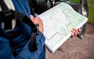
"Man, that fog!" Steve Myers lumbers out of his truck, mid–granola bar, fumbling with a brown sweater. Maps spill out of the cab, with sticky notes marking the passage that the 52-year-old has been dreaming up since the 1990s: the Great Plains Trail (GPT), a 2,200-mile trek from Canada's Grasslands National Park to Texas's Guadalupe Peak. Through the fog of western Nebraska, he's about to show me a slice of it.
Leaving the weather small talk behind, we amble past the high cottonwood trees of Fort Robinson State Park, a former military base where Crazy Horse, the Lakota leader, was killed in 1877. Soon, the White River Trail, a three-mile segment of the GPT, emerges. It's a converted railbed, now gravel, that bisects entire worlds: To the south, grasslands roll on and on and on, unwired, unplowed. To the north, the Pine Ridge, a 100-mile tableland with high ridges and forested buttes, climbs to 5,200 feet.
Myers, a Minnesotan, begins weaving a story my native Midwestern soul knows well—of recognizing the history and wildness in the plains, of feeling both frustration and shame at the flyover narrative. "I had the idea in 1991, but it just kind of sat there for decades," he says. "Every once in a while I'd study the map—where would it go?" He eventually spotted a north-south line, a public lands meridian through three national parks, three national monuments, 10 national forests and grasslands, 15 state parks, and five state high points—numbers that would make the Appalachian Trail blush. His mission? Connect them.
"So I spent a couple years talking about it. Researching it." Though not a thru-hiker himself—he has yet to tackle the GPT—Myers walks in long-distance trekkers' circles and by 2012 formed the Great Plains Trail Alliance. Its six-member board includes teachers, environmentalists, and outdoor enthusiasts who spend their time talking to communities about the trail, networking with officials, and building the GPT's social media presence. The alliance has little funding, so the trail is growing—quite literally—one step at a time.

Steve Myers and the Pine Ridge escarpment.
"We're gunning for strong hikers," he says. "You gotta understand this is a work in progress. This isn't the AT." The GPT offers a different kind of grueling—lonely, hot, largely unmarked. "[We're connecting] backcountry dirt roads. I know it turns people off," he continues. "I can't blame them, but the roads are practically trails themselves." Currently, about 80 percent of the GPT follows backroads, and the segment we're trekking soon leads to the quiet roads of Crawford, Nebraska. "The goal is to eliminate road miles. [The route] will change as opportunities come up. That evolution is hard to get across."
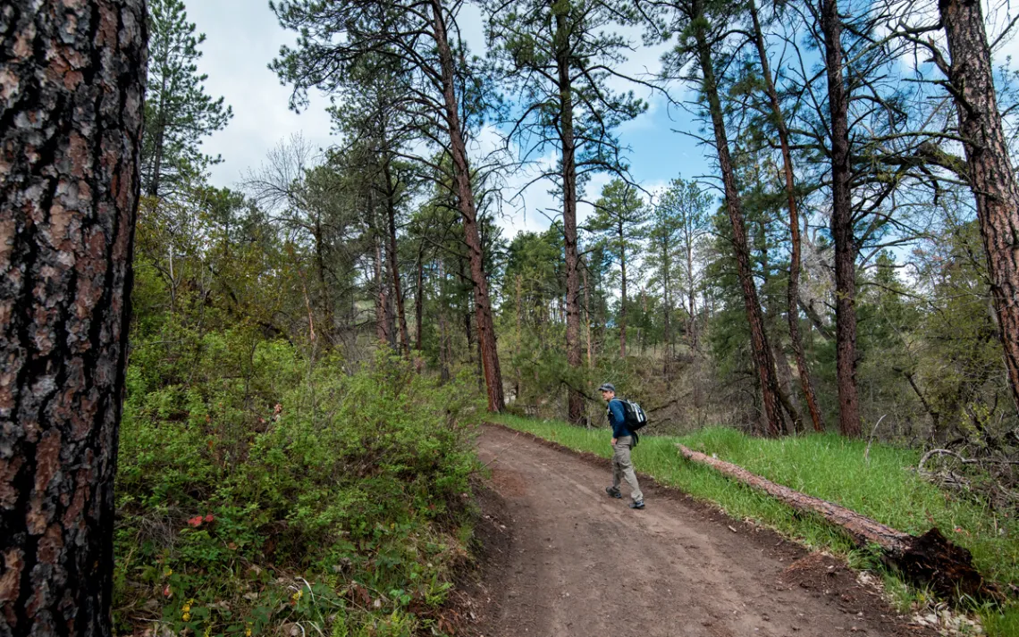
The fog lifts. It's our cue to head to that tableland we've been eyeing, the Nebraska National Forest's Pine Ridge Trail, a brand-new section of the GPT. Both the alliance and the US Forest Service worked to create this stunning segment, which travels up sandstone ridges, through ponderosa pines, along mixed grasslands, below rocky buttes, and across tiny creeks. Myers touches every fresh trail marker, his eyes lit up in satisfaction and awe. He's witnessing a 30-year dream come true.
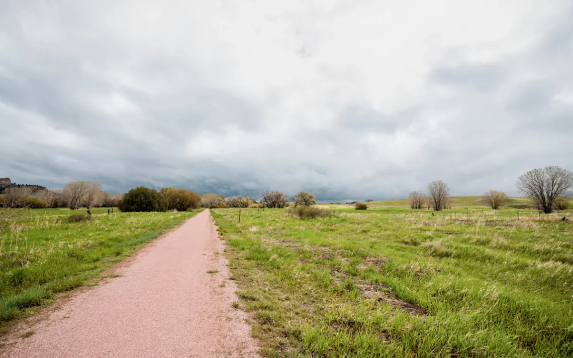
The White River Trail in Fort Robinson State Park.
"The hardest part is getting people to do the trail, of having it be hiker-friendly," he says, in between tick flicking and branch clearing, as there's little foot traffic yet to maintain the months-old trail. "That's why we have the Pilot Trail." Technically, we're on it—the GPT's most accessible, mapped-out, and camper-friendly stretch. The Pilot Trail extends for 350 miles from South Dakota's Bear Butte State Park to Nebraska's Scotts Bluff National Monument, cutting through Wind Cave National Park and Oglala National Grassland.
The other obstacle in marketing to hikers, Myers adds, boils down to reputation: "People want to be able to brag about it when they're done, and as soon as you say 'Nebraska,' people leave the room. They don't have any idea. They think they know."
I gesture to the nearest ponderosa, making some unintelligible grunt of agreement and gratitude. The improbability of someone recognizing the full beauty of this region—my region—is why I wanted to meet Myers in the first place.
"We don't have a huge following," he admits, adding that all the work is done by a handful of volunteers who, like himself, hold day jobs. He knows that it may be a while before people understand what the GPT is, what it can offer, and what they can get out of it. "We're trying to get people to go out there and experience it however they can. Foot, bike, 15 seconds, 15 miles—it doesn't matter."
But for now, it's just us. Tracing our way slowly back up the ridge, we weave alone between the ponderosas, a thousand feet above the valley, leaving footsteps in the bluegrass.
Beyond the AT and PCT
Check out some lesser-known thru-trails crisscrossing the US.
Bigfoot Trail
Even newer than the GPT, the still-unofficial Bigfoot Trail—conceived in 2009—runs for 360 miles through California's Klamath Mountains. Utilizing existing hiking trails and roads, the route carves a path from the Pacific Ocean to the Trinity Alps through a mixed coniferous forest—a true botanical museum.
Arizona National Scenic Trail
Designated a national scenic trail in 2009, the 800-mile Arizona Trail traverses the state's deserts, mountain ranges, canyons, valleys, and forests, from the US-Mexico border to Utah—and from elevations of 1,700 to 9,600 feet. It's divided into 43 parts, with the last eight "passages" offering majestic views of the Grand Canyon and the Kaibab Plateau.
Ice Age National Scenic Trail
Following in the footsteps of glaciers, Wisconsin's Ice Age National Scenic Trail traces terminal moraines, winding eskers, kames, and drumlins—geographic remnants marking the farthest extent of the most recent glaciation, some 12,000 years ago. Though this trail's roots date back to the 1950s, blazed segments still make up only half of its 1,200 miles.