The Rivers in Our Skies
Everything you need to know about atmospheric rivers
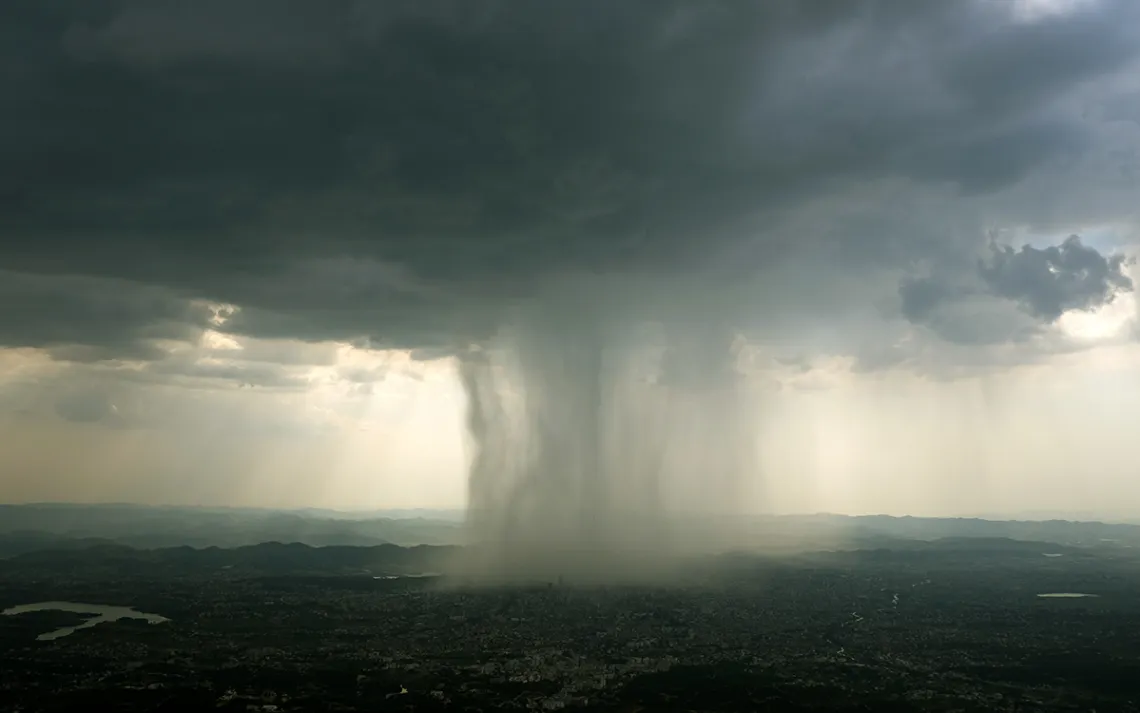
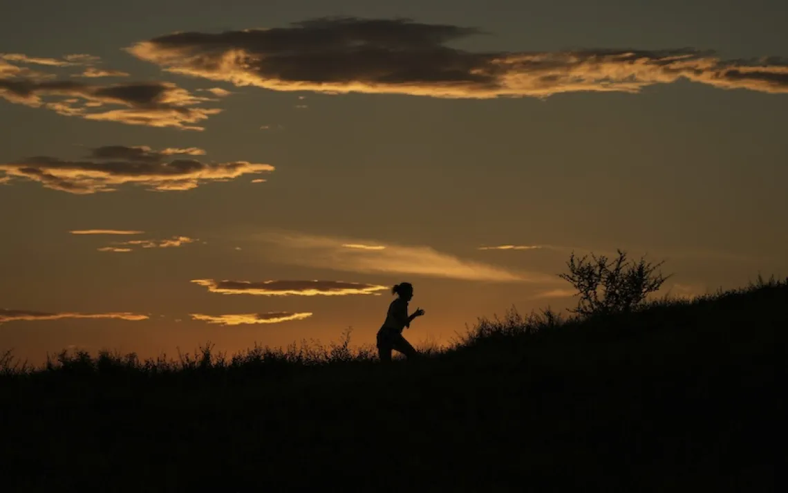
Photo by Serkan Senturk | iStock
In December 2016, meteorologist F. Martin Ralph was sitting in a restaurant in San Francisco. On the TV screen, the weather report was talking about a particular kind of weather formation called an atmospheric river, which was headed right for California.
Atmospheric rivers are exactly what they sound like—rivers of water vapor, flowing through the atmosphere. They move from the tropics toward the continents and poles, stretching to as much as 375 miles wide and carrying more water than multiple Mississippi Rivers.
When an atmospheric river meets mountainous terrain like the Sierra Nevada, the water vapor condenses and becomes rain or snow. Strong atmospheric rivers can bring about floods and landslides, but the water and snowpack they leave behind provide California with 25 to 50 percent of its yearly precipitation in just a few days.
Back at the restaurant, Ralph looked up at the symbols for the weather forecast on the television. There was a little sun on Monday, then a cloud on Tuesday, and a dark heavy cloud on the day that the atmospheric river would arrive. A little, dark cloud seemed nowhere near close to conveying the danger that some Californians would be in when the storm arrived. “I found those symbols and the explanation to be wholly inadequate in terms of conveying to the public that there's potentially a major storm on the horizon.” That was the moment he decided to develop a new way of showing just how much or how little risk an atmospheric river poses to the communities in its path.
A Double-Edged Sword?
Ralph is director of the Center for Western Weather and Water Extremes (CW3E). On the West Coast, he says, scientists have studied atmospheric rivers for well over a decade. Research on atmospheric rivers has shown that they are responsible for most of the extreme precipitation and flooding events that take place in California and other parts of the coast. Historically, the larger and stronger atmospheric rivers have been responsible for major floods (like the recent ones on the Russian River and in Riverside, California) as well as storm surges, extreme winds, breached levees, and landslides—especially in areas that have recently burned in wildfires. Close to 70 percent of postfire debris flow in Southern California can be traced back to atmospheric rivers.
But atmospheric rivers also provide much of the coast’s snowpack and water supply. The presence or absence of them can "make or break" California’s water supply for the year and be the difference between full reservoirs or drought. “They are a two-edged sword, because on the one hand, you really need the moisture that's associated with atmospheric rivers for the water supply, but on the other hand, if you get too much, in a really big atmospheric river, then you get a lot of flooding and negative consequences,” says Rob Cifelli, a radar meteorologist at NOAA.
Predicting the path and frequency of atmospheric rivers isn’t easy. All sorts of factors affect whether there will be an active season, including the condition of the Pacific Ocean, the tropics, the Arctic, and El Niño.

MIMIC-TW data of global precipitation collected by the Space Science & Engineering Center at the University of Wisconsin-Madison
Can Technology Help?
One of the problems with measuring how intense an atmospheric river is going to be is that they largely form over the Pacific Ocean, far away from weather-monitoring installations. CW3E is testing out ways to measure this intensity by dropping devices that measure temperature, pressure, wind, and water vapor from research aircraft flying above the storms. NOAA, with support from other federal and state agencies, has built seven Atmospheric River Observatories (AROs) along the West Coast, from Southern California to the Canadian border, that also collect and relay data about a storm as soon as it makes landfall.
Typically, an atmospheric river moves down the coastline from north to south, so the National Weather Service and other organizations can look at ARO data and predict what an atmospheric river’s impacts will be farther south. Near Seattle, says Cifelli, the Army Corps of Engineers uses ARO data to estimate when it needs to release water from the the aging Howard A. Hanson Dam in order to prevent it from overfilling and possibly bursting during an atmospheric river storm.
In California, the Department of Water Resources uses this information in a similar way. “They use the information to help them get a better sense of how much and how hard it's going to rain and, more importantly, to get an accurate estimate of the freezing level,” Cifelli says. As you go up in altitude, the air gets colder and colder, and at some point it freezes. If it happens to be precipitating at this point, that means the rain turns over to snow.
“This freezing level is really important in the West, because if you have a watershed and most of your precipitation is falling as snow, then the risk of flooding is reduced because the snow is going to melt off slowly,” Cifelli adds. “It's not a problem compared to a case where most of the precipitation falls as rain and it could run off and cause flooding.”
As the data collected on atmospheric rivers continues to add up, it will improve forecasts of the storms to come. When weather prediction models get direct observations like the ones these AROs provide, says Cifelli, scientists can then compare them to what the forecast model says it was going to be. And if the model agrees pretty well with the observation, then you have more confidence that it is going to make a good forecast, but if it doesn’t, you might put a little less credence in the model forecast and look into ways of improving it.
Before the AROs were installed, NOAA relied purely on climate models to predict the forecast. “A model is as good as the information that's going into it,” adds Cifelli. “Without those observatories the models were less anchored in reality, and so you had less information to help decide what you needed to do in terms of managing your water resources."
The Future
Atmospheric rivers could become more intense and unpredictable as climate change continues to change weather patterns, according to the Fourth National Climate Assessment, a federal report released in November. In the future, according to a 2018 NASA-led study, the frequency of the most intense atmospheric river storms is projected to nearly double.
As the atmosphere warms, it is able to hold more water vapor, and because water vapor is essentially the fuel for atmospheric rivers, it’s possible that atmospheric rivers will become stronger and more common—though it’s also possible that some other consequences of climate change could cancel those effects out.“The strength of an atmospheric river depends not just on how much water vapor is in the air but how strong the winds are,” says Ralph. "Some climate change factors reduce that.”
The difference in temperature between the North Pole and the equator can drive the creation of storms, including atmospheric rivers. As climate change narrows the temperature difference between the pole and the equator, the result could be less potential energy that could become the kinetic energy of a storm.
Still, says Ralph, there will be some storms in which the wind is as strong as it is today but the atmosphere is warmer and has more water vapor in it. In those cases, the atmospheric river is going to be stronger.
For areas along the West Coast that are already impacted by strong atmospheric rivers, this would mean more and more hazardous conditions for its inhabitants. That’s one reason why the atmospheric river measurement scale that Ralph started developing in 2016 and published this February in the Bulletin of the American Meteorological Society, is so important.
The scale ranks atmospheric rivers from one to five and creates the categories “weak,” “moderate,” “strong,” “extreme,” and “exceptional” for them, based on their intensity. Last month, an AR Cat 4 swept along the San Diego coast over Valentine’s Day, reaching “extreme” intensity. Almost 20 percent of San Diego’s average annual rainfall fell in one day, and several rivers flooded.
We don’t entirely know yet how climate change will affect atmospheric rivers. But in the meantime, they need to be classified, says Ralph, just like hurricanes or cyclones are. That way, the people in their path can clearly see the risks ahead.