Dams Blocked Fish Migrations in These Alabama Rivers for Decades
Now the rivers may once again flow freely into the Gulf of Mexico
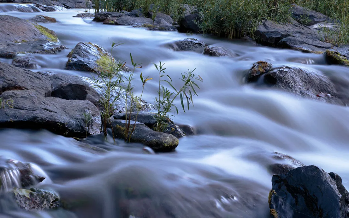
Cahaba River, Alabama. | Photo by Charles Green/iStock
When most people think of mass fish migrations in the United States, images of salmon navigating the fast-moving currents of Alaska and the American West usually come to mind. However, thousand-year-old spawning migrations by dozens of different species have taken place in the muddy waters of the Southeast for just as long.
The Geological Survey of Alabama estimates that 10 percent of freshwater resources in the continental US originate or run through Alabama. All of this freshwater means one can find more than a quarter of America’s fish species, more than half of its turtle species, and more than 60 percent of its mussel species within the state's waterways. And three rivers play a major role in supporting this biodiversity: the Alabama, Cahaba, and Coosa.
Historically, these rivers saw migrations of mullet, sturgeon, walleye, and striped bass from the Gulf of Mexico to spawning grounds upriver. This movement helped create a complex web of coevolution and dependency that worked for centuries, especially among mussels and their migratory host fish. Then came the dams. Multiple impoundments were erected, dividing wildlife populations and severing inland rivers from the coast.
Now, a coalition, led by the Army Corps of Engineers and the Nature Conservancy, hopes to pull off what the conservancy has billed as the “most ecologically significant river reconnection project in the history of the United States.” The potential project began with a feasibility study in November 2021, when the Army Corps started looking at different fish passage options, possible environmental impacts, and costs.
The groups would like to see two bypass channels, or canals that mimic a natural stream, built around dams on the Alabama River. In doing so, the bypasses would hopefully allow migrating fish to access historical spawning areas. “This is kind of the next attempt at something that can at least put a life support line to this whole system,” said Jason Throneberry, the Alabama Nature Conservancy’s director of freshwater programs.
To bring back migrations, engineers and planners must first devise a way for fish to get around two dams, the Claiborne and Miller’s Ferry, that block access to rivers upstream. As it stands, fish can only migrate over the Claiborne Dam when the whole structure is submerged due to flooding. Miller’s Ferry Dam, farther upriver, halts migrations entirely and is too tall to be submerged during high water. If successful bypasses were dug around these two dams, it would essentially reconnect the state’s longest free-flowing river to the Gulf of Mexico.
Some estimates place half of all North American extinctions since European colonization in Alabama’s Mobile Basin. The Coosa River, still one of America’s richest in terms of aquatic wildlife, suffered more so than others. Some 36 species were eradicated from the river during the first half of the 20th century after multiple sections were impounded. “It is the most underwritten conservation story in North America,” said Paul Johnson, the director of the Alabama Aquatic Biodiversity Center, referring to the environmental destruction that happened in the Southeast. “And there's not a bigger conservation crisis.”
And then there were the sturgeon—giant, plated fish that were once so plentiful they were considered a nuisance by fishermen. In Alabama, they once supported an entire caviar industry. However, fast forward to the present, and the gulf sturgeon is considered endangered, while the Alabama sturgeon hasn’t been seen in over a decade.
“It's probably definitely the rarest species in Alabama and maybe the rarest vertebrate in North America.... In fact, it may be extinct,” said Auburn University associate professor and extension specialist Rusty Wright.
The economic development that Claiborne and Miller’s Ferry dams were meant to spur never materialized. Instead, boat traffic and lock usage dwindled year after year until the locks were barely being opened at all. The Corps and others began to worry that one of the river’s last lifelines was being severed. So they started opening the locks regularly, in the hope that fish would enter and then continue their migration upriver. Wright, his colleague Dennis Devries, who is the assistant director for research programs at Auburn University’s School of Fisheries, and their team of grad students tagged a host of different species to see if this was the case. The team mainly focused on paddlefish, as sturgeon proved to be too rare to find and tag. To their dismay, they found that practically none of the fish that were tagged utilized the locks to migrate upstream. There “was a very, very low probability that fish would go through the navigational locks,” Wright said. In fact, he could count on his fingers the number of fish that were tagged and actually entered the locks and swam upriver.
That was part of the impetus for the dam bypass project. It involves, to some degree “everybody who knows anything about fish in Alabama,” Throneberry said, which is part of what makes this effort particularly remarkable. In the Alabama Nature Conservancy’s talks with dozens of agencies and groups throughout the state, the feedback has been positive virtually across the board, especially in initial conversations with the Corps of Engineers, which controls the dams, he added.
“It's nice when everybody's in the same corner. You're not fighting to constantly keep it on the table,” Throneberry said. “There was no question. This is going to be on the table. Something's going to get done.”
Public meetings held in May and hosted by the Corps addressed potential water level issues and dispelled rumors that the Corps was simply going to blow up the dams. James “Big Daddy” Lawler has lived near Miller’s Ferry for 72 years. He said he remembers catching mullet “by the bucket” with his father before the dams were built. When the rumors first surfaced, he invited the Nature Conservancy’s state director on to the Outdoor podcast he hosts, and the two discussed the project. The conversation touched on everything from changes in water levels to ecological benefits and fishing. It was that discussion, along with the director’s transparency, that Lawler said won him, and many others, over. He now counts himself an ardent supporter of the bypass. However, he does have doubts when it comes to funding. It’s estimated that the project is going to cost around $180 million if it’s approved, according to Throneberry. That’s a lot of money in a region that’s historically been plagued by poverty.
The project still has a long way to go. The feasibility study won’t be completed for another year and a half, and then there’s still the issue of funding. After that’s secured, the bypasses have to be designed and built, not to mention they have to actually work.
And what does working look like? According to Throneberry, nobody is entirely sure. This project would be a first of its kind in the Southeast, and there are still plenty of questions to be worked out. However, he and many others are hopeful.
“We know we've lost stuff. We know we will continue to lose stuff for multiple reasons. But if we can keep what we have, lessen the rate of decline because of what we do, then that's a success,” he added. “And it’ll have huge implications, not only in the Southeast but hopefully nationwide.”