Fire and Ice: The Pacific Crest Trail in the Era of Climate Change
The iconic trail and the hikers who traverse it face a number of challenges
Photos courtesy of Alex Brown
I'm climbing the western flank of Mt. Washington, a jutting outpost of volcanic rock in the Oregon Cascades, when I hear the all-too-familiar thrum of helicopter blades. Nearly four months into my thru-hike of the Pacific Crest Trail, I've come to associate the sound with bad news. In Southern California, rotors had garbled the loudspeaker-blared instructions of the rescue team hovering over our camp, dispatched to pick up a hiker suffering from altitude sickness. More than 1,000 trail miles later, just shy of the Oregon border, I'd spent days watching choppers go back and forth overhead, refilling on water to fight the blazes that were filling the valleys below with hazy smoke.
This time, the helicopter buzzes close, past the skeletal burned-out trees I'm hiking through, and hovers over a slope east of the trail. I hear it just behind the trees as I finish my climb, but it's gone by the time I top the ridge and follow the trail to the right. There, in the spot vacated by the chopper, I see tendrils of smoke rising from the trees, just 100 or so yards off the trail. My hiking buddies and I gawk at the sight, scarcely believing the fire is so close. We quickly hike on, not saying much. A couple miles later, we cross paths with a fire crew, 15 or more strong, hiking toward the blaze as we make tracks in the opposite direction.
The Mt. Washington fire that gave us such a scare was barely a footnote amid the devastating wildfire season that hit the west last year. On the PCT alone, active fires forced us off the trail at Crater Lake, the Three Sisters Wilderness, Mt. Jefferson, and Mt. Rainier. Even in places where the trail was open, we sometimes spent days hiking through smoke, our views obscured and bodies ill from breathing it in.
"Last year was the most challenging year we've had in terms of dealing with closures on the PCT," said Beth Boyst, who for the last 11 years has been the trail's chief administrator with the U.S. Forest Service (the PCT passes through all different designations of federal and state land, but USFS holds the lead oversight role). Boyst’s tenure has seen the PCT through some tenuous conditions. She watched California's five-year drought take its toll on the trail, only to be mitigated by last year's near-record snowfall that made hiking the Sierra Nevada—even in midsummer—a dubious proposition.
The PCT, “America’s Wilderness Trail,” runs from the Mexican border to Canada, traversing some of the west’s most iconic places: the Mojave Desert, the Sierra, the Cascades. That it even exists is a symbolic statement about the country's priorities—a single pathway from the southern border to the northern border of the United States, the vast majority of it on public land. As it traces its way through six national parks, 25 national forest units, and 48 federal wilderness areas, it weaves a narrative of changing ecosystems and the monumental effort required to set aside and protect each one. It's not just the snow-capped peaks that make the PCT iconic. It's the long stretches in the arid Southern California desert, the thick, sunlight-blocking forests in the Pacific Northwest, the fact that they're all part of the same trail and open to the public.
Every year, a few hundred thru-hikers—like me—walk the trail’s entire 2,650-mile length, but the number of people who simply set foot on some part of it each year is closer to a million. For thru-hikers, desert conditions in the south and heavy snowfall at high elevations mean their five-month hike must take place in a short window, generally between April and September.
Even more so than its East Coast sibling, the Appalachian Trail, the PCT is uniquely susceptible to the effects of climate change. "The west has been the center of the warming, and the warming in the west has been greater than it has been in the east," said Hugh Safford, a regional ecologist with the Forest Service's Pacific Southwest office. "Water stress is a much bigger issue in the west."
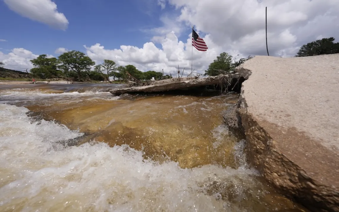
Water, scarce already in the desert, becomes even more limited when droughts persist, which can be brutal for hikers. Last year, after a particularly wet winter, I still often faced 20-plus-mile water carries between sources. Hikers in previous years frequently found dry stream beds at the spots where I refilled.
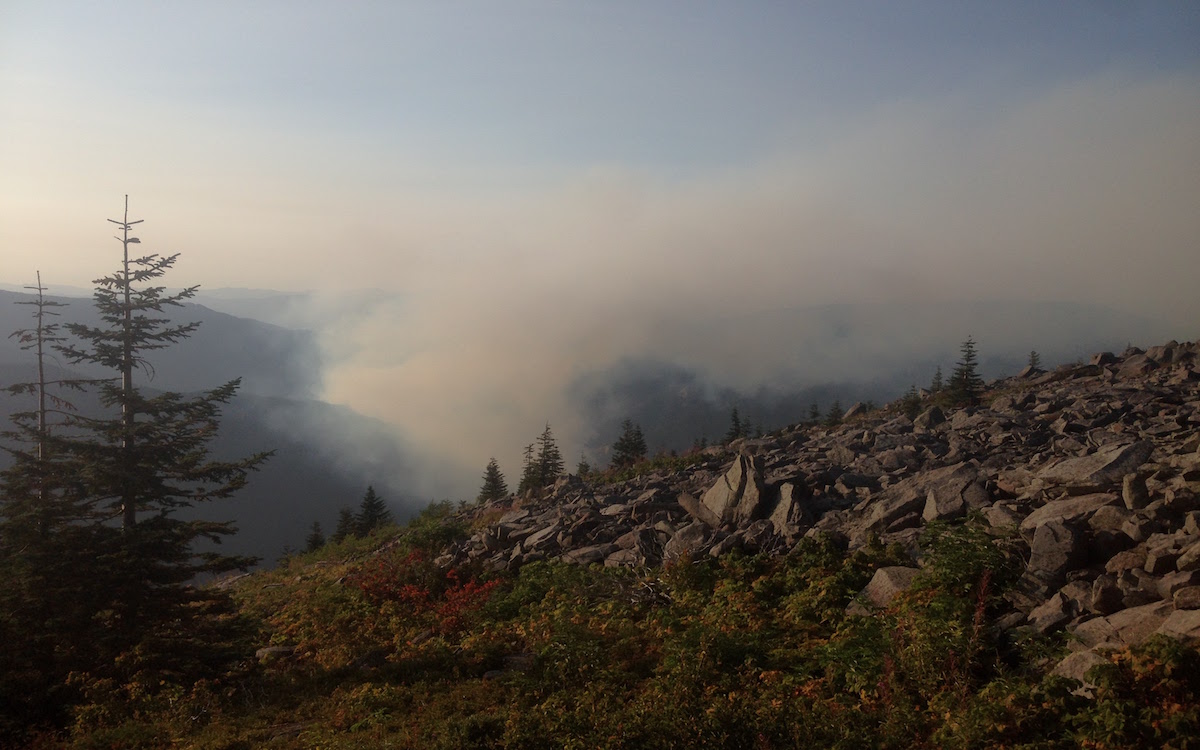
Smoke is visible from a ridge in the Mt. Hood National Forest.
At high elevations, warmer temperatures lead to change as well. “Precipitation is coming as rain now and less as snow, and that leads to less water availability,” Safford said. The snowpack in the Sierra Nevada is a frozen reservoir that releases its resource gradually throughout the year. When it rains instead of snows, much less of the water makes it down to the Sierra-dependent dams and reservoirs that supply 60 percent of California’s water.
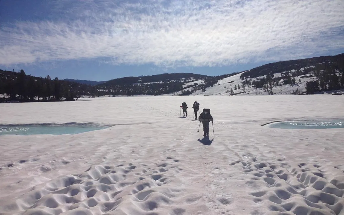
It’s not just the general trend of hotter, drier years. While the long-term averages change only incrementally, those numbers are arriving in increasingly high-variance ways. Last year, a half-decade of drought was followed by a Sierra snowfall that nearly doubled that of an average winter. More than 300 miles of the PCT was still buried when thru-hikers entered the mountains in June. For most PCTers, that meant skipping north and returning when conditions were safer—giving up on a continuous hike. For my group, that meant weeks of wielding ice axes and crampons, trudging over steep passes and constantly fording deep, raging streams.
The Sierra was arduous, sometimes dangerous. We pushed through out of blind stubbornness (not without taking all feasible precautions). It presented conditions for which we were unprepared, and for much of the summer it remained far outside the comfort level of the average hiker. Two PCT hikers drowned attempting to ford streams. “It’s not just that we’re concerned about really dry and exceptionally warm years,” Safford said. “We can have extremely wet years as well. . . . Those have huge impacts on downstream hydrology, trail conditions, and the ability of people to get through.”
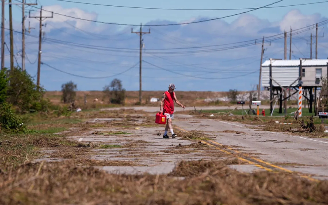
For last year’s hikers, the relief of getting through the snowy Sierra was soon tempered by the constant wildfire closures in the Northwest. We dubbed 2017 the “fire and ice” year on the PCT. But when it comes to fires, some are worried that 2017 represents more a trend than an anomaly. “In 2017, we had 300 miles of the trail that were closed at some point because of wildfires,” said Mark Larabee, the associate director of communications and marketing for the Pacific Crest Trail Association. "That issue is not going away. The ecosystem thrives on fire . . . but we’re seeing bigger fires and more of them, possibly because of climate change."
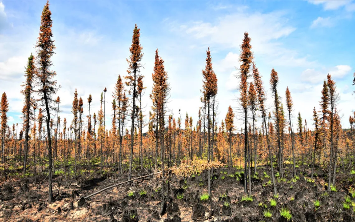
The fire issue is particularly vexing, because it’s a vicious cycle with no easy solutions. A century of aggressive fire suppression has allowed forests to grow far beyond their historical densities. That means more fuel when fires do come. It also hurts the forests in other ways. “When you have more trees on the ground than can be supported by the resources, when you have periods where you don’t have enough water, the trees become stressed,” said Dr. Steve Ostoja, director of the U.S. Department of Agriculture’s California Climate Hub. “When trees become stressed, the beetles hone in on the stressed trees and they can attack them.”
Last month, the Forest Service announced that California had reached a record of 129 million dead trees as a result of the drought and bark beetles. A wet 2017 helped slow that trend, but it’s too early to tell if the worst is over. “It takes one to three years for trees to recover their resiliency after a stressful event like this drought,” said Stephanie Gomes, who leads the Forest Service’s Tree Mortality Team. “If we don’t get a good water year (in 2018), that could further stress those trees.”
Many of those die-offs happened along the PCT; acres of dead timber were peppered with tiny holes. For a while, we wondered if particularly aggressive woodpeckers had decimated the forest. The ruined trees stood in stark contrast to the lush slopes we’d seen in other sections. Throughout the trail, we would come across large swaths with only the skeletons of dead trees, looking much like the remains of a forest fire but mysteriously uncharred.
The problem goes beyond aesthetics. When the dead trees fall and cover the forest floor, they create a carpet of fuel that’s unprecedented. “Once the fire gets in there, it’s going to cook the floor like nothing you’ve ever seen,” Safford said. “That’ll kill pretty much the rest of your living trees, cook the soil and kill everything in the soil. That sets you up for major erosion in the long run.”
Reopening a trail after a fire is notoriously hard work. In the San Jacinto Mountains in Southern California, volunteer crews have put in arduous years of work after a 2013 fire closed 25 miles of the PCT. Still, eight or nine miles remain closed in an area where the vegetation burned away and retaining walls slid off the mountainside. The PCTA and USFS are still evaluating which of the sections closed by fire in 2017 will be able to reopen this year. In spots where fire crossed the trail, it might be awhile.
Beyond climate change’s impact on the hiking experience, land managers are still working through what it will do to the ecosystems the PCT traverses. “Vegetation is certainly going to change,” Ostoja said. “We don’t know what’s going to happen to the wildlife species that use those upper elevation habitat resources. . . . As conditions change and species continue to march upward, where do they go if they can’t continue to go upward? They go away.”
Stakeholders see other threats to the PCT as well. The Trump administration outraged conservationists with a decision last June to shrink Bears Ears National Monument. Secretary of the Interior Ryan Zinke has recommended shrinking other sites as well, including Cascade-Siskiyou National Monument, through which the PCT passes.
It’s a polarizing issue. PCT hikers walk through Seiad Valley, a tiny Northern California outpost just shy of the Oregon border, a place where nearly every landowner has a large “No Monument” sign displayed on their property. Locals stridently oppose what they see as a federal takeover of lands that should be locally managed. But advocates note that Cascade-Siskiyou is the only national monument directly created to protect biodiversity and argue that it deserves to be upheld. “We would not be in favor of lessening protections for the trail in that area,” Larabee said. “We’re concerned about making sure the trail is protected.”
Preservation is not the only concern of PCT advocates. The trail is still not complete; close to 10 percent of it runs through private land, and it’s in danger of losing the resource agencies they have relied on to bring land into the public domain. The Land and Water Conservation Fund is set to expire in September, and supporters say it’s a vital piece of the trail’s future. LWCF takes money from offshore drilling fees and sets it aside for public lands acquisitions. It’s been a key resource for the trail, investing more than $15 million to help purchase private lands that are now seamless parts of the trail’s parks and wilderness areas. Over the past 16 years (that’s how long the PCTA has been keeping track), the fund has made 64 separate acquisitions to obtain land for the PCT, totaling nearly 21,000 acres.
“The Land and Water Conservation Fund has been instrumental in making the PCT what it is today,” said Amy Lindholm, who coordinates the LWCF Coalition, a nonprofit that advocates for the fund. What’s less well known is the amount of work still to be done; something like 300 miles of the PCT—about 1,500 parcels of land—remain in the hands of private owners. Those owners grant narrow easements, sometimes just a 10-foot swath, to allow hikers to pass through. That access isn’t guaranteed, however.
In November, the PCTA purchased a tract of land in Stevens Pass, Washington—a key PCT access point—from an owner who had threatened to put a fence across the trail and sell the land for development. That purchase was initially supposed to be made with LWCF funds, but after that money was diverted to firefighting efforts, it came to the nonprofit to take out a loan before the purchase deadline closed (the PCTA will turn over the land to the Forest Service and expects to be reimbursed when funding levels return to normal).
“Most people don’t realize that the PCT’s not really finished,” Lindholm said. “The PCT has huge gaps in it. People think that because the trail has a name, it’s connected end to end.” If the trail is to become a continuous wilderness, it will need the LWCF to help meet those needs.
Many of these plans, Lindholm said, are “once in a generation” opportunities. Megan Wargo, the PCTA’s Director of Land Protection, sees it the same way. “In many cases, if we can’t respond to a willing seller along the trail, those properties are sold to someone else and often developed, and our opportunity to protect that piece of the trail is lost forever,” she said. While the PCTA is often assisted with funds from private donors, “the land acquisition needs along the PCT are too large to address without the Land and Water Conservation Fund.”
At present, 218 members of the House of Representatives—a majority—have co-sponsored a bill to permanently reauthorize the fund. But Representative Rob Bishop, who chairs the Natural Resources Committee, and thus LWCF’s path to the House floor, opposes reauthorization without major changes. If supporters can’t find a way to get it passed before it expires in September, funding will lapse until Congress decides to restore it again.
Lastly, the PCT is starting to face challenges due to its own popularity. The last five years have seen skyrocketing numbers of thru-hikers, as the Cheryl Strayed memoir Wild, which became a Reese Witherspoon movie, helped bring the trail into the national consciousness. Managers have had to limit permits for the southern border to 50 a day, a quota that fills in minutes when the applications open online. Even 500 miles from the border, the “hiker herd” numbered in the scores last year. Conditions in the Sierra quickly thinned out those numbers, but that’s less likely to happen in drier years.
The trail stakeholders say they’re constantly evaluating visitor use and what the ecosystems can handle, but note that hikers are generally good about following Leave No Trace principles. One change that’s happened organically is that the GPS phone apps used by most hikers point out good tent spots along the trail, and many PCTers plan their campsites accordingly. That concentrates wear-and-tear to those areas, a better scenario than new sites getting trampled every night.
As the trail’s popularity continues to grow, its managers and aspiring hikers will have to reevaluate how to preserve the trail—and trail experience—without closing it off. “One solution is to limit visitor use,” Boyst said, emphasizing that would be a last resort. Far preferable is to find ways to ensure that it’s resilient enough to handle the extra traffic.
Future thru-hikers might have to reconsider planning for the traditional continuous south-to-north hike, said Jack Haskel, the PCTA’s trail information manager. With all the demand for starting spots on the southern border—especially on dates that line up with the PCT’s slim weather window—hikers might need to think about hiking in sections, out of order, or joining the minority of PCTers who trek southbound.
“The PCT is definitely more popular than ever, but that’s also been true every year for the history of the PCT,” Haskel said. “Trails really die when they are not used. And if the PCT was not used, that would be worse than having to figure out, ‘Wow, this is so popular. We’re going to have to do more maintenance.’”
The challenges facing the trail are not unique to its parks and forests; they're being felt in places all over the west. But only on the PCT are they threaded along a single, unbroken corridor, a reminder that none of these issues are playing out in isolation. They're being felt in the tiny trail towns that welcome hikers each year; in late June we hiked through towns with roads still snowed in, others on the brink of evacuation due to wildfires. If the Pacific Crest Trail serves as a symbol for what makes our conservation ethic great, it must also serve as a symbol for the challenges with which it will have to grapple.
But Haskel and others are optimistic about the trail’s future, despite the extensive challenges it faces. This year marks, legally, the 50th birthday of the PCT and the Appalachian Trail—The National Trails System Act passed in 1968. The Forest Service and PCTA plan on celebrating many more. They point to the 91,000 volunteer hours devoted to the trail last year and the revenues it brings to local communities to illustrate its far-reaching support. The volunteers and advocates who love it make for a strong voice. Climate change presents many unknowns, but it won’t be on supporters alone to deal with those changes. “Nature’s a little more resilient than sometimes we give it credit for,” Ostoja said. “The context that it’s set in might change, [but] the trail is still going to be a trail.”