Go Big and Go Home
You can spend four days circumnavigating Chicago on the Outerbelt Trail and still come home for dinner
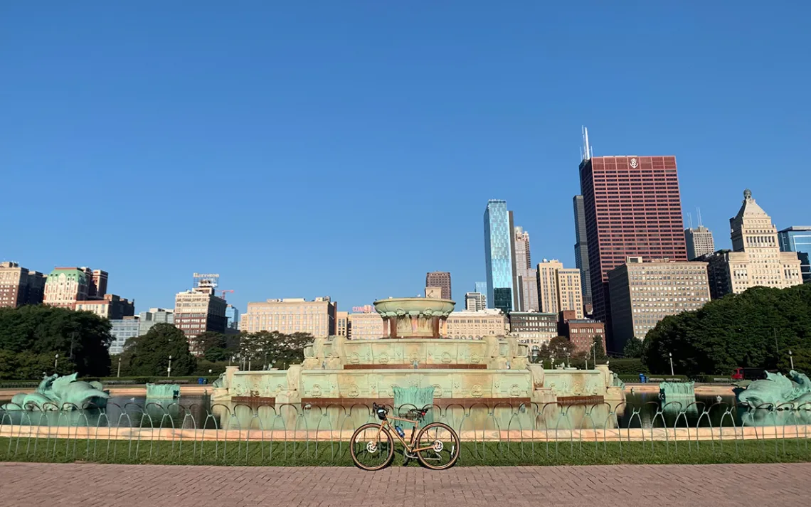
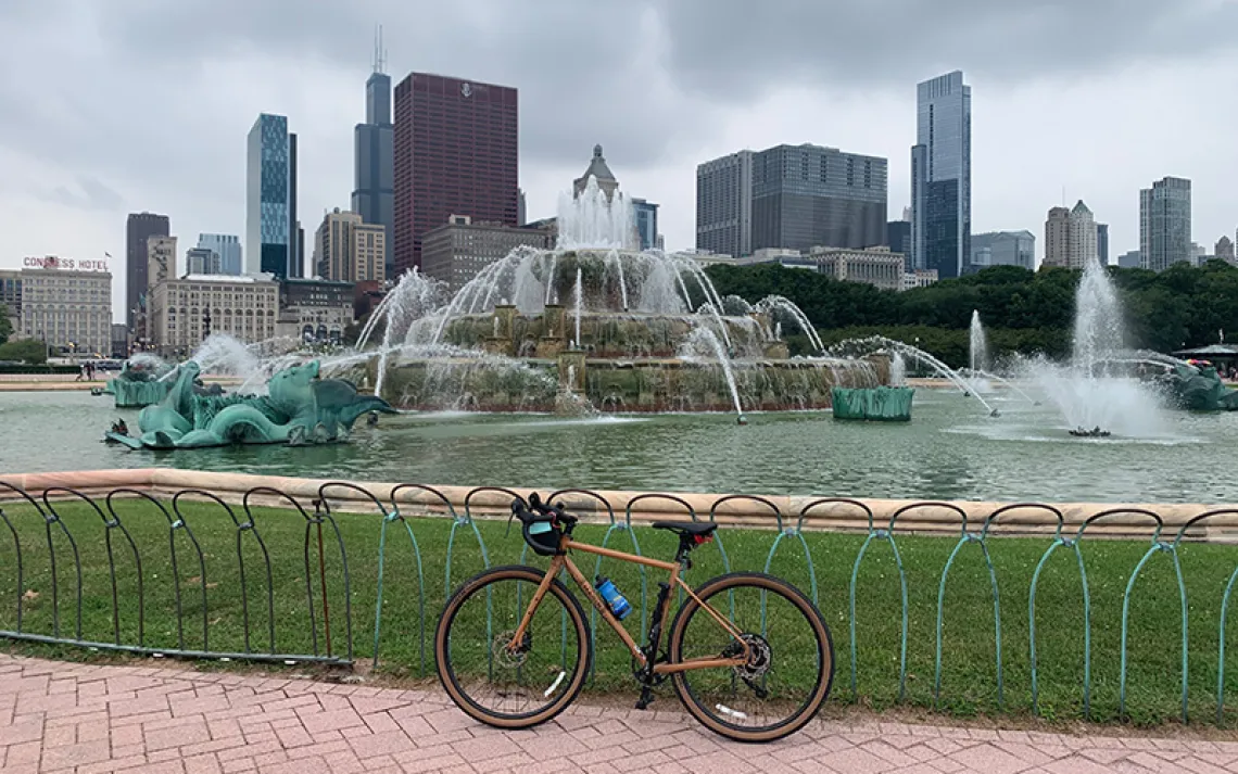
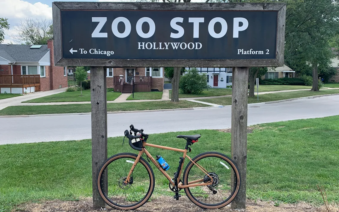
The Chicago Outerbelt Trail begins and ends at Buckingham Fountain, in downtown Chicago. | Photos by Parker Yamasaki
I should have known that the Chicago Outerbelt Trail wouldn’t be straightforward. The concept is a 210-mile loop that follows the floodplains and waterways that surround the greater Chicago area. But the trail is not a singular trail, rather a series of linked bike paths, river trails, sidewalks, side streets, service roads, frontages, and back alleyways. It is, nevertheless, well documented on Trail Run Project, the Chicago Outerbelt Alliance website, and in the Chicago Tribune. So I confidently (foolishly?) decided to bike its entirety.
Luckily, when I reached out to Jay Readey, one of the original architects of the Outerbelt Trail, he wanted to join. “Your timing is excellent,” he replied. “We have been seeking to lay out a bike-camping 3.25-day weekend trip, and I purchased ride-by-GPS so I can develop turn-by-turn directions for the whole thing.”
For this trip, we decided to bike the trail over four days, using public transportation to get to each day’s starting point. It’s possible to do the route continuously, stopping at campsites managed by the Cook County Forest Preserves, but I was as interested in the transportation to get there as I was in the trail. I wanted to know how easily someone could complete the lap while staying engaged with their everyday life. Which is to say, I still had to work.
Readey and I meet for the first time at 7:30 a.m. on the southeast edge of Buckingham Fountain in downtown Chicago. He’s easy to spot based on his text from the night before: “I’m 6'7" and hard to miss!” We start our GPS watches, cross Lake Shore Drive, and head south along the Lakefront Trail. The water of Lake Michigan to our left still has its morning gloss. We click through winding, paved miles while Readey tells me about his background in competitive ultramarathon cycling and his Tour de France heroes. Everything feels fresh.
A small detour off the Outerbelt Trail leads to a bird and butterfly sanctuary at the edge of the South Shore neighborhood.
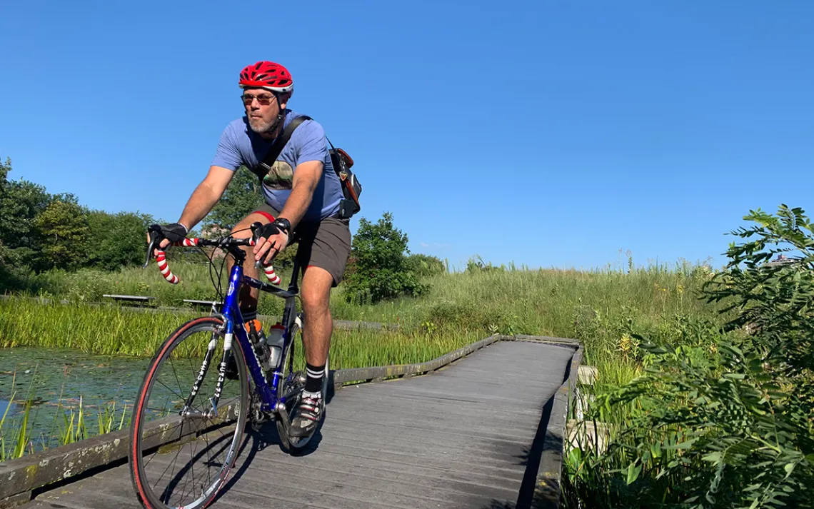
Jay Ready, Outerbelt founder and the author's personal tour guide, heads through a sanctuary sandwiched between Lake Michigan and the South Shore neighborhood.
Readey is a lawyer, an investor, a board member, a CEO, a cyclist, and a trail enthusiast who carries no fewer than three different types of business cards on him at all times. A committed bike commuter, Readey had practice linking together the best possible bike routes. The idea for the Outerbelt Trail began in 2017 with an attempt to connect his home in the south suburbs with the shore of Lake Michigan. It blossomed from there. In 2018, he and a group of other enthusiasts hiked the trail’s entirety for the first time.
Ismael Cuevas was working as the aldermanic chief of staff in the 10th Ward when Readey “recruited” him to the Outerbelt Alliance. The 10th Ward is on the southeast side of Chicago and includes both the highest concentration of industrial sites as well as the only state park in the city. “I told him that normally hiking and things like that are for people who have money, who are mostly white,” Cuevas tells me. “I grew up on the South Side, I’m Mexican from an immigrant family. We did hiking sometimes, but it wasn’t like, a thing.” He told Readey that the Outerbelt Trail is about getting access. Readey responded: “Yeah, I’m in the same boat as you. Do you want to work on this?”
In his day job in city government, Cuevas advocated for an extension of the Burnham Greenway, a bike path that will eventually bridge two segments of the trail currently split by a 500-foot dash across a heavily trafficked intersection and five sets of railroad tracks. As Cuevas talks about access, he teeters between the physical and the philosophical: “Can I get on the trail?” he asked. “Can I physically cross these tracks, the ones that have historically divided neighborhoods from one another?”
Back on the road with Readey, we get to a break in the Lakefront Trail and jump onto South Shore Drive. Readey starts reminiscing about the original planning hike along this road: Here is where a baker loaded them up with scratch-baked goods; this is where one hiker got a call that his father had suffered a heart attack. We visit a butterfly sanctuary and Steelworkers Park, where relics of the steel manufacturing industry fragment the shoreline.
Exiting the park, we cross a rusted metal drawbridge over the Calumet River and then duck under the Chicago Skyway. “The main issue with connecting the Outerbelt Trail is crossing the waterways and the highways,” Readey says, as we head toward the East Side. The sidewalk disappears out from under us, and we dip into the neighborhood of well-kept working-class houses.
We’re in the Calumet Region of southeast Chicago, an area that was known as the industrial manufacturing center of America for well over a century. It is a hub of rivers and railways that radiate out from the south shore of Lake Michigan. The deeper into this region we bike, the more they threaten to sever our route. It’s in this region, as we bike through an area called Big Marsh, that I discover how much Jay Readey loves bridges.
Big Marsh is exactly what it sounds like and nothing like what I expected. The surrounding area has hosted four steel mills (US, Wisconsin, Republic, and Acme), the Illinois International Port Grain Elevators, and a Ford assembly plant. The grain elevators and Ford plant are still active; the last of the steel mills closed in 2002, but not before making a huge mess.
“Those smokestacks over there are on the Big Marsh logo,” Readey says, pointing across a field of patchy grasses and dark-red dirt scars. “We call this the moonscape,” he says, lowering his finger toward the field. “Nothing can grow on that soil because of the slag.”
In order to make steel, iron ore is heated to a liquid state so the impurities can be removed. Those molten impurities become slag, a toxic byproduct that gets discarded into large “slag dumps.” Until 2002, that was Big Marsh. In 2011, Chicago’s Parks Department acquired the land and, in collaboration with Friends of Big Marsh, spent over a decade revitalizing it.
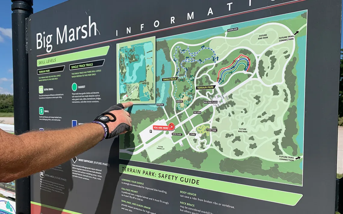
The riders take a look at an overview of Big Marsh, a restored wetland and bike park.

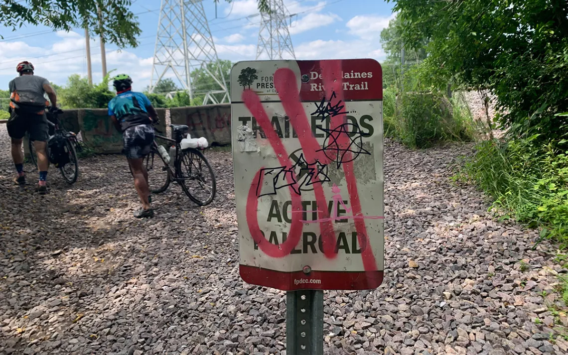
The trail was originally designed for hiking, so certain areas require some creative maneuvering.
First, they had to get rid of the bad stuff. The slag was capped with over 300 truckloads of dirt donated from various construction sites. Non-native phragmites (a tall, red-headed reed) were eliminated with controlled burns. Those burns exposed hundreds of beer bottles from urban recreationalists and had to be cleaned up as well. (They returned about a week later, reports Readey.)
The area is naturally a hemi-marsh, a deep water wetland with a mix of aquatic and emergent plants. It’s also home to muskrats, herons, and secretive marsh birds like the American coot, marsh wren, and least bittern. During the restoration, thousands of native grasses and trees were reintroduced, waterways were reestablished, and the birds made their way back to the land.
Then came the paved paths, the bike park, and the bridges. Readey wants to take me over a new bridge that he saw posted on social media. We ride to the spot where he thinks it should be, but we don’t find it. As we carry on, he is confused, then excited. We skirt the marsh and head toward a corner of the park that was previously impassable. As we approach a second water crossing, the new bridge comes into view. Its rust-colored beams and dark wooden planks probably wouldn’t have given me pause, but Readey points at his bare calf: “I have goosebumps,” he says.
For him, crossing that bridge was the culmination of a decade of restoration and rejuvenation. When the work on the area began in 2011, it wasn’t a place that people would go out of their way to visit, let alone recreate in. Now, with this bridge in place, users can circle Big Marsh on a continuous path—traveling through the bike park, along Three Finger Lake, and across the big marsh. And if there’s one thing that Readey likes more than bridges, it’s probably loops.
After Big Marsh, we make our way back to the Burnham Greenway, and the path becomes more broken. (We hit a dead end, and “Road to Nowhere” by the Talking Heads starts to play on repeat in my mind.) At the border of Indiana, we stop for pizza and end up in conversation with a man who just opened a bike shop. Readey hands him one business card, then another. Before we part ways, their conversation has wound through local cycling groups, into property tax law and business mentorship, and then back to bikes. “Sorry about the business talk,” Readey says as we pull away. I assure him it’s no problem; it’s part of being on the trail.
The first day’s ride ends up being 20 miles and two hours longer than we estimated, and on the train home, I rearrange my afternoon meetings for the rest of the week. Sadly, I also accept that my time on the Metra heading back downtown can’t be spent in the salty, sun-burnt haze that I want to succumb to. This is prime writing time.
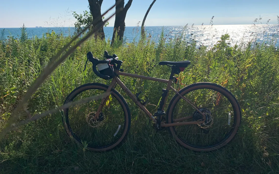
The author's bike at Buckingham Fountain, in downtown Chicago.
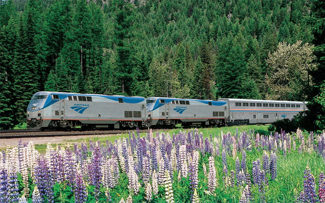
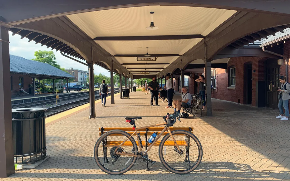
Each day started and ended on the Chicago Metra, which extends like spokes from Chicago's downtown station out into the suburbs. Above, waiting for the train at the end of the day.
The porous boundary between the city and the trail is an essential characteristic of the Outerbelt experience. It’s fragmented in the way that city life is fragmented: work and play, nature and architecture, rushing between and pausing for a breath. On the Outerbelt, it’s all integrated. You stop for a sip of water and a close look at a leaf while the traffic of I-294 rushes a hundred feet overhead.
In contrast to the industrial hum of the southeast suburbs, the next morning’s ride through the southwest is flush with forest preserves. These tracts of land are quilted together in a way that makes it possible to exit the bike path in one and head straight onto the bike path in the next. In a dozen miles, we pass through as many preserves, including the Burr Oak Woods, the Swallow Cliff Woods, and the Bartel Grassland Land and Water Preserve.
The Bartel Grassland complex is a former agricultural site that was restored and designated for protection in 2003. It was named after a well-known bird bander and conservationist in the Chicagoland area and has been designated as an Important Bird Area by the Audubon Society. Its nearly 400 acres of wide-open grassland provide important breeding habitat for bobolink, eastern meadowlark, grasshopper sparrow, dickcissel, and Henslow's sparrow. Blue herons and bald eagles can be found nesting in its tree-lined perimeter.
The trail also winds through coveted, dense oak groves like the Palos Preserve, and, farther north, miles upon miles of uninterrupted Des Plaines River Trail. The Outerbelt’s eastern boundary, the Lakefront Trail, is streetside and heavily populated but still elicits its own city-centric awe: Nearly 20 miles of smooth, paved shoreline with zero street crossings.
The Outerbelt isn’t perfect. It doesn’t have signs, and it occasionally requires some imaginative navigating through sections broken up by streets. But it’s accessible to a fault. You can still be reached by phone, email, and text. You can even join a Zoom meeting on your way to the trailhead.
The end of day three, waiting for a train back to downtown Chicago.
The Outerbelt isn't perfect, but that's part of the fun.
But the connectivity is part of its joy as well. It’s the reason we’re able to put in big days on the bike and still make it home for dinner. It’s the reason that friends are able to join us after a 7 a.m. “heads up” text. It’s the reason the 10th Ward is involved at all, and other Southeast neighborhoods that don’t have a clean, green line from the city center. It makes finding these uninterrupted lengths of greenery so much more luxurious, whether they last 12 minutes or 12 miles.
I haven’t figured out why it’s so satisfying to latch onto a logical (but entirely arbitrary) line on a map and want to physically travel along it. If you’d asked me a year or two ago, my answer would probably lean toward solitary time spent moving through nature. But after linking together as much green space as is logically (if arbitrarily) possible here in Chicago, I’m less convinced by that answer.
That’s not to say the Outerbelt is without opportunities for solitude in nature. The Chicago Parks District is the largest municipal park manager in the nation. Its 8,800 acres along with the Cook County Forest Preserves provide a total of about 78,000 acres of green space. Combined, these areas are roughly twice the size of Bryce Canyon National Park and three times the size of Illinois’s neighbor national park, Indiana Dunes. Throughout the four-day ride, we encounter large swaths of green space and places where nature has wedged itself into the built environment: old railroad lines converted to greenbelts, a former slag dump turned restored wetland, a gravel road through a cemetery.
So access to various kinds of nature on the Outerbelt Trail is absolutely integral, and I don’t need to convince anyone about the value of spending time in green spaces. But the Outerbelt Trail is about so much more. It’s about taking a long, slow look at what’s around us, and making it work.