Quarantining on the Ice Age Trail
One writer and her family cultivate patience, one hike at a time
Photos courtesy of Jenny Wisniewski
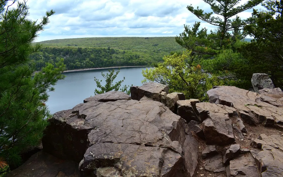
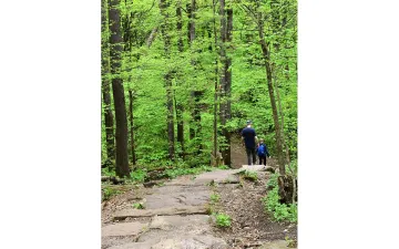
Sitting atop a picnic table at Devil’s Lake State Park (pictured above) one early June afternoon, we popped blueberries and cantaloupe chunks into our mouths as we gazed up at red-tailed hawks gliding above the treetops. My son Ryan played with my camera, pointing the lens upward, trying to capture their flight until impatience took over. Hopping off the table, he shouted his mantra—“Let’s go!” As always, Ryan, with his 13-year-old energy, was ready to move on much sooner than the rest of us. “You will do lots of waiting during your lifetime,” I told him. “It’s about time you started practicing.”
My family had come to Wisconsin’s Ice Age Trail (IAT) determined to find some purpose during this, our greatest exercise in patience, the COVID-19 pandemic. Gone were the evening soccer and baseball games, the Saturday golf and Sunday yoga classes. But, we could still move from point A to point B, one foot in front of the other, witnessing spring’s emergence in cautious, calibrated steps. So, we started taking to the trails—well, to the same trail, repeatedly.
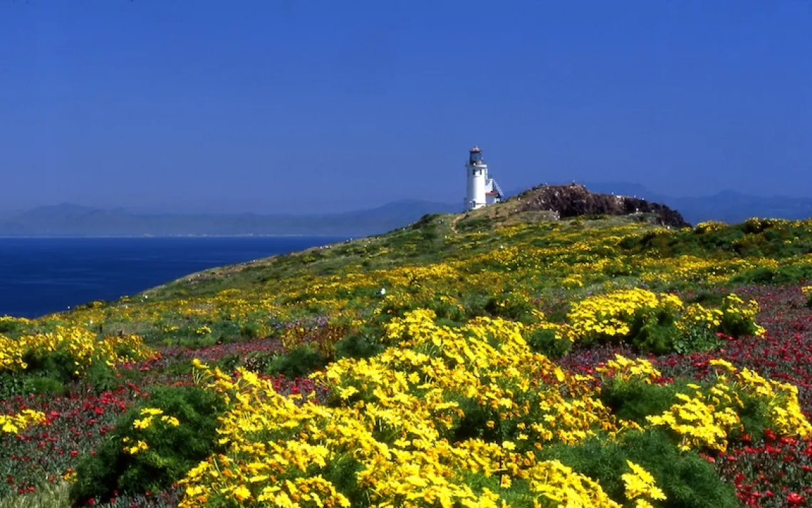
Disappointed to cancel our summer vacation to Maine’s Acadia National Park, we turned to the 1,100-mile trail in our backyard. One of only 11 national scenic trails, the IAT traces the edges of its eponymous glaciation. When a titanic sheet of ice up to two miles thick receded from what is now the state of Wisconsin, it deposited debris in its wake, artfully sculpting large cone-shaped mounds (kames), depressions (kettles), and lengthy ridges (moraines). Many experience this unusual topography via thru-hike. However, our team of four—Ryan; my husband, John; our goldendoodle, Tilly; and I—opted to take it in in stops and starts, one segment for every time the four of us could get into the same headspace. (During this ongoing period of nonstop family togetherness, of course, this spirit of cooperation was anything but automatic.)
We began in March, with layers of clothing on our bodies to shield us against the chill still holding strong in the air. Everything was barren, the ground momentarily void of snow and ice. (Wisconsin would yet see another couple of winter storms.) The four of us took our first steps along the IAT on the Scuppernong segment of the Southern Kettle Moraine area, not far from our home in Milwaukee. A week later, we visited another close-to-home Southern Kettle Moraine segment, Lapham Peak—a spot I typically came for cross-country skiing adventures. We were on a roll.
Two days later, though, our governor closed down state parks. Because the IAT traverses many of the parks in our part of Wisconsin, we were forced to put away our hiking boots. With a sigh, I resigned myself to the fact that this was one more detour I would have to wait out in the time of coronavirus.
By early May, the parks had reopened, and we were on our way to the Parnell segment of the Northern Kettle Moraine area, about an hour from home. We hiked along the four-mile Parnell Esker, a winding ridge that originated from a stream flowing under a glacier. It's impressive to imagine you’re walking the same path as this ancient stream, which deposited sediment along the ice tunnel it created. While the Parnell segment is 13.9 miles long, we had a single car, so we hiked out in one direction and backtracked, a total of nine miles.

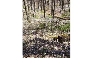
The woods were yet barren, the buds still waiting for a consistent stretch of sunshine. It was about three miles into the hike that we came to that tableau of loveliness that requires journeying deep into a landscape. It was a carpet of tiny lavender flowers calling our attention to spring’s subtle progress. The flowers, mere inches from the ground, covered yards upon yards of the forest floor, lending vibrant hope, despite all the naked tree branches.
A couple weeks later, on that particular early June afternoon at Devil’s Lake, as I sat beside John watching the hawks circle, I noted the fullness of the leaves fluttering green beneath the clouded sky. We had driven two hours west to one of the IAT’s most well-traversed segments. Home to a 10-mile slice of the IAT, Devil’s Lake State Park entices many with its 500-foot quartzite bluffs hugging its namesake, 360-acre lake. The area draws families, fishermen, and rock climbers in addition to hikers. That day, we’d begun our journey by ascending the cliffs on a twisting, two-foot-wide path, leading to outcroppings. There, we viewed the blue-gray water below, encircled first by forest, and beyond, rolling hills dotted with cherry-red barns. Ryan and Tilly shot straight up the path, stopping only to step aside for the numerous other hikers, all trying their best to social distance.
Though John and I carried backpacks with an ample supply of snacks, water, and other necessities, Ryan and Tilly traveled unencumbered, Ryan sporting a new cast on his left arm—the result of a biking incident the previous week—and a pair of beat-up Vans on his feet, the result of a 30-minute dispute over appropriate hiking footwear. Still, here we were on a beautiful-if-overcast spring day, the birdsong clear, the leaves freshly outstretched, the scent of pine lingering in the air.
I experienced a wave of gratitude that everyone in my family had remained healthy, that I wasn’t worrying about an older loved one, and that our family income had remained steady. At the same time, I lamented the loss of our lives as they used to be. Yet here on this spectacular thru-trail, we could, for at least a few hours, set aside our impatience with a world that had come to an abrupt halt two months prior; we could forget about the walls we were isolated within.
The final stretch of our hike that day was actually downslope of the IAT, on a parallel path along the lakeshore named Tumbled Rock Trail. To our right, a steep incline was filled with sharp-edged slabs of quartzite so meticulously settled alongside one another, they looked as if they had been arranged by hand. In fact, they’d been stripped from the bluffs above by frost action, tumbling down the slope over several million years—this immensity of small actions over time. Though quarantine felt infinite, Devil’s Lake reminded me that in geologic time, it is but a blink.
Earlier that day, I had lectured Ryan about the virtue of patience. I realized that I needed a lesson or two myself. At some point, quarantine will end, the pandemic will cease, and the life we once knew will resume, at least in some recognizable form. For now, I will continue to discover the beauty of the place that I call home, one hike at a time.
Follow in the Writer’s Footsteps
Where: All 1,100 miles of the IAT are contained within Wisconsin. The trail’s western terminus is Interstate Park of St. Croix Falls, in the northwestern part of the state, 53 miles from Minneapolis. From there the trail cuts across the upper section of Wisconsin, then takes a sharp turn and cuts south to Green County, south of Madison in the southwestern part of the state. It then moves diagonally up to Door County, where it meets its eastern terminus at Potawatomi State Park along Lake Michigan on the state’s eastern border.
Other Recommended Segments to Explore: Later in the summer, I had an opportunity to hike the Sturgeon Bay stretch with a friend. This 13.7-mile segment is where the IAT begins (or ends) at the eastern terminus. Tracking Lake Michigan’s Sturgeon Bay, the mostly forested trail is picturesque and relatively cool and quiet. A segment that I look forward to trekking in the future is the Summit Moraine segment in the north-central part of the state. This 12.2-mile stretch traverses a cross-country ski trail, includes a variety of terrain, and connects several scenic, inland lakes.
Getting There: Fly into Milwaukee’s Mitchell International Airport and drive two and a half hours to the eastern terminus in Sturgeon Bay. (Some airlines offer flights into Green Bay, 45 miles south of Sturgeon Bay.) Alternatively, fly into the Minneapolis–St. Paul International Airport and drive to the western terminus in St. Croix Falls in under an hour. To hike segments of the Northern or Southern Kettle Moraine areas, flying into Milwaukee and renting a car is your best bet. The closest airport to the Devil’s Lake segment is Dane County Regional Airport in Madison, only 40 miles away.
Where to Stay: The Ice Age Trail Alliance offers an “INN Style” list of cabins, cottages, inns, and bed-and-breakfasts located on or near the IAT. A number of trailside shelters and camping options also accommodate long-distance hikers. Visit iceagetrails.org for information on both.
When to Visit: Although the trails are open year-round, most people hike the trails during spring, summer, and fall. If you do decide to venture out in the winter, pack for cold and snow. If hiking in the fall, educate yourself about the various hunting seasons. The most popular is the nine-day deer-hunting season at the end of November, when some segments of the trail may be closed.
Additional Reading: For more helpful information, try The Ice Age Trail Guidebook and Ice Age Trail Atlas, both written and published by Ice Age Trail Alliance. For a great narrative, read Thousand-Miler, Adventures Hiking the Ice Age Trail by Melanie Radzicki McManus.