Tribal Conservation and Renewable Energy at Odds Over Marine Sanctuary
Northern Chumash Tribe mounts final push to sway Feds on national marine boundary before comment deadline
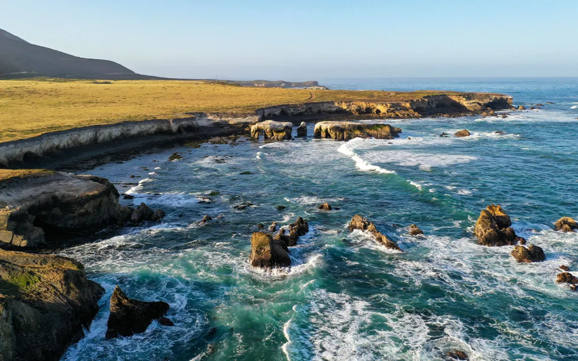
A view of the proposed Chumash Heritage National Marine Sanctuary near Montana de Oro State Park in San Luis Obispo County, California. | Photo by RobertSchwemmer/NOAA
The National Oceanic and Atmospheric Administration will mark a major milestone this month in creating the Chumash Heritage National Marine Sanctuary, the country's first tribally nominated marine sanctuary. But there's one 2,000-square-mile hole in the agency's plan: a missing patch of water the Northern Chumash tribal leaders asked for that’s crucial to satisfying the tribe’s conservation goals.
When the tribe originally proposed creating a marine sanctuary, they had hoped to connect the Monterey Bay National Marine Sanctuary, which is the largest protected marine area in California, with the Channel Islands National Marine Sanctuary, off the coast of Santa Barbara. At over 7,600 square miles, the result would have been the largest national marine sanctuary in the country—an unbroken swath of protected area stretching almost half of California's coastline, protecting iconic marine species like southern sea otters, 13 species of whales, several dolphin species, and harbor seals.
Tribal members say they were blindsided in August when NOAA released the altered proposal to the public. It was the first time members learned of the new boundary, said Violet Sage Walker, the tribal chair of the Northern Chumash Tribal Council. Walker is also the daughter of Chief Fred Collins, who led the effort to create the sanctuary before his death in 2021. Now, she and other tribal leaders are working with advocacy groups and community leaders to raise awareness about the proposed sanctuary during one of the final public comment periods, which closes on October 25.
To help inform the public about their proposal, the tribe is calling on state lawmakers who supported the initial boundary to reissue letters of support. Canvassers are speaking with local businesses in towns adjacent to the omitted portion of the sanctuary. Volunteers are tabling at local events, such as farmers' markets. And the tribe is also running newspaper and radio ads to tell people about the altered boundary and let them know about the comment period.
"We are doing everything that we can do to sway the decision to remove the northwestern section of the sanctuary," Walker said. "It's easier to say what we're not doing. And that’s sleeping."<
For the past 40 years, California legislators have advocated for a protected area off the coast of Santa Barbara and San Luis Obispo Counties. The effort gained momentum under the Obama administration, and in 2015, NOAA started exploring the potential of creating a sanctuary based on the Northern Chumash Tribe’s proposal. Now, there are multiple converging forces at play that are both spurring the creation of a national marine monument in this location and also influencing the decision to shrink its initial footprint.
The Biden administration has made collaboration with tribes and the protection of wildlife habitat a priority, with several executive orders and initiatives, including America the Beautiful, aimed squarely at bolstering nation-to-nation cooperation and expanding protected areas for biodiversity. However, the administration has also made ramping up renewable energy a signature policy it would like to swiftly advance. Sometimes, these competing priorities collide. In the case of the Chumash National Marine Sanctuary, the NOAA-preferred boundary cuts an almost perfect rectangle from the northern portion of the Chumash-proposed boundary to make way for offshore wind.
In the draft analysis, NOAA noted that offshore wind developers are likely to use the area to connect ocean platforms to onshore power via seabed transmission cables and floating substations. The Bureau of Ocean Energy Management, the agency that manages offshore infrastructure, has said that up to 30 cables would be needed for existing leases that are planned for an area near the sanctuary’s boundary. During one of the public hearings, the regional policy coordinator for NOAA, Paul Michel, said that national marine sanctuaries are more like national forests, rather than national parks, in that multiple uses are allowed to occur as long as they are compatible with the primary goal of resource protection.
Walker sees it differently, however. “If it's not compatible with marine sanctuaries, we need to figure out a way to make it compatible with conservation,” she said. “We can't be cutting off one hand to save the other. Offshore wind and green renewable energy cannot be destroying the environment too.”
Another reason for the boundary shift is neighboring tribes. The Salinan Tribe, whose land runs along the portion of the sanctuary that was omitted, voiced concerns about having the waters off their shores named after the Chumash. These objections are serious, Michel told Sierra. The agency is hoping to allow all interested groups to have a say while preserving the more well-known cultural and biodiversity aspects of the area—the kelp forests, reefs, paleoshorelines, and topological features, such as the Santa Lucia Bank.
“Sanctuaries, typically, are in the messy business of trying to address stakeholder issues and bring balance to these areas,” Michel said. A number of groups, including wind energy, oil and gas, and local harbors all wanted carve-outs and exceptions when it came to creating a sanctuary in this area. “We can't have a sanctuary that's all cut up and cut out,” Michel added. “It would be the Swiss Cheese National Marine Sanctuary.”
However, advocates of the initial boundary and members of the Chumash Tribe counter that the originally proposed boundary isn’t necessarily incompatible with transmission cables or the needs of other tribes. For the transmission cables, Walker noted that instead of laying 30 different cables, restrictions on where and how many cables are laid could be used to limit their impact, such as using a shared single cable.
While these concerns are part of the feedback that Chumash advocates are providing to NOAA, they do not represent the sole aim of the tribe's outreach. The tribe has done the hard work of combing through the minutiae of NOAA’s plan and converting that information into accessible public outreach and education at churches, schools, and community centers. It’s at these places that the tribe also conveys what it likes about the plan, welcoming regulations to protect the Rodriguez Seamount, Santa Lucia Bank, and Arguello Canyon and to require water quality testing measures.
“We're going to be working right up until October 25 to make sure that we get every voice that wants to participate in this,” said Gianna Patchen, the campaign manager for the Northern Chumash Tribal Council. The tribe's goal is to get the sanctuary designated before the 2024 presidential election.
After the public comment period closes, NOAA will need to take a few more behind-the-scenes steps before designating the final marine sanctuary. Following the comment deadline, the agency will incorporate all of the feedback into a final plan. It will also have to consult with industry groups and tribes to come up with a boundary. If all goes well, the agency could create the Chumash National Marine Sanctuary by next summer, fitting the timeline the Northern Chumash Tribe is advocating for.