Why is the Sea Rising Faster in Some Parts of the US?
Sea levels rising are affected by small regional changes too
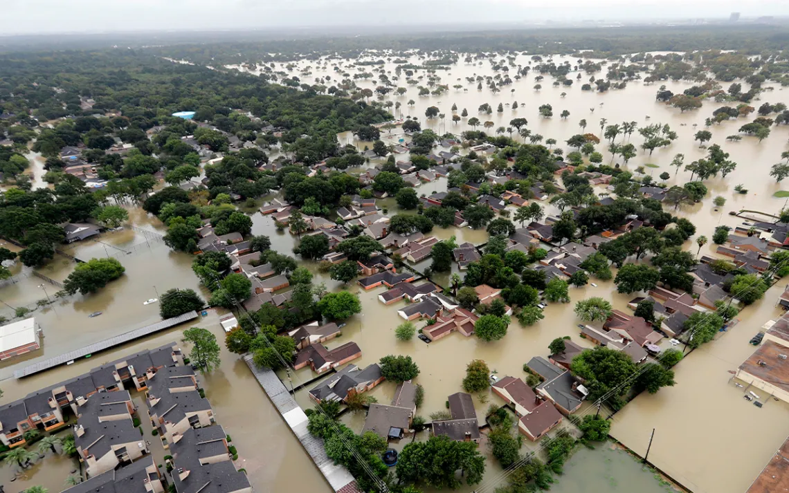
A Houston neighborhood flooded by rain from Tropical Storm Harvey in 2017. Photo by David J. Phillip | AP File
The level of the sea has risen globally by 8 to 9 inches since 1880, according to the National Oceanic and Atmospheric Administration (NOAA). But it hasn’t risen evenly everywhere. Research published in the journal Nature Communications recently shows that sea levels along the nation’s Southeast and Gulf coasts have been accelerating at unprecedented rates over the past decade—about half an inch every year since 2010, or about three times more than the average sea level rise in the rest of the world.
What’s leading to this asymmetry?
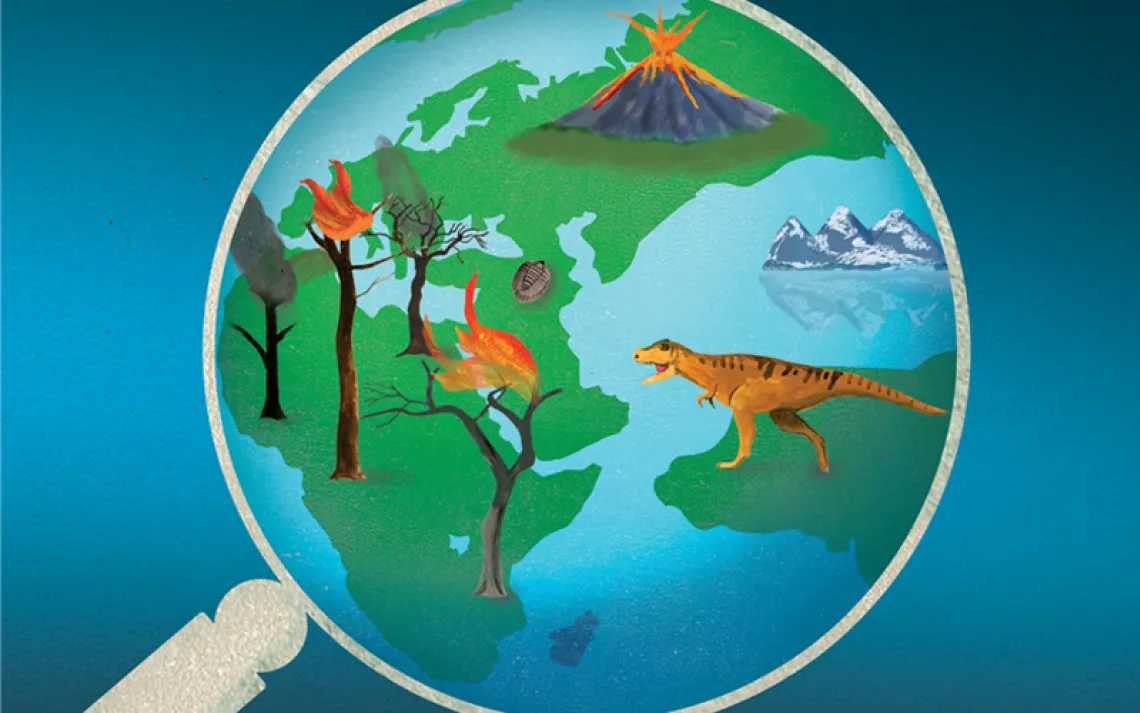
Global warming has heated up the Earth at a rate of approximately 0.14 °F per decade since the 1880s. The warmer the planet gets, the more the glaciers and ice sheets covering its surface melt, releasing more water into the ocean. At the same time, the water in the oceans gets warmer because of the increased heat and expands—the laws of physics state that hotter molecules have more energy, and move around more, taking up more space.
But the specifics of sea level rise, and how the water caresses the US is a field with many potential culprits and many schools of thought among scholars as to which are the most important. Here are some of the main suspects.
The gravitational pull of the Greenland and Antarctica glaciers
This one is often overlooked, according to Torbjörn E. Törnqvist, a geology professor at Tulane University and one of the lead authors of the Nature paper. The melting ice sheets of Greenland and Antarctica are heavy bodies of mass sitting in the water, so their weight attracts the surrounding ocean’s water to them because of the laws of gravity, in ways similar to how the moon pulls the tides. “Even though we think of the ocean surface as being perfectly horizontal, in reality, it's actually bulging up a little bit towards these big ice masses,” says Törnqvist.
As these masses melt, they lose weight, letting go of some of the pull they have on the surrounding water. That melt happens at different rates, so depending on which of these two gigantic ice sheets is thawing faster, some areas are going to be affected more than others by this sludging away of waters. As Greenland ice liquefies, its relative closeness to the Eastern US means the eastern seaboard is seeing a disproportionate effect.
The East Coast is still sinking because of the Ice Age
Land levels are dropping in some parts of the world and rising in others because the Earth’s crust is constantly moving little by little over time. The Hudson Bay Area in Canada used to be at the center of a huge ice sheet that literally pushed down the whole crust of the Earth during the last Ice Age, nearly 20,000 years ago. When that ice began to dissolve tens of thousands of years ago, the Hudson Bay Area started a rebound (also known as a glacial isostatic adjustment).
The whole of the US—the West Coast, the Gulf Coast, and the East Coast—were just outside of that huge ice sheet and are slowly sinking instead. In Louisiana, says Jeffrey P. Donnelly, a senior geologist at the Woods Hole Oceanographic Institution, about a millimeter per year of sea level rise is actually the land moving because of the ice sheet effect. If sea levels continue to rise, though, the ice sheet effect will be a smaller part of the total. “Right now a quarter of our current sea level rise is related to the glacial isostatic adjustment,” says Donnelly. “In 50 years, it's going to be, you know, 10 or 20 percent.”
A lot of the Gulf Coast is made of sediment
“People sometimes ask me, how deep do you have to go to find bedrock in New Orleans?” says Törnqvist. “And I always say, ‘Well, you would have to go several miles.’” The coastlines of Texas and Louisiana are sitting on softer, more easily sinkable ground than, say, Florida, which is based on limestone.
The very thick, water-rich, muddy, organic, marshy deposits of the Mississippi Delta literally get more and more compact under their own weight, lowering the land. Increased rates of oil and gas extraction—or water extraction for agriculture—shrivel the land, causing it to sink even further.
The lava lamp that is the Loop Current
Usually, when a section of the ocean gets warmer, it's due to an increase in heat or solar radiation, says Tim Boyer, an oceanographer at the National Oceanic and Atmospheric Administration. Yet in the southeast of the US there is a strong stream of warm water coming up from the Caribbean, into the Gulf of Mexico, and then up past Florida, also known as the Gulf Stream. Since that water is coming from closer to the equator, it has experienced more warming than waters further North, and it passes on some of that heat to water it encounters on its journey upward.
The segment which specifically goes through the Gulf is called the “Loop Current” because as it comes into the inlet it loops into a bulge, sometimes even breaking off into separate blobs of deep, hot water—like in a lava lamp—which scientists call “eddies.” These eddies stay in the Gulf for long periods of time, warming the waters around them.
Boyer’s research suggests that if it weren’t for the Loop Current, the Gulf would actually be losing heat to the atmosphere on average. Instead, the current has caused sea level rise by the order of millimeters per year, according to Boyer. That might not seem like much, but since it’s been going on since the 1970s, a few millimeters a year add up, he says.
New research currently in pre-print by scholars at Woods Hole Oceanographic Institution has reached similar conclusions. These eddies left behind by the Loop Current also help storms grow much stronger and get much closer to land, further endangering the coast, because tropical storms take energy from warmer water.
While the Loop Current is a constant feature, it only travels deep into the Gulf of Mexico at irregular intervals, says Boyer. It’s unclear if it will continue to do so, but data so far doesn’t suggest that it’s slowing down.
Do not forget the Atlantic Subtropical Gyre
The unprecedented acceleration in sea level rise over the past decades has been observed to extend all the way north to Cape Hatteras in North Carolina. Yet, says Törnqvist, the entire Atlantic coast from Miami up to Cape Hatteras is totally outside the path of the Loop Current. Clearly, he says, there is something else going on here.
That something else might be a much larger ocean current known as the Atlantic Subtropical Gyre that has been expanding over the last 12 years, primarily due to changing wind patterns and continued warming. Water levels within the gyre are a few meters higher than outside of the current, and as it shifts closer to the coast, it moves large quantities of water in that direction.
The Subtropical Gyre is one of many natural cycles making up the ocean’s behind-the-scenes clockwork. Törnqvist expects that its recent acceleration is going to slow down in the near future as part of the natural ebbs and flows of ocean currents around the globe. These findings suggest that the past decades of sea level rise along the east coast have, at least in part, been turbocharged by an unfortunate combination of climate change and pre-existing weather patterns, he says.
Yet, even once the gyre begins to pull away, taking its higher water levels with it, we must remember that the Greenland and Antarctic ice sheets are still melting, and will add much more water than what the gyre briefly contributed.
Moving forward, against the current
Overall, the US is likely to see sea levels grow by another foot by 2050. Locally, there are several things that communities can do to mitigate the effects of rising ocean levels.
For instance, coastal states have been losing their buffer between the ocean and their cities for centuries, and currently lose 80,000 acres of coastal wetlands each year due to development, sprawl, and agriculture. Aiding the return of those wetlands—and living shorelines, mudflats, beaches, and dunes alike—would go a long way to curb the land’s sinking in certain areas of the nation. The main policy strategy for this is called “rolling easement,” meaning restricting the density of development at a certain distance from the water so these habitats can naturally migrate inwards and take up more space.
Limiting the extraction of oil and gas would also help slow down land sinkage, as would identifying and maintaining open space that can be used to recharge groundwater. Coastal cities can relocate infrastructure to higher elevations and build flood barriers that won't disrupt the flow of new sediment to nearby landscapes.
Globally, studying the details of sea level rise and its distribution is imperative, says Törnqvist, and will allow for more accurate predictions and better-informed coastal policymaking. “We will hopefully be in a position that we know, ‘Okay, we're going to face a rough time, let's get ready for it’,” says Törnqvist. “As opposed to being caught by surprise, which is a little bit what has happened in the past dozen years or so.”