Ozark National Scenic Riverways Roads & Trails Plan Sierra Club Position
(A easily printable 2 page version of the Sierra Club position can be found here)
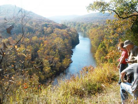
The Sierra Club believes everyone deserves access to the outdoors. Nature is a human right but not at the cost of the health and safety of our land, water, animals, and other people. You can help us protect the Ozark National Scenic Riverways now and for future generations. Act today!
What is the ONSR? The Ozark National Scenic Riverways are nationally protected wild and scenic rivers and the first national park to protect a river system. At the ONSR clean water flows from more than 400 springs and provides 134 miles of some of the nation’s best natural river recreation on the Current and Jacks Fork Rivers. These resources support an array of plants and animals - some of which can be found nowhere else in the world, as well as the opportunity for more than 1.5 million visitors each year to experience quiet solitude in nature.
What is a Roads & Trails Plan? The ONSR Roads & Trails Plan is part of the ONSR General Management Plan that determines how the National Park Service( NPS) will carry out their responsibilities to protect the park while providing safe access to visitors. The draft plan makes recommendations on unauthorized roads and trails and how to address these issues in the park. NPS’s draft plan shows a fantastic commitment to a horse permitting system and the consideration of the natural and cultural resources within the park. However, the plan does not go far enough in protecting these resources that are globally significant and irreplaceable.
How is the ONSR at Risk? In 2011 American Rivers added ONSR to its list of “Most Endangered Rivers'' in the nation, citing overuse and poor planning. Under-enforced regulations have led to a large number of undesignated roads and horse trails and rampant use of ATVs (all-terrain vehicles). The result is significant water quality issues, habitat fragmentation which can lead to extinction, and detrimental impacts on other park recreations. As a Scenic river, priority should be given to protecting the native and endangered species that live within the park.
Unmanaged ATVs, roads, and horse trails threaten the ONSR by contributing to species decline and loss of biodiversity, and impacting water quality from erosion, habitat disturbance and pollution from horse waste.
The draft Roads & Trails Plan does not adequately enforce ATV use. ATV use damages natural and cultural resources. This includes disturbance to wildlife, damage and removal of vegetation, disturbance to soils, damage to archeological resources, etc. ATV use at the ONSR is incompatible with activities already being enjoyed at ONSR (hunting, fishing, camping, hiking, canoeing, and more.) This is a slippery slope that will quickly cause further harm.
The draft Roads & Trails Plan does not adequately address unlawful horse crossings. Illegal horse crossings in the upper Current River are prevalent. Horse traffic causes erosion along the riverbanks and E.coli and other contaminants from horse manure impact water quality and sensitive species like the critically endangered Ozark hellbender.
The National Park Service’s proposed plan does not guarantee future protection of this cherished natural resource. Unless the National Park Service gives ONSR the strong protections afforded to the country’s other national parks, the area’s clean water and rare remote experience will be lost.
Suggested recommendations:
- Protect the on-river experience of floaters by reducing motorized access to the rivers.
- Create a section along the upper Current River that is not impacted by horse crossings. Do not build new trails or crossings before existing illegal trails are effectively closed and enforced.
- Implement fee-based a horse permitting system by 2024 that:
- Includes limits for how many horses should be in the park at a time
- Provides education and signage regarding which trails can be used
- Closes, blocks and revegetates existing unauthorized horse trails to their natural conditions
- Halts planning of a new horse staging area at Cedar Grove until there is stronger enforcement throughout the upper Current River area
- Remove and restore unauthorized horse river crossings and reduce the number of designated horse crossings which impair the floating experience and increase fecal pollution in the river.
- Keep horse trails at least 50 feet from the river and provide horse tie-ups so riders can proceed to the river on foot at designated access points.
- Do not open park service roads to ATVs. There are no enforcement mechanisms in place to ensure compliance with the proposed rule.
Additional information for your consideration:
1. ATVs
ATVs, or all-terrain vehicles, are increasing throughout ONSR and threatening the national significance and integrity of these extraordinary rivers and ecosystems.
NPS states that ATV’s have led to adverse impacts on natural and cultural resources, including disturbance to wildlife, damage and removal of vegetation, disturbance to soils and archeological resources, and other resource impacts. Opening up roads and river access points to the impacts caused by an increasing number of ATV’s is a slippery slope that will quickly become very difficult to manage. Park roads should not be opened to the ever-growing ATV industry for non-locals.
We support the proposed permitting system for use of ORVs or UTVs on county roads within the ONSR corridor (as provided by state law), but urge ONSR not to allow ORVs on NPS-maintained roads, except where absolutely necessary, in order to avoid user conflict. Permit fee revenues should be used to help maintain park infrastructure.
2. Excessive Vehicle River Access Points
In 1984, there were 13 developed river access points and public campgrounds. Today, there are more than 130 vehicular river access areas, many characterized by a maze of unmanaged dirt roads that send untold amounts of sediment into the river. Virtually all gravel bars (used for canoe and kayak camping) are subject to invasion by all-terrain vehicles (ATVs) and other vehicles. The vehicles destroy vegetation, and contribute to severe erosion and harm water quality.
3. Excessive Horse Trails and River Crossings
Only four horse trails totaling 25 miles are currently designated by the ONSR, yet more than 90 miles of horse trails have been built and tolerated - and 83 places where horses cross the streams.
Many visitors and equestrians would appreciate the elimination of the confusing, unsightly, often rutted and eroded maze of user-created trails and accesses to riverbanks and gravel bars.
Because equestrian use has increased dramatically in this area in recent decades on a maze of user-created trails, it is critical to designate carefully sited trails at least 50 feet back from the river to minimize erosion and discourage unpermitted horse access to and crossings of the river.
NPS does not have adequate capacity to enforce the dozens of miles of existing unauthorized horse trails and crossings on the Upper Current so trails should not be built near the river. Plenty of miles of trails are available in nearby conservation areas, and Mark Twain National Forest provides for equestrian use without impacting river user experience.
We strongly support the proposed equestrian permitting system, and think the permits should be issued to individual riders for designated days and areas in order to avoid overuse and conflict with other visitors. We oppose any additional horse staging areas or any overnight horse camping in the narrow corridor of NPS-owned land. We also oppose any additional designated horse trails below Akers as in Alt C. While we understand the desire of equestrians to visit historic structures and other special sites, hitching racks should be provided an appropriate distance from the sites so that equestrians can leave their horses and walk to the sites.
We encourage all Sierra Club members who care about the future of the Riverways to submit comments on this plan by August 15.
Please include comments about your own user experience.