Waterpocket Fold in Capitol Reef National Park — South-Central Utah
Here is the park website, titled Discover the Waterpocket Fold, a geologic wrinkle on Earth!
This article is mostly about that, a geologic feature that originated with the Laramide Orogeny. The park's geology page has good info including a cross-sectional diagram of the strata. If we are ambitious could do a hike across the strata and identify with the diagram, then take pictures with our hands on them for later memories. Below in the Visting section about hikes, campgrounds, etc.
We can also follow Wikipedia pages about all this. So: Waterpocket Fold (pictures). The Laramide Orogeny 70 to 50 million years ago which resulted from tectonic plates sliding under the North American plate from the west. That resulted in the Waterpocket fold, the far larger Rocky Mountains and the easternmost result being the Black Hills in South Dakota.
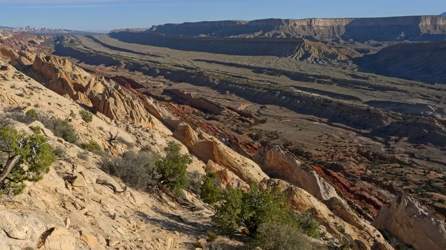
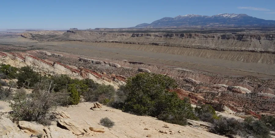
Three pictures below, the first two looking across the fold from the west. The third looking south from a spot northwest of the fold.
Visiting
From the Plan Your Visit page we can get the park brochure map PDF, high resolution and topographic detail. And the Things to Do page, with camping and hiking pages. From the latter there is a list of fifteen trails (here's the guide/map PDF) in the area south of the Fruitia visitor center. On the map/brochures page, scroll down, there is another list of trails by area. I was there in March 2015 (first two pictures) and May 2014 (last two pictures). We can find the spots where they were taken by looking at the map linked above.
RoadTripRyan.com has bunch of pages about hiking and climbing opportunities. Years worth of stuff but few of us will bother with the technical routes.
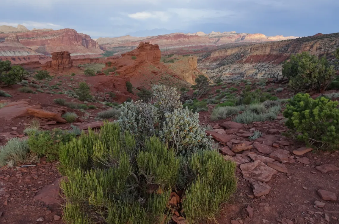
The next picture is off a short road south from hwy 24, west of the visitor center. As with the previous pictures we can tell which way we are looking as the strata was tilted up by the tectonic plates coming from the west. The fold is beyond the high mesas upper left. Going through the park website's Nature section the bushes bottom appear to be green ephedra and those center roundleaf buffaloberry.
Cathedral Valley
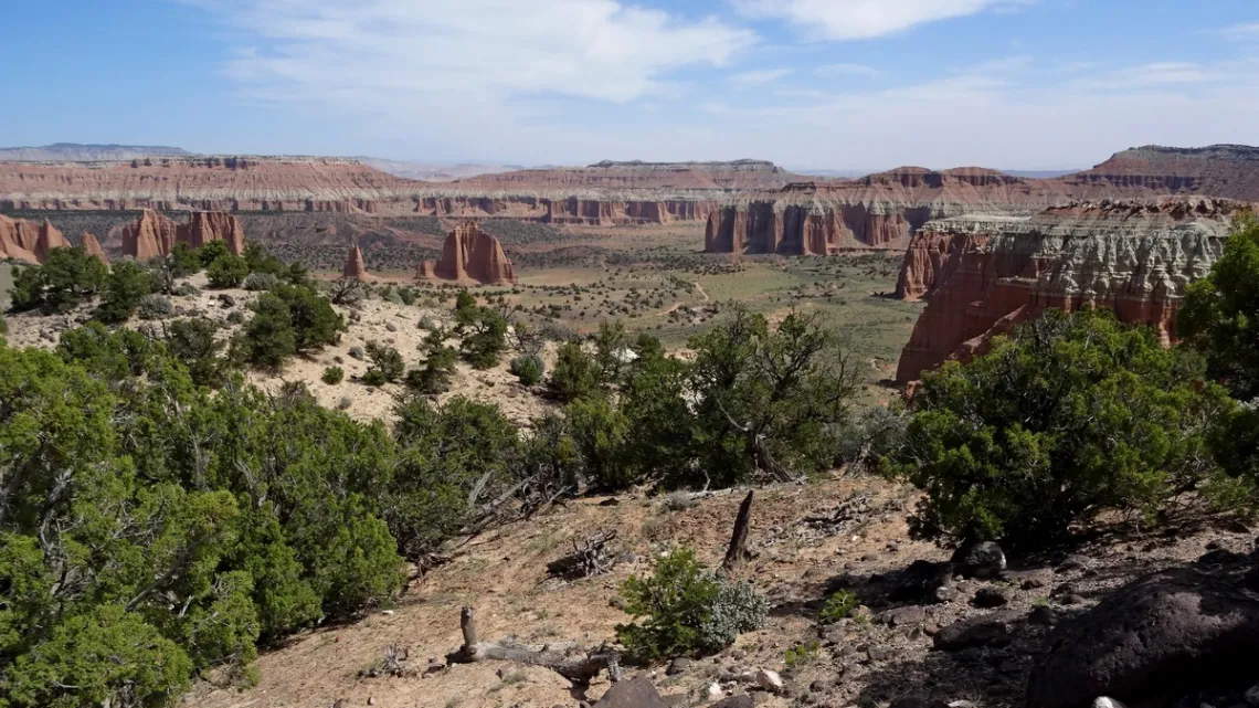
There was an article about this park in this newsletter August 2016 with some bits about Waterpocket Fold and Cathedral Valley. The latter (next picture) is an amazing experience, with a 60 mi loop on the north side of the park, comprised of Hartnet and Cathedral roads. The picture is from the far northwest corner of the loop, almost halfway around. Need a high-clearance/all-wheel drive vehicle, should be mostly fine, though have to ford Fremont River. Best to do the loop clockwise so the potentially challenging stuff is first, and be prepared for vehicle probs and significant delays en-route, just in case.
by Kevin Hartley, Sierra Club Life Member
Tuesday June 16th, 2026
Climate Communication: Outreaching the Message in the Age of Climate Disinformation
with Environmentalist Bill Hurley
Meeting schedule
| Informal get-to-know-you | 6:00 pm to 6:15 pm |
| Announcements | 6:15 pm to 6:30 pm |
| Featured program | 6:30 pm to 8:00 pm |
| Discussion | 7:30 to 8:00 pm |
Venue
This is an in-person only meeting at:
William R. Sinkin Eco Centro, 1802 North Main Avenue
Map
Program topic
Environmental activism has won many battles in our lifetime, but we are not winning the greater climate war quickly enough, considering the urgent and existential challenges we face. Even major news outlets and other respected voices often misconstrue, misunderstand, or over-simplify climate science to the point of misinformation and even disinformation. This has real and dangerous consequences.
At our May 19th meeting, we watched the Climate Action Now webinar “Talking Climate in the Age of Disinformation”. In it, Dr. Hayhoe stated "the most important thing you can do to fight climate change [is] talk about it", and that in this Age of Disinformation we need to stay away from culture wars and stick with the facts. About 2/3 of Americans are very worried about the climate but don't know what to do, and the speakers suggested how to best communicate to them.
But what about that remaining 1/3 who dismiss climate concerns? How do we listen and effectively persuade, instead of walking away in frustration? Preaching to the choir doesn't help; as Dr Hayhoe said, "It hardens their resolve." Bill Hurley will discuss how he tailors discussions to different audiences, introducing the nuance essential to effective communication. He will share his experiences with the dismissive segment and their sidekicks trying to dominate the headlines today.
About our presenter
Bill Hurley has a long history of involvement with environmental groups in various capacities, including with the Bexar Audubon Society (1980’s), Land Heritage Institute (until late 1990’s), Friends of Government Canyon (1998-2000), the San Antonio River Foundation, San Antonio River Authority (retired 2014), Green Spaces Alliance of South Texas (formerly Bexar Land Trust, since mid 1990’s), and a group leader with Citizen’s Climate Lobby (since 2016). Bill has a BA in Information Systems from Our Lady of the Lake University, a Minor in English from George Mason University in Fairfax VA, and attended the Masters Leadership Program of Greater San Antonio in 2010.
The Alamo Group of the Sierra Club holds its general meetings the 3rd Tuesday of most months. They're always free and open to the public.
From the e-Mailbag
From time-to-time, the Alamo Group receives messages concerning local environmental issues. If you have thoughts on any of these issues, send us a message and we'll forward it to the writer. The views and opinions expressed here are those of the individual authors and do not represent the views or opinions of the Alamo Group or its members.
Hill Country ranch west of San Antonio to become giant new state park
From a story in the San Antonio Express-News: Silver Lake State Park will be the second-largest state park in Texas. It will include miles of property along the West Nueces River and a 30-acre spring-fed lake.
submitted by Joan C.
Outings: The Call of the Wild
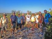
Visit the Alamo Sierra Club Outings page on Meetup for detailed information about all of our upcoming Sierra Club Outings.
The Alamo Sierran Newsletter
Richard Alles, Editor
Published by the Alamo Group of the Sierra Club.
The Alamo Group is one of 13 regional groups within the Lone Star Chapter of the Sierra Club.
Changed your contact information?
If you're not sure whether the Sierra Club has your current email address, send an email to Member Services with your name and address and/or member ID (see Locating Your Member ID) so they can add your email address to your member record.
Have you moved? Let us know by sending your old address, your new address and your member ID to: address.changes@sierraclub.org.
Go online for the latest news and events
 |  |