Organ Mountains-Desert Peaks National Monument – West Side of Organ Mountains
The monument was established by President Barack Obama in 2014. This article's focus is on a section of the monument east of Las Cruces, New Mexico, on the west side of the Organ Mountains. The pictures are all from mid-April 2026. Here's BLM's webpage for the monument and from there the map, PDF. The Wikipedia page about the monument mentions it is within the Chihuahuan Desert, though looking at the bunch of maps on-line the delineation of the North American deserts varies quite a bit, but I trust Wikipedia.
There was an article about an area in this national monument in this newsletter, June 2024, the Dona Ana mountains, which is just north of Las Cruces. That article included a couple pictures of another area, Kilbourne Hole (Wikipedia), a maar caldera (resulting from a water vapor eruption). The latter page mentions that Kilbourne Hole was used for Apollo moon mission training.
Visiting
On the initial webpage linked above halfway down there are links for maps and brochures. The PDF map linked above is a good overview though limited detail. The interactive map is more helpful but we still need other info sources. And the brochure links below. Eg he Sierra Vista trail, 29 miles north/south, no motor vehicles. Here is the trail brochure, PDF. The trailheads are noted and most have a few cleared campspots.
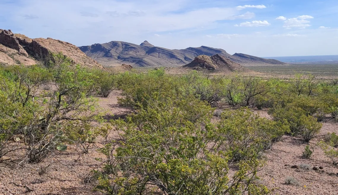
BLM allows distributed camping (also called at-large) in many backcountry spots. TheDyrt.com has a good list of spots in this area. Driving from Texas we may hope to find a good spot for the first night; I found the one at the Sierra Vista trail crossing of B059 about 12 miles south of Las Cruces, which at I-25 is named Mossman Arroyo road, so we exit and drive east 5 miles. The Dryt map has detail, likewise for other areas. Here I met a BLM ranger who pointed out Pena Blanca, picture above. He said drive just a short distance to the parking for that. Per the caption, I made a mistake. But still had a nice hike about 3 miles round-trip; temperature was like 60. Was happy to see my car on the way back, and my phone navigation app was fine; the map showed the trails (OpenAndroMaps.org). I usually carry a backup phone with same app and maps. And I had some printed map snips for this trip. AllTrails.com has excellent pages for this area, here is the one for Pena Blanca.
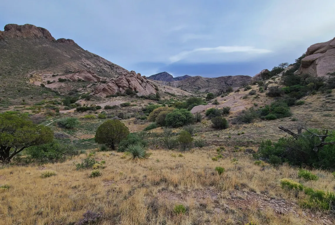
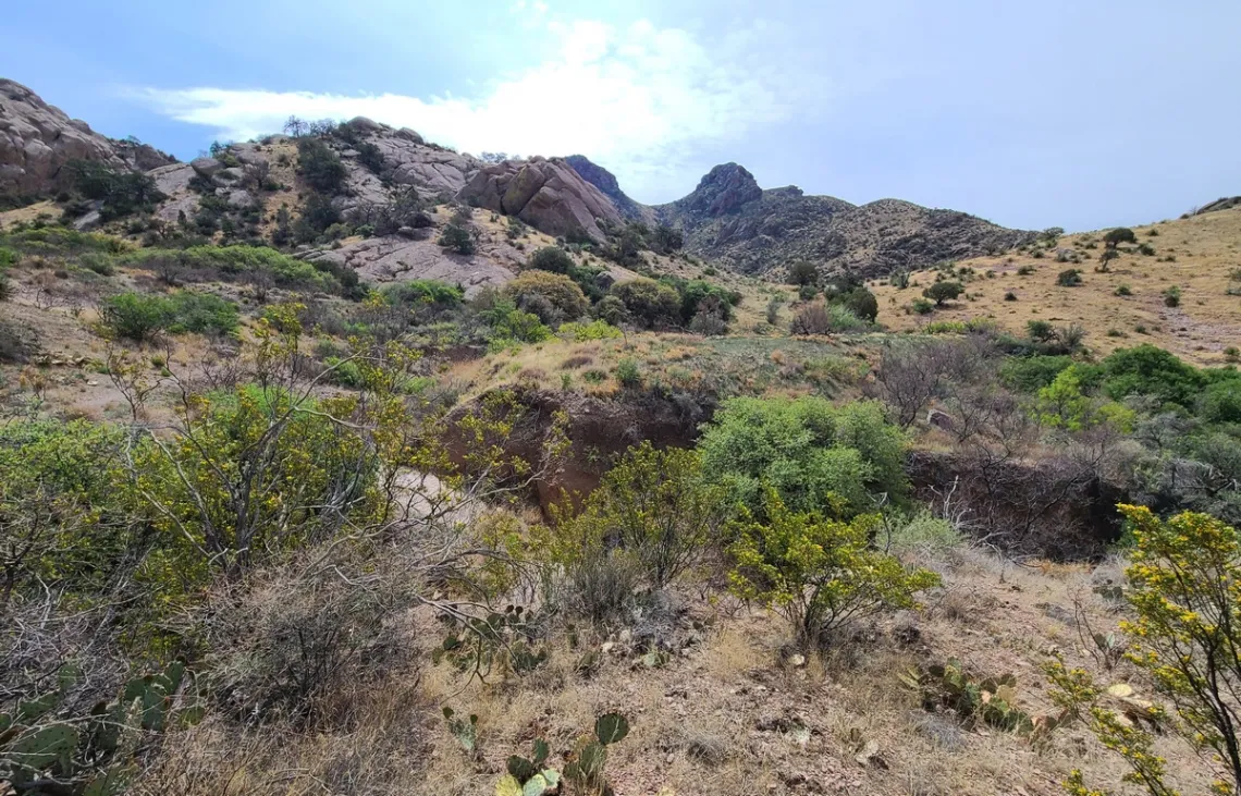
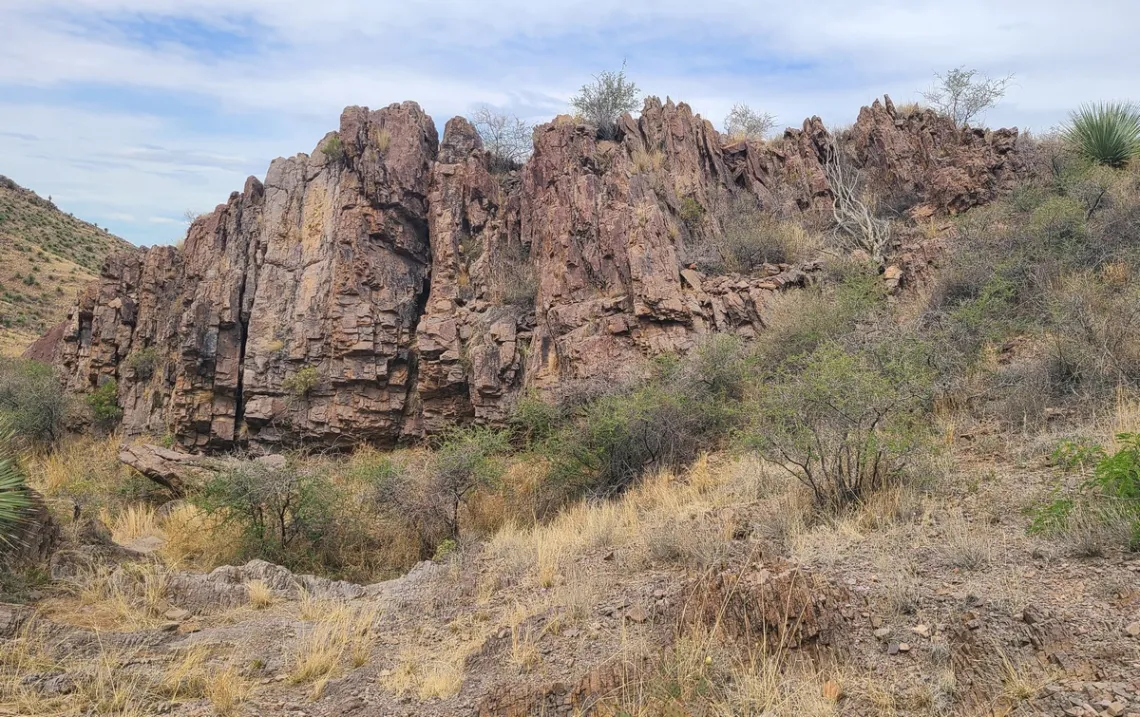
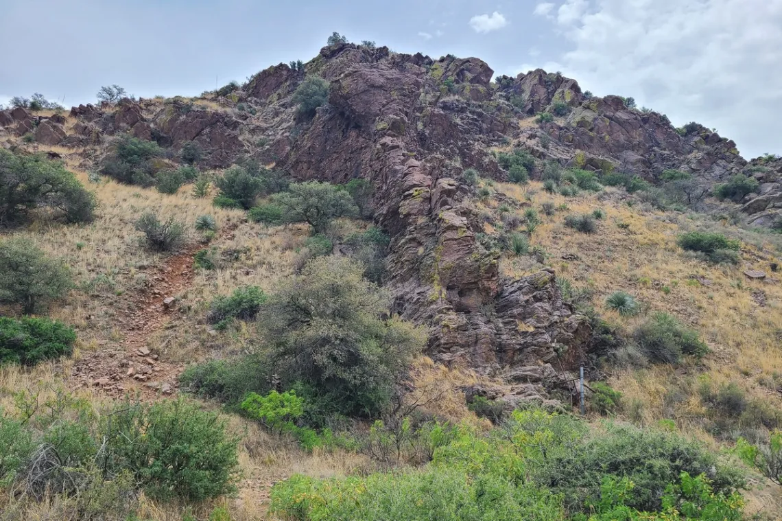
That afternoon went on to the Achenbach Canyon trailhead east side of Las Cruces, AllTrails page. The map, can zoom way in, good detail. The description says "...it seems that you will not find anything amazing, but as you walk will find a beautiful landscape with very nice mountains and canyons." Yes, very appealing, wandering around the little peaks/side canyons. Getting to the trailhead and campspots, the last bit we drive up a rather rough road only 1/5 mile. Out-and-back 5.1 miles, gain 1,233'. The trail is fairly obvious but there are no signs or cairns; first four pictures below. A couple started the hike afternoon without a map or phone navigation app. I showed them my paper map. They had parked their Prius back at the real road due to the entrance road condition. I was thinking would call 911 if their car was still there in the morning; saw them come out thankfully.
Another nice trail is Soledad Canyon (AllTrails), just north of Achenbach, picture below. Easy to get to the trailhead which has a paved parking lot, day use only. I only did the loop near the trailhead as had to get to on the Dripping Springs, next bit. There is a waterfall at the end of the northeast section beyond that initial loop. Thinking worth yet another visit.
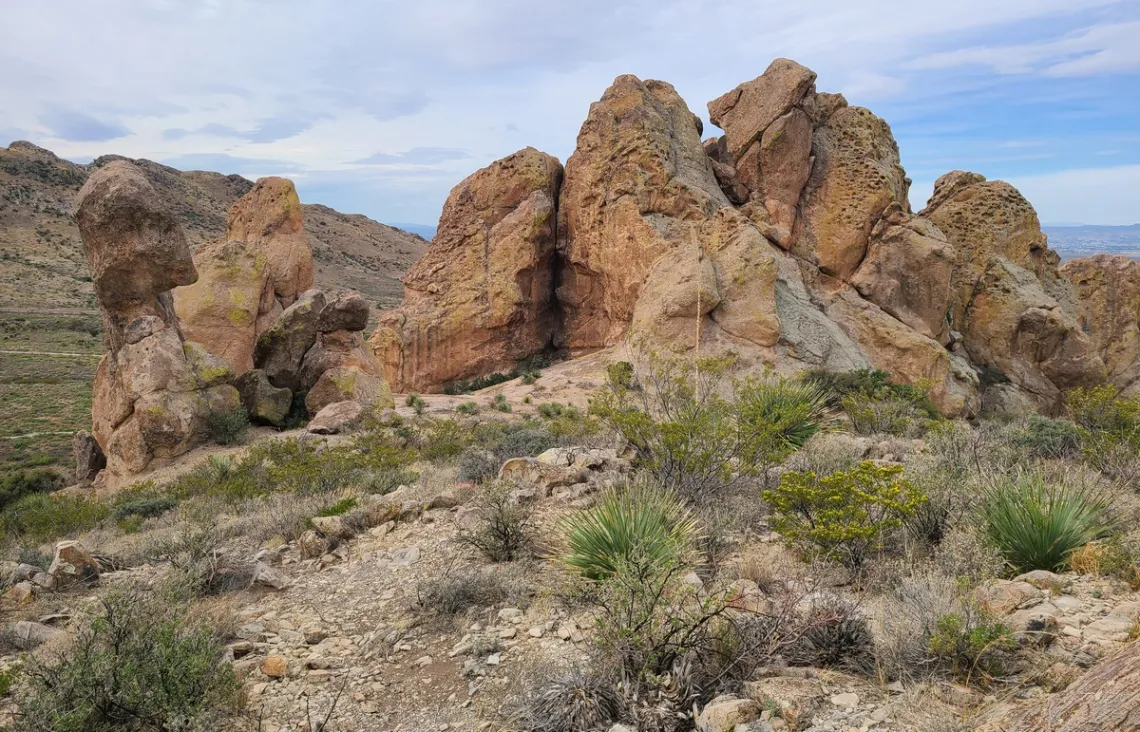
Just further north is Dripping Springs Natural Area, webpage, day use only. And the trail maps at AllTrails, zoom in on this spot east of Las Cruces, at the east end of Dripping Springs road. Three trails including La Cueva loop, picture below. We might imagine would like to have one of these big rocks in our front yard. Some of us will remember our hiking buddy who is said to have an anti-gravity/AI-controlled/fusion-powered barge with tractor beam used for collecting campfire wood on trips. Surely could take such rocks, in particular the one far left that looks like a head with bit of torso.
There is an at-large fenced camping area west of Dripping Springs with limited spots. A better large area with many spots on Baylor Canyon road, 5 miles north of Dripping Springs road. Then Aguirre Springs Recreation Area, at the northeast corner of the Organ Mountains, good campground (55 sites!) and two nice trails up into the mountains. About 18 mi drive around north from Dripping Springs. Likely a future article about Aguirre Springs.
Organ Mountains geology
Wikipedia has a page explaining this mountain range, "The Organ Mountains are near the southern end of a long line of mountains on the east side of the Rio Grande's rift valley. ... The Organ Mountains are made primarily of igneous rock (intrusive granite and extrusive rhyolite)."
So we might like to see some rock photos to guess what were looking at or have pictures of. Chochise College has a page (follow links from Igneous to Granites or Rhyolites) with 84 of pictures of various granites, the rhyolite page has 31.
The above Wikipedia page says at the southwest side of the range there is Bishop's Cap Hills, consisting of fault-block limestone. Therefore the idea about the rocks in the fourth picture, in the caption. Found some pictures that look similar.
Seeing this rock stuff in person, or even the pictures and reading web pages, we may be wishing had taken a geology course in college. Now reading a good textbook co-authored by Jon Turk (his website), large format with good color diagrams: Introduction to Physical Geology. Got this book as also have by Turk: The Raven's Gift: A Scientist, a Shaman, and Their Remarkable Journey Through the Siberian Wilderness. And In the Wake of the Jomon: Stone Age Mariners and a Voyage Across the Pacific. The latter includes sailing a small trimaran from Japan to Alaska, across the Bering Sea. Also including science about the migration of animals and humans across that long ago, referred to as the Bering Land Bridge, which is properly known as Beringa (Wikipedia).
Tangent: the NPS page about Yosemite geology. Looking at the pictures we may wish had seen those before visiting, and read up some, and then went to many of those vista spots.
by Kevin Hartley, Sierra Club Life Member
Tuesday July 21st, 2026
Atmospheric Water Generation
with GEAA* Executive Director Annalisa Peace and Policy Director Rachel Hanes
Venue
This is an in-person only meeting at:
William R. Sinkin Eco Centro, 1802 North Main Avenue
Map
Meeting schedule
| Informal get-to-know-you | 6:00 pm to 6:15 pm |
| Announcements | 6:15 pm to 6:30 pm |
| Featured program | 6:30 pm to 8:00 pm |
| Discussion | 7:30 to 8:00 pm |
Program topic
Texas will need innovative solutions to prevent water shortages and crises. Central Texas is an ideal location to increase adoption of atmospheric water generation (AWG) technology due to both its climate and its need to reduce reliance on typical water sources. AWG cannot solve every water crisis, but has the potential to be a critically important resource, especially when used innovatively.
About our presenters
Annalisa Peace (MS in Urban Administration, Trinity University) has over thirty years’ experience with government and non-profit organizations. This includes organizing citizens’ campaigns, and serving on governmental advisory boards in San Antonio (SA) and New Braunfels such as Kelly Air Force Base Restoration Advisory Board, and the City of San Antonio (CoSA) Task Force that drafted SA’s water quality rules. Since 2004, Ms. Peace has been Executive Director of the Greater Edwards Aquifer Alliance (GEAA), which works to protect the Edwards and Trinity aquifers, their contributing watersheds, and the Texas Hill Country. She also serves on the Texas Water Development Board’s Regional Flood Planning Group for the Guadalupe watershed, CoSA’s Water and Natural Resources Stakeholder Group for the Climate Action Plan, the Environmental Advisory Committee of the SA River Authority and more, working to maintain the environmental integrity of our region.
Rachel Hanes (BA in Political Science and Spanish, and Master of Public Policy and Management) has multiple years in environmental and water policy, working within and with non-profits and local, state, and federal governments. Before joining GEAA, Ms. Hanes was a program analyst for the U.S. Department of Interior, Bureau of Reclamation, working to help manage and conserve water in the West. She has also worked for the Natural Resources Defense Council on decarbonization efforts, the Office of Congressman Joaquin Castro, the League of United Latin American Citizens on environmental issues along the border, and the Esperanza Peace and Justice Center in San Antonio on local water issues, and much more. She currently is GEAA Policy Director.
* GEAA: Greater Edwards Aquifer Alliance
The Alamo Group of the Sierra Club holds its general meetings the 3rd Tuesday of most months. They're always free and open to the public.
From Quarry to Garden: The Remarkable Story of Butchart Gardens
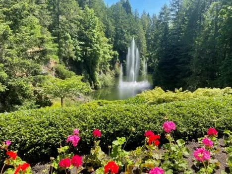
Just north of Victoria, British Columbia, the world-famous Butchart Gardens demonstrates how a damaged industrial landscape can be transformed into an environmental and cultural treasure. In 1904, Robert and Jennie Butchart established a cement plant beside a limestone quarry on Vancouver Island. When the quarry was exhausted, Jennie Butchart envisioned something extraordinary: converting the scarred landscape into a garden. By carefully bringing in topsoil and thousands of plants, she created what is now the spectacular Sunken Garden. (Our Story - The Butchart Gardens)
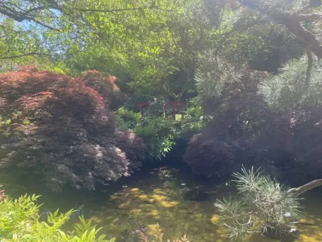
Over the following decades, the Butcharts added a Japanese Garden, Italian Garden, and Rose Garden, creating a 55-acre horticultural masterpiece featuring more than 900 varieties of plants and millions of blooms. Today, the site is recognized as a National Historic Site of Canada and attracts more than one million visitors annually. (Our Story - The Butchart Gardens)
Beyond its beauty, Butchart Gardens demonstrates environmental stewardship. The gardens operate extensive composting programs, recycle green waste into mulch, use drip irrigation, practice integrated pest management, recycle water, and emphasize energy efficiency and waste reduction throughout the property. (Sustainability - The Butchart Gardens). It is an inspiring example of ecological restoration reclaiming a depleted industrial site and transforming it into a place of beauty, biodiversity, and environmental responsibility for future generations. (ResearchGate)
Photos on May 22, 2026, by Bill Barker.
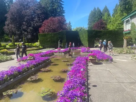
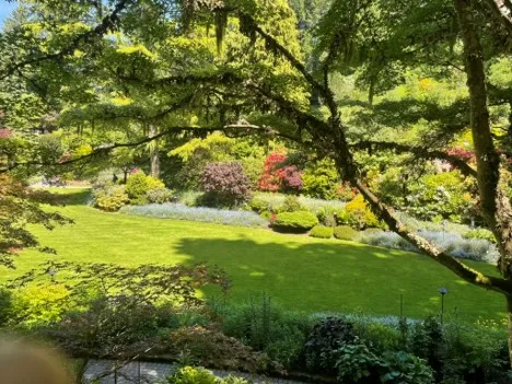
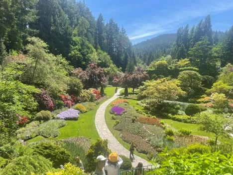
by Bill Barker, Alamo Group executive committee member
Outings: The Call of the Wild
Visit the Alamo Sierra Club Outings page on Meetup for detailed information about all of our upcoming Sierra Club Outings.
The Alamo Sierran Newsletter
Richard Alles, Editor
Published by the Alamo Group of the Sierra Club.
The Alamo Group is one of 13 regional groups within the Lone Star Chapter of the Sierra Club.
Changed your contact information?
If you're not sure whether the Sierra Club has your current email address, send an email to Member Services with your name and address and/or member ID (see Locating Your Member ID) so they can add your email address to your member record.
Have you moved? Let us know by sending your old address, your new address and your member ID to: address.changes@sierraclub.org.
Go online for the latest news and events
 |  |