Over 45 Million Acres Of Pristine National Forest Are Threatened By Trump's Attempts To Rescind The Roadless Rule. More Than 1 Million Acres Of Roadless Area & Public Lands Can Be Found In Southern California. Over 600,000 Acres & 40 Species Are At Risk In The Inland Empire Alone.
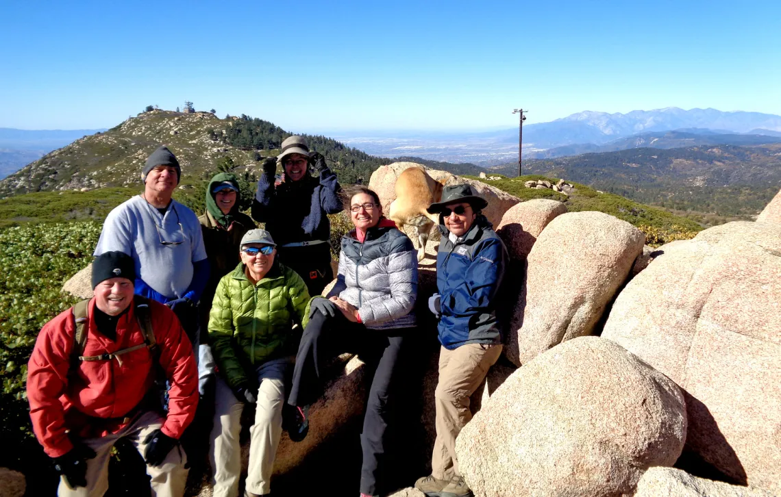
Photo by Karla Kellems / Mountains Group. Slide Peak looking towards Keller Peak, before the Line Fire, considered Roadless Area in The San Bernardino National Forest.
Written in collaboration by:
Ismael Gonzalez, Vice Chair, Box Springs Group, San Gorgonio Chapter
Karla Kellems, Outings & Programs Chair, Mountains Group; Outings Co-Chair, San Gorgonio Chapter
Mary Lunetta, National Conservation Strategist
The Roadless Rule (officially: The Roadless Area Conservation Rule) was established as a federal policy in 2001, and protects forests across 39 states.[1] More than 45 million acres of national forests across the country are at risk of being opened up for the first time in over 25 years for potential development in road building, logging, mining, and other extractive industries that come with that.
The Trump Administration argues the Roadless Rule prevents land managers from fighting fires in national forests, undeniably a growing crisis. However, data indicates wildfire ignitions nationwide are lowest in roadless areas and highest near roads.[2] Roughly 90% of wildfires start within half a mile of a road, which directly rebuts the administration's stated rationale.[1] Wildfires are 4 times more likely to start in roaded areas rather than in roadless forests. Thinning and logging also does not protect anyone from wildfires, and in fact, logging makes forests less resilient to fires.[4]
On August 18, Agriculture Secretary Brooke Rollins announced that the agency was moving forward with plans announced last year to repeal the Roadless Rule in its entirety, opening millions of acres of public land up to road construction and resource extraction.[2] The U.S. Department of Agriculture announced a 30-day comment period that opened August 18, and will run through September 21, 2026.[1]
On behalf of those millions acres of public, wild lands, the millions of fellow Americans who cherish those lands, and us here at Sierra Club, would you please take the next few minutes to join us in these Calls To Action:
- Call your local members of Congress! They represent you and they represent the public lands in their districts. Hearing from you makes a big difference. Personal comments are most impactful. Submit an official comment before September 21!
- Dial 1-855-980-2275 to get connected.
- Here’s a draft script.
- Our representatives here in the Inland Empire are:
- Congressman Jay Obernolte:
- CA 23rd District: includes portions of Kern, Los Angeles, and San Bernardino Counties.
- Hesperia Office Phone: (760) 247-1815
- Congressman Ken Calvert:
- CA 41st District: stretches across Riverside County including the cities of Corona, Norco, Lake Elsinore, Wildomar, Canyon Lake, Menifee, Calimesa, Palm Springs, Palm Desert, Rancho Mirage, La Quinta, Indian Wells, and portions of Eastvale and Riverside. The district also includes the unincorporated areas of El Sobrante, Woodcrest, Temescal Valley, Lakeview, Nuevo, Homeland, Winchester, Cherry Valley, Anza, Pine Cove and Idyllwild.
- Corona Office Phone: (951) 277-0042
- Palm Desert Office Phone: (760) 620-0041
- Write My Elected Officials! Sign the petition!
- Send a Public Comment Before Or On Monday, September 21, 2026, to the US Forest Service: Protect Our Wildest Forests from Trump!Send a Public Comment Before Or On Monday, September 21, 2026, to the US Forest Service: Protect Our Wildest Forests from Trump!!
- Send a Letter to the Editor of your local newspapers!
- Attend an upcoming San Gorgonio Chapter Event to find out more information regarding The Roadless Rule & The Inland Empire!
- Celebrate and protect America's 250 year long natural legacy by visiting your favorite national forest public lands and sharing how they impact you! Use the #PublicLands250 to share a story and connect with other land defenders!
View The National Roadless Areas with this interactive GIS map, developed in part by Sierra Club.
Roadless Nationwide:
The Roadless Rule protects the most intact forests in the country, providing critical wildlife habitat, drinking water for millions of Americans, places to recreate with our families, and carbon storage critical for the fight against climate change. Roadless Areas contain vast swaths of the country's remaining old-growth forest and significant carbon storage.[1] These areas provide habitat to more than 1,600 threatened and endangered plants and animals, and 1,930 sensitive species, including the grizzly bear and lynx.[4]
National Forests and Grasslands are the single most important source of municipal water supply in the US, serving more than 60 million Americans rely on national forests for drinking water.[4] Intact forests filter water naturally and provide habitat to species that depend on undammed, unlogged streams and connected landscapes.[1]
According to the Forest Service itself, developing new roads may have unavoidable effects on streams, regardless of how well they are located, designed, or maintained.[4] Building and maintaining roads is expensive. Limited resources, aging infrastructure, and an increase in public use have led to the delay of a portion of the regularly scheduled maintenance. The current estimate of the agency-wide maintenance backlog, or “deferred maintenance”, was over $8.6 Billion in the fiscal year of 2023. The US Department of Agriculture (USDA) should not invest in new infrastructure with so much existing infrastructure already needed to be repaired and maintained.[4]
The Roadless Rule is also a rare public land management decision that enjoys overwhelming support across the political spectrum, from hunters and fishermen, to environmentalists.[2] The original Roadless Rule garnered 1.6 million comments across 600 public meetings, with 95% of those comments in favor of the rule.[4]
This federal attempt to rescind The Roadless Rule and weaken national forest protections will also impact and jeopardize Tribal treaty rights of countless indigenous peoples and tribes across the continent.[4]
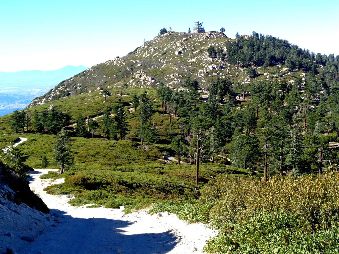
Keller Peak in The San Bernardino National Forest. Roadless Area. Photo by Karla Kellems.
Southern California & The Inland Empire:
The Inland Empire is unceded land and home to their original stewards and peoples: the Tongva (Kizh/Gabrieleño), Taaqtam (Maarrênga'yam/Yuhaaviatam/Serrano), Ivilyuqaletem (Cahuilla), and Payómkawichum (Luiseño).
The region of Southern California commonly known as The Inland Empire, is just an hour East of Los Angeles, and home to over 4 million people. That’s nearly 1 in 9 Californians. This area consists of both Riverside and San Bernardino counties, the 12th largest metropolitan area in the country.
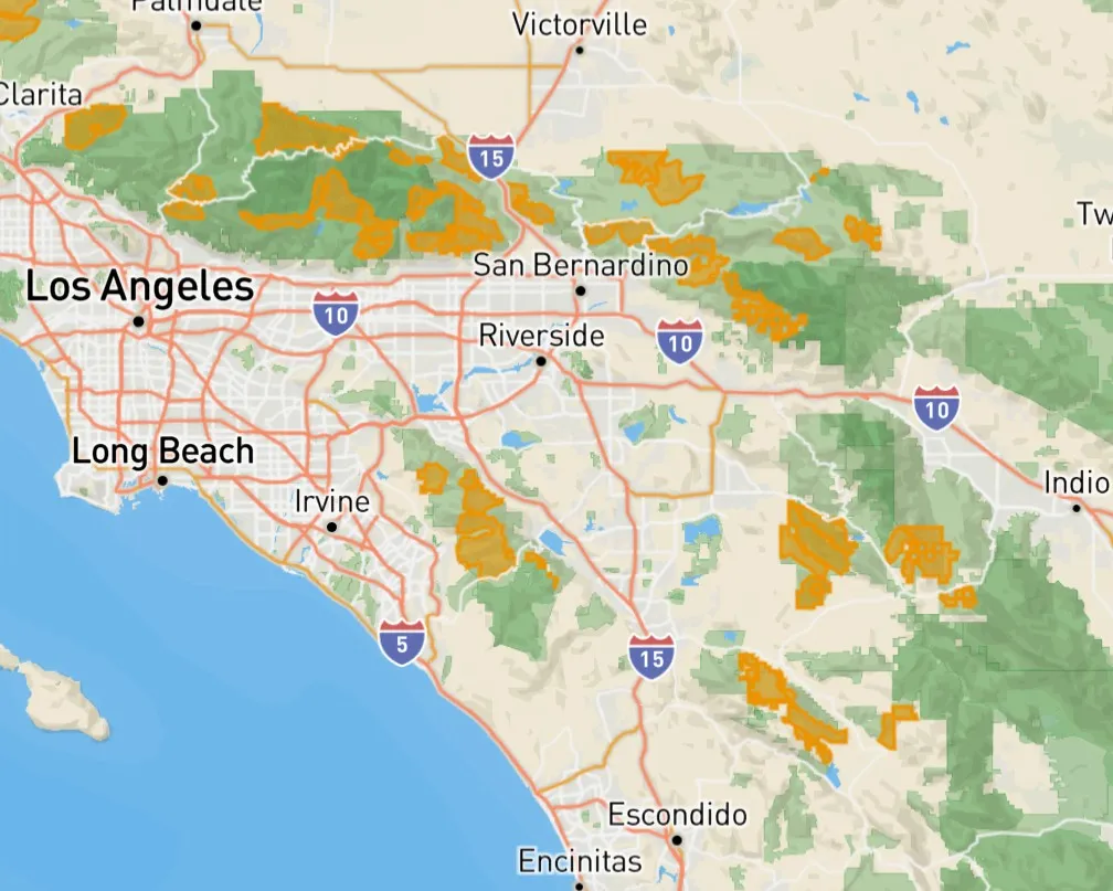
Image from The National Roadless Areas Interactive GIS Map, developed in part by Sierra Club. Yellow highlighted areas are at risk.
The Angeles National Forest, near Los Angeles, contains 663,000 acres. The San Bernardino includes 665,700 acres and abuts the Inland Empire. The Cleveland includes 420,000 acres in Orange and San Diego counties. Upwards of 38% of Southern California Roadless Area can be found in The Inland Empire alone!
These Southern Californian forests host a high diversity of ecosystems, including chaparral, oak woodlands, savannas, deserts and alpine areas. Habitat for sensitive, threatened and endangered animals is significantly affected by poorly managed roads, increasing demands for motorized recreation from the growing populations in Los Angeles and San Diego, oil and gas development; urban infrastructure; and other developmental pressures.[5]

Thread-leaved brodiaea. Photo by Joanna Gilkeson/USFWS.
According to The Roadless Forests interactive GIS map, developed by Defenders Of Wildlife, more than 43 at-risk species can be found across Angeles & San Bernardino National Forests. Some notable flora include the Braunton's Milk-vetch, California Taraxacum, Nevin's Barberry, Parish's Daisy, and the Thread-leaved Brodiaea. Some notable fauna include the California Spotted Owl, California Condor, California Red-legged Frog, Coastal California Gnatcatcher, Desert Tortoise, Least Bell's Vireo, Monarch Butterfly, Pacific Pocket Mouse, San Bernardino Merriam's Kangaroo Rat, Southwestern Pond Turtle, Southwestern Willow Flycatcher, Yellow-billed Cuckoo, Steelhead, and Southern Rubber Boa.

Rubber Boa. Photo by Todd Battey.
If you live in and around the Riverside and San Bernardino areas chances are, without traffic, you can arrive at your nearest Roadless Area in about a 45-minute to and an hour drive in any direction.
Deep Creek, City Creek, Crystal Creek, and Sugarloaf roadless areas are just a few found in the San Bernardino Forest. These roadless areas are critical sources of clean water that ultimately flow into the Santa Ana and Mojave Rivers, replenishing groundwater supplies that millions of people in our communities depend on. These areas also provide outstanding opportunities for outdoor recreation and support local recreation-based tourism.[6]
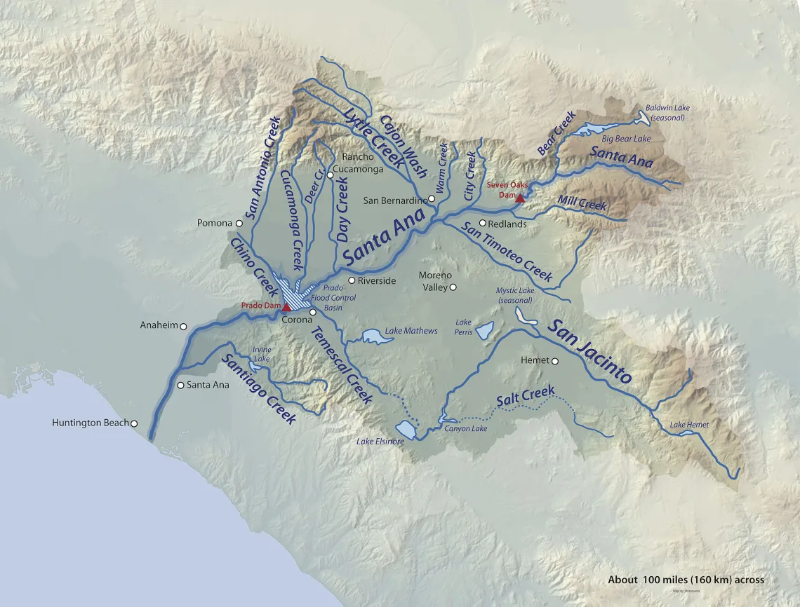
Map of the Santa Ana River Basin
"The Trabuco District is the northernmost district of the Cleveland National Forest, which straddles the Orange and Riverside County boundary and will be impacted by a Roadless Rule rescission. This District includes more than 138,000 acres with 40,000 acres of roadless wilderness. Area residents have a lot to lose if the Roadless Rule rescission goes into effect. Loss of the wilderness and Roadless Rule means recreational impacts, water quality degradation, loss of sensitive habitat, and more costs for the federal government to maintain new roads. Not to mention the increased threat of wildfires, as new roads are added."
—Joel Robinson, Naturalist For You
Karla Kellems, Outings & Programs Chair for the Mountains Group, and the Outings Co-Chair for the San Gorgonio Chapter, leads educational excursions to these areas to raise awareness about their importance and advocate for why Roadless Rule protections should not be rescinded.
"Visiting these areas right after it rains, assuming the weather clears, the views can be spectacular. On a really clear day, you may even be able to see Catalina Island from some of the peaks."
Karla's Recommended Driving Tour:
There’s a great driving tour that could be used to encourage folks to visit some of the Roadless Rules areas on Highway 18, Strawberry Peak Road, and Keller Peak Road. All of the following locations are within Roadless Rule areas and are easy to access:
- Baylis Park Picnic Area
- Red Rock Wall Point
- Strawberry Peak
- Crest Park Picnic Area
- Switzer Park Picnic Area
- Owl Rock — a popular kite-flying area
- Keller Peak Yellow Post Site #8
- Keller Peak
Karla's Recommended Hiking Destinations:
There are a couple of popular hikes within the Roadless Rules Area:
- Mill Peak — Approximately 2.5–5 miles round trip, depending on the route, with about 600 feet of elevation gain. Moderate.
- Sugarloaf Mountain — Approximately 10 miles round trip with about 3,000 feet of elevation gain. Strenuous.
- Constance Peak — Approximately 4 miles round trip with about 900 feet of elevation gain from Angelus Oaks. Moderate.
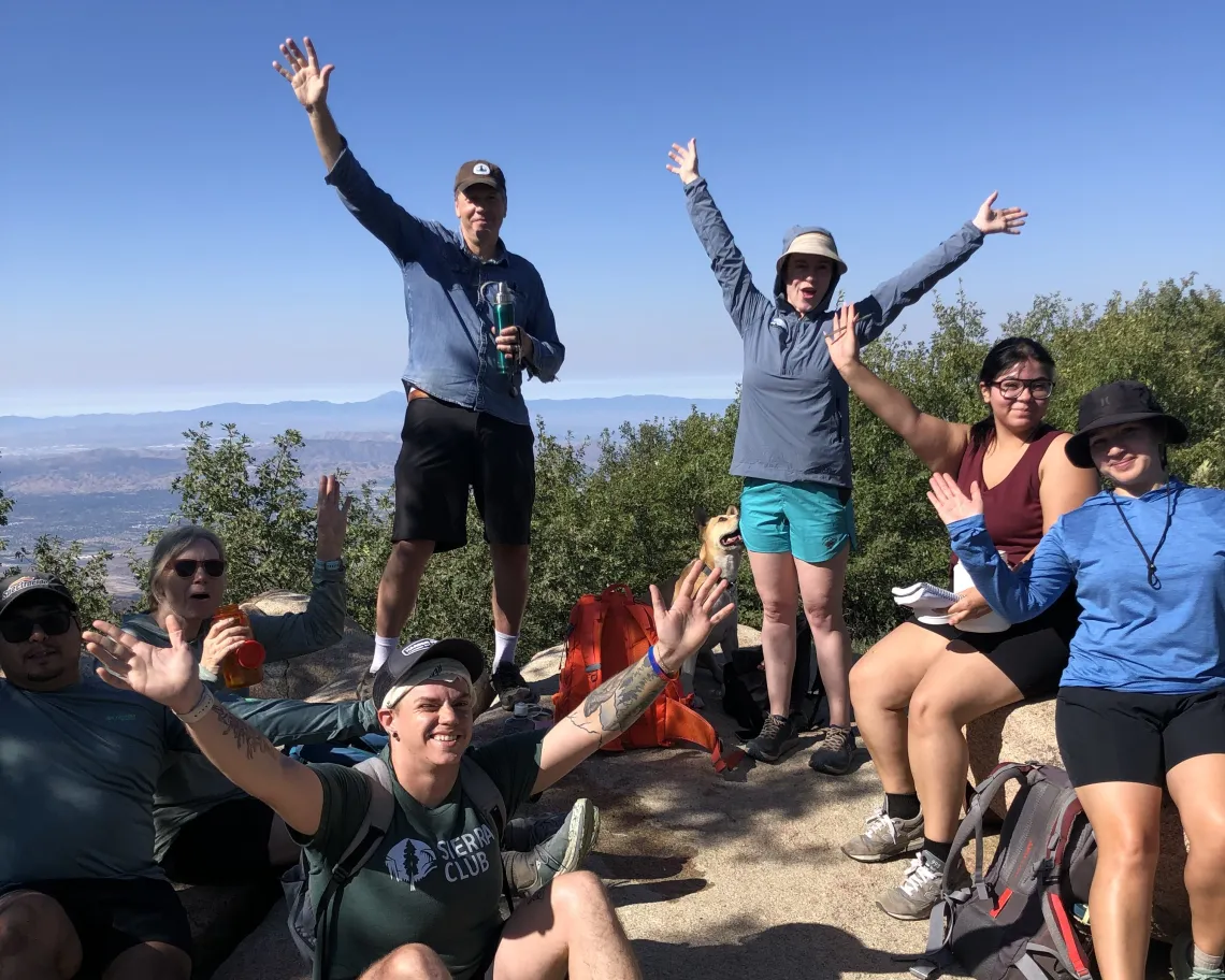
Members of The Mountain Group pose atop Mills Peak in The San Bernardino National Forest. Photo by Karla Kellems.
Karla's Recommendations for Backcountry / Forest Road Access:
Another important area includes Bench Trail and Hawes Peak, accessed from Crab Flats Road (3N16) at Tent Peg Campground. The trail begins approximately 0.2 miles west of Tent Peg Campground on Forest Road 3N34. The route follows the Pacific Crest Trail east for approximately ¼ mile before heading north on 2W14 toward the summit. The overall hike is approximately 8 miles round trip and is moderate to difficult. Because the Pacific Crest Trail runs directly through this backcountry Roadless Rule area, I think the Pacific Crest Trail Association would be an especially important organization to engage in the campaign to maintain Roadless Rule protection.
Sources:
[1]: "Save the Roadless Rule to Protect Our Forests" Sierra Club
[4]: "What is the “Roadless Rule?" Sierra Club Oregon Chapter (2026)
[5]: "Agreement Protects 1 Million Acres of Roadless Areas in SoCal Forests" Earthjustice (2010)