Shifting Border Wall Plans Threaten Big Bend Region
Covert plans to militarize remote parts of Texas could endanger fragile desert communities
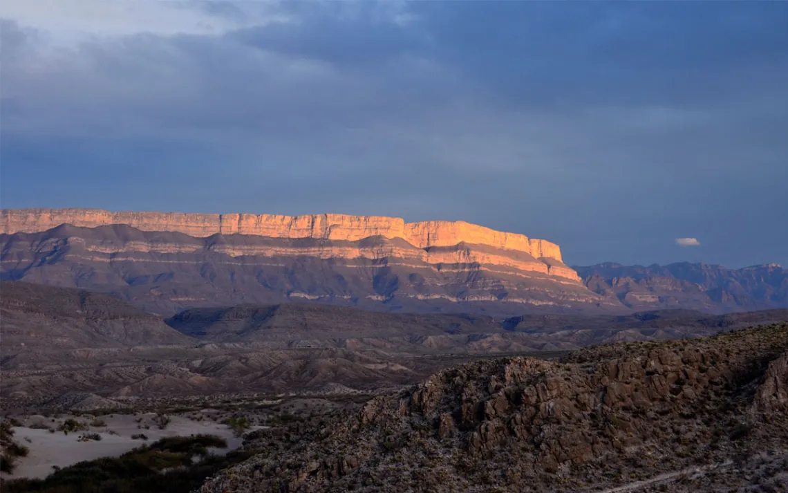
Sierra del Carmen sunset. | Photo courtesy of NPS Photo/Cookie Ballou
The Big Bend region is one of the remotest areas of the contiguous United States. Along this stretch of the southern border straddling Texas and Mexico, at least five major parcels of public land converge. Earlier this year, the Trump administration quietly unveiled plans to build a 30-foot-high border wall through every one of them, severing millions of acres of wild, rugged natural area between the US and Mexico.
The blowback was immediate and swift. As soon as Customs and Border Protection (CBP) released plans on its website, residents started speaking out against the plans. Most found out through word of mouth and The Big Bend Sentinel. Some of them received letters that the federal government wanted to take their land. Others got notifications that it wanted to occupy their farms to set up camps. The opposition has spanned political affiliation and included over 130 environmental groups, 46 Texas lawmakers, and five border sheriffs.
In response, CBP has updated its online maps, indicating that no wall structures will be built through the national and state parks. Instead, it appears as if it will put up an arsenal of remote sensors, towers, cameras, and other surveillance, collectively called “detection technology.”
But for many locals, the threat remains. The administration is still planning to build a steel border along 200 miles, set to cut through wildlife habitat, several communities, archaeological sites, and small historic cemeteries. And some fear that the administration’s plan could, again, change as it's not final yet.
In addition to being home to Big Bend National Park and Big Bend Ranch State Park, the area includes the Rio Grande Wild and Scenic River, Amistad National Recreation Area, Black Gap Wildlife Management Area, and El Carmen Land and Conservation Company. The rare combination of monsoon desert, mountains, and river makes this one of the most fertile and biologically diverse regions of the country. And while many have rightfully focused on the people whose land is being trespassed, others have pointed out the environmental destruction and threat to historical sites along the river.
Normally, construction projects on public lands require environmental assessments or environmental impact statements, but the Trump administration has waived 28 federal regulations, including the Endangered Species Act, to build the border wall and detection technology in Texas. This is in addition to other federal laws, such as the Small Business Act, that were waived in 2025 to build portions of the wall in Arizona.
Mark Williams, former liaison between CBP and Big Bend National Park from 2010 to 2016, described the typical way in which federal officials collaborate as healthy and essential. “There’s a whole process to building anything in the park, anything at all. Whenever they disturb the soil, they first have to study archaeological sites, for example,” Williams said. “When we had Border Patrol housing built, they did so according to environmental laws.”
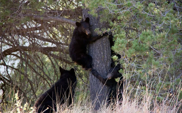
Black bear cubs in Big Bend National Park. | Photo courtesy of NPS Photo/Big Bend National Park
Wildlife connectivity
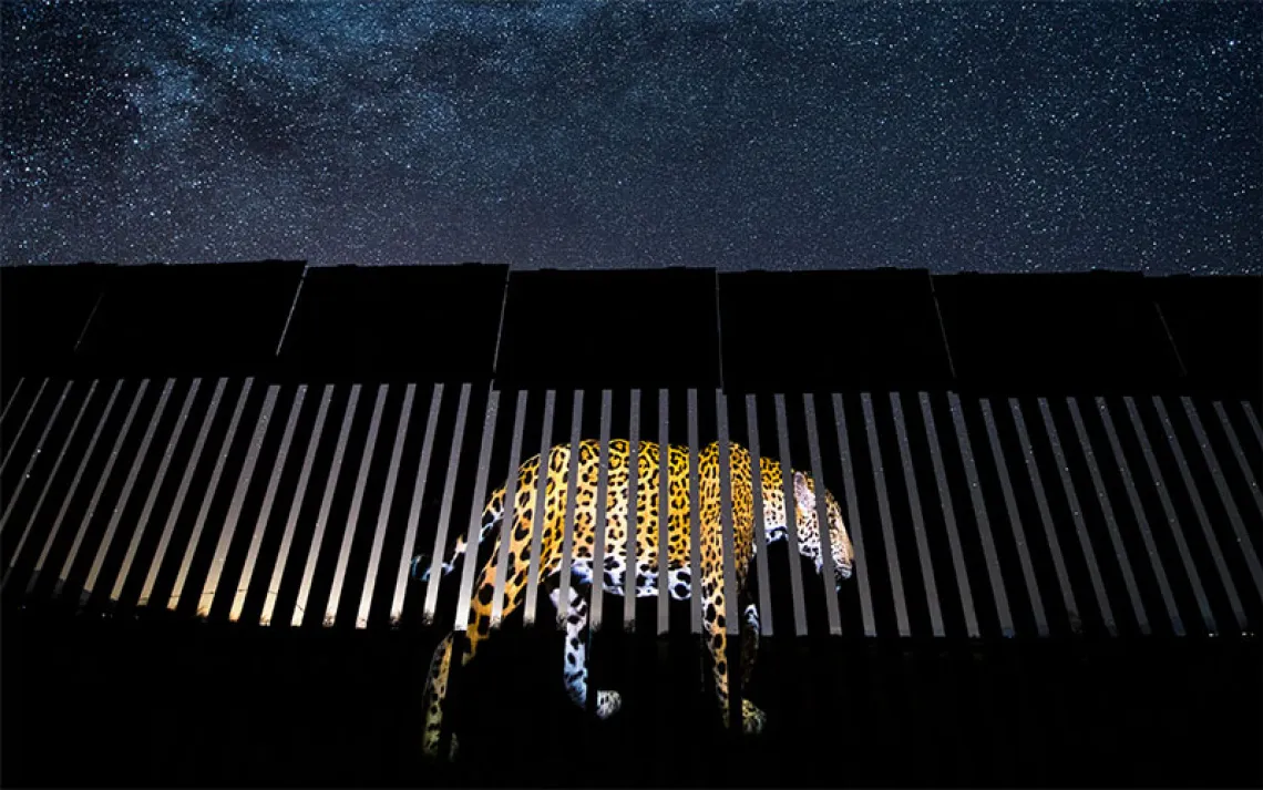
Physical barriers are a death sentence for wildlife. According to Raymond Skiles, who was the wildlife biologist at Big Bend National Park for 30 years before retiring, wildlife can’t just relocate. “Populations adjust to the environment that can support them," he said. "Without access to the water, they’ll die in large part.”
In South Texas, animals such as mule deer, javelinas, coyotes, black bears, mountain lions, and bighorn sheep regularly cross the border to meet their daily needs—food, water, shelter, and mating. Skiles says this is especially true for the local black bear population, whose gene pool needs a constant influx of new bears to stay healthy. “The Texas mountains function as islands, genetically speaking,” Skiles said. “While the Mexican mountains are the mainland.”
Mountain lions are also at risk, as the population in Texas is one of the least protected in the country. Like black bears, their genetics depend on the Mexican source population. Samantha Miller, large carnivore conservation specialist for the Center for Biological Diversity, described the Big Bend area as “the last unfragmented binational habitat in the southern US.”
The wildlife corridors here, she said, provide scarce resources in the desert—water and prey—for lions. Their presence is a sign of a complete ecosystem, she said, since predators need abundant habitat and large prey. In turn, they keep the ecosystem healthy by preying on the weak, old, and sick.
In addition, the entire Rio Grande corridor is one of the most important critical habitats for migrating birds in the world. The region is home to roughly 450 species of birds, with most of those being travelers that rely on this intact ecosystem as a stopping point along their migration routes. The greater Big Bend also makes up the largest international dark sky reserve in the world, at over 9 million acres.
Amber Harrison, a local dark sky advocate and former interpretive ranger at the state park, worries that the increase in lighting will damage dark sky tourism and wildlife. CBP claims that they intend to use infrared lights in the national and state parks, but Harrison pointed out that this will require the use of lights for installation, monitoring, and service roads.
“It doesn’t take much. The experience of light in a dark environment is very different than in an already light-polluted area,” Harrison said. “Artificial lights affect predator-prey patterns, mating patterns, and breeding cycles.”
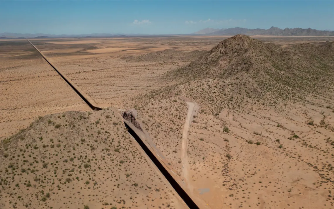
On the Arizona-Mexico border, the wall along the Organ Pipe Cactus National Monument separated all wildlife from access to drinking water in the Rio Sonoyta in Mexico. Peter Holm, a former ecologist at the monument, stated that the National Park Service sometimes found roadkill along the wall’s service road, a high-speed road used by CBP and the military. He also described exotic weeds growing along drainage ditches and major hydrological problems. Elevated service roads caused flooding, and tons of vegetation debris collected along the wall, rotting in the hot sun, following the monsoons.
No matter where the wall is, its destruction extends far beyond the wall itself. “When you scrape clean 50 feet of desert to build [a] border wall, you eradicate tens of thousands of acres of habitat—their food, water, and shelter,” Skiles said. “Most animals can’t handle the heat of those open spaces. They all need shrubs, arroyos, mature trees, hiding holes, in addition to food and water, to survive.”
A wall no one wants
In March, the Department of Homeland Security awarded a $1.2 billion contract to Fisher Sand and Gravel, a North Dakota–based company that built part of the border wall in Arizona, to build portions of the Texas wall. That same month, the agency awarded a Montana-based company, Barnard Construction, nearly $2 billion for border wall construction. The comment period for this work ends on April 6, and construction is scheduled to begin in Texas as early as this summer.
This is occurring even though the number of illegal crossings in Big Bend is the lowest on the border because of the difficult, mountainous desert terrain and inhospitable temperatures. Total apprehensions in 2025 were the lowest they have been since 1970, with law enforcement catching 1.3 percent of border crossers within the Big Bend Sector, a geographic region created by CBP.
Even Big Bend Sector Border Patrol agents oppose the physical wall, said Catherine Eaves, the mayor of Alpine, Texas. “They live here too; they love to hike in the parks too,” she said recently. “They love the dark skies also.”
When the Trump administration built the wall at Organ Pipe, it waived the National Environmental Policy Act, which impacted not only Park Service operations but also worker morale, Holm stated. Matt Stoffolano, former chief ranger at Coronado National Memorial in Arizona, said many of their staff were so upset that they not only left the park but quit the Park Service altogether.
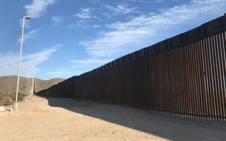
An existing section of the border wall is severing Organ Pipe National Monument in Arizona. Along it is a service road and a blockade of lights. | Photo by Margret Grebowicz
Presidio, a town roughly 15 miles west of Big Bend Ranch State Park, is the only city slated for steel wall construction. Small and sleepy, with quaint colonial architecture and sporadic palm trees, it is an international port of entry with no public river access point.
Mayor John Ferguson stated, “The border wall would compound the disconnect that Presidio already has to the river and to our sister city across the river, Ojinaga.” Coakee Wildcat, an ecosystems restoration specialist who worked on green infrastructure in Presidio, has lived in many cities that had rivers through them, but never one that had no public river access.
“There’s all this fear and shame and grief around what should be the heart of this community,” Wildcat said. “On the Ojinaga side, there’s attractive public space. Here, there’s only a militarized zone. When I did plant surveys, men with guns and dogs approached me immediately. This isn’t nourishing for a community or a culture. Presidio needs a riverwalk, not a border wall.”