The Geographic Information Systems (GIS) Committee provides mapping and other GIS services to Chapter entities.
ESRI
Committee members are volunteers who use the Chapter's ESRI ArcGIS software to develop conservation-related maps. Example efforts below.
Open Street Map
OpenStreetMap is a free, open-source map (no copyright) that anyone can contribute, edit, and use.
Volunteers
The committee matches volunteers with appropriate skills with project requests. We can provide training and software for interested volunteers with good computer skills and general mapping knowledge. Members who can volunteer a few hours per month should contact the Chair. Requests for mapping projects for other Chapter entities should be directed to the Chair: Shawn.Britton@lomaprieta.sierraclub.org.
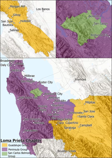
Loma Prieta Chapter Membership Map 2023 by Kristine Piedad
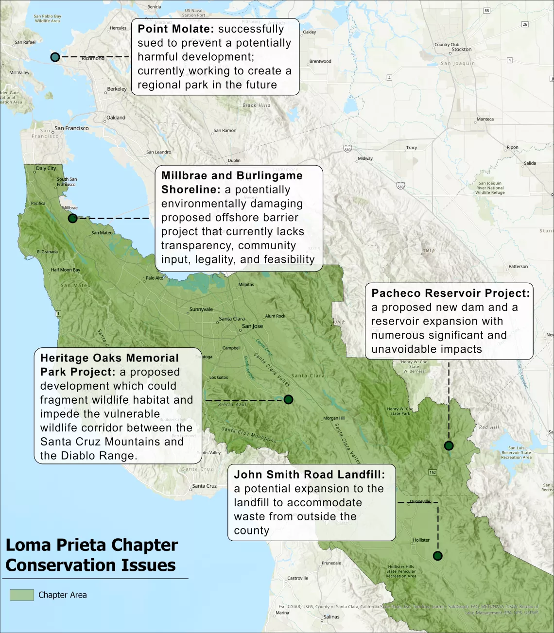
Current Chapter Conservation Projects by Kristine Piedad
ERSI Example work:
Coyote Valley Land Use and Ownership
Coyote Valley Main Development Area
Minorities and access to public transportation.
Millbrae California Transportation