The Rise of Community-Led Landslide Monitoring
Could an innovative natural-disaster monitoring system in Alaska be a model for the rest of the country?
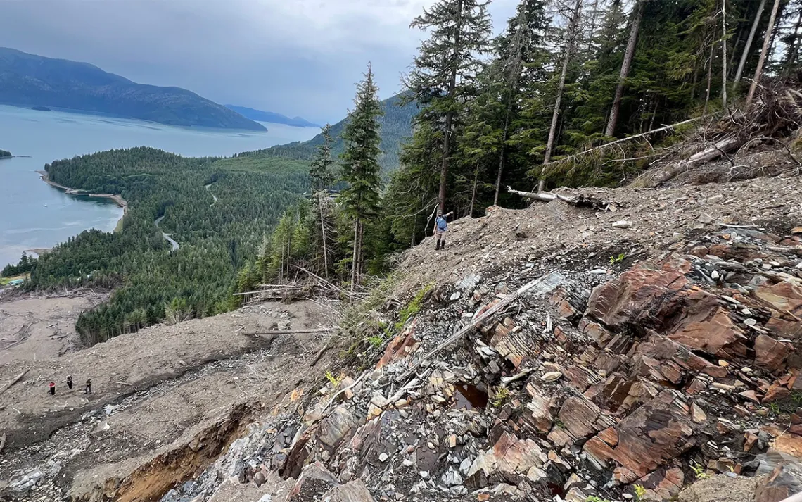
National Weather Service forecaster Aaron Jacobs surveys the Wrangell, Alaska, landslide that killed three people in 2023. Bedrock ledges created a stair-step landscape pattern that resulted in cascading, projectile-like movement of the landslide, according to Kutí project research. | Photo by Josh Roering
It rains constantly in Southeast Alaska. But on August 18, 2015, during a particularly intense deluge, a forested slope some 1,200 feet above Kramer Avenue in Sitka, Alaska, began to shudder. Then it gave way. A debris flow hurtled down the mountain, burying a home and killing three residents of the small, close-knit coastal town.
Southeast Alaska has always experienced landslides—it’s a wet place with steep mountains, a deadly combination. But what’s happening now is different. Climate change is supercharging atmospheric rivers that flow up the coast from the tropics and slam into those mountains, dropping huge volumes of rain all at once. Increasingly, slopes become so saturated with water, they can’t hold together. Deadly landslides have hit Haines, Ketchikan, and Wrangell in the years since, and damaged property in Juneau and Skagway.
The 2015 landslide was a breaking point for Sitka. Residents had long seen their mountains as a refuge—a place to evacuate when the tsunami sirens went off. Now, they looked to them in fear. Heavy rainstorms meant sleepless nights.
With no system for monitoring slopes, detecting slides, or issuing warnings and sparse data, Lisa Busch, then director of the Sitka Sound Science Center, took it upon herself to find answers. Along with the Sitka Tribe of Alaska, she called up scientists at universities and government agencies. “We basically said, ‘What questions can you answer that will help our community feel less anxious?’” recalled Busch. “Because people were afraid to send their kids to school.”
A group of landslide scientists heeded the call. They came up with a plan—a system of soil moisture sensors and rain gauges that could provide town emergency managers with data to sound evacuation sirens when landslides looked likely. The group landed a National Science Foundation grant for the project. The scientists expected the community to love the plan.
“And everyone did not love it,” recalled Josh Roering, a University of Oregon geomorphologist on the project. Residents didn’t want sirens that could either indicate they should evacuate toward (in the case of a tsunami) or away from (in the case of a landslide) the mountains. And the town didn’t want the responsibility of ordering evacuations.
Instead, after a four-year, community-led process, they landed on a forecasting tool—an online dashboard for “situational awareness.” It shows a low, medium, or high-risk level based on the amount of rain that’s fallen in a three-hour period—the most significant factor for triggering landslides. Roering and Annette Patton, an Oregon State University geomorphologist, combined 20 years of rain records collected at Sitka’s airport with US Forest Service data on landslides near Sitka to determine what intensity threshold of rain has triggered landslides historically. Now, residents can cross-check that risk level with susceptibility maps of Sitka’s mountains to make their own decisions about risk tolerance. They also started a buddy system—households in tsunami inundation zones pair up with ones in landslide susceptibility zones so each have a place to evacuate. It's the country’s first functioning, community-based landslide warning system.
Right after Sitka’s warning system went live, a deadly landslide struck Haines, Alaska. “Haines called us and said, "We want what you have. Can you just bring your scientists to our community?'” Busch recalled.
Busch went back to the NSF along with the Central Council of the Tlingit and Haida Indian Tribes of Alaska and established a project called Kutí, the Tlingit word for weather. Now, 10 years on from the deadly Sitka landslide, the Kutí project has grown to include six communities in Southeast Alaska, with some 15 more interested in warning systems.
In 2021, Congress passed the National Landslide Preparedness Act, with the urging of Alaska Senator Lisa Murkowski, herself from a community that’s endured deadly landslides. The act, currently up for reauthorization, directs the US Geological Survey to create a national warning system for landslides. But such a system is decades away, and its future is uncertain after nine months of deep cuts to the USGS and other key agencies.
Alaska is used to not relying on the government, said Busch. These community-developed and operated systems, customized to each town with grassroots support, are filling the gap and likely with far more buy-in than an eventual government-run system would enjoy. With more government cuts on the horizon, Southeast Alaska could be an example for rural communities across the country that increasingly face landslide risk, like California and North Carolina.
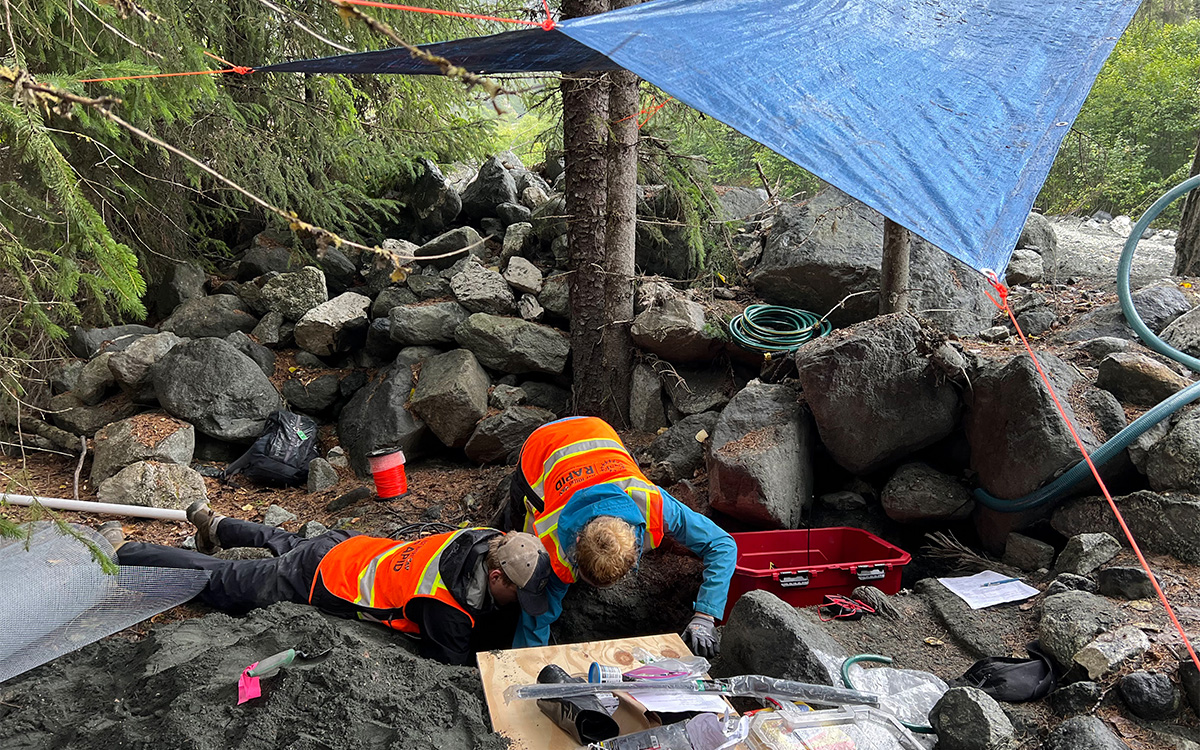
Graduate students Maryn Sanders, Ian Wachino, and Selina Davila Olivera hike up the Mile-19 debris flow channel above the Haines Highway and Chilkat River in Southeast Alaska. The channel experiences multiple debris flows each year. The Kutí team is assessing sites on the slide for sensor deployment. | Photo by Josh Roering
Landslide island
Prince of Wales Island is at the Kutí project’s innovative frontier. Home to the world’s largest temperate rainforest, the Tongass, Prince of Wales is larger than the state of Delaware and contains half of Southeast Alaska’s communities, connected by an extensive road network—unique in a region where most towns are only accessible by air or sea.
The island is a place of delicate balance. On steep slopes carved by glaciers, magnificent, centuries-old yellow cedar trees—used for thousands of years by Tlingit and Haida communities for important cultural products like canoes and totem poles—stretch into the gray, rainy sky. Those trees are nourished by the sea. Each year, salmon from the Pacific Ocean swim up the island’s rivers to spawn and die. Vast networks of mycorrhizal fungi suck up the nutrients from their bodies and share them with the trees, which in turn hold the slopes together.
“It should have been a wake-up call, but instead we cleaned up the mess and kept going about business as usual.”
Starting in the 1950s, humans began upsetting that balance, constructing roads that slice across hills—acting like dams that prevent water from flowing downriver—clearcutting forests, warming the climate, and leading to a mysterious and precipitous decline in the yellow cedars.
The first sign of trouble was in 1993, when an outbreak of more than 300 landslides struck the island, covering roads and leaving communities stranded. Adelaide Johnson, then a geologist and hydrologist for the Forest Service, arrived to study the outbreak. With Doug Swanston, who’d studied the connection between logging and landslides there since the 1970s, she showed nearly 50 percent of slides within clearcuts occurred within one year of timber harvest.
“It was the herald to what we are seeing today,” said Quinn Aboudara, natural resources manager for the Shaan Seet Tribal Corporation on Prince of Wales. “It should have been a wake-up call, but instead we cleaned up the mess and kept going about business as usual.”
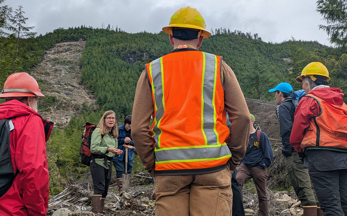
Retired USFS hydrologist Adelaide Johnson leads an investigation team to a landslide that crossed a road and impacted a stream on Prince of Wales Island. Her team of Alaska Youth Stewards and USFS scientists quantified how the slide mobilized and transported sediment. | Photo by Josh Roering
Aboudara grew up on Prince of Wales in the town of Craig. He’s seen the frequency and intensity of landslides increase over the past 30 years, from maybe one a year to dozens. Today, everyone has a landslide story. Most involve roads. In 2019, the community of Kasaan was cut off for three months in the middle of winter when a landslide destroyed the road into town and a government shutdown delayed cleanup efforts. Families have been separated, unable to reach grocery stores or medical clinics. Slides have hit hydroelectric plants, knocking out power for days at a time. Aboudara’s road crews are almost always clearing a slide somewhere.
“It’s a matter of when, not if, we have a catastrophic landslide that claims human lives,” said Aboudara.
The cutting edge
Last summer, the science team, led by Roering and his students, used satellite imagery to inventory every landslide on Prince of Wales since 2009—over 1,000—mostly during “landslide season,” August to December and on slopes logged 20 to 30 years prior. Like in Sitka, they matched those slides up with historic storms to figure out triggering factors. Atmospheric scientist Deanna Nash, who specializes in atmospheric rivers at the Scripps Institution of Oceanography, created highly localized computer models of historic storms, interpolating between very limited rain gauge data points at coastal airports.
At the same time, Johnson, who recently retired from the Forest Service to engage communities in science with more freedom, recruited community high school students through the Alaska Youth Stewards program to install mid-slope rain gauges and simple soil saturation sensors—a tube filled with ground cork that rises in level when water is present. Researchers are also working on better susceptibility maps that simulate exactly where slides are likely to initiate and how far they would flow—modeling that could be applied anywhere in the country. With this extra data, the team is moving beyond “where” and “when” landslides happen, Roering said, to “why.”
Data shows that when atmospheric rivers hit perpendicular to mountains (typically on south-facing slopes), they cause more landslides. Also, atmospheric rivers dump most of their water at the mid-slope elevation as water vapor cools and condenses into rain—up to 50 percent more than in valleys and at peaks. The more moisture already in the soil, the less rainfall is needed to trigger a slide. All this means predicting landslides is more complicated than just measuring rainfall intensity, as Sitka’s system does.
Nash likes to think of a given slope as a jar, and each factor—the rainfall amount, the history of logging, the presence of a road, the direction of the atmospheric river—as a marble. When the jar fills, a landslide happens. All those variables will go into a dashboard for Prince of Wales like Sitka’s, which will be available for residents next spring. The National Weather Service forecasting office in Juneau also uses Nash’s models and language about landslide risks to send out official warnings when weather conditions mean landslides are likely.
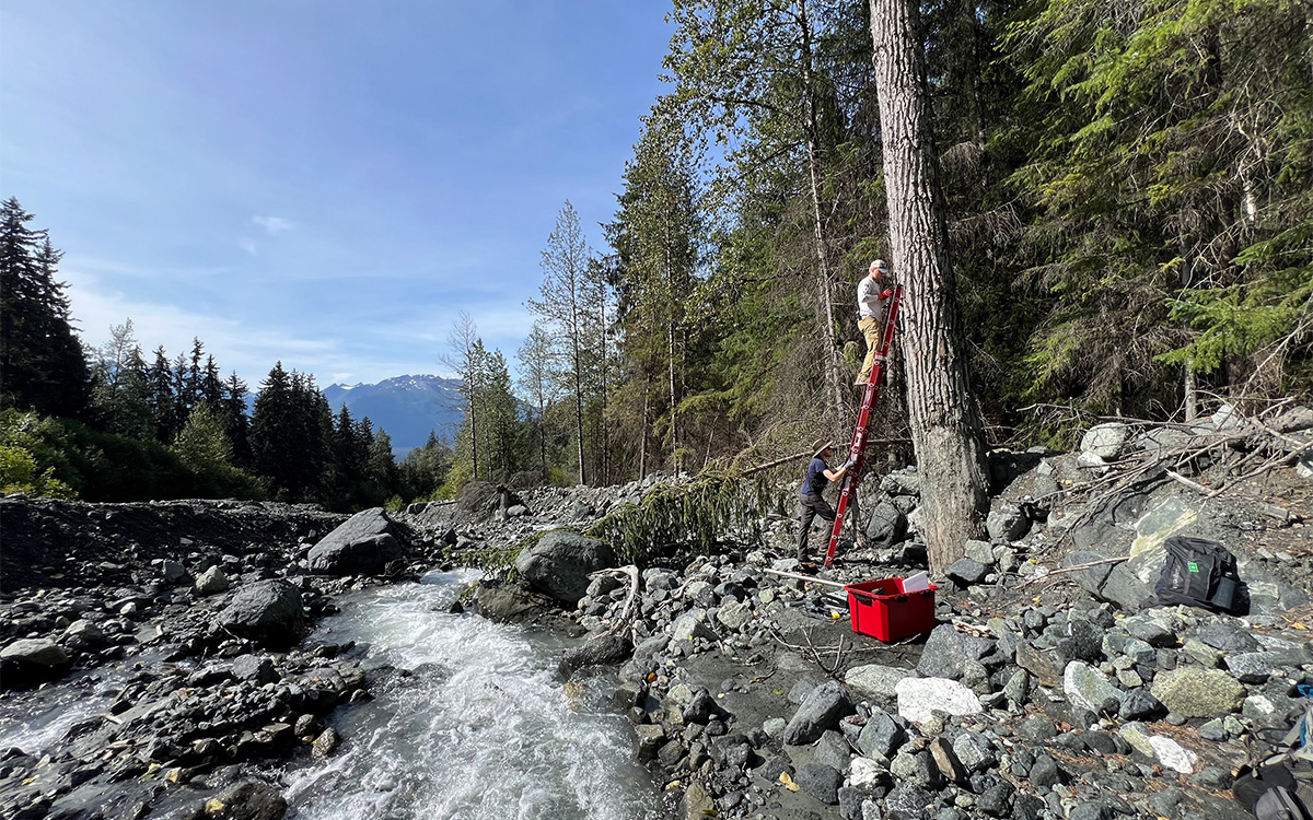
University of Oregon graduate students gather data that may help detect how debris flows generate. | Photo by Josh Roering
There’s one big problem with predicting future landslides based on past data: The climate is changing, and rapidly. A warmer atmosphere can hold more moisture, which means more intense and potentially more frequent atmospheric rivers. Most of Prince of Wales’s biggest slides have followed “rain on snow” events, when heavy rain falls on a snowy slope and melts it, putting more pressure on the soil and rock. With climate change, Southeast Alaska will experience significantly more unseasonable rains, according to Nash’s models, and more such events.
“I grew up used to the rain and being wet.… But the intensity of the rain was not there, and it is now.”
“Here we are at the end of October, when we should be seeing frost on the ground, and we are preparing for another atmospheric river this week,” said Aboudara, when I spoke with him last month. “I grew up used to the rain and being wet.… But the intensity of the rain was not there, and it is now.”
Landslides are an inconvenient truth. Tribal communities especially may not be inclined to trust outside scientists, given a history of mistreatment at the hands of government agencies. Roering credits the Kutí project’s acceptance on Prince of Wales to a year-long listening tour and a foundation of decades of work in local communities—more than 30, in Johnson’s case. The project’s research questions were informed by Alaska Native perspectives. Tribal members, in tune with the weather, told Nash the difference between raining and “really raining” and told her to look into the influence of wind on landslides, which turns out to be significant. Alaska Youth Stewards have gone door to door handing out informational material and trekked up landslide scars to plant baby yellow cedars in the debris. One of Aboudara’s sons helps check weather stations and shares landslide knowledge—like to warn others if the water in a culvert turns the color of chocolate milk. “If it’s brown, it’s coming down,” is the mantra.
“That’s that passing of traditional ecological knowledge, being able to pass that information to my children and grandchildren, and then they pass it on,” said Aboudara. “We take the time because we’re here; we’re every day on the land. We’re very intimate with landslides around here.”
University of Oregon graduate students Ries Plescher and Henry Chandler deploy seismometers along Klukwan Creek to detect rockfalls and debris flows. The students are working with Josh Roering and the Chilkat Indian Village to understand landslide triggers and inform resilience for the village downstream. | Photo by Josh Roering
A way forward
Alaska isn’t the first place to attempt community-based landslide monitoring.
In February of 2006, a landslide swept through a neighborhood in the Philippines, killing 1,200 residents. With some government funding, the University of the Philippines Diliman launched a landslide-monitoring effort called Dynaslope. In 2009, Ray Kaimo, an engineer, joined the project, installing sensors to measure ground movement. A few weeks later, the sensor wires were stolen. Kaimo realized community buy-in would be key.
Over the next 15 years, Dynaslope expanded to 53 communities. In each town, Kaimo's team conducted workshops and trainings. Residents are responsible for their community’s sensors and also take their own measurements, holding measuring sticks across cracks that open up on the slopes and reporting them to Dynaslope’s leadership team. Kaimo’s government-funded office monitors data 24/7 and sends out warnings. The project is now weaning its member communities fully off centralized support—seven towns already monitor their own sensor data and order evacuations independently. The project has success stories—in one case, the sensors failed but trained community members noticed warning signs and ordered an evacuation before a landslide half-buried a house.
“I don't think anybody in this country would say that it isn't a good idea to have communities take charge of taking care of themselves.”
This fall, Kaimo flew to Alaska to share knowledge with communities in the Southeast.
“It’s heartening to us because we have so much to learn from these other places,” said Busch. Johnson envied their sensor technology. Unfortunately, the two landslide teams had another topic to commiserate on: funding cuts. The Dynaslope project saw a 40 percent funding cut this year. The Kutí project is coming to a close, and new grants have proven hard to come by.
Busch is working on diversifying funding to keep the work going. The follow-up to Kutí, called the Southeast Alaska Landslide Informational Partnership, or SLIPP, has 60 members and funding from tribal councils and various agencies.
“I don't think anybody in this country would say that it isn't a good idea to have communities take charge of taking care of themselves,” said Johnson. But to do that, those communities need federal funding and expertise and data from agencies.