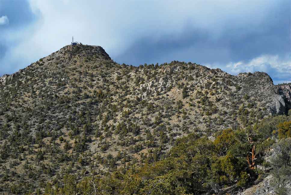
John Hooper and I were on our way back from climbing a few peaks in Zion NP when took a little detour to ascend Mt. Irish in southeastern Nevada. Mt. Irish dominates the skyline in the Mt. Irish Range from both the Pahranagat and Tikabo Valleys. We used Logan Pass as the trailhead for the climb, which is situated about 1.4 miles south of the summit. There are two ways to approach Logan Pass: a good-to-excellent graded dirt road from the east, or an equally well-graded road from the southwest. Passenger cars should be able to reach the pass with little difficulty as long as the road is occasionally graded. We took the east-side approach to get to the pass, and left the pass using the southwestern side.
To get there: From the intersection of Highway 375 and 318 in Pahranagat Valley, we went north on Highway 318 about 2.4 miles to a graded dirt road near Nesbitt Lake. We passed a minor dirt road to our left (west) just as we reached the lake. Just a few hundred feet further north, a much more prominent unmarked dirt road to our left (west) is reached. This is the correct road. There is a barbed wire gate here, but it is unlocked. The gate appears to be there merely to keep wandering cattle off the highway. From this intersection, it is 12 miles to Logan Pass.<\p>
 Driving in from the east side has the added bonus of passing through the Mt. Irish Petroglyph Site. We saw several rock outcroppings with Indian petroglyphs and stopped at the nearest one to take some pictures. There are also a few nice camping spots along the way to the pass. Several side roads are also passed on the way up, but most are clearly less used and are not graded. A junction with another good dirt road is reached after the petroglyph area. Stay right. The left branch probably descends to abandoned site called Logan. <\p>
Alternatively, one can approach Logan Pass from Highway 375 in Tikabo Valley. Near the eastern side of Tikabo Valley about 10 miles west Hancock Summit on Highway 375, take the unmarked dirt road north up the valley. This is the only well-graded road on the north side of the highway in the eastern part of the valley. It is labeled Cold Springs Road on my map but don’t expect to ever see any road signs. From this intersection, follow the main dirt road 14.5 miles to Logan Pass. A few miles from the intersection the road gets curvy and undulates quite a bit. As with the eastern approach, always stay on the best graded road when side roads are encountered. Roughly 10.4 miles in, a four-way intersection is reached. Go straight. At 13.6 miles in, an old log cabin is reached on the right (south) side of the road. People have used it as a campsite and it is well shaded by trees.
The climb: At Logan Pass there is a wide spot for 3-4 cars to park. However, we continued 0.1 mi. on a fair dirt road leading north from the top of the pass to another parking location. People have used this spot for camping. From our parking spot we hiked north through a pine and juniper forest to a rock outcropping of sparkly white quartzite with colorful red streaks. We then side-hilled over loose talus just to the east of the quartzite ridge for about 200 yards where the ridge then took an abrupt uphill turn. We entered a steep chute here, located just above the quartzite ridge. Plenty of loose talus is found in its lower end. The chute went class 2 with one 10-foot section of low-exposure class 3 about two-thirds of the way up. The top of this chute is hard to spot on the way back, so it would be helpful to look back and remember what the terrain around it looks like on your return.
We continued walking north over pleasant, easy terrain through a shady forest, then up and around a false summit composed of grey limestone where we saw the summit of Mt. Irish for the first time since the start of the climb. Mt. Irish has a flattish summit with a radio facility on top. All the equipment on the top was apparently flown in by helicopter, as there are no roads to the summit.
A short descent follows the trip around either side of the false summit, with only occasional minor bushwhacking for the remainder of the way up. The register was in a small pile of rocks on the northern edge of the small summit plateau, thankfully away from the radio facility. Views were extensive, but we did not stick around to enjoy it with a thundercloud quickly bearing down on us. The hike came in just under 3 miles round trip with 1600 feet of gain, but still took us close to 4 hours to complete. April 30, 2011 - Daryn Dodge