by Susan Alcorn
Below, Susan Alcorn answers a series of questions from Chapter staff about her experience with the challenge that we think will inspire you.
You can read and download the Nifty 90 list here. Once you've summited all 90 peaks, send us your completed list with dates of each climb and we'll send you a special commemorative bumper sticker — and your name will live on for eternity in the pages of the Yodeler
When I first saw the item in the Winter 2017 Yodeler announcing the challenge to “Bag the Bay Area’s ‘Nifty Ninety’ Peaks!,” I read through the list of peaks and saw that there were several familiar names. Mount Tamalpais and Mount Diablo are dominant landmarks in the Bay Area. San Francisco’s Nob Hill, Telegraph Hill, and Russian Hill are popular spots for tourists and locals alike.
My immediate reaction was, “that looks interesting; we’ve even done some of them.” I put the article aside for the moment—and it could have stayed in my large pile of articles about places that I would like to go, to hike, to eat, etc., but somehow I couldn’t get it out of my mind. Getting my husband, Ralph, on board took no time at all. We soon went out to Sibley and Briones (East Bay Regional Parks), where we often hike, and climbed an easy peak in each: Round Top (1,763’) in Sibley and Briones Peak (1,483’). Though we had already hiked both before, we agreed that even if we had climbed a peak previously, we would do it again for the challenge.
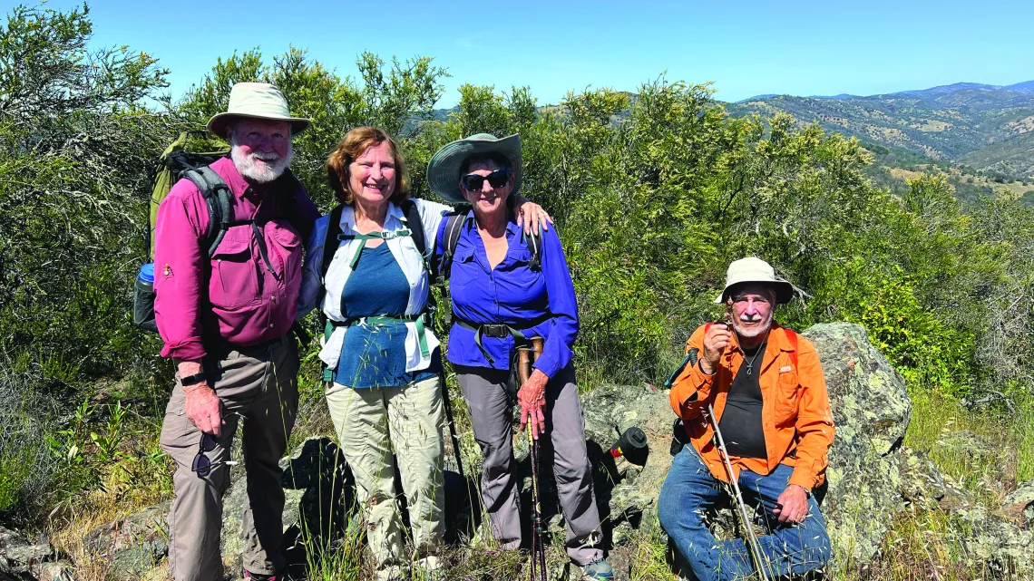
A couple of months later, our friends, Patricia Schaffarczyk and Tom Coroneos, decided to join us on the peak walks. Patricia, and Tom to some extent, caught up with us by doing the ones they had missed independently.
What was the toughest ascent?
There are three that stand out for us— Rose Peak in Ohlone Regional Wilderness, Mount Sizer in Henry Coe State Park, and Berryessa Peak in Berryessa Snow Mountain National Monument. Rose Peak was tough because it’s an 18-mile round-trip hike from Sunol Regional Park and gains almost 4,000 feet in elevation. Sizer involves a round-trip hike of 15.5 miles, also with about 4,000 feet gain. Berryessa involves a 14.7-mile out-and-back trail with an elevation gain of 3,507 ft. We did all three as overnight backpack trips because of the length of the hikes, and because of their distance from home.
Two of them, Rose Peak and Mount Sizer, are frequently mentioned on forums as the most challenging hikes in the Bay Area. Berryessa Peak, also rated challenging, doesn’t pop up as often on online discussions — perhaps because of its remote location in Napa County — but we found that earlier wildfires had left parts of the trail in poor or unstable condition (trail work has since been done).
What did you learn about the Bay Area in the course of this epic accomplishment?
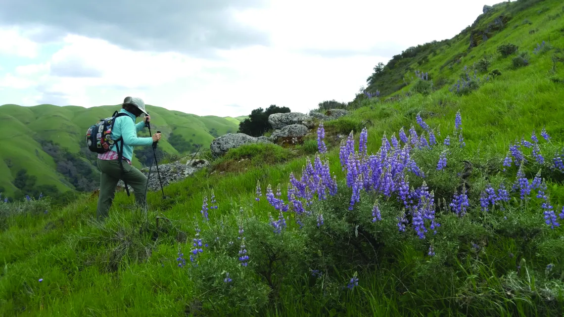
I learned there is always more to discover! Even though I have lived in the Bay Area about 75 of my 81 years, there are always new trails, new backroads, and new vistas to be explored! I particularly loved finding wildflower displays at their best.
Any standout wildlife sightings?
I am happy with ANY wildlife sightings! I barely missed stepping on a large rattlesnake when going up a rocky section on the way to Mount Hood in Mount Hood Regional Preserve. We saw a bobcat in Henry Coe, and many coyotes and deer in various parks. Plenty of cows — not very wild, but sometimes a bit intimidating! Birds — including quail, woodpeckers, hawks, vultures, and more.
Which was your first peak on the list? Which was your last? Any method behind what order you tackled them in?
The first peak was Round Top in Sibley Volcanic Regional Preserve. The last was Burra Burra in Henry Coe State Park. Round Top was first because it is close to us, and easy. Burra Burra was last because the entrance station we wanted to use (Dowdy Ranch) has rarely been open in the last few years. Much of the park was closed for several months after the SCU Lightning Complex Fire in 2020. The Dowdy Ranch entrance is rarely open because of staffing cutbacks. We were able to enter on April 29, 2022, for the Coe Backcountry Weekend — the only time they are expected to be open this year.
We had a few other considerations: For the most part, we started with the easier and/or shorter hikes and peaks and moved to the harder and/or longer ones as we got stronger. We considered the weather; we avoided places that would be too hot in the summer or too muddy during rainy spells. Finally, because there were (usually) four of us, we had to consider our personal schedules and the driving time needed to reach trailheads.
Sometimes, especially when the parks were a long drive for us, we did more than one peak in an area. Sometimes we made backpack trips or stayed overnight in lodging to be nearer our destinations — that included Berryessa, Henry Coe, Big Basin, and Robert Louis Stevenson State Park.
You finished this challenge over the course of the pandemic. What additional difficulties or opportunities did this present?
Once COVID hit, we stopped carpooling, and shuttling cars, for a while. We walked several feet apart and wore masks when necessary. We carried our own lunches instead of stopping at a local pub until eating outside in public again felt safe. Once we were able to get vaccinated, we felt much safer and were able to resume riding together!
Any lessons you want to pass along to hikers?
In the process of doing the Nifty Ninety, I realized that generally we hike on trails that travel through valleys rather than along ridges. There is a lot to be said for taking the high routes, or going to the peaks, because of the far-reaching views. It’s also a lot less crowded up there!
The peaks on the Nifty Ninety are non-technical — they don’t require mountain climbing skills. A few involve a scramble at the end. I came down the trail from Mount Diablo’s North Peak by sliding on my butt rather than chance slipping on loose rock. Most of the peaks on the list were chosen by Sierra Club leaders from hikes that they had previously led. (A few of the peaks’ exact geographical tops were fenced off because of communication towers.)
We found some helpful information about the peaks online. The Chapter’s list doesn’t include information about trails or trailheads to take to reach a given peak, so it usually involves some research to find the route that would work best. We had great fun keeping track of our ascents on Peakbagger.com. It’s free to use and will dazzle you with its hundreds of other peaks you can explore throughout the world! We also often used AllTrails.com. You’ll also find many posts about the Nifty Ninety challenge at my website: susandalcorn.com/nifty-ninety-peaks-challenge/
Doing this challenge has been a joy and provided a real sense of accomplishment. As I looked through our photos, I found myself wishing we could do it again. Thank you, Bay Chapter!