Check Out This Incredible NASA Image of Hurricane Season
In early September 2018, three separate hurricanes churned in the Caribbean
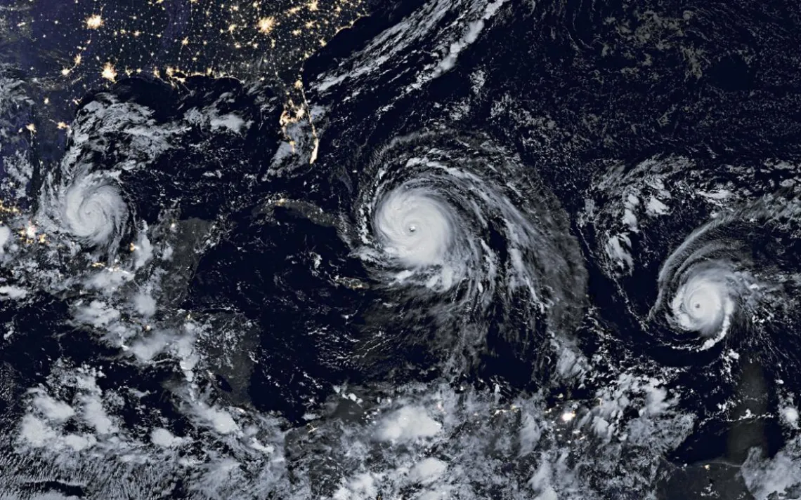
Hurricanes Katia, Irma, and Jose as seen by NASA meteorologists in early September 2017 | Photo courtesy of NASA/Earth Observatory
NASA meteorologists struggled for words to describe the trio of hurricanes brewing in the Atlantic Ocean in early September. This composite image from satellites captured Category 2 Katia as it was headed for Mexico even as Category 4 Irma was on its way to Florida, where it would ultimately cause more than $62 billion in damage and contribute to some 70 fatalities. The final storm, Category 4 Jose, glanced off the Lesser Antilles before dumping rain across the Eastern Seaboard.
This article appeared in the January/February 2018 edition with the headline "Rolling Thunder."