 The Magazine of The Sierra Club
The Super El Niño Has Arrived
Coral cores show that we are entering an unprecedented warming weather pattern on top of climate change
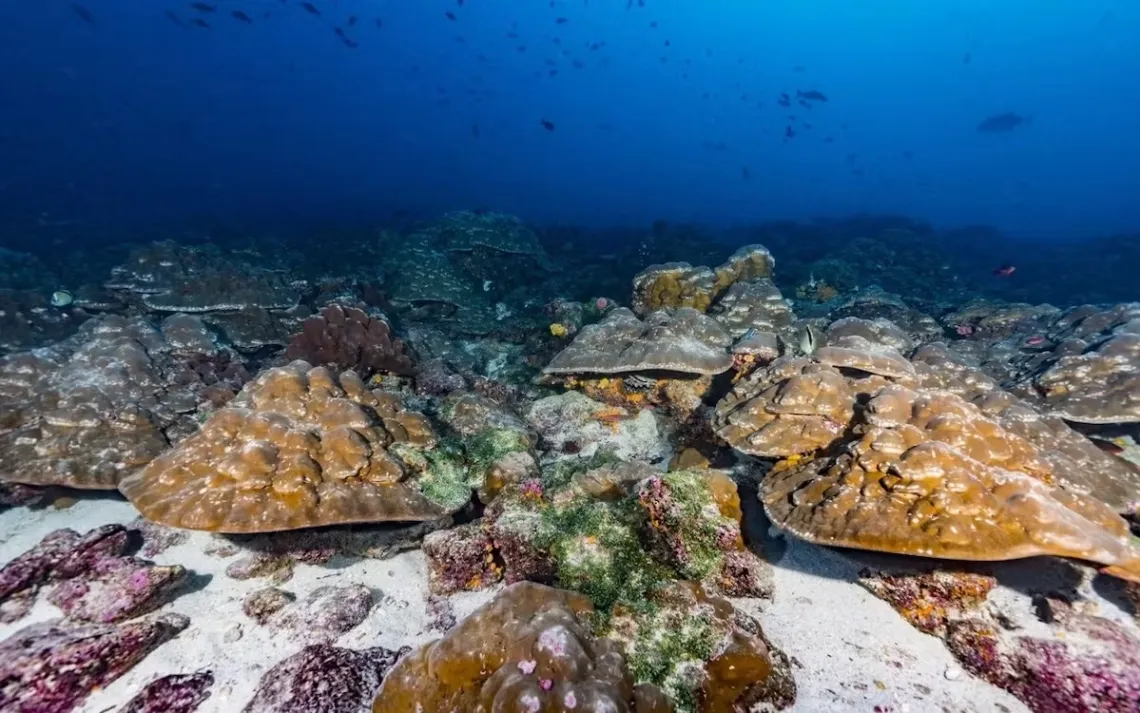
The Galápagos Islands are known for their astounding biodiversity, a result of high nutrients and the mixing of cool and warm waters. | Photo courtesy of Greg Asner
This year’s El Niño is coming in hot: The weekly Niño 3.4 Index reached +2.7°C on August 12, far higher than previous already warm cycles and earning the title “super El Niño” by moving past the 2° barrier. There is a 90 percent chance of it being a very strong event.
Global climate scientists say the natural climate warming pattern may break records, as it traditionally peaks in December. A new study in Science may explain why this year’s and previous ones have been so strong.
Similar to using tree ring samples to reconstruct previous geological events, University of Michigan climate scientist Julia Cole turned to core samples of ancient and young corals, both dead and alive, from the Galápagos, “the heart of El Niño country.” In the coral, Cole examined the ratio of atomic elements—strontium to calcium—and the abundance of oxygen-16 and oxygen-18 isotopes, which document temperature shifts in an environment. The samples showed that warming patterns in the past 40 to 50 years are stronger than they were before the industrial era, which spanned between 1760 and 1914.
“The very strong inference [is] that El Niño is changing dramatically due to climate warming,” Cole said, who has been striving to understand the golden question of how humans impact the cycle, since the 1980s. While the coral cores may have helped fill in sections of the drawing board, they did not settle the argument for everyone.
“I think the jury is still a bit out on how strong that connection is,” said Zeke Hausfather, another climate scientist and research lead at Stripe. Hausfather points to the lack of historical data. Despite this, Hausfather does agree with Cole that the intensity of the pattern is unprecedented. “It's a pretty unusual event,” he said.
Since the 1980s, there’s only been three other events earning the title of super El Niño, resulting in drought, rainfall, and extreme weather around the globe. The difference now is we are seeing hotter overall temperatures, with 2024 being the hottest year on record around 1.55°C above the preindustrial level. The global annual temperature has been increasing at an average rate of 0.08°C (0.14°F) per decade since 1880. Now, with the added pressure of warming surface water in the Central and Eastern Tropical Pacific Ocean, there is likely to be consequences not simply for ocean ecosystems but in some regions of the US.
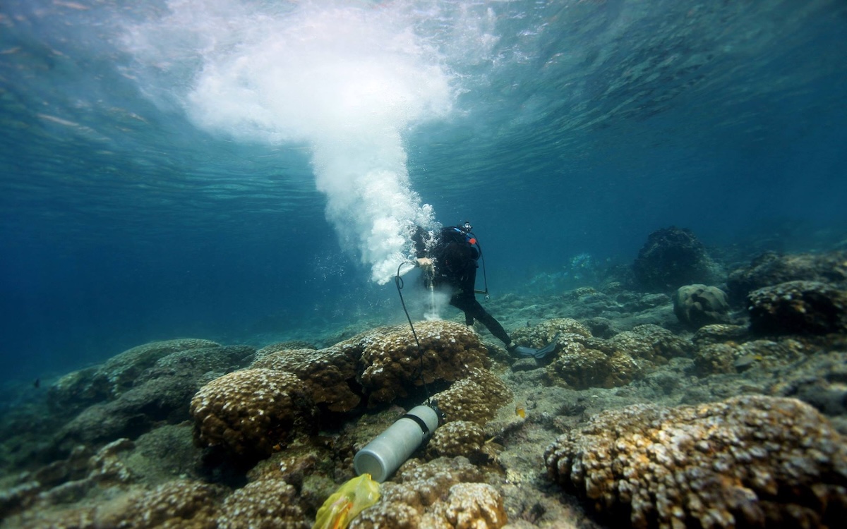
A NOAA scientist uses a pneumatic drill to take a coral core. This process does not injure the colony, which will grow back over the hole in a few years. | Photo courtesy of NOAA
What is an El Niño?
It’s a delicate and orchestrated dance between the atmosphere and the ocean. Normally, equatorial trade winds—highways of air that steer ships and hurricanes through the tropical south—blow east to west across the equator, moving warm surface water from South America toward Asia.
“Imagine a bathtub, and the wind is blowing from one side of the bathtub to the other side,” said Ben Kirtman, a climate scientist at the University of Miami.
As the warm surface water moves, colder water rises from up the deep, in a process known as upwelling. “It's cool; it's rich in nutrients. And it's low in pH, meaning it's more acidic,” Cole said. Nutrients, such as nitrate and phosphate float to the surface, feeding tiny plants like phytoplankton, which are a critical part of the food chain.
Every two to seven years, the atmosphere puts down its baton, breaking the pattern. The trade winds lessen or reverse, marking the El Niño. The ocean responds accordingly, and upwelling slows.
“When the winds relax, what happens to the bathtub? Warm water sloshes back, and when that warm water is sloshing back, it comes up to the surface in the eastern Pacific a few months later. That's the El Niño.” Kirtman said.
El Niño translates to “little boy.” It earned its full name in the 1600s when fishermen in South America noticed that the ocean water was unusually toasty. The full name of the climate warming pattern is El Niño de Navidad—the Christmas Child.
As warm water shifts to the Central and Eastern Pacific and trade winds weaken, heat from the ocean moves back into the atmosphere, strengthening the subtropical jet stream—another highway of air that moves from west to east, often propelling airplanes. The air highway expansion brings wetter and cooler weather to the US, specifically in the South and Southwest.
“What we're seeing in stronger El Niño events is just one more way that global warming is having an impact on the planet in ways that we didn't fully anticipate."
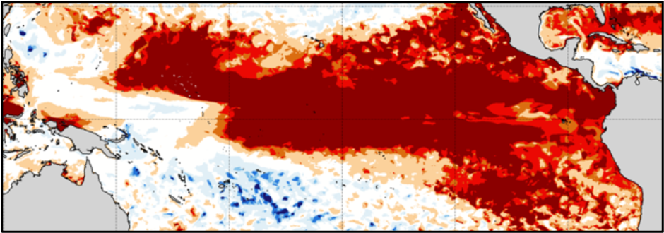
This map of the tropical Pacific shows the ranking of ocean surface temperature extremes in July 2026, with the darkest red areas experiencing the warmest conditions for any July on record. | Image courtesy of Julia Cole, University of Michigan, modified from Mercator Ocean International
Effects in the US
There is often more rainfall in parts of Southern California, with risks of mudslides. Water along the Pacific coast also warms up, sometimes pushing fish to migrate farther north or even swim deeper. The warming water, reduction in upwelling, and harmful algae blooms can take an economic toll on fishermen.
During the super El Niño between 2015 and 2016, which accompanied a North Pacific marine heat wave named “the Blob,” the government paid fishermen, processors, and dealers over $140 million in relief.
While it can be problematic, there may be some benefit to the trade winds lessening, especially in the southern US. “The one silver lining for the US is that El Niño events are generally associated with much lower Atlantic hurricane activity,” Hausfather said.
With fewer tropical storms, southern states usually experience more rainfall and cold fronts. In central and south Texas, there is even an increased likelihood of snowfall during the cycle—normally this is rare.
Each El Niño is different, though. Simply because these weather patterns have happened previously does not mean it’s guaranteed, according to Hausfather. In terms of preparation, the sooner we start the better, especially if it becomes a record-breaking year. We should be focusing on preserving coral reefs, which are already facing bleaching warnings, and setting systems in place for other countries that may be impacted by famines or storms.
The best way to mitigate the effects of future super cycles is to reduce our emissions, according to climate researchers.
“What we're seeing in stronger El Niño events is just one more way that global warming is having an impact on the planet in ways that we didn't fully anticipate: sources of major climate impacts [and] devastating climate impacts around the world,” Cole said. “We should take more seriously the need to curb global warming if we want to dial that back.”