A Trail Runner’s Paean to Bears Ears
Ultrarunner Bryon Powell spends nine days exploring the monument under siege

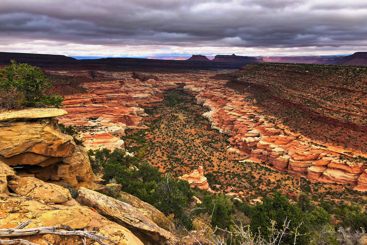
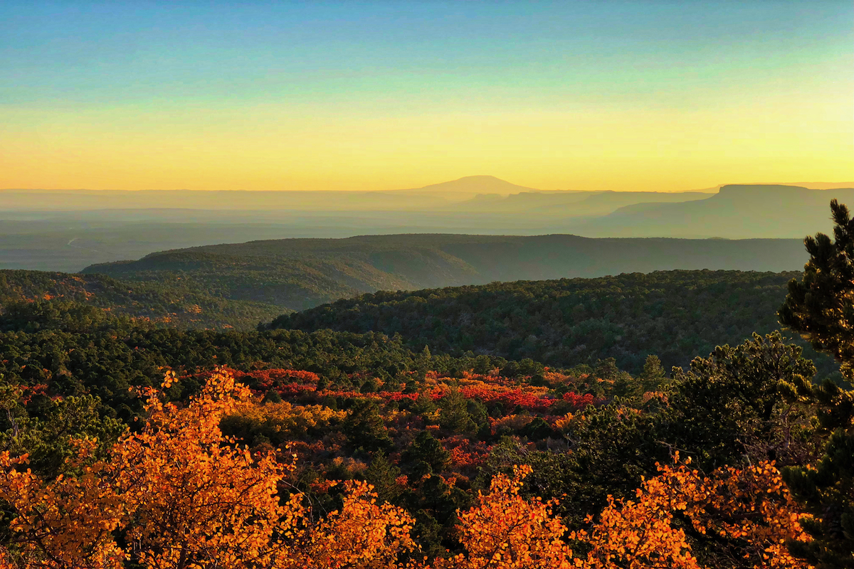
Lockhart Basin at sunset
|Photos courtesy of Bryon Powell
The sun is still hidden below Owl Canyon’s south rim, and the cool October-night air lingers in the canyon bottom. I exit a hairpin bend and find myself facing a canyon wall.
Dead ahead of me is a bright speck in the midst of broad shadow, the telltale sign of a rock window. “Nevills Arch?” I think. “No. Couldn’t be. Not yet.”
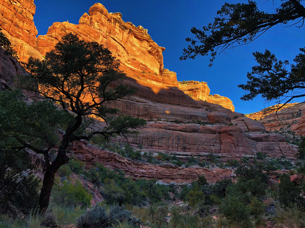 Nowhere on my maps, nor in my guidebook, is there mention of a rock window here. From the looks of it, this window is likely “open” only for a short time each day, while the light angles just so.
Nine days into my run across Bear Ears National Monument, I’ve only grown fonder of these daily discoveries, these surprise gifts that sparkle across the monument as densely as stars in the high desert sky.
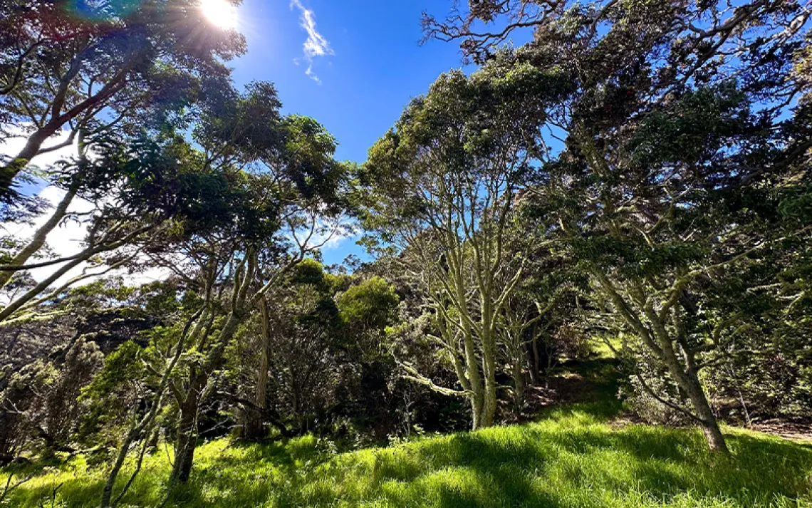
Two months earlier, I limped from spring into summer overworked and overstressed. I desperately needed to rekindle my spirit. It just so happened that I had a brand-spanking-new national monument to explore in San Juan County, Utah, where I live. Bears Ears. You may have heard of it.
You may also know that Bears Ears National Monument has been under attack by Utah’s politicians since last December, when then-president Barack Obama declared its 1.35 million acres—which comprise one of the most culturally and spiritually significant landscapes for five Native American nations in the Southwest—a national monument, as explicitly authorized by the Antiquities Act of 1906. Soon after coming to power, however, President Donald Trump and Secretary of the Interior Ryan Zinke put Bears Ears and numerous other national monuments in their crosshairs. While he lacks explicit statutory authorization to reduce the size of national monuments, it appears imminent that President Trump will attempt to drastically cut the size of Bears Ears National Monument—as well as its elder sibling in southern Utah, Grand Staircase–Escalante National Monument—via executive order. However, numerous Native American tribes and conservation groups stand poised to legally challenge this action for as long as it takes to preserve these monuments in their entirety.
I’d heard tales of amazing sights in store, beyond the Bears Ears namesake—a twin butte rock formation that conjures a bear overlooking the piñon-juniper treetops. When the Trump administration got busy threatening this national monument’s boundaries, I realized how badly I wanted to see a few of them for myself. So, I started planning a long, self-supported trail-running trip through its 200-plus miles of redrock canyons and mesas.
*
At 10 A.M. on a sunny, early-fall Friday, I set out on the marathon-length route from my home, southeast of Moab. I run down Pack Creek, through Behind the Rocks, across Kane Creek Canyon, and over Hurrah Pass to the Colorado River, located a few miles north of Bears Ears National Monument’s northernmost border. I grab some sleep at a remote lodge—my last night under a roof for more than a week.
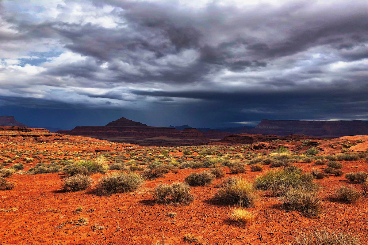
The next morning, a moody sky and an unusual late-September thunderstorm welcome me into the monument itself. Before midday, the clouds burn off. As I run between Hatch Point above and the inaccessible Colorado below, a hot sun bakes me. Early afternoon, I find my way to a spring on the map, but its emptiness deflates my spirit—there will be no refilling my dwindling water supply here. Half an hour later and 20-some miles into my day, I stop in the shade of a large boulder and decide to rest through the heat of the day—roughly another hour—so as to titrate my remaining supply. I figure it’s safest to press on through dusk and into the night toward my night-one destination: Indian Creek.
Traversing the little-used dirt road through Lockhart Basin in the dark, my headlamp ensconces me in a 30-yard-wide world of only rabbitbrush, dust, silence, and stars. My lone wildlife encounter is a beautiful scorpion, unfazed by my own radiance, lying to the south of my path (not unlike the Scorpio constellation simultaneously hugging the southern horizon). Perhaps an hour before midnight, I stride across Indian Creek, set up camp, and heat up a bit of dinner. Too exhausted to further put off sleep, I wait until morning to fill my reservoirs with sandy orange water from the small, slickrock pools catching the creek’s pouroffs.
I spend the next night camped out in a sliver of neighboring Canyonlands National Park. Come morning, I ascend Lavender Canyon. Thick riparian brush gives way to scattered juniper and sage, and the faintest of abandoned roadways leads up through the canyon. On my way up, I find a barely exposed segment of flint knife blade. Not long afterward, I arrive at the headwall leading 750 vertical feet up to a mesa, scout out a more or less continuous line of rock fall, and press upward, trusting it’ll provide a route through the many cliffbands above. Forty minutes later, I’m at the top looking down at the most marvelous canyon view I may ever take in.
South Fork of Lavender Canyon
I pause for half an hour—reveling in a light swirl of snow—before undertaking the 18 miles of dirt road to my day-end food cache. The run starts out cold and overcast. What looks to be hoarfrost decorates the highest conifers poking out of the clouds hovering over Horse Mountain. Later, the clouds dissipate, allowing autumn’s colors to saturate. The farther I climb above 7,000 feet, the more Bears Ears’ reds and rusts and oranges pop off its scrub oaks and dwarf maples. At 8,000 feet, stands of aspens show off in their brightest golden capes. A variety of conifers lend an array of distinctive greens. I’m pushing hard to make camp at Big Spring before dark, but as I turn to head west for the final few miles, an underlying aspen grove erupts in sound—the bugles of a bull elk. In the past day and a half, I’ve heard as many elk as I have cars.
Not long after lacing up on day five, I come to the North Long Point overlook, where I’m treated to the grandest among this trip’s vistas. To the northwest lays Beef Basin, a thickly forested basin dotted with khaki sandstone domes, beyond which soar the spires of the Needles formation. Across a narrow neck of mesa to the west, the Sweet Alice Hills and Dark Canyon Mesa fill a long expanse. To my southwest, the jagged white walls of Dark Canyon provides sharp contrast to the dark conifers above. All the while, I bathe in splendid autumnal colors, and savor the bluebird sky above.
Not long after topping off my water supply at a pleasant upland cattle pond, I glimpse the Bears Ears up close, for the first time. After six days of foot travel, I’m hit with a wave of emotion—delight at the late-afternoon beauty, awe at having traveled so far, and joy at seeing the embodied head and heart of Bears Ears while the national monument still remains unbroken and unblemished.
Still gazing around in awe, I make my way up the road between the ears before catching my first-ever view of Cedar Mesa to the south. The low light, suspended dust, and distant mesas comingle to create a landskein reminiscent of the Blue Ridge Mountains back east.
Cedar mesa with Navajo Mountain, as see from the Bears Ears buttes
It’s taken a week, but on day seven I awake confident that I’ll finally get to explore Grand Gulch, a place that friends and long-time local adventurers speak of with a mix of excitement and reverence. Beyond its undeniable physical beauty, the Gulch offers a remarkable repository of Ancestral Puebloan culture; it’s where many indigenous Americans nurtured the skills that allowed them to flourish in this hardscrabble land.
As I head into Kane Gulch, one of the main arms that make up the Grand Gulch canyon network, I feel transported from the Anthropocene back into the last ice age, when cool temperatures allowed aspens to move into Cedar Mesa’s canyons. Throughout the intervening 11,000 years, this grove has remained steady at 6,300 feet, cloning itself for generations while temperatures gradually rose and the remainder of the area’s aspens receded, en masse, to above 8,300 feet.
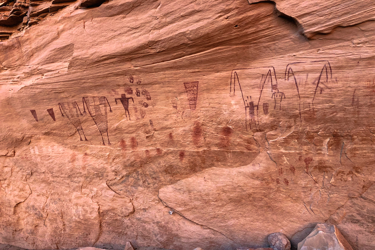 Many hours later, I decide to spend that night in Sheik’s Canyon, based on friends’ recommendations. Here, water access is good, and it’s possible to camp across from the iconic Green Mask rock-art panel, an alcove boasting vivid, Ancestral Puebloan artwork. Upon reaching the canyon, I scoot the quarter mile up to the spring and enjoy a few gulps of cool, clear water. Then, I head over to the rock-art panel.
Nothing in my life has prepared me for the Green Mask. There must be 100 yards’ worth of human figures rendered in multiple styles, plus hand prints, geometric designs, and so much more—not to mention a collection of ruins I’d never anticipated. I’ve always considered myself the non-superstitious type, but all signs suggest that this site has hosted spiritually intense happenings—and for far too long a period of time for me to comfortably spend the night alone here. I move on, and instead set up camp a few miles later, at the confluence of Kane and Bullet Canyons.
The next morning, I’m thankful for having covered those extra miles—the trip up and out of Bullet Gulch offers a breathtaking blend of Cedar Mesa sandstone and perfect, pastel, desert morning light. And then I come upon the Jailhouse and Perfect Kiva Ruins themselves. The intricacy of these ruins’ construction, their setting, and the morning itself, light up my spirit. It soars. I’m now eight days into my trip, and I can’t think of a time I’ve felt more alive than in this glorious moment.
I don’t know it yet, but my final night in Bears Ears will be rough. Deep within the tight confines of Owl Canyon, I pitch my tent on a small “island” in the wash through which water flows during the region’s infrequent rainstorms. As someone who often uses washes to travel through canyon country, I know very well that animals do, as well. This has me on edge. All night long, the light breeze blows the surrounding grasses against my tent, toying with my mind.
It’s in the afternoon of day nine when Meghan, my partner, surprises me on her mountain bike, meeting me where Fish Creek hits Comb Wash. As she rides beside me, I jog on, contemplating all the places through which I’ve powered myself: Lockhart Basin, Indian Creek, Davis Canyon, Salt Creek Mesa, Long Point, Dark Canyon, Elk Ridge, the Bears Ears, Cedar Mesa, Grand Gulch, Owl and Fish Canyons, Comb Wash, and more. Each, like the iconic twin buttes, is a destination in and of itself. As I reach the San Juan River, I hit the 250-mile mark. I bend down to touch the water, then sit on a branch below an ancient cottonwood, sucking down the cold beverages Meghan repeatedly hands me. But we’re not done exploring Bears Ears. River House Ruin sits just up the river. We’ve just got to see that. So I think it will always be, with Bears Ears.
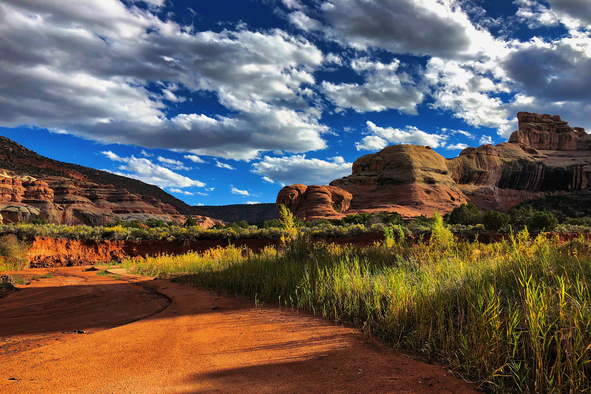
Davis Canyon
What I couldn’t have understood before putting one foot before the next for more than a week across the grounds of this expansive monument is that it’s not just the collection of details that makes Bears Ears special; it’s that which is most threatened that makes this monument truly exceptional—its enormity. You can get your fill of stark basin and mesa desert, sky island forest, and juniper and piñon country. You can explore countless canyons carved through the underlying Cedar Mesa sandstone. You can do so for 200-plus miles, and then have enough terrain to do it again and again. There’s enough of Bears Ears to fill a lifetime with discovery—which is exactly what I hope to do.
However, ensuring that Bears Ears National Monument remains whole will be no easy fight. Comments to Secretary Zinke’s recent “review” of select national monuments make it clear that a vast majority of Americans support maintaining Bears Ears National Monument as it is—as a cultural and natural legacy that we preserve and pass down to future generations. However, a small group of influential opponents, and the politicians pandering to them, guarantee that the Bears Ears will remain under attack for the foreseeable future. It’s thus imperative that we are unceasing in our efforts to protect the national monuments with our voices, our votes, and our wallets—so that a lifetime of cultural history, natural grandeur, and discovery awaits our great-great-great grandchildren in Bears Ears.