The Sustainable House
There are many things we can do to improve the sustainability of our homes, resulting in a reduced consumption of resources, most of which are not renewable. This column will address a number of ways to move towards a greener future.
Climate change is real and impacting San Antonio. What used to be the extreme range of heat and cold has now become the norm, all the while the average temperature creeps up. These conditions define energy use as we struggle to stay snug at home. Doing so, in 2020, consumed over 20% of all energy use nationwide.
While heating and cooling constitute half of a home’s energy use, appliances also have significant impact, including: hot water heaters (12–14% of a home's energy use); washers/dryers (5–13%); lighting (9–12%); and refrigerators (4–8%). So what can you do to reduce your energy consumption in these areas?
Hot water heaters
A major reduction in energy use has been made possible by new heat-pump water heaters that work like a refrigerator in reverse. While more costly to buy, they can save between $100-300 a year on electrical costs. Also the 25C Heat Pump Water Heater tax credit may cover up to 30% of your heat pump water heater project costs, capped at $2,000. CPS also offers a rebate.
Washer/Dryers
Again, a major reduction in energy consumption has been made possible by new heat-pump washer/dryer combinations (all-in-one units). While these cost more, and as of yet there is no tax rebate for their purchase, they can save 40-50% of the electricity of an electric washer/dryer. Best is they require no venting and eliminate the lint buildup and fire hazard that the old dryer vents presented. They also emit no heat or moisture in to your laundry room, eliminating potential mold problems.
Lighting
This is probably one of the best known areas where reduced energy consumption has resulted from technological advances. By now, you hopefully have replaced all the lights in your house with LED units. They even make replacements for those old fluorescent tubes. Homeowners can save about $4,000 over 20 years by switching from incandescent lamps to LED units. That saves about 2,000kWh per year and 1.71 metric tons of CO2. An added advantage is that LEDs last about 20 years, meaning fewer bulbs to change.
Refrigerators
On the average, a refrigerator with the freezer on top will be the most efficient (10-30% less energy), followed by the bottom drawer and then side-by-side units. Exterior ice and water dispensers reduce efficiency as they leak cold air and reduce efficiency by 14-20%. So the French door bottom mount freezer with dispensers is probably the least efficient of all. In all cases look for the Energy Star label for all your appliance purchases and compare the yellow tags which show the efficiency of the unit itself.
As conscientious consumers, we all need to do our part to improve our ecological footprint. These are opportunities where you can make a real difference.
by John B. Hertz, Architect, Alamo Group Green Building Leader
A Journey Through San Antonio’s Water History
Our February 18th General Meeting will feature Gregg Eckhardt from San Antonio Water System. Mr. Eckhardt has combed through city and water purveyor archives to make an interesting presentation on the history of our famous and much loved Edwards Aquifer. Please come to see these old papers, photographs, and postcards of the aquifer that made San Antonio famous.
When
Tuesday, February 18th
6:00 pm
Meeting schedule
| Informal get-to-know-you | 6:00 pm to 6:15 pm |
| Announcements | 6:15 pm to 6:30 pm |
| Featured program | 6:30 pm to 8:00 pm |
Venue
This is an in-person meeting at:
William R. Sinkin Eco Centro, 1802 North Main Avenue
Map
Program topic
From Spanish Colonial acequias to gushing artesian wells, San Antonio has a unique and colorful water history like no place on Earth. Gregg Eckhardt will draw from his extensive archive of rare and historic images and documents to trace the development of the city's water supply and management.
About our speaker
Gregg Eckhardt is an environmental scientist with 36 years of experience in environmental modeling and analysis, water resource planning and development, state and federal permitting, and water treatment. He is known as The Nerd King of South Texas Water History and has operated The Edwards Aquifer Website, a treasure trove of information and images, for years.
As Senior Analyst for the San Antonio Water System, he is involved in the planning, operations, and management of the city's water supply and wastewater.
The Alamo Group of the Sierra Club holds its general meetings the 3rd Tuesday of most months. They're always free and open to the public.
Overlooked Benefits of Solar Canopies over Parking Lots
When I saw the solar canopy over the parking lot at the Convention Center in San Juan, Puerto Rico, I was impressed with the sound thinking and positive image of turning a hot parking lot into a cooler, renewable energy producing facility. Covering about two parking spaces with a solar canopy will generate enough electricity to power a house for a year.
Asphalt parking lots can easily get to be over 140°F in temperature during a 95°F summer day only adding to the “urban heat island” phenomenon. Research by Arizona State University found that a solar canopy over a parking lot can reduce temperatures of the pavement on a hot day by as much as 47°F.
Most people want to park their cars in the shade. At San Antonio’s Airport Security Parking, for example, users pay an additional $2 per day to park under cover. Scooters, bikes, and bike racks can get very hot in the direct sun, and users benefit from their rides being in the shade.
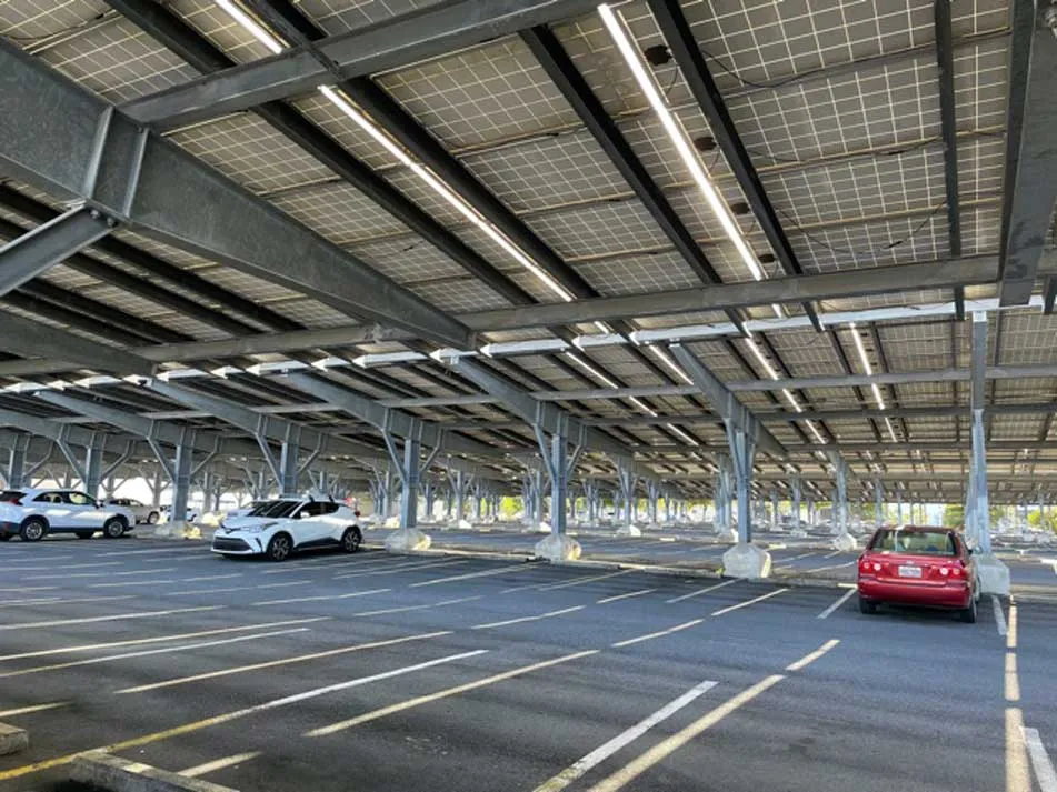
Photo by Bill Barker
The main cause of reduced fuel economy is running a car’s air conditioning system in hot weather. Under very hot conditions, using the AC can reduce a conventional vehicle’s fuel economy by more than 25%. More fuel consumption means more air pollution. Bexar County is in violation of ozone air quality standards, and the American Lung Association has given San Antonio an "F" grade for air quality.
Parking transit buses in the shade reduces fuel consumption because the buses do not have to idle as much to cool them down before going into service. Valley Metro in Mesa, AZ, for example, estimates that the solar canopies now shading their buses will save $67,000 a year in fuel costs.
By cooling a nearby parking lot, demand for building air conditioning in nearby buildings is also reduced. The USDA Forest Service research in the late 1990s documented elevated temperatures in neighborhoods up to a quarter mile downwind of unshaded parking lots. It is no surprise that France now requires all large (about 50 spaces or more) parking lots to have solar canopies. Think about all the big parking lots in San Antonio that could and should have solar canopies.
by Bill Barker, Alamo Group Executive Committee member
Adventures in iNaturalist
We await the arrival of spring with its burst of fresh plant growth and accompanying flowers. Animals such as grazers, browsers, insects and pollinators will respond to this growth and initiate their annual life cycles. As naturalists we will also be invigorated.
The Alamo Group will have a series of naturalist outings both in daylight hours and in evenings. The later will focus on the moths and other insects that come to night lights having a broad UV spectrum. Besides enjoying the natural world these outings will encourage attendees to become citizen scientists that contribute images and sounds to iNaturalist. This cellphone app and website is building a worldwide database for investigative scientists that can be used to follow what is happening in the biological world.
The March 18 program of the Alamo Group will explore the value and applications of iNaturalist. Questions about joining and adding observations will be answered. After the meeting UV light setups will provide viewing of the moth and insect world and the opportunity to learn about making images for iNaturalist.
The highlighted observations for this article will be butterflies. They have four life stages that begin with the laying of eggs on seasonal host plants. The following stages are caterpillar, chrysalis, and adult. Foremost adults will catch our eye with fluttering of wings that have patterns formed from a rainbow of colors. However, we can look closely for caterpillars on plant leaves and stems.
There is a myriad of butterflies to be observed. In fact, iNaturalist documents six families containing a total of 218 species in the twelve counties of the San Antonio Metro Area. Not all will be present in the spring but several dozen species may be encountered on a warm sunny day in a good habitat in March, April, and May. A few representative species are highlighted below.
The Swallowtail family has large and striking members. The Pipevine Swallowtail is the most common. It lays its eggs on a specific plant, Aristolochia erecta, that is hidden among the grasses in meadows. The largest local swallowtail is the Giant Swallowtail which mainly lays its eggs on the Wafer Ash.
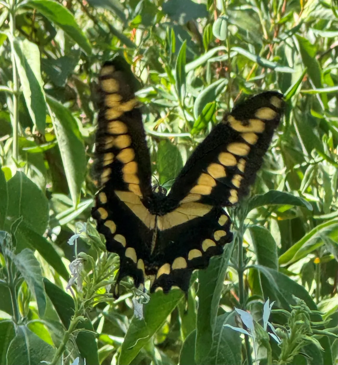
Photo by Jerry Morrisey
The Brushfoot family has many colorful medium-size butterflies. In the spring look for American Lady which host on Sweet Everlasting and Red Admiral which host on Pennsylvania Pellitory. The Queen and Monarch butterflies are family members observed in the fall.

Photo by Jerry Morrisey
The Whites, Yellows and Sulphur family is the most commonly observed family on most outings. In spring look for the Checkered White which hosts on Peppergrass and the Orange Sulphur which host on the Pea family.
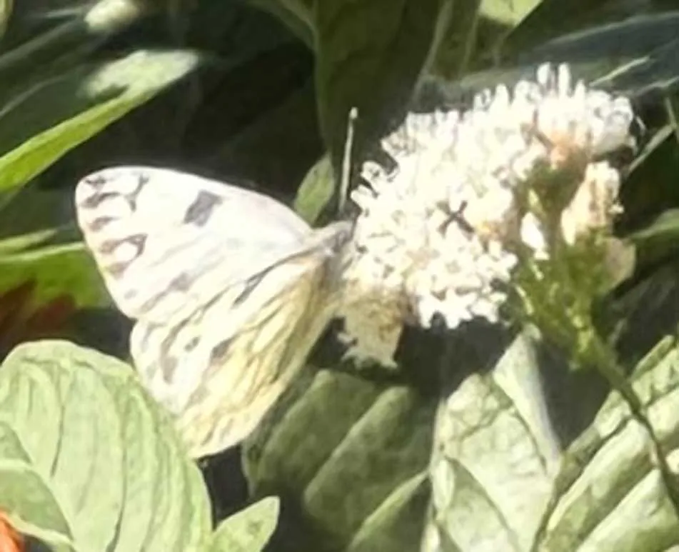
Photo by Jerry Morrisey
The Gossamer-winged family contains the Hairstreaks and Blues which are observed on many outings. Spring representatives are the Gray Hairstreak and Reakirt’s Blue. They host on members of the Pea family such as vetches and mesquite.
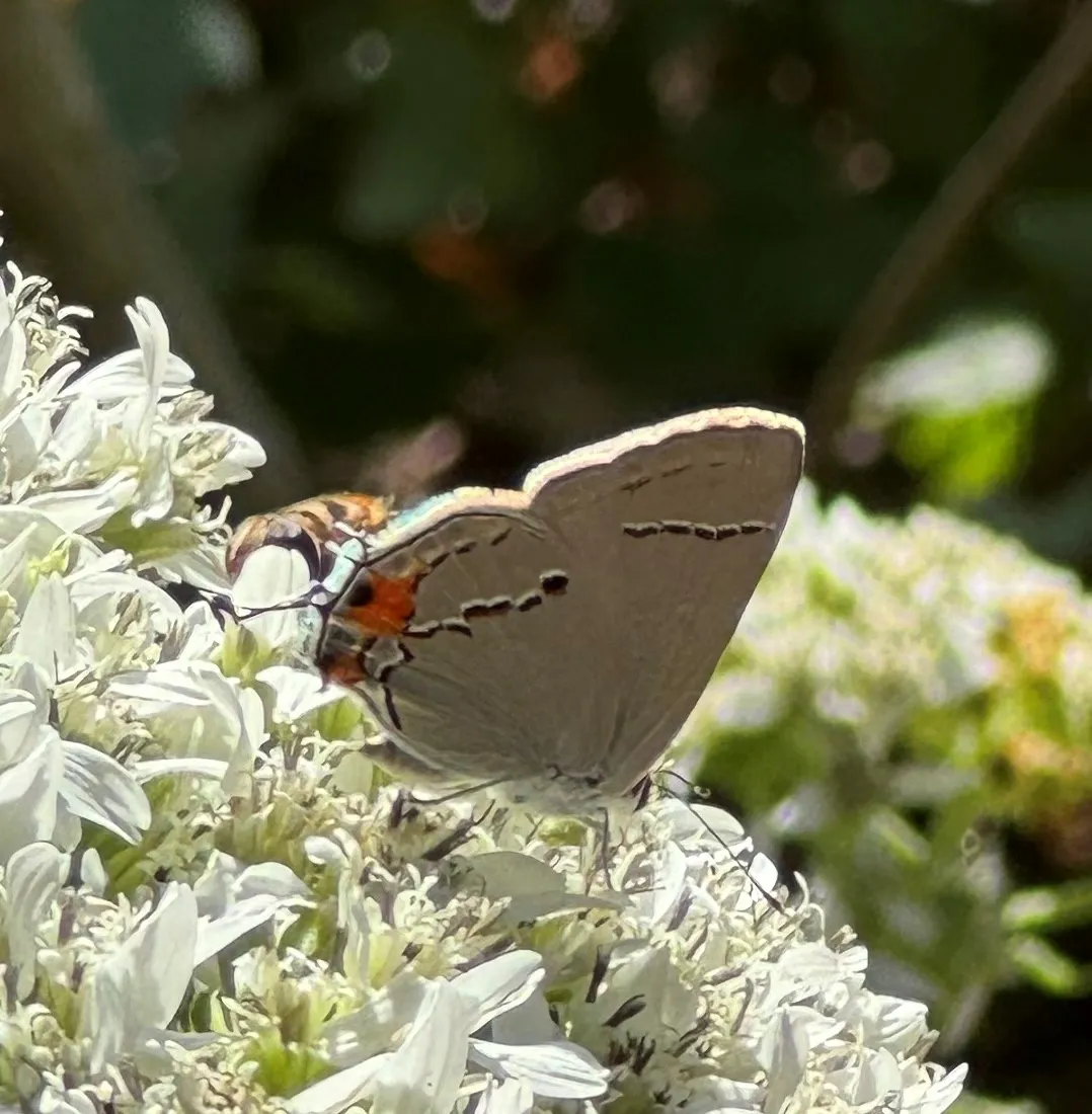
Photo by Jerry Morrisey
The Skipper family is a large family of small to medium-sized butterflies that in generally fly low over vegetation. In the spring look for the Common Checkered Skipper which host on the Mallow family and Texan Crescent which host on Flame Acanthus.
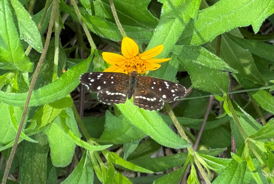
Photo by Jerry Morrisey
The Metalmark family is the smallest. Its most common representative is the Fatal Metalmark which is more commonly observed in the fall.
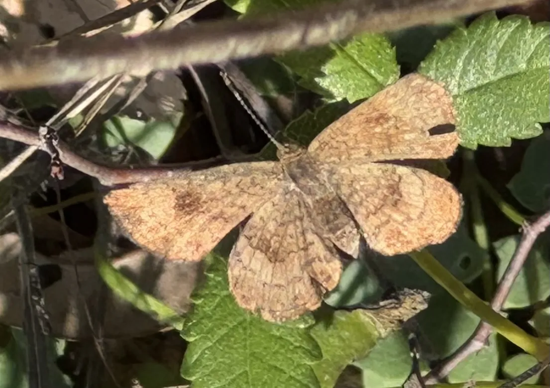
Photo by Jerry Morrisey
Roosevelt-Campobello International Park, New Brunswick
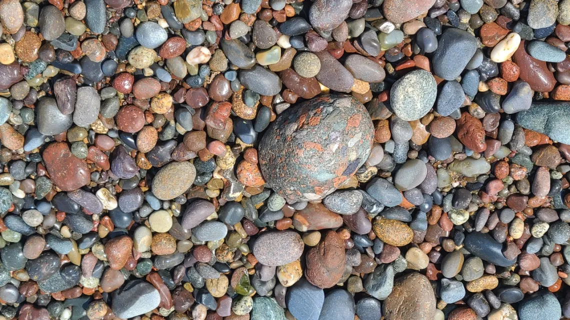
Another park not many of us might get to, but these pictures and little explanations hopefully are of interest. The park is in Welshpool, New Brunswick, occupying much of the southern half of Campobello Island, and is just north of the easternmost point in the US (see the first picture's caption). The park is administered by a commission that has equal representation from Canada and the US and costs are shared equally.
Here is the US National Park service website. The Canadian park website is very useful, lots of info about what to see and do, and the story page. The latter includes pages about the Roosevelts and one titled About the Park - Celebrating 60 Years of Friendship, 1964-2024. And a park map.

Getting there and camping
Most folks would get here via the border checkpoint at the northern corner of Lubec, Maine, with the FDR bridge connecting to Campobello Island. The road there runs NE through the NW side of the park, past the park visitor center, to the little town center of Welshpool. Looking at the map linked above we can see park trails and roads. From Welshpool we can turn SE and drive to Herring Cove Provincial Park, which is on the east side of the island.
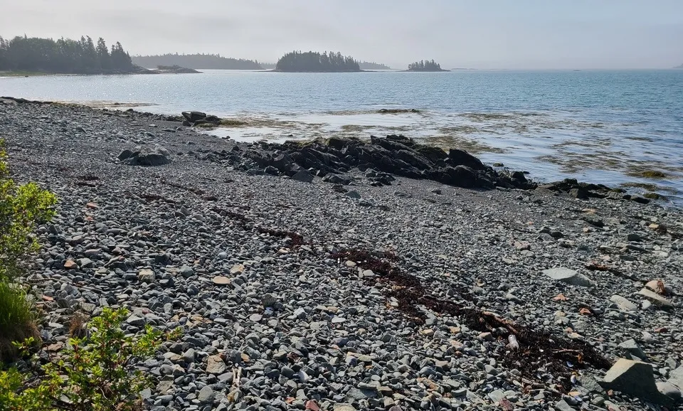
There is no campground in Roosevelt-Campobello and camping options aren't mentioned. But Herring Cove (website), mentioned above, has a good campground with one loop next to the coast (see the third picture). Reservable, has wifi and hot showers. When I was there in July 2024 the campground was nearly empty excepting the loop by the coast.
There is a restaurant in the international park visitor center. One in the center of Welshpool. One I really liked at the golf course just NE of the campground.
Hikes
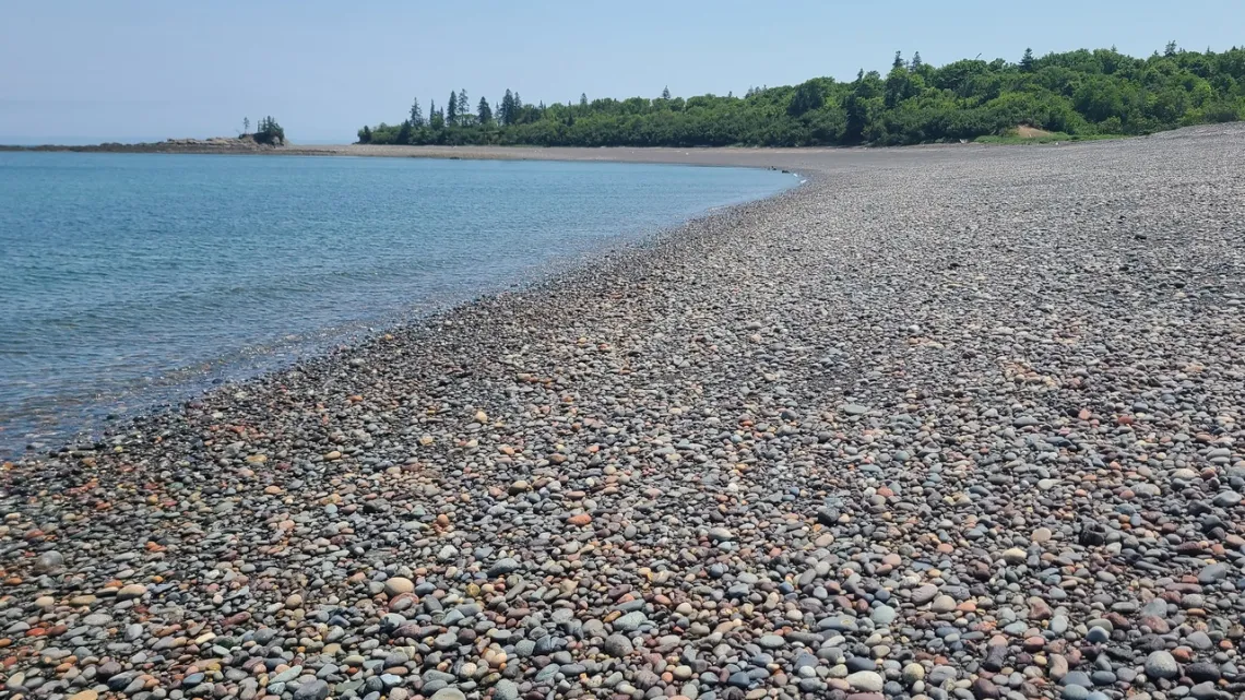
Looking at the map we can see there are many coastal spots around the island we can visit. Of particular appeal is the loop in the provincial park from the campground south along Herring Cove (next picture), around S and back N through the forest, going around Lake Glensevern.
So I guess the coastal bit of this one is along a barrier island. And a big loop in the international park from Raccoon Beach S around Ragged and Liberty (1st picture) points and back past Lower Duck Pond Bog.
Didn't bother with many pics this time doing the latter loop as the tide was in and knew I took pictures on previous visit. But that old camera didn't record location coordinates and so those appealing pictures at lowish tide have been misplaced in the morass of other similar nice views in the greater area.
Want to redo the latter loop, paying attention to the tide schedule. And there are some loops through the provincial park forest and a bit east along the coast from the campground.
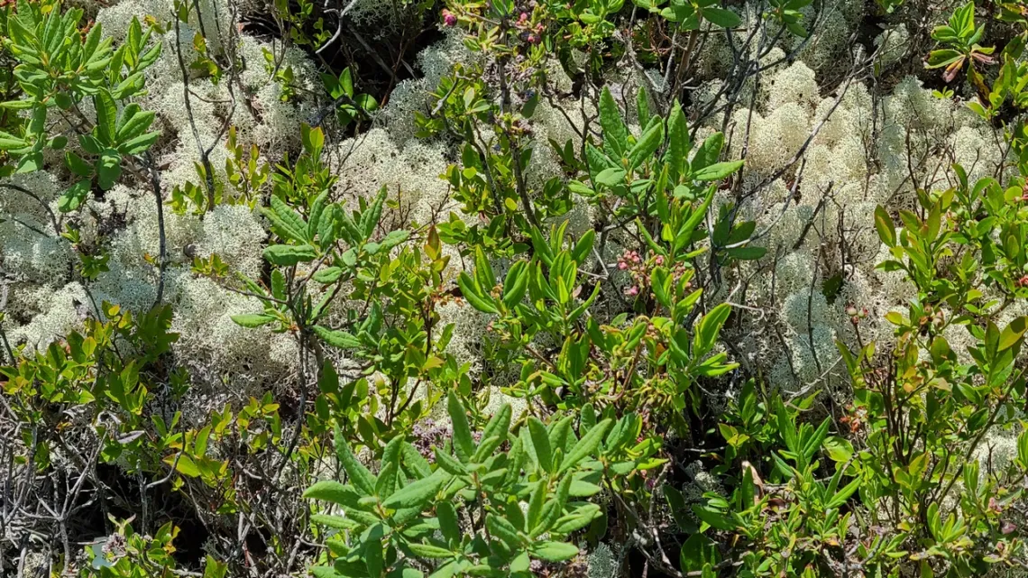
Lastly a bit about reindeer moss, next picture. Encountered a sign explaining this organism (caption). Very common. So we might be encouraged to read up on the roles of lichen in their environments.
In this newsletter October 2018 there was an article, Don't Tread On Me! about biological soil crusts, which include lichen, in Novenweep National Monument, Utah. Here's a USGS resource about this, the link in the article is defunct.
The Secret Knowledge of Water – Discovering the Essence of the American Desert by Craig Childs
This starts with profound accounts about southwestern Arizona, particularly Cabeza Prieta National Wildlife Refuge. The author worked for US Fish and Wildlife Service in the NWR in the 1990s or so. There was a bit about Cabeza Prieta at the end of an article in this newsletter July 2022.
Some of us have done hikes in southwestern national parks, desert ecology, but Cabeza Prieta is different. As he wrote the latter doesn't have many creeks and drainage channels; his work was finding and documenting water holes, which in other areas are called tinajas. Memorable stories about traversing the Sonoran desert and finding water holes documented in Indigenous peoples' accounts going back centuries.
There was a Jesuit missionary whose work resulted in surprisingly accurate maps dating to the 1600-1700s. It is quite interesting to read this book and learn a lot of stuff we didn't know and are glad don't try to take these journeys ourselves.
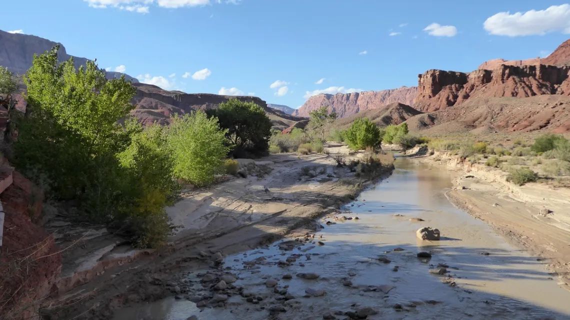
Then he visits other spots east and northeast in Arizona and Utah, including Paria Canyon-Vermilion Cliffs Wilderness. There he finds what John Wesley Powell named Thousand Pockets (tinajas) in 1870. This is east of and above the Paria River, picture below. He talks about walking past hundreds of these water pockets. And provides many bits about the organisms living within and erosional features.
Details about where the spots are is limited; guessing some of that resulted from the author hoping ignorant/inexperienced folks wouldn't try to do those themselves. Many of his expeditions weren't along documented trails or even routes.
And the adventures into caves (thankfully with buddies) from water holes with wetsuits and headlamps, crawling through passages and wondering, is there a vertical passage out ahead? If someone had a problem, if there weren't prior info provided about the intended route or vehicle seen at top of the route, body/ies might not be found for years or never.
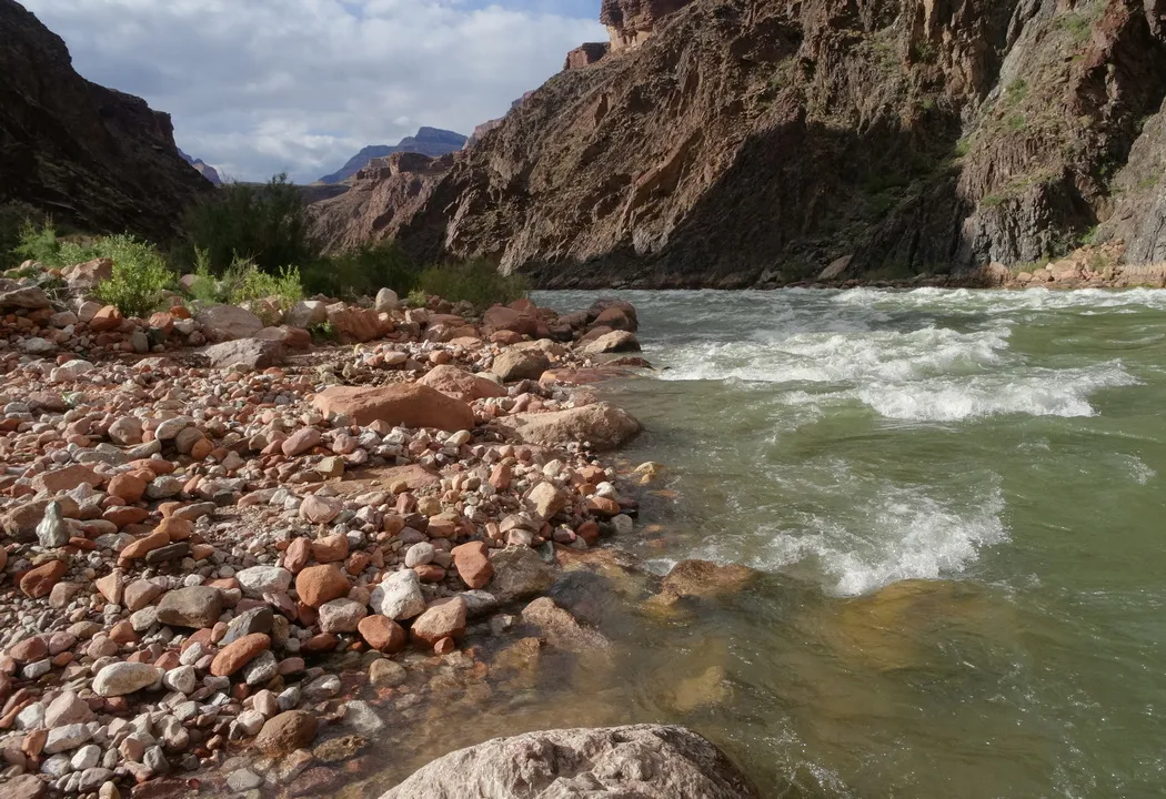
The last half of the book is mostly in Grand Canyon, in the national park near the Colorado River, spots likely reached from the north through Kaibab National Forest and then in the national park, which includes most sections along the river. In one chapter he mentions Crystal Rapids, resulting from Crystal Creek which runs to the Colorado from the north side. Crystal Creek is a couple miles downstream from the next picture at Boucher Rapids, resulting from Boucher Creek, running to the Colorado from the south side. And other spots in the national park: Deer Creek, Phantom Canyon etc.
The book ends with Epilogue: The Arrival. On an entirely clear day an unusual major flood comes down Kanab Creek in the national park from the north. So he was on the north side of the river, about 40 miles downstream of the above picture. “...It was not moving quickly. Instead it paused into plunge pools, filling them, spouting over the lips to the next pools down. Trapped in a confounded stare, I did not look for an escape route”. Just a sample of the profound commentary throughout the book.
by Kevin Hartley, Sierra Club Life Member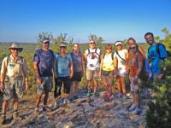
Outings: The Call of the Wild
Visit the Alamo Sierra Club Outings page on Meetup for detailed information about all of our upcoming Sierra Club Outings.
The Alamo Sierran Newsletter
Richard Alles, Editor
Published by the Alamo Group of the Sierra Club, P.O. Box 6443, San Antonio, TX 78209, Website.
The Alamo Group is one of 13 regional groups within the Lone Star Chapter of the Sierra Club.
Changed your contact information?
If you're not sure whether the Sierra Club has your current email address, send an email to Member Services with your name and address and/or member ID (see Locating Your Member ID) so they can add your email address to your member record.
Have you moved? Let us know by sending your old address, your new address and your member ID to: address.changes@sierraclub.org.
Go online for the latest news and events
 |