Cooling San Antonio in a Hotter Future
If you live in San Antonio, you can expect it to get hotter for the rest of your life. Since the Industrial Revolution, humanity has added so much carbon to the atmosphere that, even if all emissions stopped today, it would take centuries for global warming to stabilize.
There are four main ways we can cool our environment:
- Shade
- Water
- Geothermal Cooling
- High Tech Surfaces
The official San Antonio temperature is measured at the Airport in the shade. And, since human beings start to experience heat stress starting at about 90°F, shade will not be enough to reduce human heat stress during our hottest days.
Water cools as it evaporates, whether through misting, irrigation of ground surfaces, or permeable pavements that allow soil moisture to rise and reduce surface heat. Evaporative coolers, aka “swamp coolers”, have been used in the U.S. for over 100 years.
Water is also an efficient carrier of heat energy and can, in its liquid form, take heat away from areas that need to be cooled. However, small bodies of water can actually make urban spaces warmer at night. Research in the Netherlands found the conditions under which bodies of water can cool urban spaces.
Temperatures below 30 feet in San Antonio stay around 70°F year-round. Buildings like the Credit Human headquarters use geothermal systems, while cities such as Seville, Spain, employ underground cisterns to cool pedestrian areas.
The “coolness” of a surface like a roof is determined by solar reflectance, the fraction of sunlight that is reflected, and thermal emittance, the efficiency with which a surface cools itself by emitting thermal radiation. New “daytime passive radiative cooling” technologies can result in “really cool” roofs and can reduce surface temperatures without electricity or water by radiating heat through the atmosphere into deep space.
Note that care must be taken to make sure that the reflected or emitted heat is not directed at nearby pedestrians, etc.
Our climate has changed so that we now live at a time when the air temperatures are dangerous to human health, and we must change our physical environment for our health and comfort. Fortunately, we have some ways that can be used to cool outdoor spaces.
by Bill Barker, Alamo Group executive committee member
Preventative Search & Rescue at Big Bend National Park
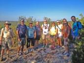
Our September general meeting features Sierra Club members Alan Montemayor and Cheryl Hamilton, who will talk about their work as Preventative Search and Rescue rangers in Big Bend National Park.
Tuesday, September 16th
6:00 pm
Meeting schedule
| Informal get-to-know-you | 6:00 pm to 6:15 pm |
| Announcements | 6:15 pm to 6:30 pm |
| Featured program | 6:30 pm to 8:00 pm |
Venue
This is an in-person only meeting at:
William R. Sinkin Eco Centro, 1802 North Main Avenue
Map
Program topic
“Hello! Welcome to Big Bend! Is this your first time here? Are you looking for a particular hike? How many days will you be visiting?"
For the past five summers, Sierra Club members Alan Montemayor and Cheryl Hamilton have volunteered as Preventative Search and Rescue (PSAR) rangers at Big Bend National Park.
Alan and Cheryl work with a team of volunteer PSAR rangers to ensure visitor safety and enjoyment of the park. Seven days a week, volunteers interact with hikers at the Chisos Basin Trailhead, making sure they have adequate water, experience, and knowledge of the trail they plan to hike.
Cheryl and Alan and other members of the PSAR team also assist hikers in distress at the trailhead and on the trails. Using radios, they communicate on the status of hikers in the area and important wildlife sightings. Nearly every day they complete a “3 pm sweep” of the Window Trail. Over the years, they assisted hundreds of visitors suffering from heat-related illnesses and saved countless lives.
For our September meeting, join Cheryl and Alan for a lively discussion of how their interventions save lives and improve visitors’ experiences at Big Bend.
The Alamo Group of the Sierra Club holds its general meetings the 3rd Tuesday of most months. They're always free and open to the public.
San Rafael Swell — Southeastern Utah: Little Grand Canyon & Smith Canyon
From Wikipedia: “The San Rafael Swell is a large geologic feature located in south-central Utah, United States about 16 miles west of Green River. Measuring approximately 75 by 40 miles, the swell consists of a giant dome-shaped anticline of sandstone, shale, and limestone that was pushed up during the Paleocene Laramide Orogeny 40–60 million years ago. Since that time, infrequent but powerful flash floods have eroded the sedimentary rocks into numerous valleys, canyons, gorges, mesas, buttes, and badlands. ... The folding is much steeper on the eastern edge of the Swell than in the west, and this eastern edge is referred to as the San Rafael Reef."
The north half of the swell is drained by San Rafael River, which drains into the center of the swell via Little Grand Canyon (next). San Rafael River joins Green River in San Rafael Desert, 43 miles southeast of Wedge Recreation Area (includes Wedge Overlook), and eight miles north of Trin-alcove Bend of the Green (picture in article October 2022). I couldn't find any specific BLM info about Wedge Recreation Area, but the Wikipedia Swell article linked above says 217,000 acres here are managed by the BLM as San Rafael Swell Recreation Area.
Writing this article four years after these March 2021 hikes I read the Wikipedia articles and looked carefully at maps and my recorded routes. Learned a bit of the geomorphology (Wikipedia) here, about what happened to the rocks and where the waters went. Much of the rock we hike through is sandstone, obvious in the pictures.
At HikingProject.com there are 43 routes listed for the Swell. Some covered in the prior articles, and a few more wish I could do, in particular Good Water Canyon Rim Trail. We would have to look at the maps to see which are inside the Swell, up the Reef (Smith Canyon), or on top of the Reef (Little Grand Canyon). With a free account we can do the above link and view details for any selection; then if we click on "San Rafael Swell" above on any selection screen we can see a map for the larger area with the trails marked, and put our pointer over one, see the name and link to the detail page (this link results in the area map). Then we have some pleasurable hours of studying these routes and imagining wonderful trips, maybe.
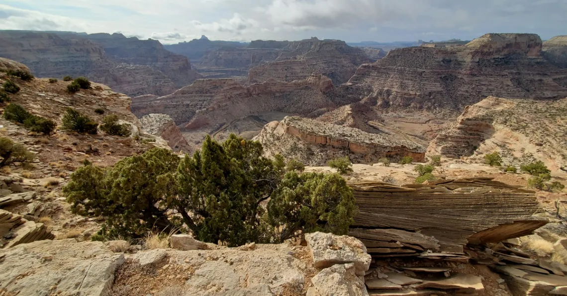
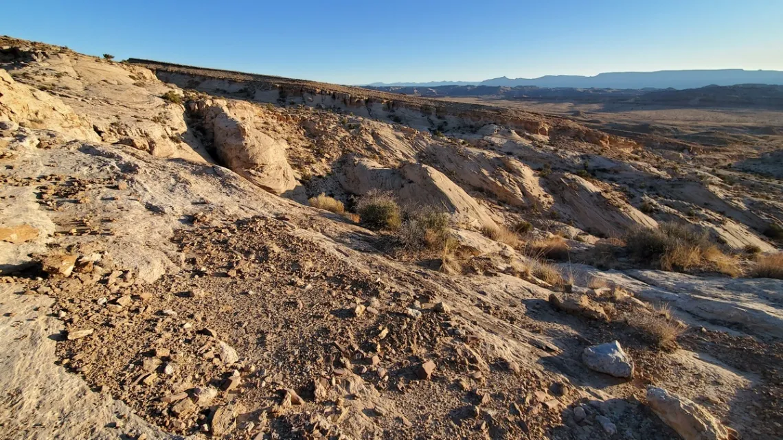
Little Grand Canyon
This is a section of the San Rafael River gorge that is 1080' deep at Wedge Overlook, but just about as deep in the next two pictures. This is at the north edge of the San Rafael Swell, on the San Rafael Reef. Introduced in an article September 2023 with two pictures and a bit about the Good Water Canyon Rim Trail (detail below). Here's an overview map at AmericanSouthwest.net. On the map we can see Wedge Overlook on the north side. There was an article September 2022 about a popular canyon loop on the south side of the Swell.
In the next two pictures we are looking southeast across the inside edge of San Rafael Reef, where the strata are largely horizontal and substantially stepped, compared to those on the outside edge of the Reef where they are gradually sloped (last picture, next section). So the access road to Wedge Recreation Area easily climbs the outside north edge of the Reef, but certainly doesn't try that on the inside, at Little Grand Canyon. These pictures are arguably more scenic than the vista at the Wedge itself, which is out of the second picture to the right.
A good way to get here is on Buckhorn Draw road; turn off I-70 35 miles west of the town of Green River, then 22 miles north to San Rafael Bridge campground, with a short walk to the historic bridge. There is a trail along the south side of the San Rafael beginning about a mile west of the bridge; pretty nice, did a few miles round-trip. From the campground it is 14 miles drive north on Buckhorn Draw and south on CR-406 and then CR-405 (Wedge road) to the CR-407 turnoff east for Good Water Canyon Rim trailhead, ¼ mile on. From the junction it is another 3 miles south to Wedge Overlook.
Two miles north of the San Rafael Bridge campground on Buckhorn Draw road we get to Calf Canyon, turnoff right. A mile or so up Calf a lovely creek is present, which dries up near the road. At seven miles there is Buckhorn Draw pictograph panel. And some at-large campspots along the way. At ten miles turn left on Oil Dome road and another mile turn left (due south) on CR-406 and a ways south CR-405, Wedge Overlook road, with the CR-407 junction for the north end of Good Water Canyon rim trail (next section) at 13.6 mi from San Rafael Bridge campground. Then another 5 miles on CR-405, to Wedge Overlook on the south end of the Good Water Canyon rim trail (next section).
Good Water Canyon Rim Trail!
Further to the September 2023 article linked above. If we want to do this surely wish to know exactly where the campsites are and how to get there, therefore this detail. A page at UtahMountainBiking.com says "this is one of the best rides in Utah". That page has a pile of pictures, brochure, map, and GPX file for phone apps. The double loop is 21 miles total including the 15 miles along the rim. The trail meets CR-407 at the north end of the canyon (halfway around the entire loop), so if hiking could do the whole thing in two day hikes. Walking along the unpaved roads to complete the loops not bad, nice vistas of the grasslands and short mileage.
Page at TheDyrt.com, Little Grand Canyon Dispersed Camping. There is a map, zoom in and scroll around and we can see the nine Wedge Overlook campsites. #5 is at the head of Good Water Canyon (caption of 1st picture), just south of CR-407, near the north end of the double loop. Some the detail is visible on Google maps with a search for “Wedge Overlook, Utah”, in particular Good Water Rim Main Trailhead and camp site #5 are noted.
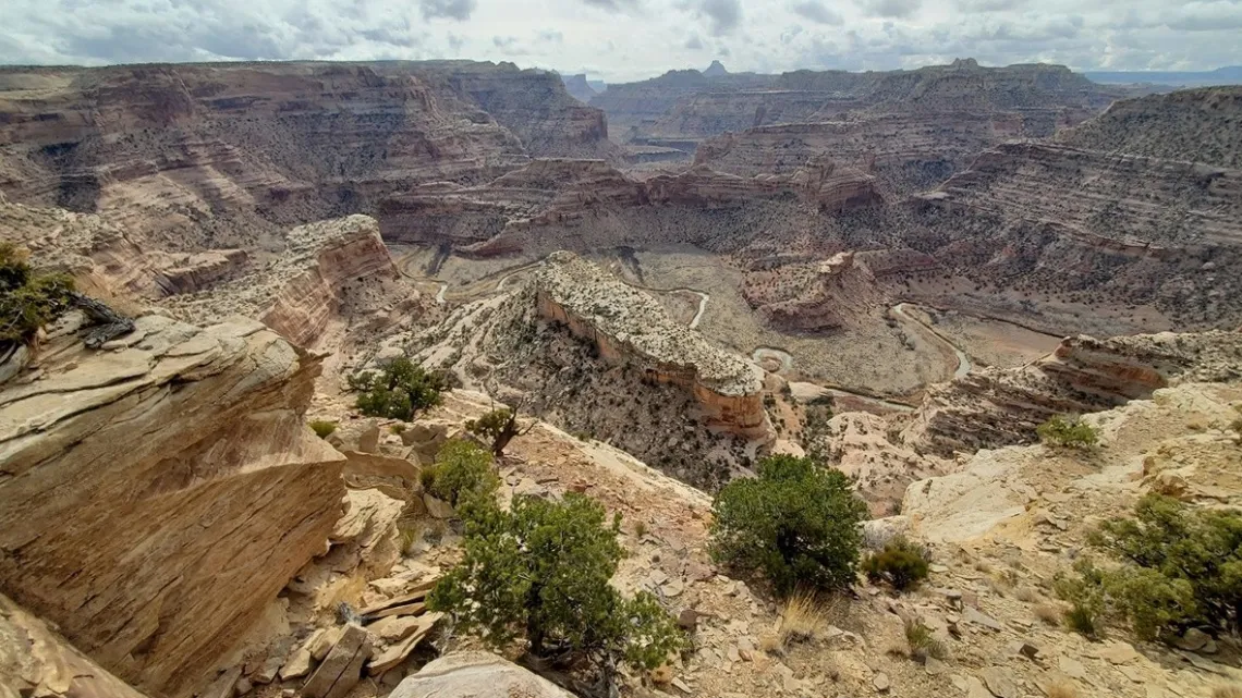
Can see more of the San Rafael River in this picture than in the prior one. Also in the September 2023 article.
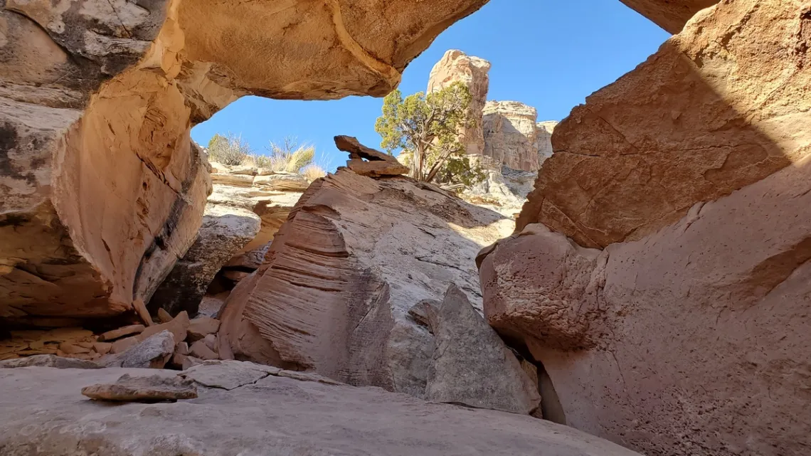
Smith/Horse Thief Canyon
This isn't much of a canyon, but drainages to the east from the top of San Rafael Reef. Here's a good page at RoadTripRyan.com, with a map, pictures, directions and history including Smith cabin/ranch (below). Another page on this spot with history: “Once a staging area for horse thieves and cattle rustlers, the Old Smith Homestead in Utah's San Rafael Swell is now used to stage a more benign activity - hiking Horse Thief Canyon. The 1880's Smith Cabin is also rumored to have been one of the many hideouts of Butch Cassidy and his gang." Therefore likely the dual canyon name, though couldn't find an official reference.
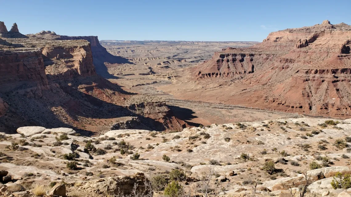
So we can wander up the meandering drainage to the top of the Reef, climbing reasonable stuff, thinking we are almost through this, then do that again and again (example, next picture).
So I got up Smith Canyon to the top of the Reef, and then looking down (next picture) decided I didn't believe the route provided by the RoadTripRyan web page above (limited location points). Surely if I decend to the shelf I can wander around to the right and find an easy way up. So did that and the way up was longer and trickier than that of route provided would have been, which I happened to get a picture of (never mind that one).
by Kevin Hartley, Sierra Club Life Member
Sun Day San Antonio
Join the Sierra Club and other organizarions for Sun Day 2025, a Nationwide Celebration of the Power of the Sun. This event, founded by the highly celebrated environmentalist Bill McKibben is free and open to the public!
Sunday, September 21st
11 am to 3 pm
ACCESS Welcome Center, 2222 N Alamo St (near Broadway and Josephine)
RSVP here
Sun Day is a global day of action on September 21st, 2025, celebrating the unstoppable rise of clean energy. We’ll come together to showcase the power of the sun and wind, the energy sources that can power our world without pollution.
See this flyer for more information.
Trouble in Paradise — Barton Springs Edition
On July 26, 2025, an apparent transphobic attack took place at Barton Springs, Austin’s world-famous freshwater spring-fed swimming hole, leaving multiple injuries including a hospitalized “Good Samaritan.”
Read the rest of this story on Deceleration.
submitted by Greg Harman, Managing Editor/Founder of Deceleration
Outings: The Call of the Wild
Visit the Alamo Sierra Club Outings page on Meetup for detailed information about all of our upcoming Sierra Club Outings.
The Alamo Sierran Newsletter
Richard Alles, Editor
Published by the Alamo Group of the Sierra Club, P.O. Box 6443, San Antonio, TX 78209, Website.
The Alamo Group is one of 13 regional groups within the Lone Star Chapter of the Sierra Club.
Changed your contact information?
If you're not sure whether the Sierra Club has your current email address, send an email to Member Services with your name and address and/or member ID (see Locating Your Member ID) so they can add your email address to your member record.
Have you moved? Let us know by sending your old address, your new address and your member ID to: address.changes@sierraclub.org.
Go online for the latest news and events
 |