The Art of Activism
The Alaska Wilderness League's poster campaign highlights why the Arctic is worth protecting
It’s a time-honored tradition to codify environmental activism in art. “Art for the Common Good” and “Parks for the People,” for example, became a joint cause in the mid-1930s, when President Franklin D. Roosevelt’s Works Progress Administration commissioned Bauhaus-inspired work from artists who suffered in the Great Depression. Advertising for public lands blossomed commercially when the Santa Fe Railway and the Fred Harvey Company provided access and lodging in the Grand Canyon in 1901, and later, access to other scenic wonders of the West.
In 1963, the Sierra Club published The Place No One Knew—Eliot Porter’s pictorial elegy for Glen Canyon—a book meant to stop dams on the Colorado River. Porter, a student of Ansel Adams, sensed the clout of rebellious art. He described his camera as useful “for the defense of the environment.” Ditto for colored inks and silk-screen printing, means recently employed to create graphic tokens of resistance. These powerful, vibrant artworks remind us that what’s happening now in the Far North—witnessed and weathered by its inhabitants—will reverberate quickly, destructively beyond the Far North.
More recently, the Alaska Wilderness League spearheaded a poster campaign in the spring of 2024 to inspire the protection of more than 13 million acres in the Western Arctic (the Biden administration did just that). Specifically, these concern "special areas" in the National Petroleum Reserve-Alaska on the state’s North Slope, between the Brooks Range and the Arctic Ocean’s Beaufort Sea. The league rallied support with five posters in the tradition of those New Deal doozies. Each highlights breathtaking natural affluence as well as outdoor activities within the protected areas. Humans are, after all, a part of biodiversity and for millennia stewarded these incomparable lands.
While national parks and monuments and even some wilderness areas and wildlife refuges attract the bulk of public attention, designated special areas are equally or even more important for ecological reasons. Now, as the Trump administration looks to open up the Arctic for drilling, campaigns to lift up the need to protect these wild places matter more than ever. Here’s why.
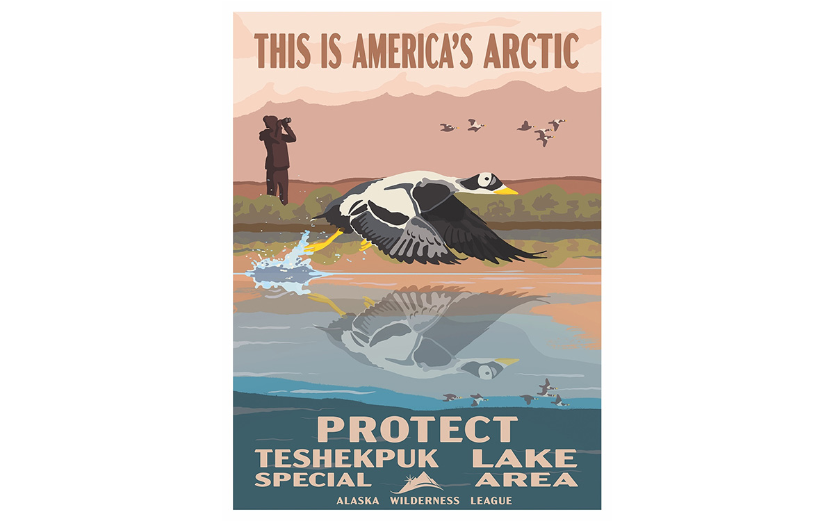
Beloved by birders, Teshekpuk Lake ranks among the best intact ecosystems in the US, many of which cluster in Alaska’s northwestern quadrant. At more than 200,000 acres, larger than Lake Tahoe, it offers sanctuary to millions of migrating birds from around the globe. Up to 100,000 geese—greater white-fronted, snow, cackling, and brant—and 600,000 shorebirds congregate annually on the lake and surrounding wetlands to molt, hatch, and raise chicks, and to store fuel for the arduous flight south. Numerous birds of prey, from jaegers to snowy owls, depend on healthy lemming populations in this special area. Fifty-two bird species have been documented in it, with the vast majority also breeding there. This landscape, riddled with ponds (more water than solid ground), hosts a 64,000-strong caribou herd. The area is sensitive to saltwater contamination from shrinking sea ice and pollution from oil fields like the new Willow Project.
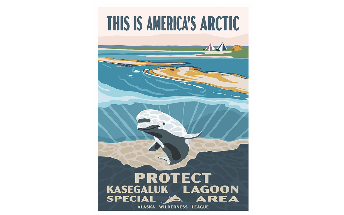
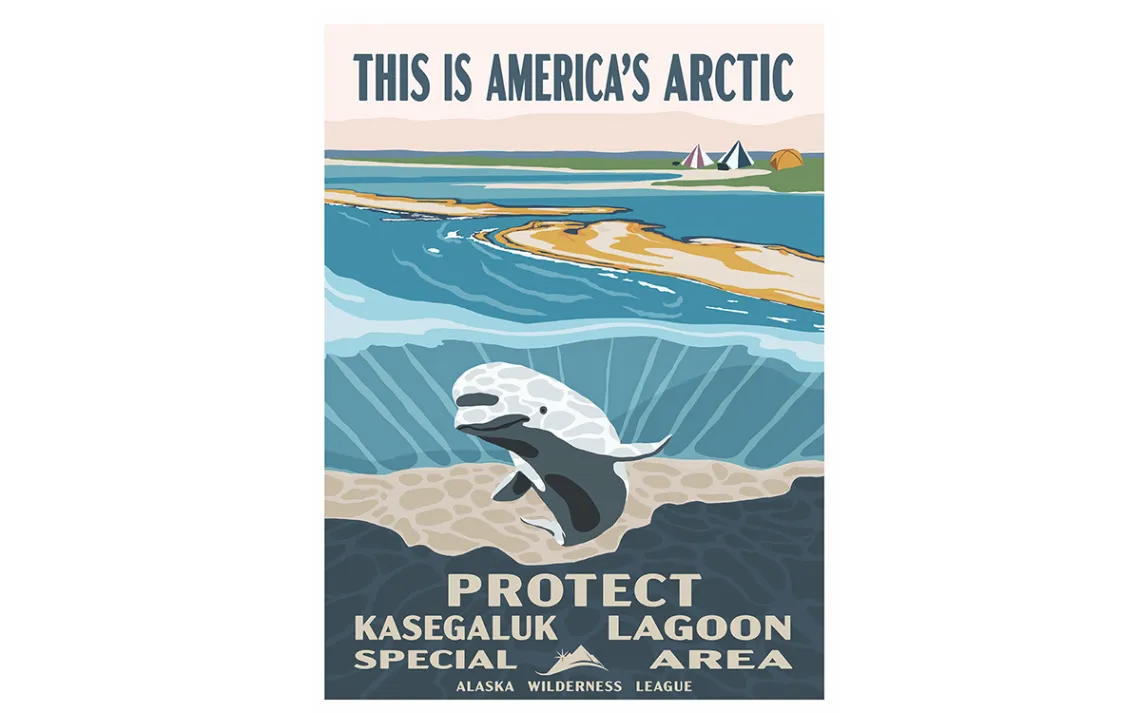
Kasegaluk Lagoon, south of the Iñupiaq whaling community of Wainwright, nestles against the Chukchi Sea. This special area contains prime summer habitat for walrus and spotted seals, which haul out by the hundreds on the lagoon’s barrier islands. Bowheads pass by twice every year, ploughing north in the spring and south in the fall, commuting between breeding and rich Arctic feeding grounds in the Beaufort Sea. Beluga whales give birth and nurse calves in the lagoon’s protected waters. Like the whales, loons, ducks, geese, shorebirds, and songbirds—Lower 48 and Central American summer guests—frequent this rest stop on the Pacific Flyway. Lastly, with its wealth of marine mammals, Kasegaluk Lagoon provides for some of the 3,000 polar bears of the Chukchi Sea subpopulation that, with sea ice vanishing, now spend more time onshore, foraging.
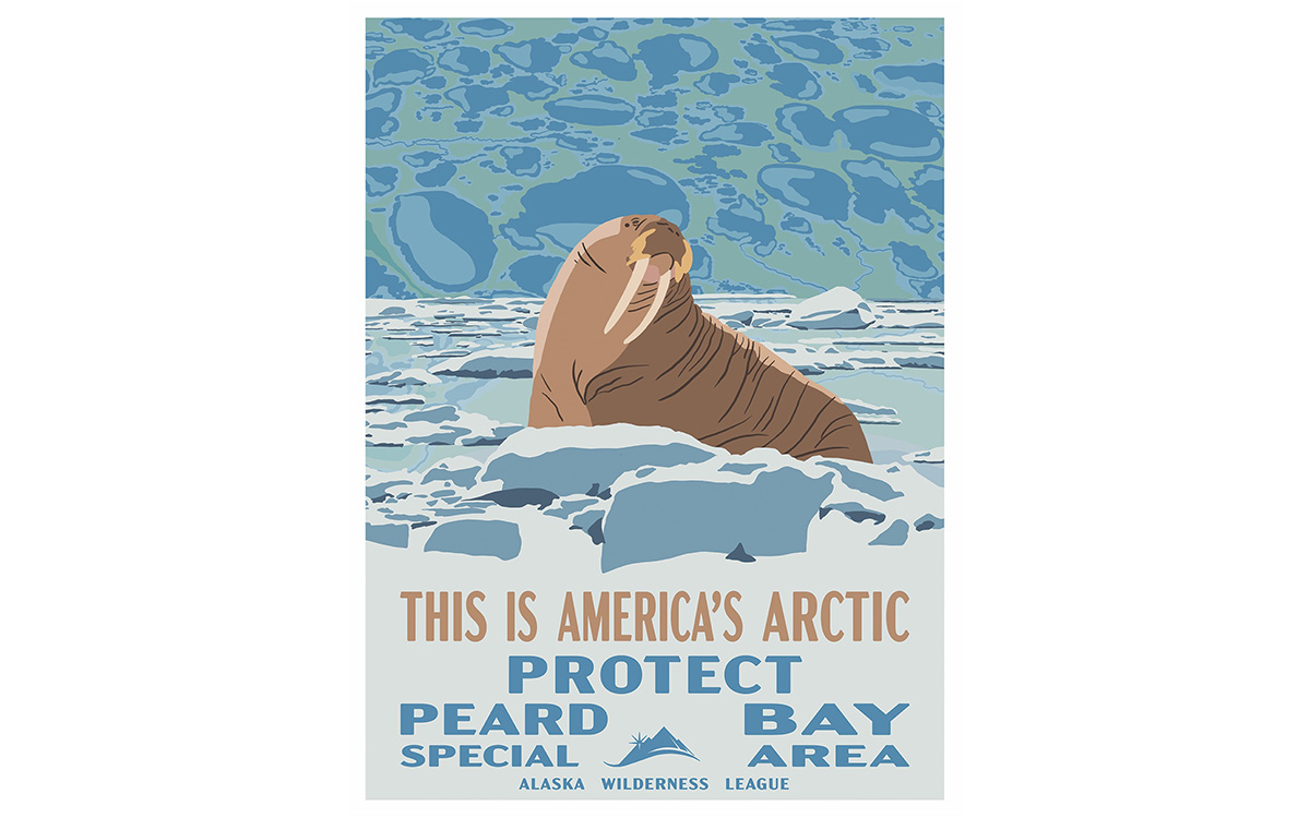
Because of Peard Bay's remoteness, even many Alaskans have never heard of it. Another critical coastal place, this bump on the Chukchi Sea shore sits halfway between Kasegaluk and the Iñupiaq regional center Utqiagvik (formerly Barrow), a town just shy of 5,000 residents. Subsistence hunters travel to the bay for walrus and ringed-seal meat and blubber. Roughly a thousand meltwater lakes dapple this special area, caused by underlying impermeable permafrost, which prevents drainage. Like Teshekpuk and other wetlands along this Arctic coast, Peard acts as a huge carbon sink. These help stabilize temperatures globally. With the climate spiraling and permafrost thawing ever deeper below the tundra’s surface, more methane will be released. And methane is a far more potent greenhouse gas than carbon dioxide, trapping over 80 times more heat in the short term.
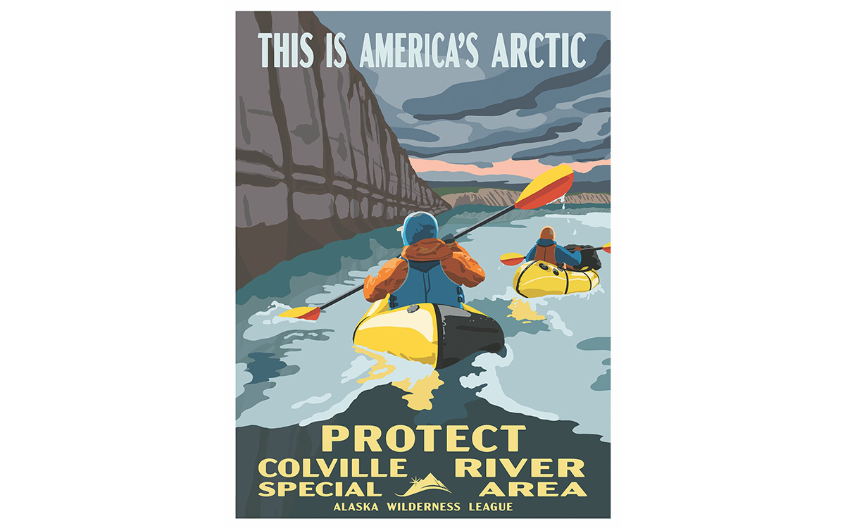
Hemmed by bluffs, braiding together 300 miles of riparian habitat overlooked by weathered, rounded peaks, the Colville River is Arctic Alaska’s largest waterway. Golden eagles, gyrfalcons, and peregrines nest on its lofty cliff ledges. Popular with adventurers—rafters, packrafters, and canoeists, mostly—the Colville springs another surprise: the Liscomb Bonebed, Earth’s most prolific deposit of dinosaur fossils. Among other finds, it yielded remains of a crested, duck-billed unusual species that thrived 70 million years ago, in a forested Arctic. The Colville drainage encompasses 2.4 million acres (3,750 square miles), but numbers alone don’t do it justice. They cannot capture the plaintive chu-weep of a plover, or the riffles’ shushing over gravel bars, or the spicy scent of crushed Labrador tea on the tundra.
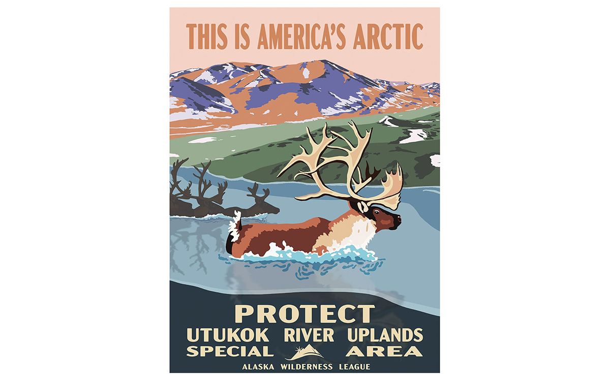
Nourished by nutrients that the 225-mile Utukok River distributes, the Utukok Uplands host the largest remaining intact grassland ecosystem in the US. This plateau in the southwest corner of the Petroleum Reserve, abutting the De Long Mountains part of the Brooks Range, teems with wolves, grizzlies, arctic foxes, wolverines, raptors, and caribou. Its 4 million acres account for less than a quarter of the reserve’s entire land surface. That’s 6,250 square miles for this special area, larger than Connecticut, roughly the size of the Hawaiian archipelago. In a big state, Utukok Uplands is a big place. Alas, vast coal beds underlie the northern two-thirds of this tectonic-plates uplift, drawing attention from energy companies. With “Arctic greening”—willows advancing in streambeds, driven by a wobbly climate—moose now colonize this turf, with hydrology-changing beavers not far behind. This also affects grazing caribou upon which dozens of villages depend for food and for the preservation of their culture.