The Fight to Save Nine Mile Canyon
The Trump administration is trying to force through a road-expansion plan that endangers irreplaceable artifacts in Utah
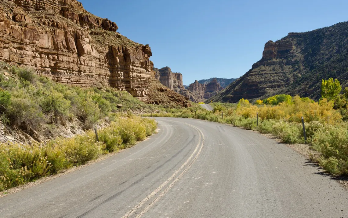
The narrow road winding through Nine Mile Canyon is set to see a huge increase in oil truck traffic. | Photo by Jeremy Miller
Nine Mile Canyon in central Utah is one of North America’s great cultural treasures. Often referred to as “the longest art gallery in the world,” its high cliffs and deep alcoves house countless artifacts and ancient sites. Inscribed into its ruddy slabs of sandstone are tens of thousands of petroglyphs and pictographs spanning 8,000 years of human history. Most were created by the Fremont people, a group that inhabited the Southwest between 400 and 1300 AD. The canyons also contain inscriptions left behind by white settlers in the 19th century who wrote their names on the walls with axle grease.
Now the canyon and its troves of artworks and artifacts are under threat. In April, the Bureau of Land Management announced it had approved a project to widen and straighten a steep and winding two-lane track called Wells Draw Road, which passes through a deep gorge called Gate Canyon. The BLM is advancing this plan while ignoring the mandates of the National Environmental Protection Act (NEPA), which requires federal agencies to give the public a chance to comment on projects impacting public land. It’s part of a disturbing trend under the Trump administration, which has shown a willingness to destroy public lands first and ask questions later.
For decades, this narrow, hazardous passage has been a chokepoint for industry. Widening the road, say BLM officials, will allow massive, heated oil tankers to fast track crude oil at 60 miles per hour between the oil fields of the Uinta Basin and the rail lines along the Price River and Interstate 70, an hour south.
The roadwork will entail blasting through massive rock formations—many adjacent to rock art panels and archaeological sites. To stabilize the roadbed, crews will dump close to 200 feet of fill and overburden into the canyon bottoms.
“It's like building a freeway through the Louvre."
Activists say the road will irrevocably harm the scenic, ecological, and cultural resources of this remote region. It will also increase traffic drastically, putting over 1,000 trucks on the narrow road each day—the equivalent of a tanker every seven minutes, according to a recent report by The Salt Lake Tribune.
“It's like building a freeway through the Louvre,” said Mike Hansen, president of the Nine Mile Canyon Coalition, a Utah-based nonprofit.
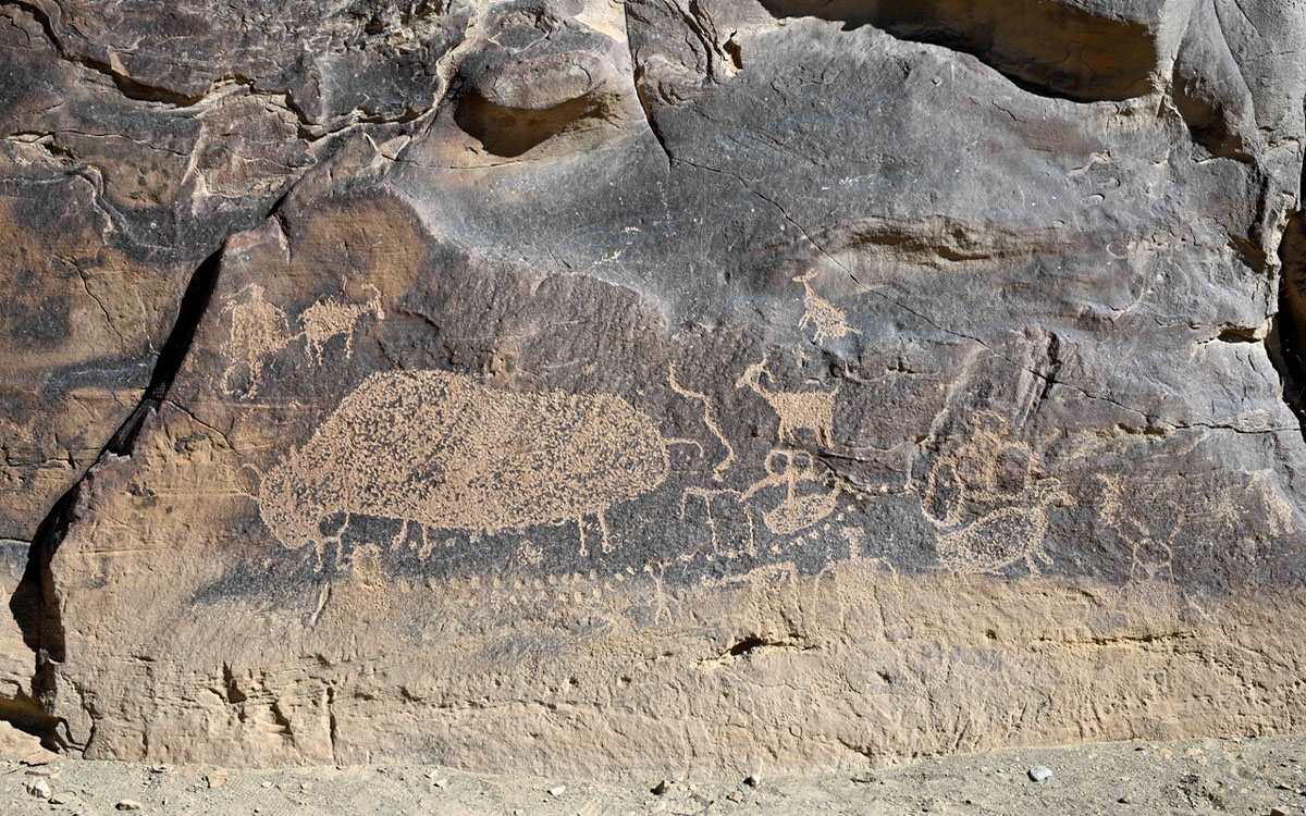
One of thousands of petroglyph panels in Nine Mile Canyon, this one depicting a bison.
*
On a bright October afternoon, I met Dennis Willis, former BLM outdoor recreation planner, at a gas station in the small town of Wellington, 10 minutes east of Price. We climbed into his red Tacoma and drove 45 minutes north into the region of high, pine-studded plateaus and deep canyons.
Willis spent 35 years working for the BLM, most of that time in the Price district office. He came to know these canyons and plateaus like few others. While we drove, he gestured to lonely monoliths and treacherous cliff bands that he and his team explored over the years—remote enclaves where they discovered and documented thousands of archaeological sites.
As he negotiated the sharp curves of the canyon, we passed century-old Fremont cottonwoods, their sprawling canopies bursting with yellow and gold foliage. Willis told me he had hired a well-respected archaeologist named John Veverka to write the interpretive plan for Nine Mile Canyon.
“He was just in awe out here,” Willis said. “He did not understand how Nine Mile Canyon was not a national park or monument.”
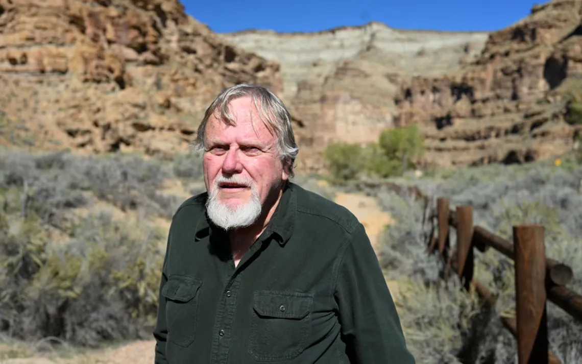
Former BLM planner Dennis Willis in Nine Mile Canyon.
We stopped along the roadside at a sign that read "First Site," the first marked archaeological site along Nine Mile’s main road. We encountered a group of tourists huddled up below a dizzying menagerie of petroglyphs—spirals, snakes, cow skulls, birds, warriors with shields. The images covered a wide cross-section of rock, from inches above the desert floor to ledges 30 feet above us. (Most of the glyphs were also no more than 100 feet from the roadway.)
“It’s unbelievable,” said Ed McFee, a resident of South Jordan, Utah. “The more you look, the more you see. It’s like it just appears out of nowhere.”
I asked the group what had brought them out to the site. McFee said he had long known Nine Mile was an incredible place to glimpse rock art. But they had also heard that the canyon—like many treasured landscapes across the US—is now facing destruction. “Hundreds of semi-trucks a day driving through here will totally change the atmosphere of the canyon,” McFee said.
“Move fast and break things,” said Mark DiMeglio, also from South Jordan. “That’s the motto of this administration, isn’t it? It’s honestly ridiculous.”
The Wells Draw project didn’t begin with the Trump administration. “This is a zombie project,” said Hansen. “You can't kill it. It keeps coming back.”
The project was first announced in 2014, and the response from environmental groups and the hiking public was swift and unequivocal. “There were hundreds of responses to the EIA,” said Hansen. “People were overwhelmingly against the road, and it didn't move forward. Finally time expired, and the BLM killed it. We thought that was the end.”
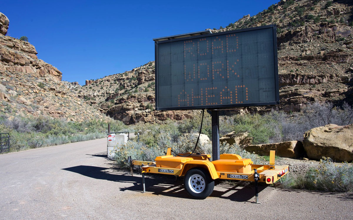
A road sign announcing impending road work at the head of Gate Canyon, a tributary of Nine Mile Canyon.
But the project was resuscitated in 2022, this time by Duchene County. “It was opened up again to public comment, and again there were hundreds of responses against it,” Hansen said. “At that point, the county voluntarily withdrew their application.”
What makes this latest version of project different, says Hansen, is that the Department of the Interior is brazenly ignoring NEPA’s public comment requirements. In March, he said, a notice appeared on the BLM page that a new application had been filed for the Wells Draw Road. “The proposal was vague and lacked specifics,” Hansen said.
Nonetheless, the coalition filed letters along with the Southern Utah Wilderness Alliance and the Center for Biological Diversity. “We asked for a public comment period under NEPA, but it was denied by the BLM. On April 26, we were informed that no public comment was necessary, and the project was approved.”
In early October, the two conservation organizations filed a lawsuit challenging what they call a “rushed and behind-closed-doors environmental review.” The suit charges that the BLM’s plan failed to “disclose or analyze the threats of increased traffic and canyon blasting on wildlife, the area’s rock imagery, historic axle grease inscriptions and scenery, and for failing to consider alternative, less damaging routes.”
“The BLM knew that prior versions of this same proposal were extremely controversial and faced fierce public headwinds,” said Landon Newell, a staff attorney with the Southern Utah Wilderness Alliance in a statement. “This time around, instead of facing the public, they hid their decision and rushed their analysis and approval, all under the guise of Trump’s ‘energy dominance’ agenda.”
Hansen pointed out that Nine Mile Canyon and its tributaries are more than repositories of ancient archaeology. They also provide habitat for dozens of species of plants, insects, mammals, reptiles, and birds, including the critically endangered Mexican spotted owl.
“They are in clear violation of law,” Hansen said.
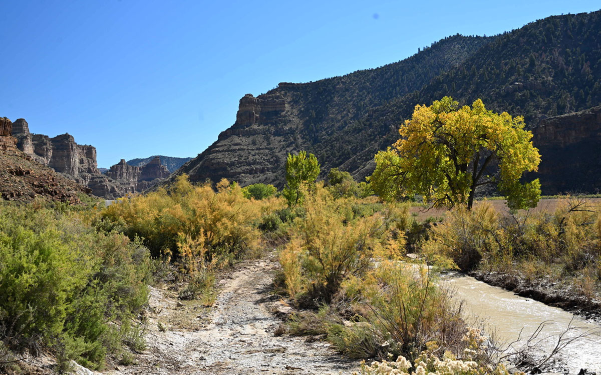
Fremont cottonwoods turn gold in the depths of Nine Mile Canyon, which houses one of the richest troves of ancient artwork in the southwestern US.
*
“A highway down here would change that meaning forever.”
Back in Willis’s car, we negotiated Nine Mile’s narrow and winding paved road—the section that would see a massive increase in truck traffic—and turned north onto Wells Draw Road. At the junction stood an electronic sign notifying motorists of impending closures and delays. There was also a gate, which Willis noted, was less than a month old and had been constructed to stop traffic once construction commences.
We ascended the washboard of Wells Draw Road cautiously. The canyon narrowed and dropped precipitously along the edge of the road. It was hard to imagine a steady stream of 40-ton trucks passing through here without visualizing one careening over the edge. In a large sandstone alcove sat a massive backhoe beside several sections of circular culvert pipe, which looked to be at least 10 feet in diameter. These massive cylinders hinted at the scale of the flash floods that can strike this steep terrain; they also were a clear sign that work is imminent.
Near the top of the canyon we passed through a second gate, identical to the one at the bottom. We pressed through a narrow cleft and onto a plateau covered in stunted piñon and juniper. Suddenly a sweeping panorama of the snow-capped Uinta Range sprawled out before us.
“In the interpretive world, this is what we call a ‘grand reveal,’” said Willis. “There aren’t too many places in this part of the state that give you that kind of scenic surprise.”
After leaving Gate Canyon, Willis merged back onto the main road and drove to what many consider the crown jewel of Nine Mile—a petroglyph panel called “The Great Hunt,” which depicts several hunters with bows drawn and aimed at a herd of bighorn sheep.
Amid the bighorns is a trapezoidal, horned figure standing beside a squiggling snake. This effigy, known to archaeologists as an “anthropomorph,” is a common feature of Fremont art. To my eye, it looked like a nature god or protector of the canyon and its wildlife.
If this canyon is the Louvre, "The Great Hunt" is its masterpiece—the Mona Lisa, as Willis called it. But the panel is more than a beautiful image. It is the exuberant cultural expression of the people who called these canyons home for millennia. The panel’s meaning, he added, is inextricably connected to Nine Mile Canyon’s landscape. “A highway down here would change that meaning forever,” he said.