What Happens to Birds and Butterflies When They Migrate?
A network of DIY radio towers is on the case
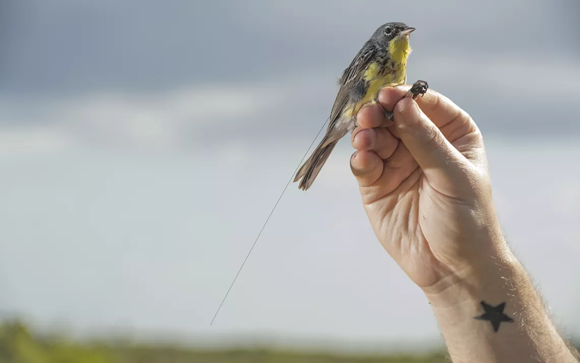
A tag attached to a Kirtland's warbler. | Photo courtesy of Tim Romano/Smithsonian Migratory Bird Center
Lisa Kiziuk, who runs the bird conservation program for the Willistown Conservation Trust in Pennsylvania, attached a stainless-steel bracelet onto an owl’s matchstick leg with nary a sound. But for Kiziuk to get the elusive bird of prey close enough to label, she had to play the saw-whet owl’s shrill, insistent call over a loudspeaker, often in the middle of the night, night after night It isn't, she says, an operation that endears the Conservation Trust to its neighbors.
“They sound like a garbage truck backing up,'' she said. “It's just this monotonous tooting.”
The long nights weren’t the problem for Kiziuk—it was the low return on investment. She wanted a way to get more information from the banded birds. The bands themselves couldn’t tell her where the birds were traveling or why they chose to follow the routes they did. They couldn’t show how events like storms affected their survival. Only a tiny fraction of the birds Kiziuk banded were spotted later, which means that she needed to spend long hours blasting bird calls to tag enough birds to get any data back at all.
Kiziuk wasn’t the only naturalist with these complaints. In 2013, a network of scientists and amateur collaborators, initially headed and funded by Birds Canada, began attaching radio telemetry nanotags to migratory animals and building small radio towers that could receive the tags’ signals as they flew by. Enthusiastic conservationists up and down eastern North America began to install receiver stations and nanotag birds. One of those early adopters was Kiziuk.
Forty percent of bird species will migrate at some point during their lives. Some, like the red-winged blackbird and the American robin, might make a relatively short hop of a few hundred miles or up and down a mountainside. Others, such as the red knot, make an epic annual round-trip voyage between breeding grounds in the Canadian Arctic and wintering spots in Tierra del Fuego. Monarch butterflies make multigenerational journeys between Mexico and parts of the US and Canada. But even as astronauts have ventured to the moon, biologists on Earth struggle to map out the migratory routes of many species, especially those that travel at night or to sparsely populated regions.
This growing network of telemetry towers developing across the continent intends to address this challenge. As tagged birds pass by towers, a picture emerges that helps connect the dots between threats and response: Where do we see the most mortality? What do birds do when storms hit? What happens to birds that collide with buildings during their migration? In the same way that satellite and radio tracking collars have revolutionized researchers’ understanding of large mammal movement and behavior, nanotags, which only weigh a few grams, are poised to revolutionize birding.
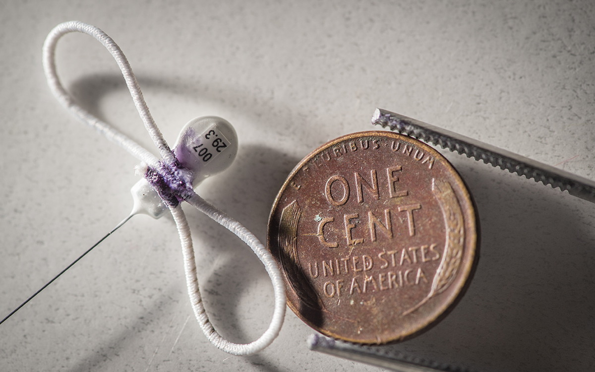
A radio tag used in a study of Kirtland's warblers. | Photo courtesy of Tim Romano/Smithsonian Migratory Bird Center
Like banding, tracking birds using the Motus (Latin for “movement”) network requires researchers to attach a tag to each individual bird. Kiziuk, who still catches birds for banding, uses a drop of nontoxic glue, placed via an elastic strap around the bird’s midsection (“Like a fanny pack,” Kiziuk says). Lucas DeGroote, avian research coordinator at the Powdermill Nature Reserve outside Pittsburgh, gets his supplies from the beading section of his local craft store, using clear elastic thread and small metal crimps to secure the ends together. The tags Kiziuk uses weigh around 0.13 grams (it would take eight tags to equal the weight of a dollar bill) and have a battery life of around a year. Even smaller tags can be attached to butterflies and dragonflies.
Each tag can be picked up by receivers up to 10 kilometers away. Just as police can reconstruct a person’s travels by determining which cell towers are picking up the signal from their phone, DeGroote, Kiziuk, and other researchers can follow most birds for about a year before the tags fall off. Newer tags can stay attached and fully charged for even longer.
The radio tags used by the Motus network cost around $200 each—and that doesn’t count the amount needed to build each radio tower. But that’s one-tenth the cost of larger radio tags and collars used on mammals and large birds, and the large, rich amounts of data that scientists receive helps take some of the sting out of the expense. Today, the current array of towers can track tagged animals over tens, even hundreds or thousands of miles. “It allows for the tracking of the smallest individuals over the greatest distance,” says Stuart MacKenzie, a migration ecologist who helped develop Motus. “You can scale up to hundreds or thousands of kilometers depending on the study.”
Currently, just under 1,000 Motus receiver stations dot four continents. Most of them are clustered in New England and Canada’s Maritime Provinces, with a few in Europe, South America, Australia, and Taiwan. A new $998,000 grant from the US Fish and Wildlife Service is helping to blanket more of New England with receivers.
Knowing where a species migrates and where it stops along the way is key to stemming the tide of crashing bird and insect populations, says DeGroote. A bird’s annual lifecycle can be divided into breeding, migration, and wintering, but, he says, “connecting those different portions has been nearly impossible until we had different technologies to track the birds.” Although banding can provide a snapshot of bird activity and create a starting point for researchers, he’s turned to the Motus network to fill in some of the gaps.
Take the red knot. On its journey from South America to the Arctic, the bird stops over along the Atlantic Coast to gorge on horseshoe crab eggs for two weeks in May. How much weight they gained at the all-you-can-eat seaside buffet predicted their reproductive success later. Motus data has added to the list of important stopover sites along the North American Continental Shelf.
Numbers of monarch butterflies have been on the decline for years, but the eastern subspecies of monarch, which migrates over Iowa and other nearby states, has shown especially concerning drops. Conservationists think that if they know more about how monarchs find food, they can improve where they plant milkweed. Motus tags, with their small size and ability to provide fine-grained movement details, can help decide where to plant.
The network is now seven years old, but it’s only been within the last handful of years that scientists have been able to rely on enough radio receiver stations to get detailed results over large areas, MacKenzie says. Scientists who register to use the Motus system must make basic datasets freely available for public use, although they can delay availability to certain information until after their studies are published.
In Ontario, a group of biologists from Western University used Motus to track northern barn swallows, a species whose numbers are currently declining. They found that the swallows’ migratory problem started early. Only 40 percent of nestlings survived long enough to even begin. By tracking which fledglings were able to complete their journey, the scientists were able to narrow down the nest factors that contribute to survival.
In a separate study published in October 2020 in Current Biology, scientists from the Smithsonian Conservation Biology Institute found that the rare and formerly endangered Kirtland’s warbler moved over much longer distances during the breeding season than previously thought. Motus tags showed that some individuals moved more than 50 miles—data that can be used to show that the birds need more habitat in order to rebuild their former numbers.
Other scientists are using Motus to track bird movements to ensure that offshore wind farms aren’t built in places where birds are likely to collide. “It provides us with new insight as to what the requirements are for conservation beyond that little patch that they call home,” MacKenzie said.
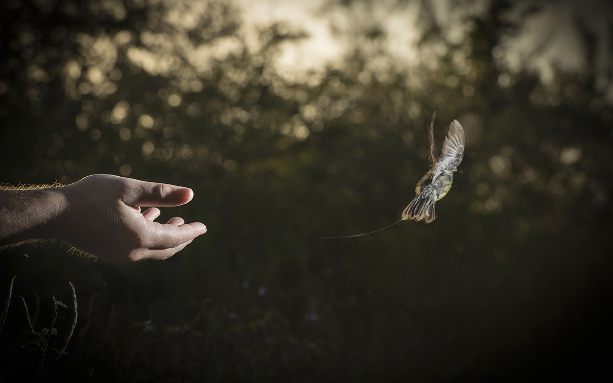
A warbler with a radio tag takes flight. | Photo courtesy of Tim Romano/Smithsonian Migratory Bird Center
Kiziuk is continuing with the joint efforts to build out the Motus network across Pennsylvania. Once this is complete, she will begin tagging northern saw-whet owls and other birds. She hopes that when data from the tracking system starts coming in, it will allow her to understand what environmental factors, such as light, temperature, and food availability, make the owls decide to migrate and to choose stopovers along their route. Since their migration corridor closely follows Motus arrays from Pennsylvania, through New England and into Canada, Kiziuk hopes to identify how wind, land, and even the Earth’s own magnetic field spur the bird on its journey. She has also begun a project to tag birds that have recently collided with windows to see how they fare after their crash.
“We’re trying to build the holy grail of what birds are doing all the time,” she said. “We want to have a full picture of what our birds are doing and where the bottlenecks are in conservation.”
 The Magazine of The Sierra Club


